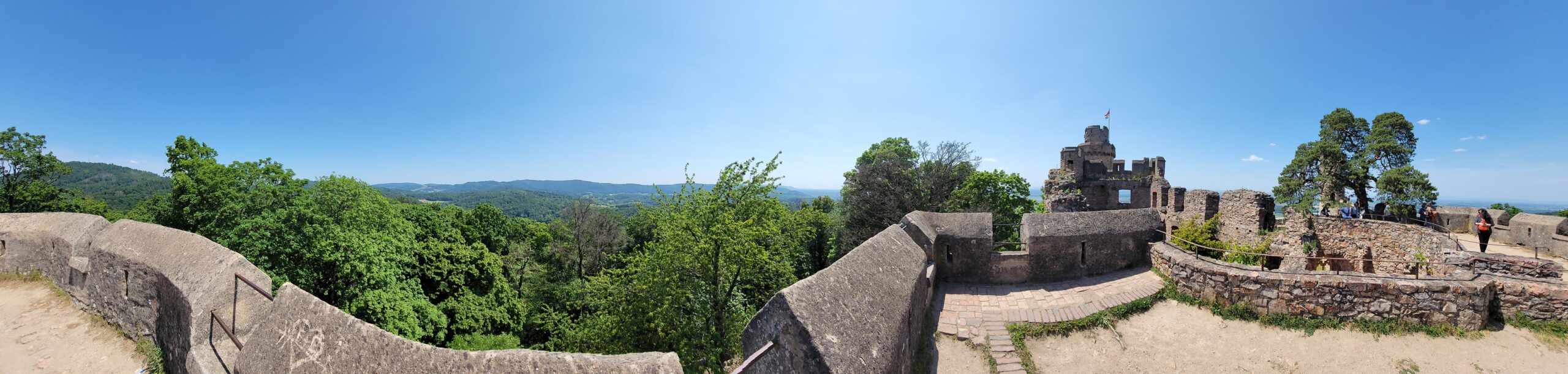
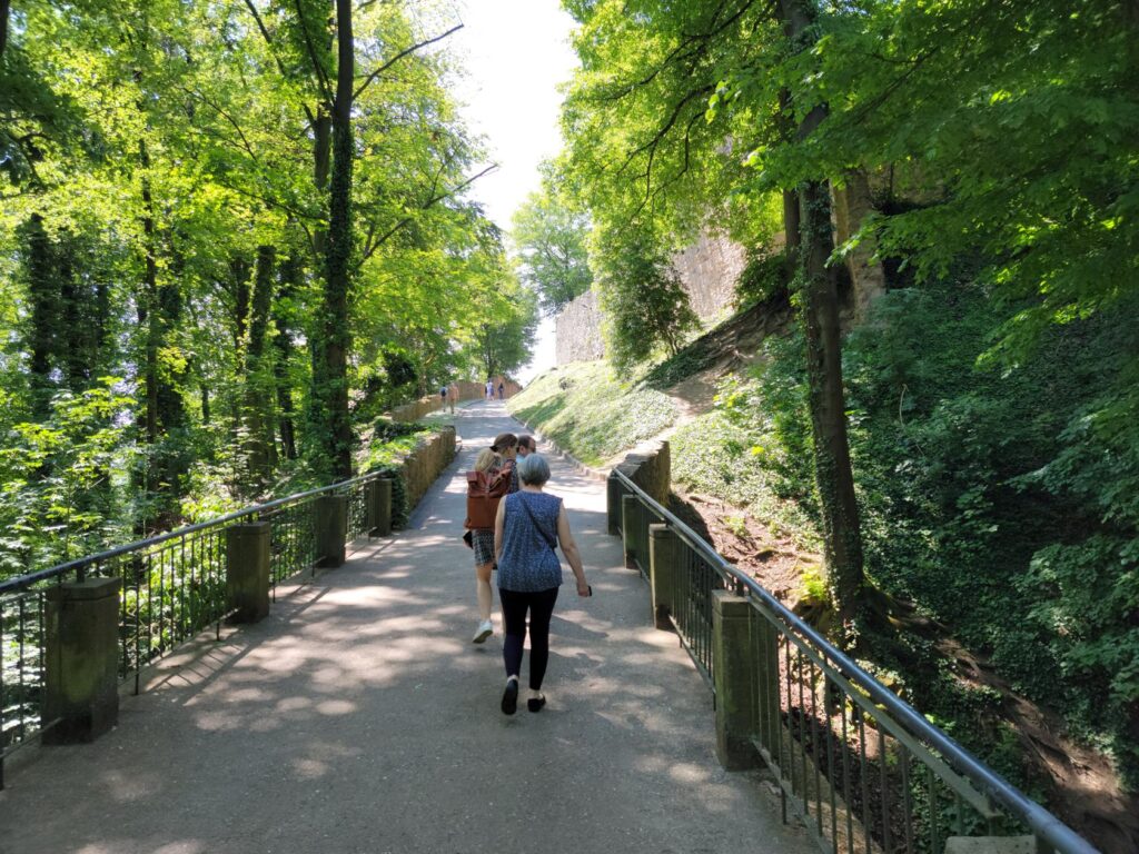
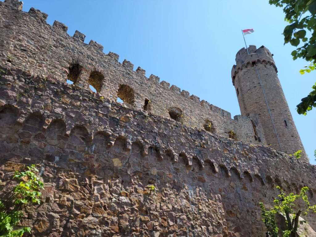
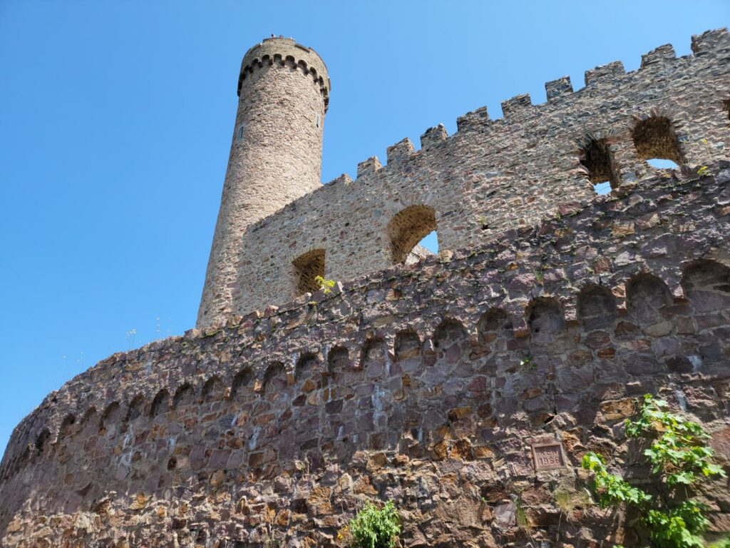
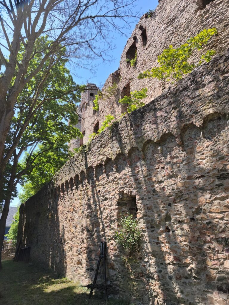
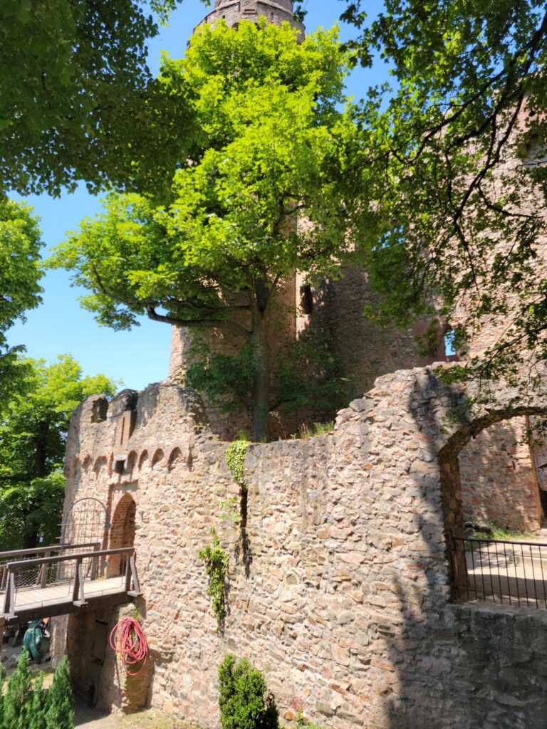
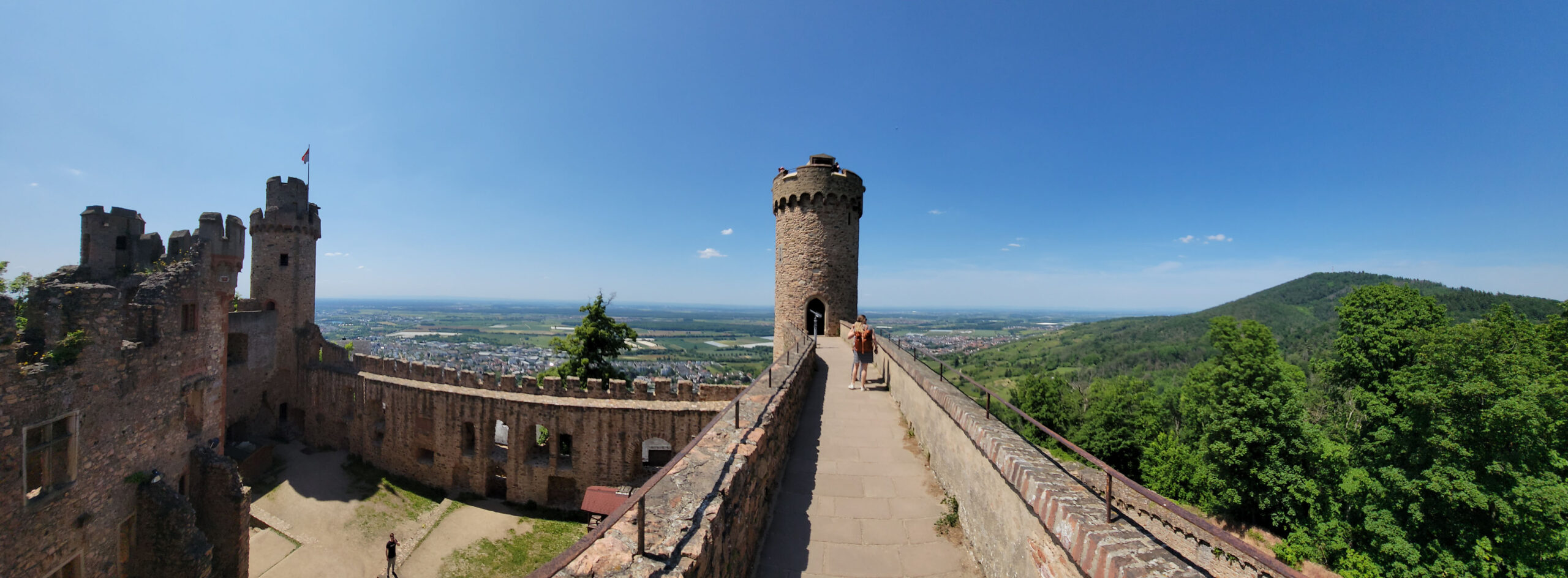
Perched above the small hamlet of Auerbach, located immediately north of Bensheim, Germany is the castle of Auerbach. The Auerbach Castle is privately owned, maintained and is free to visit. Hiking and walking around its grounds and castle is allowed and encourage by the many structures that have been put in place to reach the upper parts of the castle.
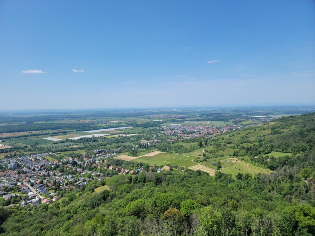
South panorama – Auerbach Castle – Auerbach, Germany
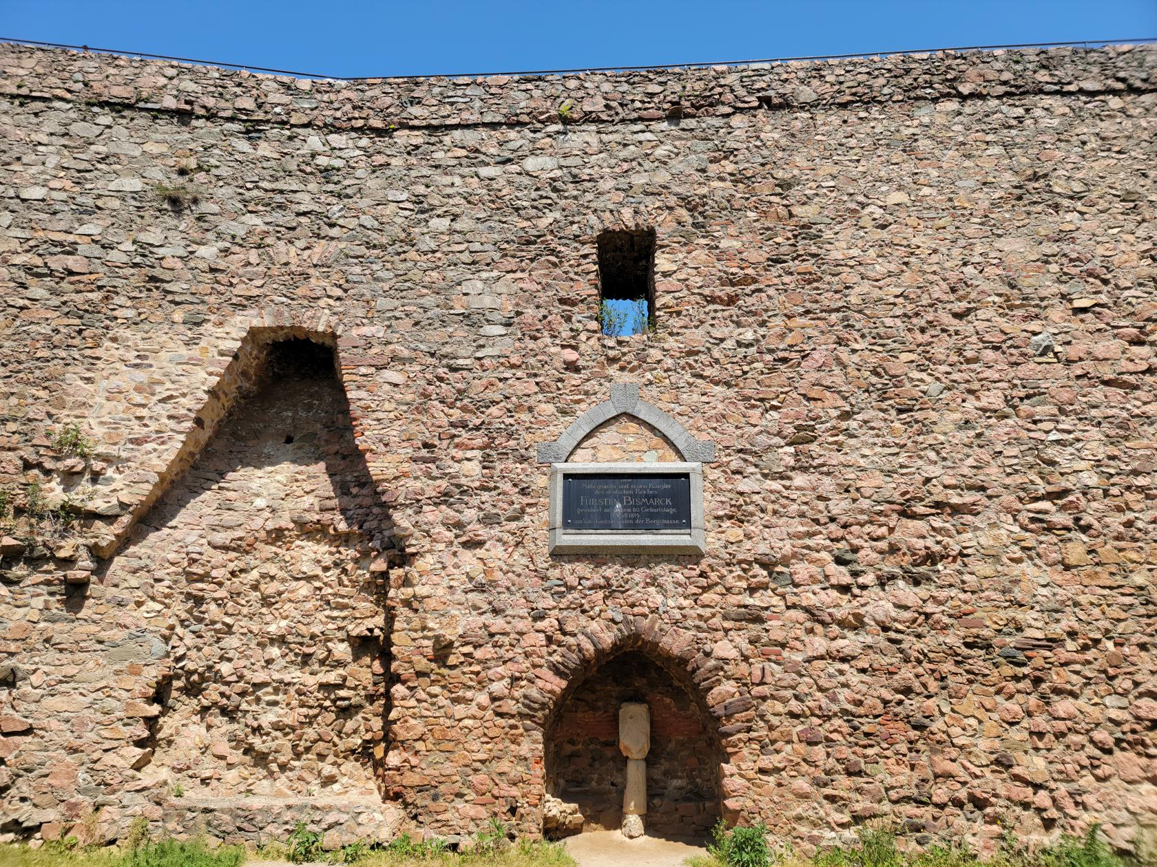
Auerbach Castle
This is a perfect destination for a day trip, where one can go and enjoy the weather and the beautifully forested grounds of the castle. The castle itself is rather small and may be used to get an excellent view of the surrounding area and countryside beyond.
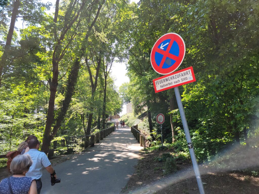
The way up from nearest parking lot – Auerbach Castle – Auerbach, Germany
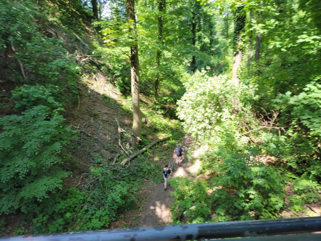
There are plenty of trails – Auerbach Castle – Auerbach, Germany
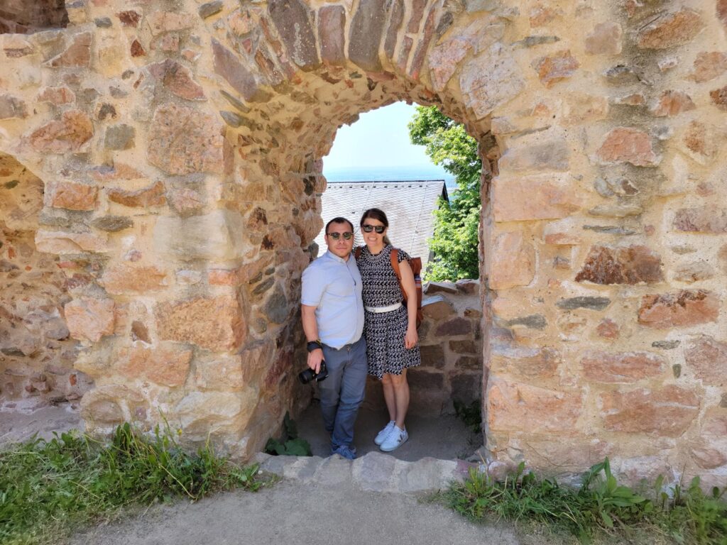
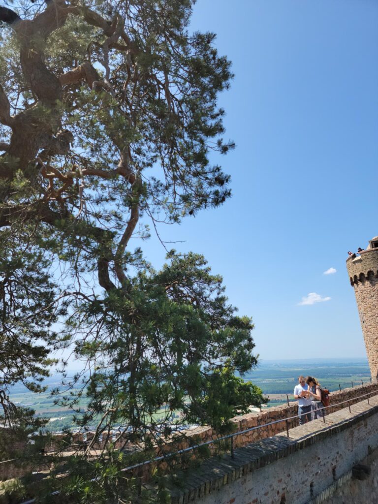
Gabi and Ericka – Auerbach Castle – Auerbach, Germany
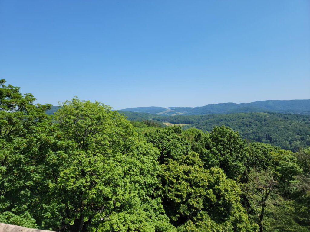
We were lucky enough to stop on our way to Frankfurt, and on a day of exceptional weather, where we were able to easily make out the nuclear power plant ten miles away and the hills beyond that, at what must be close to fifty miles away.
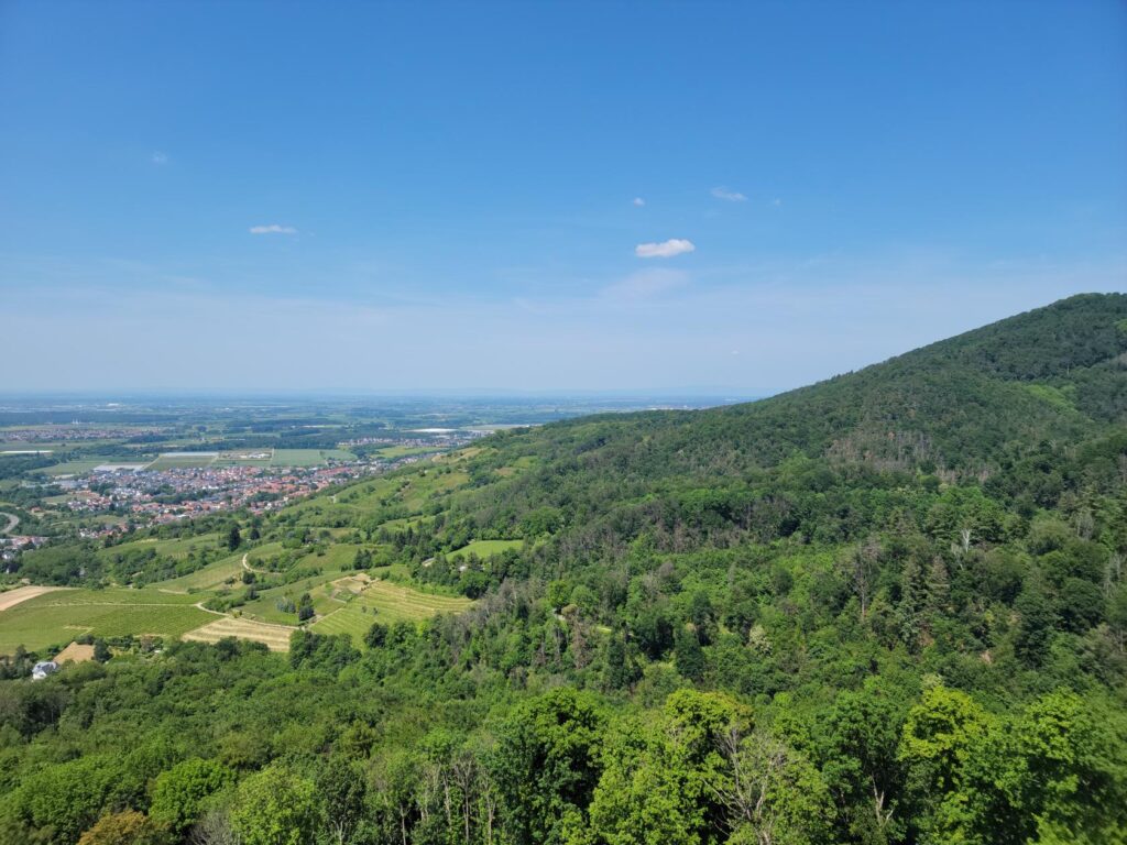
North panorama – Auerbach Castle – Auerbach, Germany
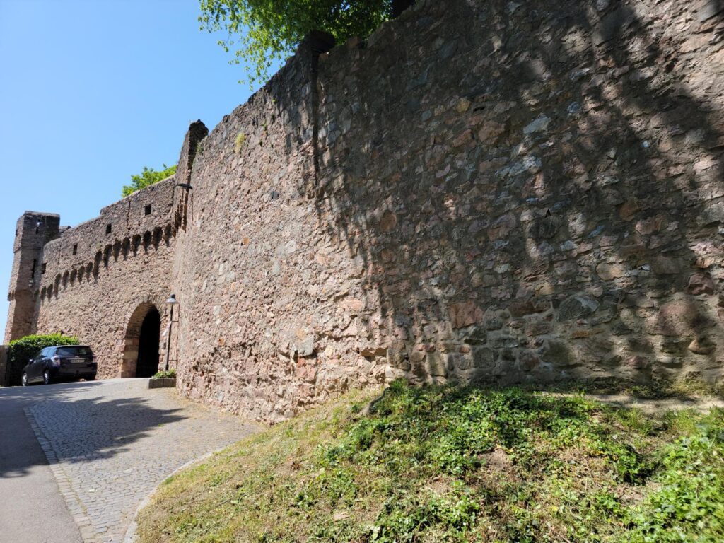
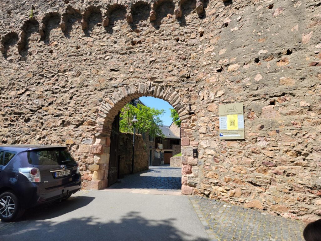
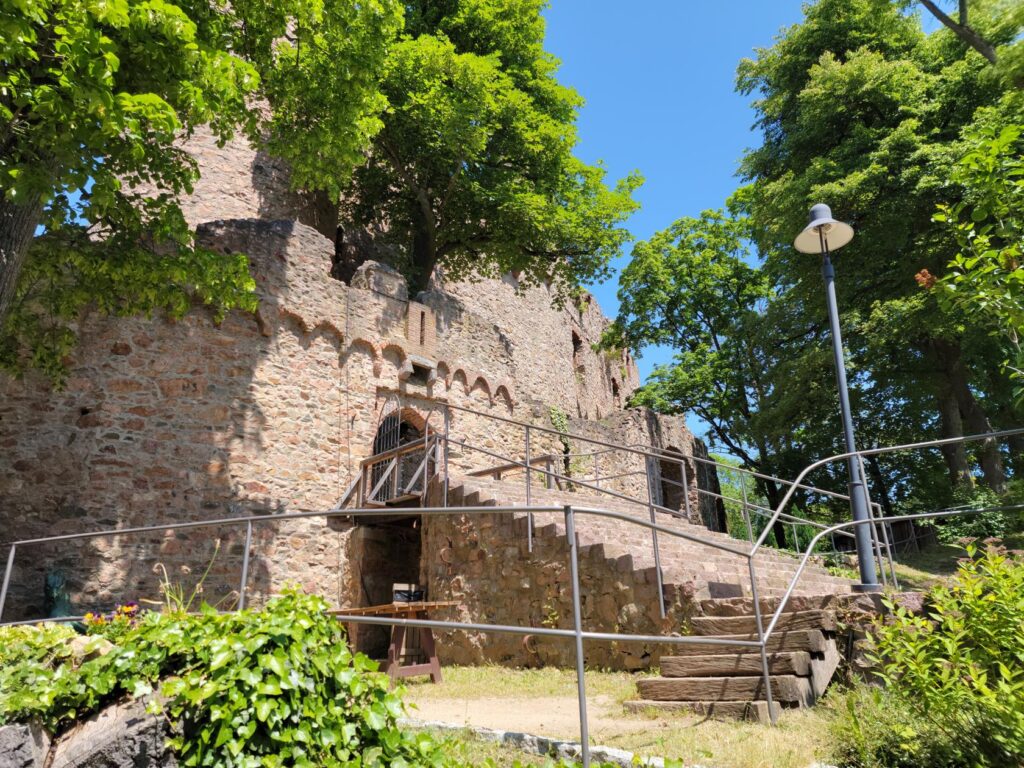
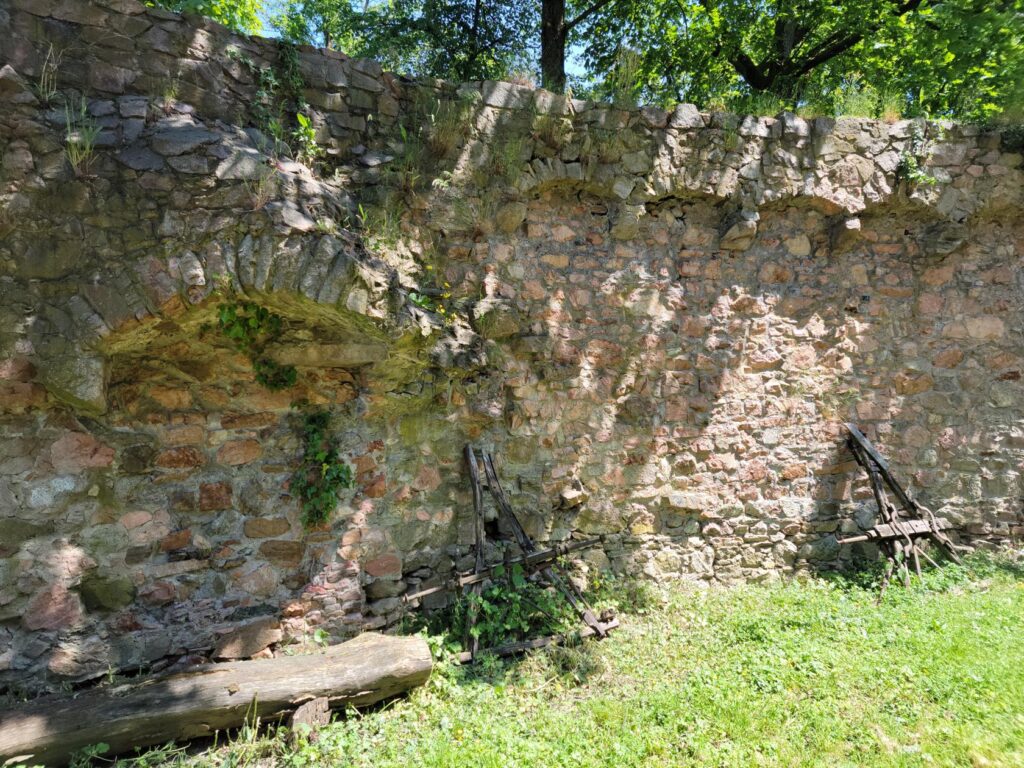
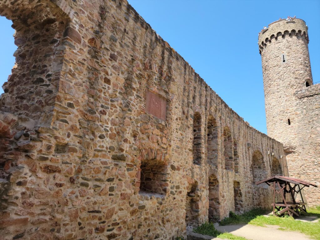
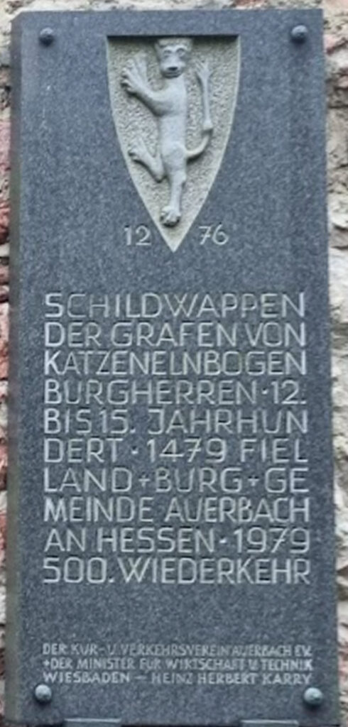
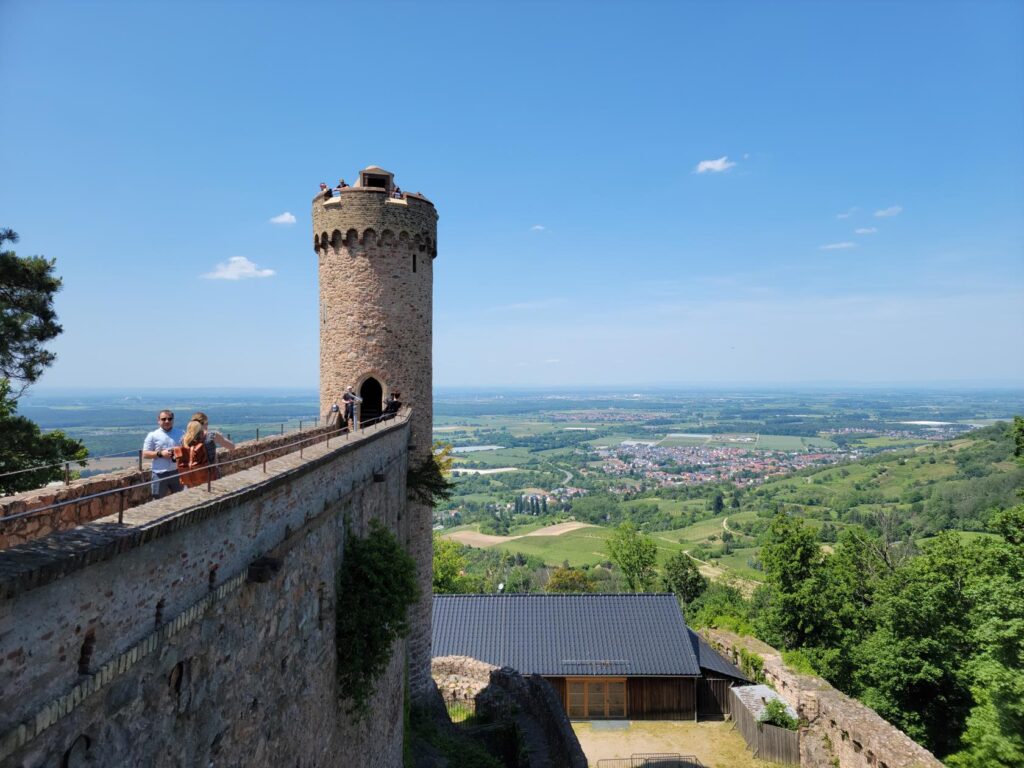
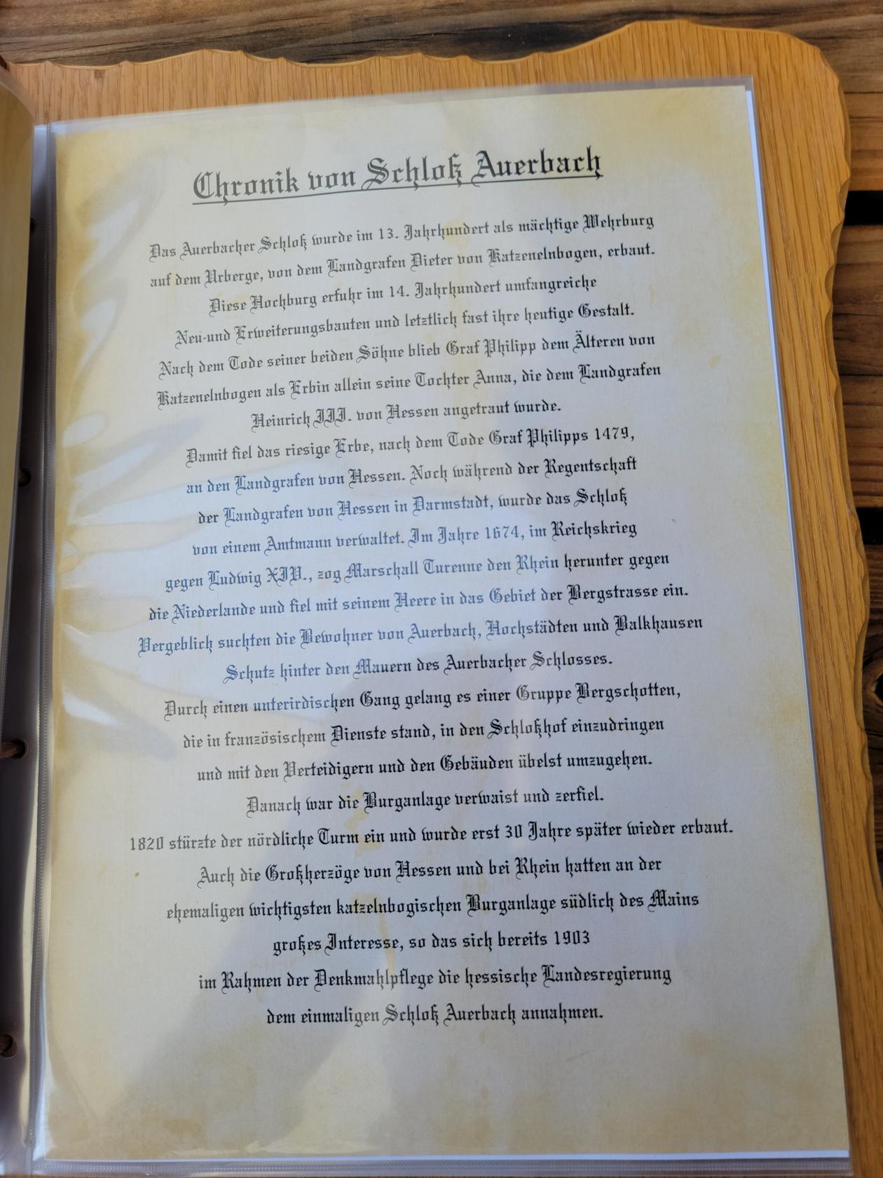
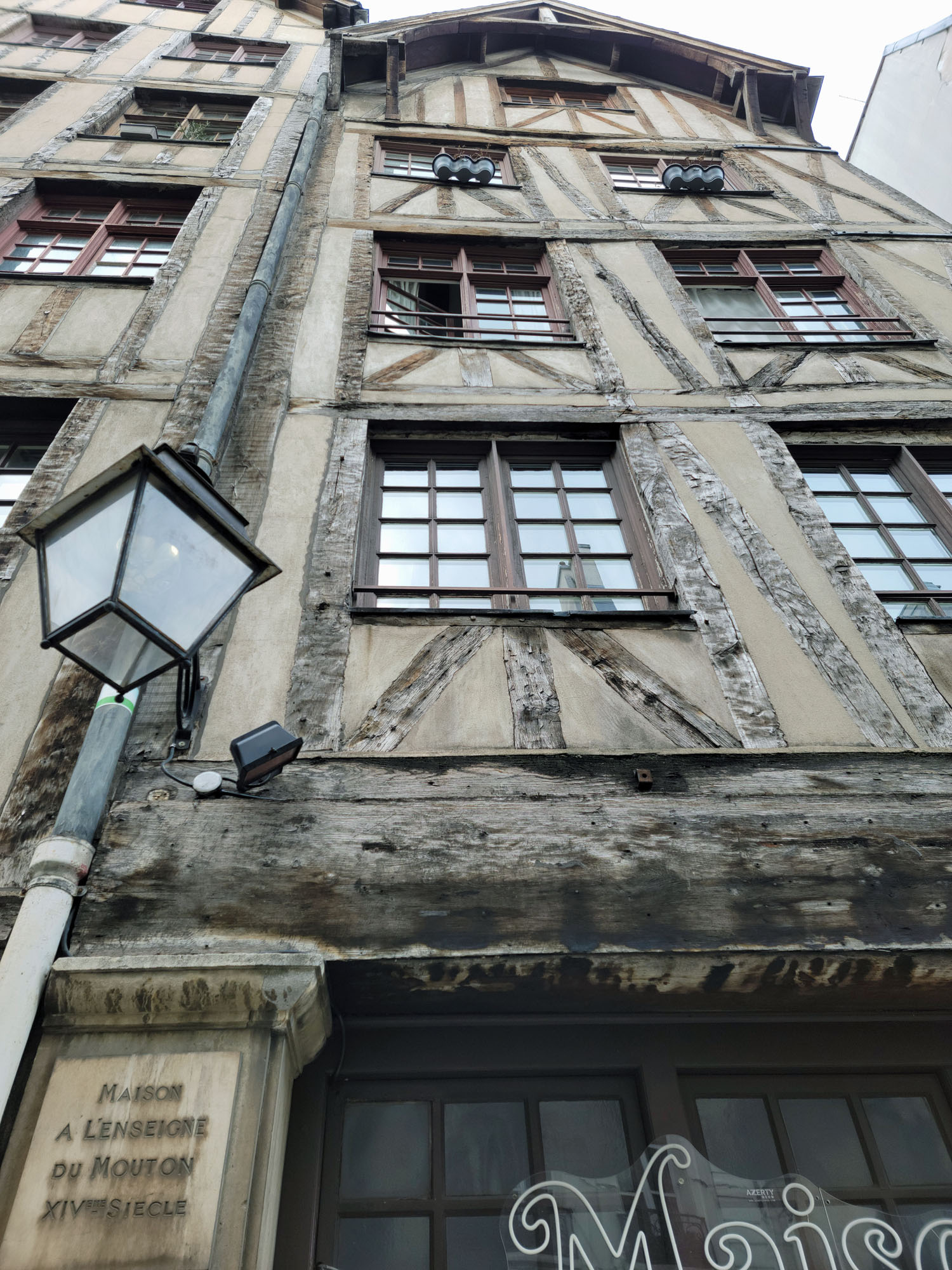
The castle was built sometime in the thirteenth century on what they called the old hill, or Urberg. It was probably partially maintained as a strategic fortification well into the seventeenth century, when it was no longer needed.
Over the next hundred years or so, it fell into disrepair and eventually the north tower collapsed. In the nineteenth century, it was repaired and partially rebuilt, the former bailey[1]A bailey is a protective walled courtyard, usually surrounded by a palisade or ditch outside. being converted into an Inn and eventually taking on its final form we see today. You can actually stay at the Inn even today.
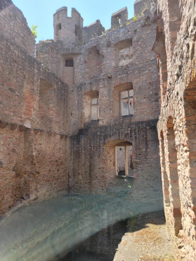
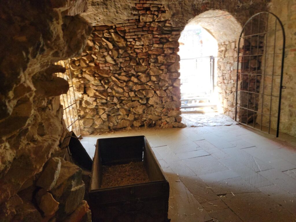
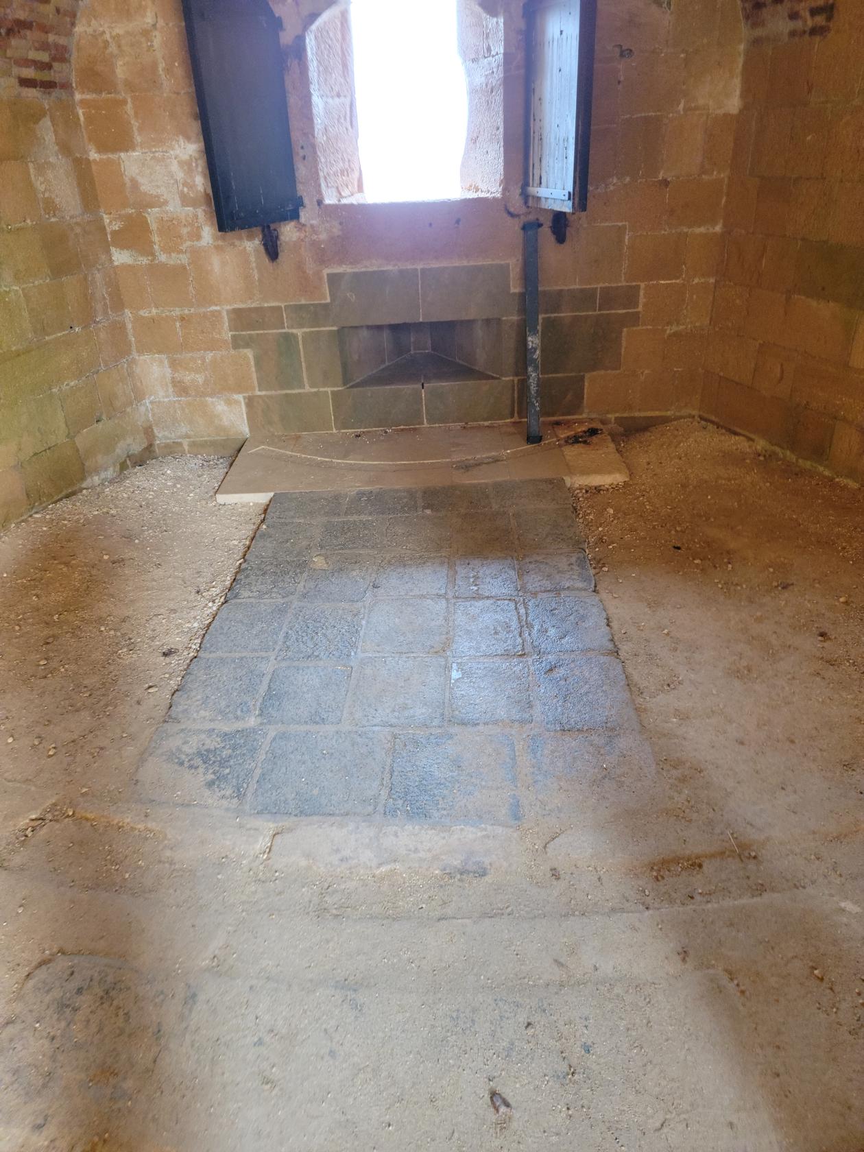
Interior – Auerbach Castle – Auerbach, Germany
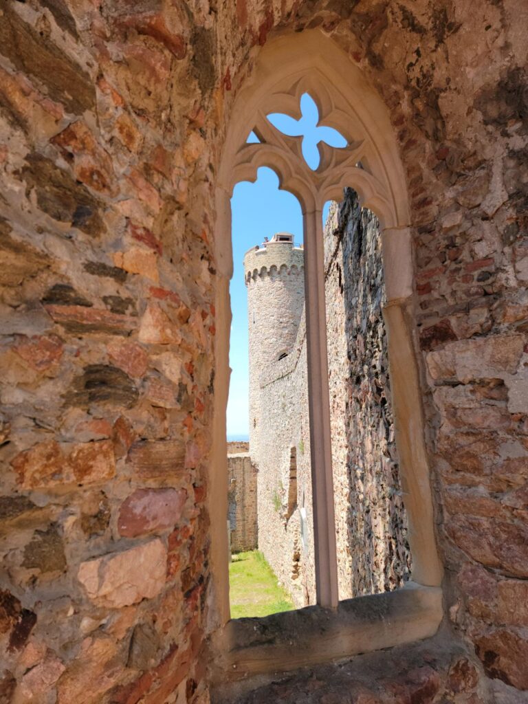
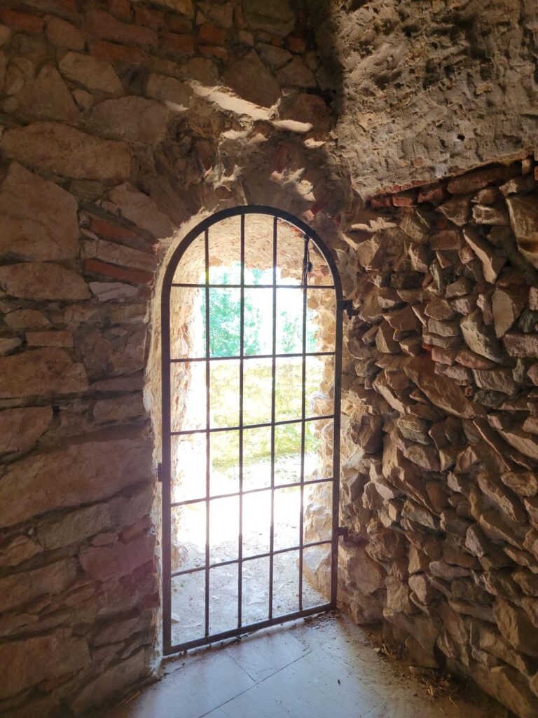
An old window – Auerbach Castle – Auerbach, Germany
A view of the outside wall – Auerbach Castle – Auerbach, Germany
North tower gate – Auerbach Castle – Auerbach, Germany
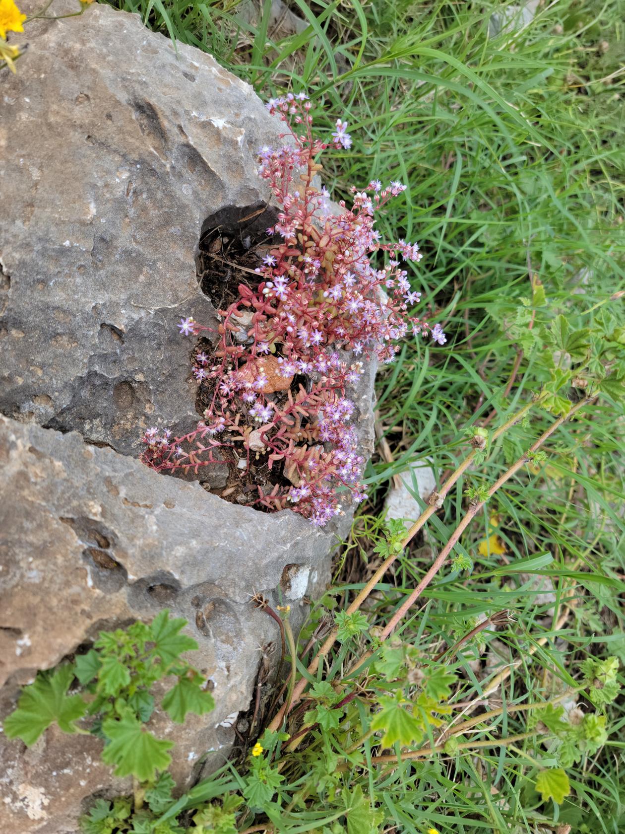
Old tree – Auerbach Castle – Auerbach, Germany
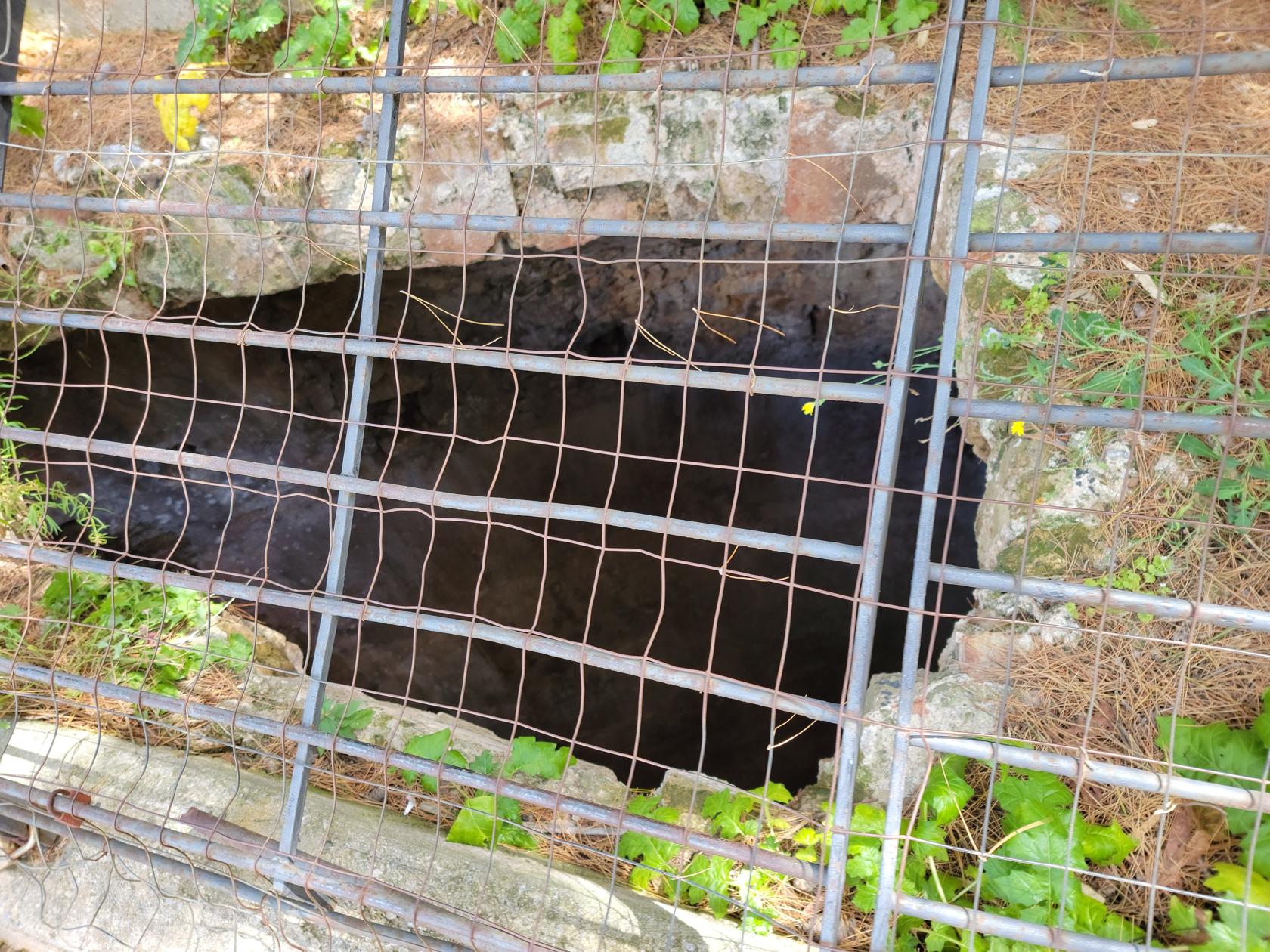
The moat – Auerbach Castle – Auerbach, Germany
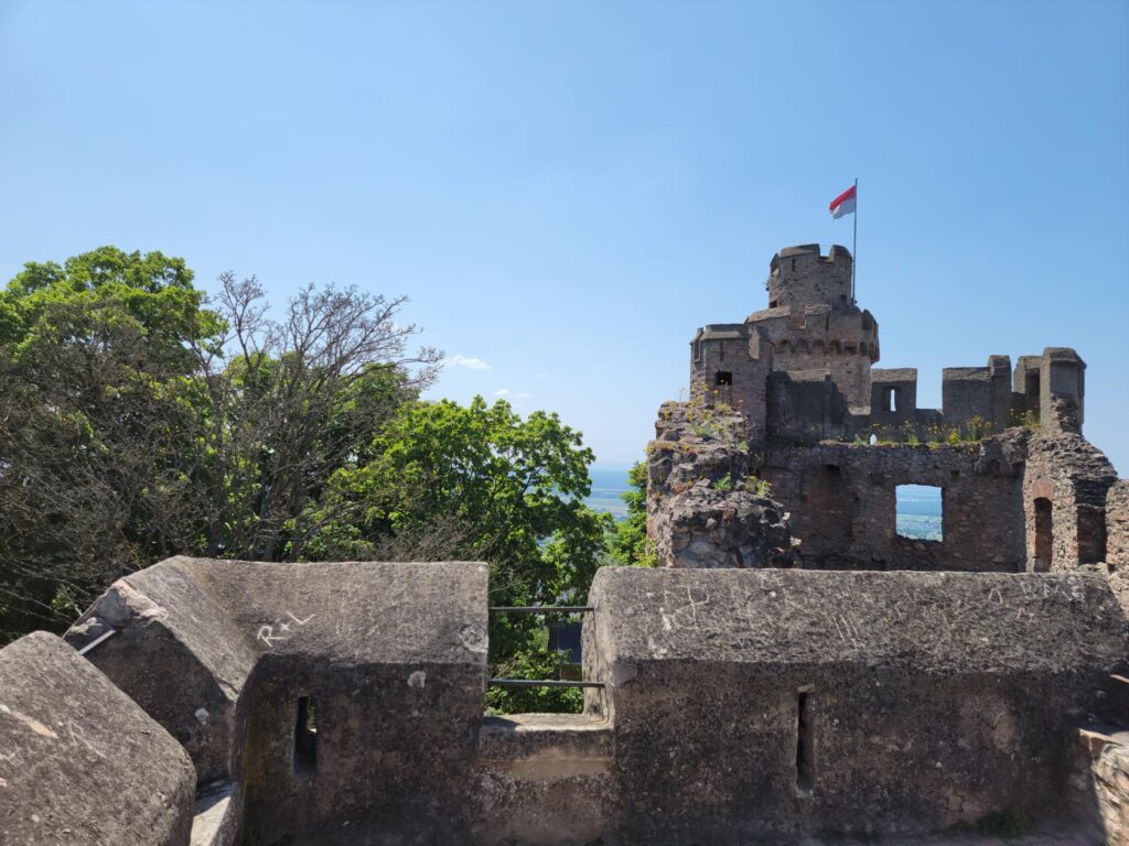
The south tower – Auerbach Castle – Auerbach, Germany
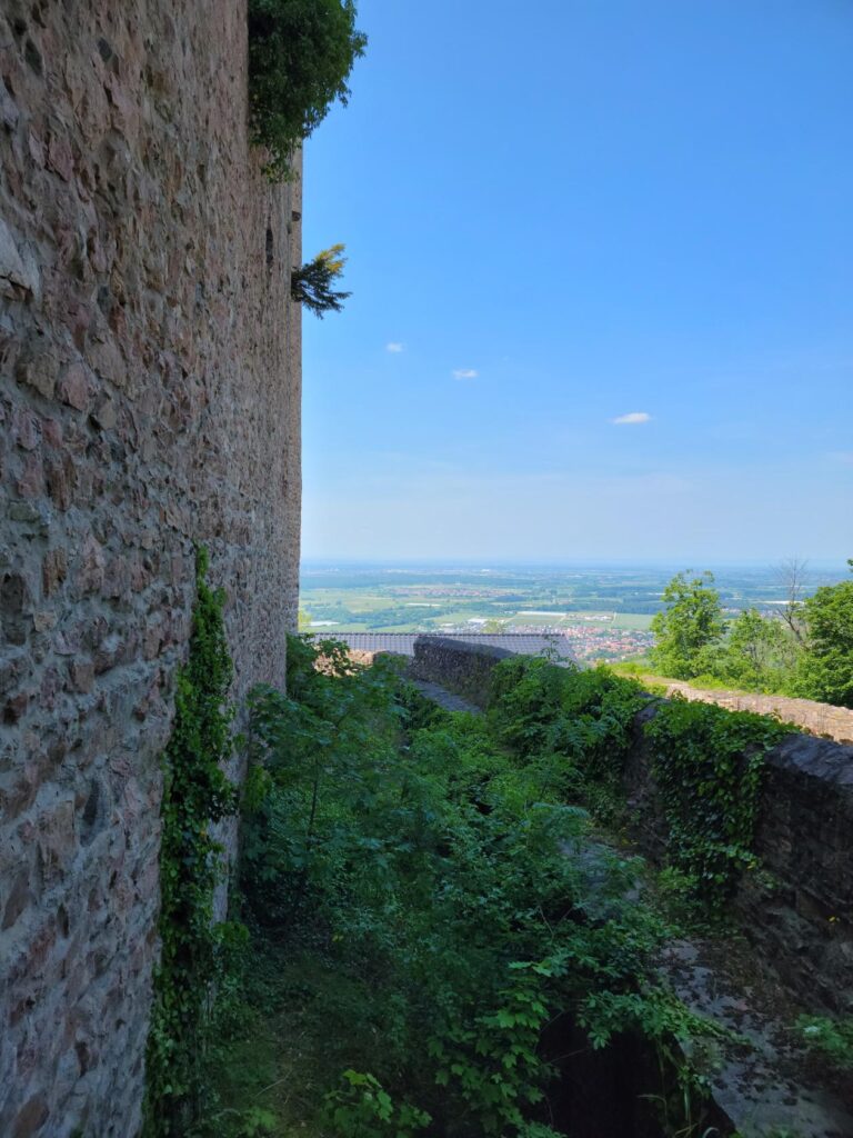
A view of the hills behind – Auerbach Castle – Auerbach, Germany
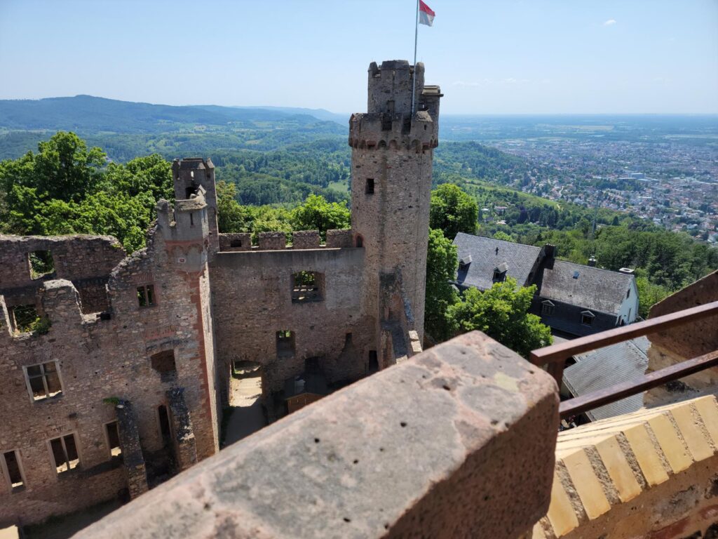
The north tower with Zwingenberg – Auerbach Castle – Auerbach, Germany
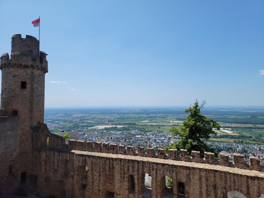
South tower and Bensheim below – Auerbach Castle – Auerbach, Germany
South tower looking south – Auerbach Castle – Auerbach, Germany
Looking north – Auerbach Castle – Auerbach, Germany
Inside one the north tower – Auerbach Castle – Auerbach, Germany
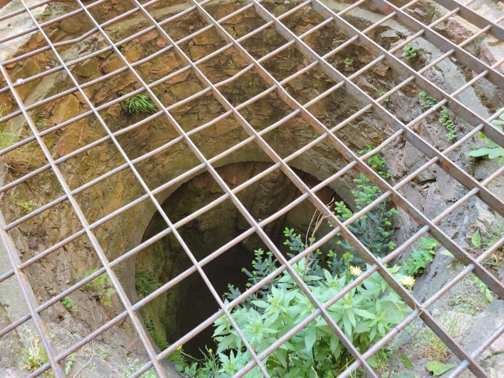
Castle well – Auerbach Castle – Auerbach, Germany
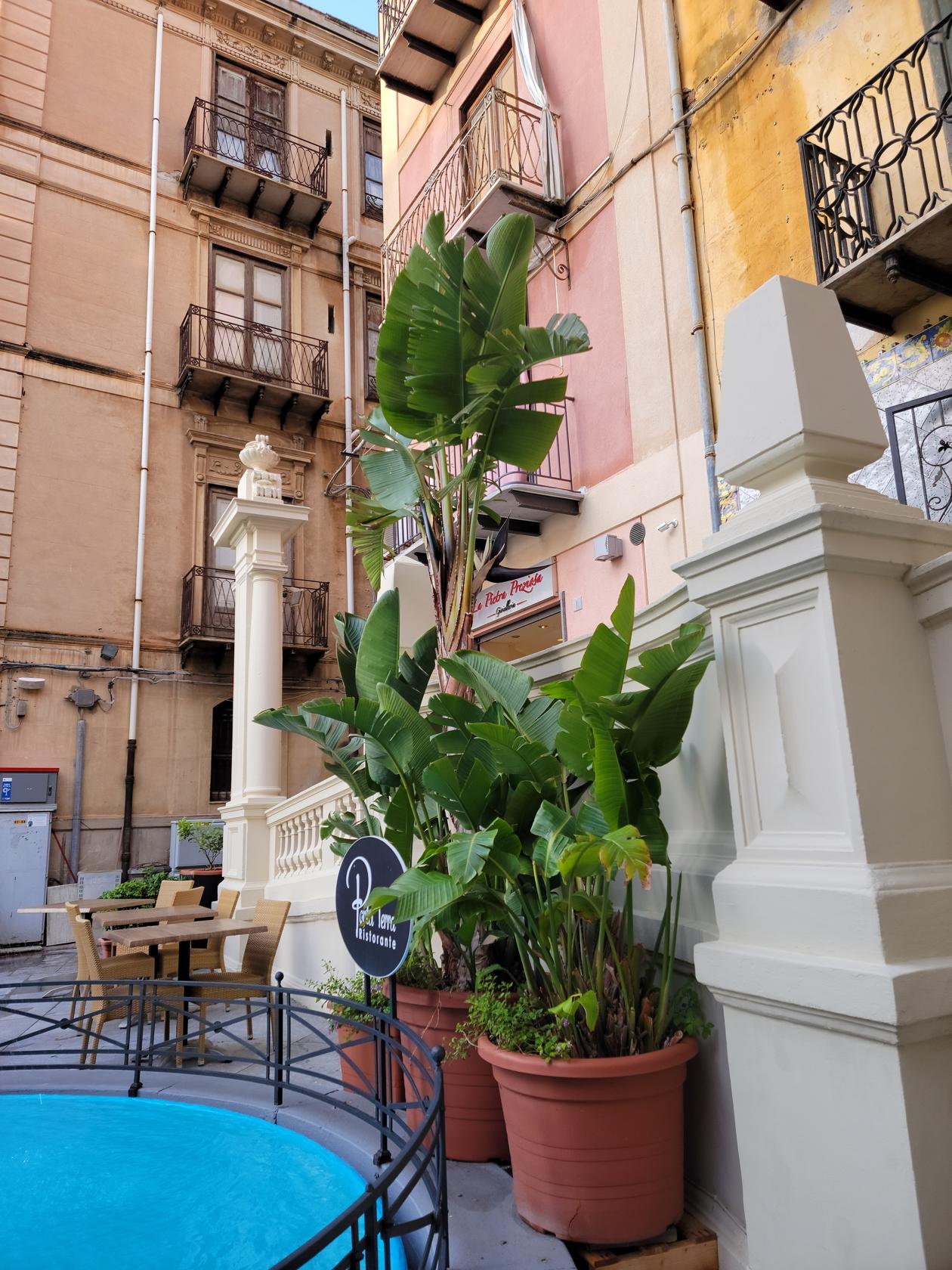
Restaurants
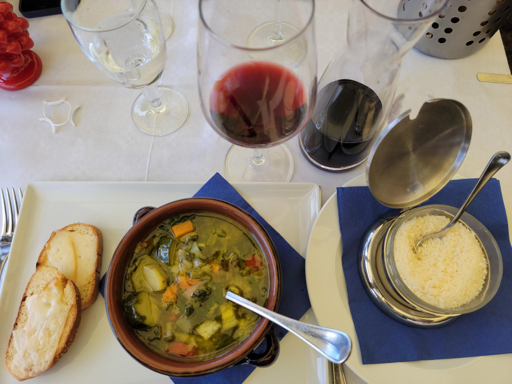
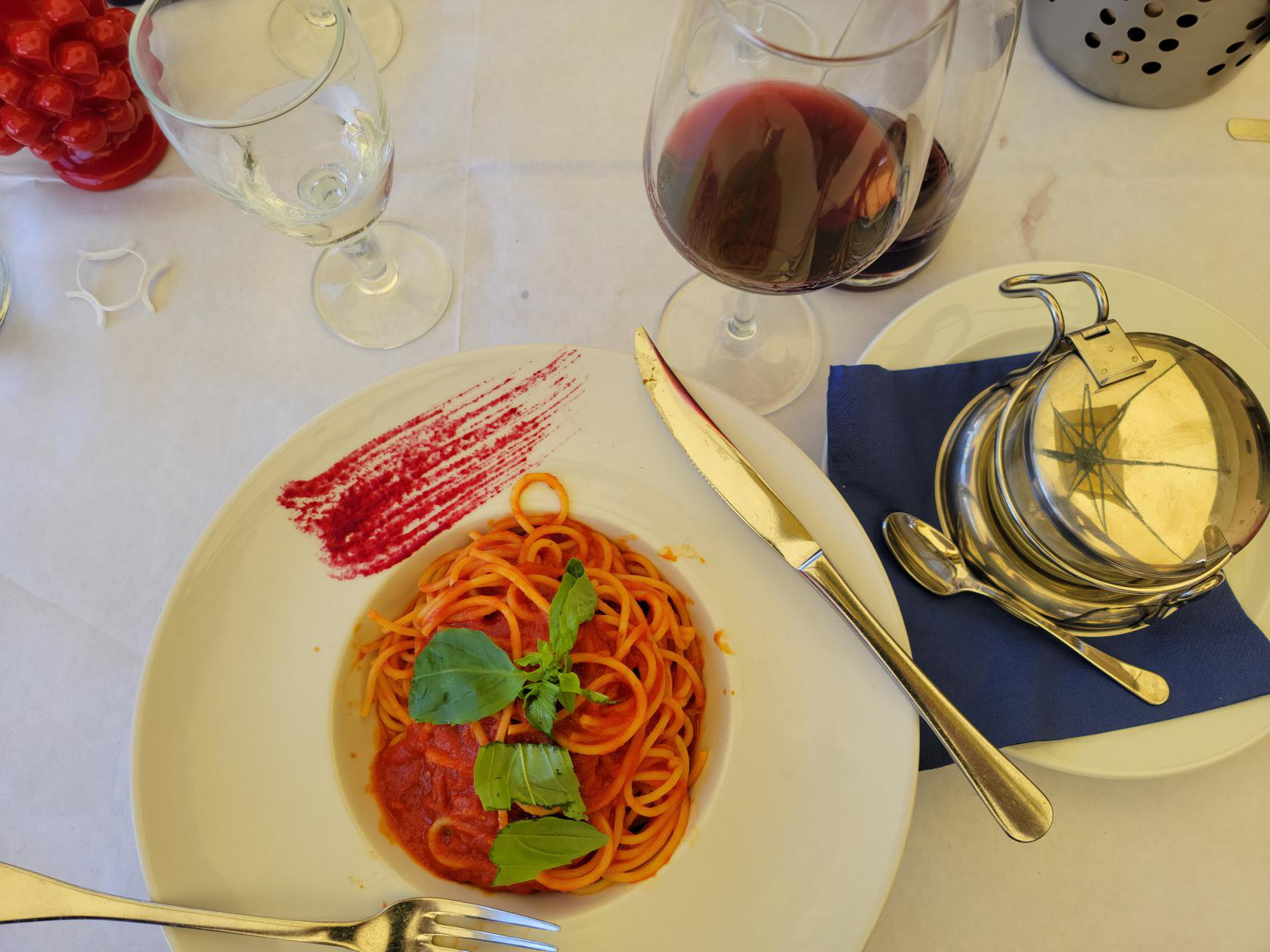
There is only one restaurant on the grounds and a cafe. The cafe is situated outside and you may even bring your own food and enjoy a nice picnic on the tables that have been provided, assuming I would guess, if you buy a drink. The restaurant is inside, has a marvelous outside terrace with overlook and is fully staffed. The restaurant and grounds are capable of actually holding weddings, with the appropriate arrangements, of course. They also occasionally hold dinner theaters and a Rittermahl[2]In the U.S., this would be similar to our Medieval Times, where you get a knight fight and a dinner, while cheering your team on., complete with medieval games.
Auerbach Castle Restaurant
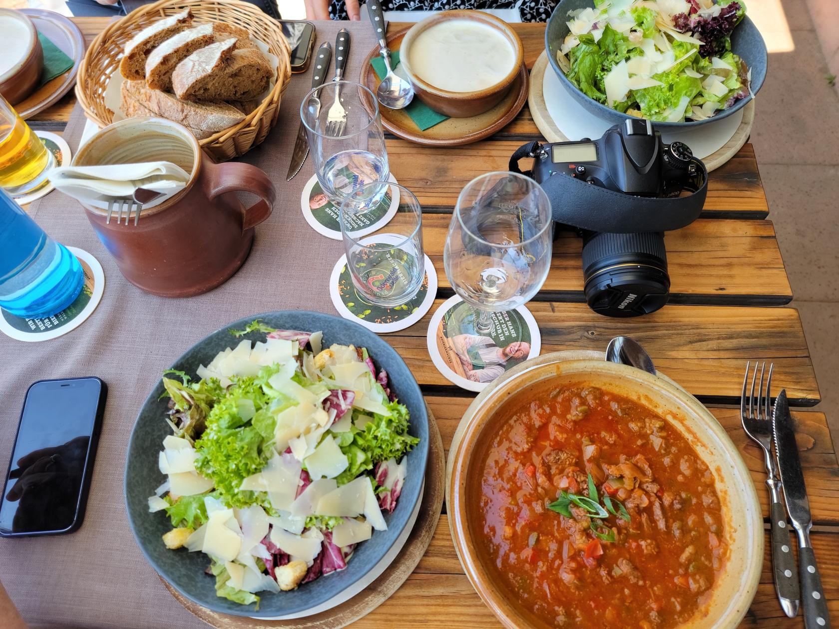
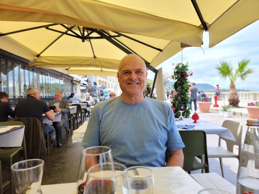
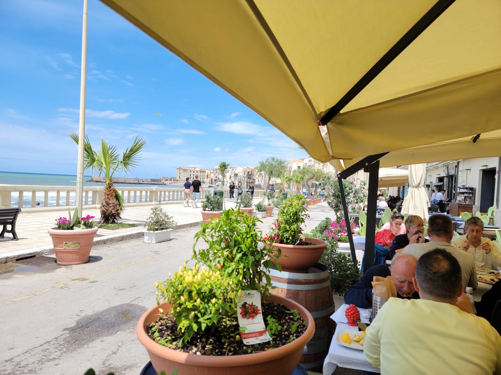
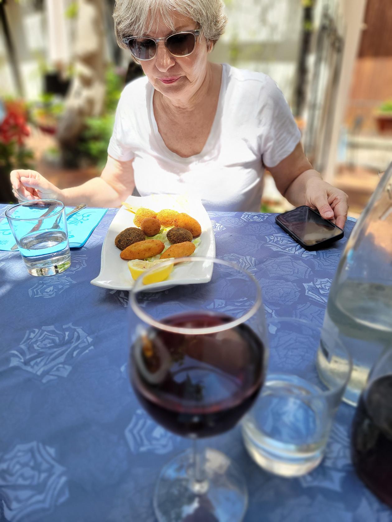
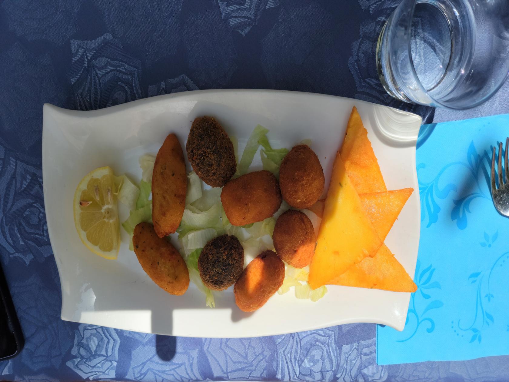
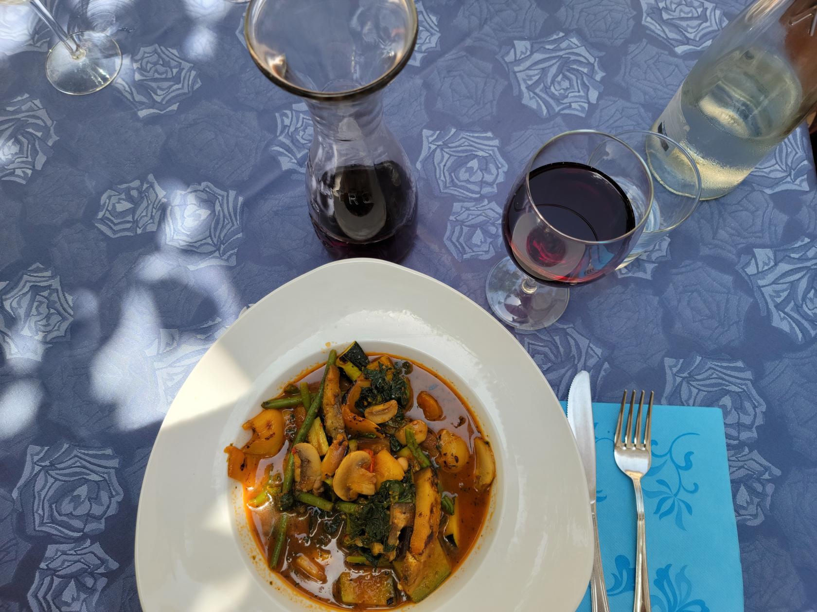
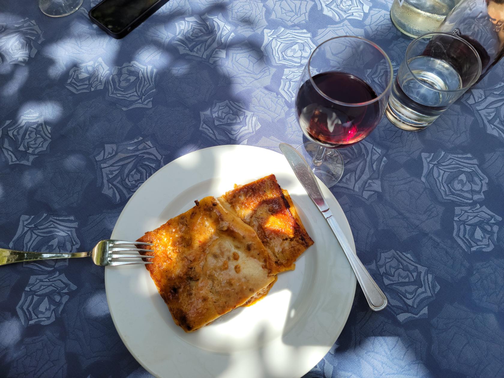
We ate lunch at the restaurant on the terrace, which of course has a commanding view of the countryside below.
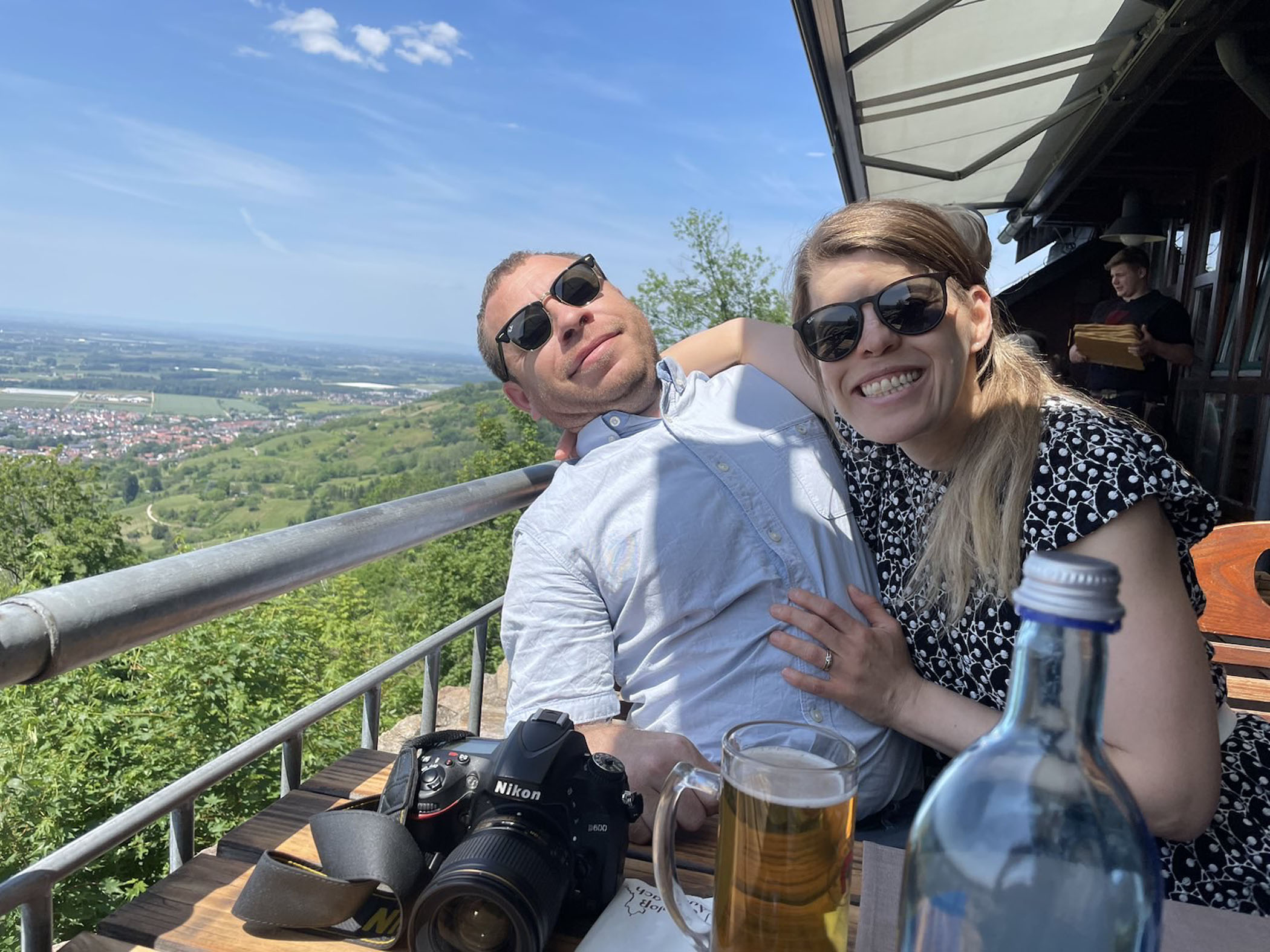
Gabi and Ericka – Auerbach Castle Restaurant – Auerbach, Germany
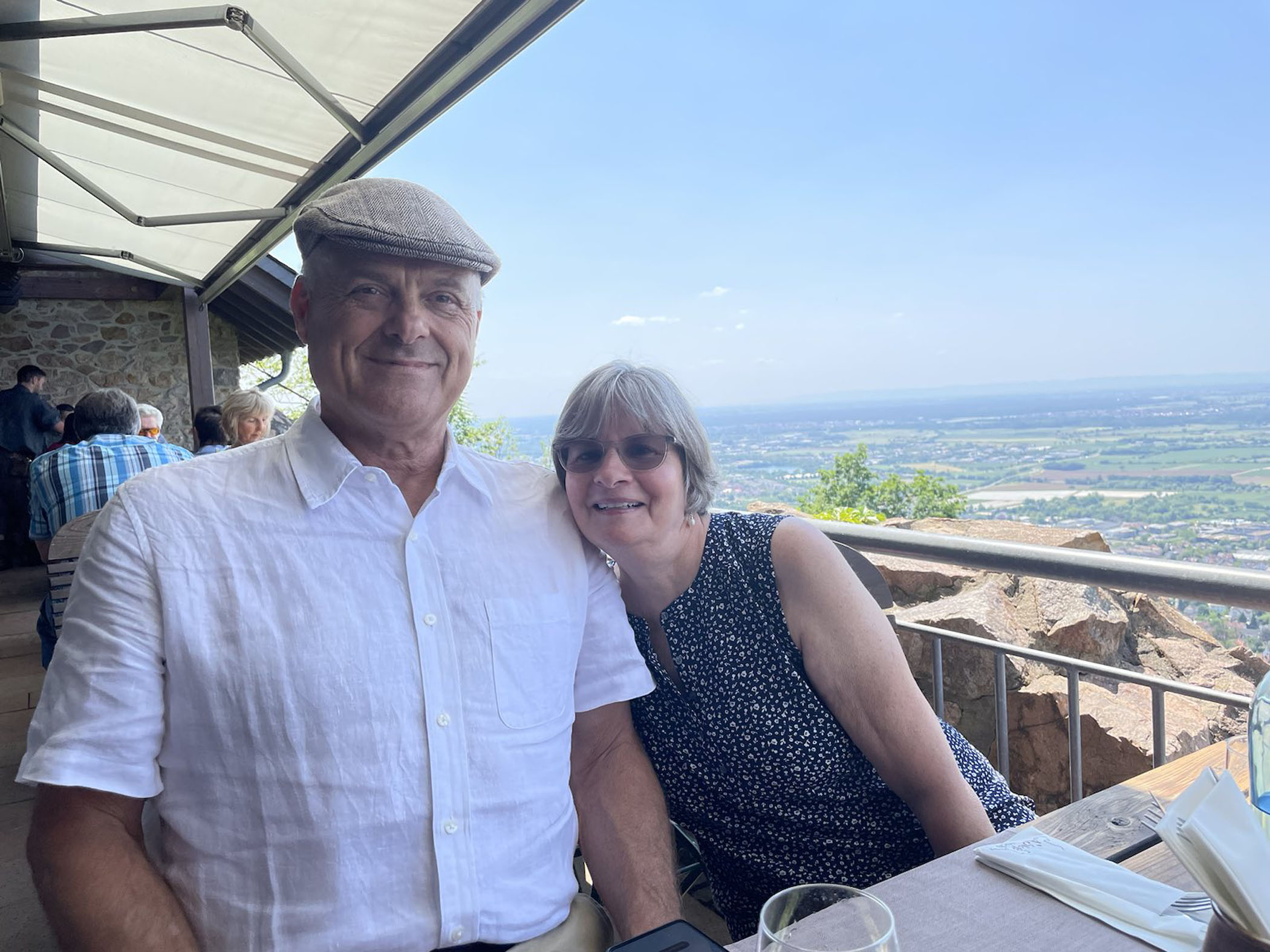
Erick and Patti – Auerbach Castle Restaurant – Auerbach, Germany
They have a very good selection of typical German dishes and the service is also very good and timely. However, I am not sure how much English they speak, since we only spoke German to them and they never attempted to speak English. So if you are an English only speaker and plan to visit, be prepared, you may have to use the point and grunt method of ordering.
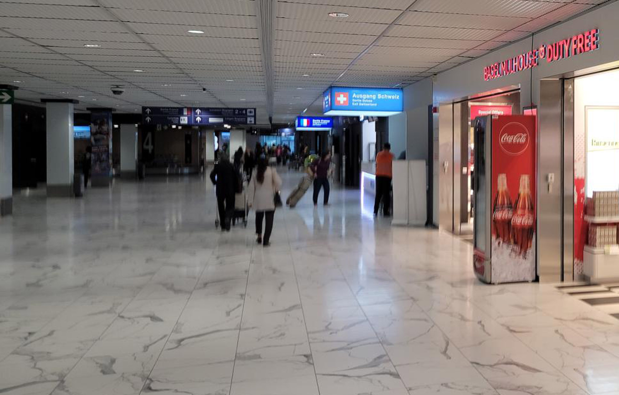
We arrived by plane from Catania, Sicily in France’s EuroAirport, also known as the Basel-Mulhouse-Friebourg airport. You arrive via the air and exit in any one of three countries, Switzerland, Germany or France.
Three exits at airport, Germany, Switzerland and France – Basel -Mulhouse-Freibourg Airport, France
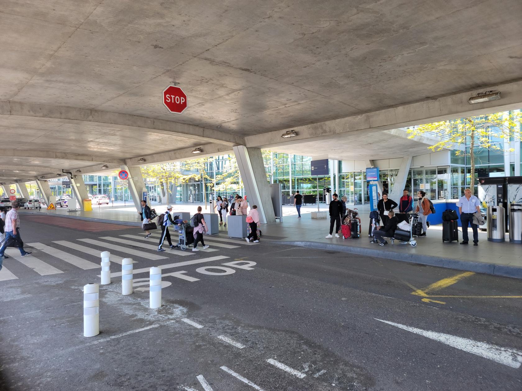
A word of caution though, exiting in France, you may find it difficult to get a taxi. We waited for a half an hour and ended up sharing a ride with a Frenchmen that explained to us that exiting via the France exit has the least amount of taxis. Of course, the airport has no information booth and you can’t of course change your mind once you are out.
French exit – Basel -Mulhouse-Freibourg Airport, France
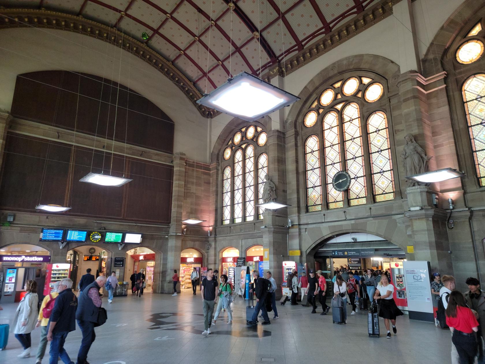
The taxi drive was about five minutes and we were standing at the Saint-Louis la Chaussée train stop, having already purchased our tickets via phone. From there we went to Mulhouse and then on to Strasbourg, again using France’s regional train service, which you can essentially purchase any ticket in the future and still be able to use it for earlier trains.
Main train station – Strasbourg, France
Argantorati
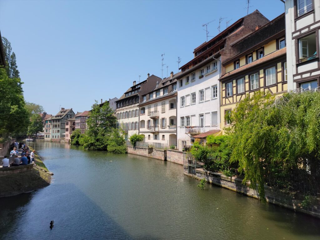
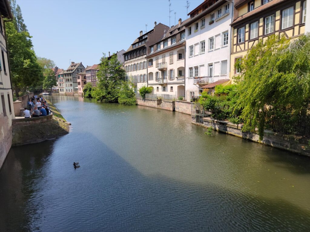
Just barely in France on the border with Germany is the small quaint city of Straßburg, or Strasbourg to the French, and it actually goes by other names to some of the ethnic minorities. The name has German origins and meaning as ‘the town at the crossing of roads‘. It is also the place where the river Ill dumps into the mighty Rhine river.
Notre Dame de Strasbourg – Strasbourg, France
The original settlement here before the fifth century CE, was known as the fortified silver settlement, a compound of the Celtic arganto for silver and rati for fortification. It was later latinized into Argentium and Argentina, or city of silver, where it is known in numerous texts. What follows is a slideshow of some of the many amazing sites you will see as you walk the city.
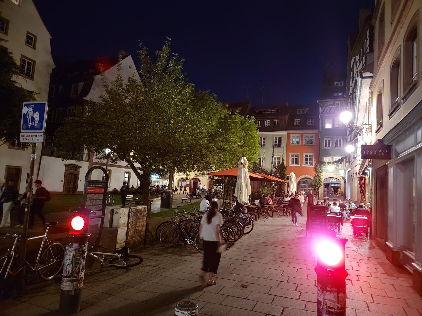
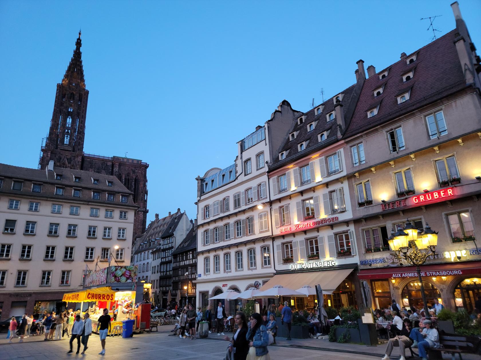
Restaurants in the evening – Strasbourg, France
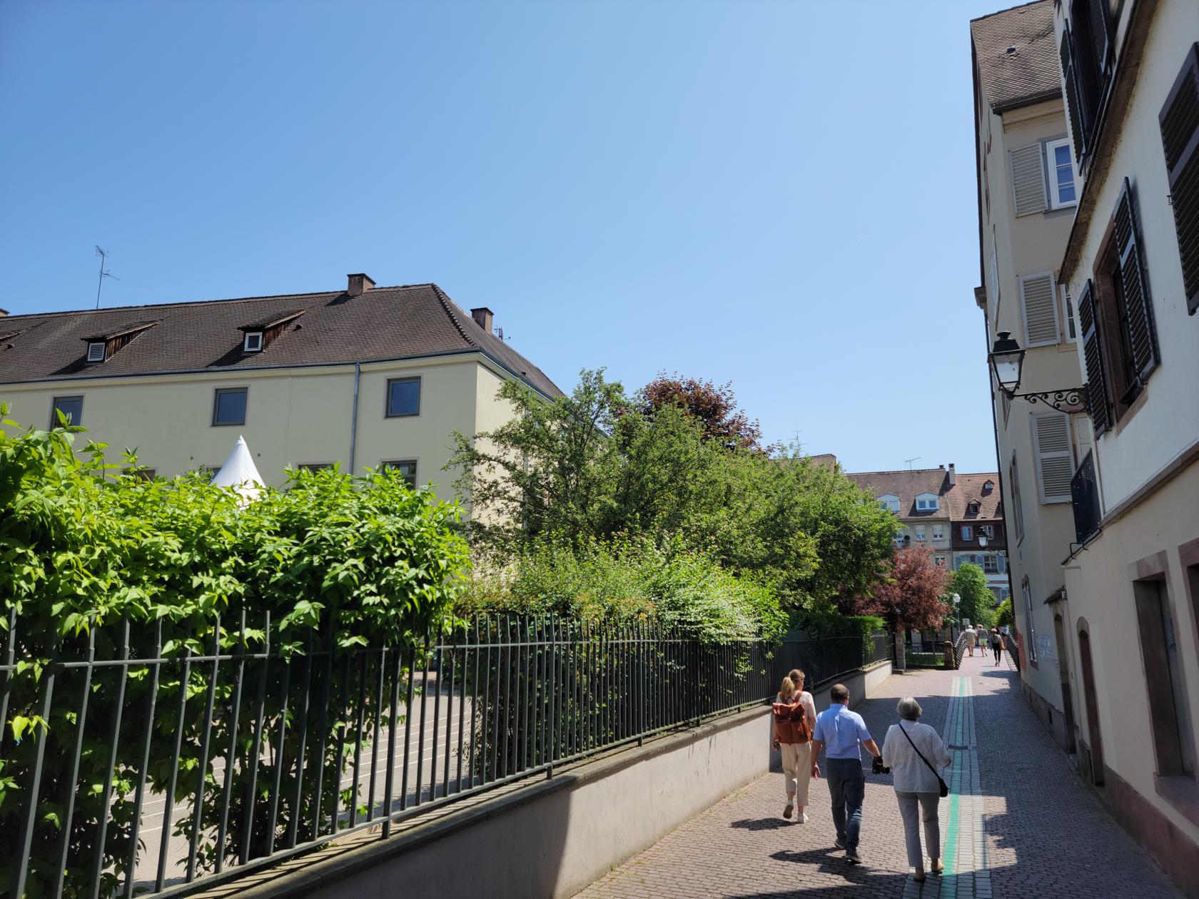
An evening walk – Strasbourg, France
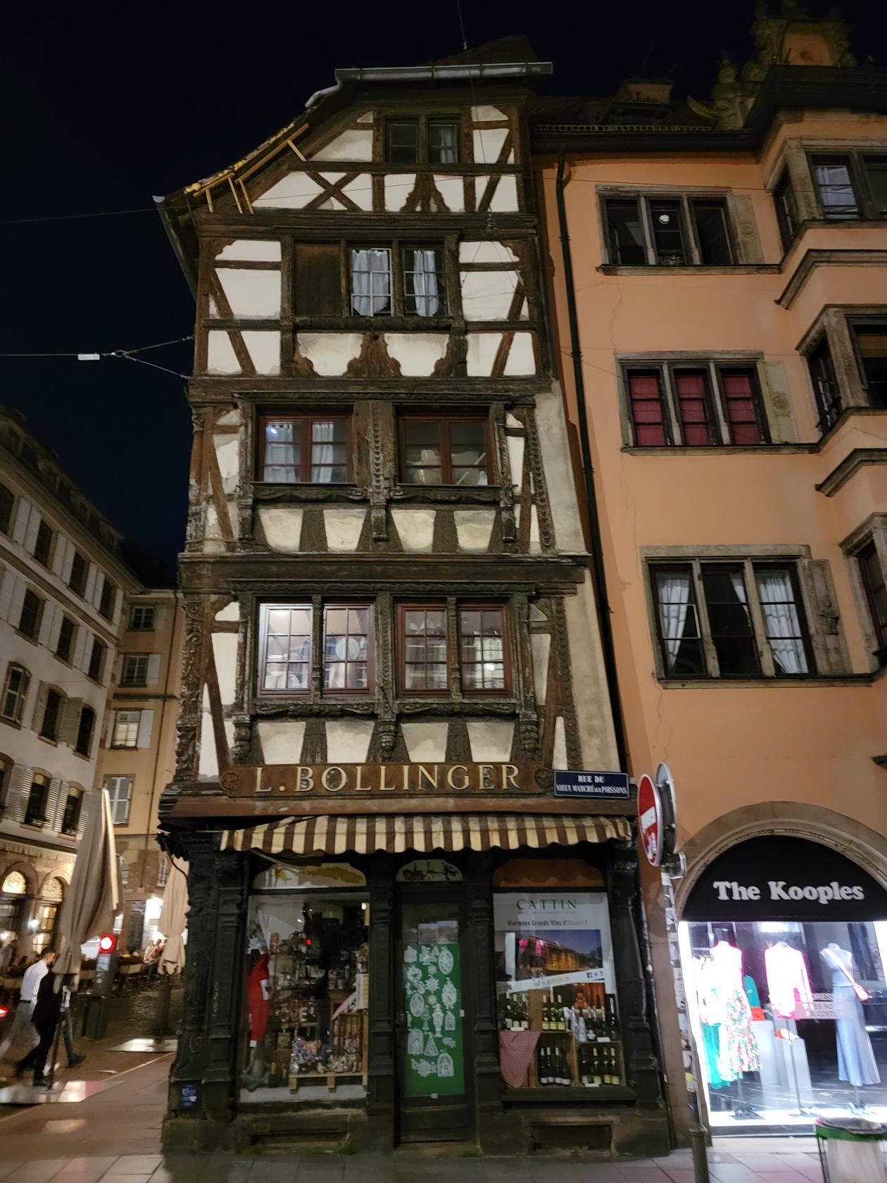
The old Bollinger House – Strasbourg, France
The river Ill from outside the hotel – Hotel Cour Du Corbeau – Strasbourg, France
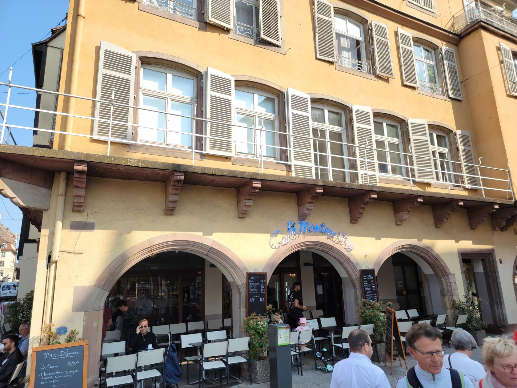
Cafe Mont Martre – Strasbourg, France
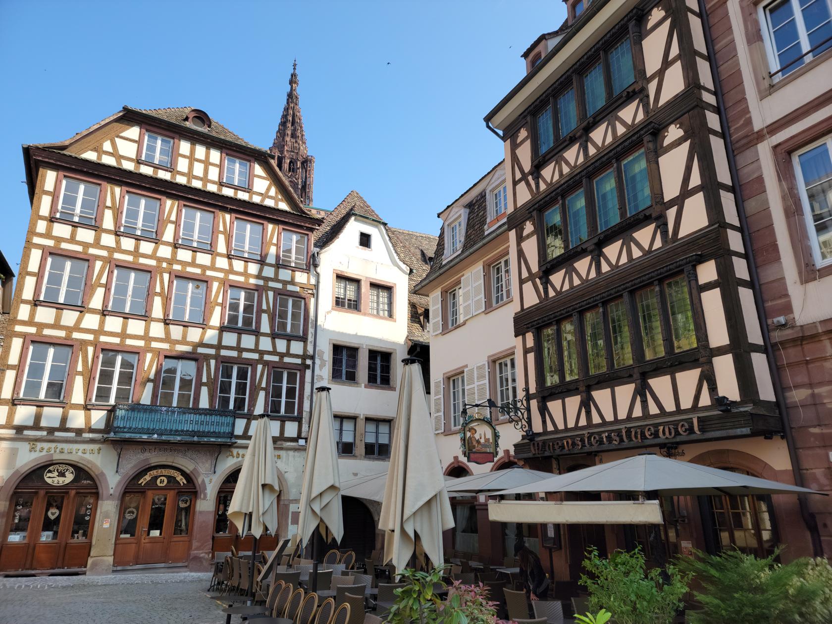
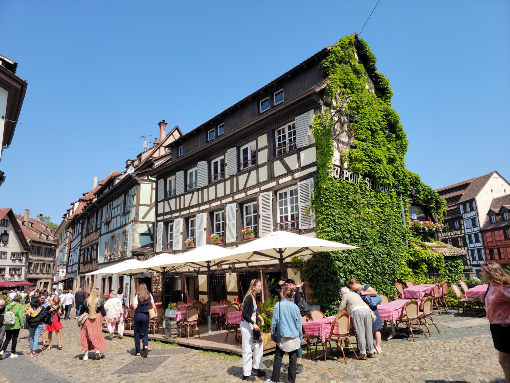
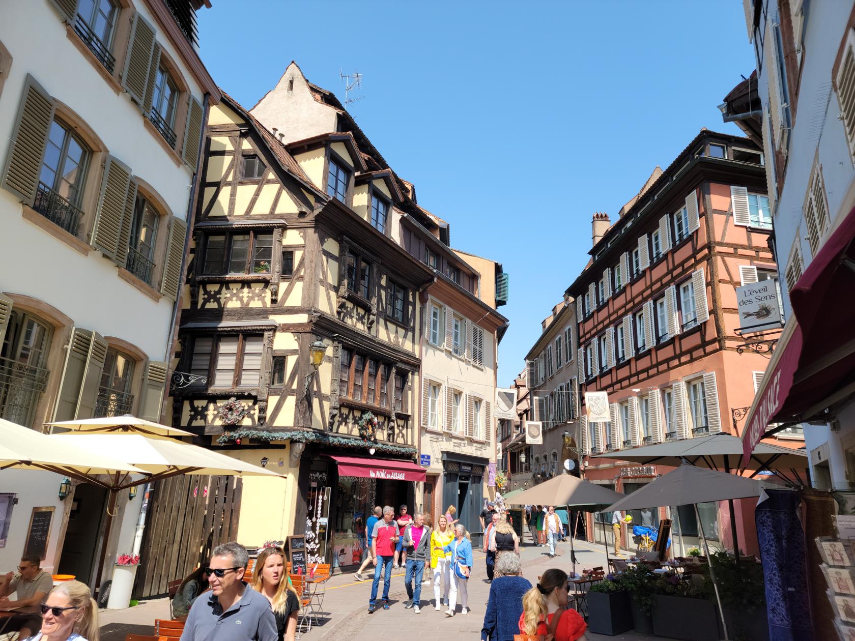
Old wooden framed houses – Strasbourg, France
Old business signs – Strasbourg, France
Another unique wooden framed house – Strasbourg, France
A beautiful day from Pont Saint-Thomas – Strasbourg, France
A beautiful day from Pont Saint-Thomas – Strasbourg, France
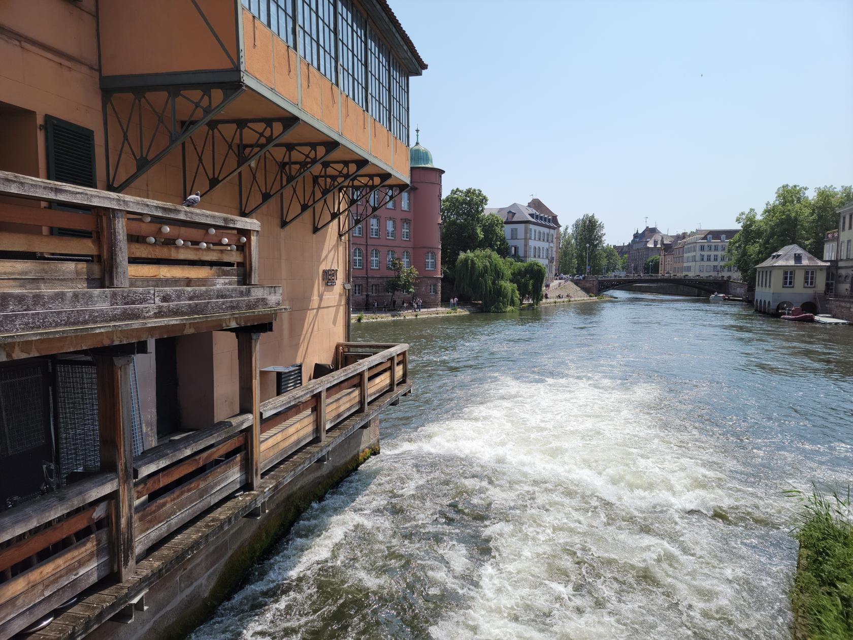
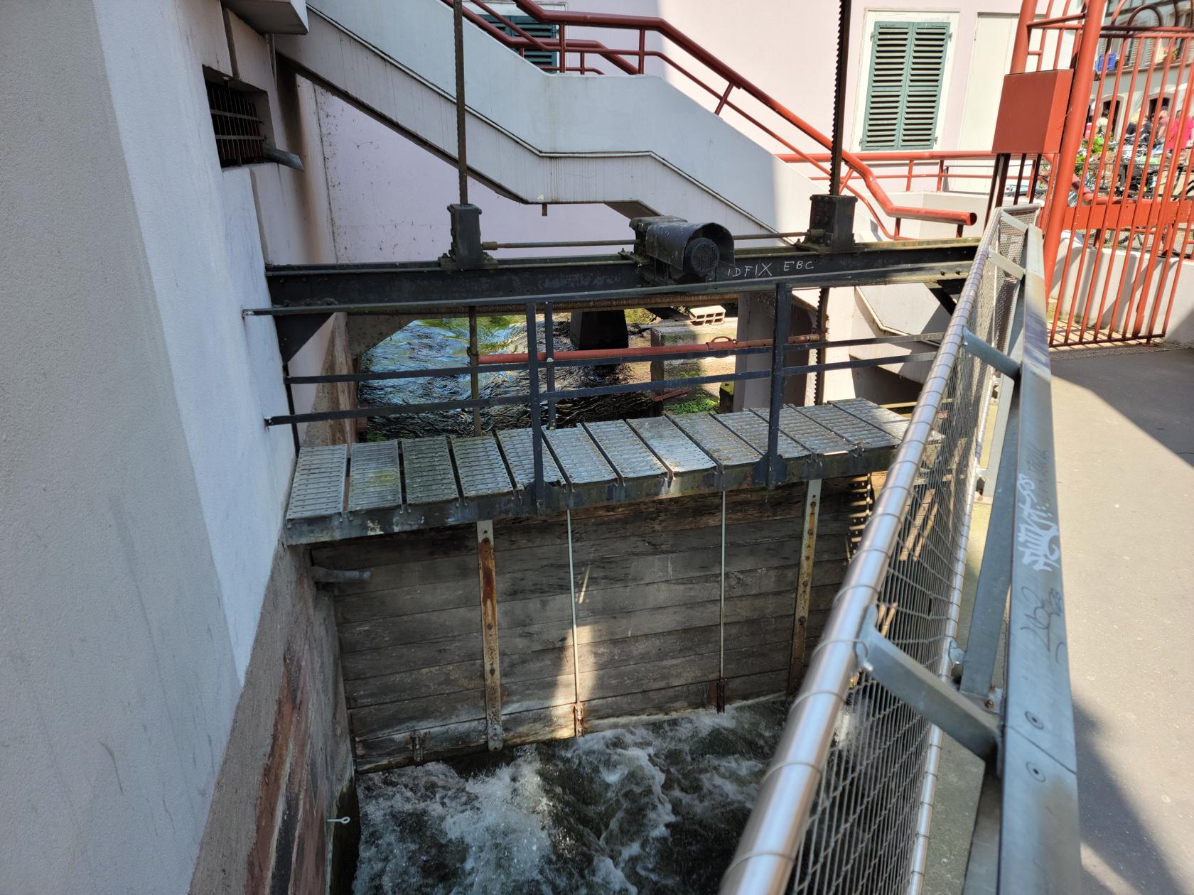
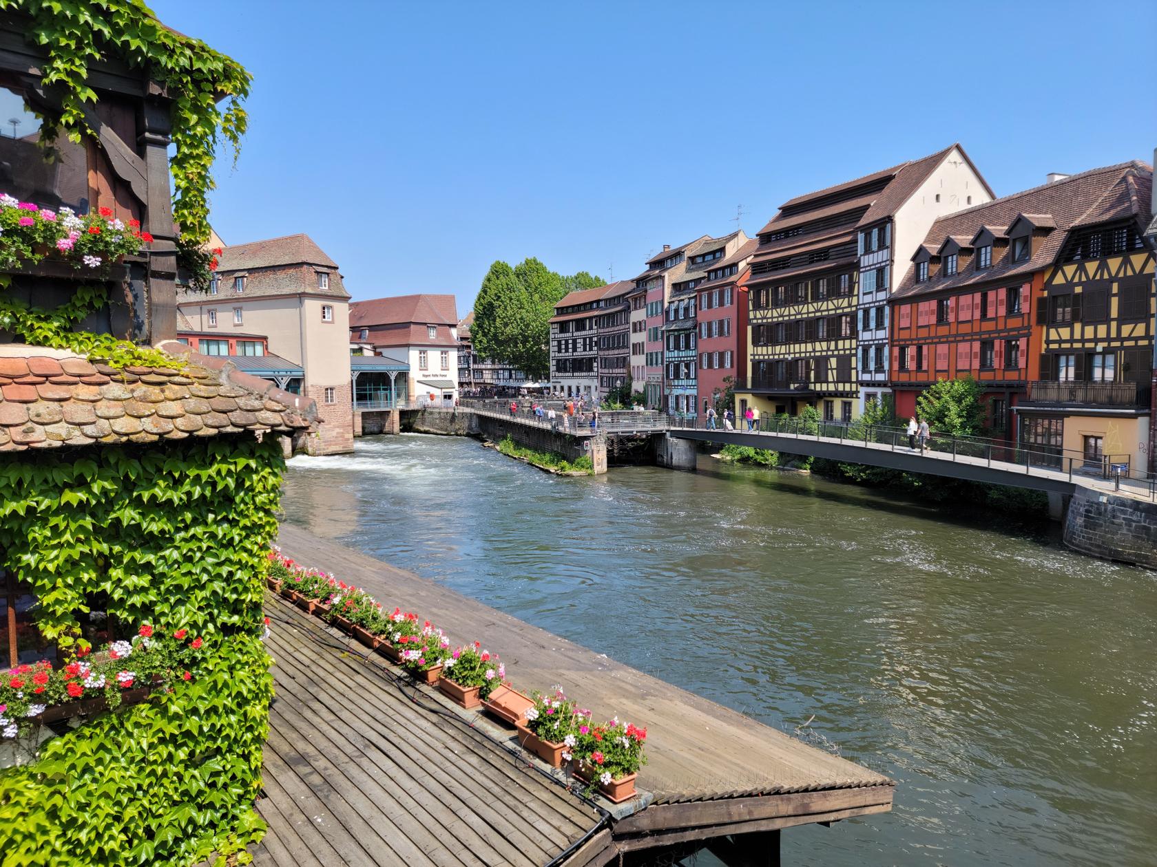
One of the dam overflows – Strasbourg, France
A dam – Strasbourg, France
A beautiful restaurant – Strasbourg, France
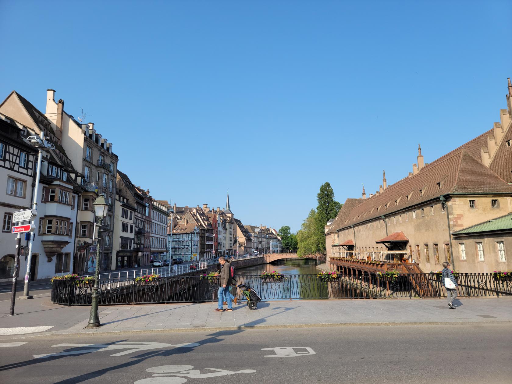
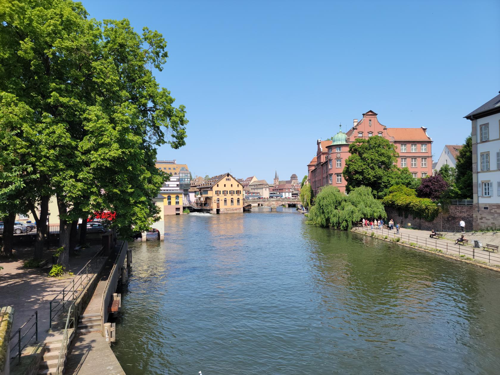
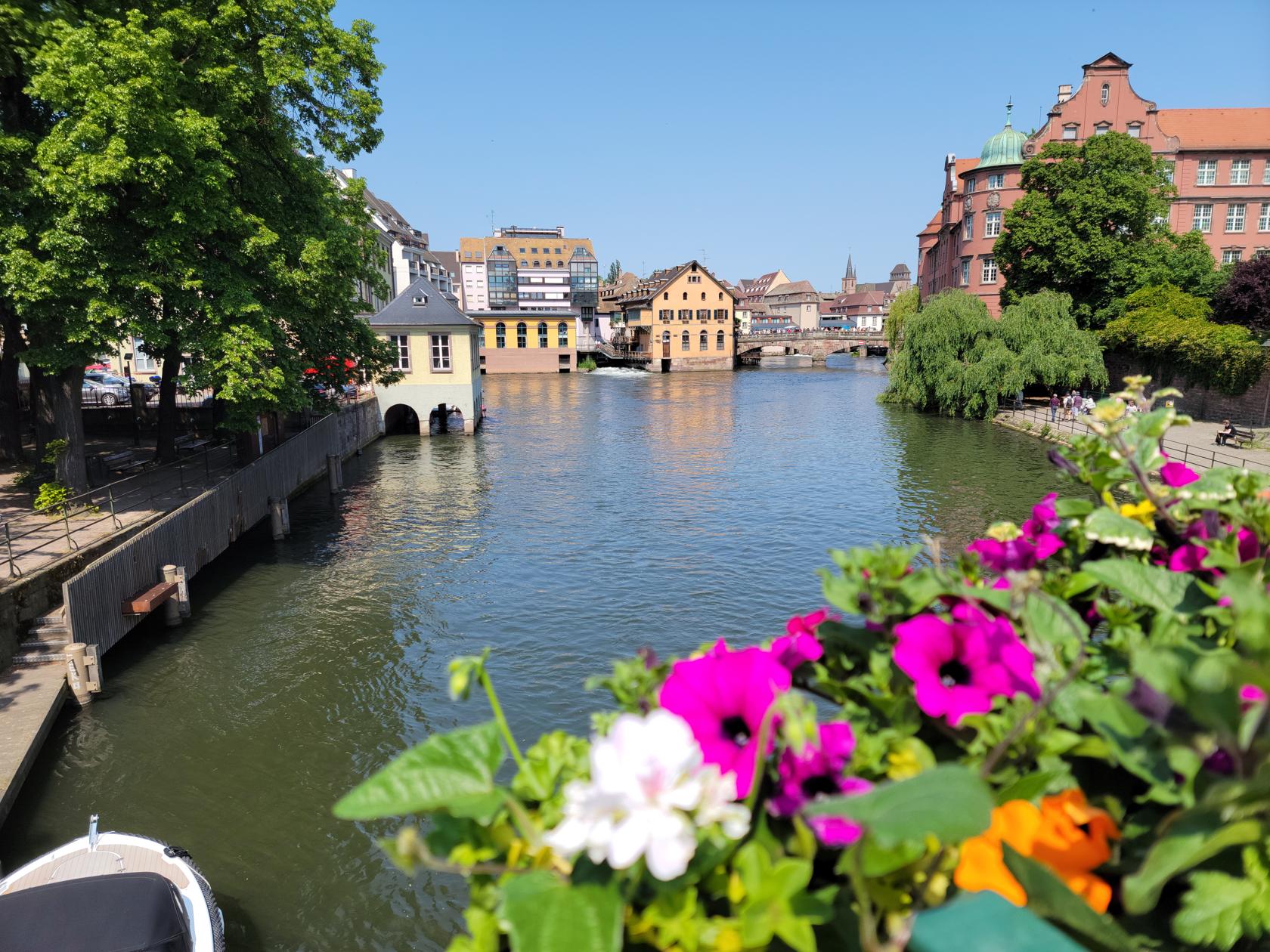
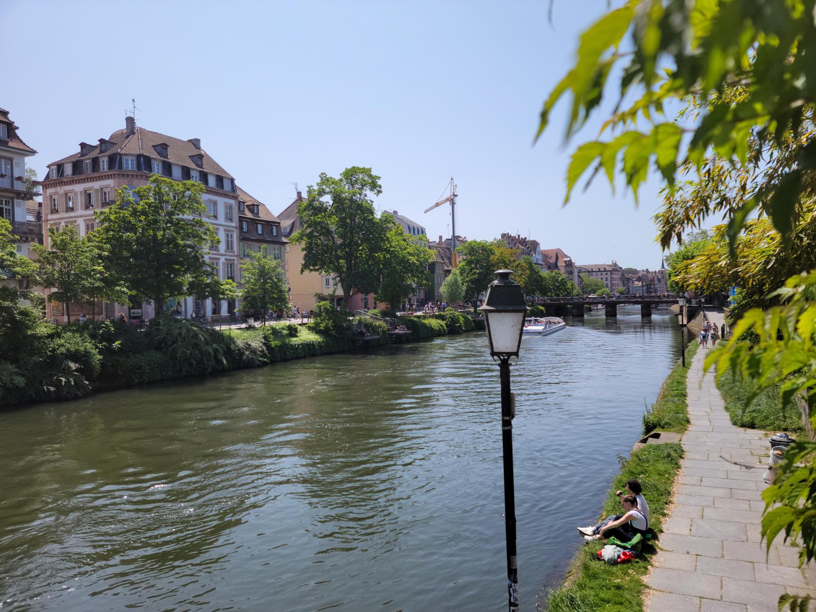
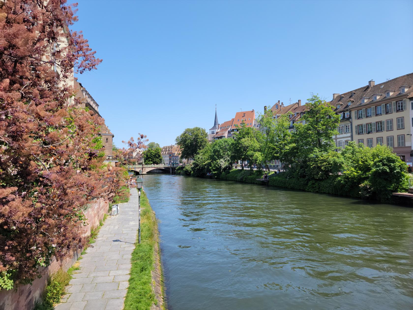
The river Ill – Strasbourg, France
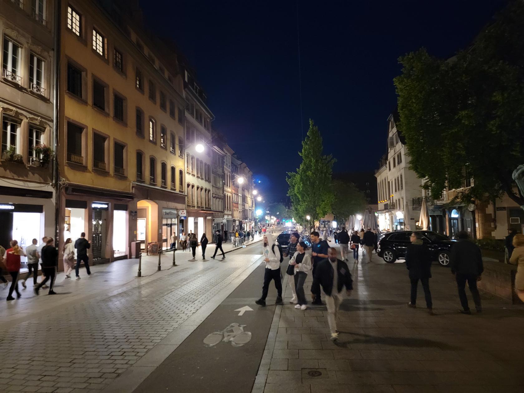
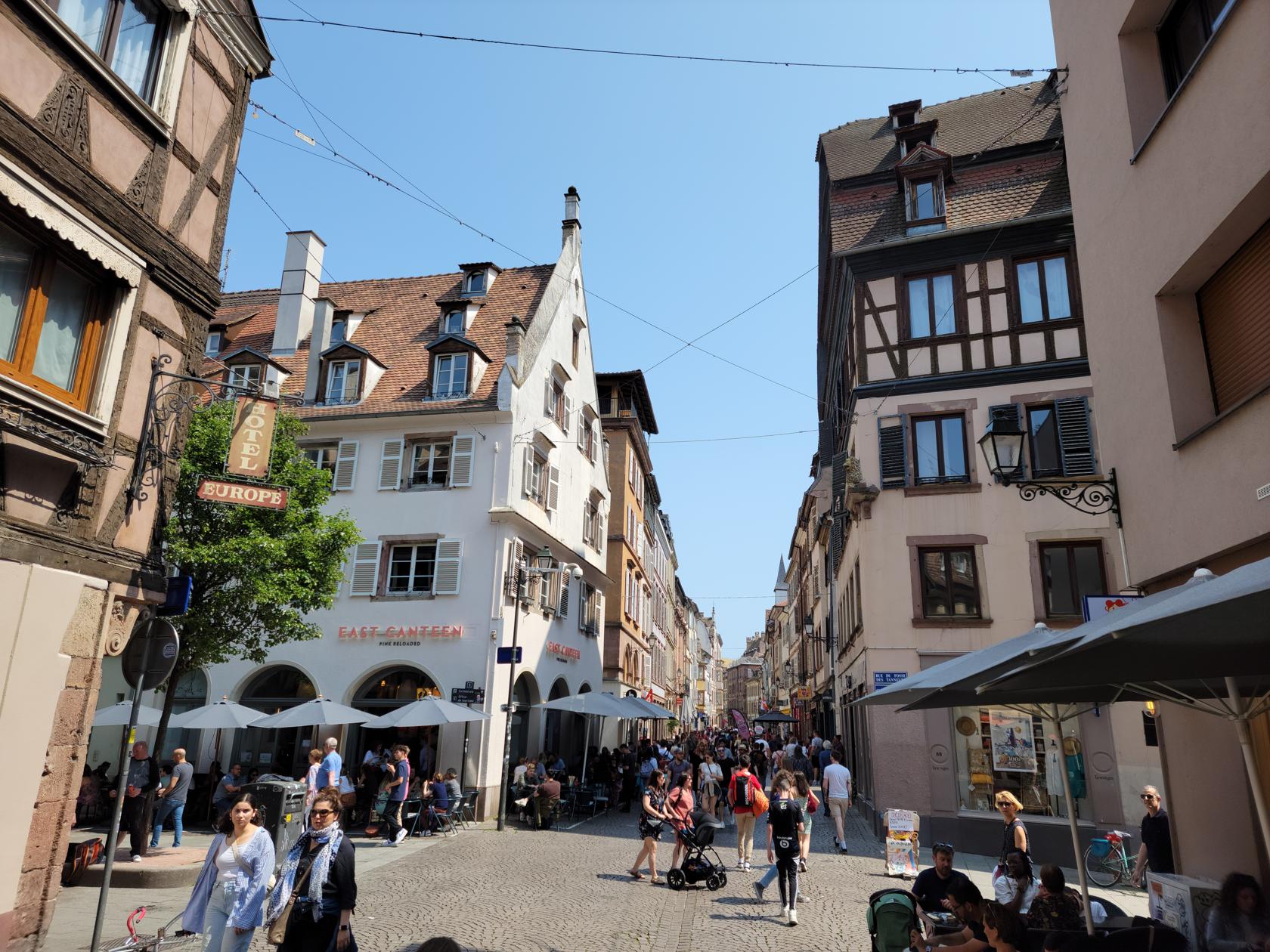
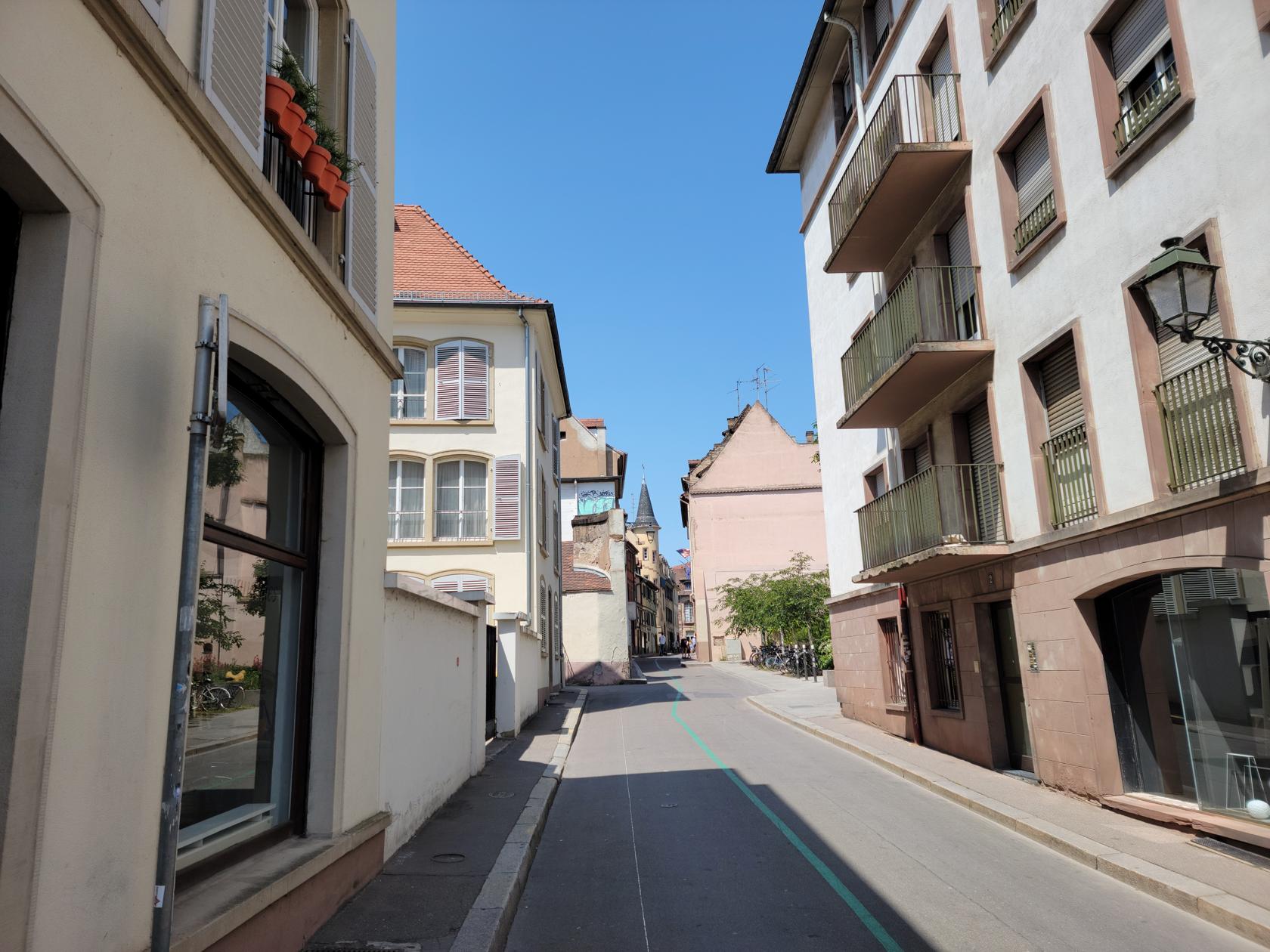
Walking the streets – Strasbourg, France
Town center – Strasbourg, France
Place de Gutenberg – Strasbourg, France
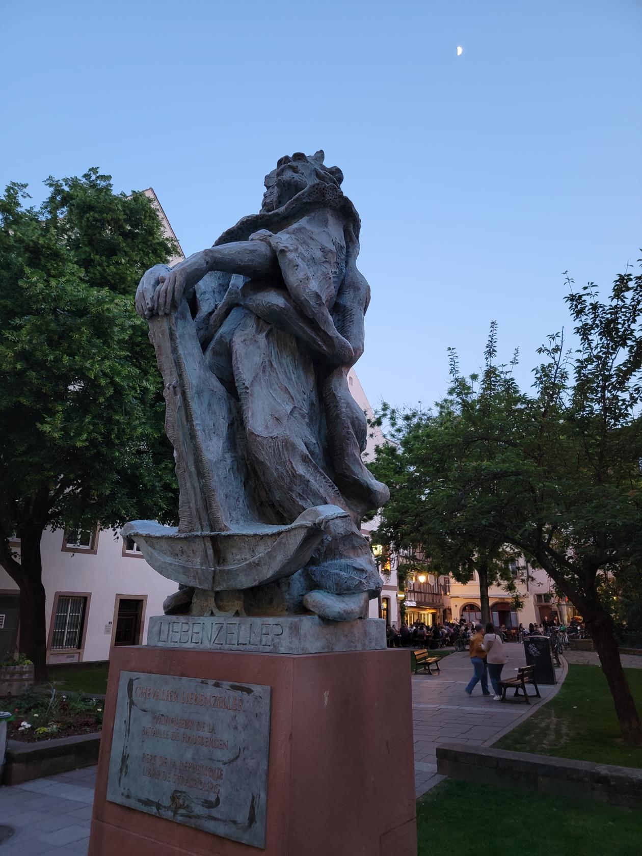
The Liebenzeller memorial – Strasbourg, France
Bierstube – Strasbourg, France
Modern street – Strasbourg, France
The other side of town – Strasbourg, France
The river Ill on a lazy day – Strasbourg, France
Another view of the Ill – Strasbourg, France
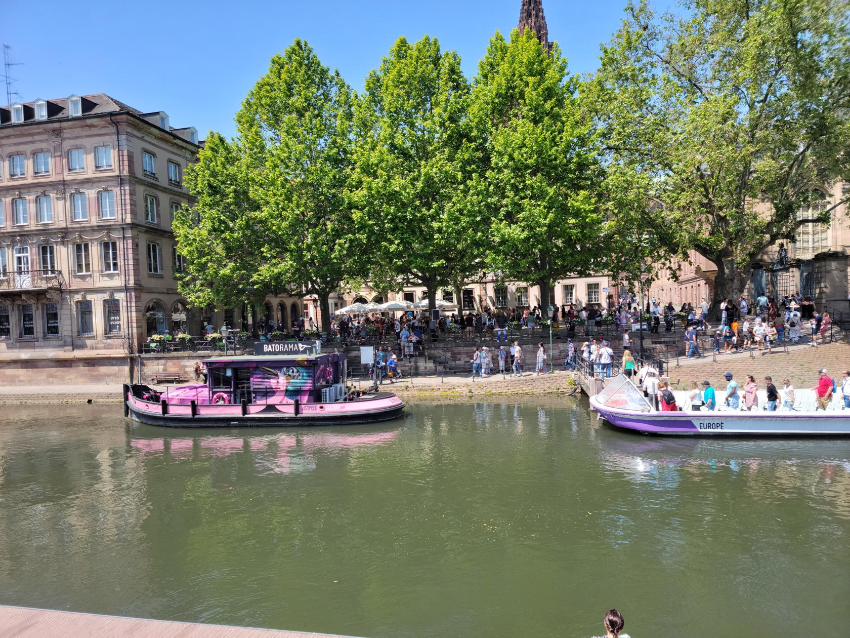
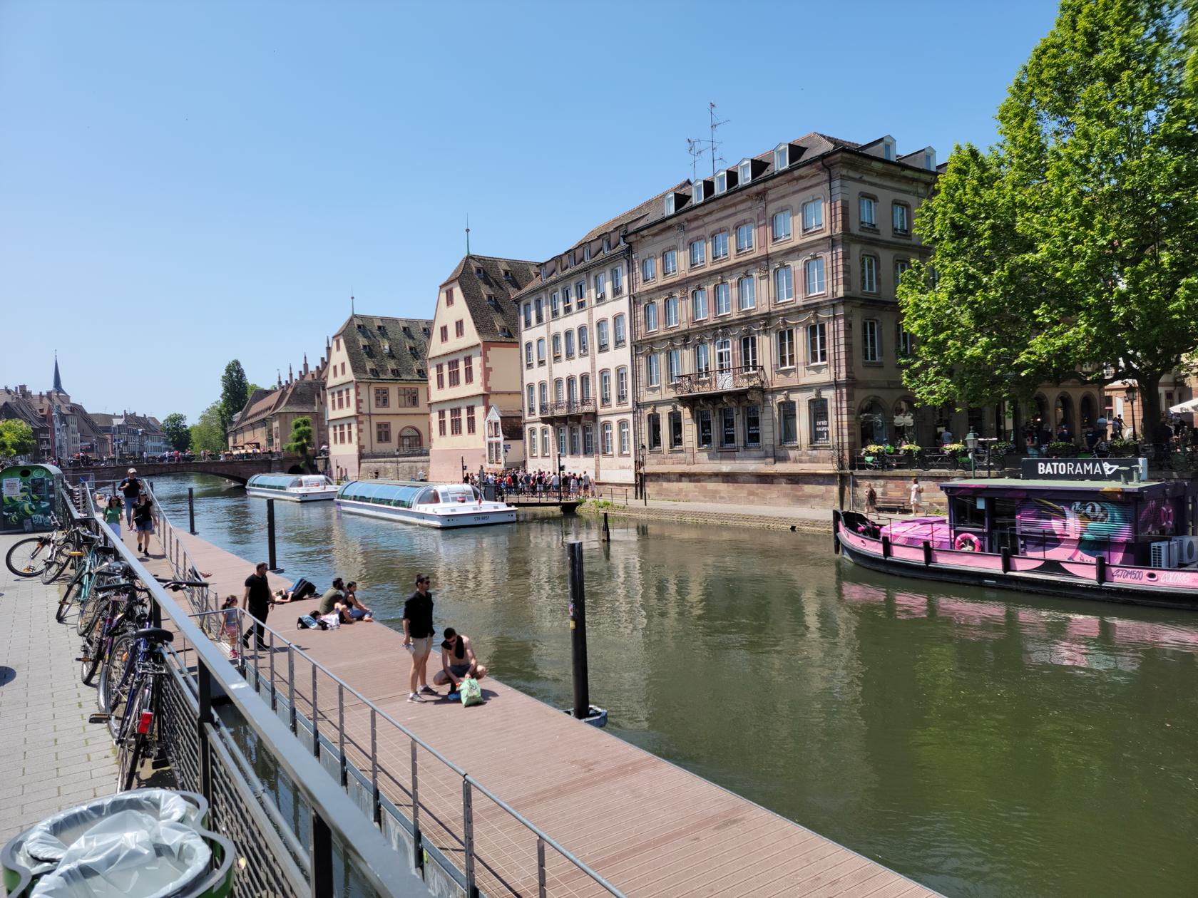
The boat tour anchorage – Strasbourg, France
Boat tours – Strasbourg, France
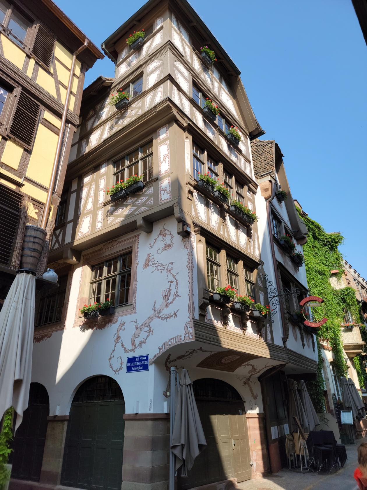
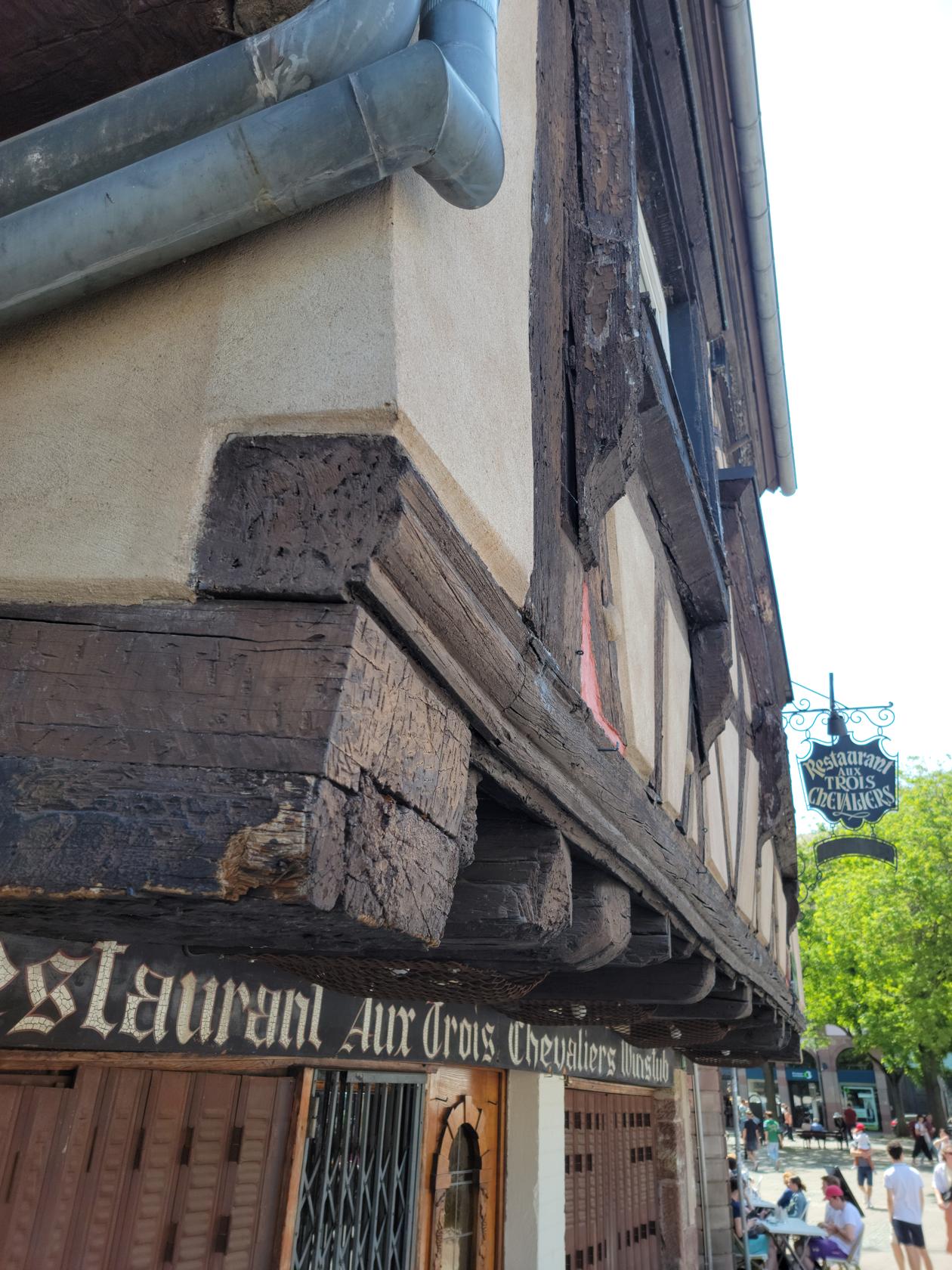
Old wooden beams up close – Strasbourg, France
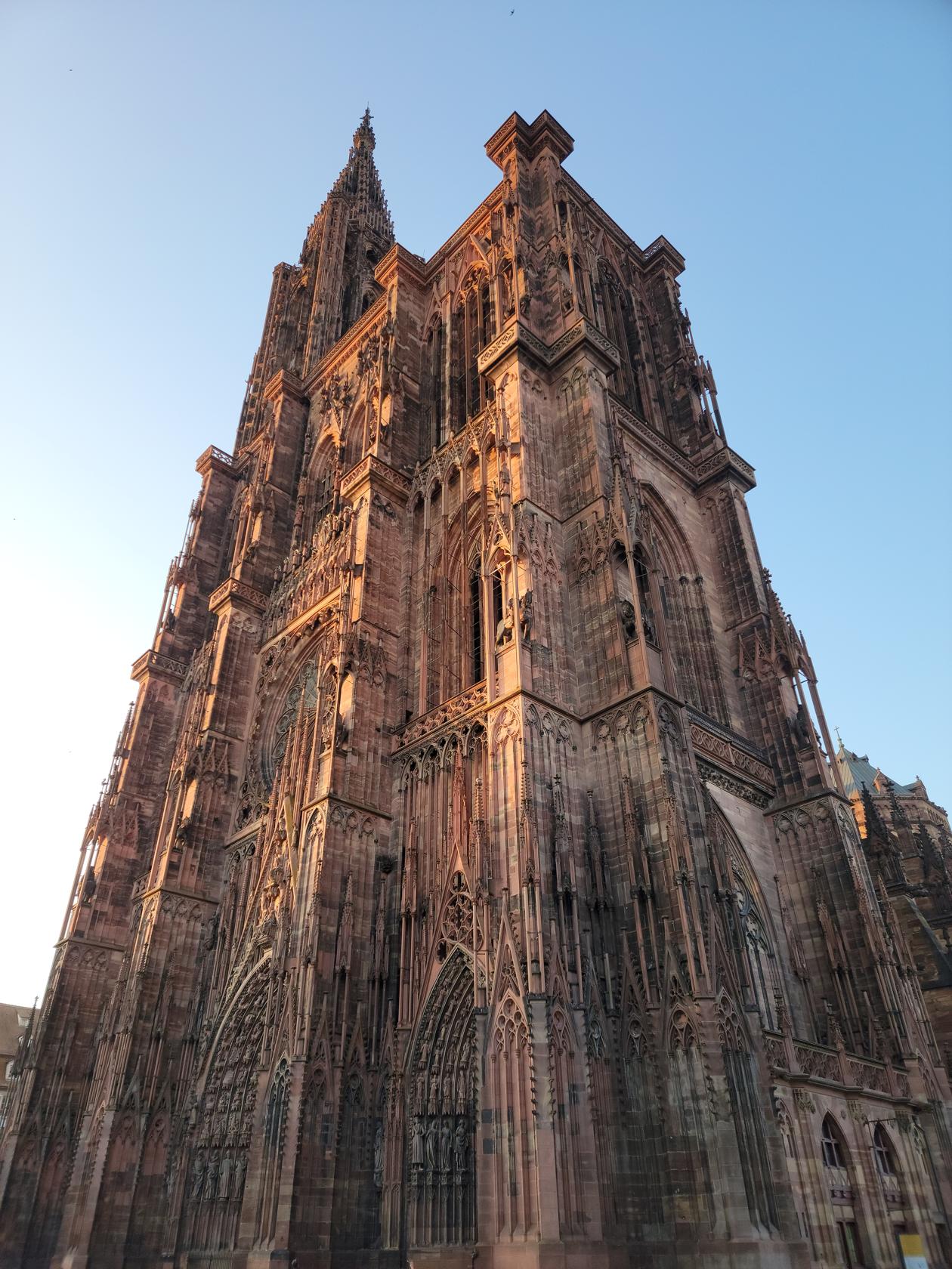
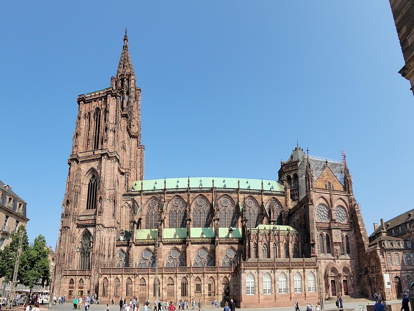
Notre Dame
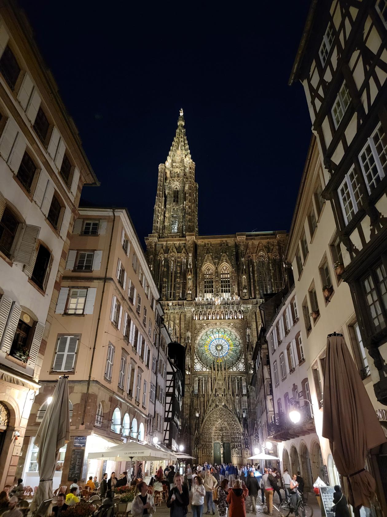
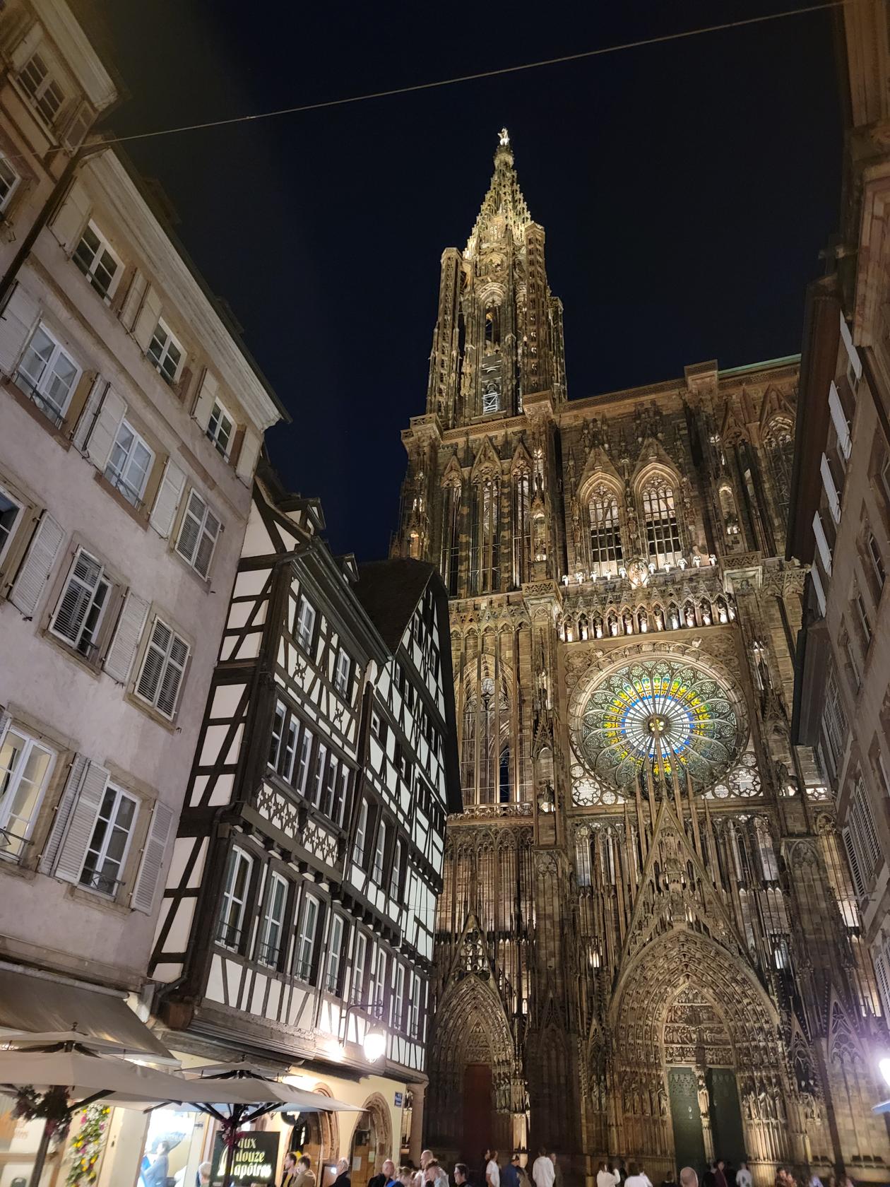
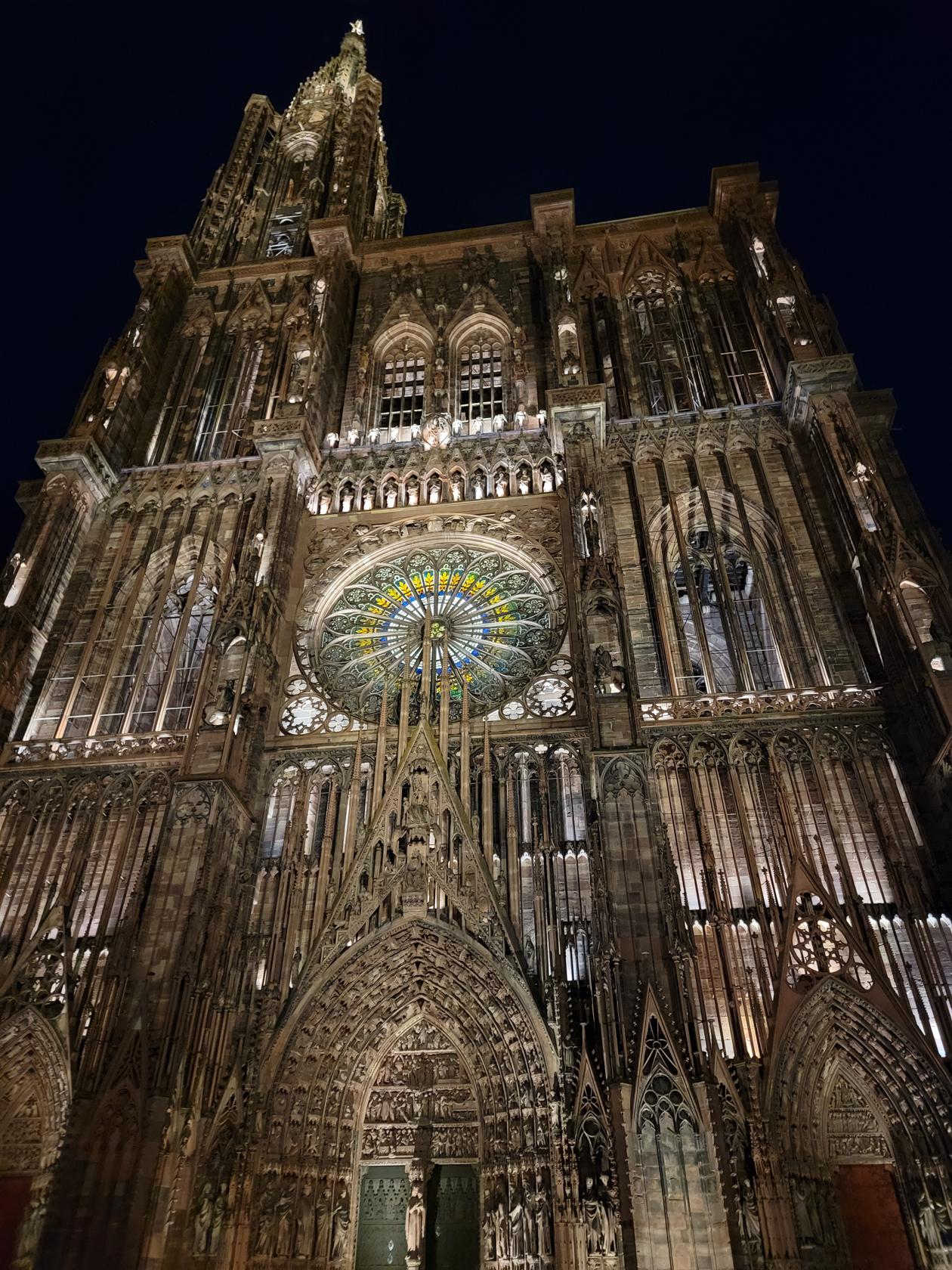
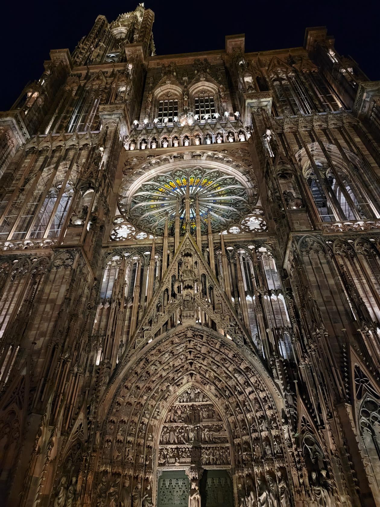
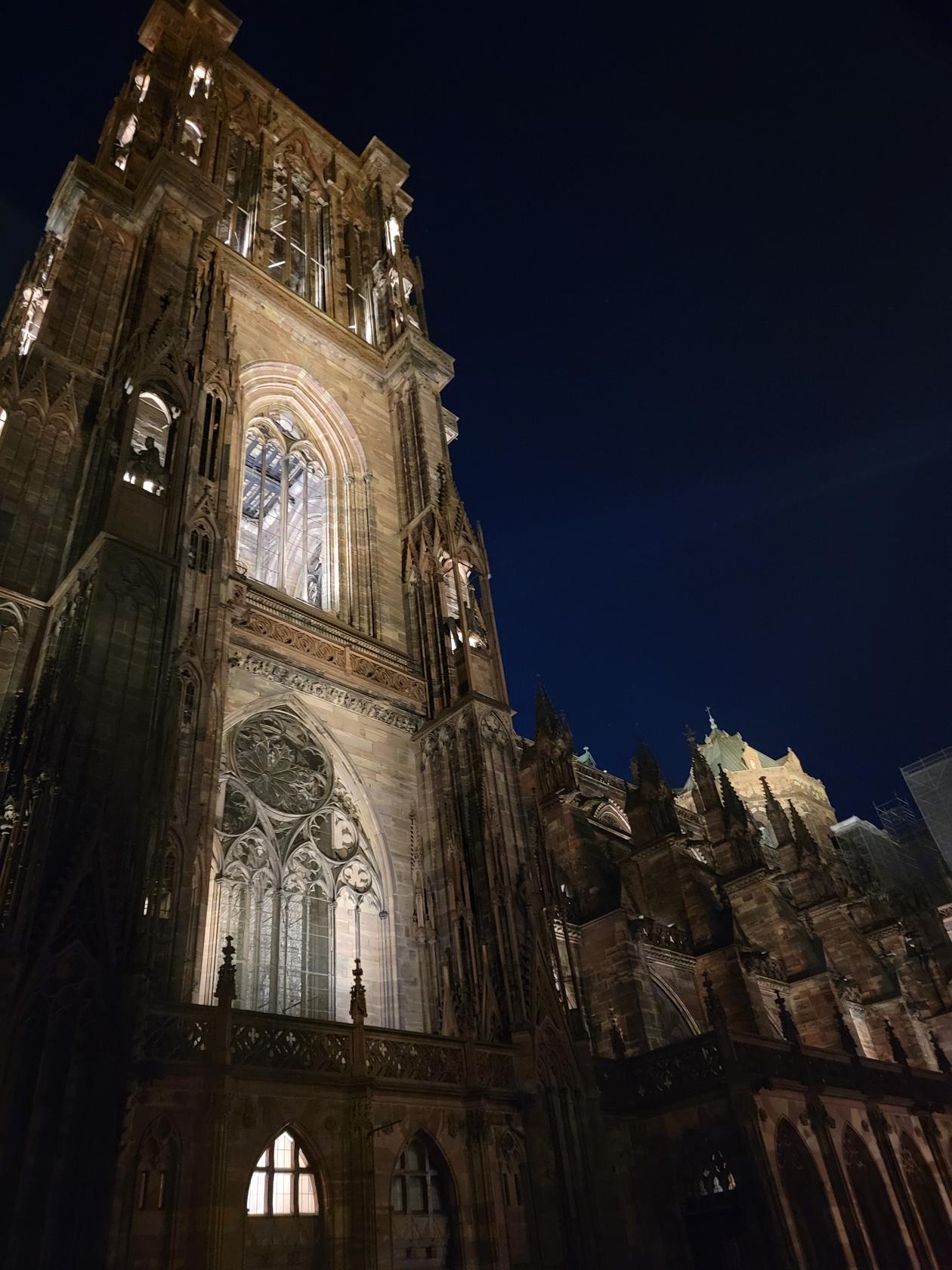
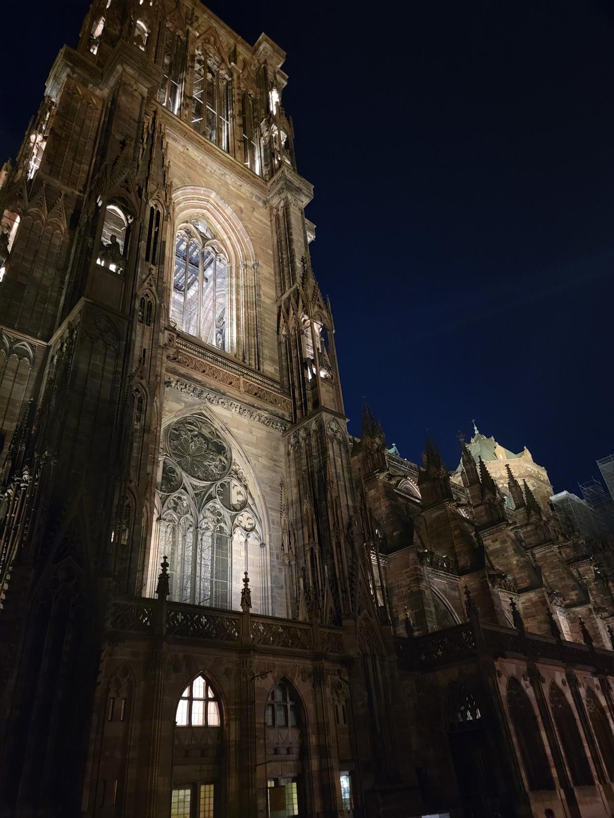
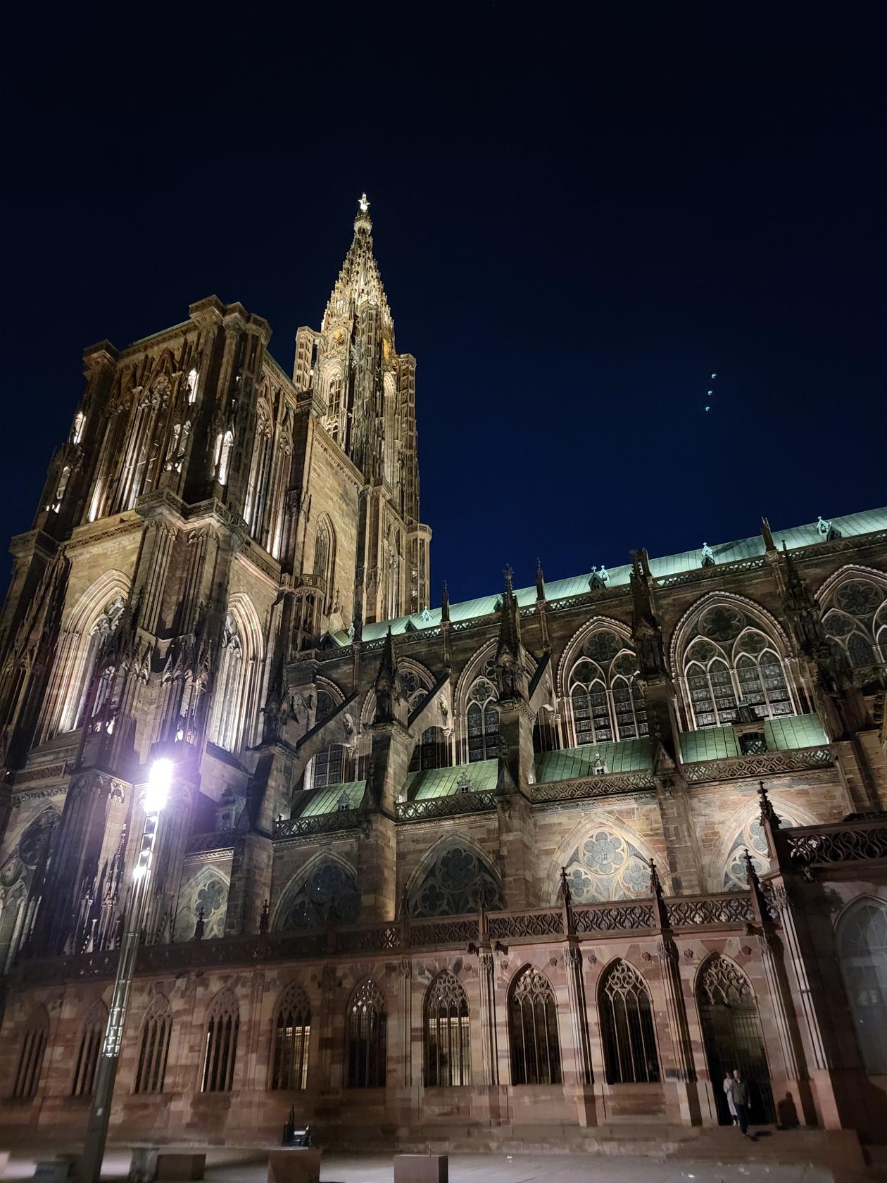
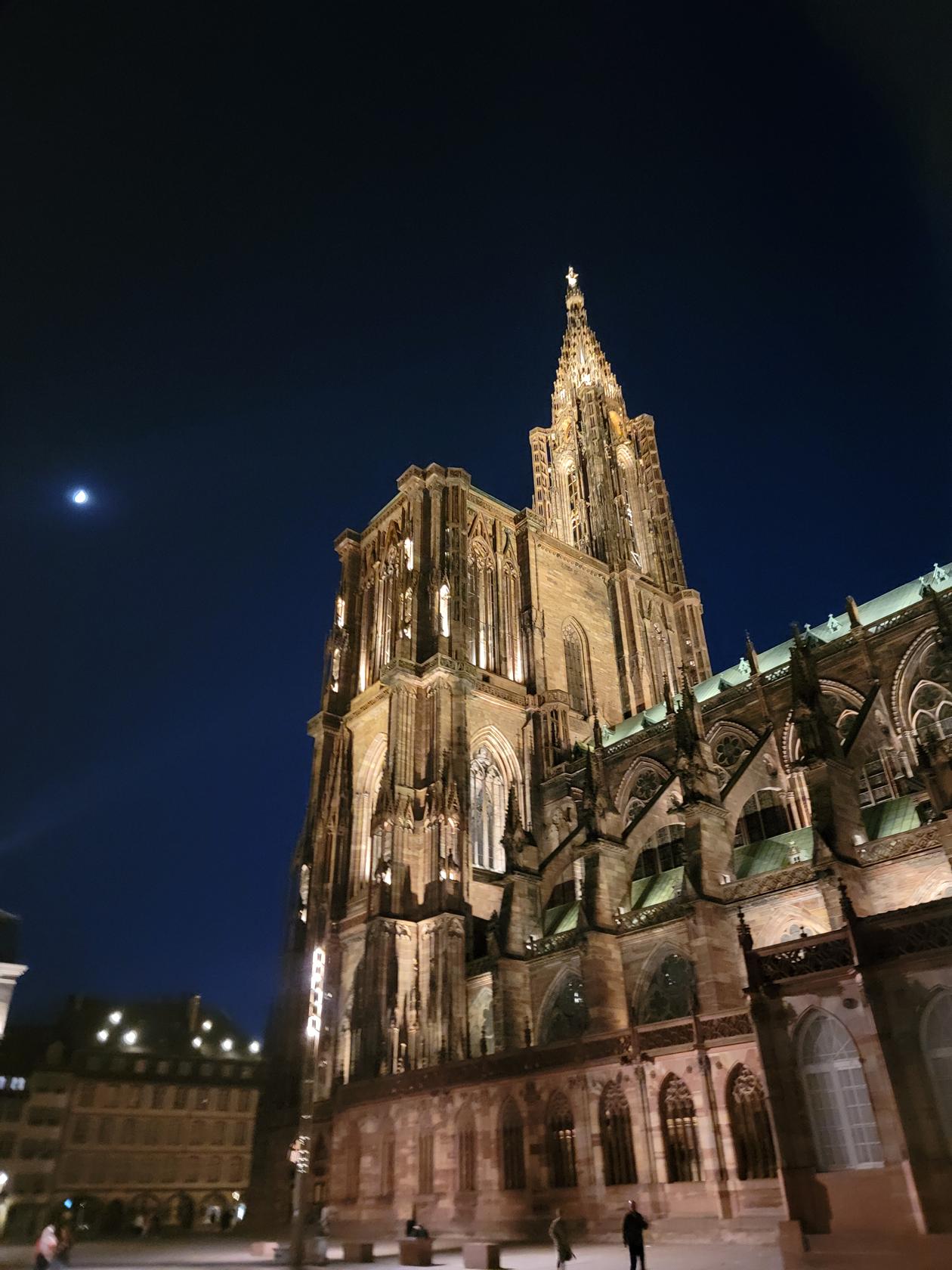
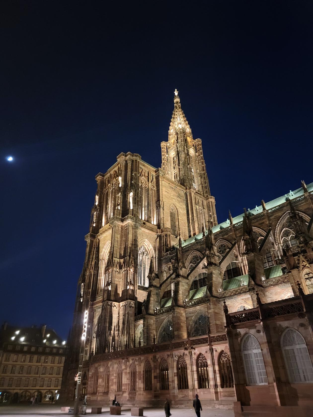
The town has a huge and wonderfully prominent cathedral called Notre Dame de Strasbourg, also known as the Straßburger Münster in German.
Lit up at night – Notre Dame de Strasbourg – Strasbourg, France
Its construction began in the late twelfth century and its impressive bell tower and spire were added more than 120 years after the start of construction, which I might add was never completed, since the addition of a second right tower and spire never came to fruition. The outside at night is spectacular, the interior and exterior lighting provide an excellent balance to show the real grandeur of this cathedral.
Lit up at night – Notre Dame de Strasbourg – Strasbourg, France
Lit up at night – Notre Dame de Strasbourg – Strasbourg, France
Lit up at night – Notre Dame de Strasbourg – Strasbourg, France
Lit up at night – Notre Dame de Strasbourg – Strasbourg, France
Lit up at night – Notre Dame de Strasbourg – Strasbourg, France
Lit up at night – Notre Dame de Strasbourg – Strasbourg, France
Lit up at night – Notre Dame de Strasbourg – Strasbourg, France
Lit up at night – Notre Dame de Strasbourg – Strasbourg, France
Lit up at night – Notre Dame de Strasbourg – Strasbourg, France
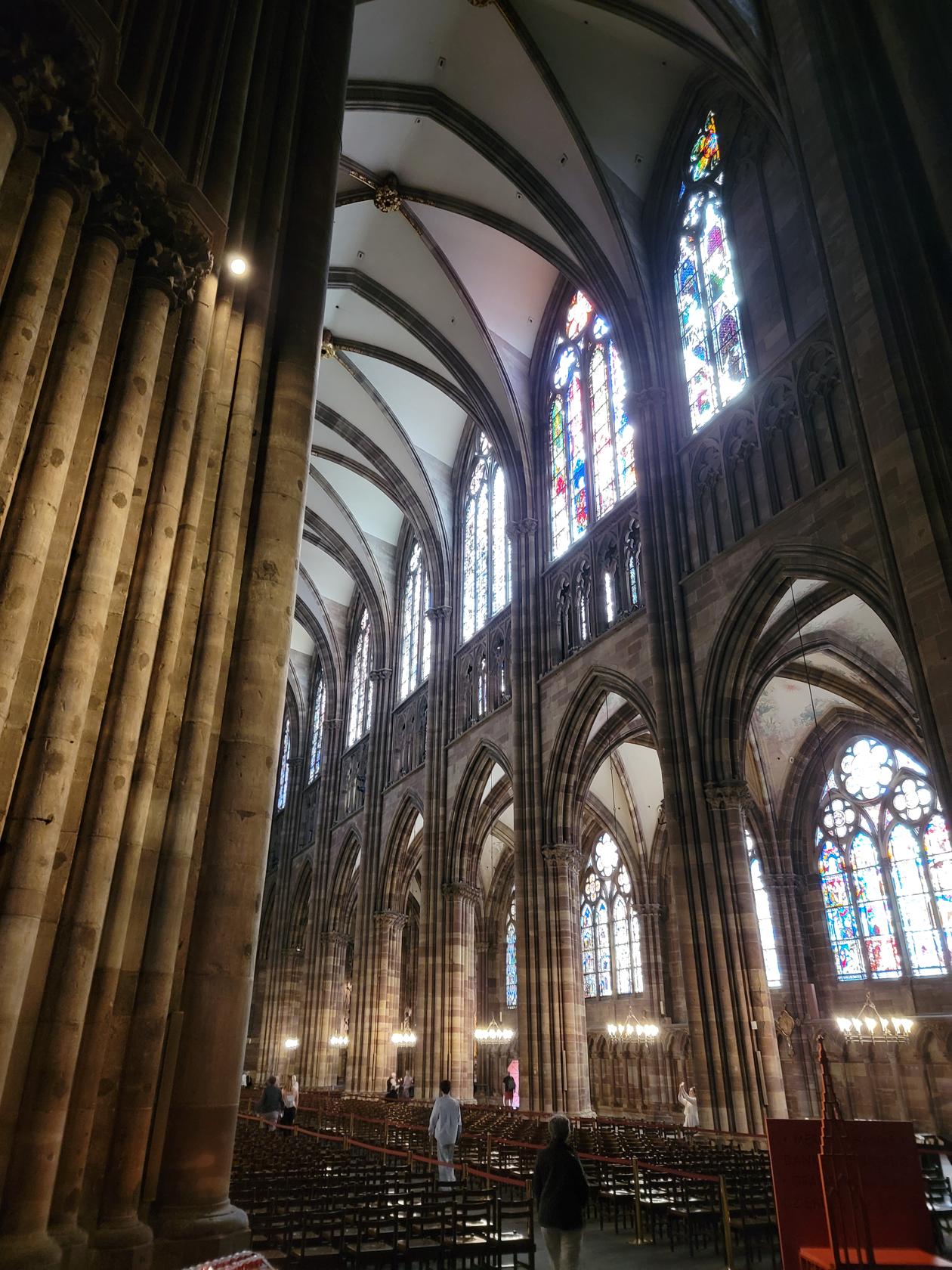
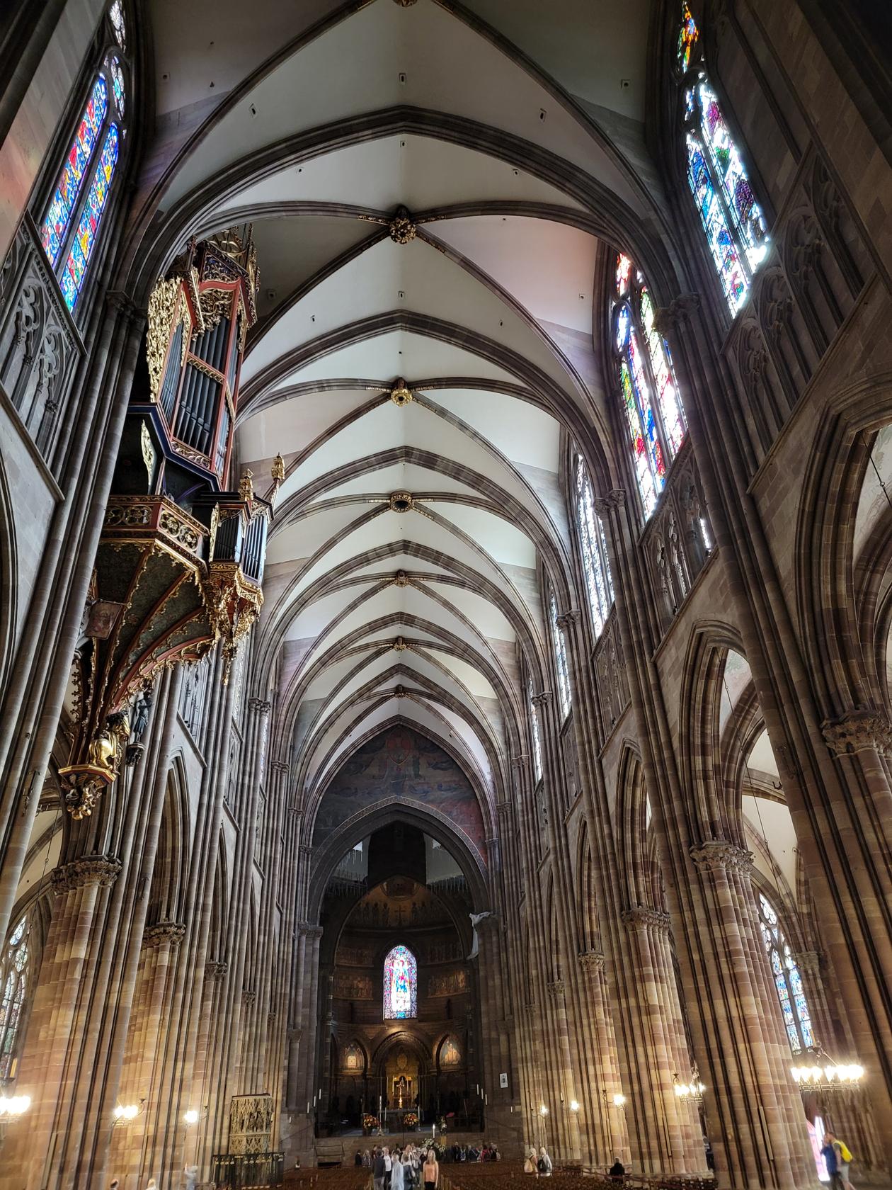
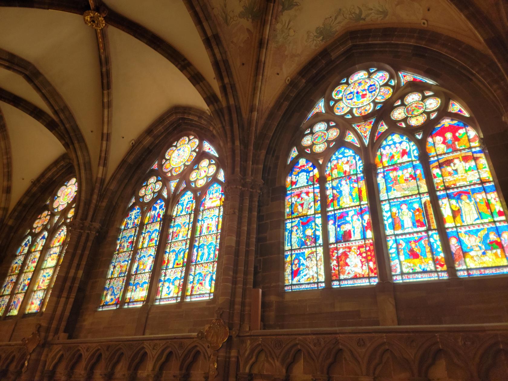
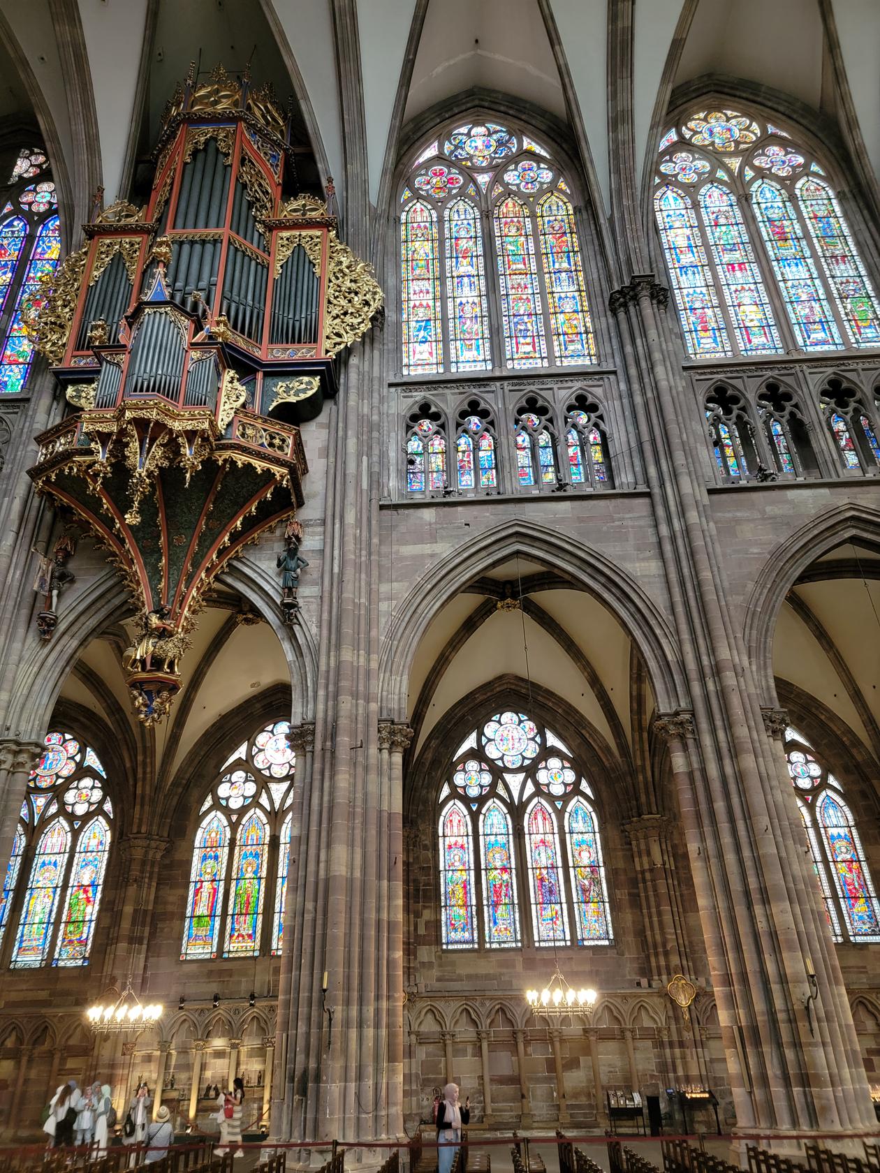
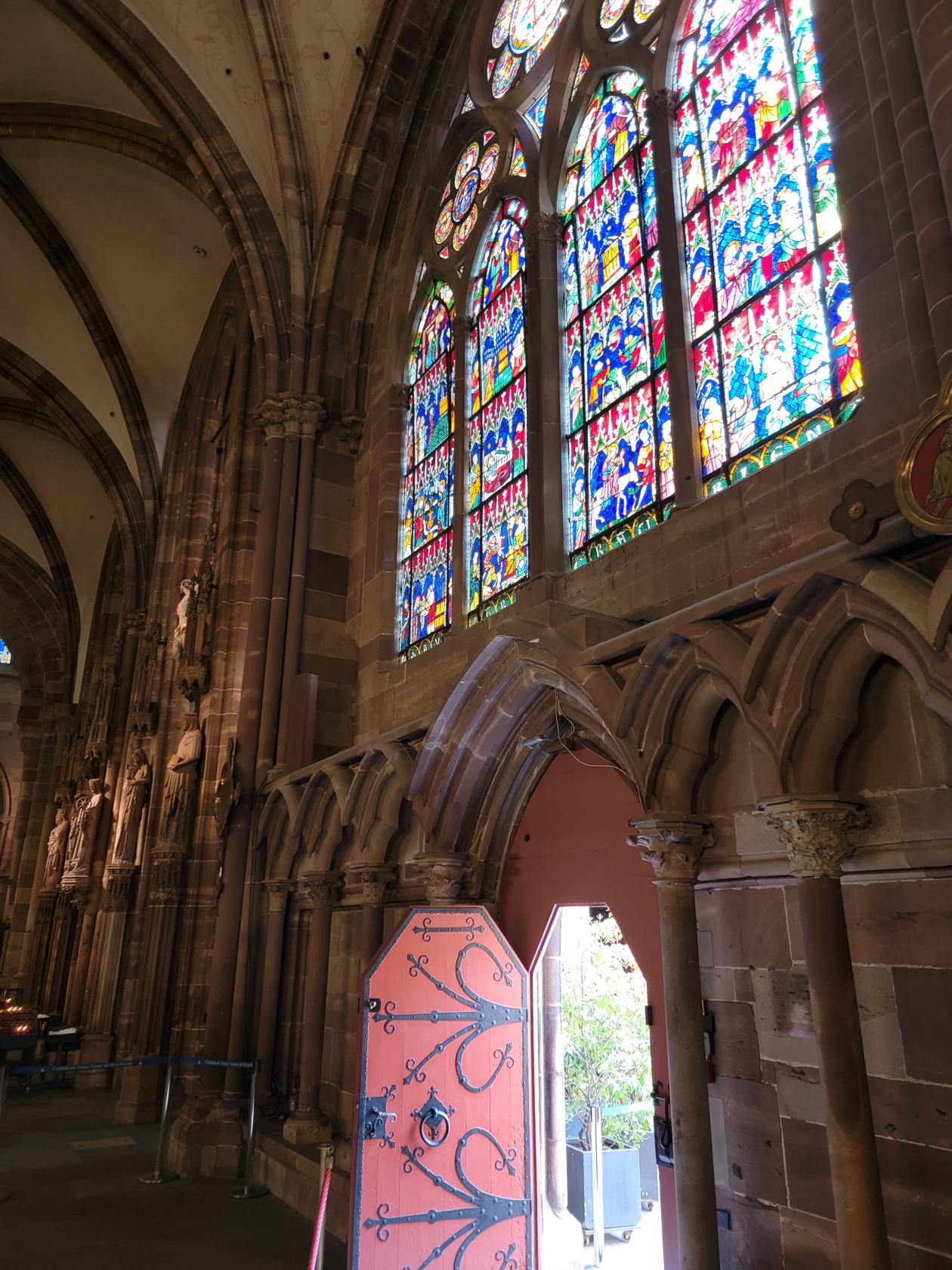
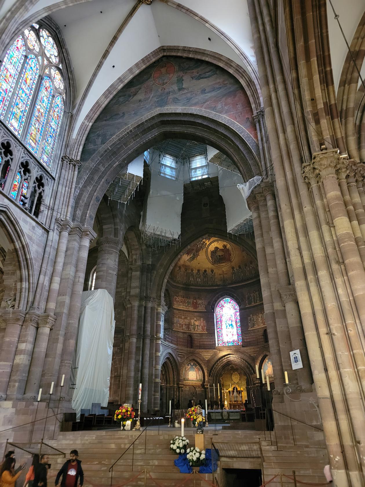
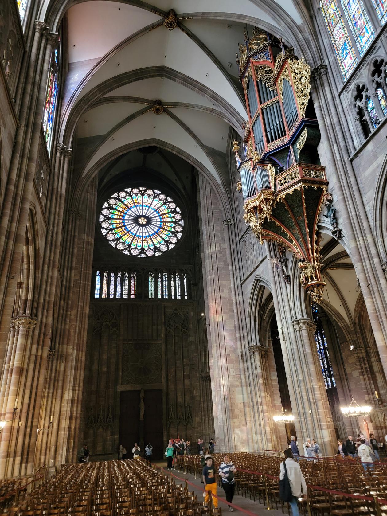
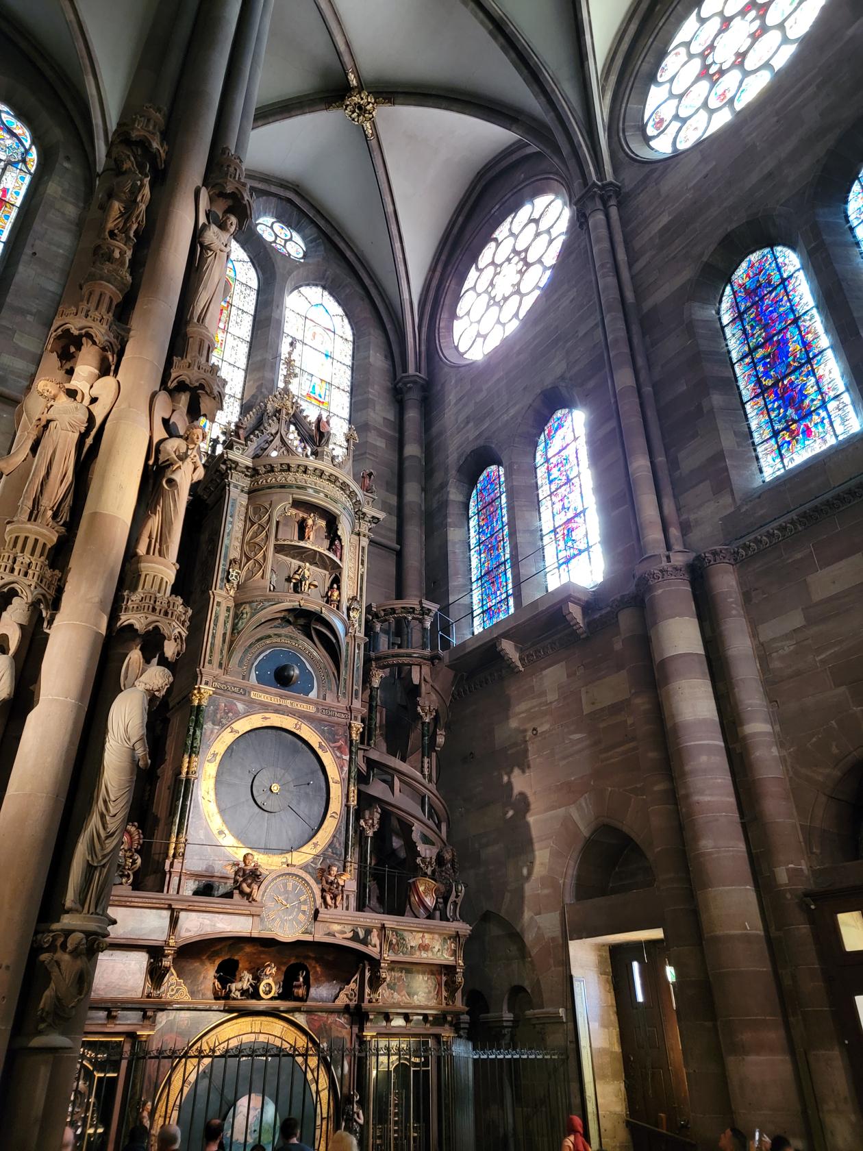
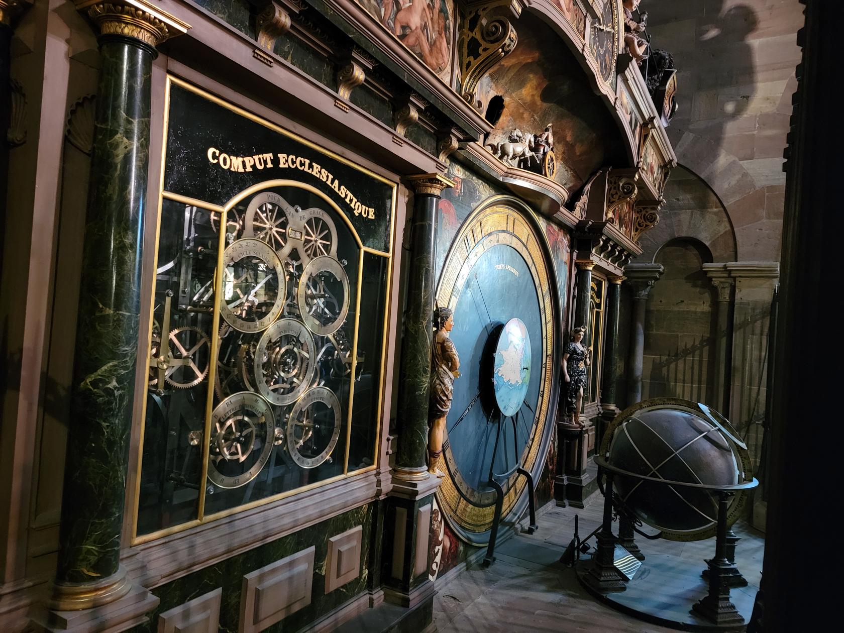
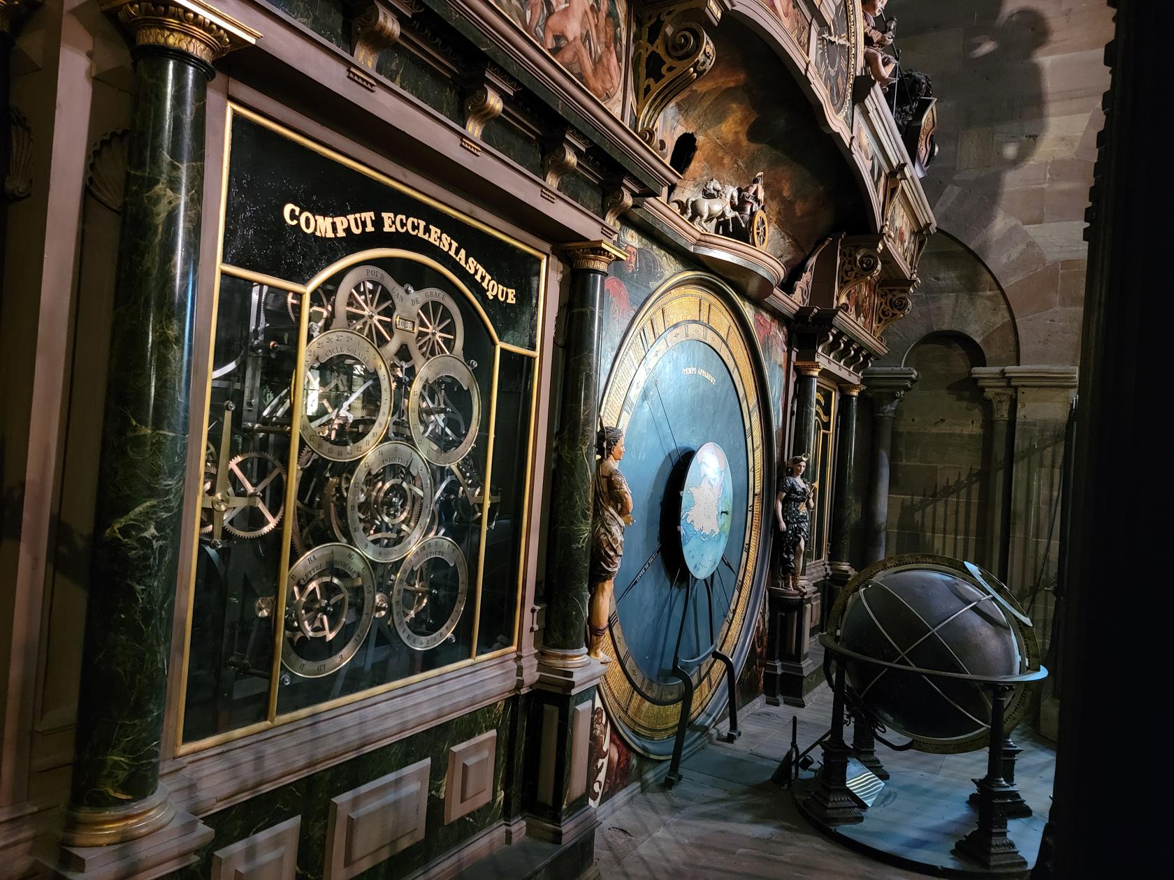
Of course, this is balanced well by the stained-glass windows illuminated by the sun in the early morning hours. The interior also houses an ecclesiastical astronomical clock which was built in the early 1570s.
Inside the cathedral – Notre Dame de Strasbourg – Strasbourg, France
Inside the cathedral – Notre Dame de Strasbourg – Strasbourg, France
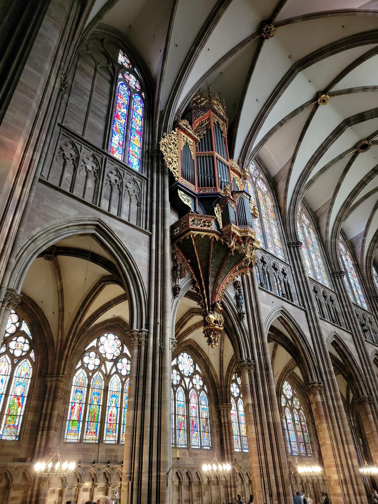
The organ – Notre Dame de Strasbourg – Strasbourg, France
Stained glass – Inside the cathedral – Notre Dame de Strasbourg – Strasbourg, France
Organ and stained glassed windows – Inside the cathedral – Notre Dame de Strasbourg – Strasbourg, France
Another shot of organ and glass – Inside the cathedral – Notre Dame de Strasbourg – Strasbourg, France
Old renovated side door – Inside the cathedral – Notre Dame de Strasbourg – Strasbourg, France
Inside the cathedral – Notre Dame de Strasbourg – Strasbourg, France
The large rosette window – Inside the cathedral – Notre Dame de Strasbourg – Strasbourg, France
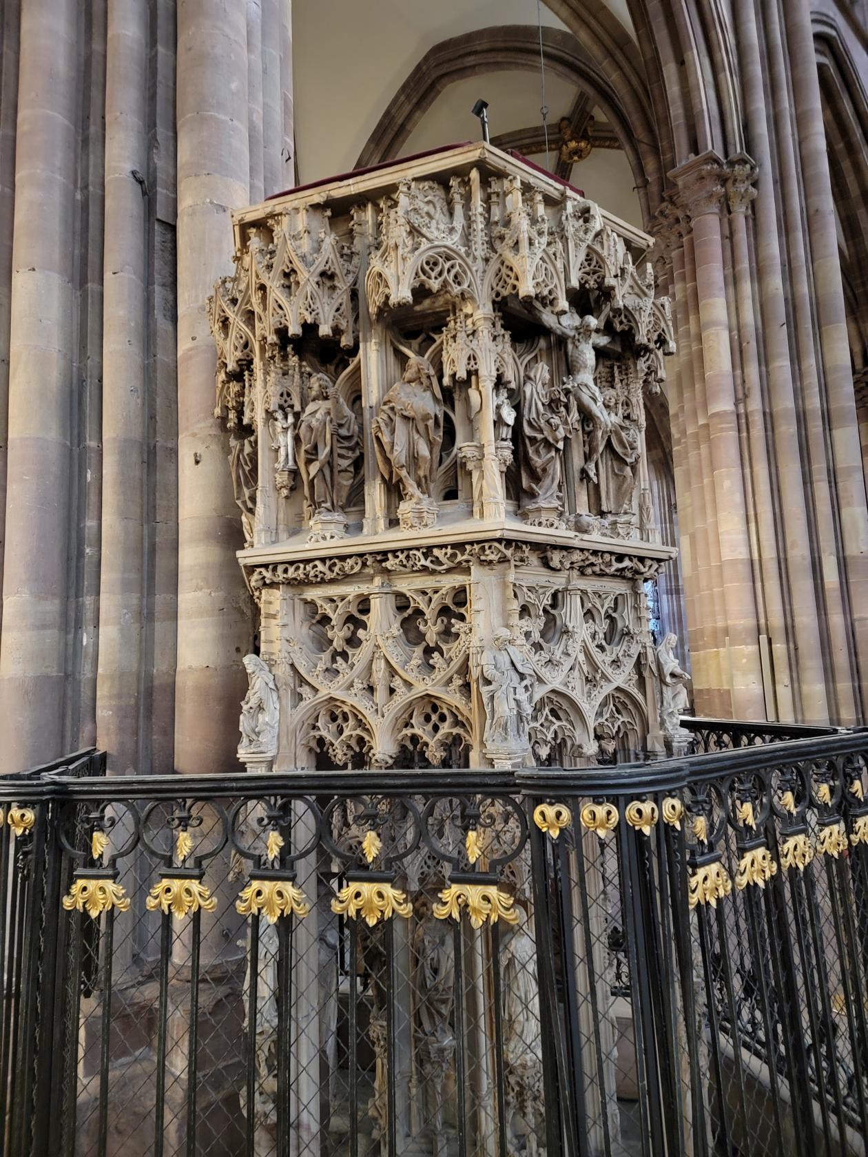
The pulpit – Inside the cathedral – Notre Dame de Strasbourg – Strasbourg, France
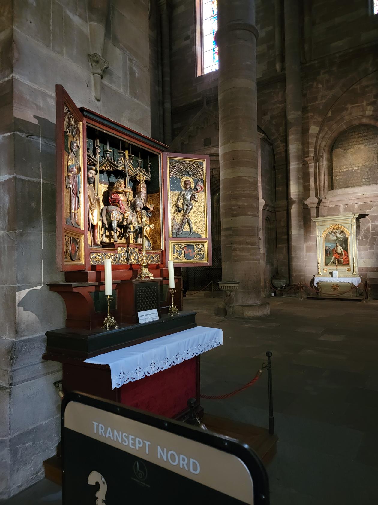
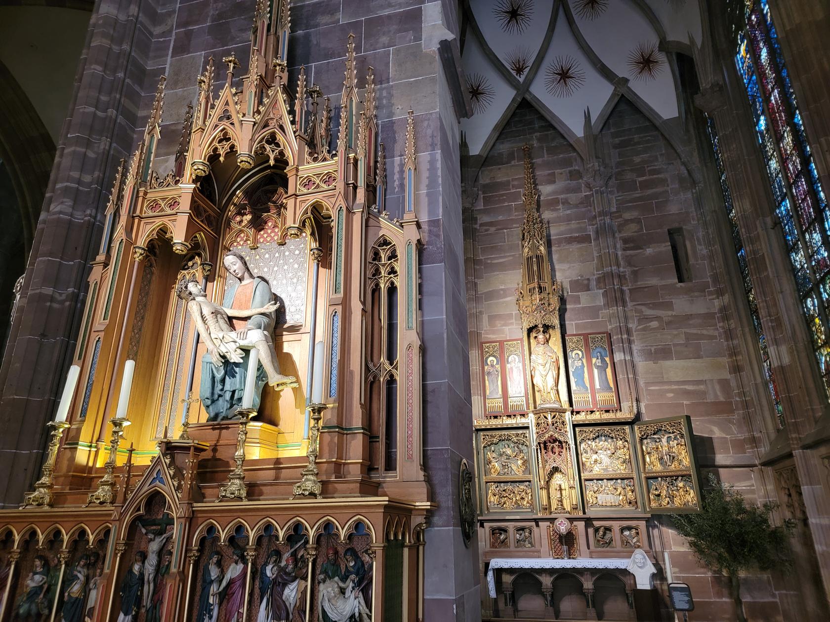
A small side altar – Inside the cathedral – Notre Dame de Strasbourg – Strasbourg, France
More statues – Inside the cathedral – Notre Dame de Strasbourg – Strasbourg, France
The ecclesiastical clock – Inside the cathedral – Notre Dame de Strasbourg – Strasbourg, France
The ecclesiastical clock – Inside the cathedral – Notre Dame de Strasbourg – Strasbourg, France
Side chapel – Notre Dame de Strasbourg – Strasbourg, France
Very old stone carvings – Notre Dame de Strasbourg – Strasbourg, France
An entire view – Notre Dame de Strasbourg – Strasbourg, France
Get here early, usually before ten o’clock, otherwise the tour groups from the Viking cruises start to assemble and you will have little chance, the line often snakes all the way out the courtyard and around the block!
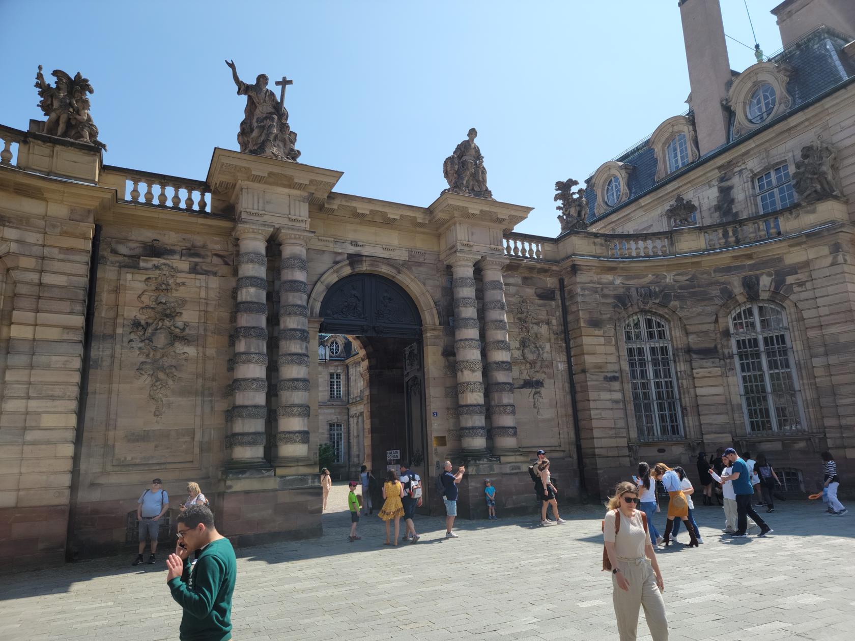
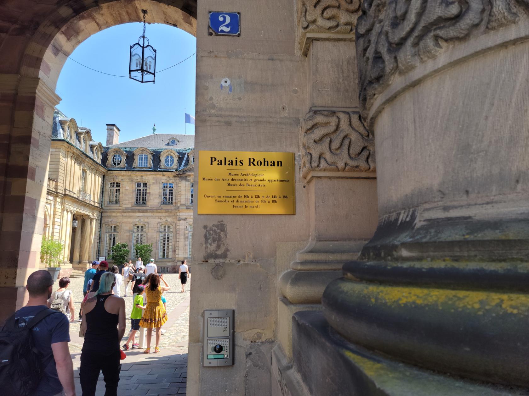
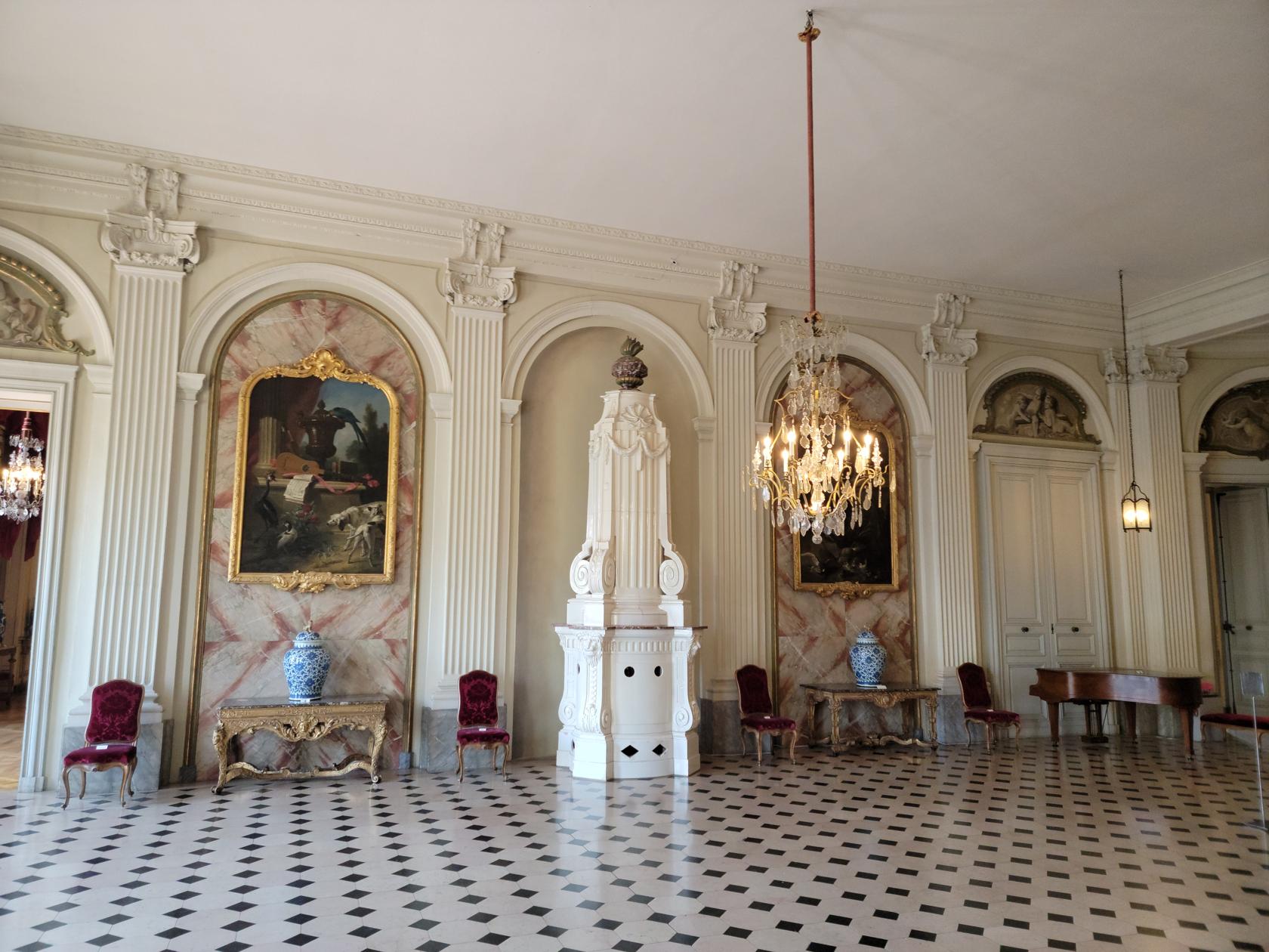
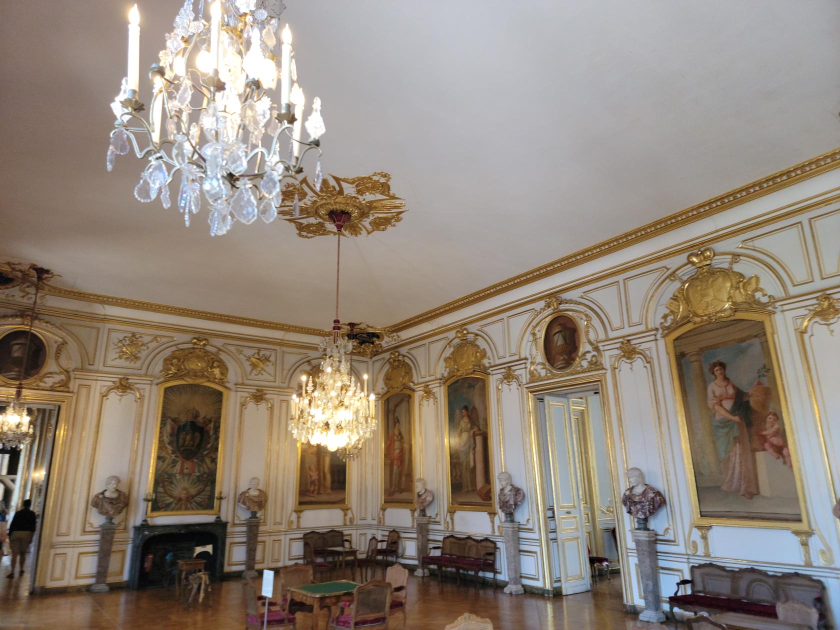
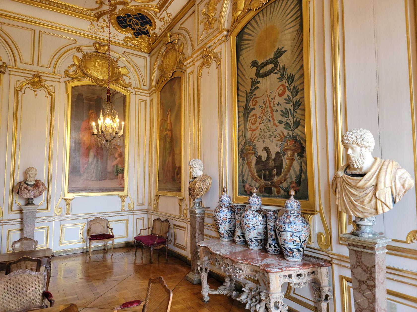
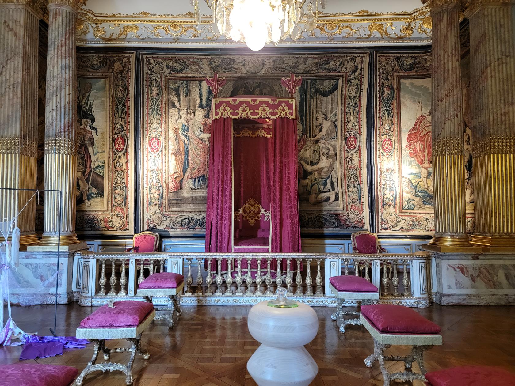
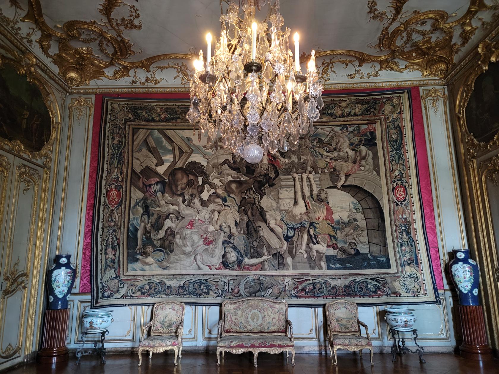
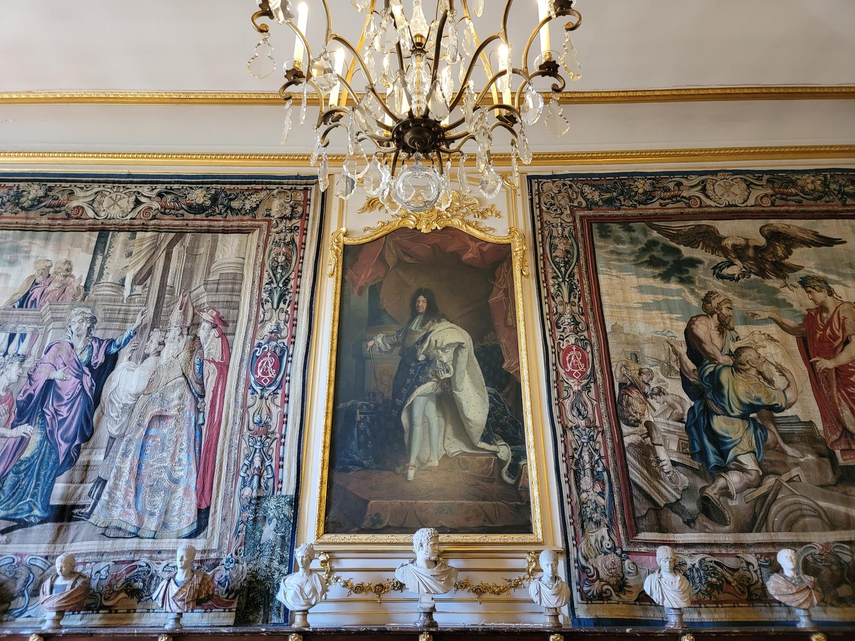
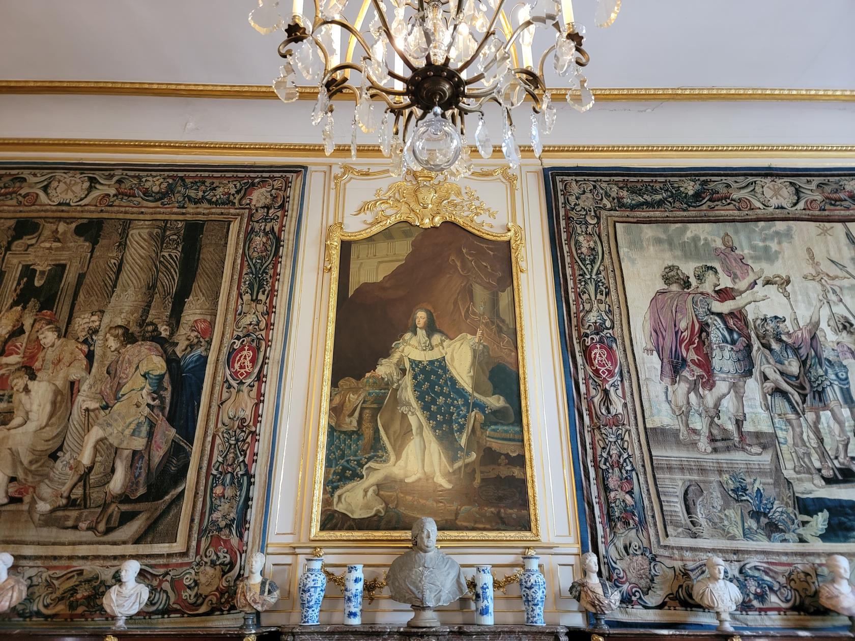
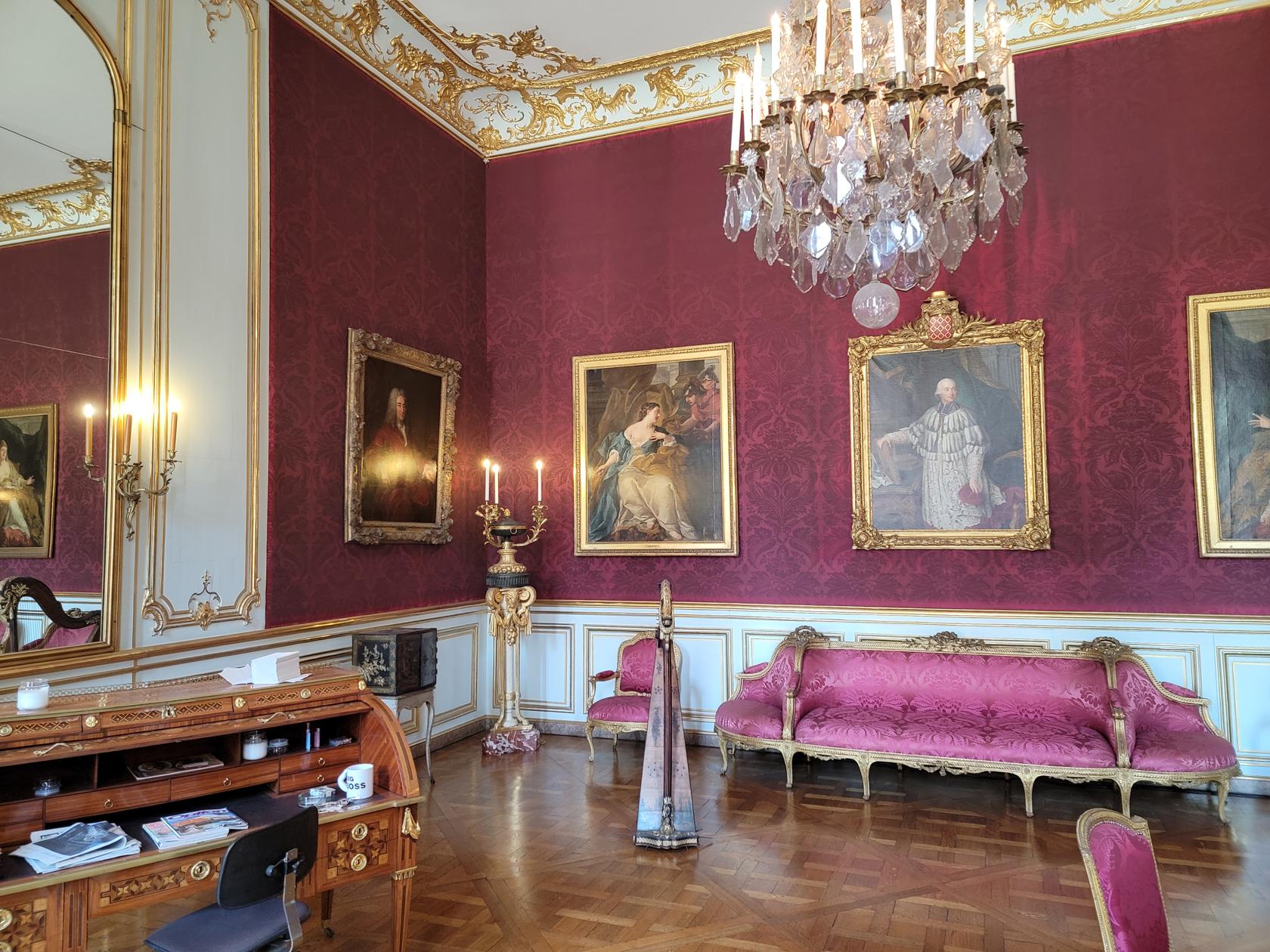
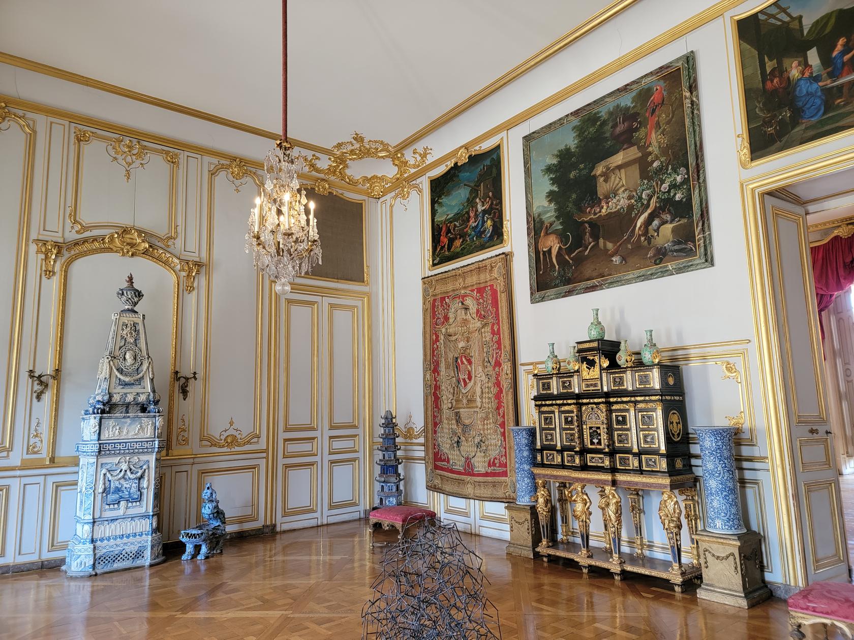
Palace Rohan
Across the river Ill from our hotel was the Rohan Palace, which houses several museums. We toured the Museum of Decorative Arts, just to get a view of the palace from inside.
Palace Rohan entrance – Strasbourg, France
Palace Rohan – Strasbourg, France
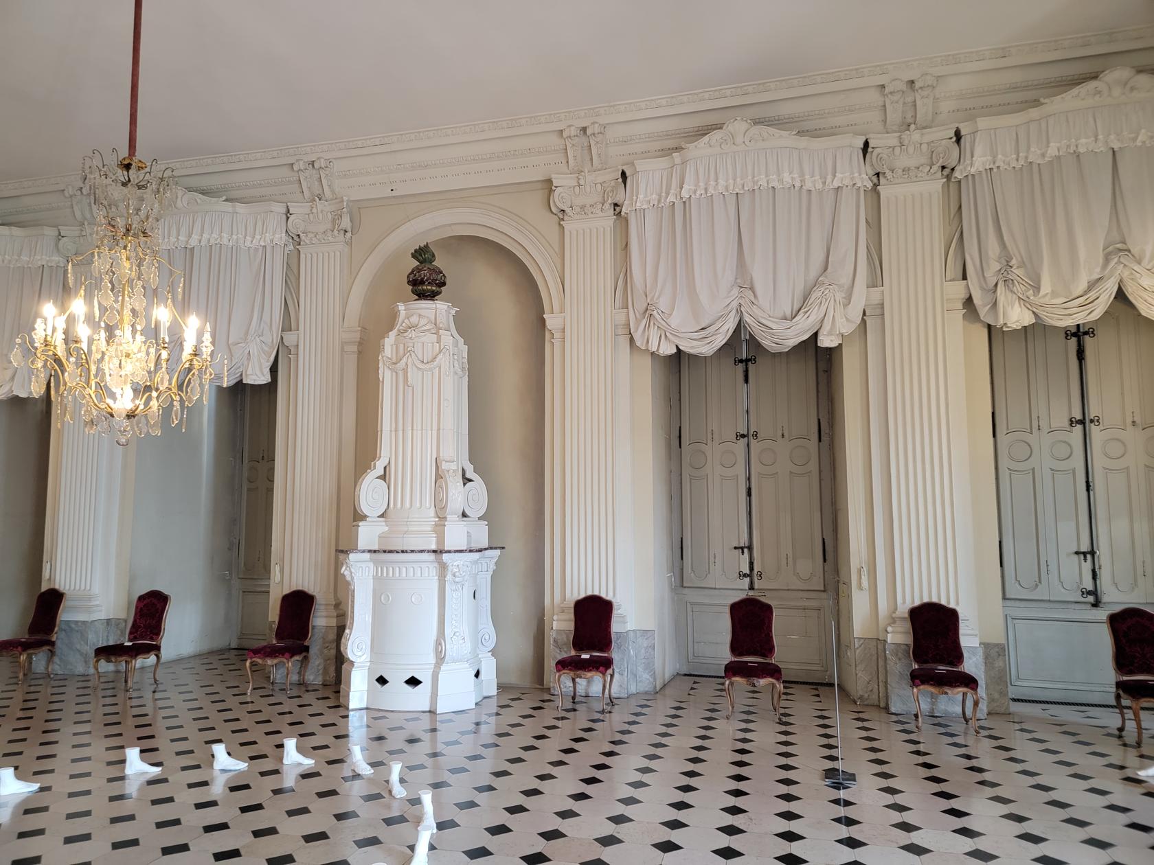
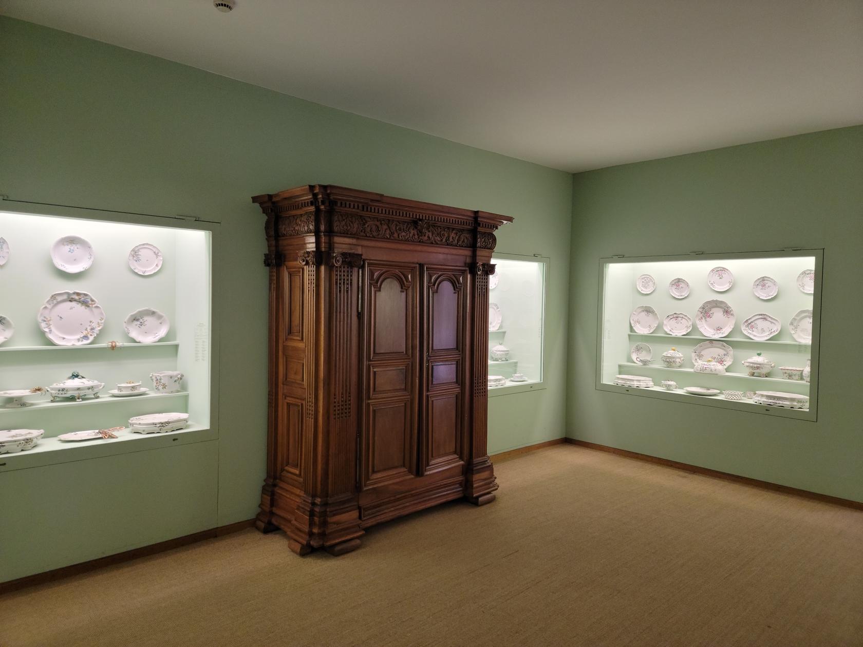
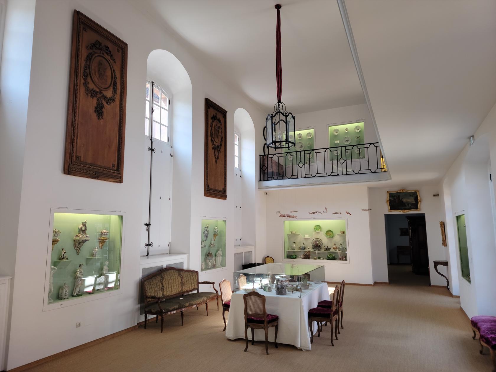
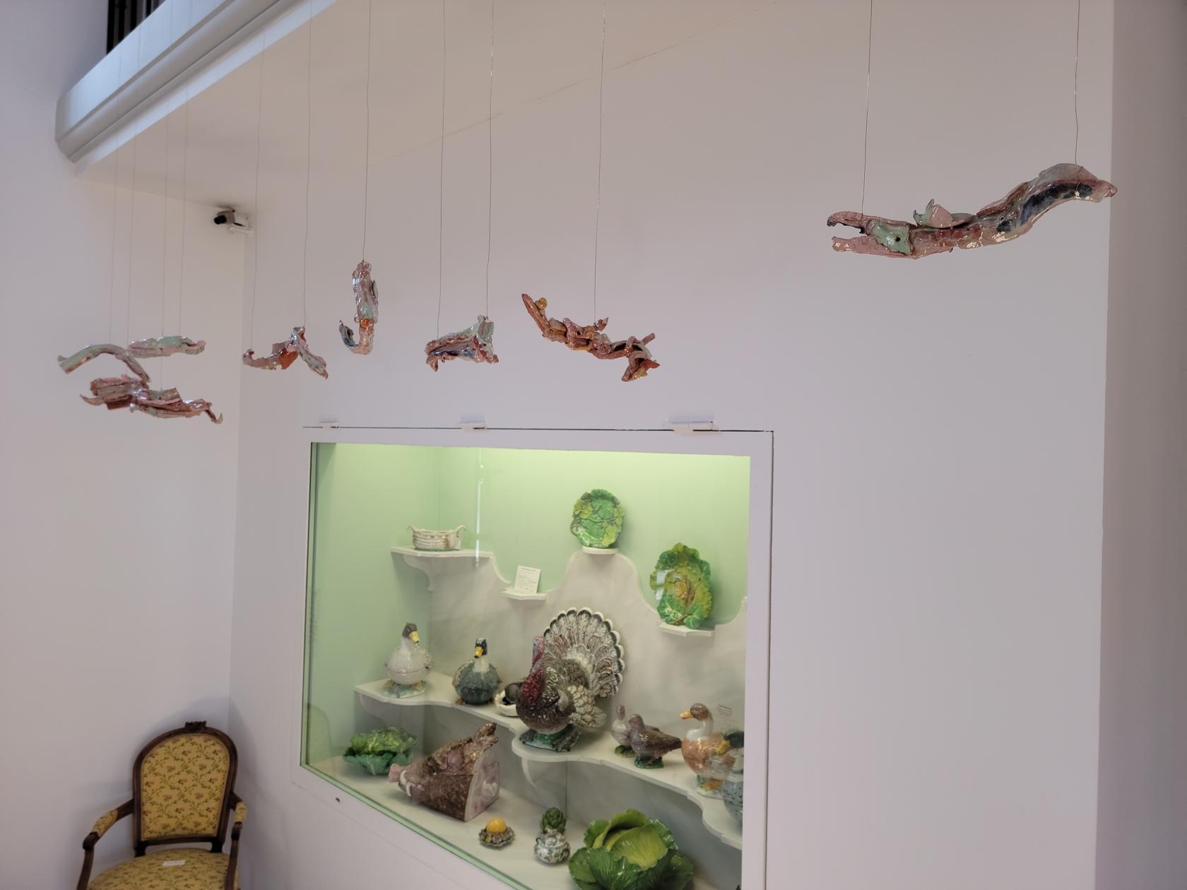
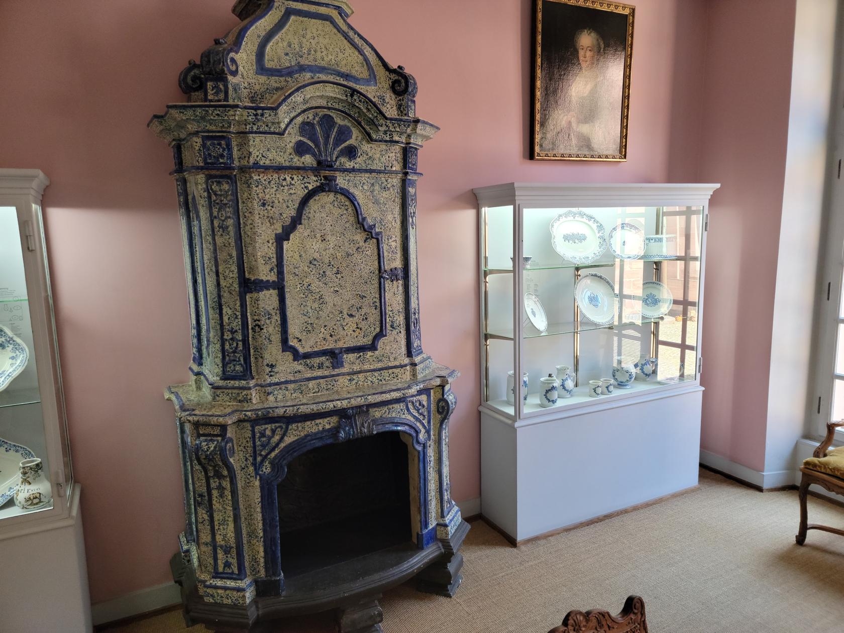
We all found the decorative arts inside the museum a bit avant-guarde for our tastes, but typically French. The interior of the palace for the most part met expectations.
Palace Rohan – Strasbourg, France
Inside the Decorative Arts Museum – Palace Rohan – Strasbourg, France
Decorative Arts Museum – Palace Rohan – Strasbourg, France
Decorative Arts Museum – Palace Rohan – Strasbourg, France
Decorative Arts Museum – Palace Rohan – Strasbourg, France
Decorative Arts Museum – Palace Rohan – Strasbourg, France
Decorative Arts Museum – Palace Rohan – Strasbourg, France
Decorative Arts Museum – Palace Rohan – Strasbourg, France
Decorative Arts Museum – Palace Rohan – Strasbourg, France
Decorative Arts Museum – Palace Rohan – Strasbourg, France
Decorative Arts Museum – Palace Rohan – Strasbourg, France
Decorative Arts Museum – Palace Rohan – Strasbourg, France
Decorative Arts Museum – Palace Rohan – Strasbourg, France
Decorative Arts Museum – Palace Rohan – Strasbourg, France
Decorative Arts Museum – Palace Rohan – Strasbourg, France
Decorative Arts Museum – Palace Rohan – Strasbourg, France
Decorative Arts Museum – Palace Rohan – Strasbourg, France
Pont du Faisan
Built in 1888 this is a working example of an old hydraulic swing bridge. Below is a short video showing it in operation. First the two ends are closed for traffic, then the operator swings the bridge to allow boats through the gate. We were able to see this as a pedestrian and on the Strasbourg sightseeing tour boat. It is a very interesting piece of engineering and on a small scale, perhaps better than raising a bridge.
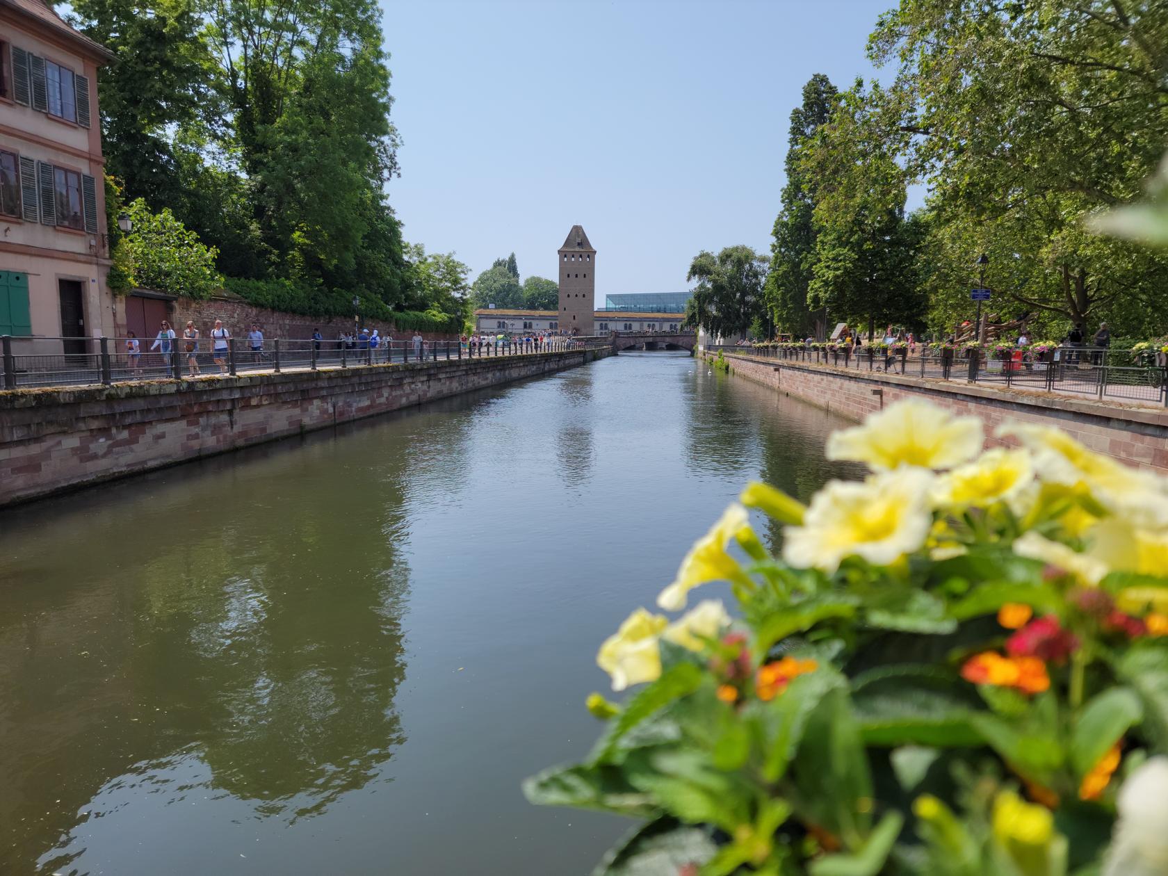
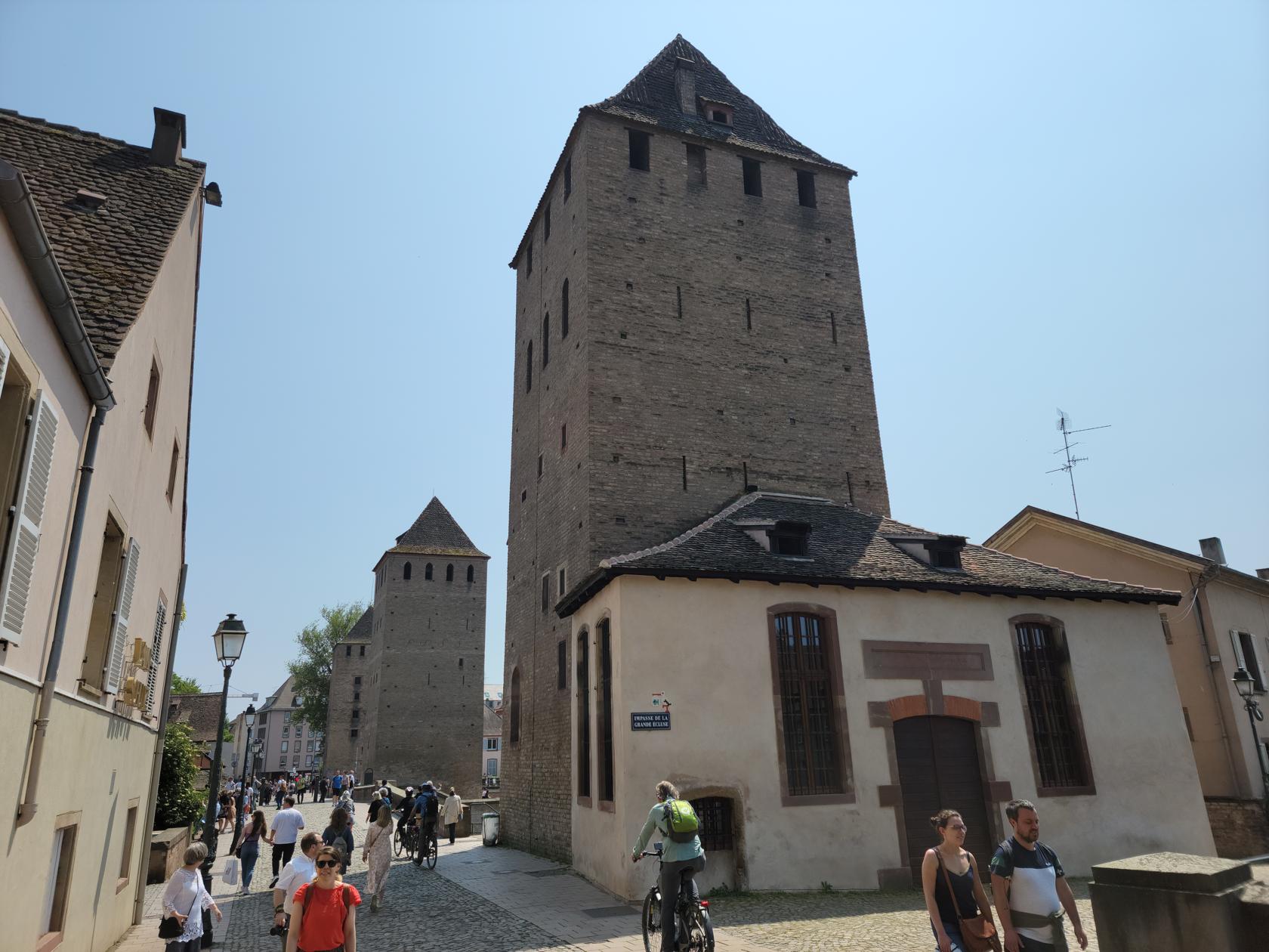
Ponts Couverts de Strasbourg
This Ponts Couverts is a set of thirteen century covered bridges and towers on the southwest part of the island. Initially a battlement and constructed of wood, the roofs were later removed and eventually the bridges were rebuilt in stone.
The Pont Courverts – Strasbourg, France
At least one of them was made into a prison and it was later told, though falsely, that executions were also carried out there, though there is no evidence of this happening.
The Courvert Towers – Strasbourg, France
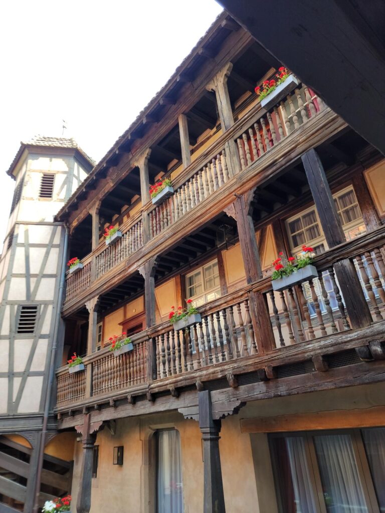
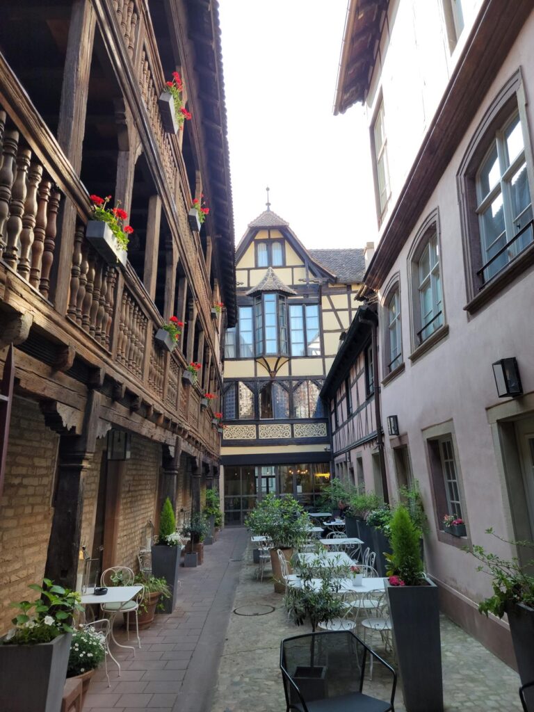
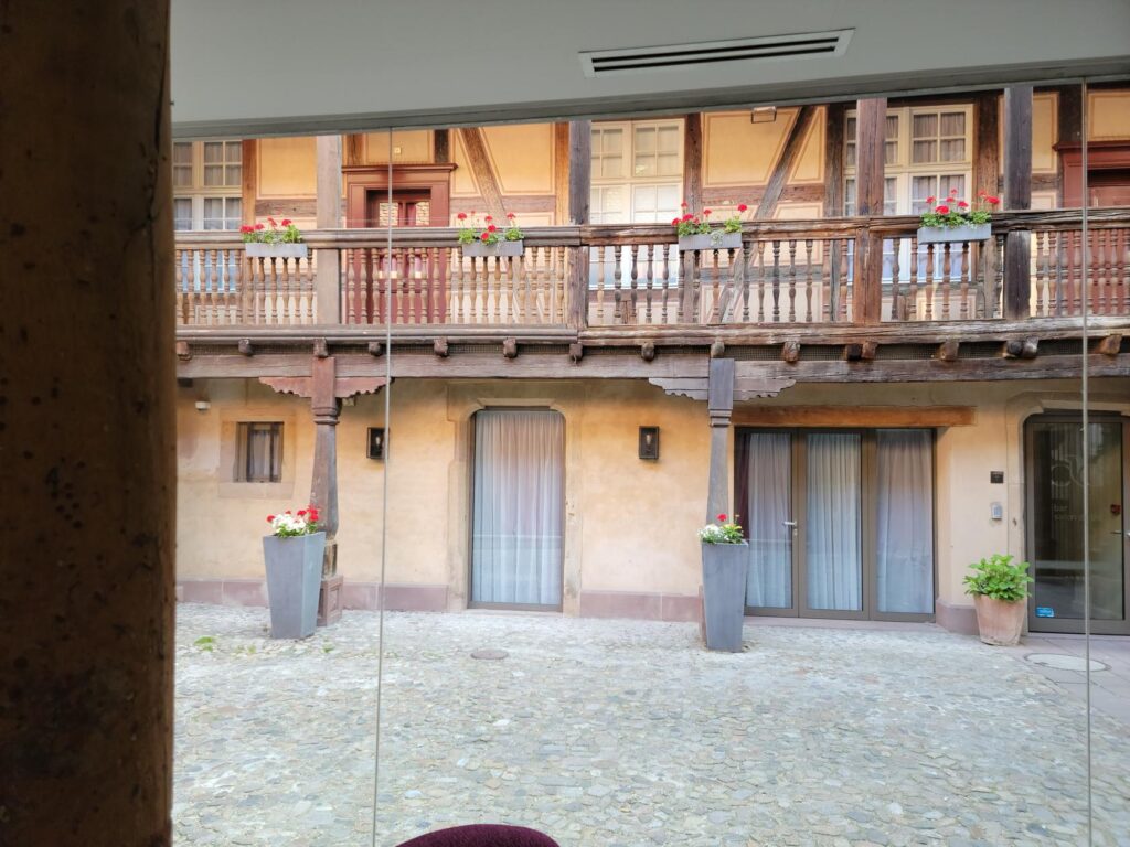
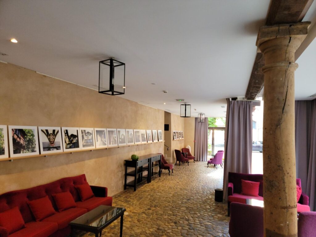
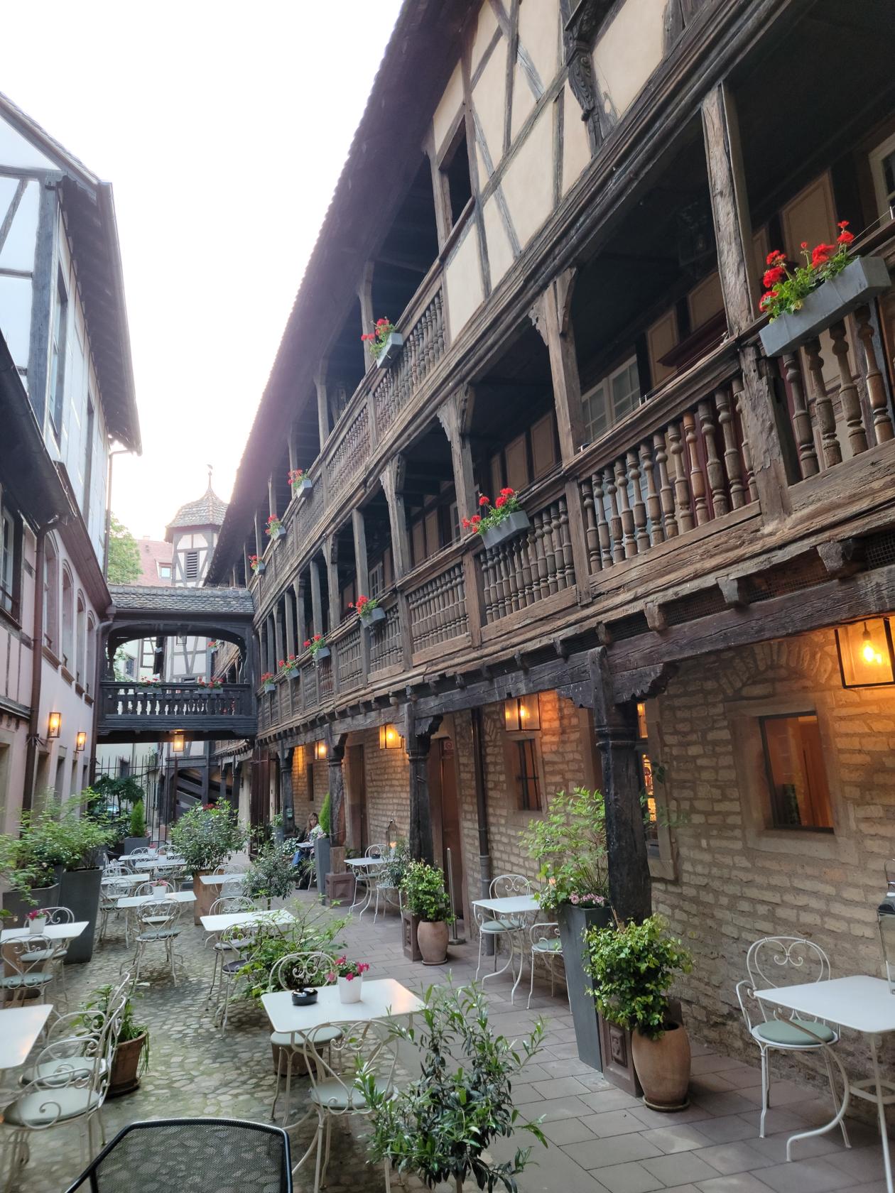
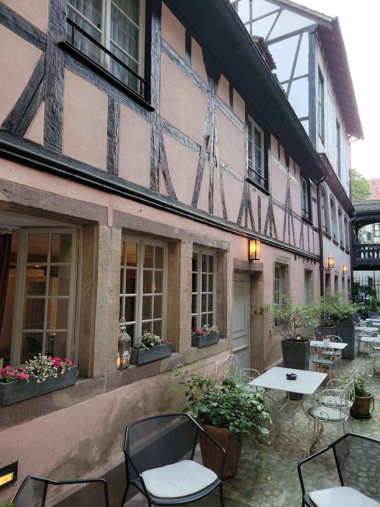
Hotel Cour Du Corbeau
A very good hotel that is strategically located close to the old city center in Krutenau is the Hotel Cour Du Corbeau. It is situated just across the river Ill and two blocks away from the cathedral. Parking for cars is only a block away and many restaurants and cafes are within ten minutes walking distance.
An old inn renovated – Hotel Cour Du Corbeau – Strasbourg, France
The courtyard and cafe – Hotel Cour Du Corbeau – Strasbourg, France
Old wooden framing – Hotel Cour Du Corbeau – Strasbourg, France
Renovated inside – Hotel Cour Du Corbeau – Strasbourg, France
Since we were arriving by train, we took the D Tram from the Central Station and got off at the Hospital stop. From there we were only a ten minute walk away.
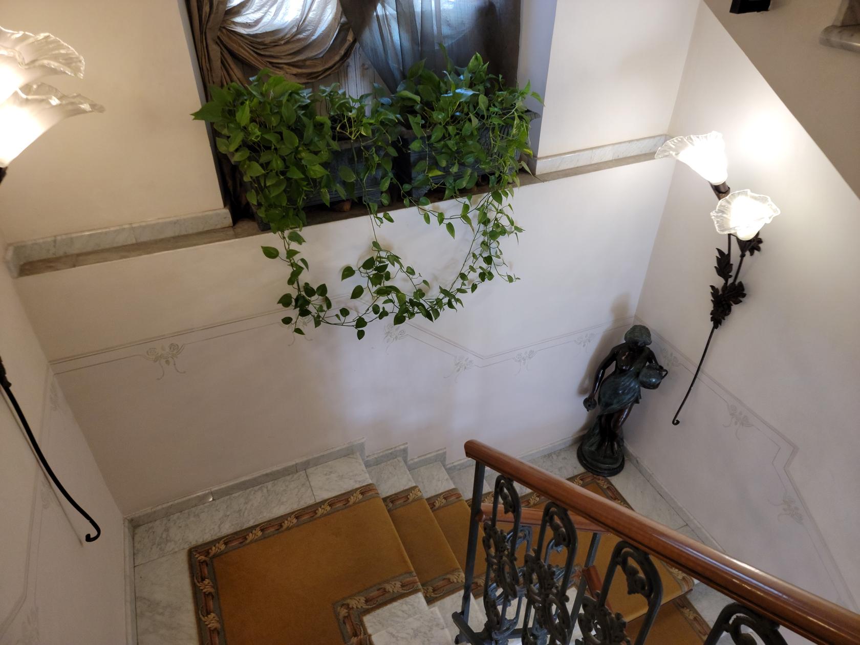
Old spiral staircase – Hotel Cour Du Corbeau – Strasbourg, France
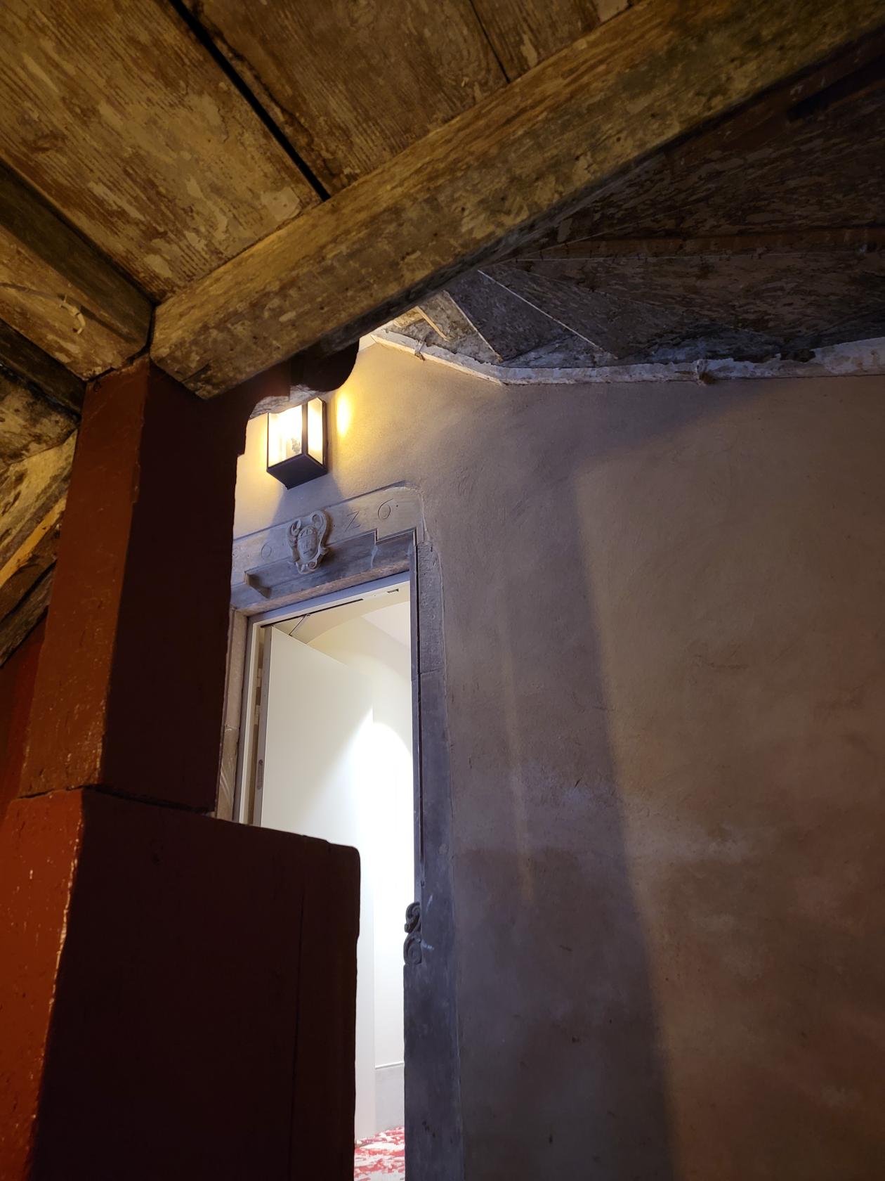
The hotel is a smartly renovated and modernized version of an old inn that was used by workmen that worked at the tanneries and other places throughout the city. It maintains many of the old beams and architectural elements of the old building. However, it includes air-conditioning and many other modern amenities.
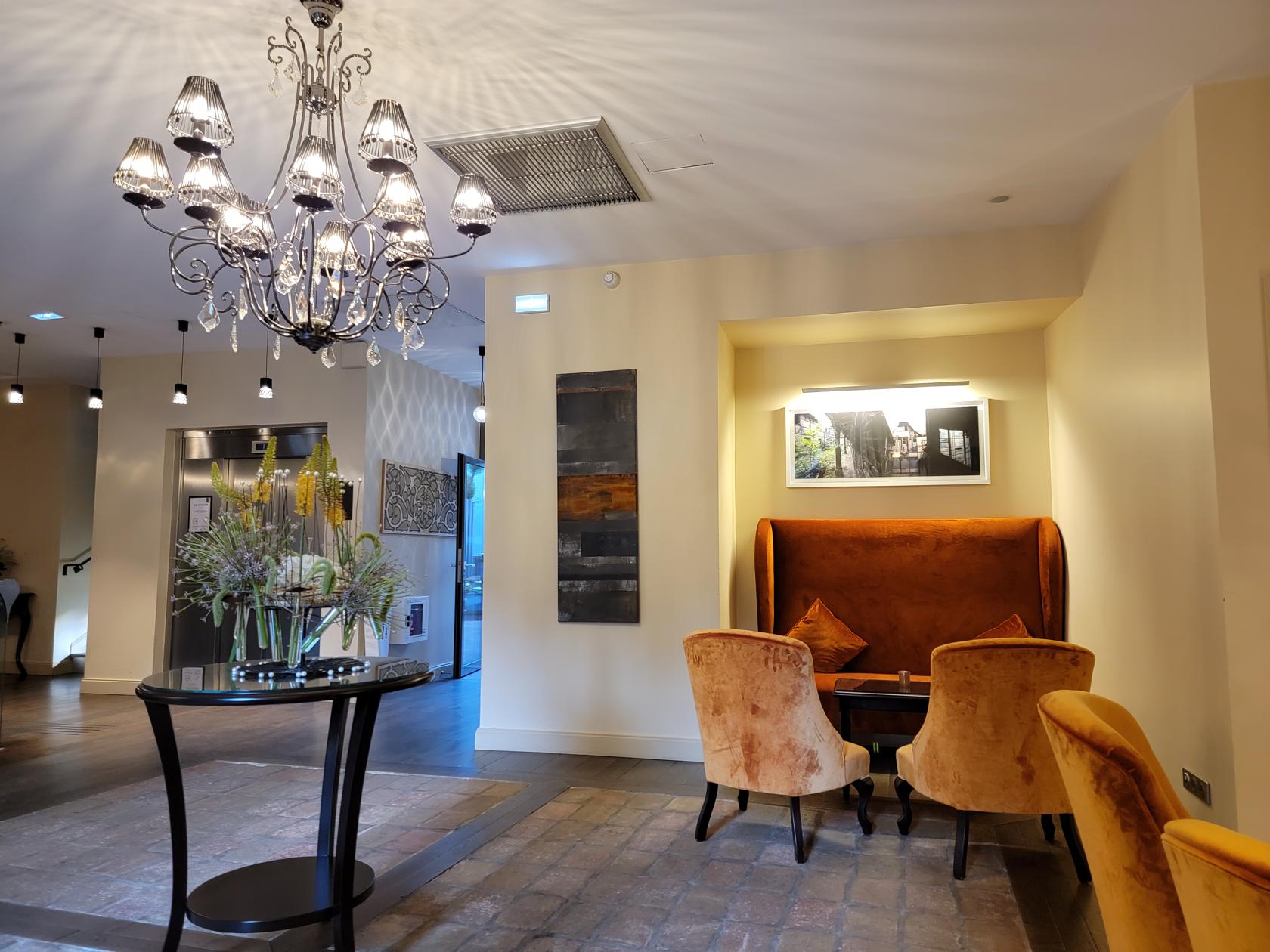
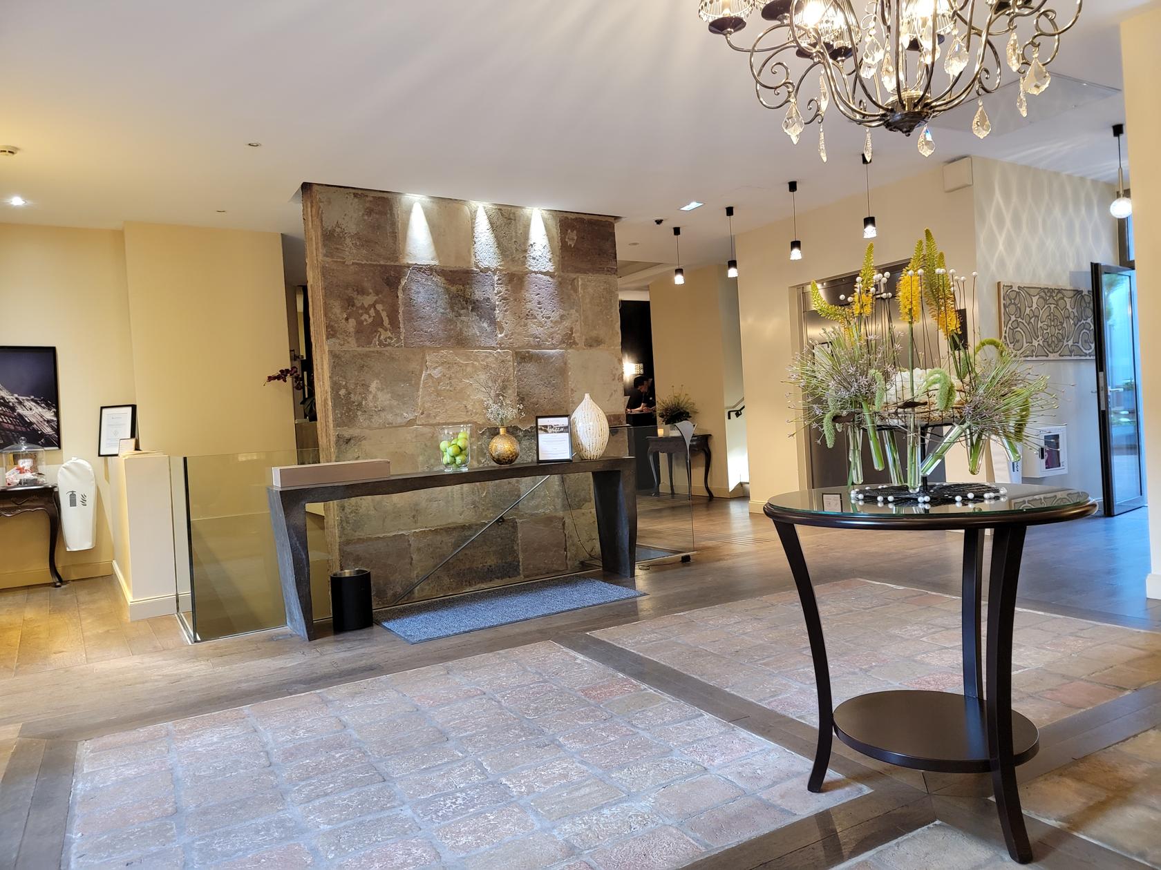
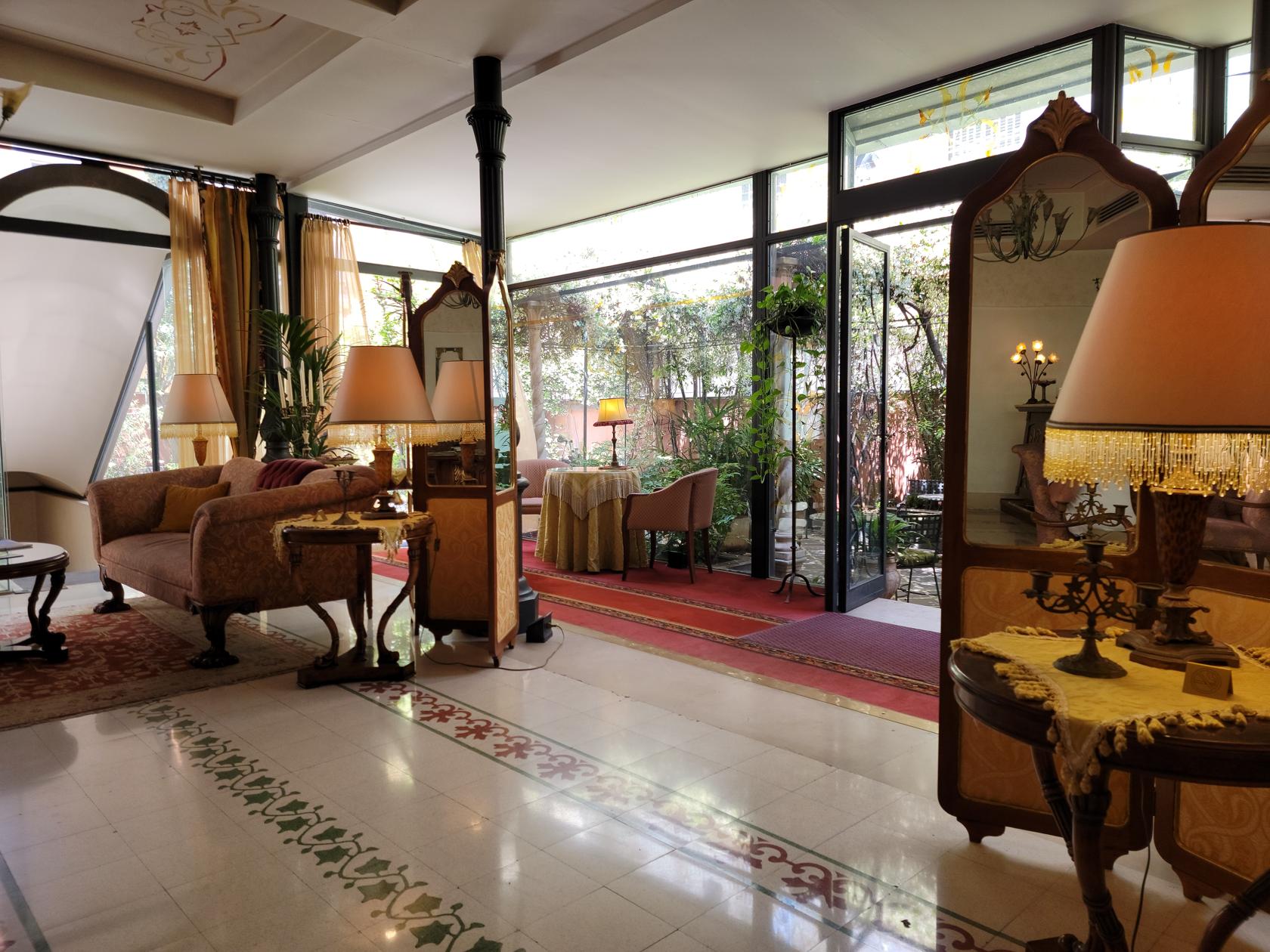
The lobby – Hotel Cour Du Corbeau – Strasbourg, France
The lobby – Hotel Cour Du Corbeau – Strasbourg, France
Outside courtyard – Hotel Cour Du Corbeau – Strasbourg, France
Outside courtyard and bar – Hotel Cour Du Corbeau – Strasbourg, France
Although you may initially find their 27€ price for breakfast a bit steep, it is well worth it since they provide both hot and cold buffet items, as well as a wide selection of coffees.
Old spiral staircase – Hotel Cour Du Corbeau – Strasbourg, France
Restaurants
Being a very busy tourist spot, Strasbourg has a plethora of restaurants, anything from traditional Alsatian food, to Chinese and other cosmopolitan cuisines. So you shouldn’t go hungry, even without a reservation.
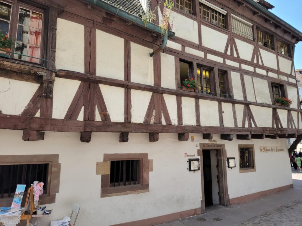
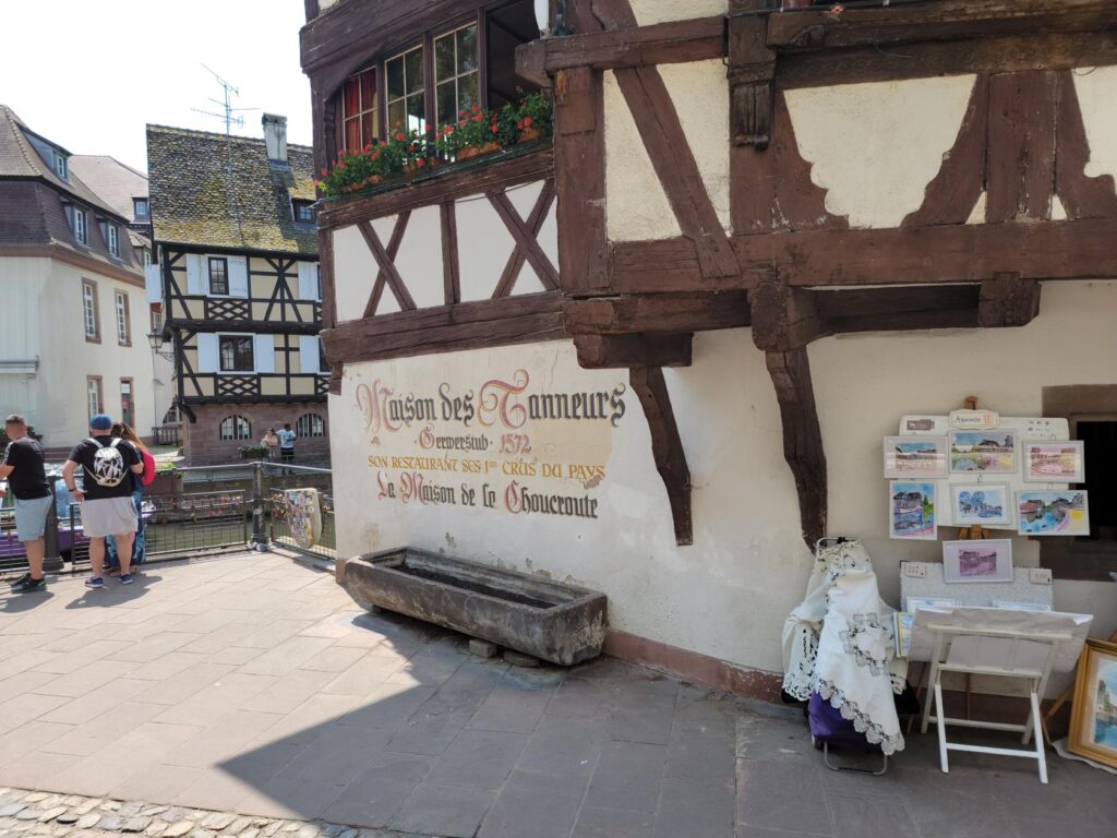
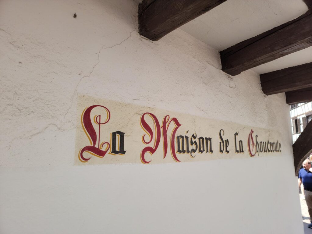
Maison Des Tanneurs
The House of the Tanners restaurant was the furthest of all the restaurants from our hotel and took a good fifteen minute walk to reach.
Restaurant – The House of Tanners – Strasbourg, France
Restaurant – The House of Tanners – Strasbourg, France
Restaurant – The House of Tanners – Strasbourg, France
Former names – The House of Tanners – Strasbourg, France
Located in the far southwest corner of the island and near the Ponts Couverts it commands a nice view of the river Ill. So, if you want window side seat, reserve your seat early, we arrived at our reservation time and the sign was already posted on the menu outside – totally booked this evening.
View from window – The House of Tanners – Strasbourg, France
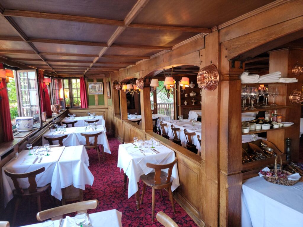
Inside – The House of Tanners – Strasbourg, France
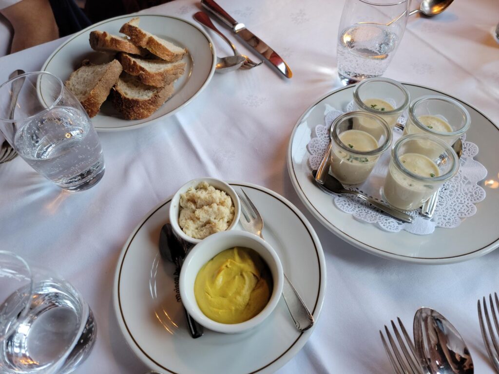
Our appetizers – The House of Tanners – Strasbourg, France
Gulash like soup – The House of Tanners – Strasbourg, France
La Choucroute – Heap of sauerkraut and assorted meat – The House of Tanners – Strasbourg, France
Tenderloin with sauce Bearnaise and potato croquettes – The House of Tanners – Strasbourg, France
Inside – The House of Tanners – Strasbourg, France
The window view again – The House of Tanners – Strasbourg, France
La Piazza
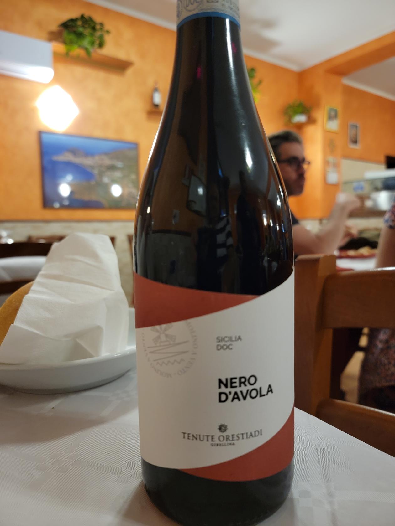
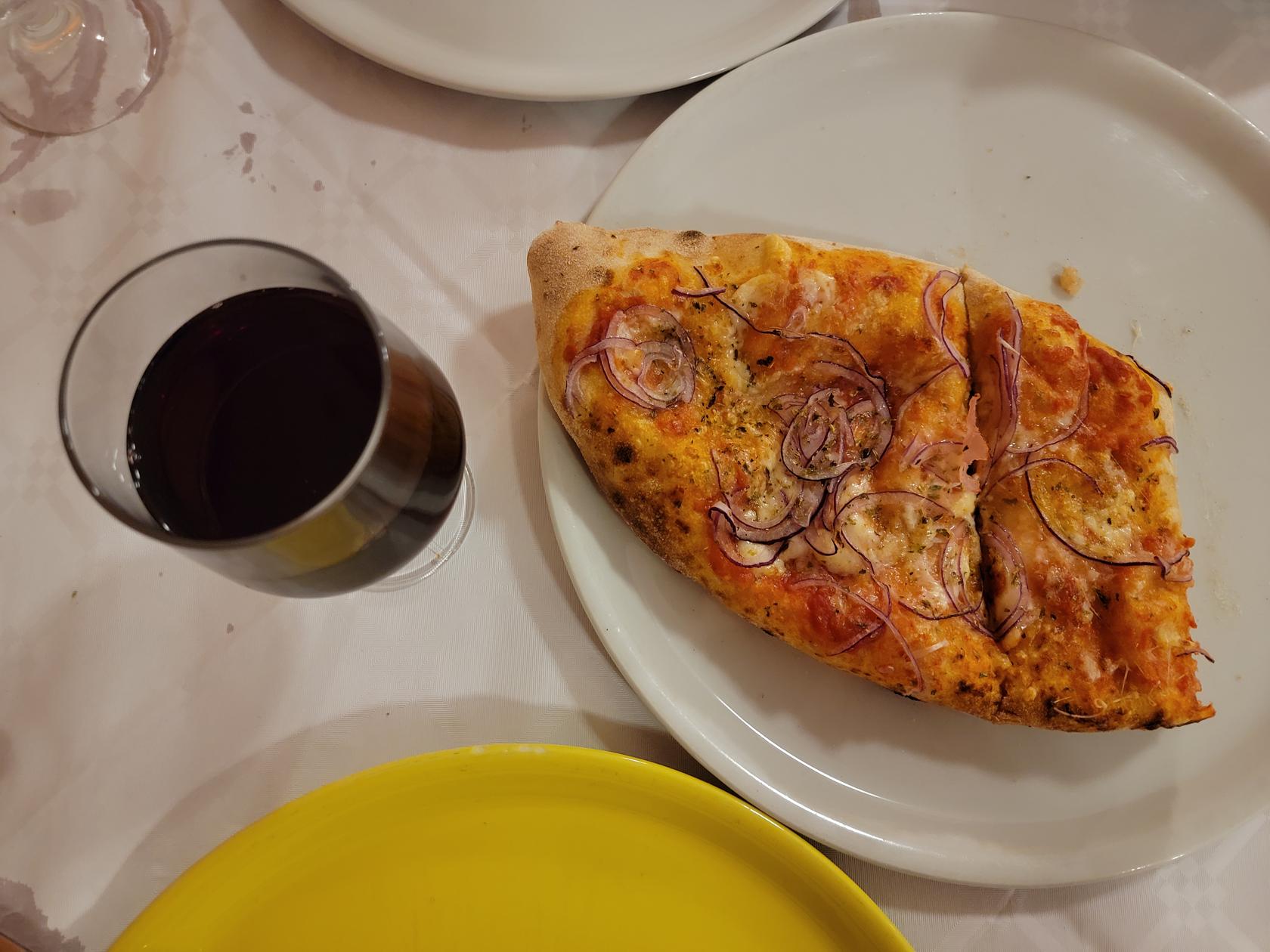
We ate here on a first night and it is a decent restaurant with pretty good Italian food. We sat inside near the wood burning over, so the pizza they made for us was using the traditional method. The service was fine and our drinks met all of our expectations. However, the toilet left much to be desired, I suggest you become prepared to avoid a visit.
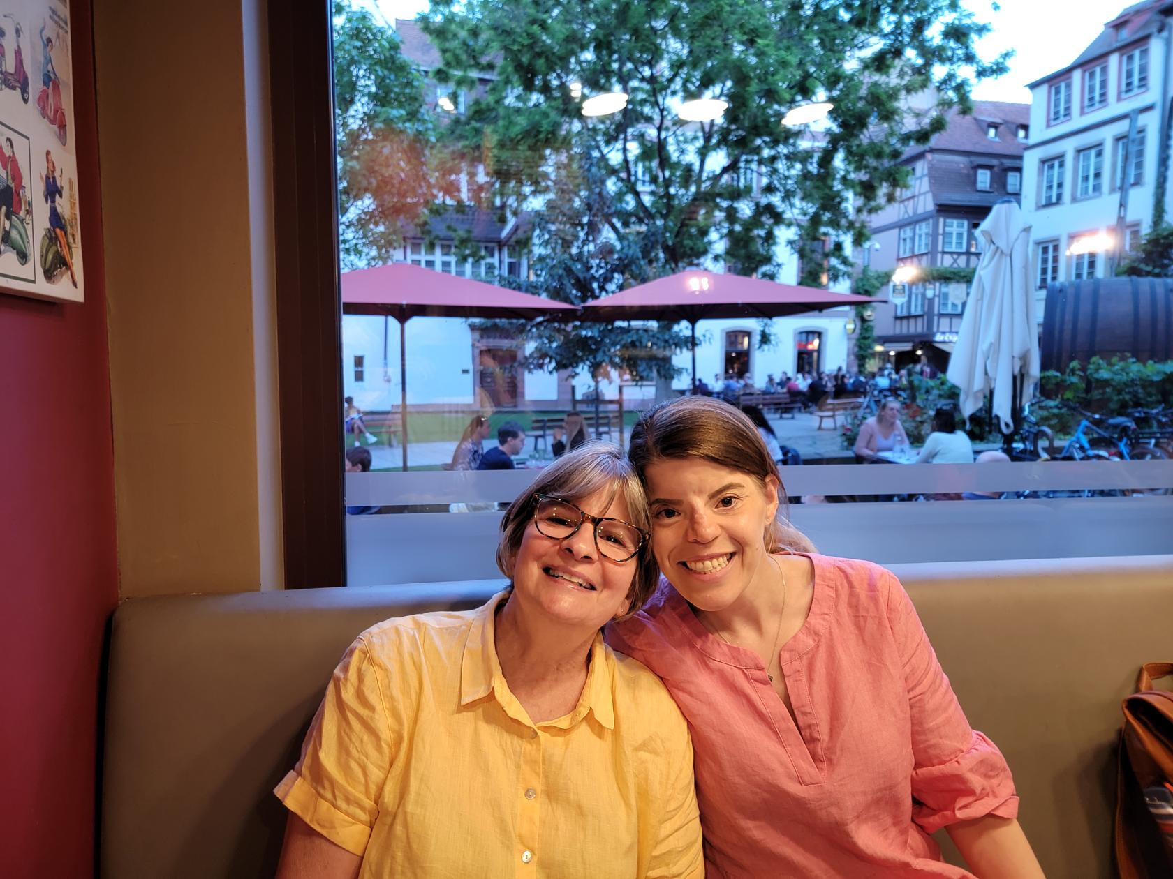
Patti and Ericka – La Piazza restaurant – Strasbourg, France
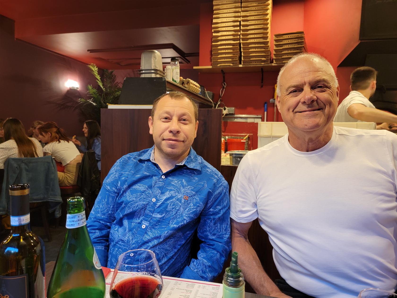
Gabi and Erick – La Piazza restaurant – Strasbourg, France
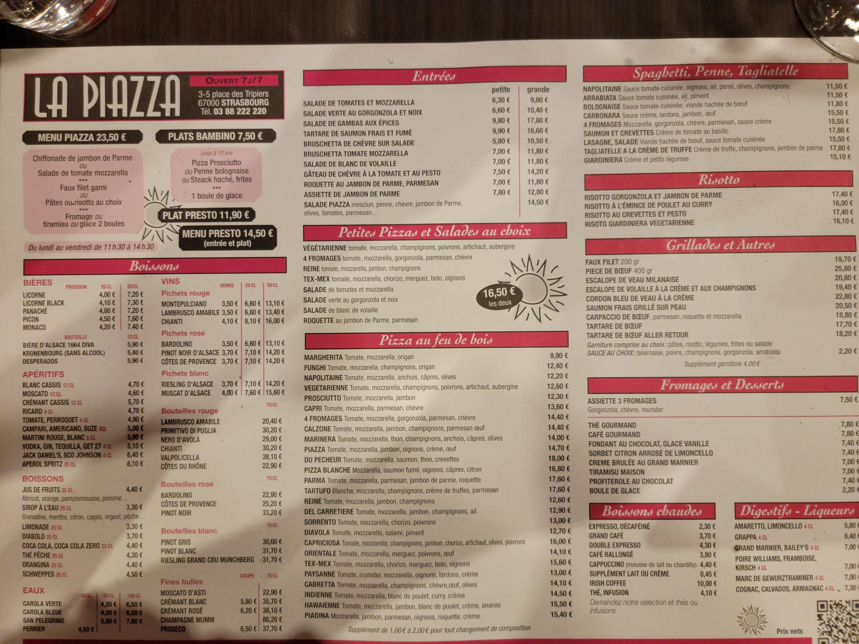
The menu – La Piazza restaurant – Strasbourg, France
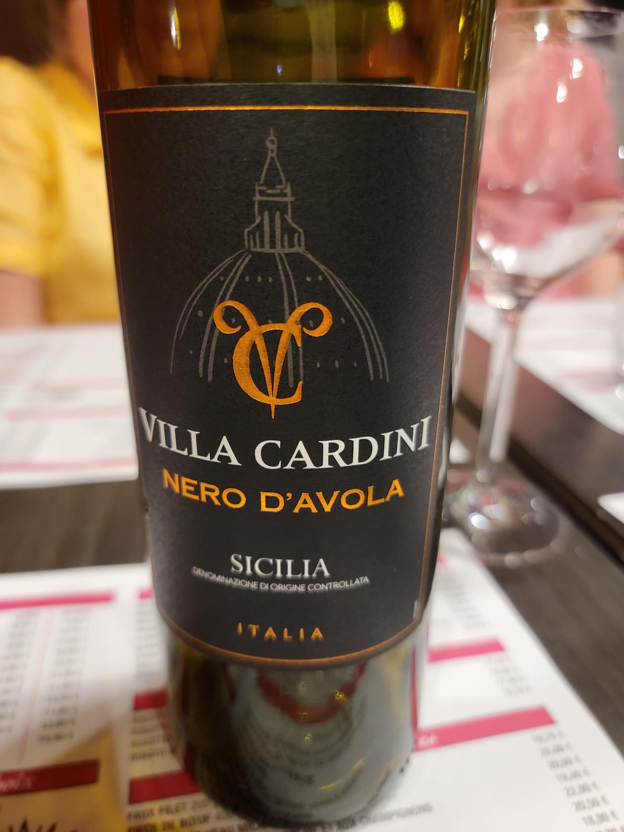
A nice wine – a Sicilian Nero D’Avola – La Piazza restaurant – Strasbourg, France
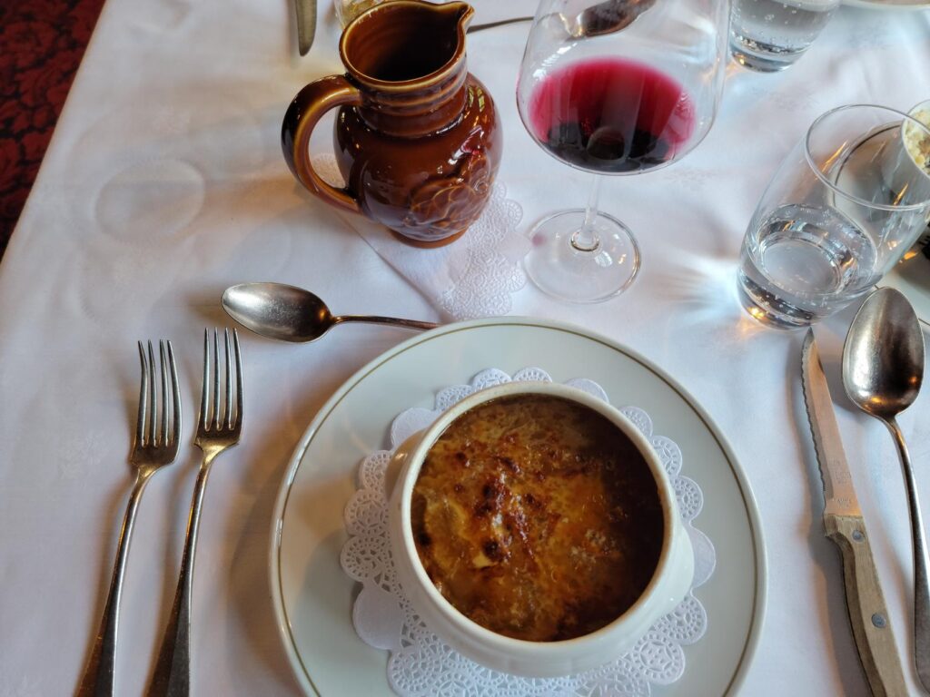
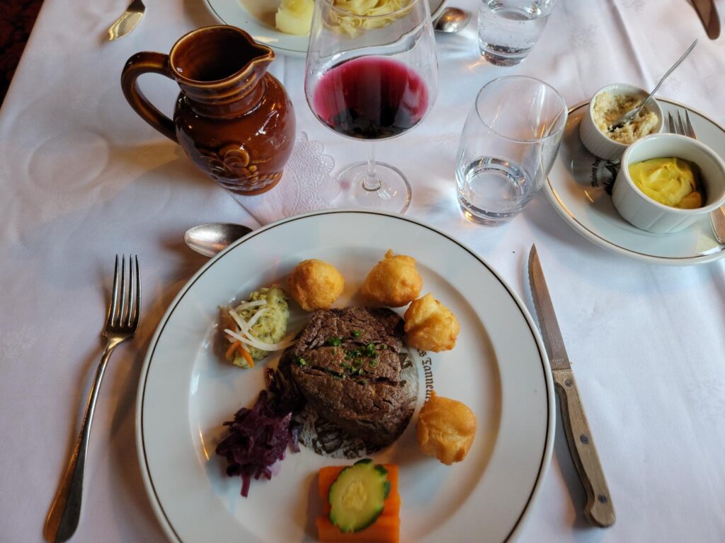
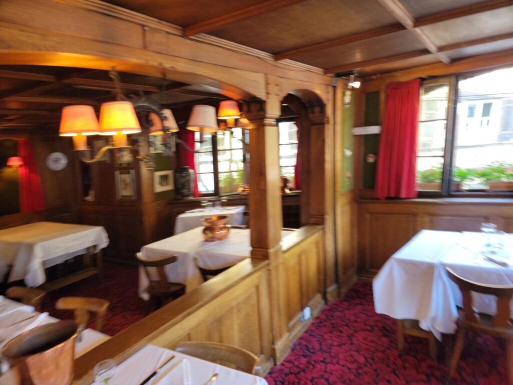
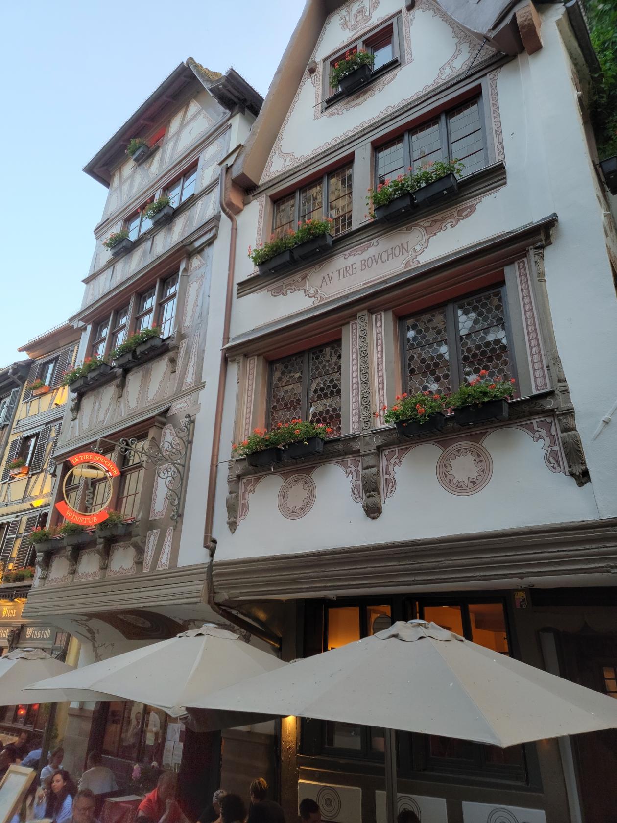
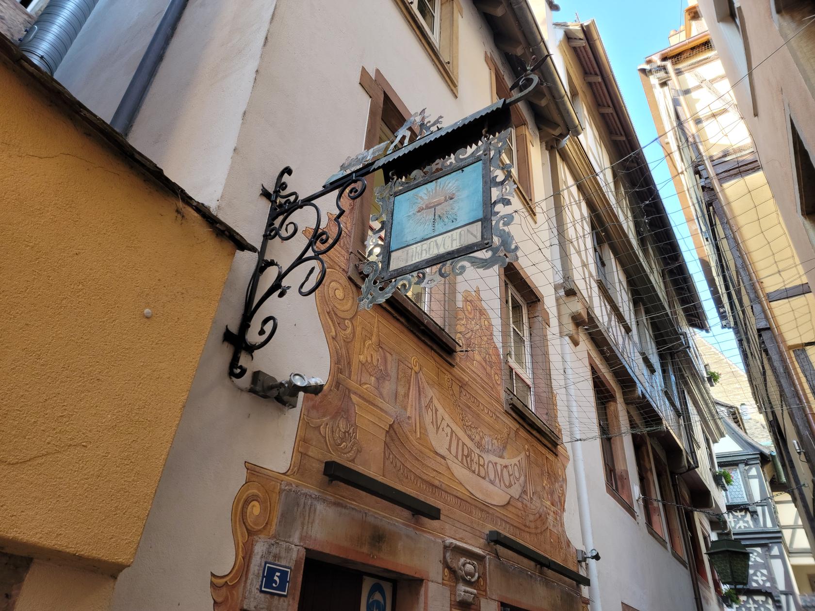
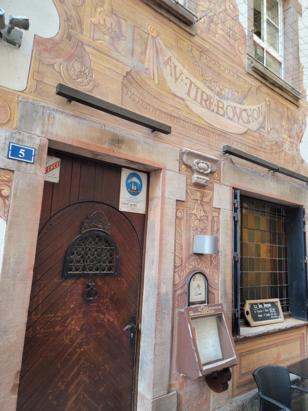
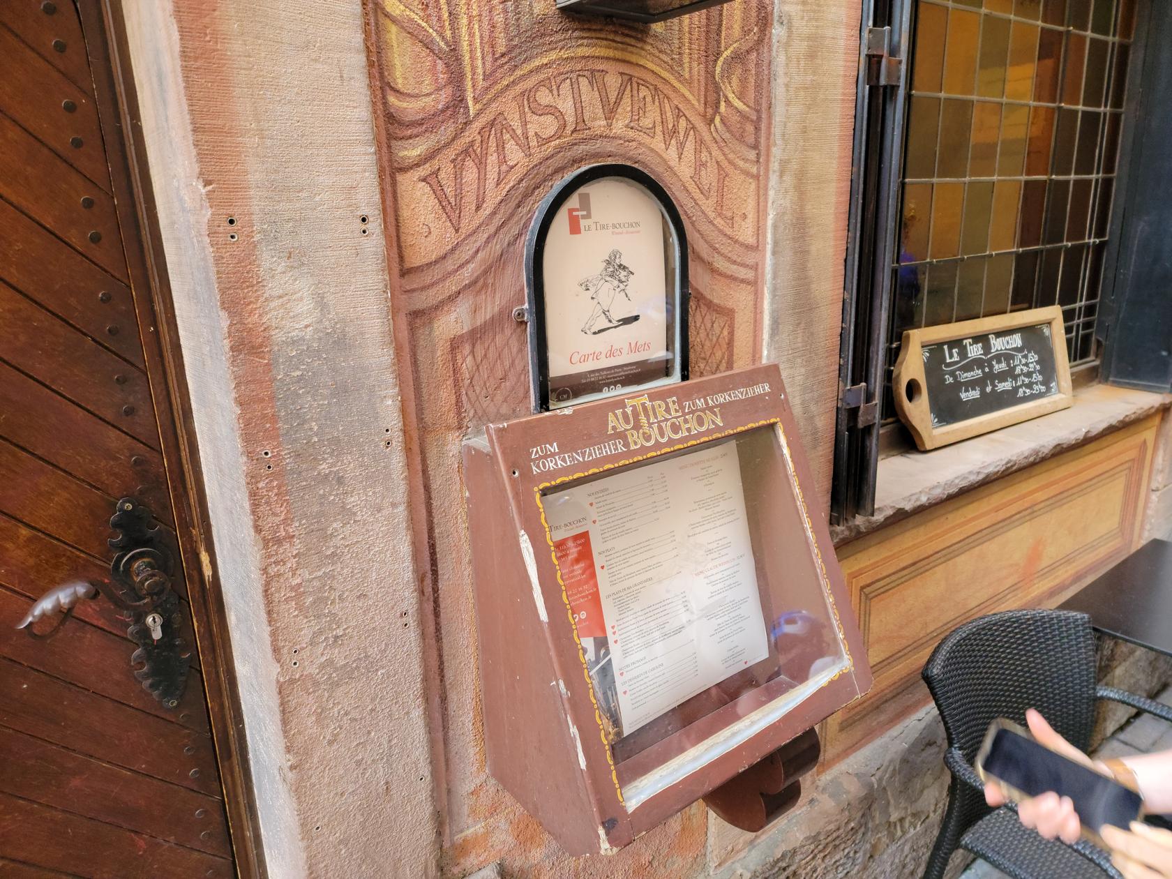
Au Tire Bouchon
Another excellent Alsatian restaurant choice is the Au Tire Bouchon. Though it does not have the view the House of Tanners provides, the food is on par with that establishment.
Street entrance – Au Tire Bouchon – Strasbourg, France
Alley and back entrance – Au Tire Bouchon – Strasbourg, France
Entrance sign – Corkpuller – Au Tire Bouchon – Strasbourg, France
Entrance – Au Tire Bouchon – Strasbourg, France
The menu – Au Tire Bouchon – Strasbourg, France
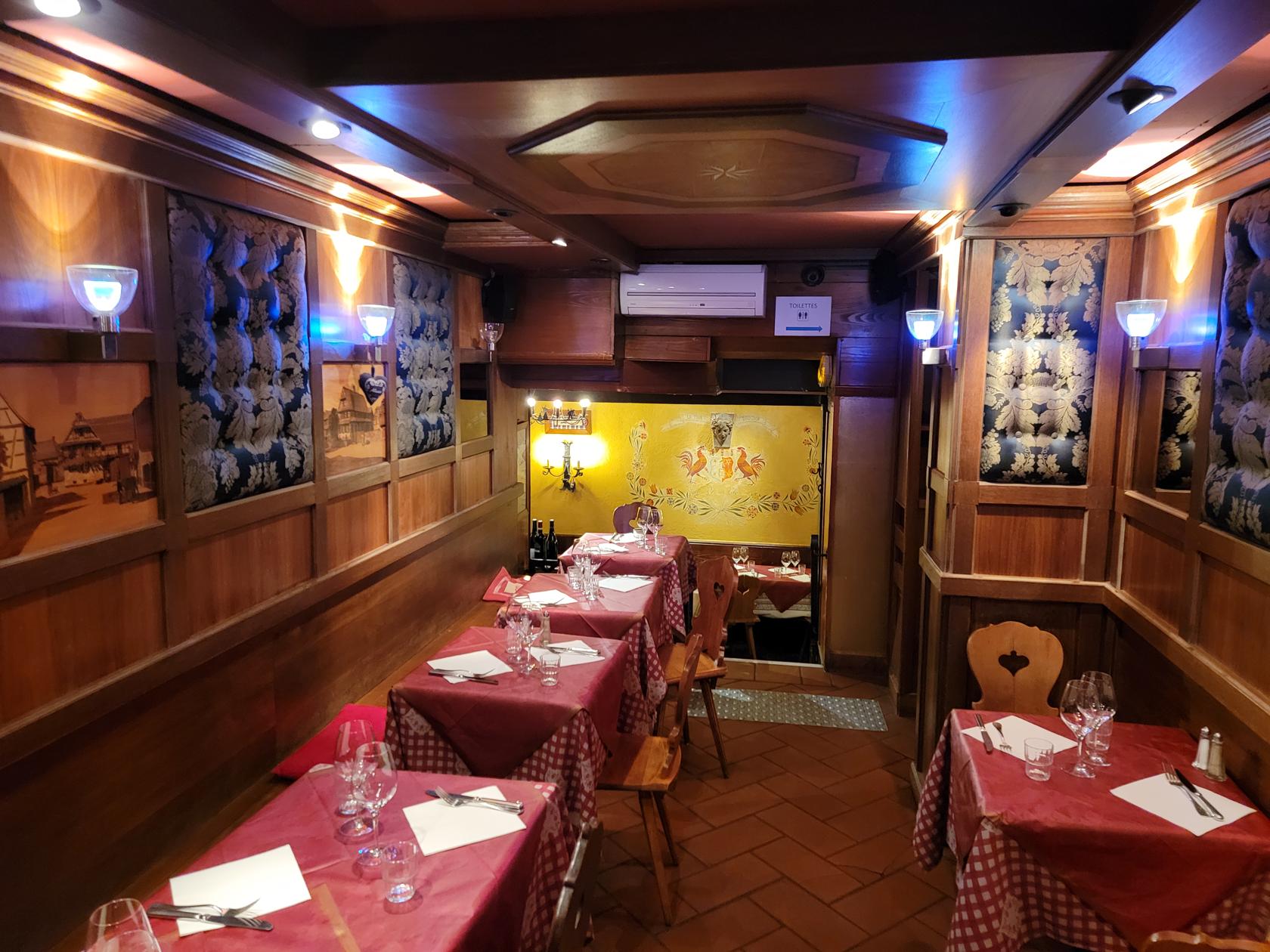
Inside – Au Tire Bouchon – Strasbourg, France
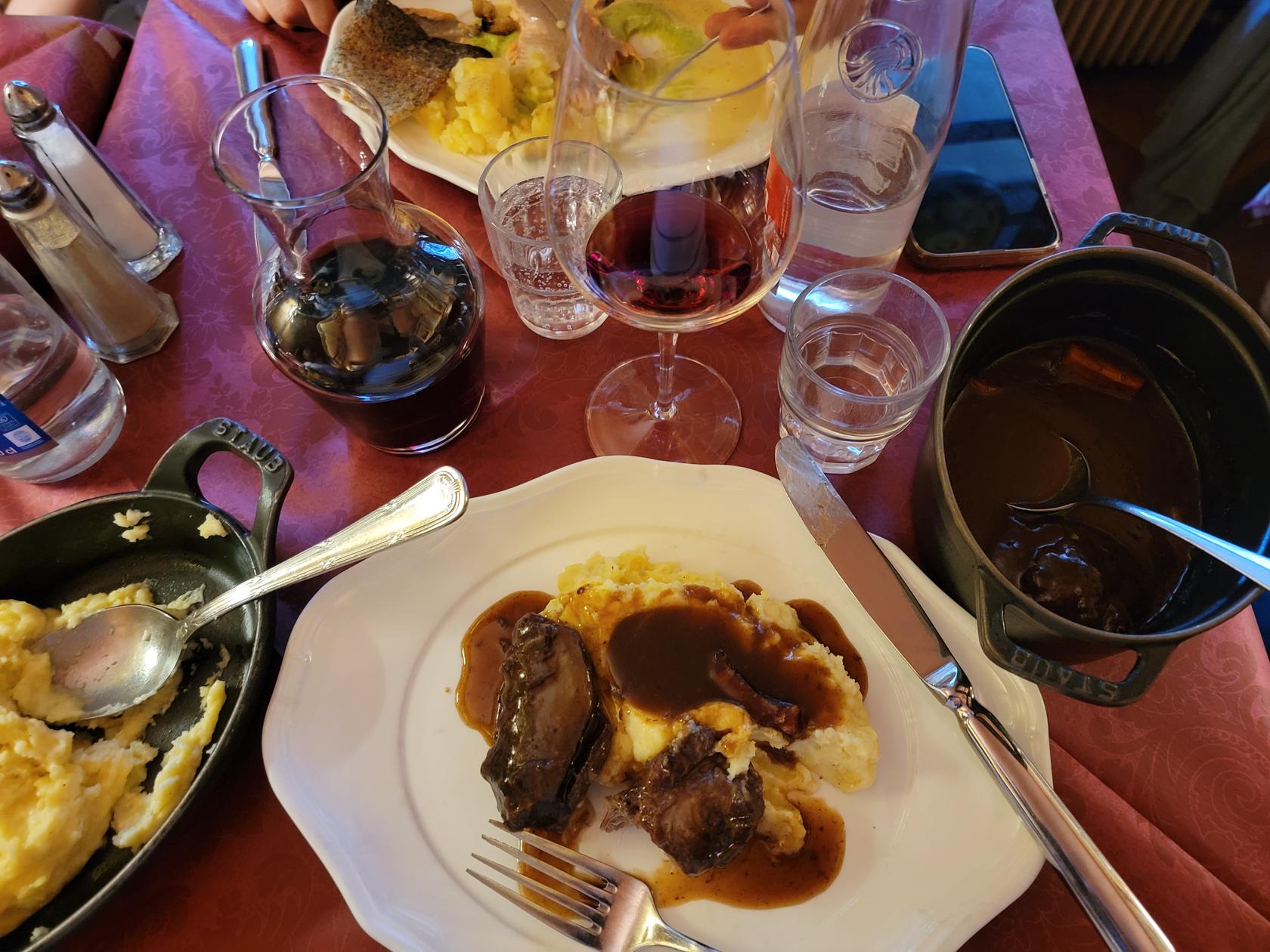
Beef and mashed potatoes – Au Tire Bouchon – Strasbourg, France
Continuing our journeys on the eastern coast of Sicily, we arrived at Catania. A port city and working town that believe it or not, is even grittier than Naples.
Catania, a panorama – San Nicolo L’Arena Church – Catania, Sicily
Catania
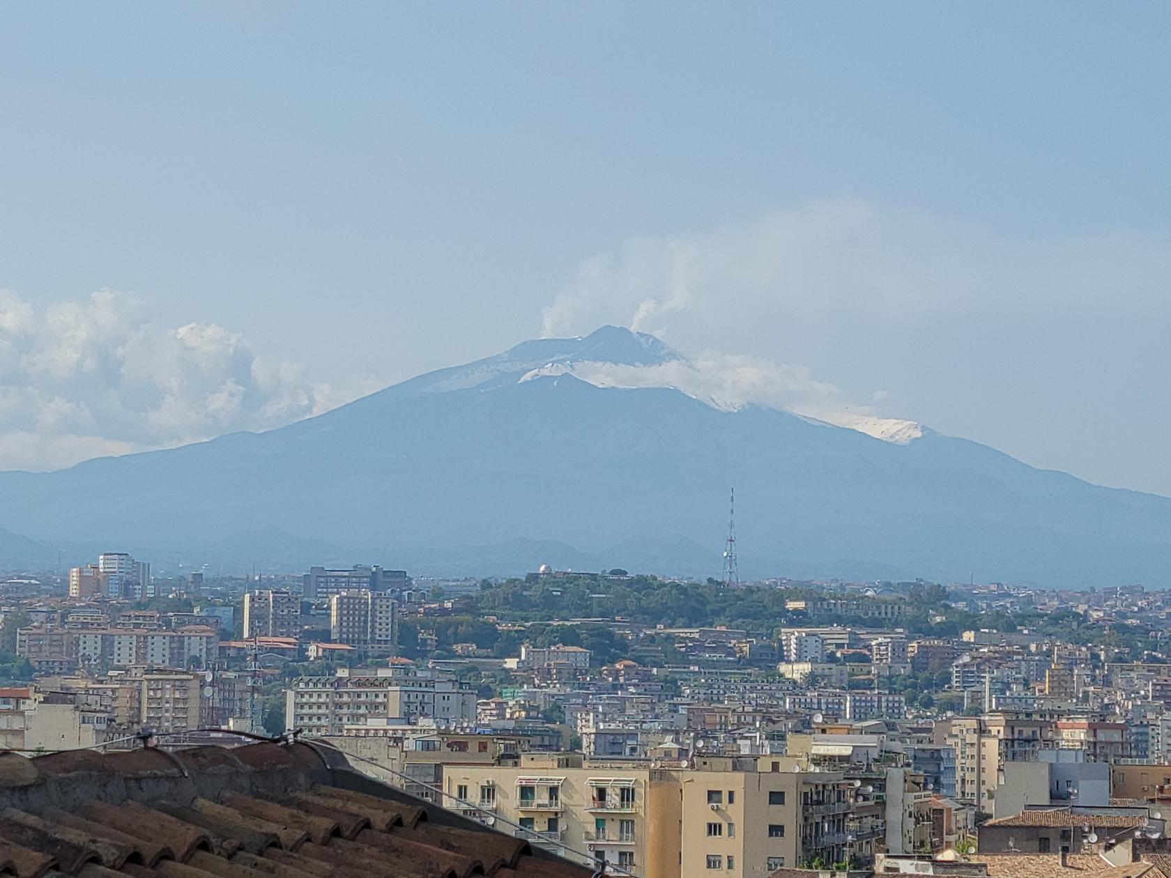
Existing in the shadow of a large, ever erupting volcano, would seem like a fool’s errand. But the people of Catania do it everyday and only give it a second thought. Luckily, the volcano has not had a major eruption in some time, and since it’s monitored continuously, most people try to ignore it.
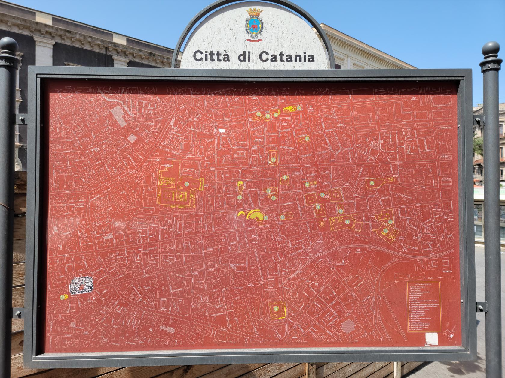
Map of Catania – Catania, Sicily
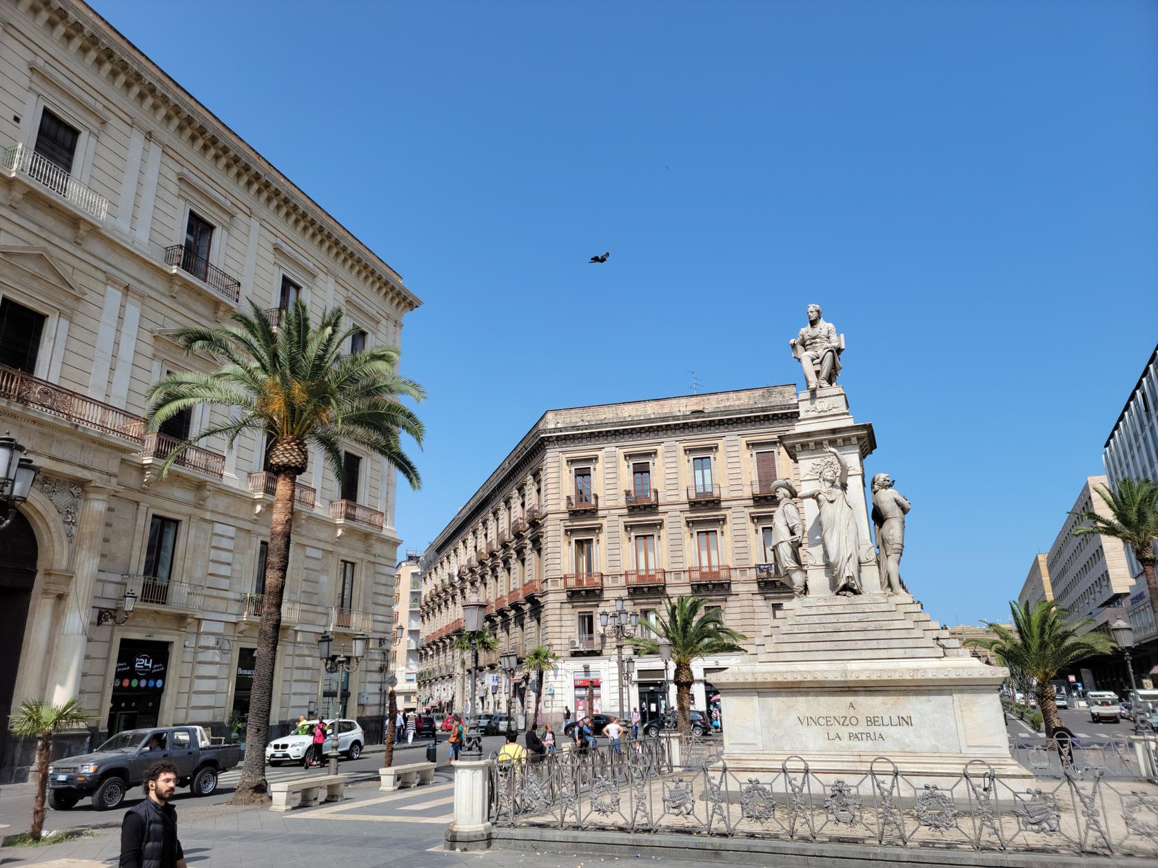
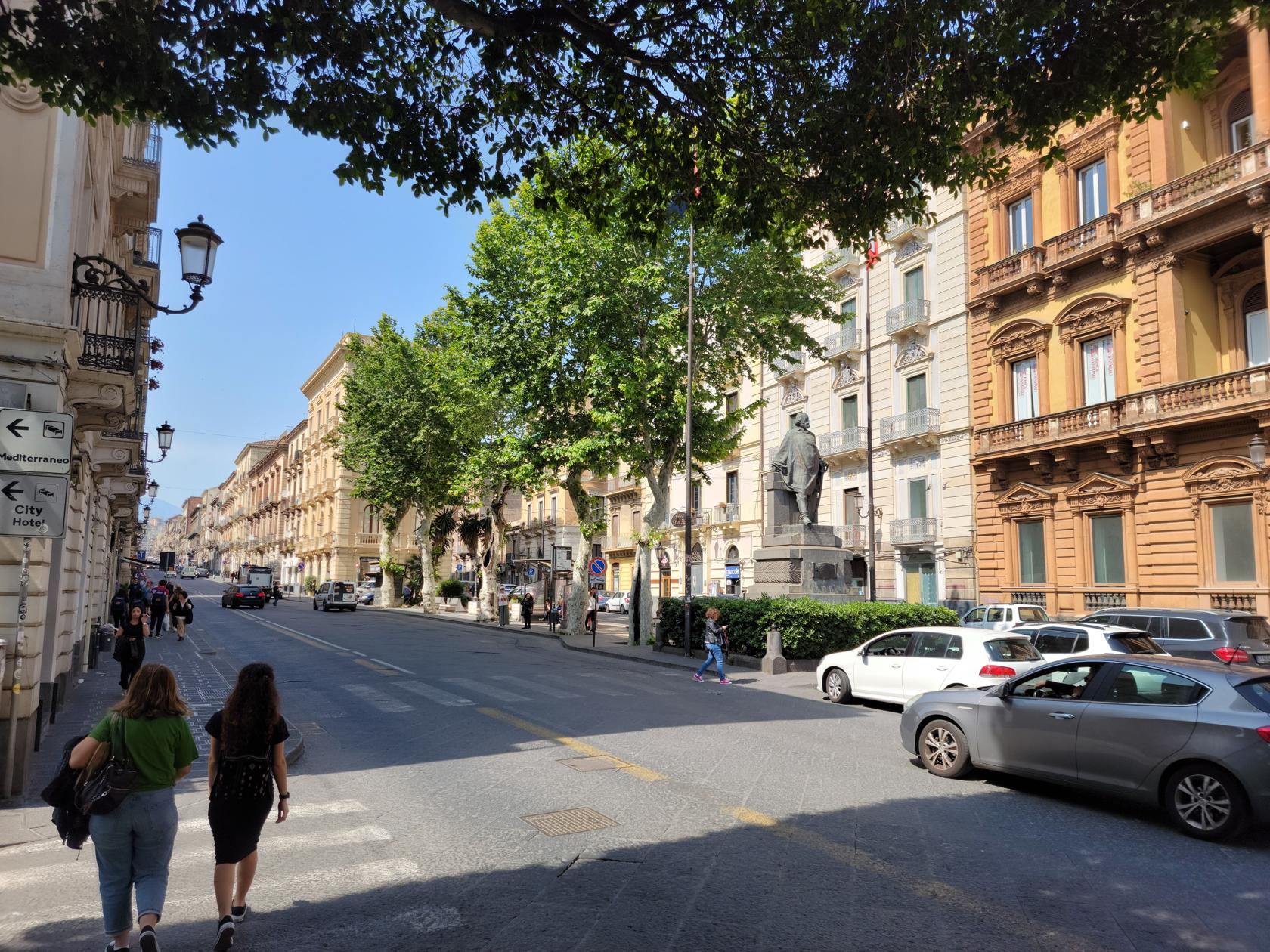
Via Etnae – Catania, Sicily
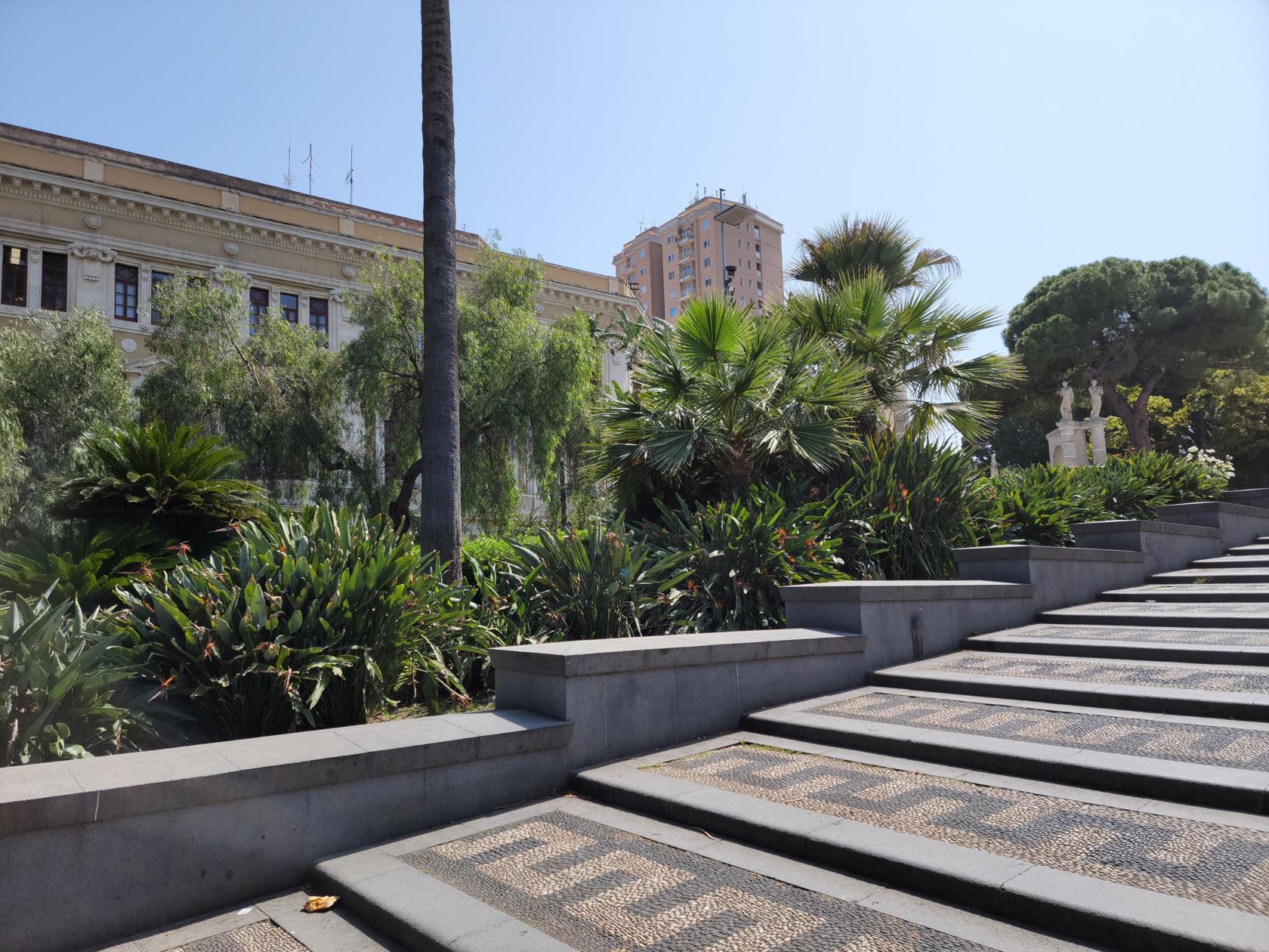
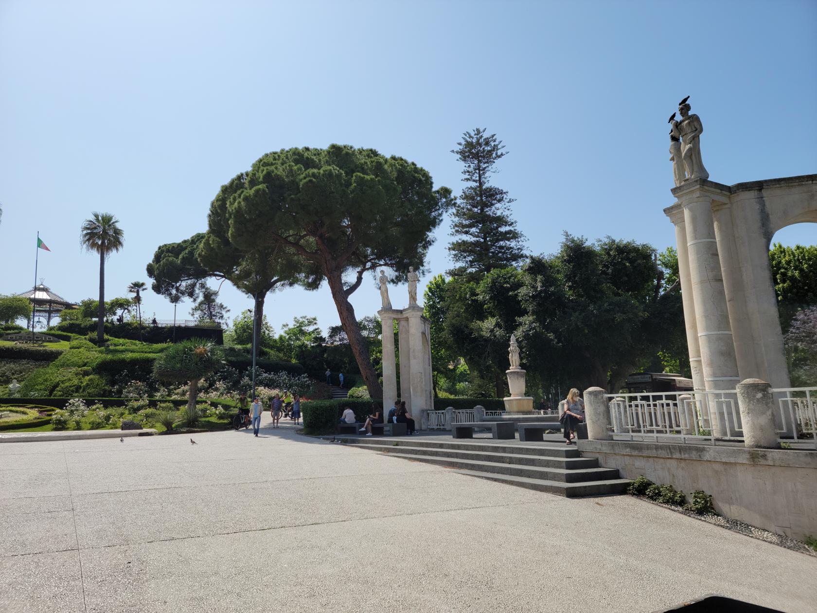
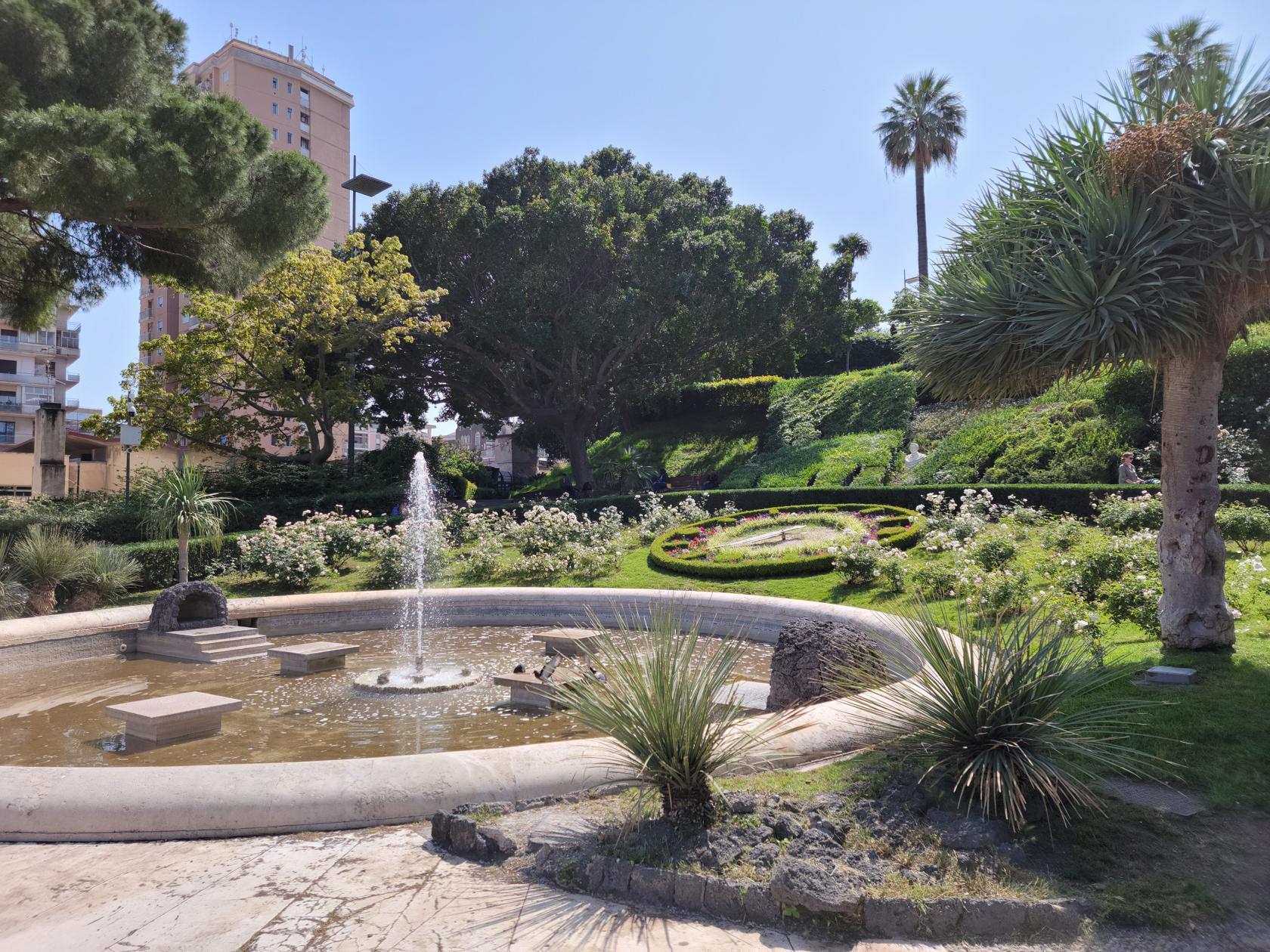
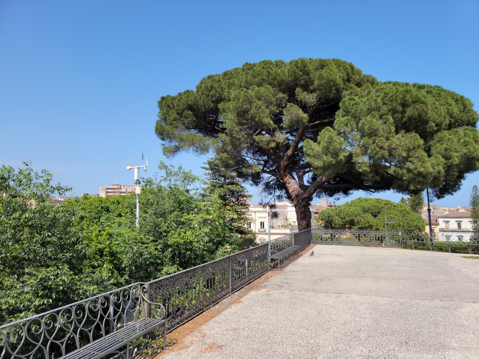
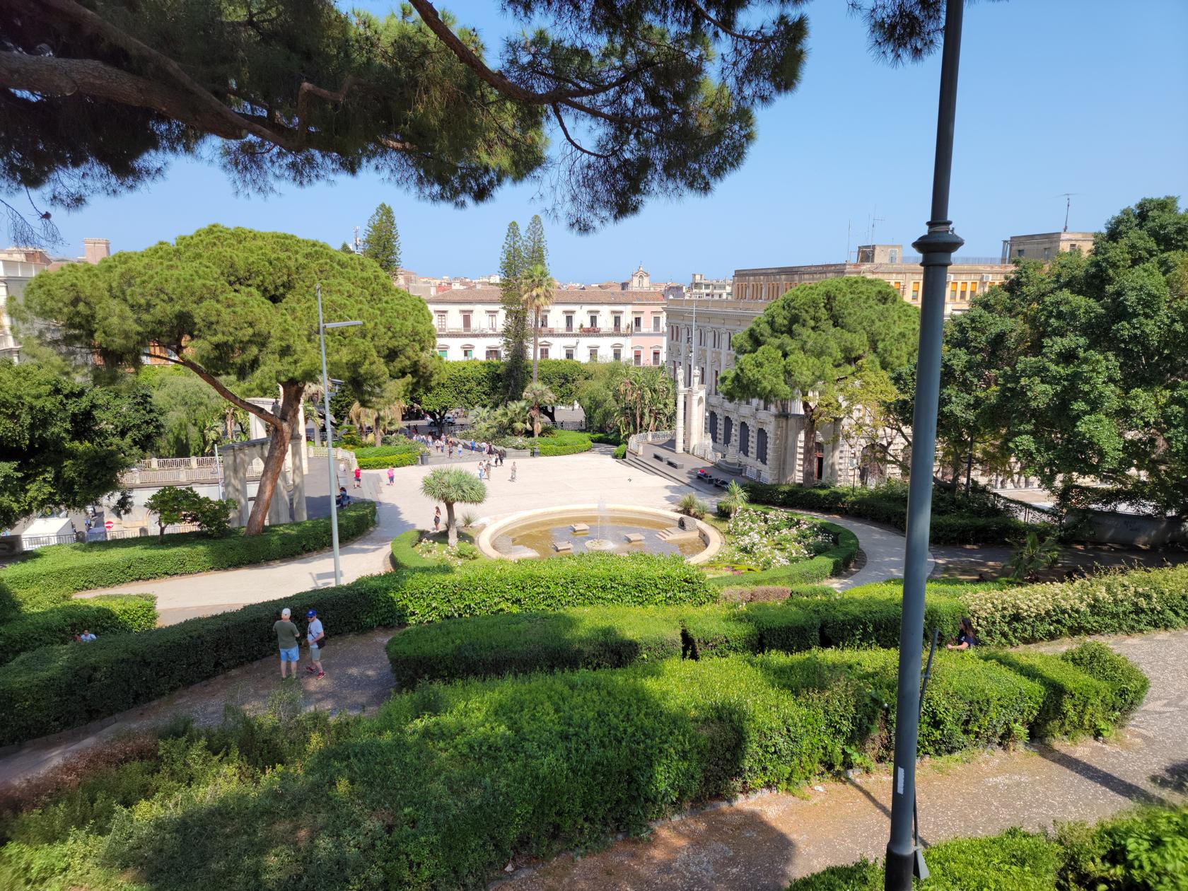
The city has at least one good park near the city center that is easy to visit. The Villa Bellini and Park Maestranze is right off of Via Etnea and has some great views of the volcano and a very quiet place to visit.
Villa Bellini – Park Maestranza – Catania, Sicily
Villa Bellini – Park Maestranza – Catania, Sicily
Villa Bellini – Park Maestranza – Catania, Sicily
Villa Bellini – Park Maestranza – Catania, Sicily
Villa Bellini – Park Maestranza – Catania, Sicily
Villa Bellini – Park Maestranza – Catania, Sicily
Villa Bellini – Park Maestranza – Catania, Sicily
Villa Bellini – Park Maestranza – Catania, Sicily
Villa Bellini – Park Maestranza – Catania, Sicily
Via Etnae – Catania, Sicily
Mount Etna
The presence of Etna is felt everywhere, from the architecture, to the items some of the shops sell, to the very grit you grind under your feet as you walk. Even though as you walk the streets and cannot see it, it will rear its ugly snow-capped head as you round a corner, or ascend some lookout in the city.
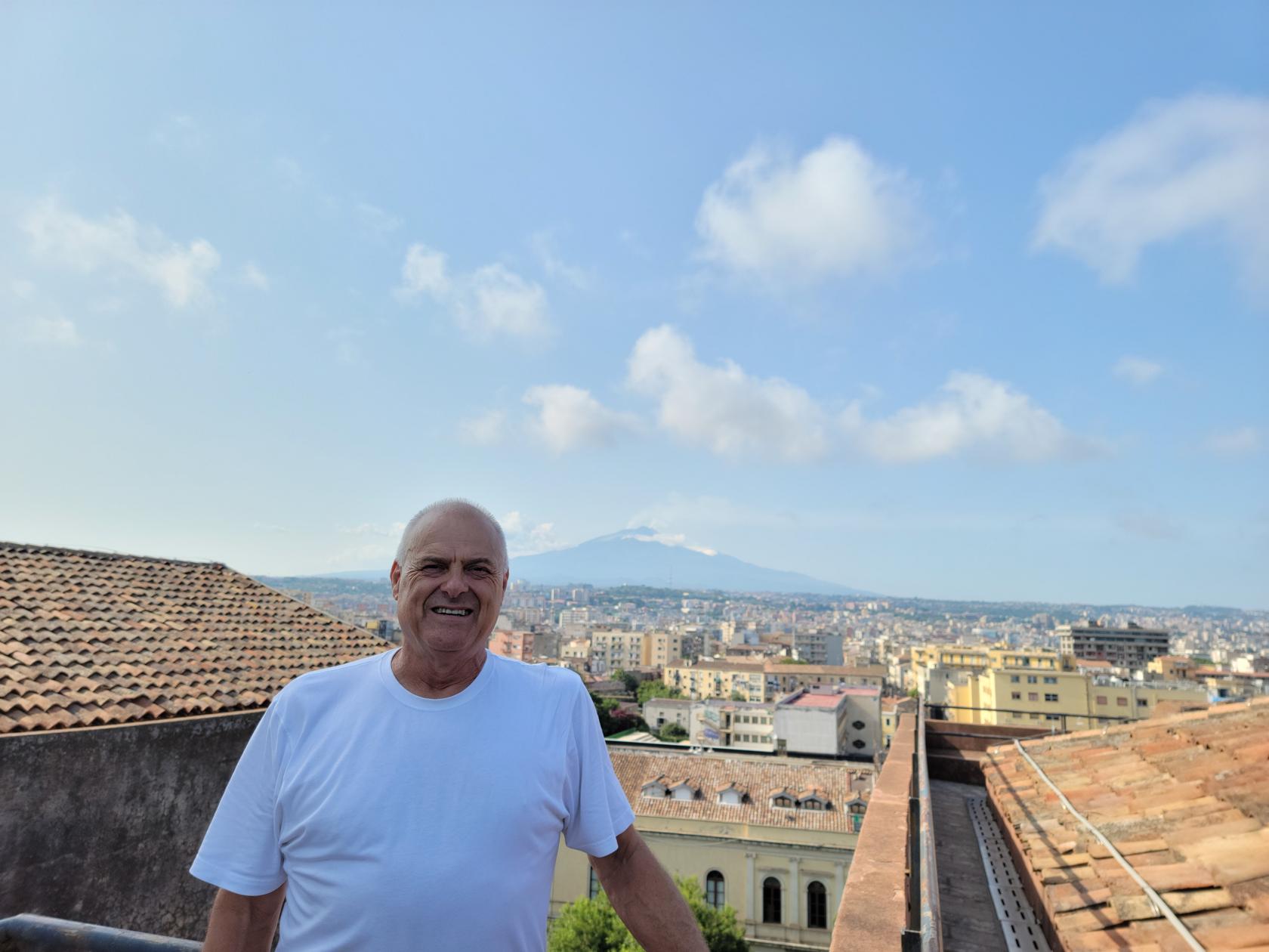
A view of Mount Etna from the roof – San Nicolo L’Arena Church – Catania, Sicily
Theaters and Baths
Many of the ruins in and around Catania contain theaters and baths from the Greek and Roman periods.
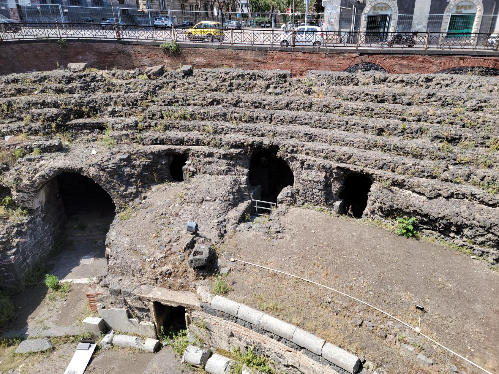
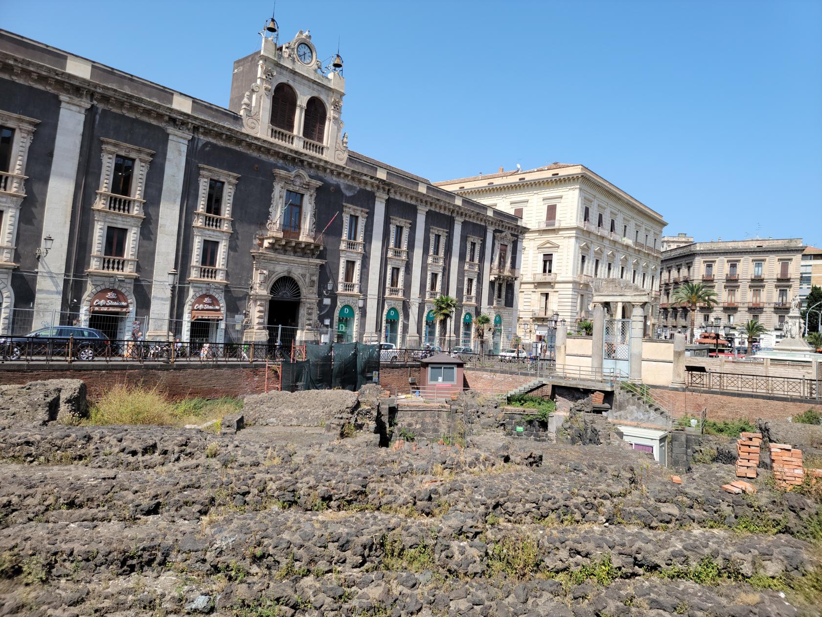
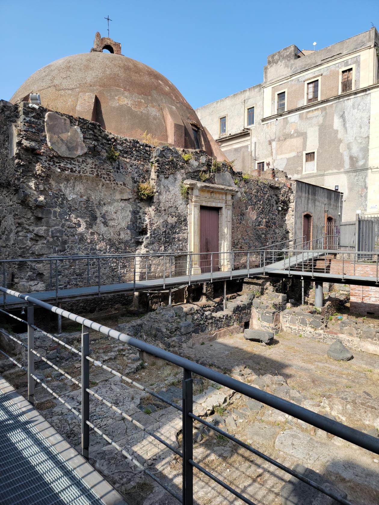
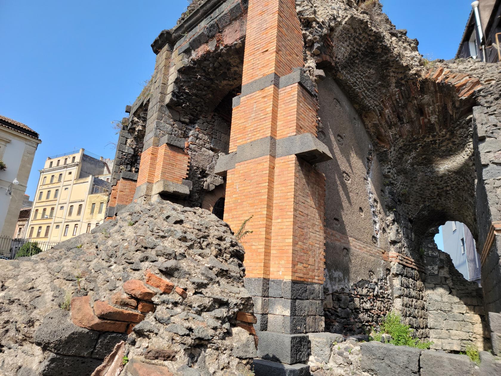
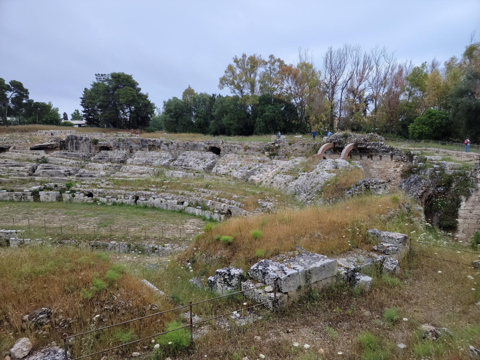
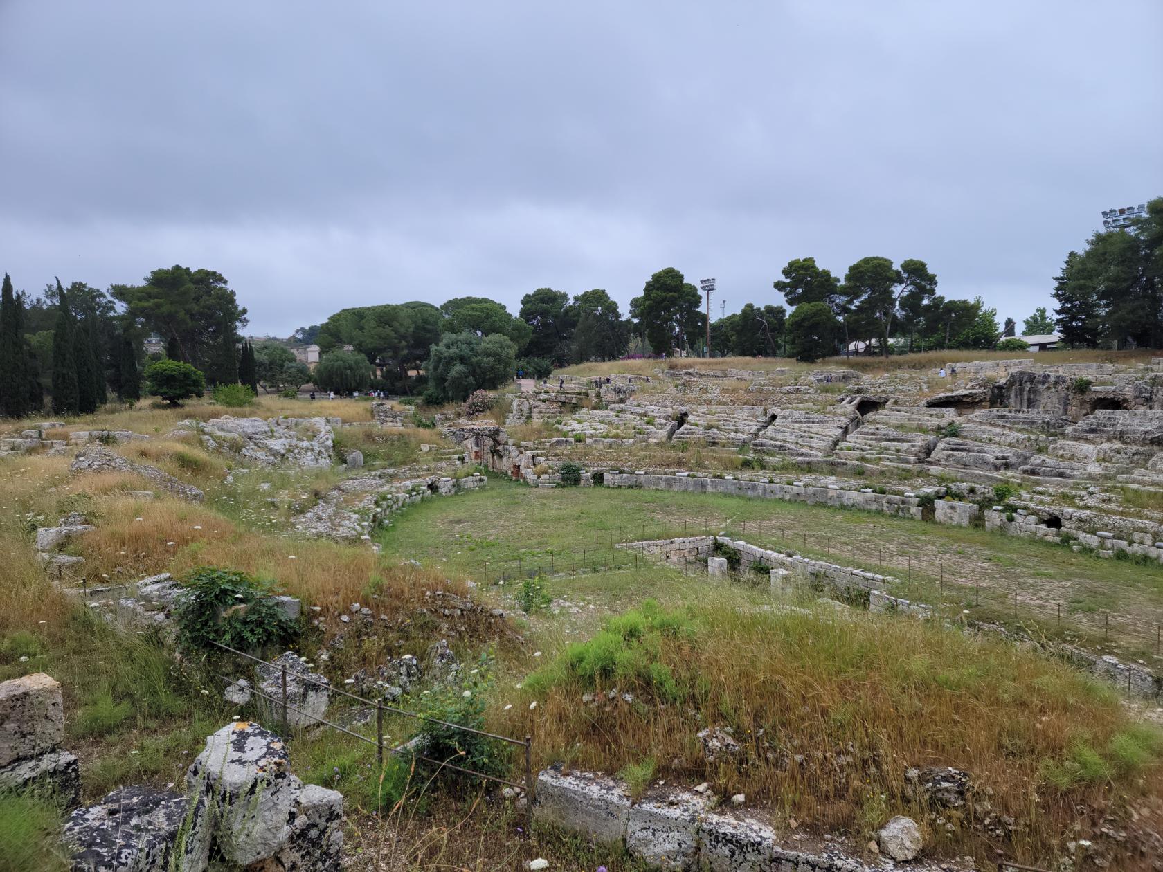
The Roman Amphitheater
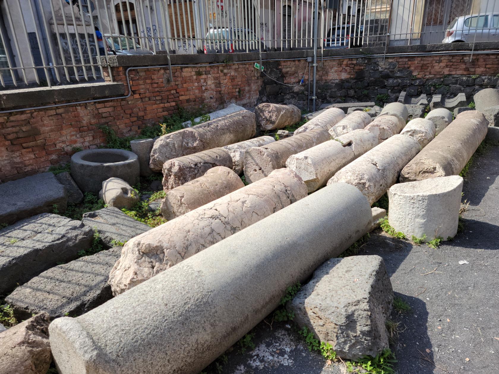
A stone’s throw away from our hotel the amphitheater forces all the traffic to go around it. There is not much story behind the amphitheater other than in the fourth century the town’s people had started robbing it stones for building material. Later it was almost completely covered up by a building project in the eighteenth century. It was later rediscovered and preserved as part of an urban archeological site.
Roman Amphitheater – Catania, Sicily
Roman Amphitheater – Catania, Sicily
Roman Amphitheater – Catania, Sicily
Roman Amphitheater – Catania, Sicily
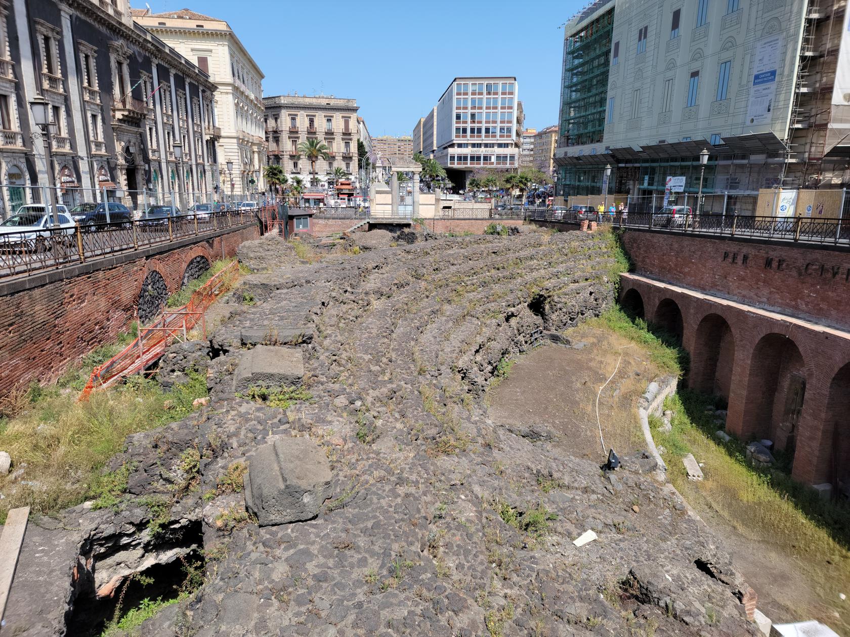
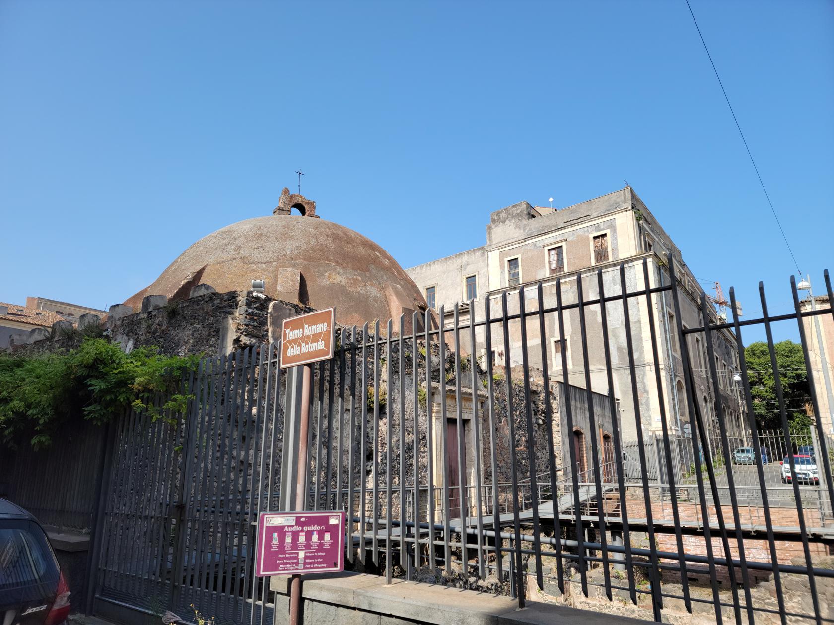
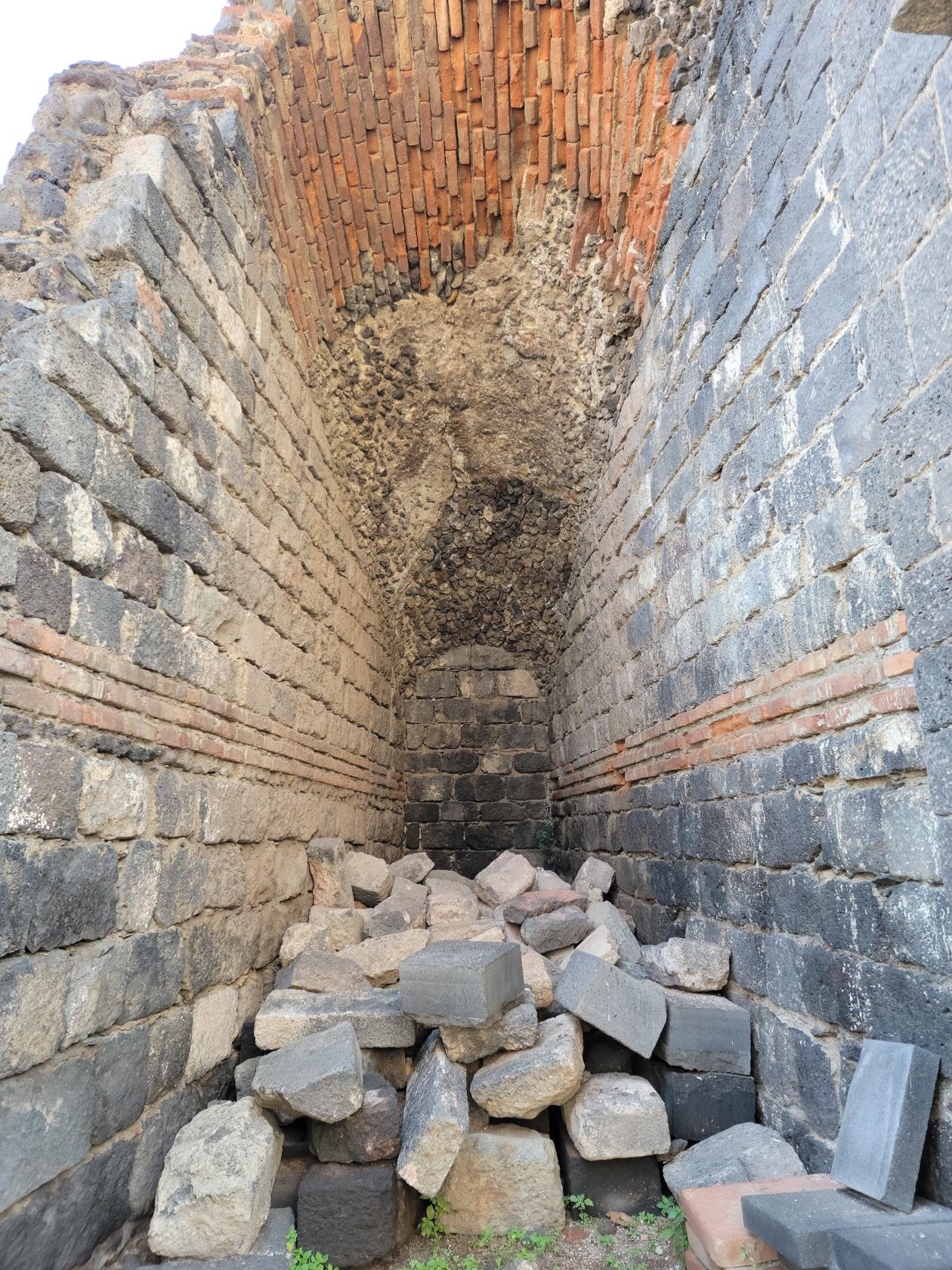
The Roman Baths
Very close to the Greek and Roman Theater are the Roman Baths. They appear to be part of a city walking audio tour, but since we did not visit the information center, we have no other details on the site.
Roman Baths of the Rotunda – Catania, Sicily
Roman Baths of the Rotunda – Catania, Sicily
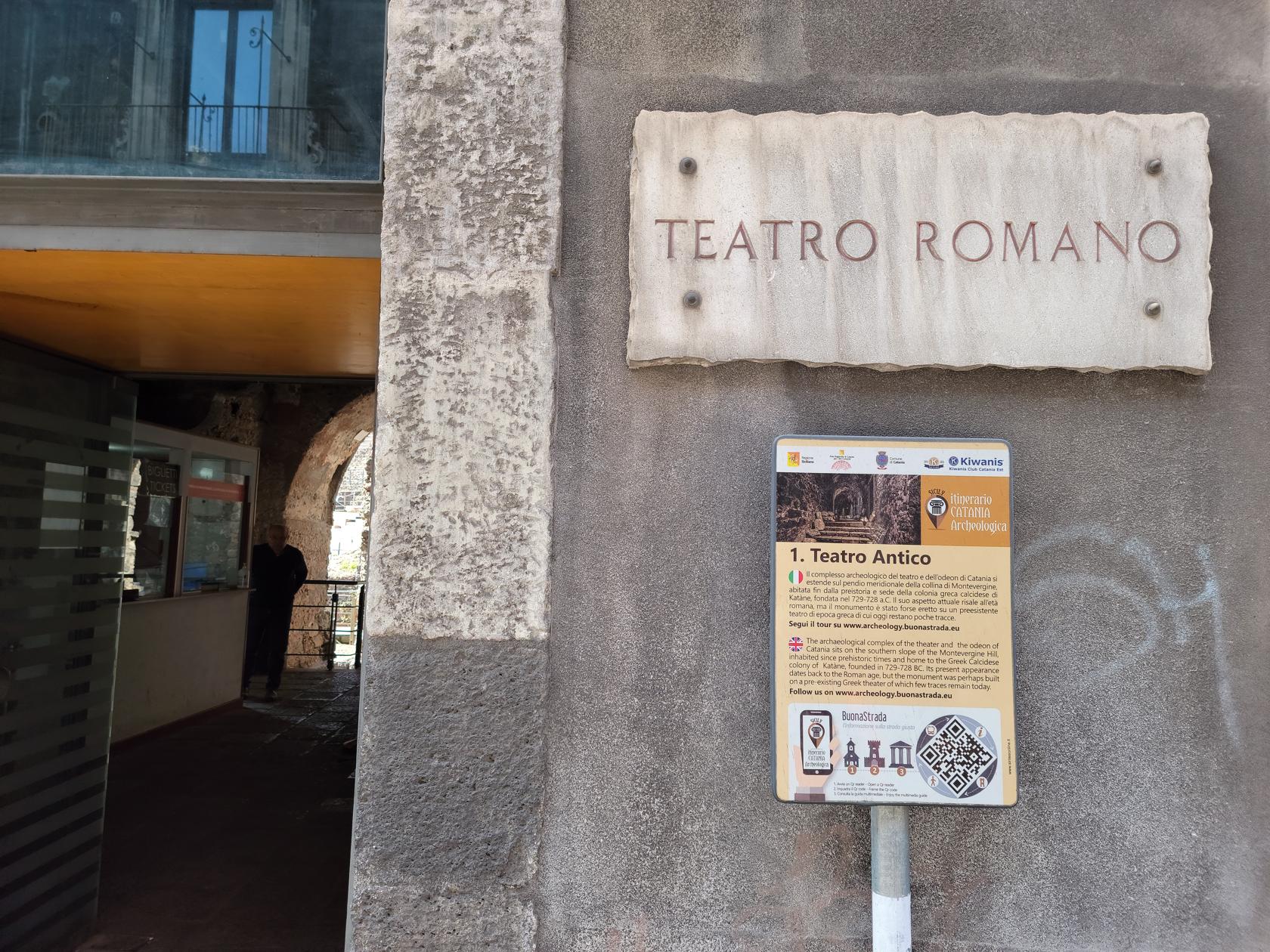
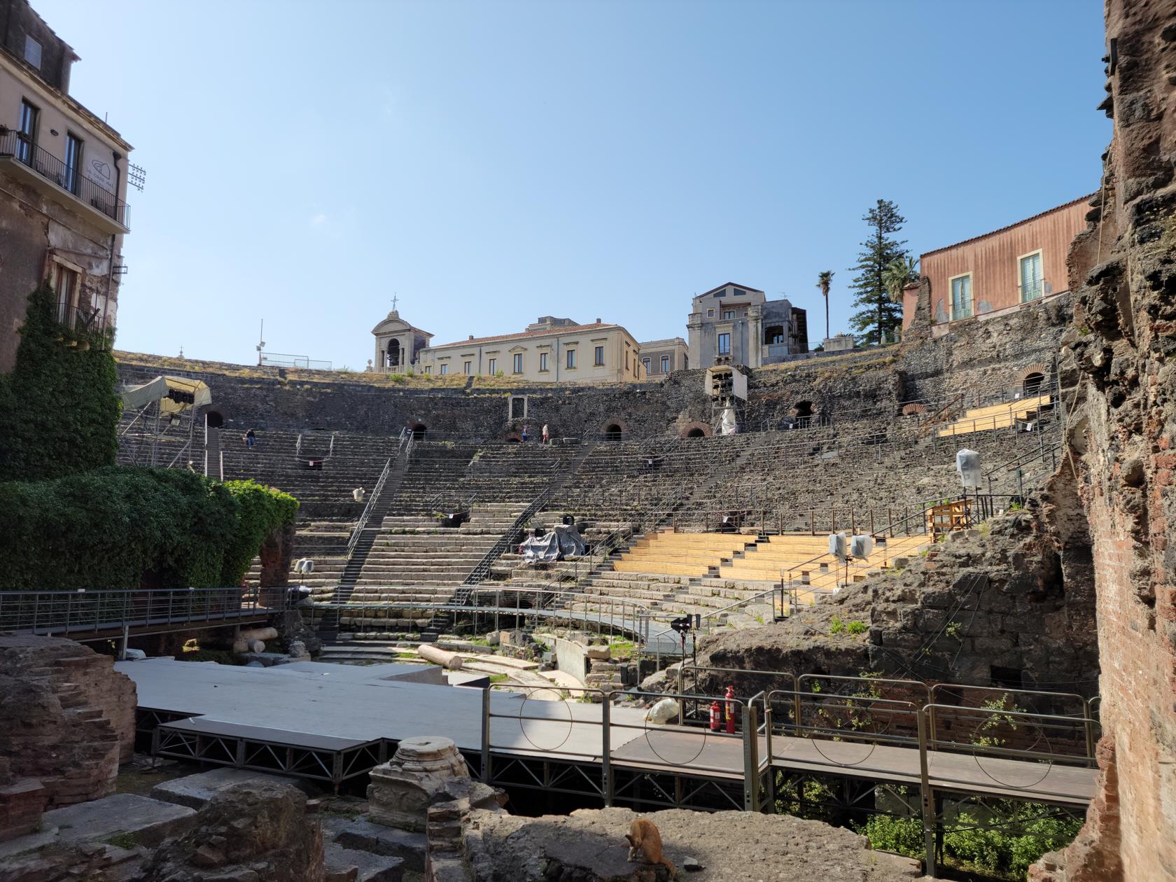
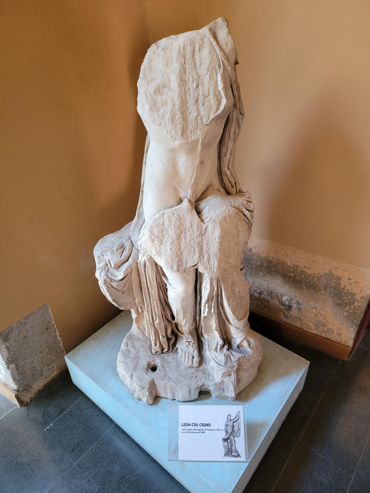
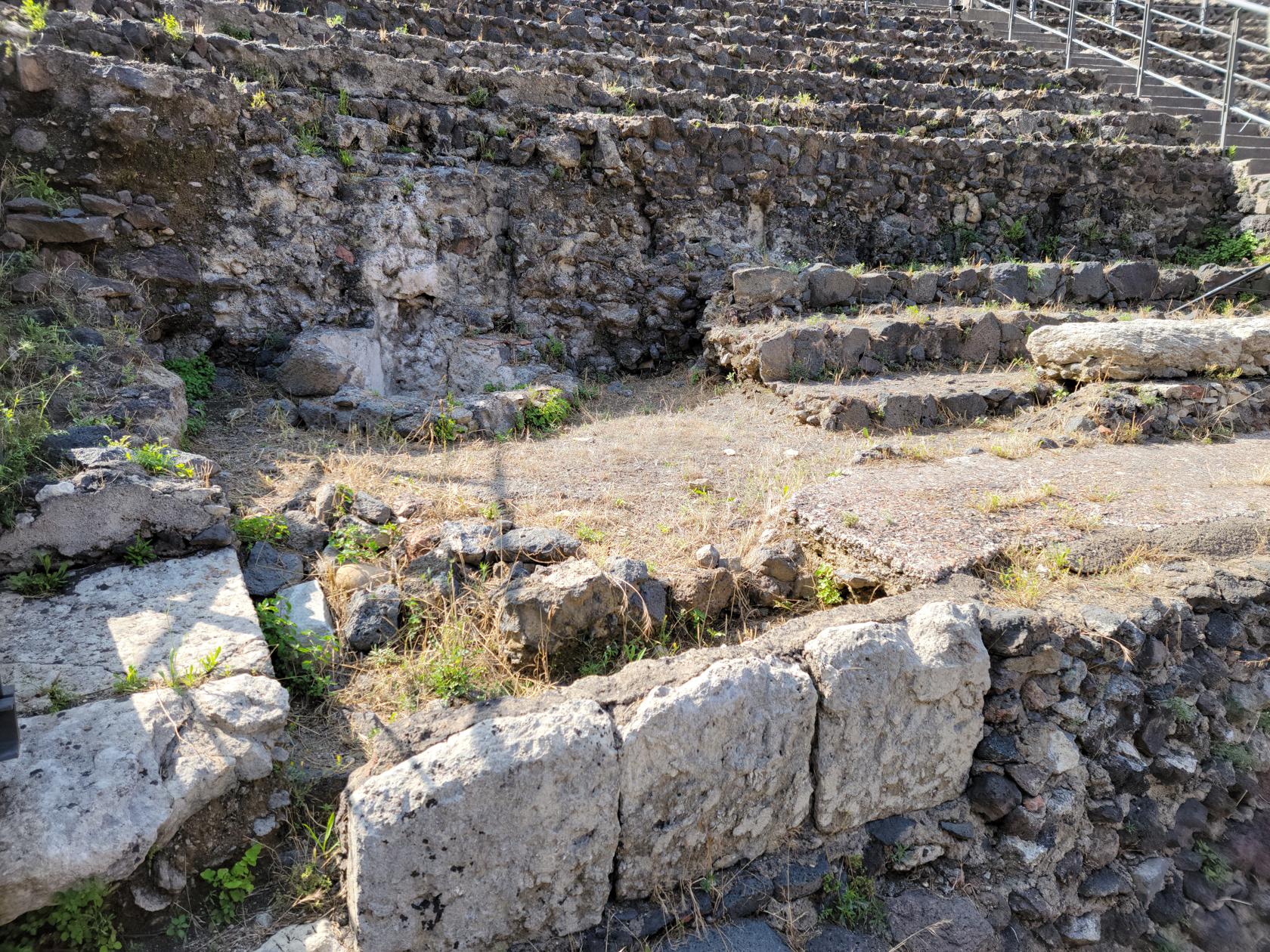
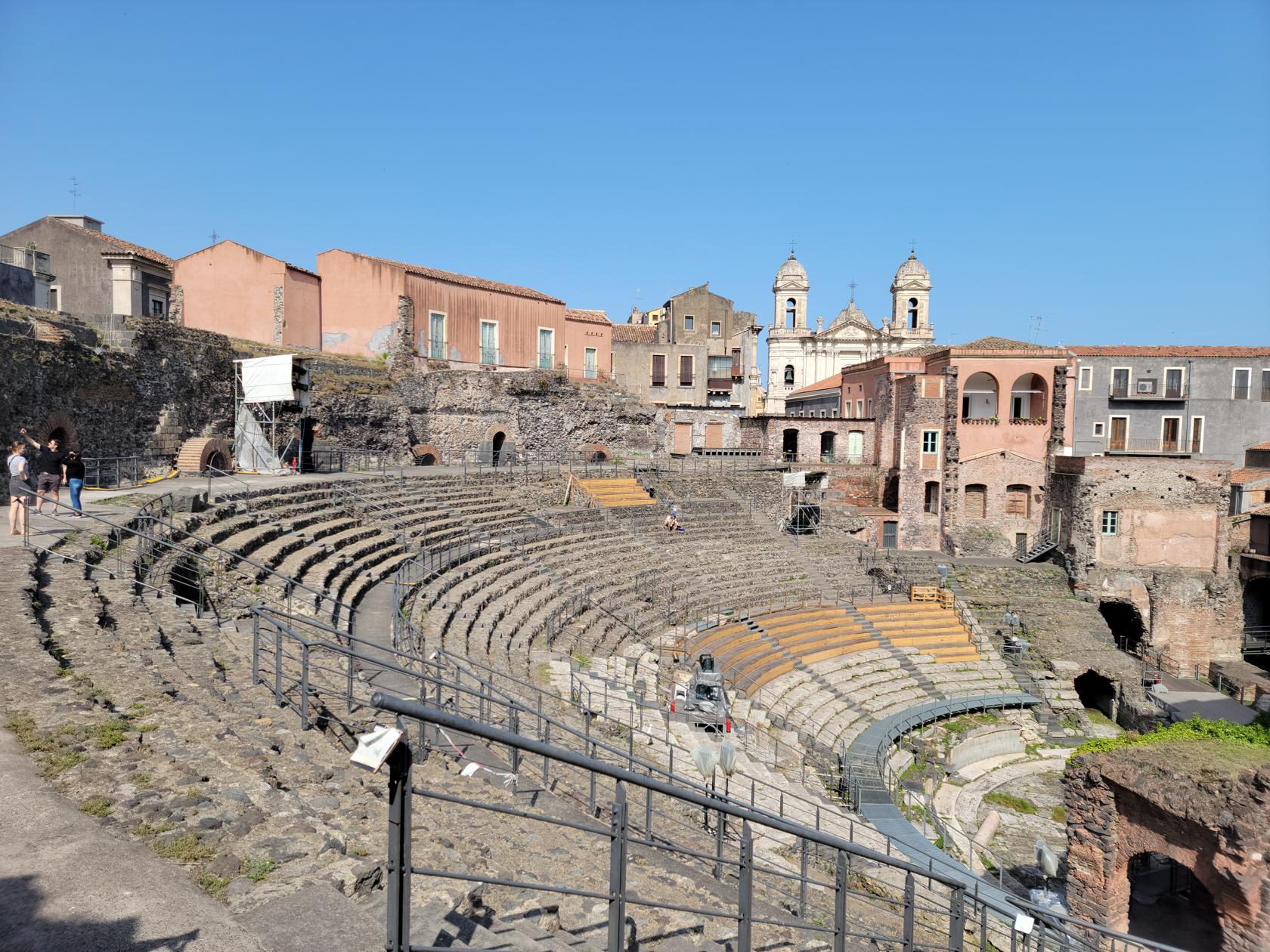
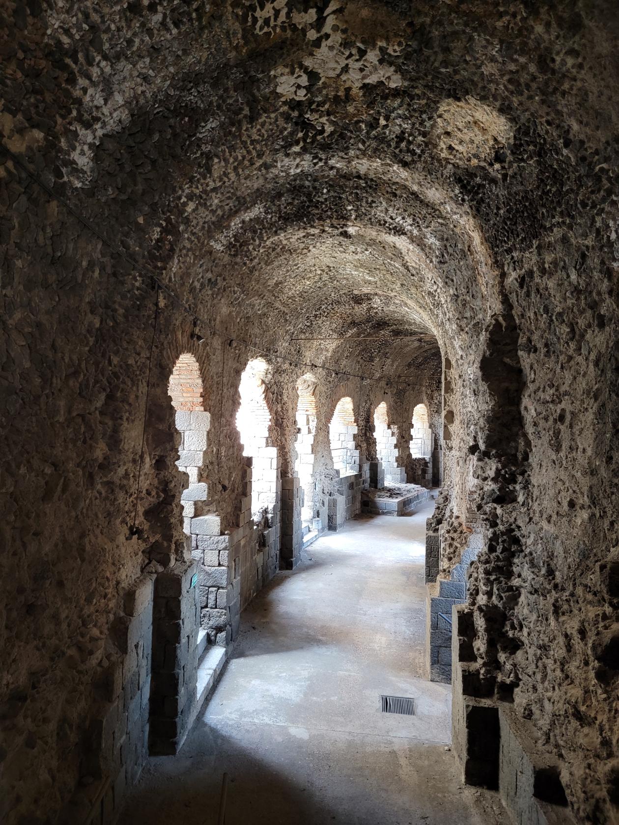
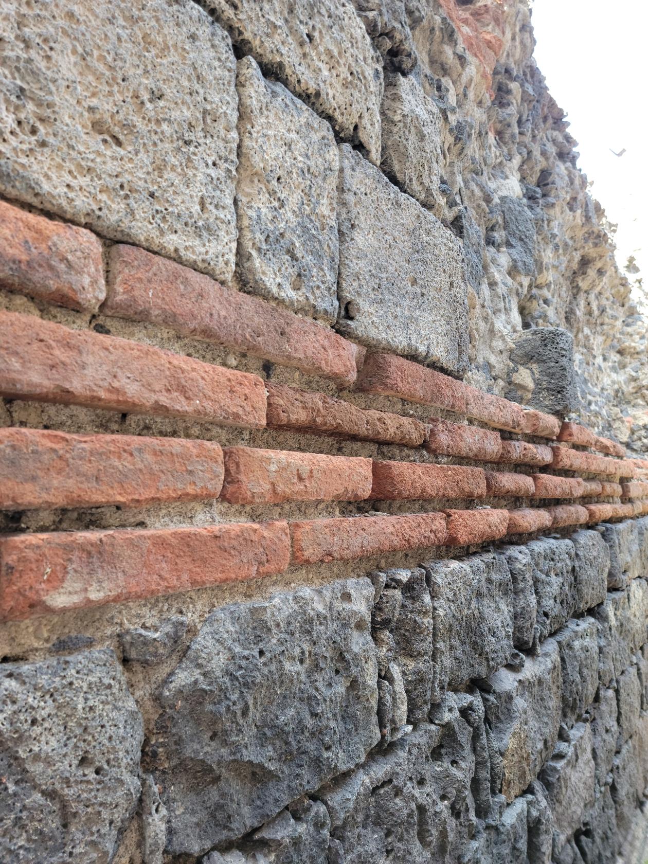
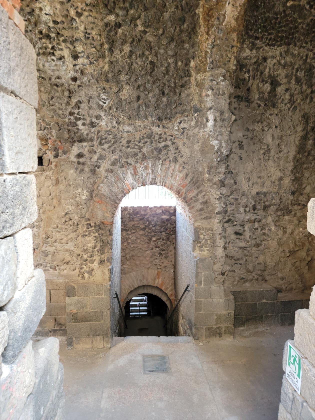
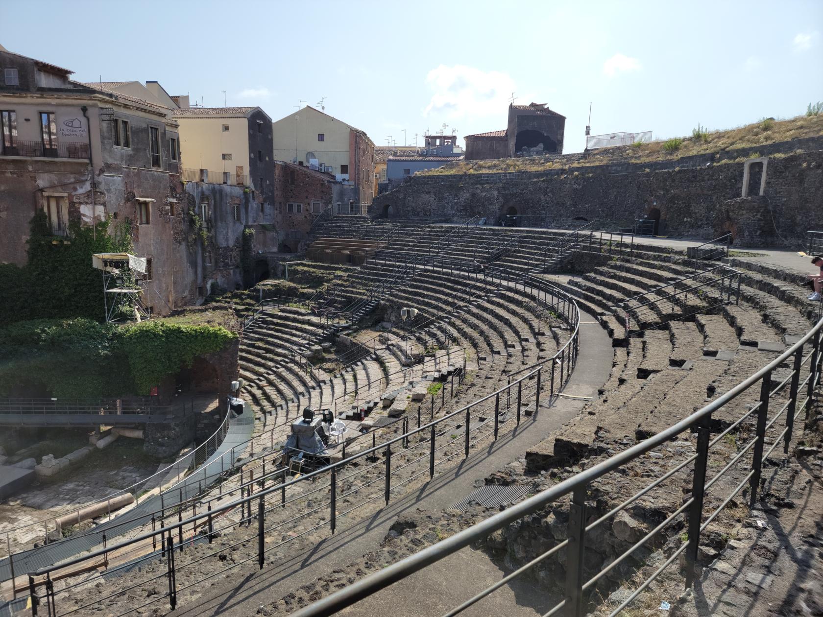
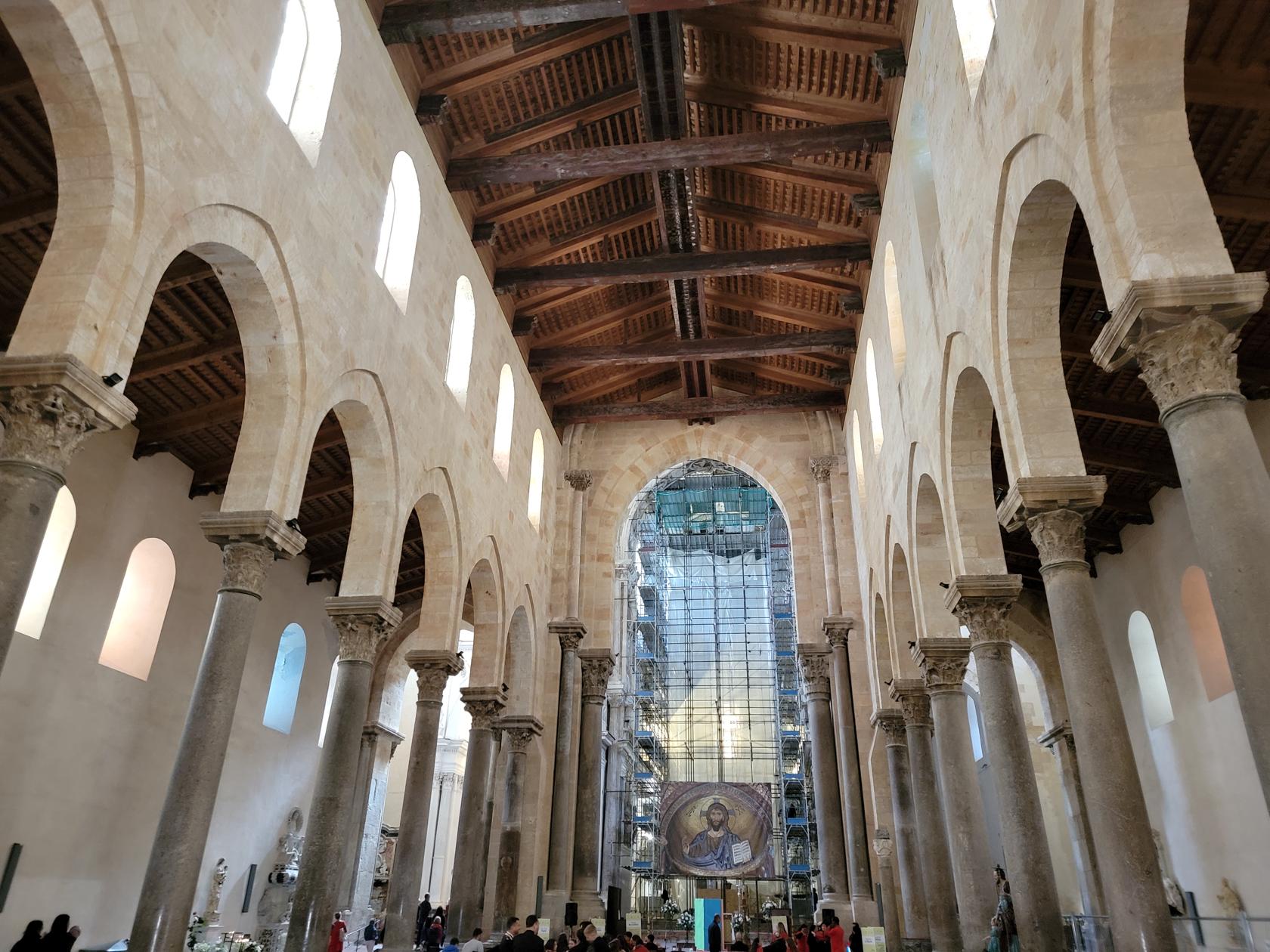
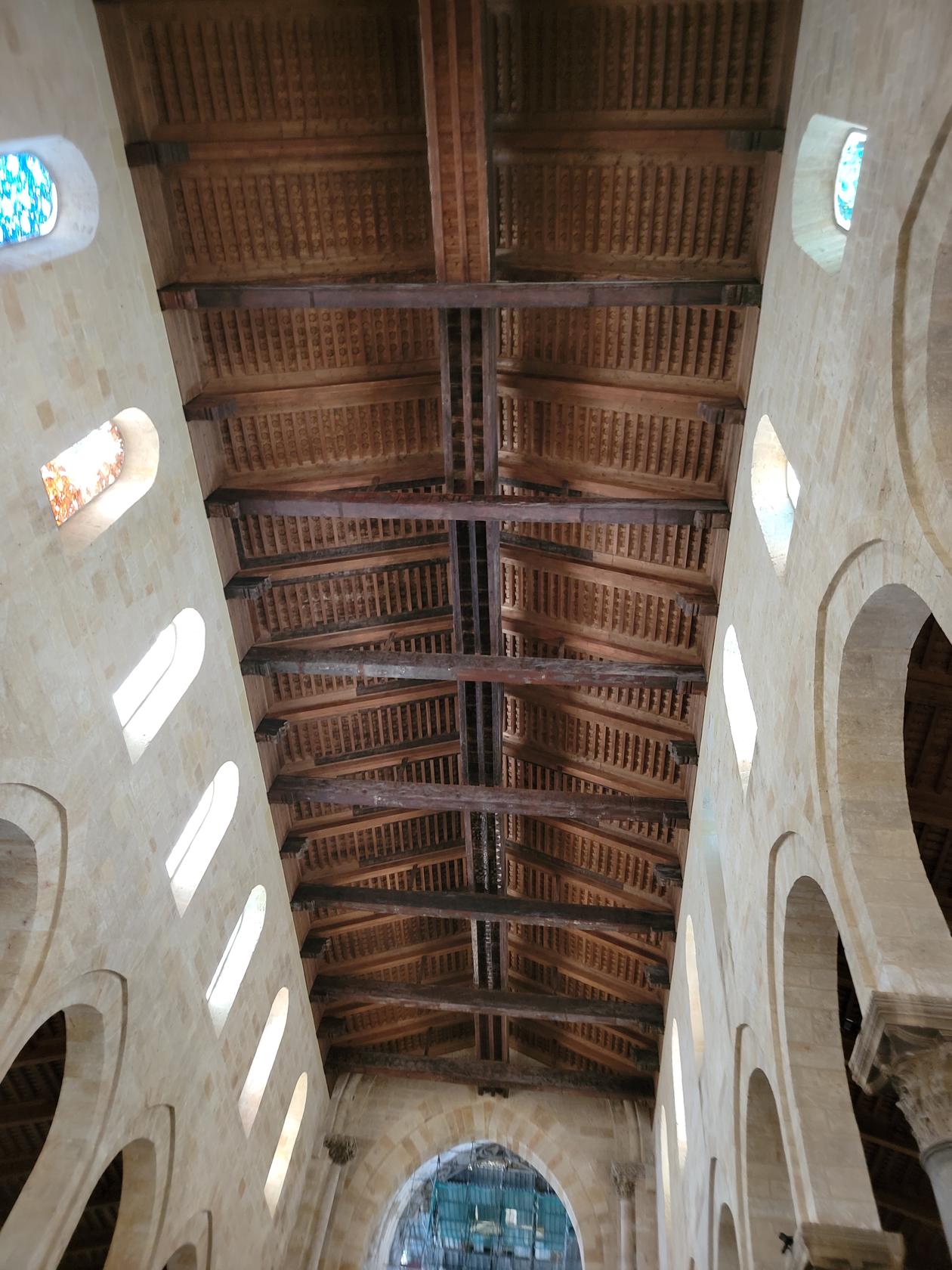
The Greek and Roman Theater
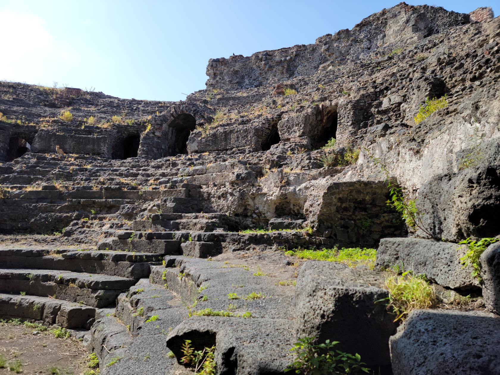
Labeled the Roman Theater, it was actually established by the Greeks and later rebuilt as a Roman Theater. There is an entrance fee for this exhibit, which again seems to be repurposed for shows. Though there is ample space to take photographs to get a good idea of how it used to look.
The Greek-Roman Theater – Catania, Sicily
The Greek-Roman Theater – Catania, Sicily
The Greek-Roman Theater – Catania, Sicily
The Greek-Roman Theater – Catania, Sicily
The Greek-Roman Theater – Catania, Sicily
The Greek-Roman Theater – Catania, Sicily
The Greek-Roman Theater – Catania, Sicily
The Greek-Roman Theater – Catania, Sicily
The Greek-Roman Theater – Catania, Sicily
The Greek-Roman Theater – Catania, Sicily
The Greek-Roman Theater – Catania, Sicily
The Greek-Roman Theater – Catania, Sicily
The Greek-Roman Theater – Catania, Sicily
The Greek-Roman Theater – Catania, Sicily
The Greek-Roman Theater – Catania, Sicily
The Greek-Roman Theater – Catania, Sicily
Churches, Cathedral and Basilicas
There are numerous churches and other religious structures of note all throughout Catania. The most noteworthy one is the Cathedral of Catania.
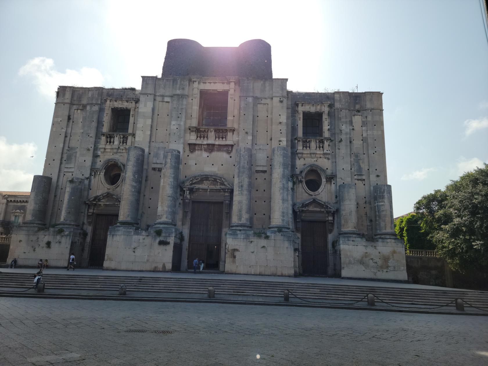
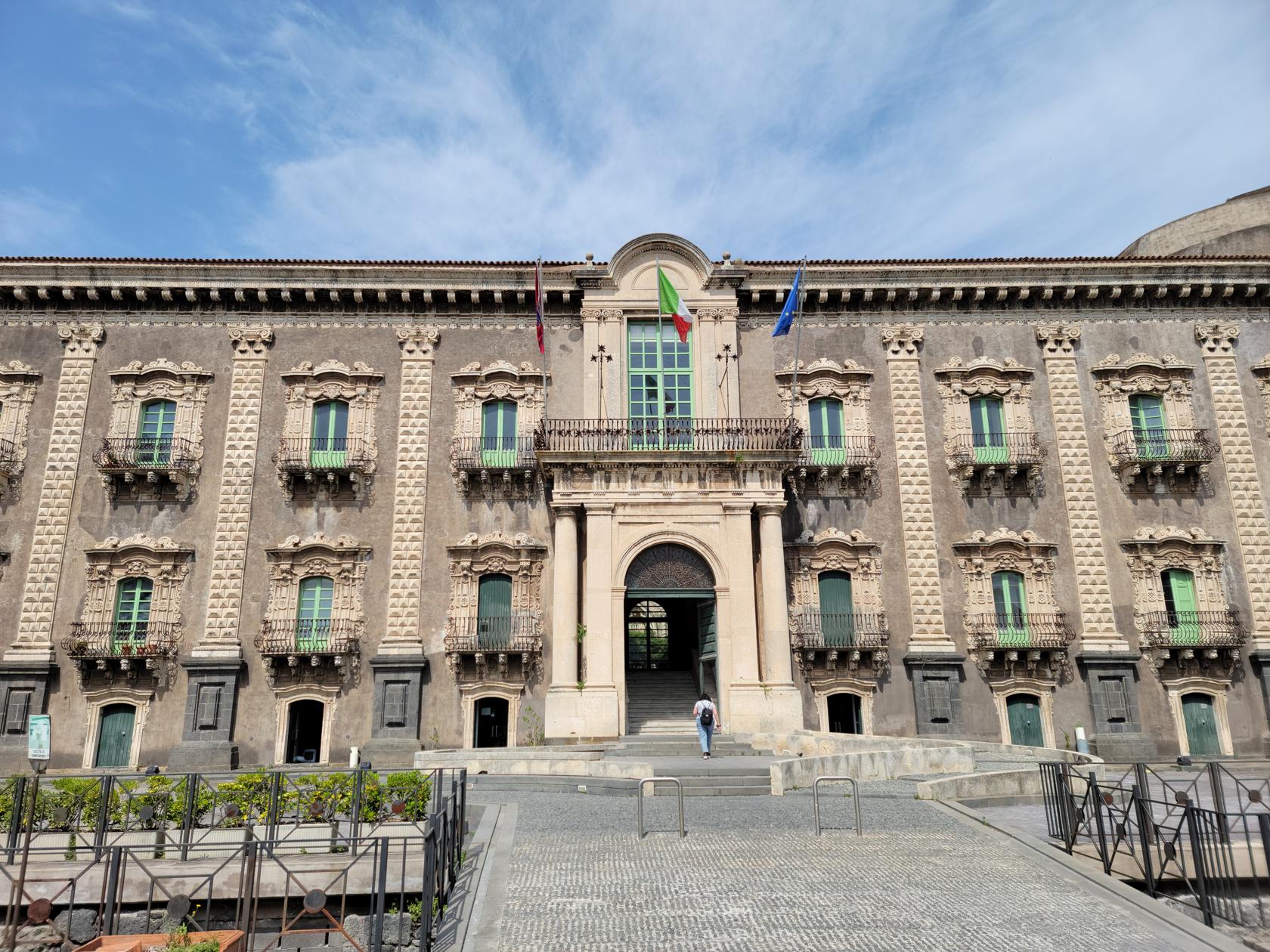
Church of San Nicolò l’Arena
A large unfinished artifice is the Church of San Nicolò l’Arena. It was started in the late 17th century and interrupted by the large earthquake of 1693. The dome and inside were later completed, but the facade remains unfinished sadly even to this day.
San Nicolo L’Arena Church – Catania, Sicily
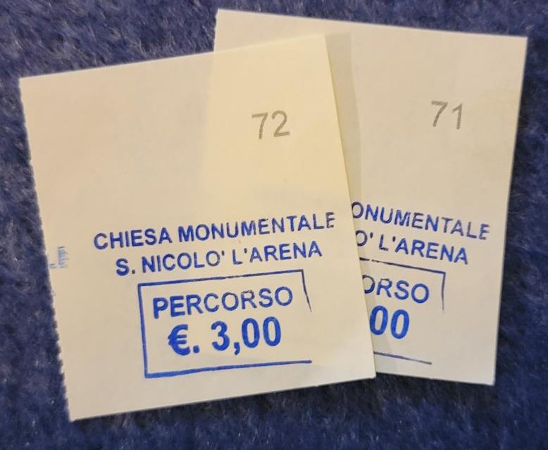
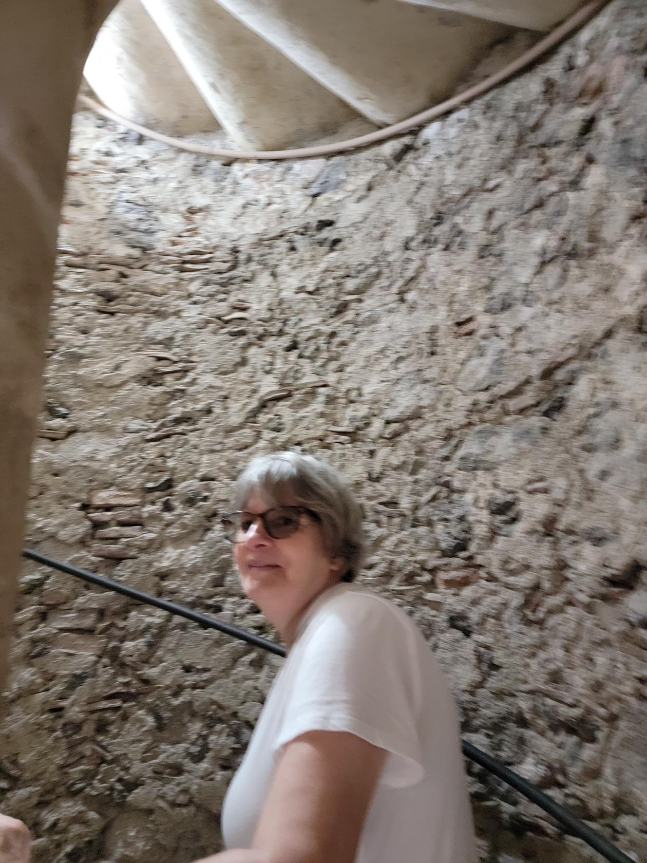
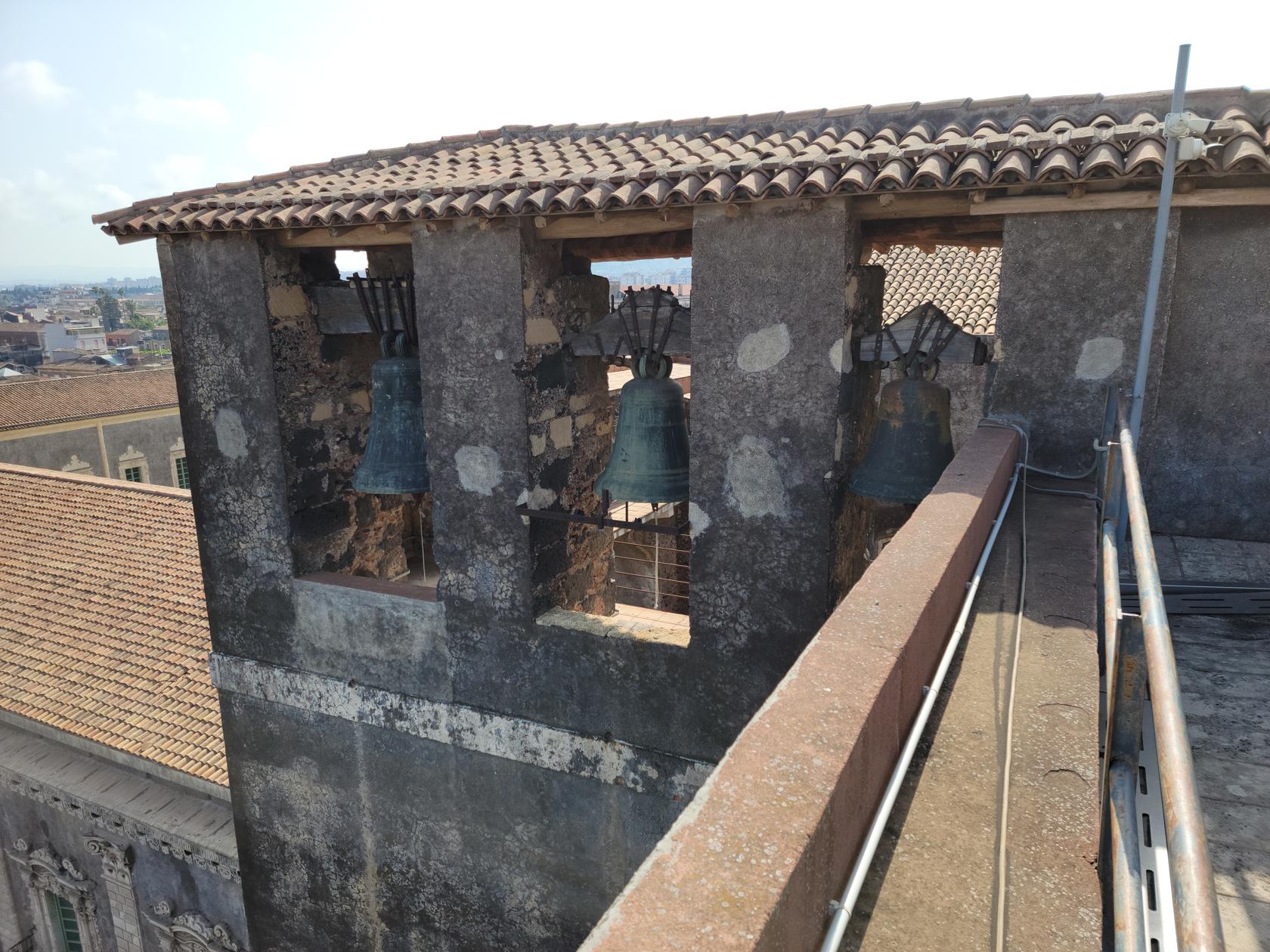
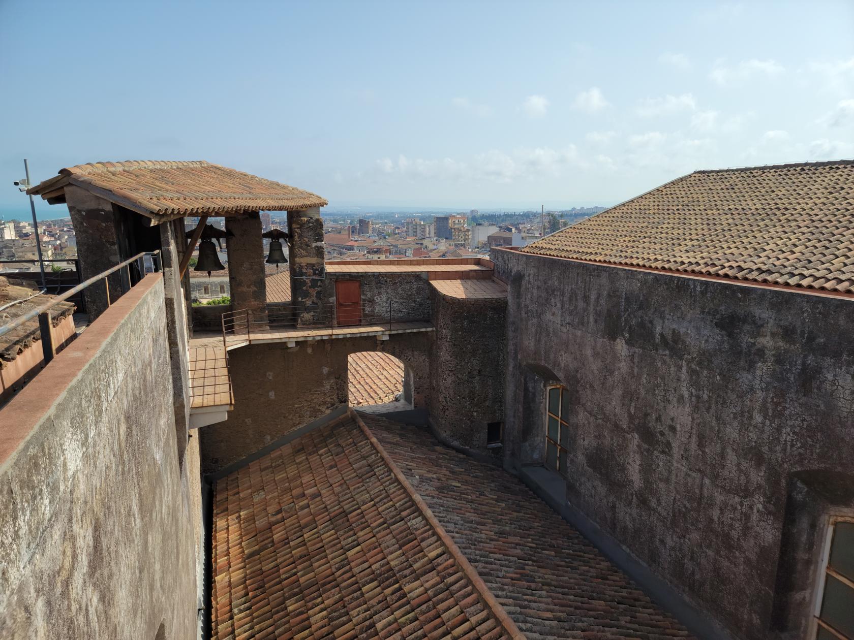
This church has a secret though, for small fee you may ascend its narrow spiral staircase to the roof for its impressive view of the city.
Tickets For Two – San Nicolo L’Arena Church – Catania, Sicily
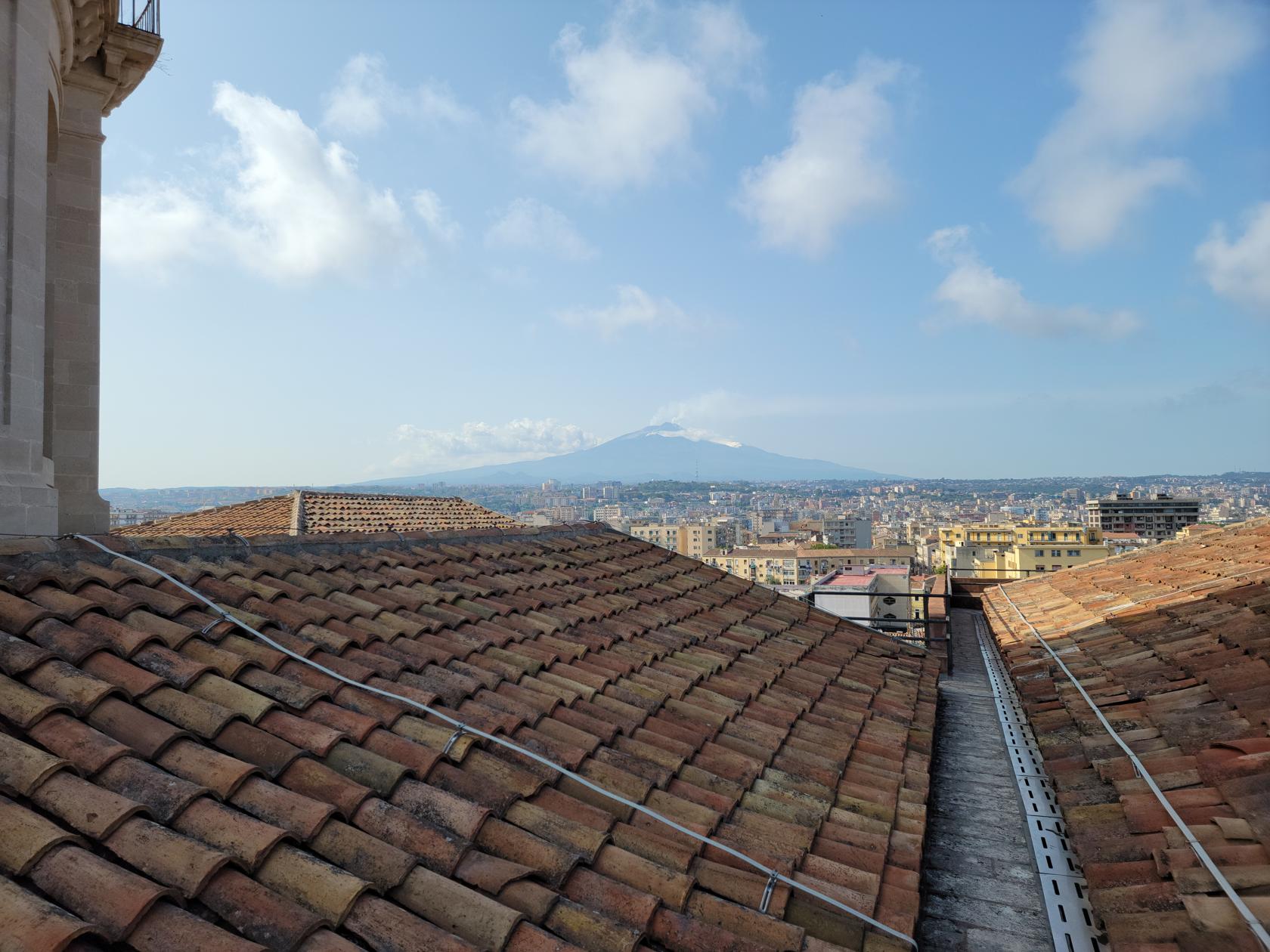
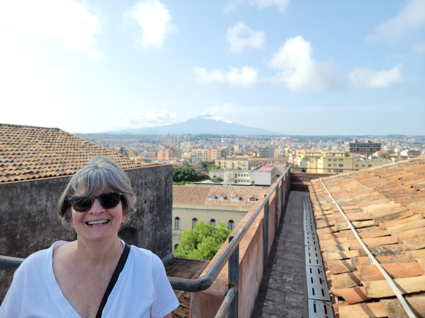
From this perch you can also get an amazing shot at Mount Etna.
Climbing the stairs to the roof – San Nicolo L’Arena Church – Catania, Sicily
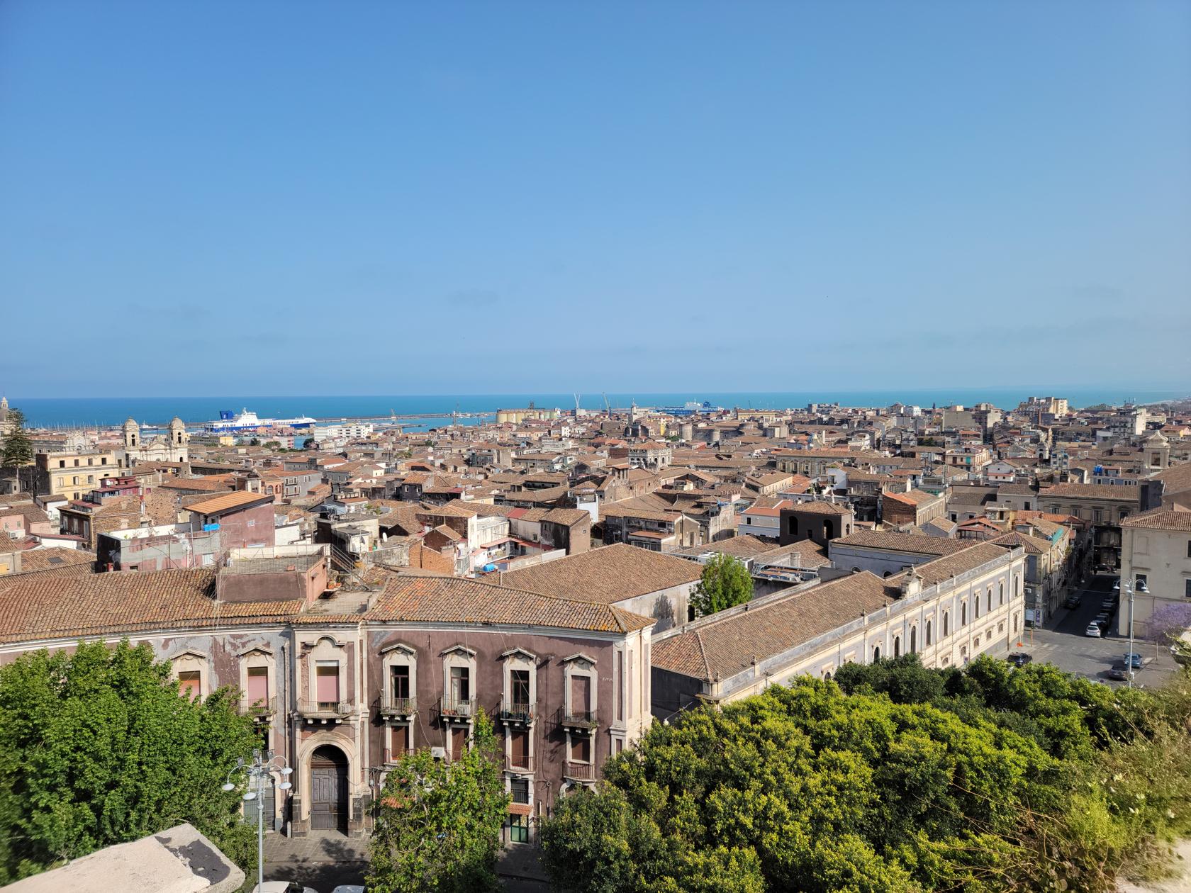
View of Catania Bay from the roof – San Nicolo L’Arena Church – Catania, Sicily
View from roof – San Nicolo L’Arena Church – Catania, Sicily
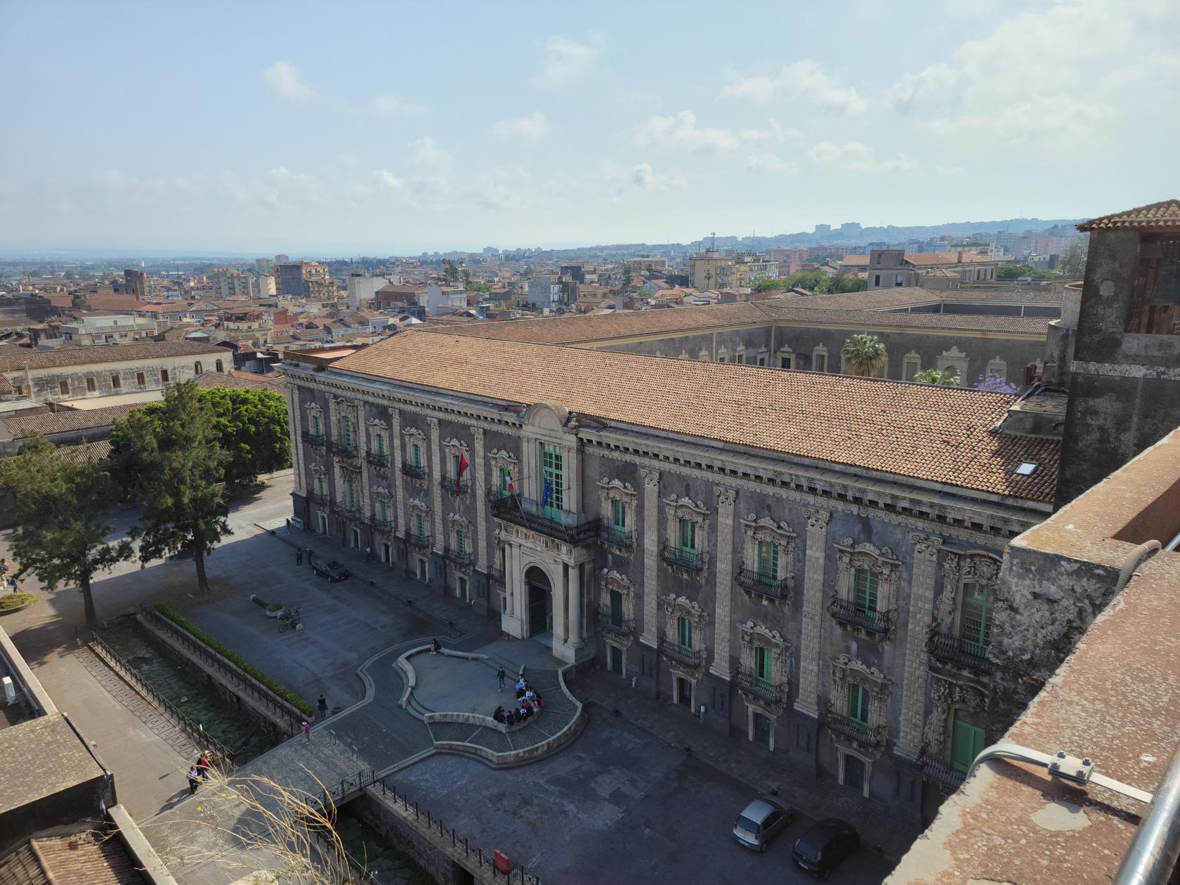
The belfry tower – San Nicolo L’Arena Church – Catania, Sicily
The roof – San Nicolo L’Arena Church – Catania, Sicily
A view of Mount Etna from the roof – San Nicolo L’Arena Church – Catania, Sicily
A view of Mount Etna and Patti from the roof – San Nicolo L’Arena Church – Catania, Sicily
A view of Mount Etna and Erick from the roof – San Nicolo L’Arena Church – Catania, Sicily
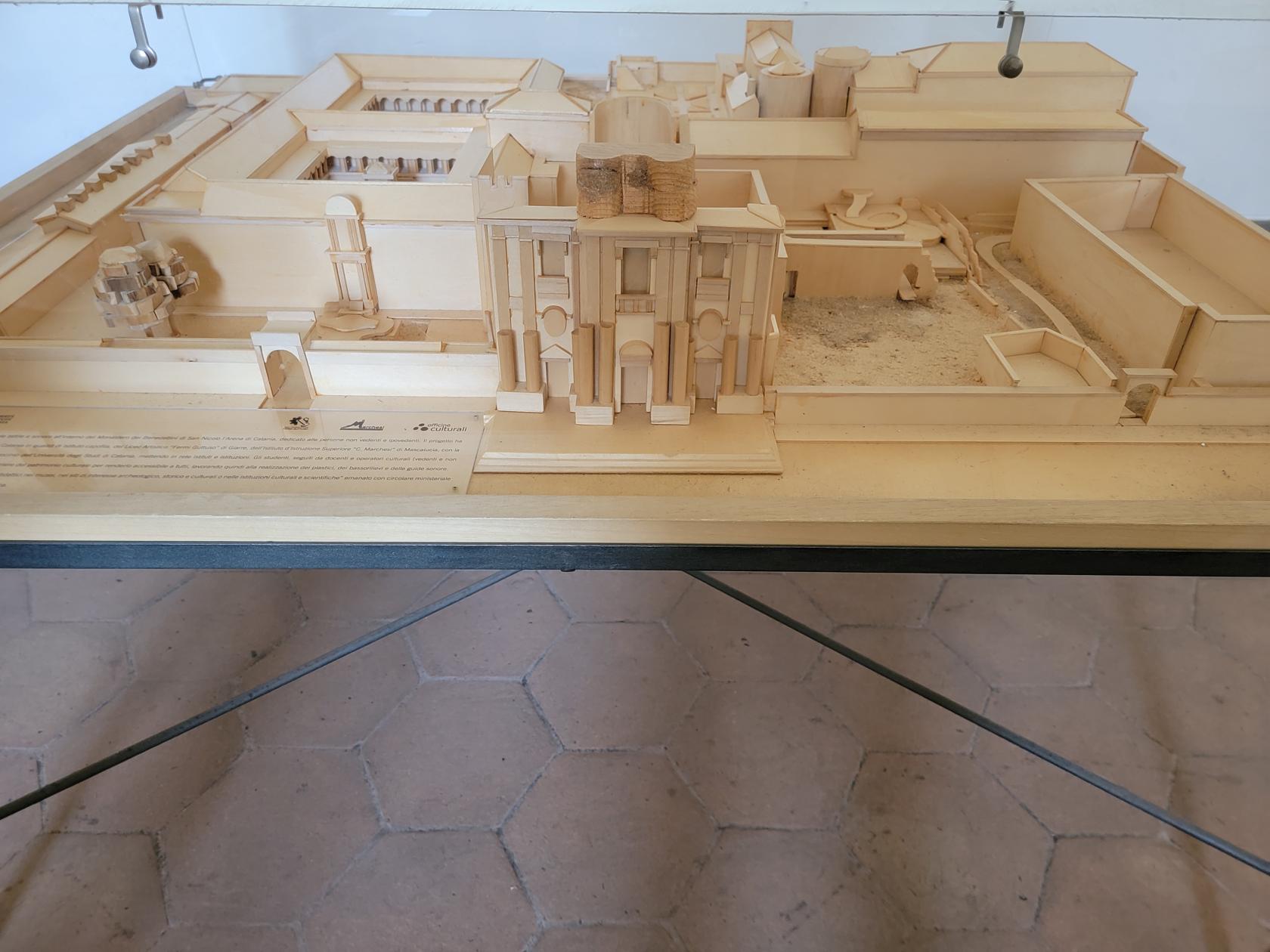
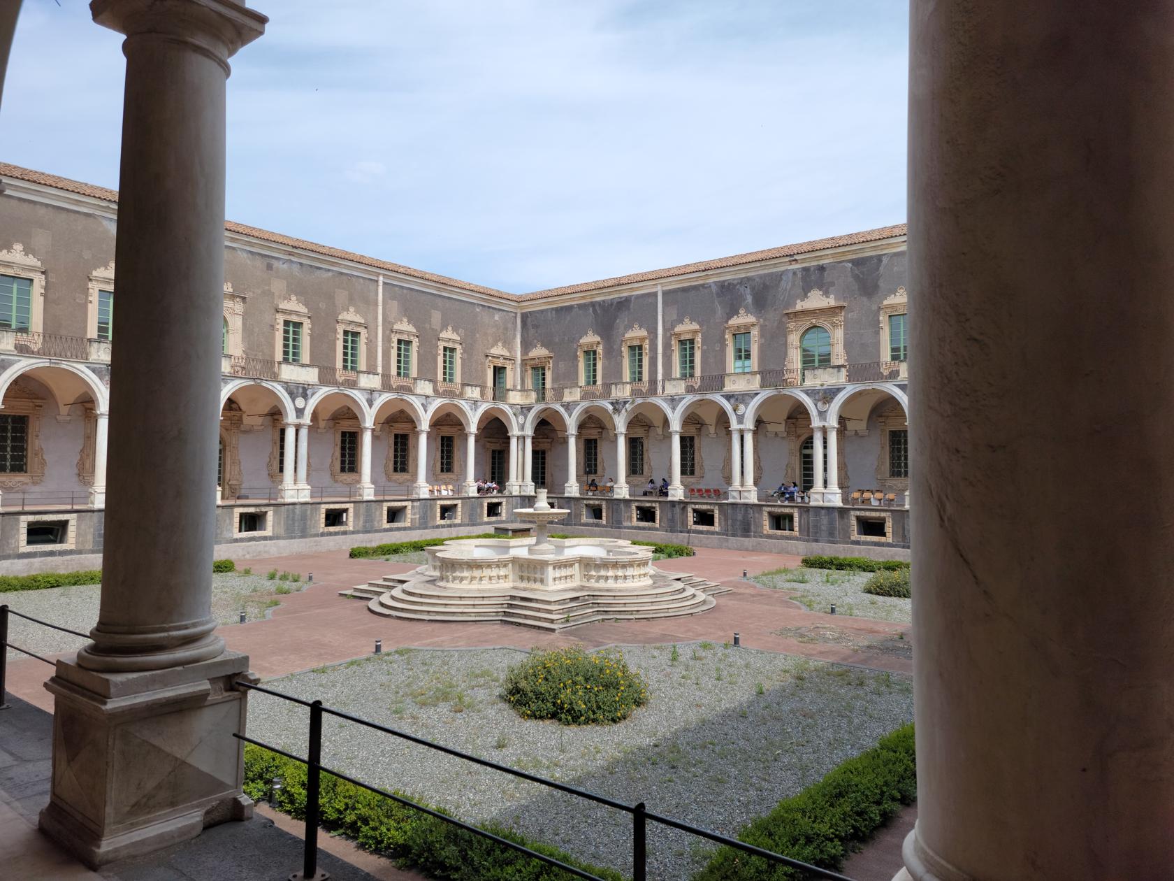
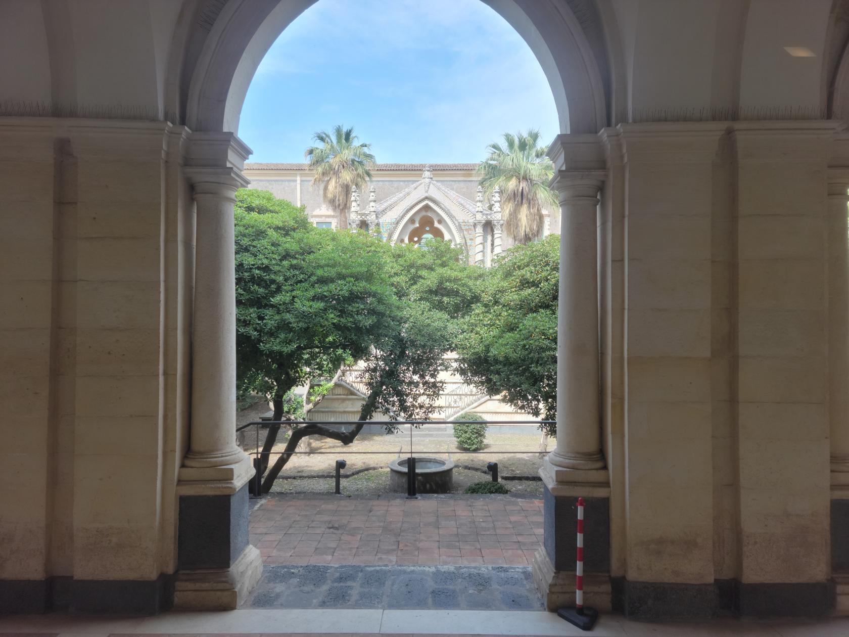
A diorama of the Benedictine Monastery – Catania, Sicily
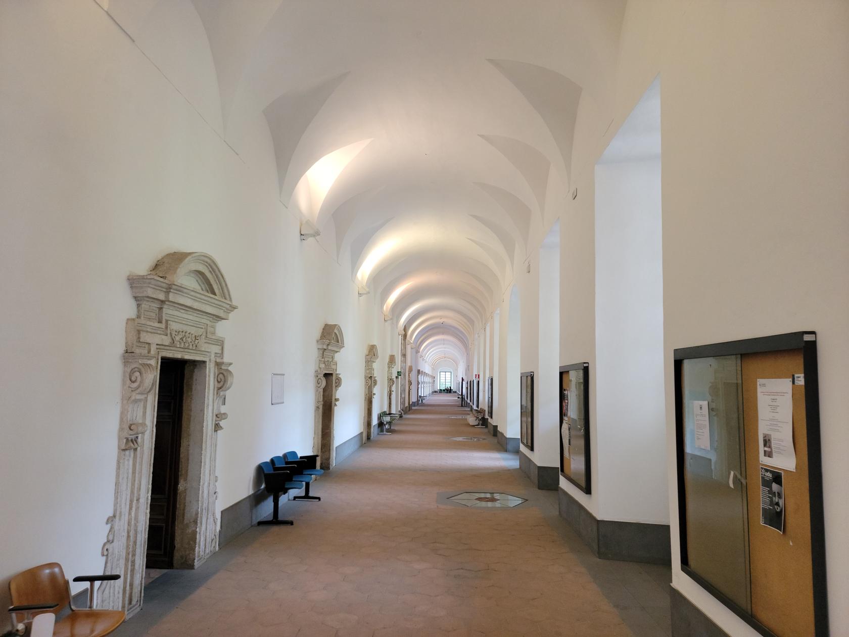
Benedictine Monastery – Catania, Sicily
Benedictine Monastery – Catania, Sicily
it is only open for guided tours and they were completely booked up when we inquired with school groups and other tour groups. We were lucky however to get a glimpse of some of the grounds which is also used as part of the university, which holds lectures on philosophy and other classical topics.
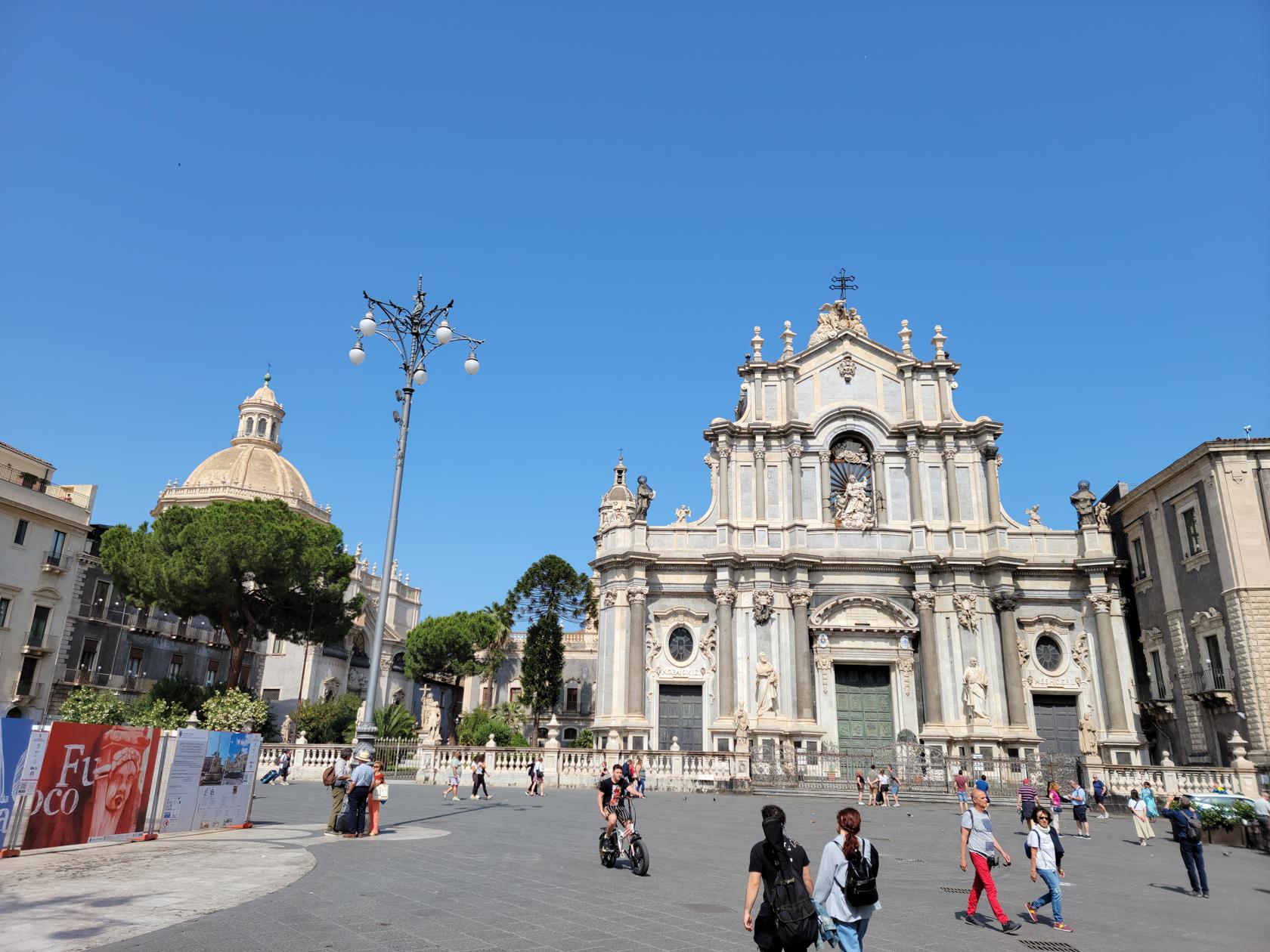
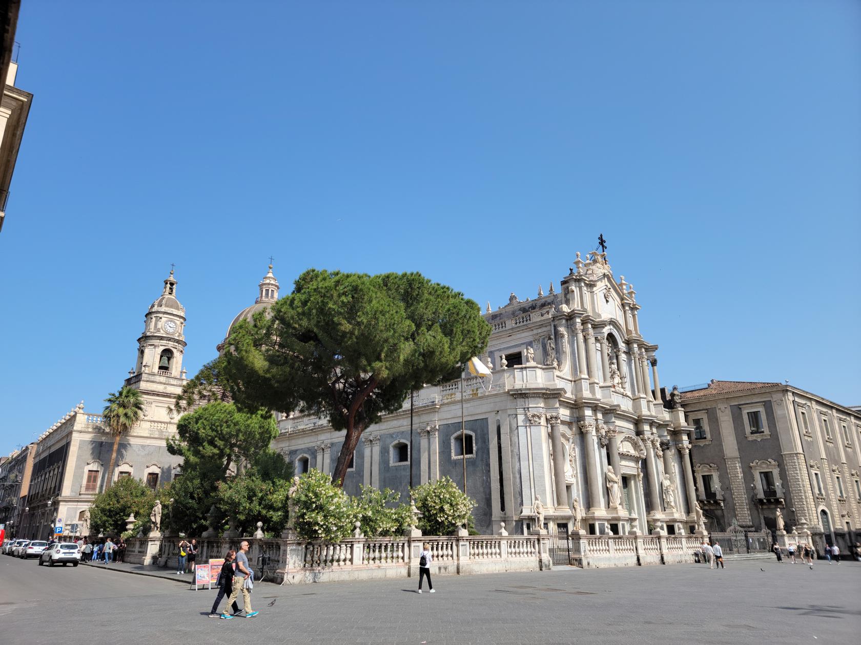
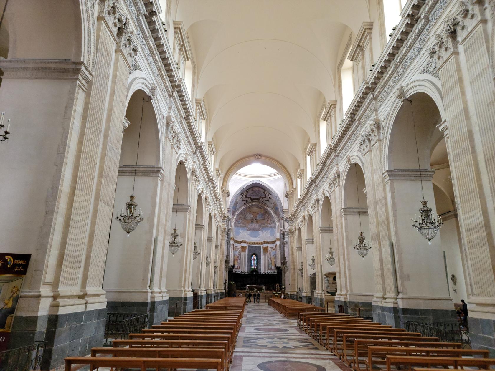
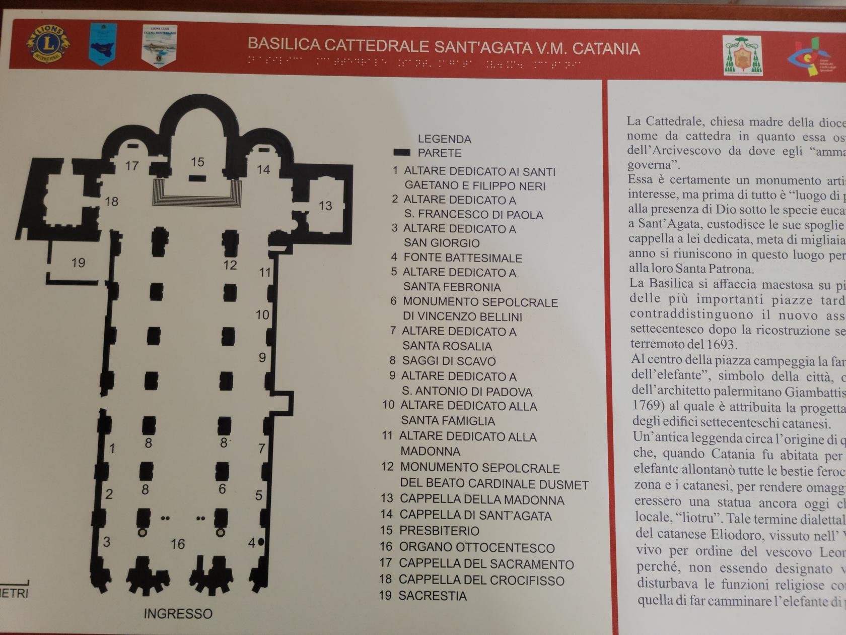
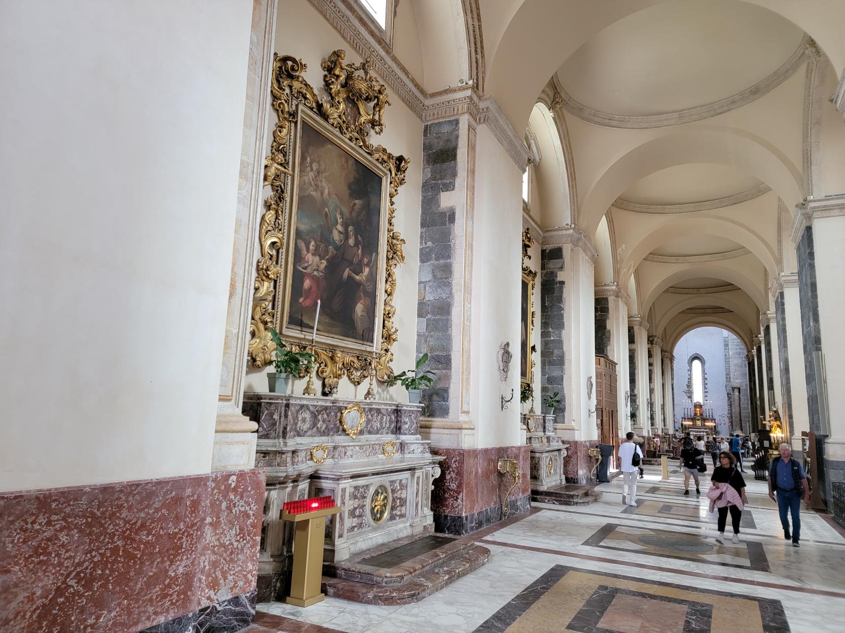
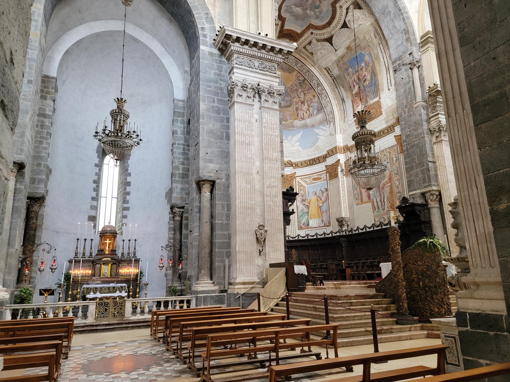
Basilica of Saint Agatha
This basilica has a Sicilian Baroque facade that was designed by Vaccarini in the early 18th century. It has a clock tower and a large piazza outside it to support its impressive entrance.
Basilica Cathedral of Saint Agatha – Catania, Sicily
Basilica Cathedral of Saint Agatha – Catania, Sicily
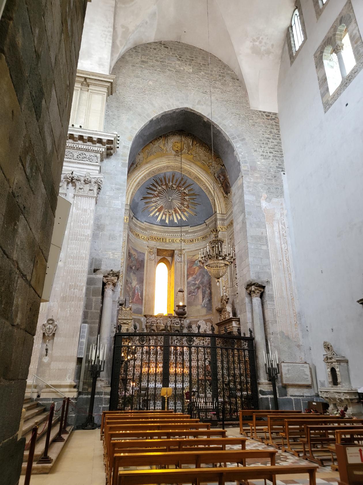
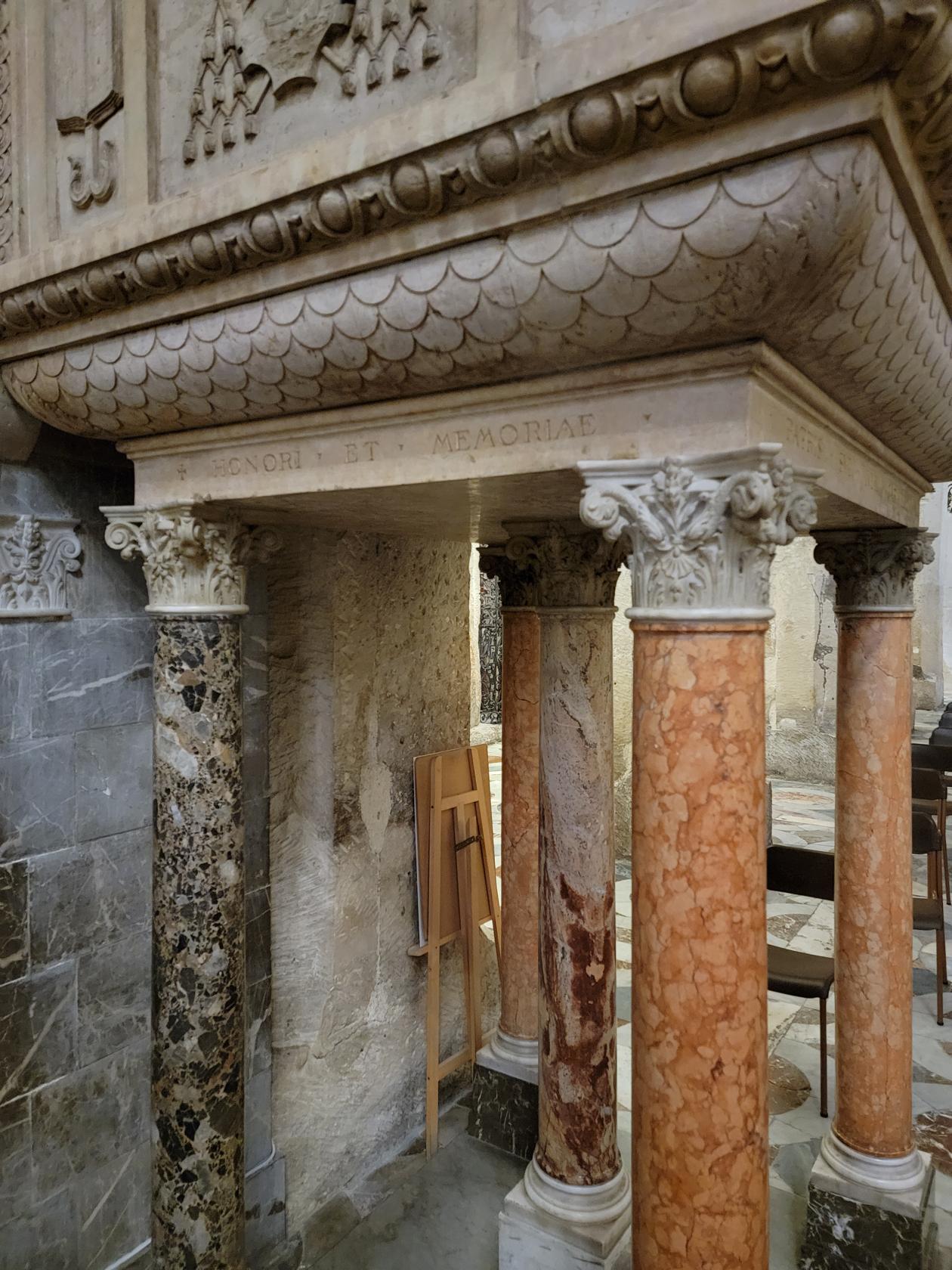
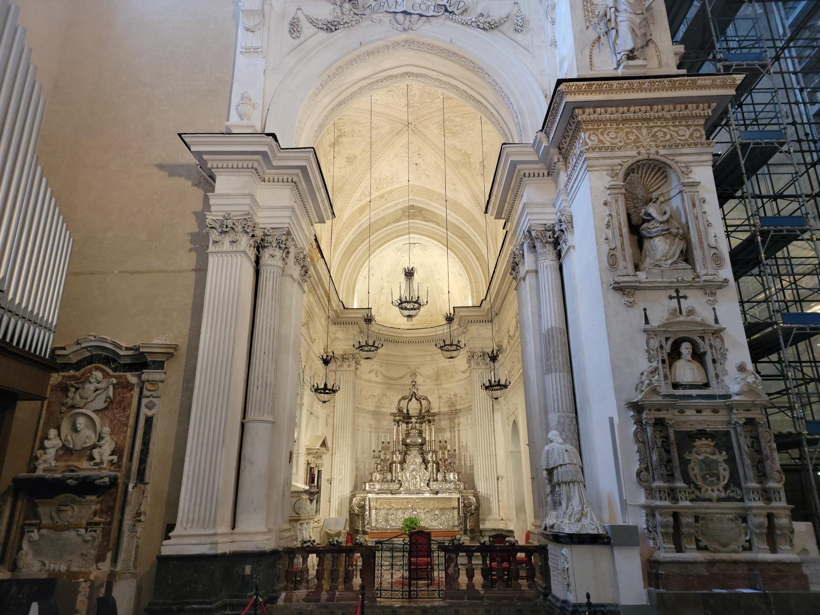
The interior is very large and has ten or twelve sub-chapels along its walls. There are three main altars, the two are the sides appear to be lit at all times, while the main alter, along with its wooden pulpit is probably only used to special occasions.
Cathedral of Saint Agatha – Catania, Sicily
Cathedral of Saint Agatha – Catania, Sicily
Cathedral of Saint Agatha – Catania, Sicily
Cathedral of Saint Agatha – Catania, Sicily
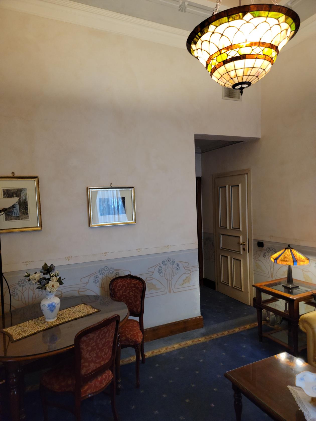
Our Hotel – Hotel Liberty
This hotel is situated above the main thoroughfare of Via Etnea (Etna) and just outside what would be perceived as the nice part of the city. It is most likely, the nice part of town has moved over time and now it finds itself a bit on the margins; but it is a great four-star hotel and the rooms are really great. The staff is very courteous and knowledgeable. Irons are not in the rooms but are available for those seeking to touch up their clothes after a hard travel.
Hotel Liberty Lobby – Catania, Sicily
Hotel Liberty Bar – Catania, Sicily
Main stairwell – Hotel Liberty – Catania, Sicily
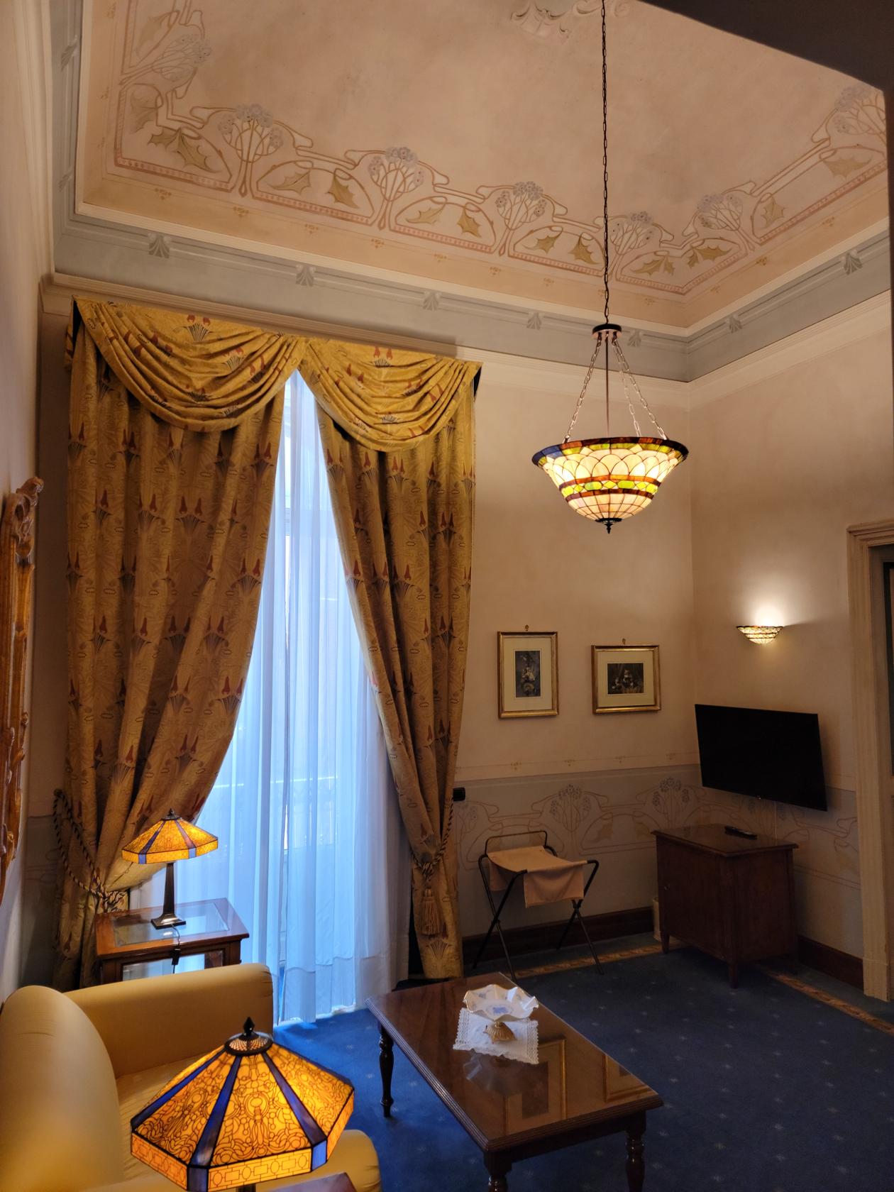
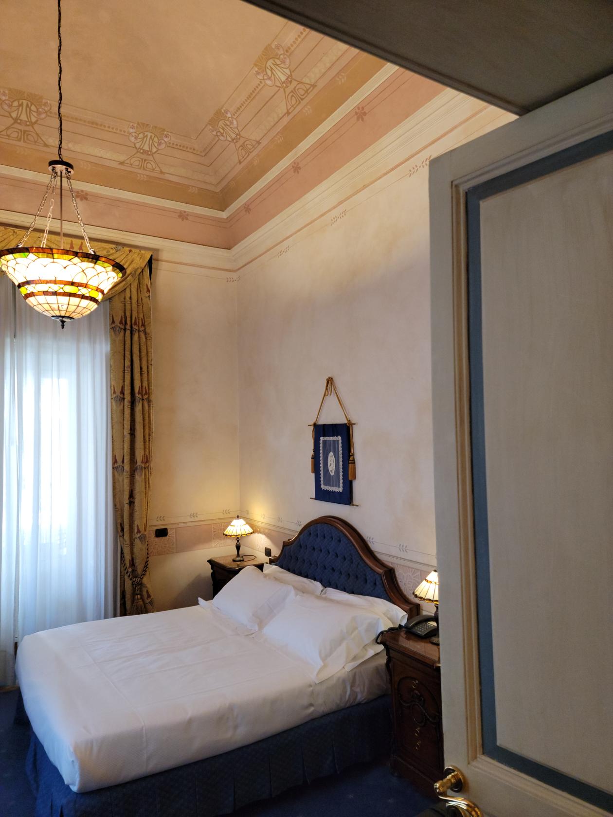
We were booked into a luxury room and upgraded to the Estasi suite, it was almost as big as our entire apartment in Turin!
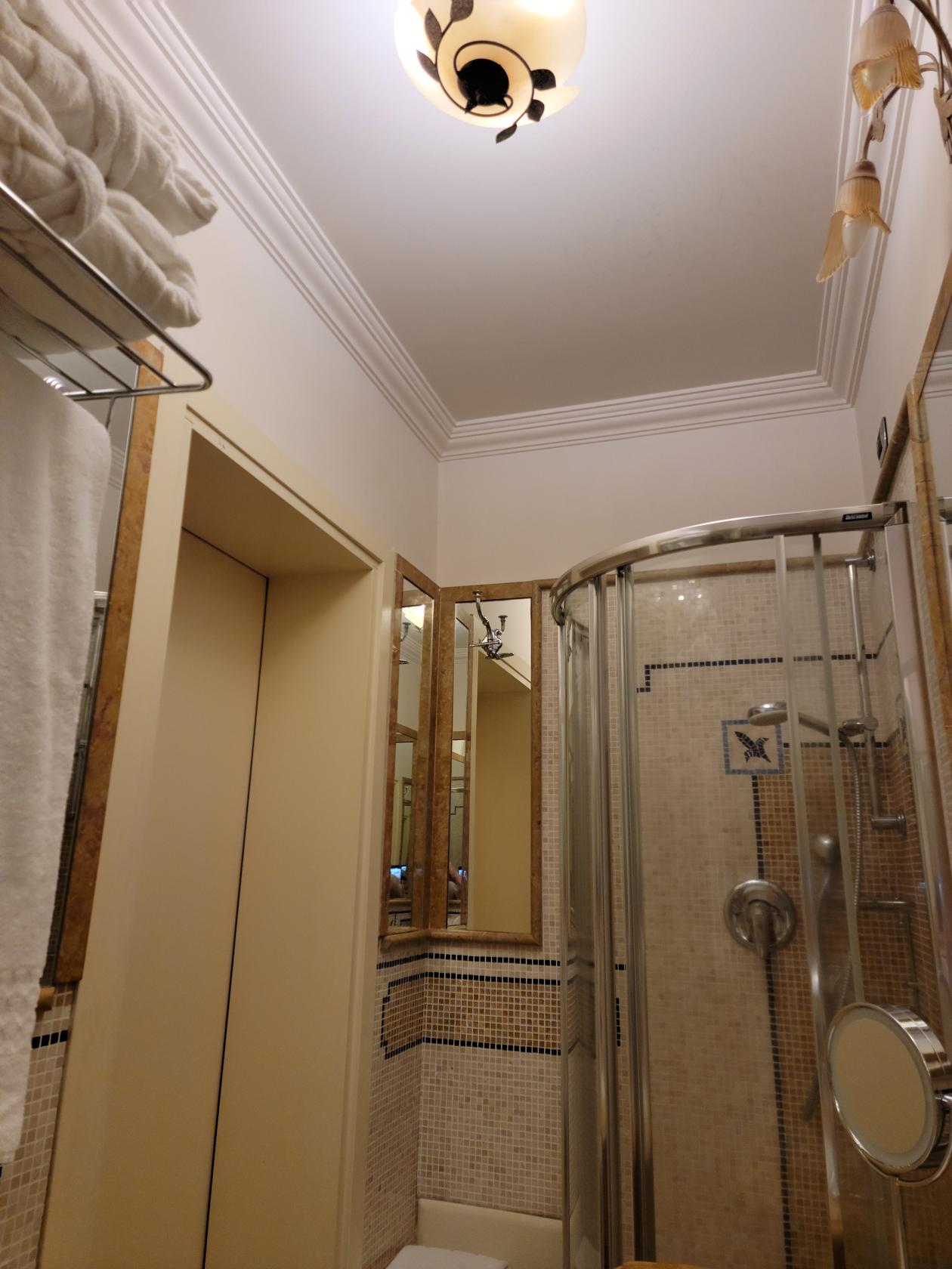
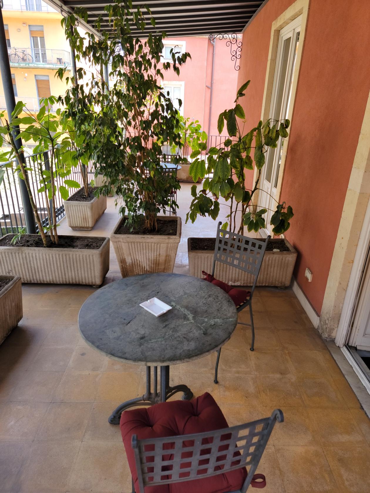
Our rooms – Hotel Liberty – Catania, Sicily
Our rooms – Hotel Liberty – Catania, Sicily
Our rooms – Hotel Liberty – Catania, Sicily
Our rooms – Hotel Liberty – Catania, Sicily
Our rooms – Hotel Liberty – Catania, Sicily
Our rooms – Hotel Liberty – Catania, Sicily
Restaurants
Like any large city, Catania has a variety of restaurants to choose from, including Asian and other cuisines. Since our stay was so short we stuck with the local favorites and something new as well.
La Taverna Del Grande Albergo
This is a very good restaurant with excellent typical Sicilian food. It has a limited menu, but that’s what makes it so great. What ever is on the menu is delicious. It was so good in fact, we ate here both evenings.
Inside – La Taverna Del Grande Albergo Ristorante – Catania, Sicily
Inside – La Taverna Del Grande Albergo Ristorante – Catania, Sicily
La Taverna Del Grande Albergo Ristorante – Catania, Sicily
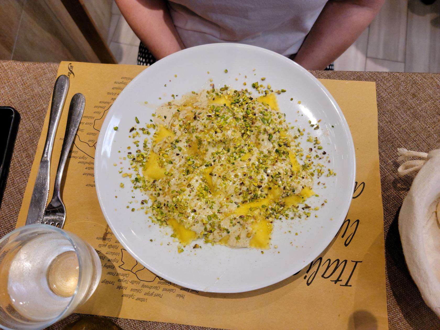
Ravioli stuffed with ricotta cheese, honey and pistachios – La Taverna Del Grande Albergo Ristorante – Catania, Sicily
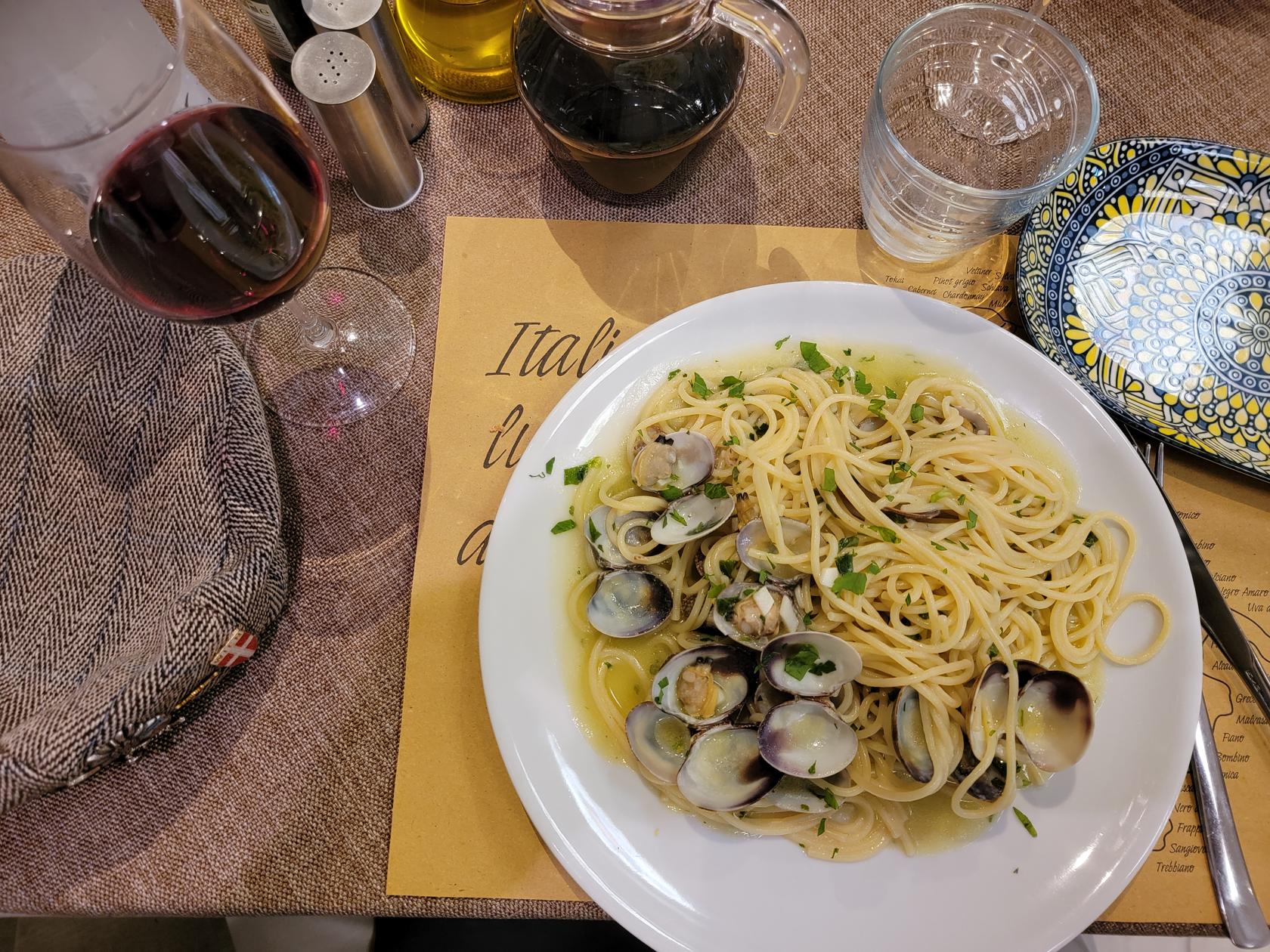
Spaghetti with clams – La Taverna Del Grande Albergo Ristorante – Catania, Sicily
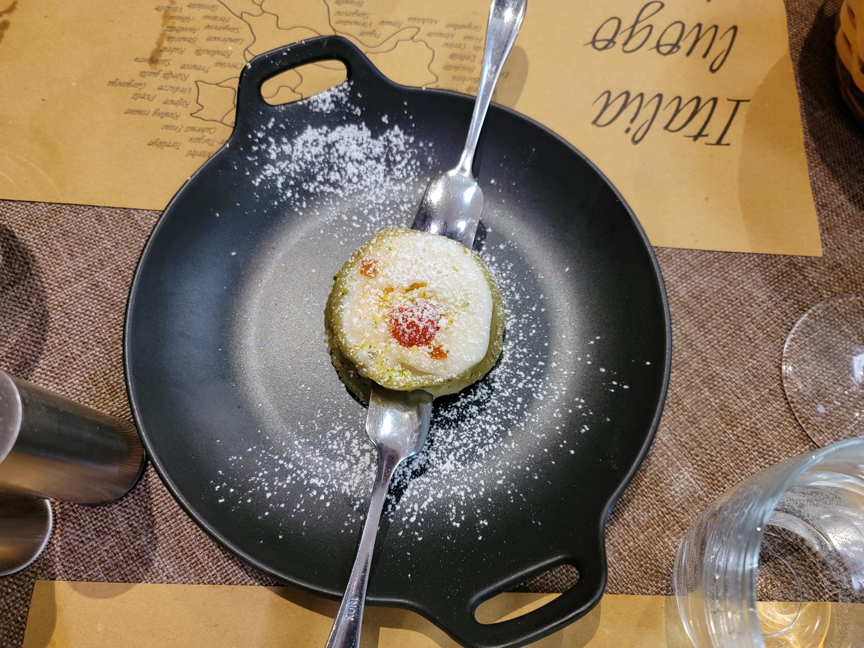
Casatta – La Taverna Del Grande Albergo Ristorante – Catania, Sicily
Forma Ristorante
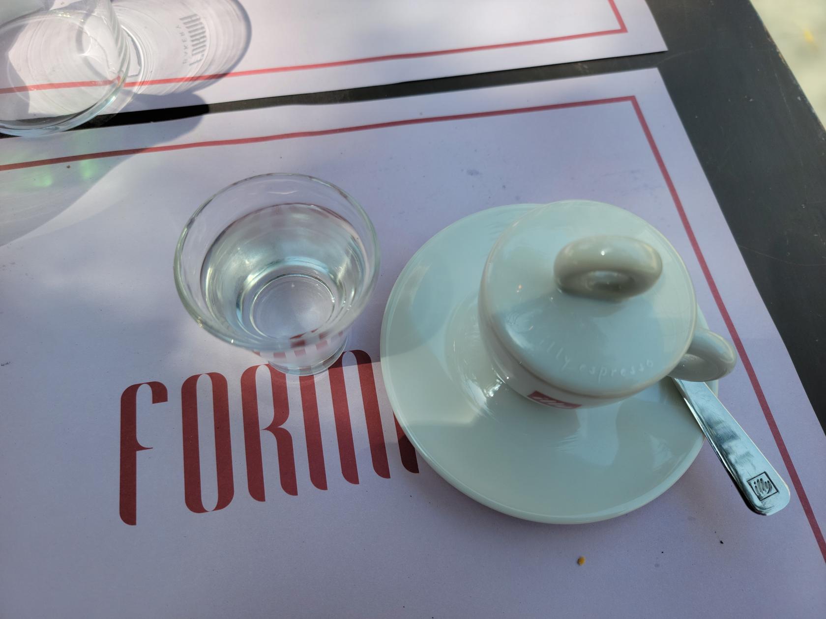
A new kind of boutique restaurant, it has a select menu of typical dishes created with some style. The outside seating is under a very large tree where you can enjoy your food and the great weather. The staff is fairly energetic and responds quickly if you require any assistance or your bill. As with most establishments in Italy, you pay inside at the cashier.
Pizza Margherita and Chicken Club – Forma Ristorante – Catania, Sicily
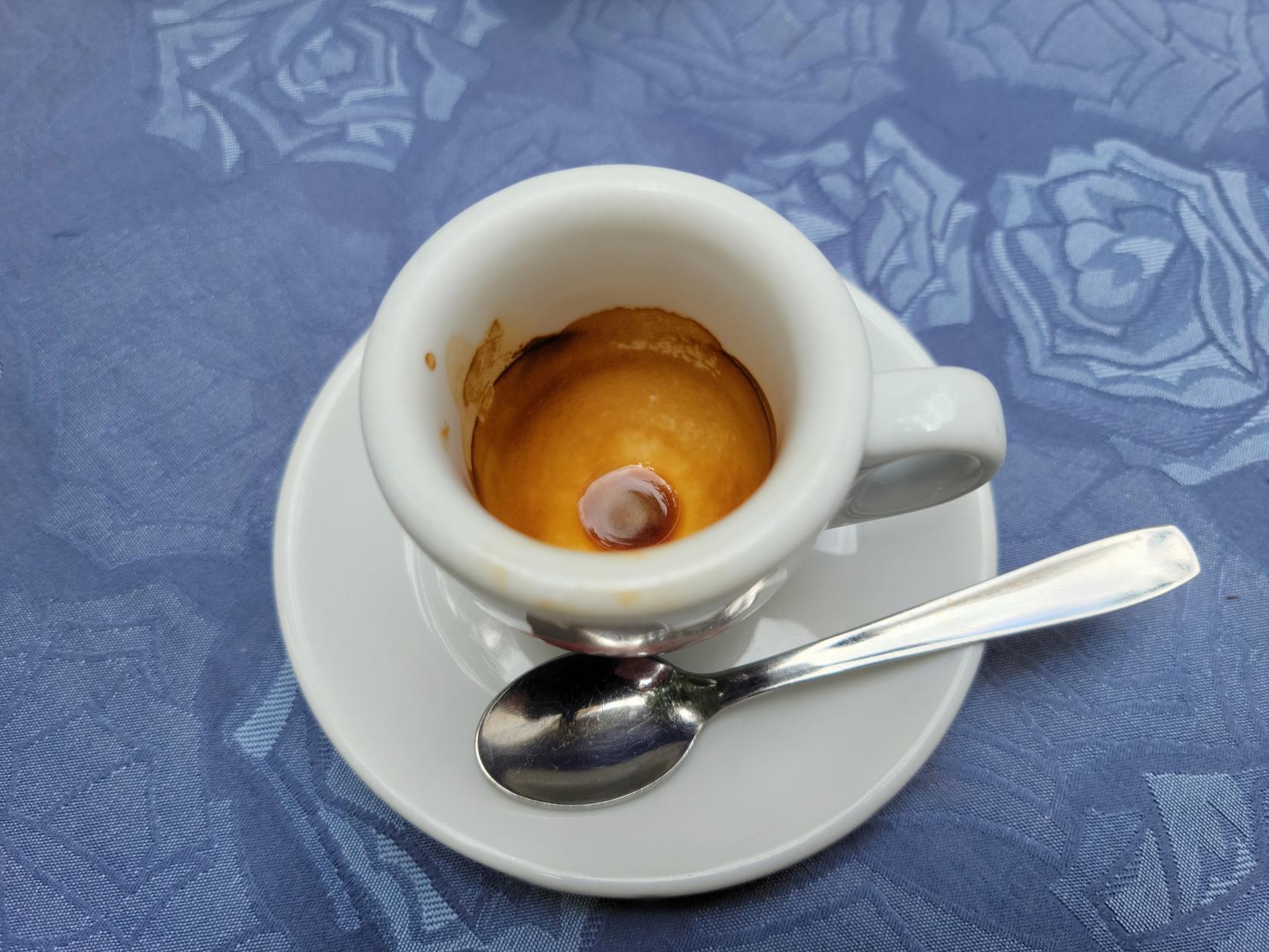
Espresso and Sambuca – Forma Ristorante – Catania, Sicily
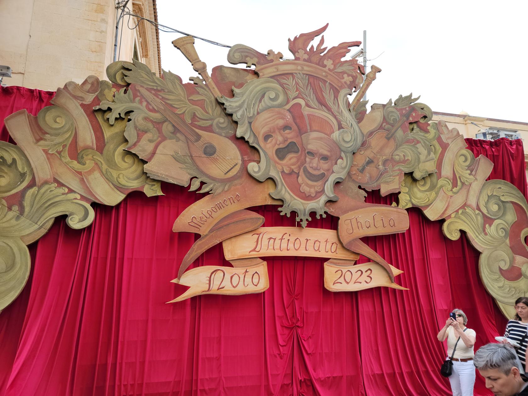
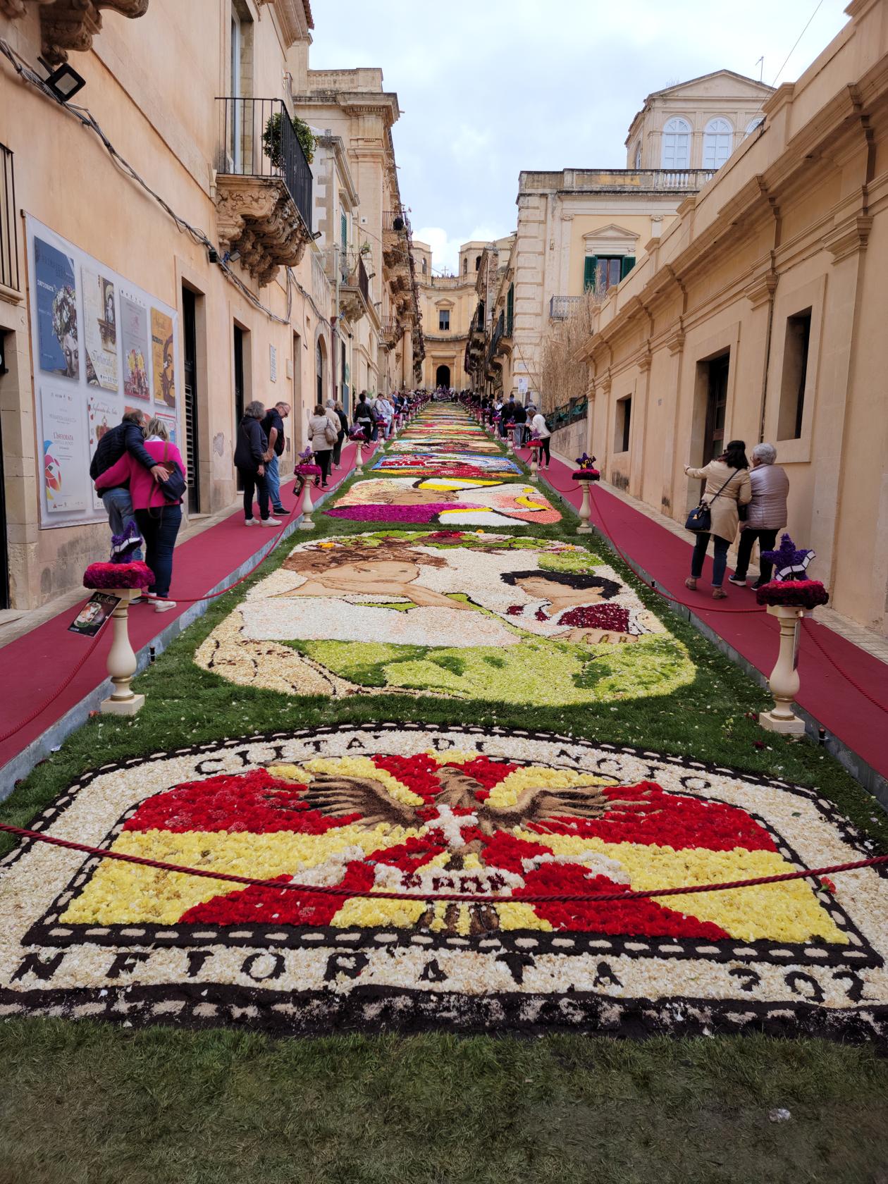
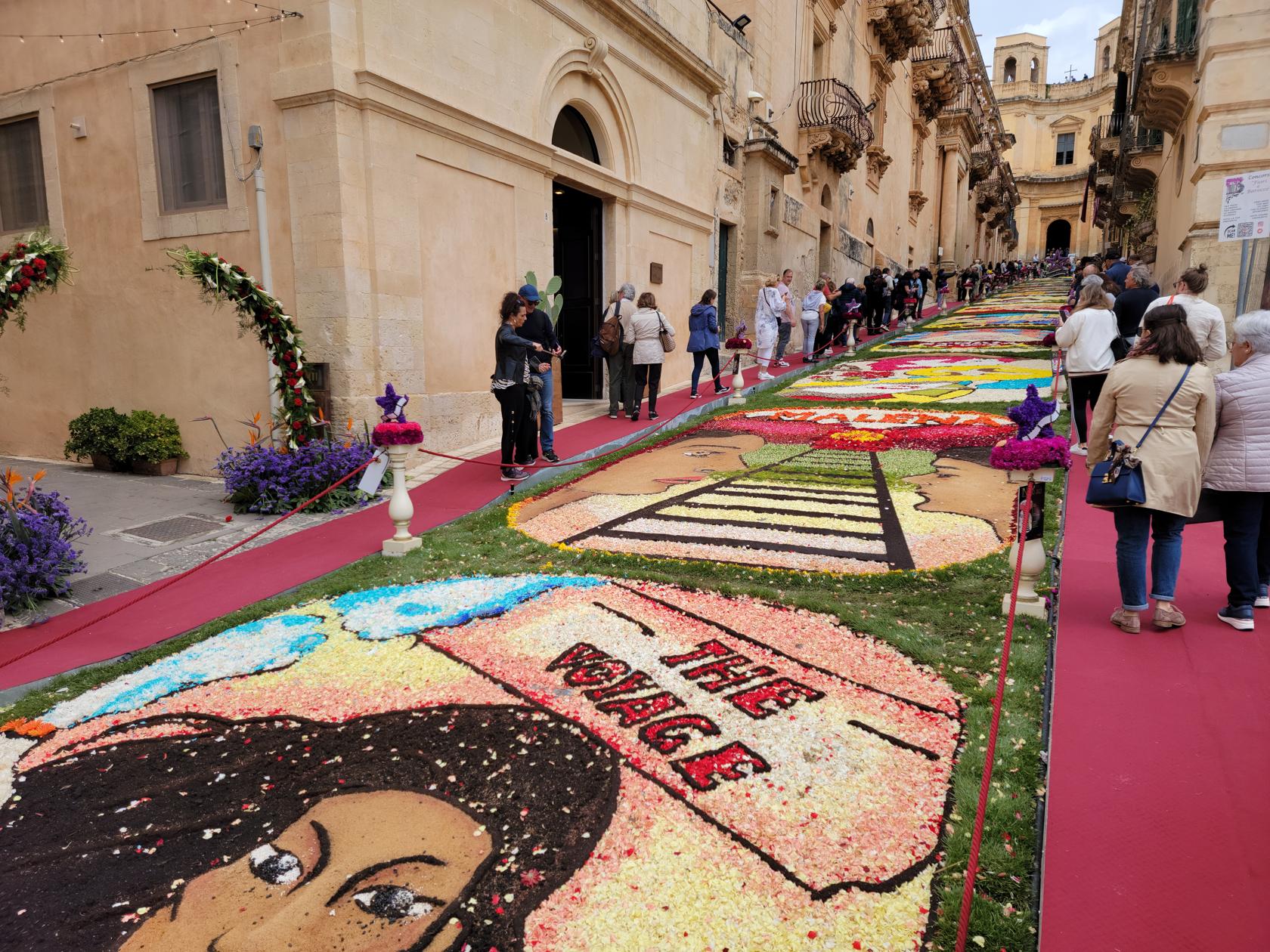
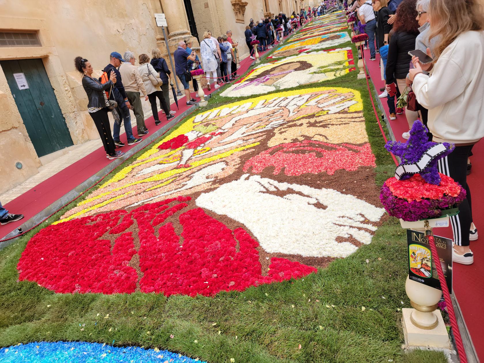
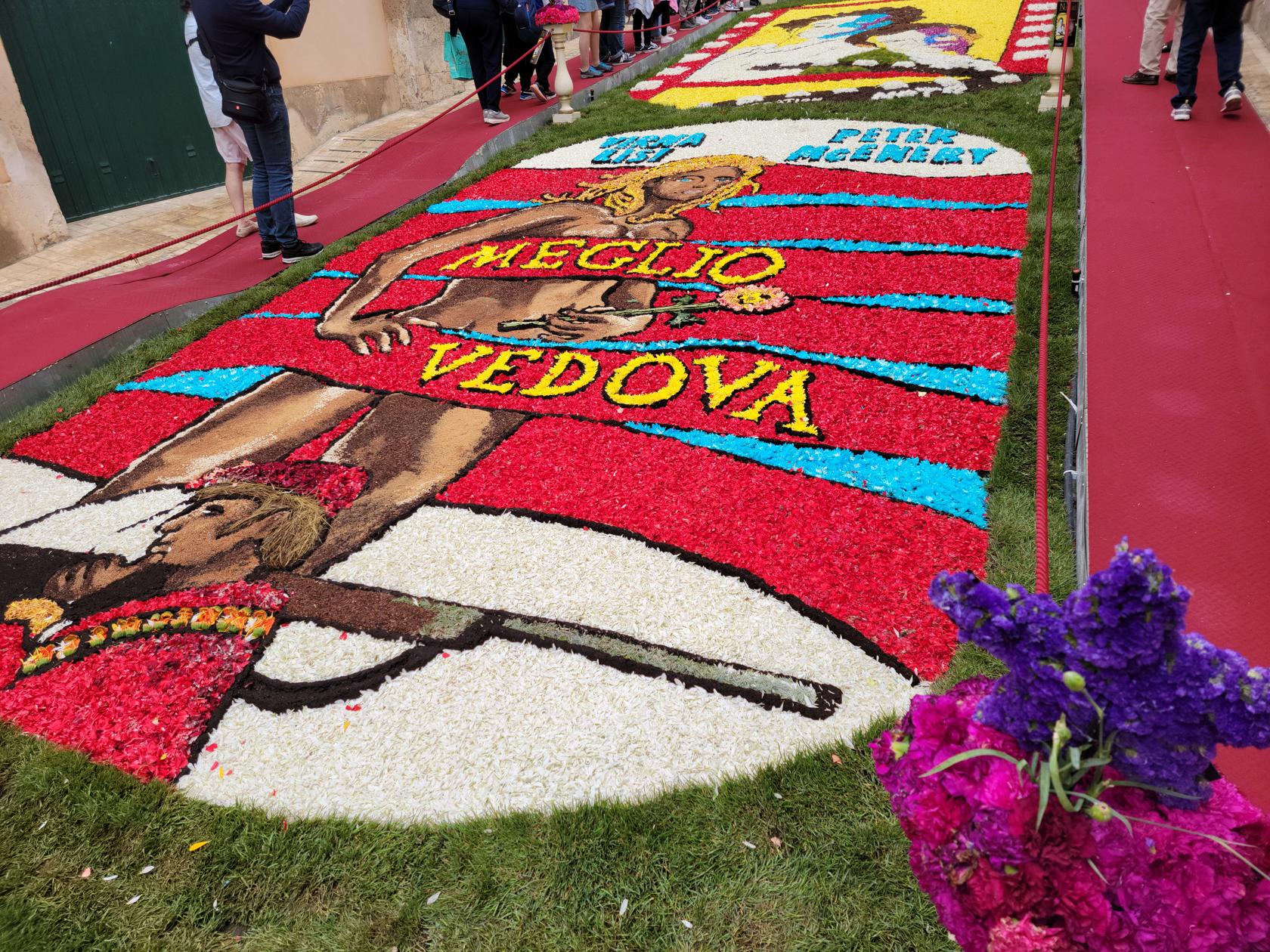
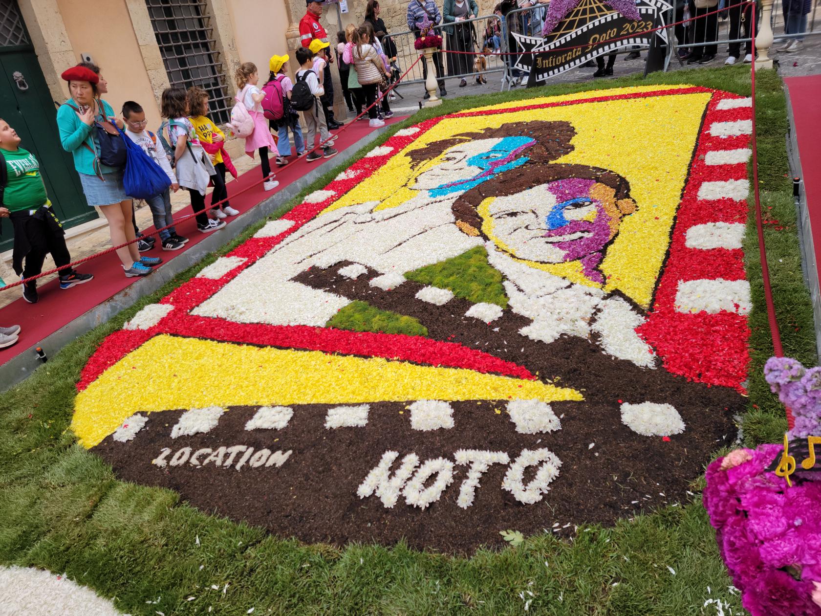
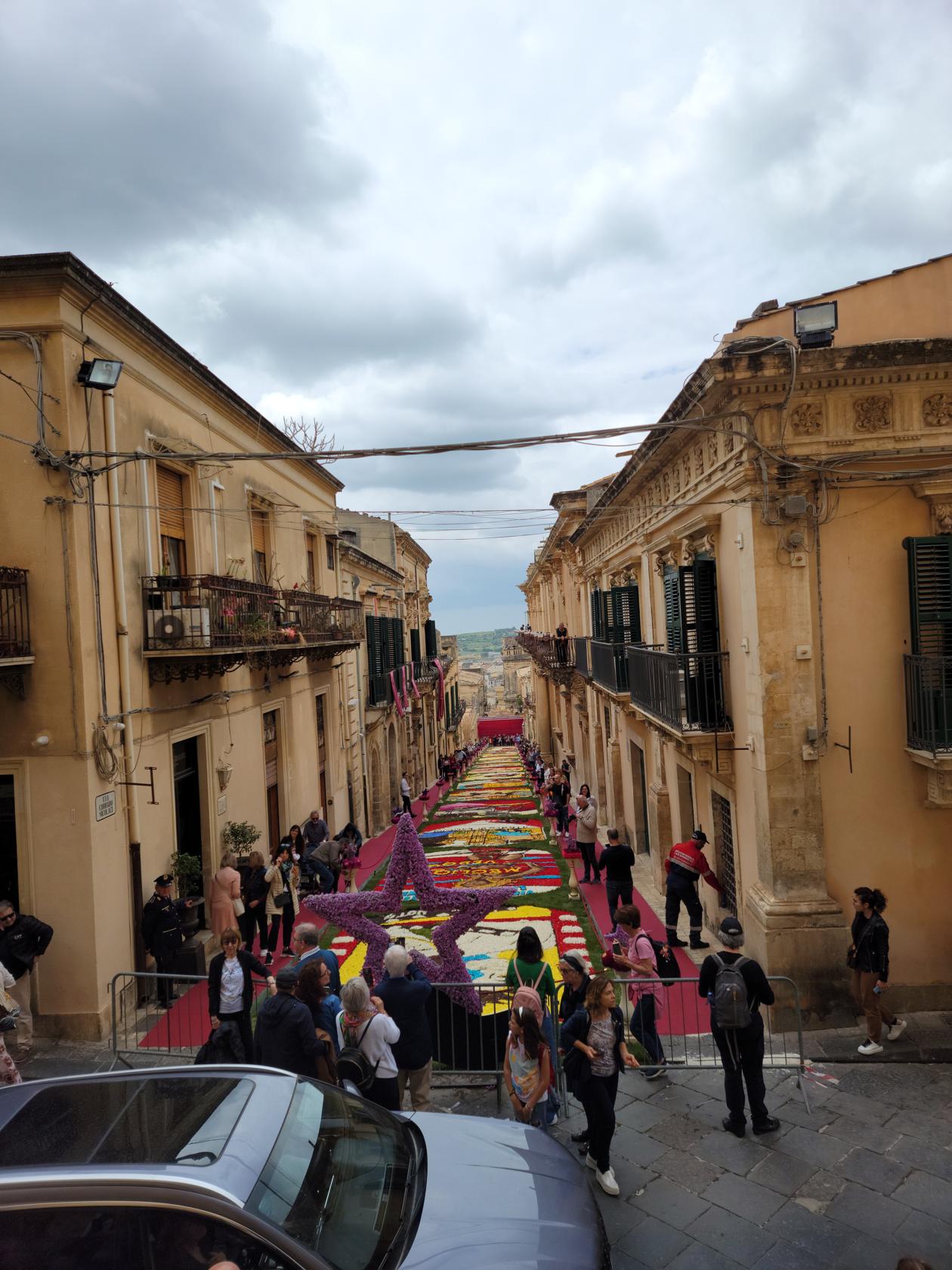
To my knowledge there is no analog in the United States to the custom and festival similar to the one practiced in Noto, Sicily. Each year the town and local people celebrate the Infiorata, or festival of flowers. It is one of three towns known to have such a festival, which includes the towns of Spello and Genzano.
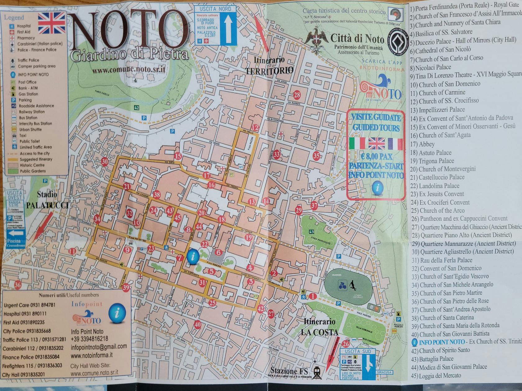
Noto the town – Map – Noto, Sicily
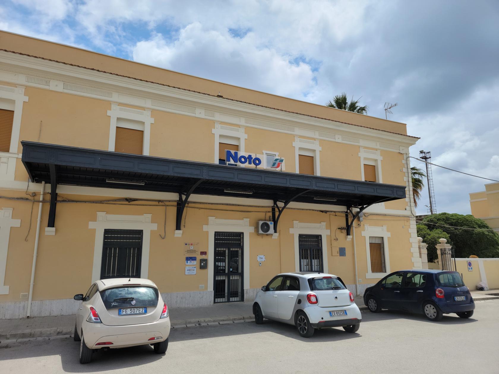
Noto train station – Noto, Sicily
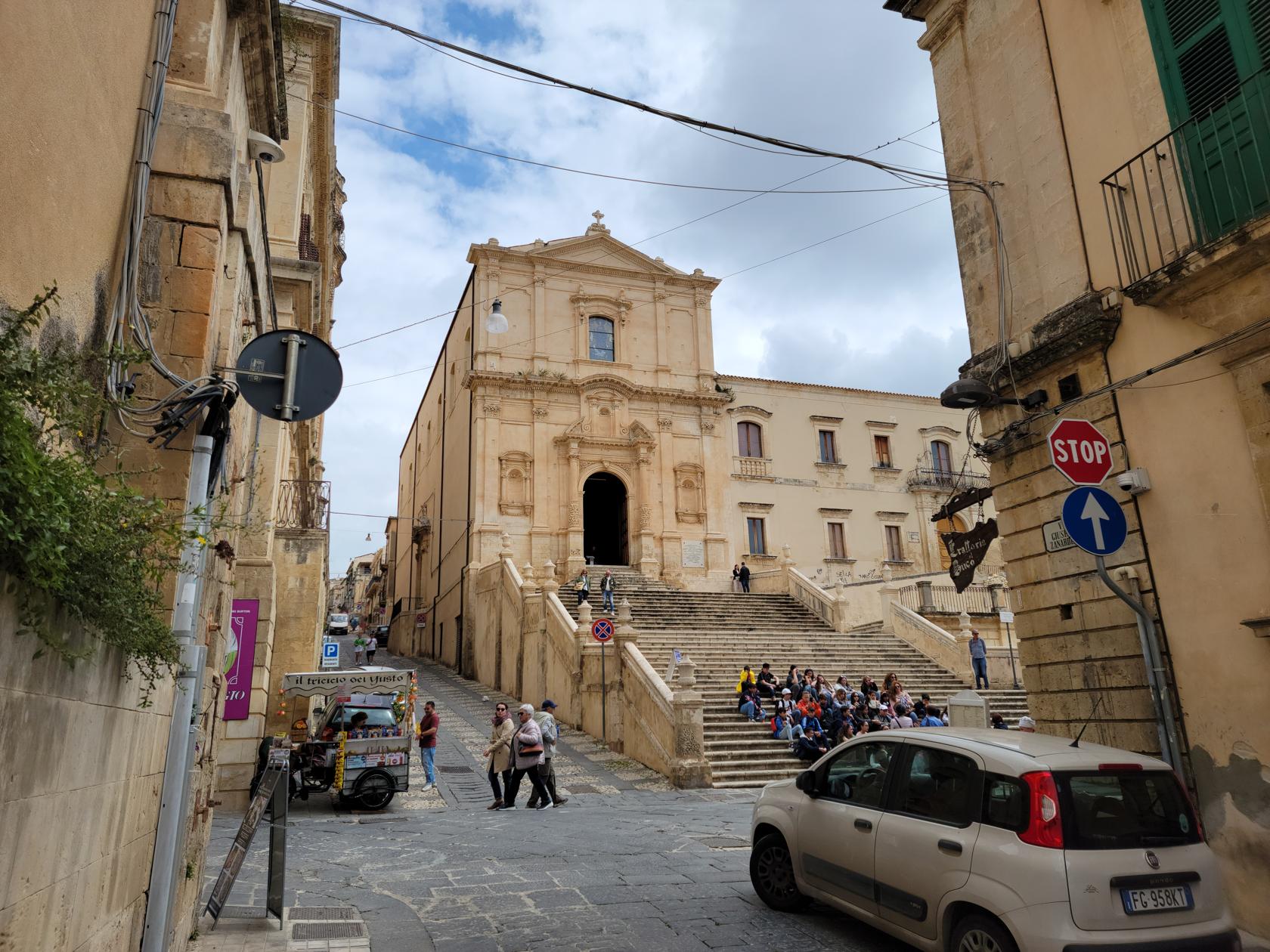
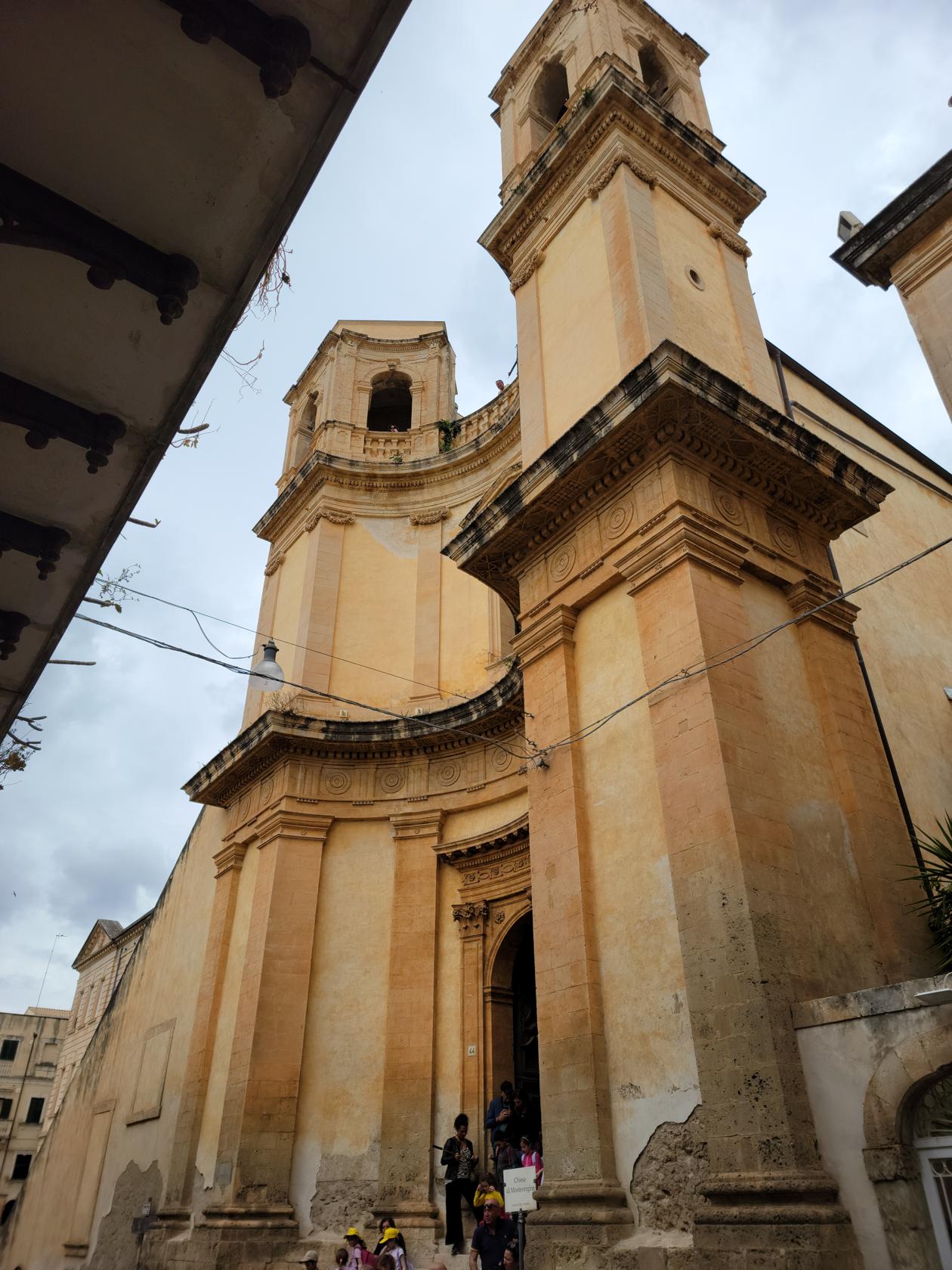
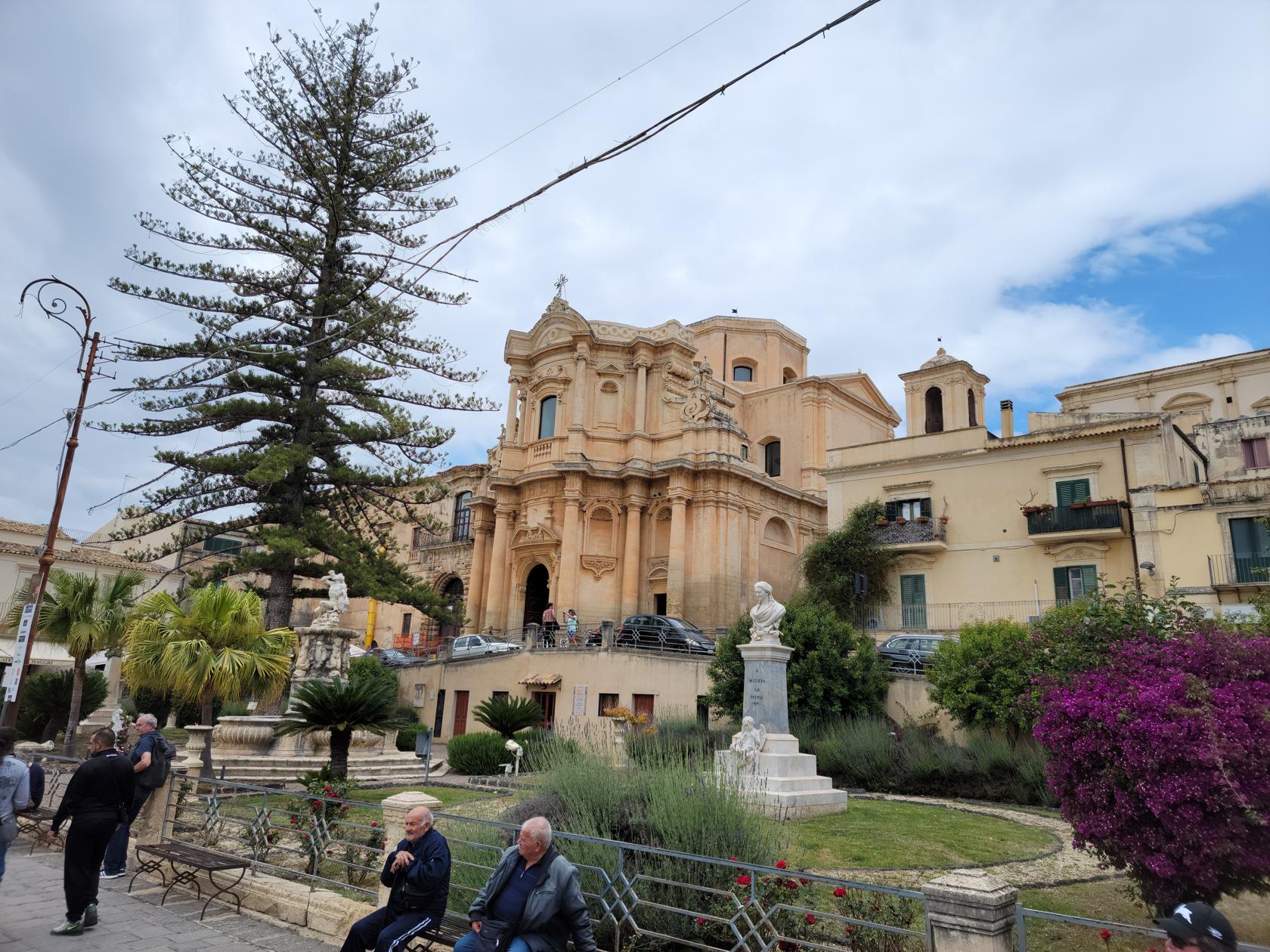
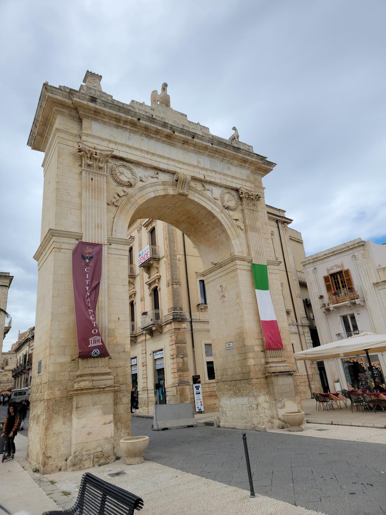
Noto
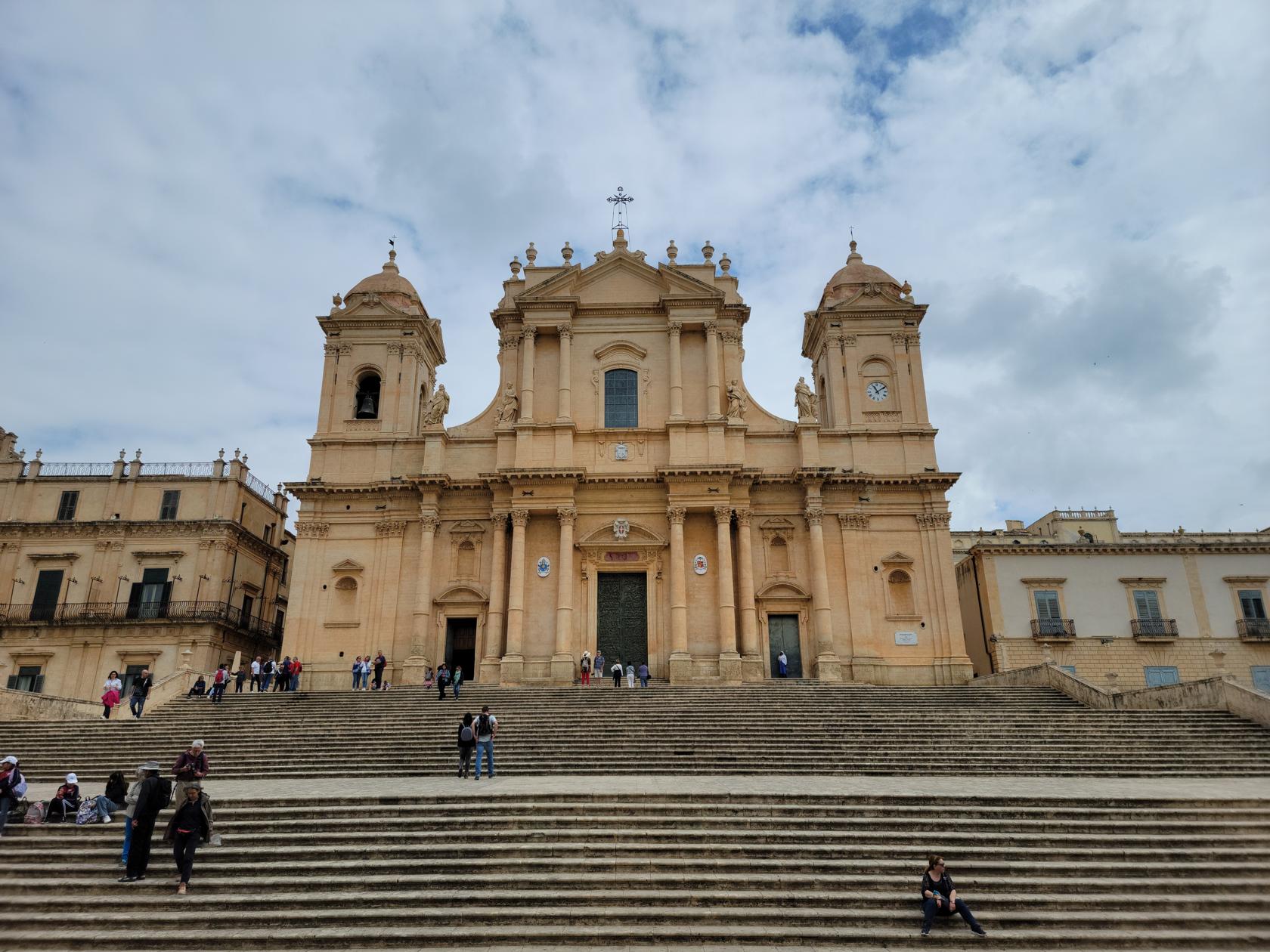
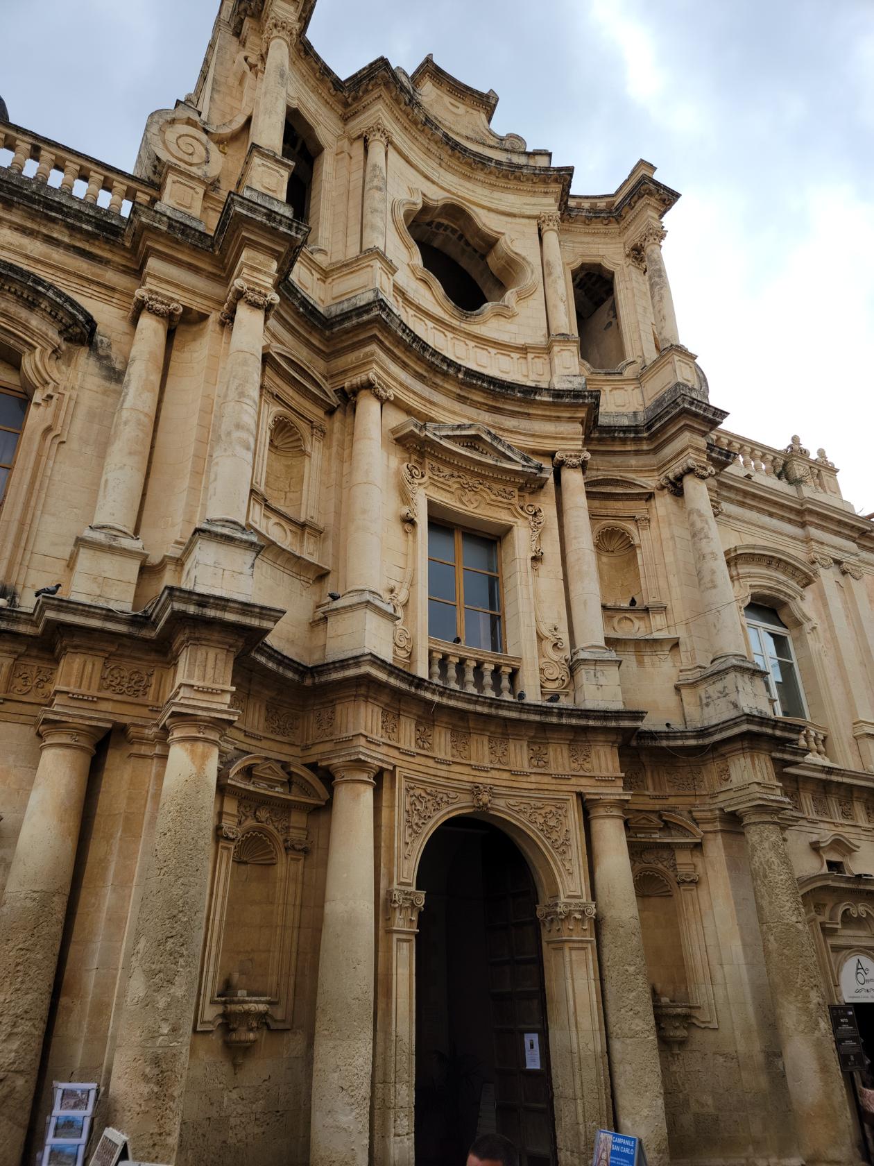
Noto is a world heritage UNESCO site and is well known for its cathedral and other archaeological wonders. Not only does the Noto Cathedral represent the epitome of Sicilian Baroque style, but it is the major landmark in the city. Over the years it suffered damage from repeated earthquakes and shoddy repairs, only to finally collapse in the 1990s after years of neglect. The church that stands before us today is almost a complete resurrection of the former cathedral, since only the facade and outside walls escaped destruction.
Cathedral of Noto – Noto, Sicily
It was totally destroyed in 1693 by an enormous earthquake and devastated it and the surrounding towns and villages. More than half of the residents perished in the violent event. It was later reconstructed at its current location in what is now considered the Sicilian Baroque style. Below is a slideshow with other sites that we saw while visiting, mostly churches of course.
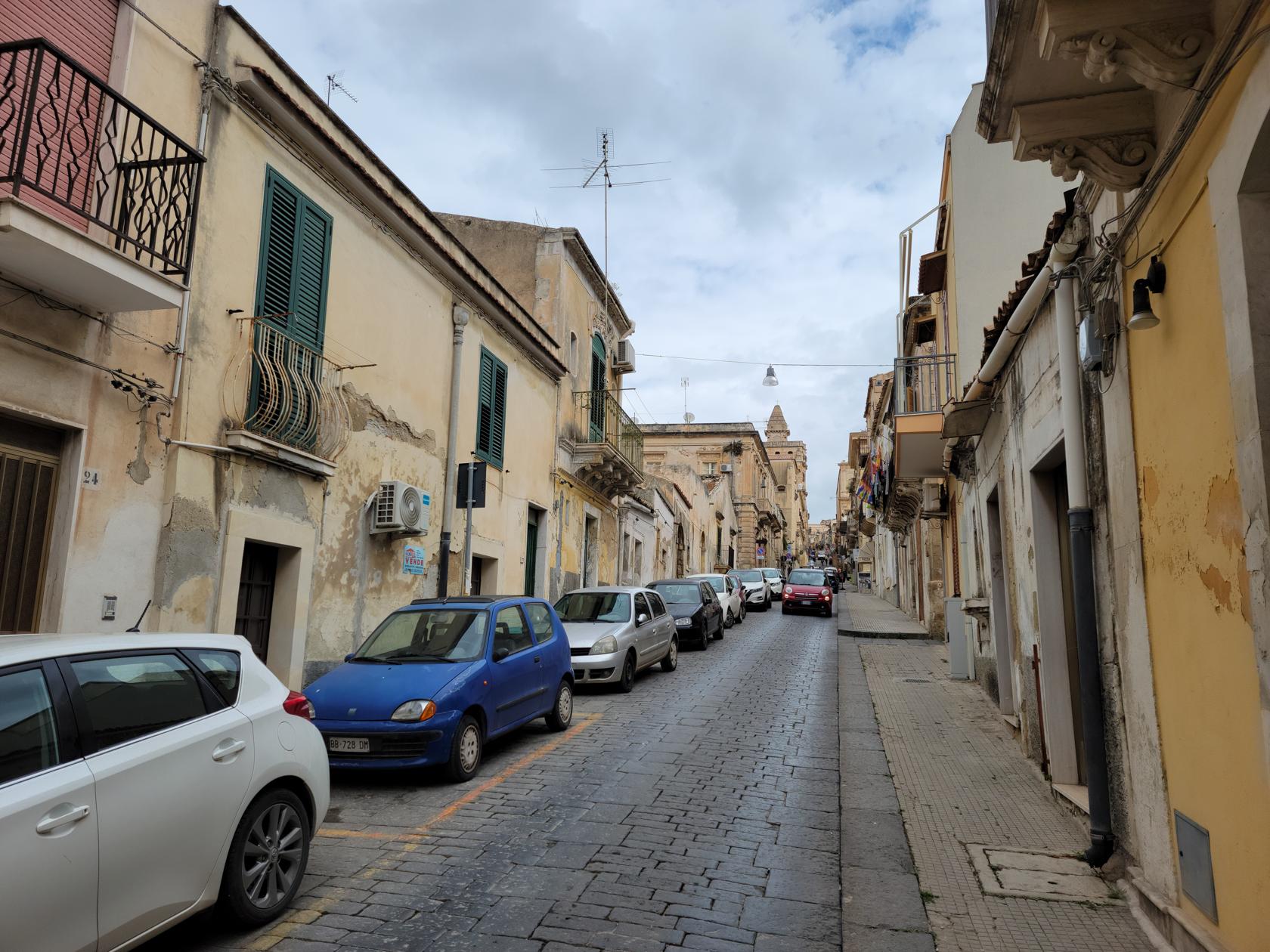
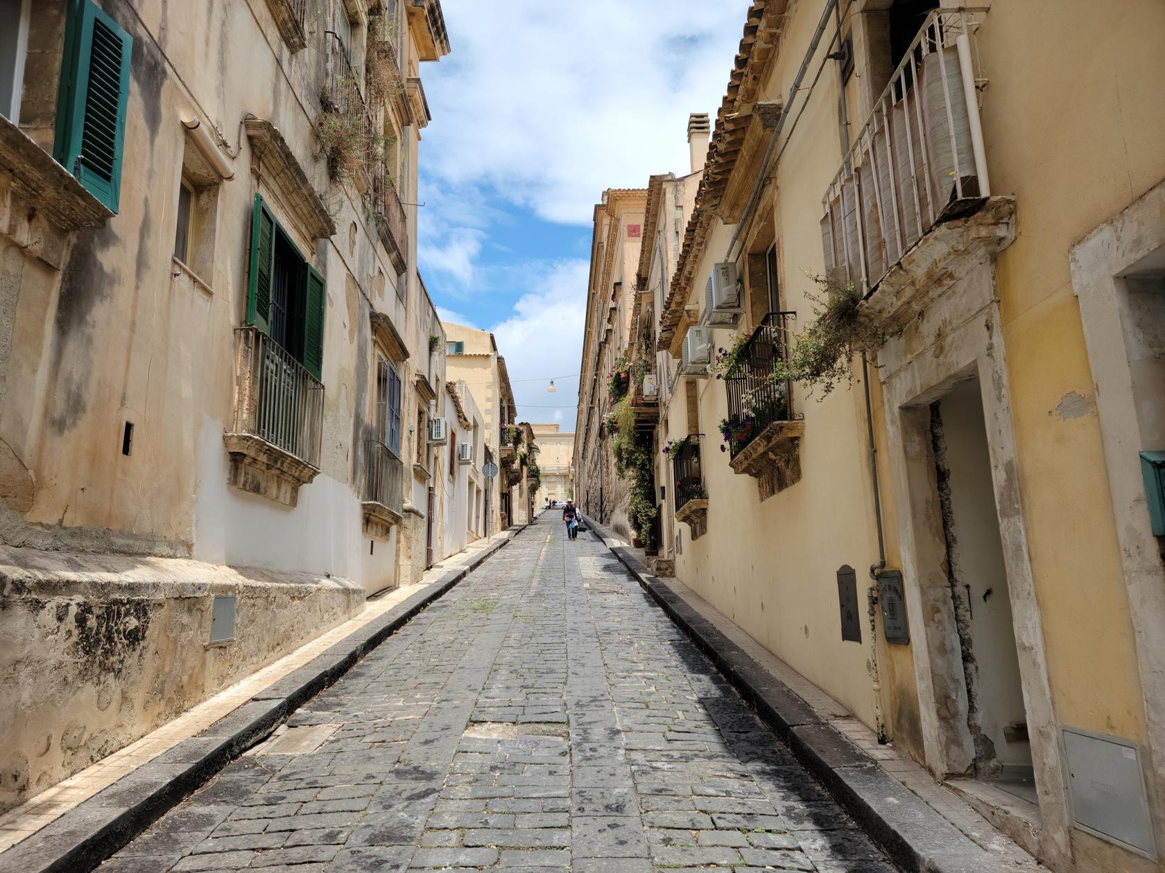
Street from the train station into town – Noto, Sicily
Street going up into town – Noto, Sicily
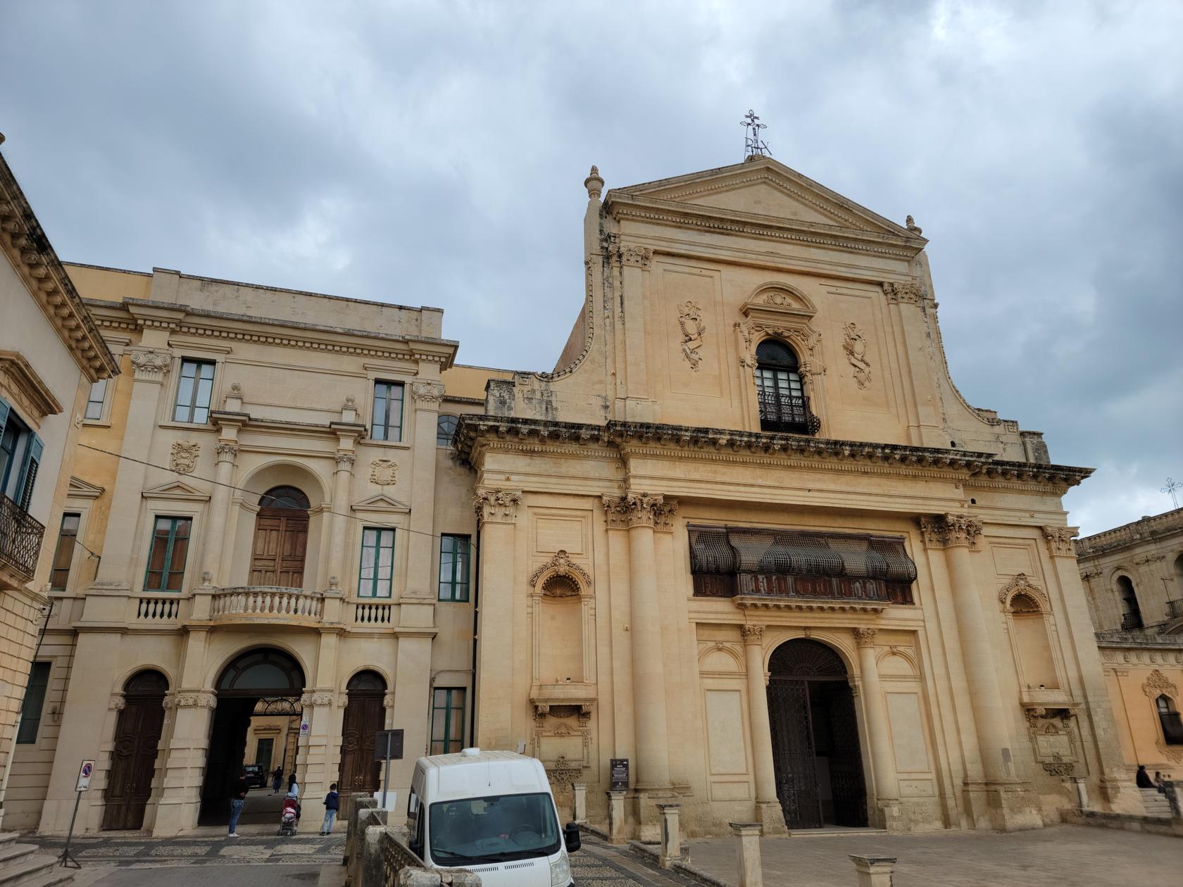
Church Saint Francis of Assisi – Noto, Sicily
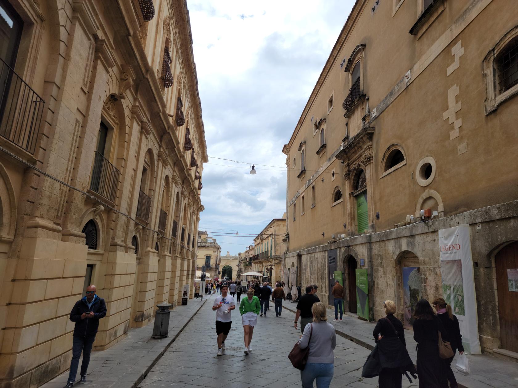
The street of Noto – Noto, Sicily
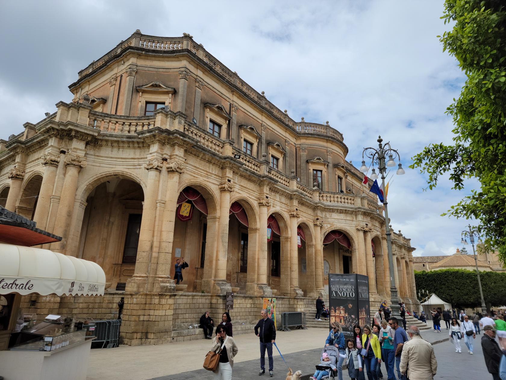
Palazzo Ducezio – Noto, Sicily
Church of Montevergine – Noto, Sicily
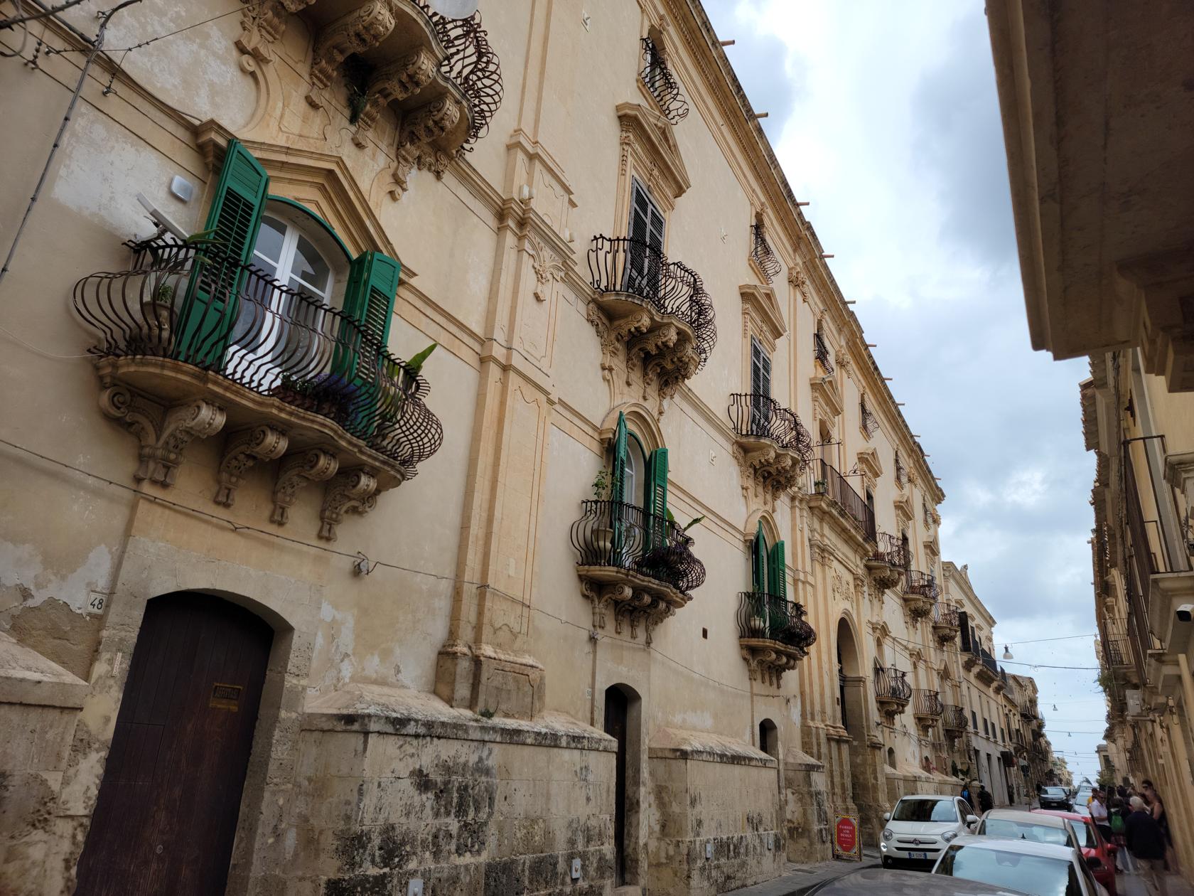
Ornate balconies – Noto, Sicily
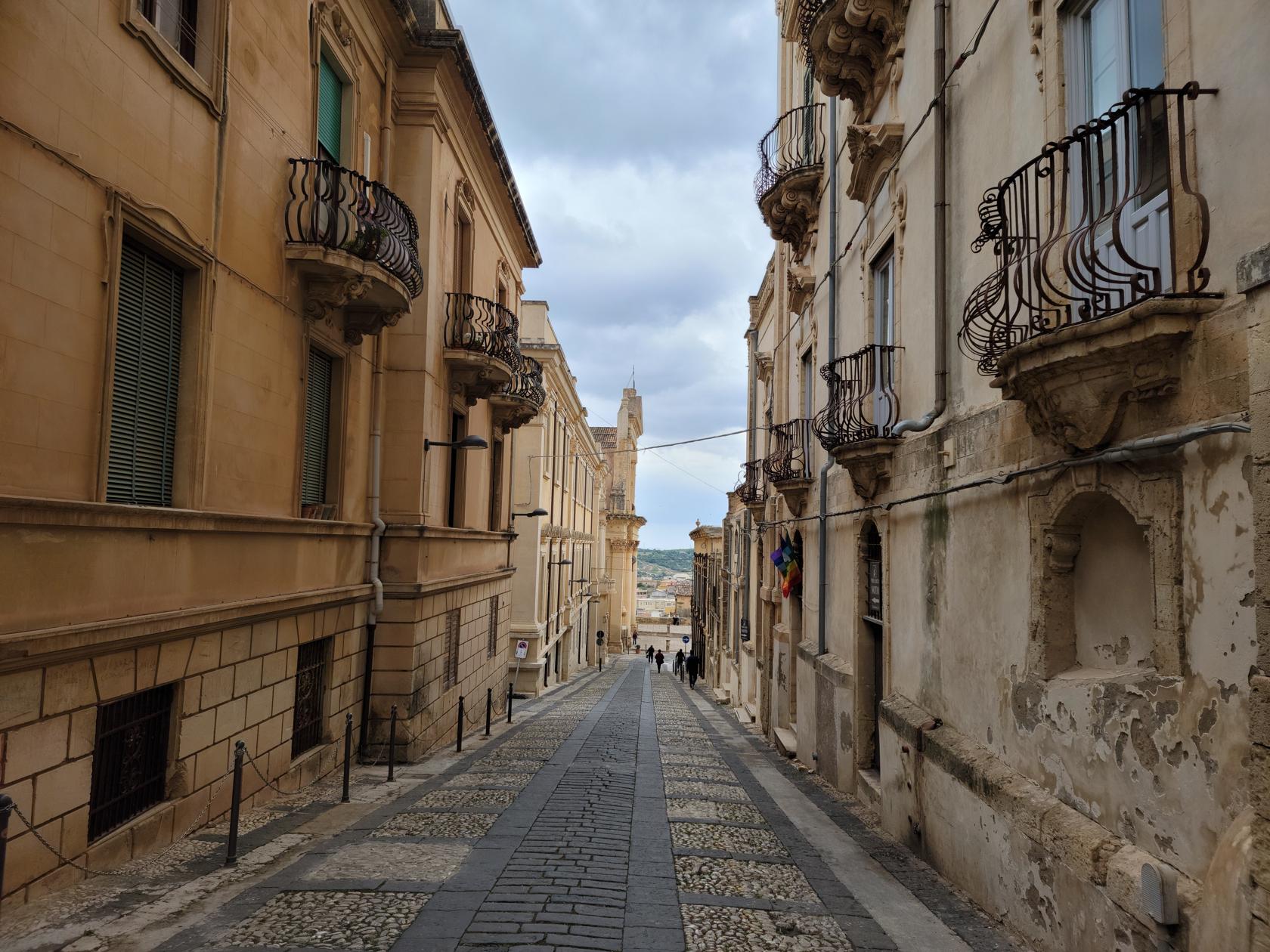
Typical stone streets – Noto, Sicily
Another church – Noto, Sicily
Church of Saint Salvatore – Noto, Sicily
Chuch of San Salvatore – Noto, Sicily
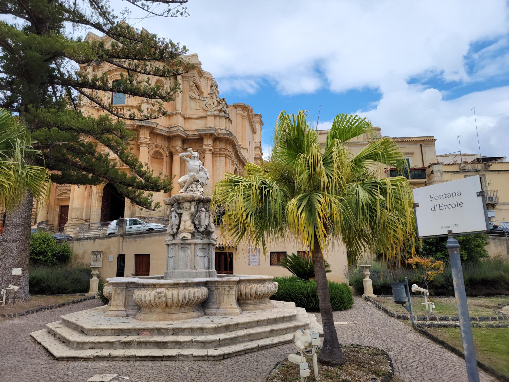
Fontana d’Ercole – Noto, Sicily
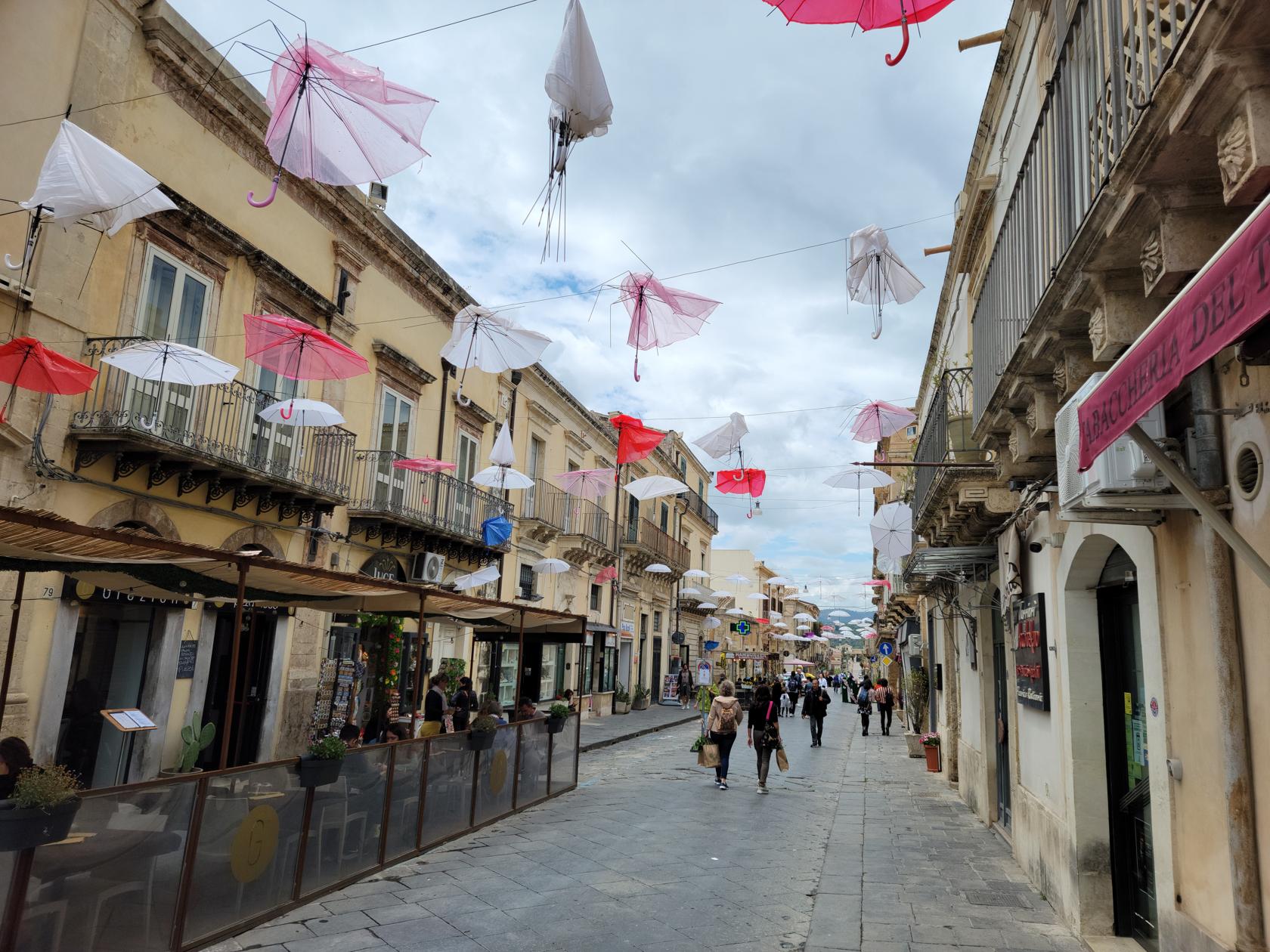
Corso VIttorio Emanuele – Noto, Sicily
A very steep street – Noto, Sicily
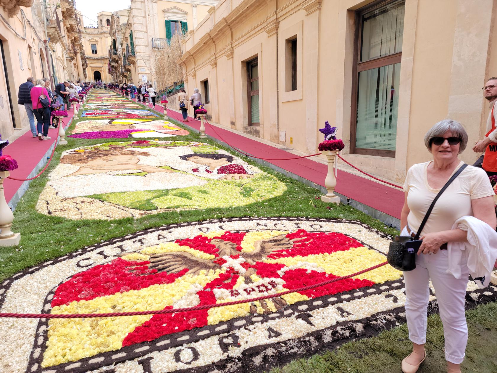
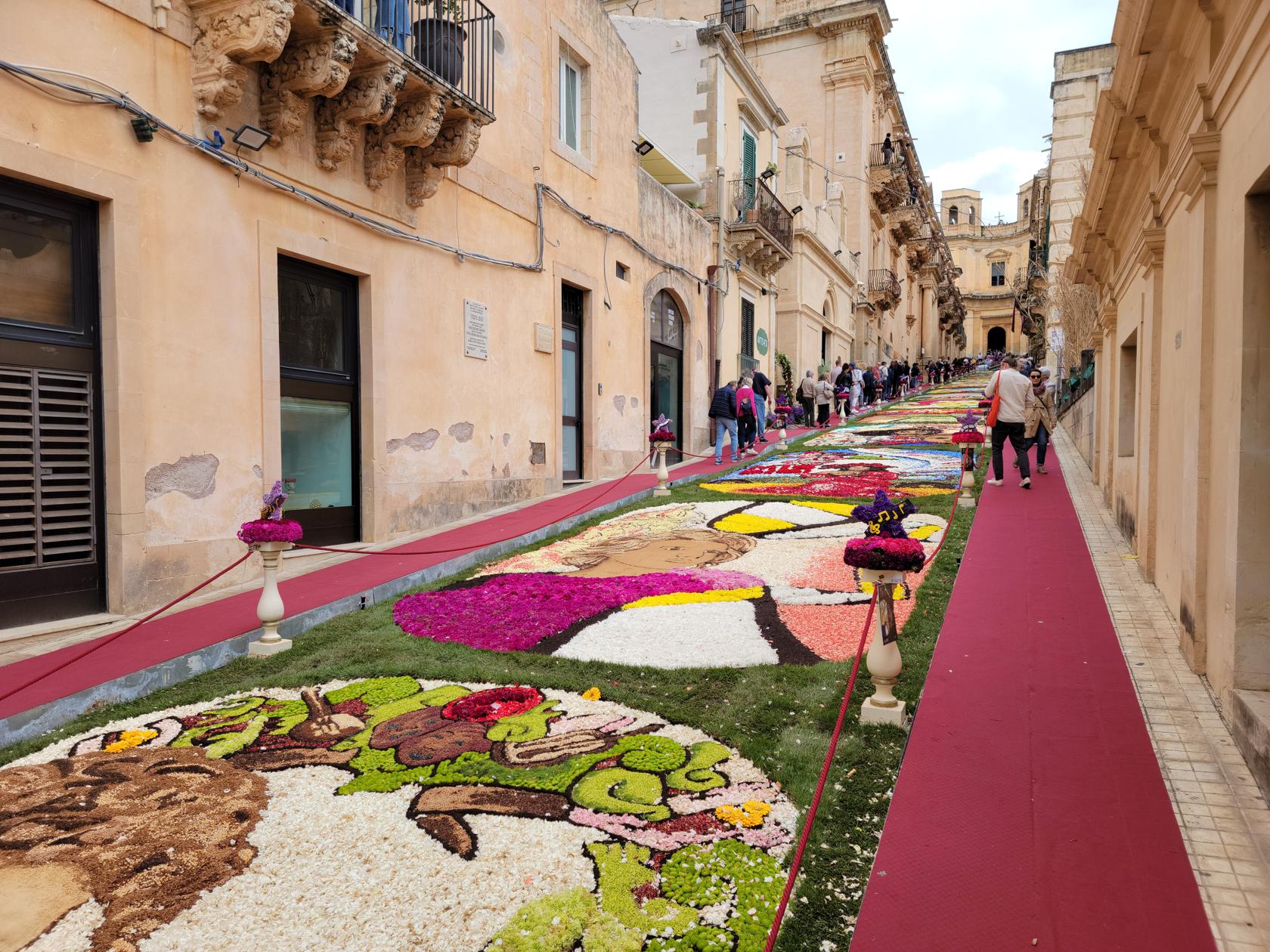
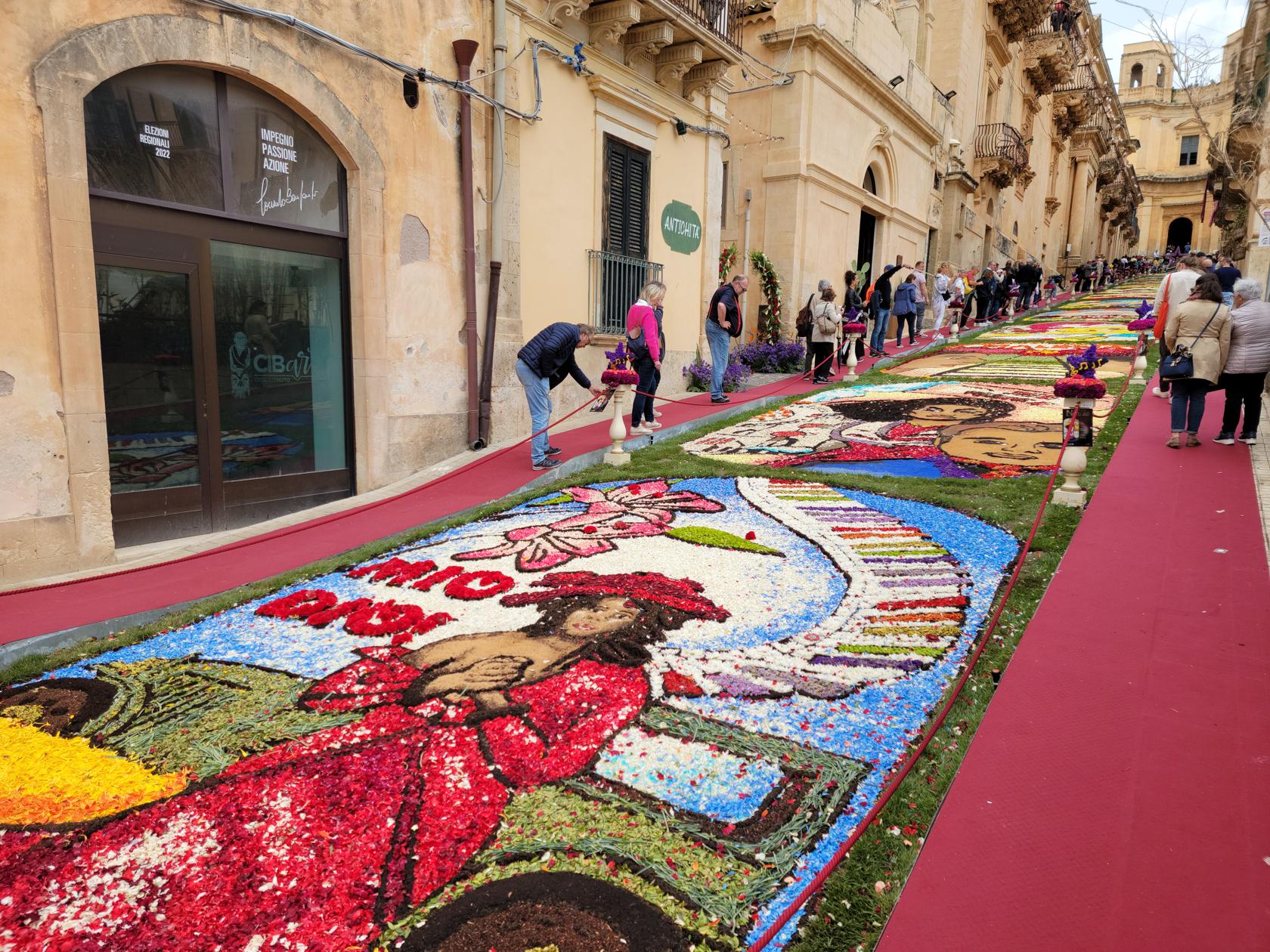
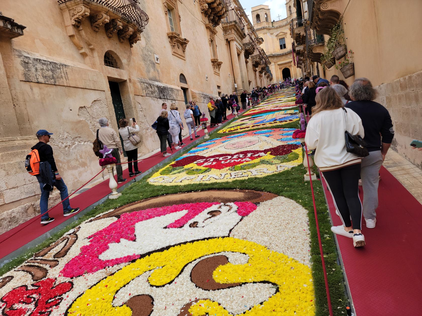
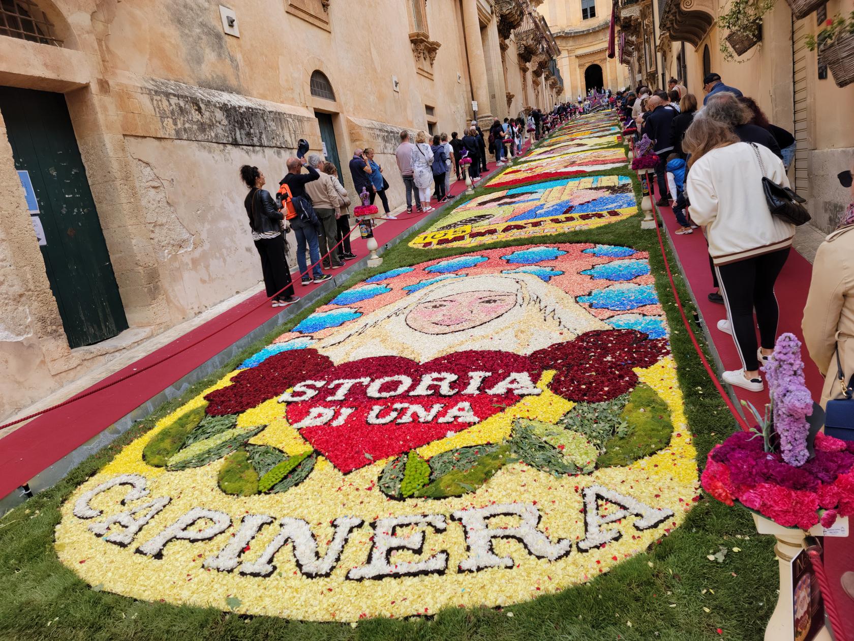
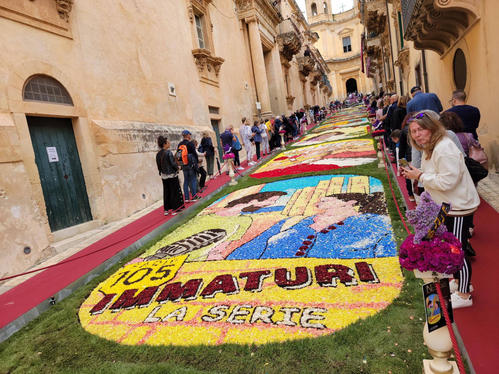
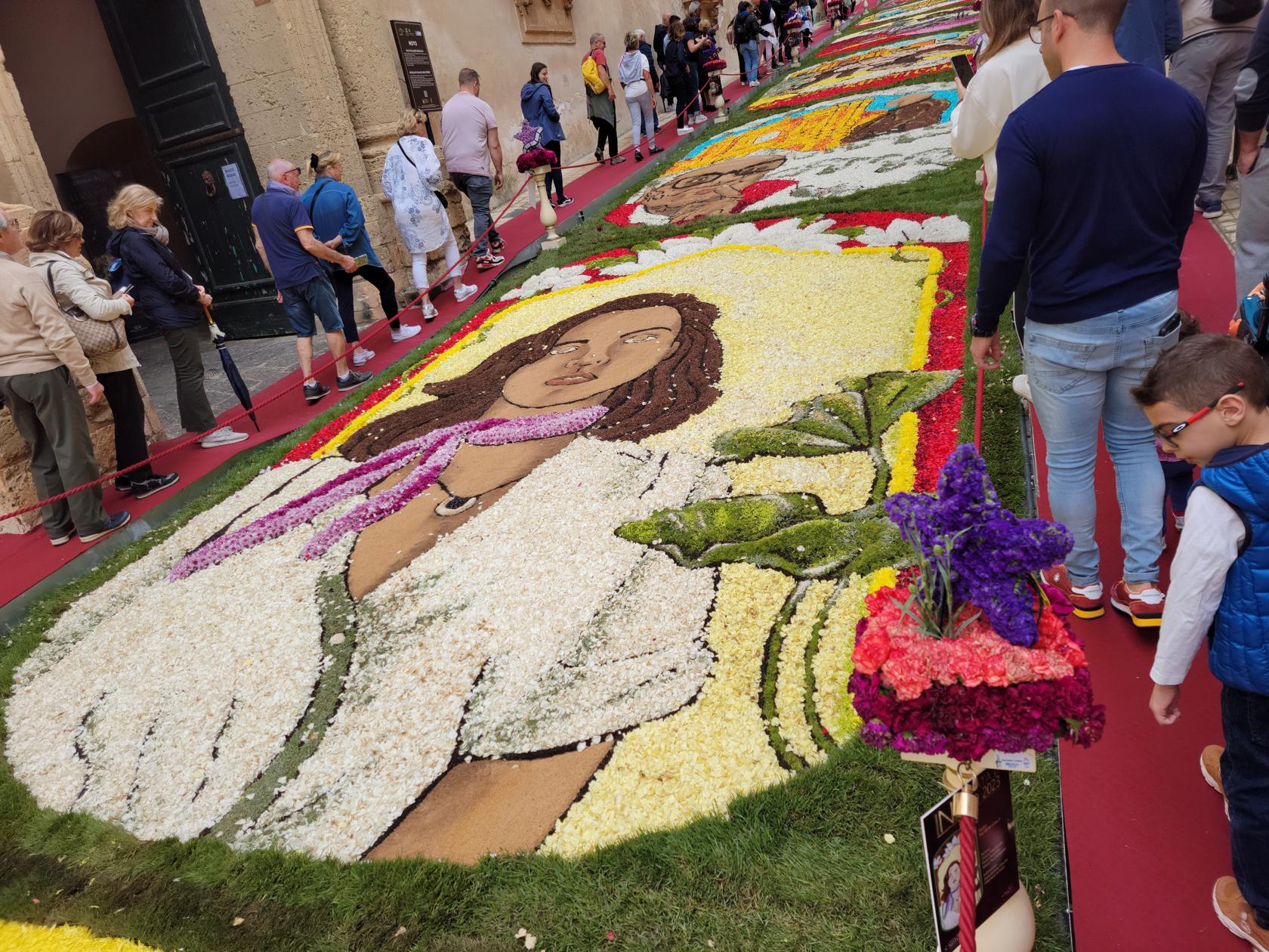
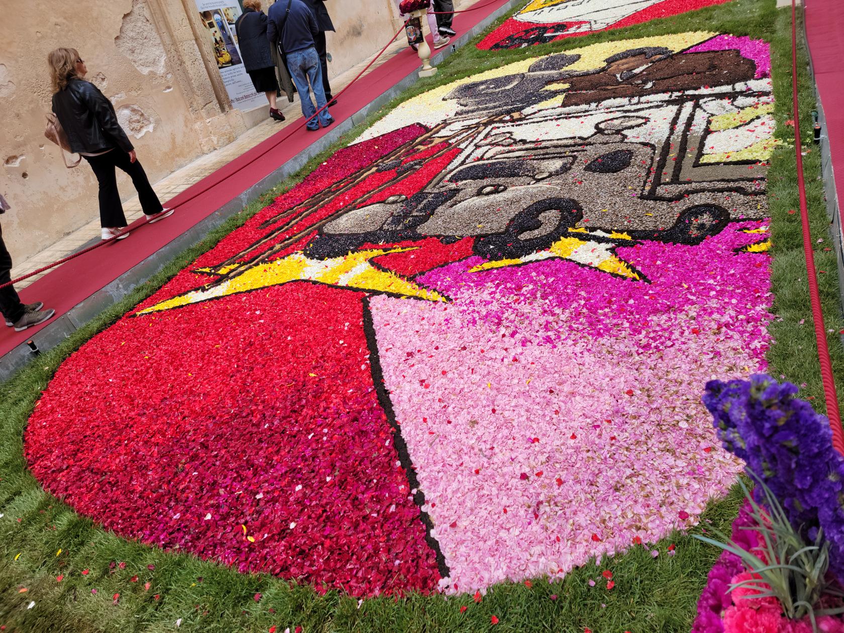
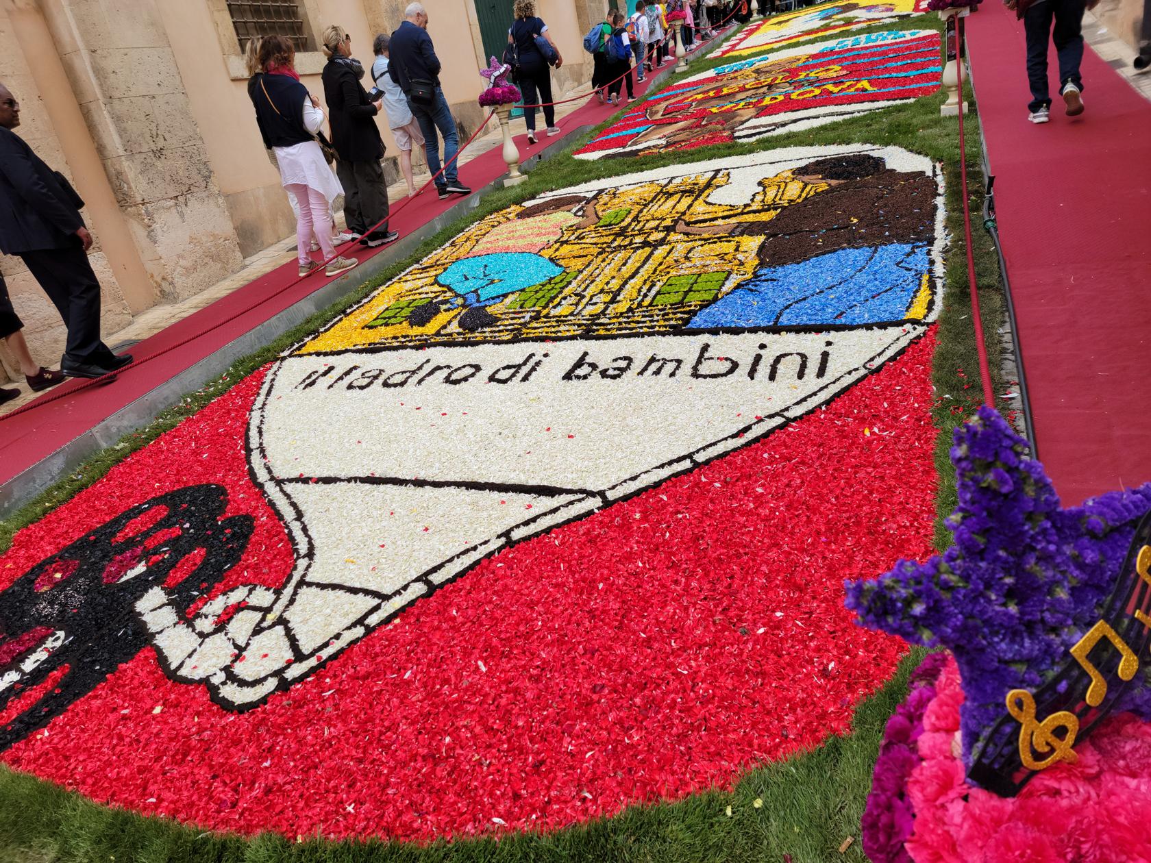
L’Infiorata di Noto
The entrance fee on-site is 3€/person, however we booked our’s through the website and were charge 3.50€/person, plus an additional .60€ for processing. So keep in mind, obtaining your ticket early may not always be the best or most cost effective.
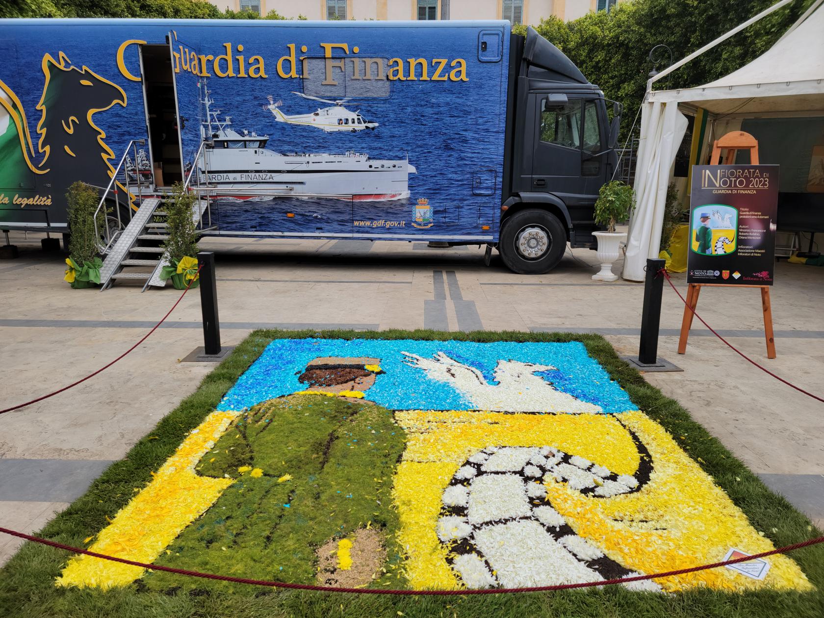
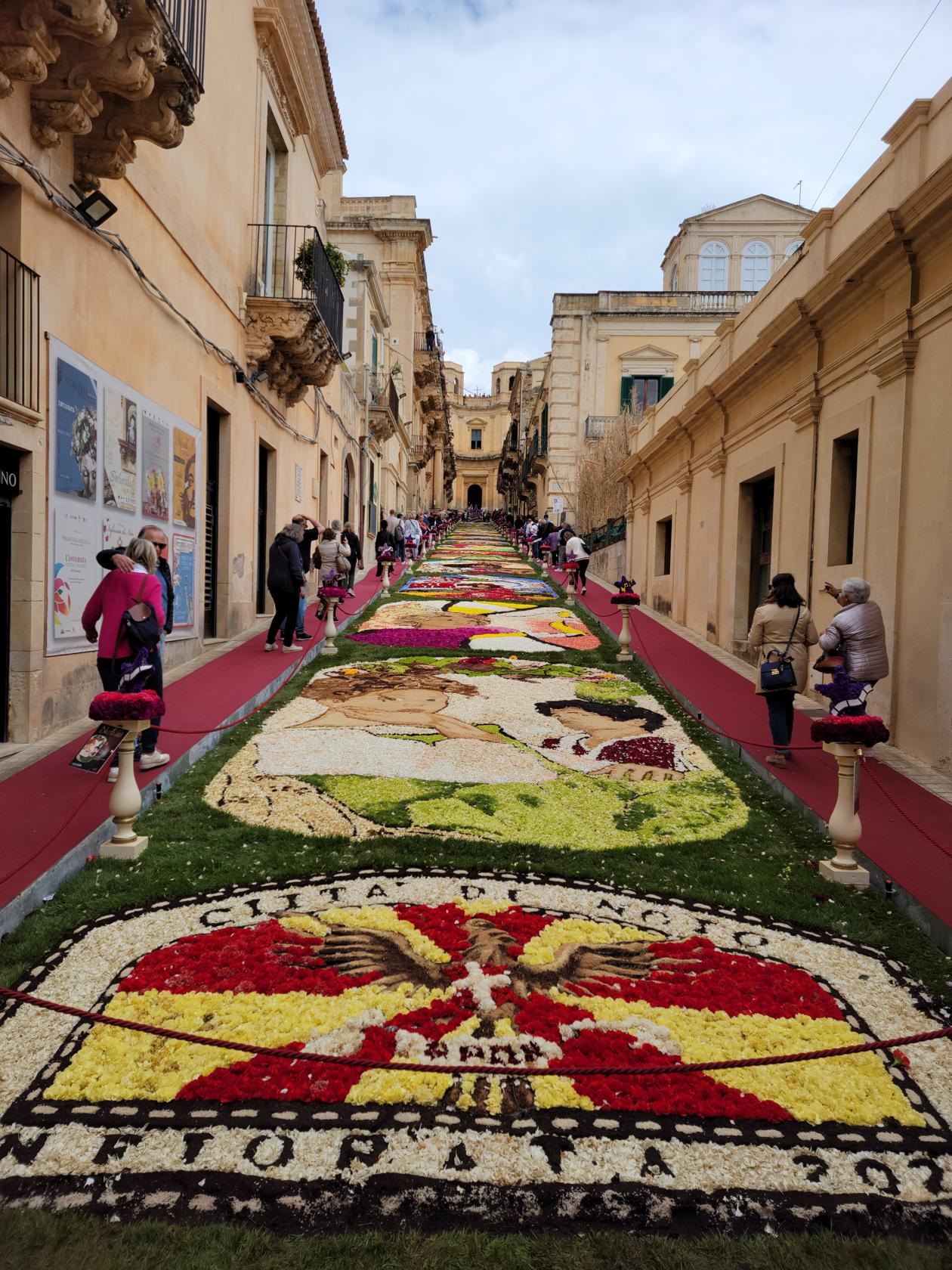
L’Infiorata – Via Corrado Nicolaci – Noto, Sicily
The route of the flower festival is in the center of town and includes the entire street of Via Corrado Nicolaci. This year’s theme was Italian cinema.
L’Infiorata – Finance Office – Noto, Sicily
L’Infiorata – Via Corrado Nicolaci – Noto, Sicily
L’Infiorata – Via Corrado Nicolaci – Noto, Sicily
Patti before the flowers – L’Infiorata – Via Corrado Nicolaci – Noto, Sicily
L’Infiorata – Via Corrado Nicolaci – Noto, Sicily
L’Infiorata – Via Corrado Nicolaci – Noto, Sicily
L’Infiorata – Via Corrado Nicolaci – Noto, Sicily
L’Infiorata – Via Corrado Nicolaci – Noto, Sicily
L’Infiorata – Via Corrado Nicolaci – Noto, Sicily
L’Infiorata – Via Corrado Nicolaci – Noto, Sicily
L’Infiorata – Via Corrado Nicolaci – Noto, Sicily
L’Infiorata – Via Corrado Nicolaci – Noto, Sicily
L’Infiorata – Via Corrado Nicolaci – Noto, Sicily
L’Infiorata – Via Corrado Nicolaci – Noto, Sicily
L’Infiorata – Via Corrado Nicolaci – Noto, Sicily
L’Infiorata – Via Corrado Nicolaci – Noto, Sicily
L’Infiorata – Via Corrado Nicolaci – Noto, Sicily
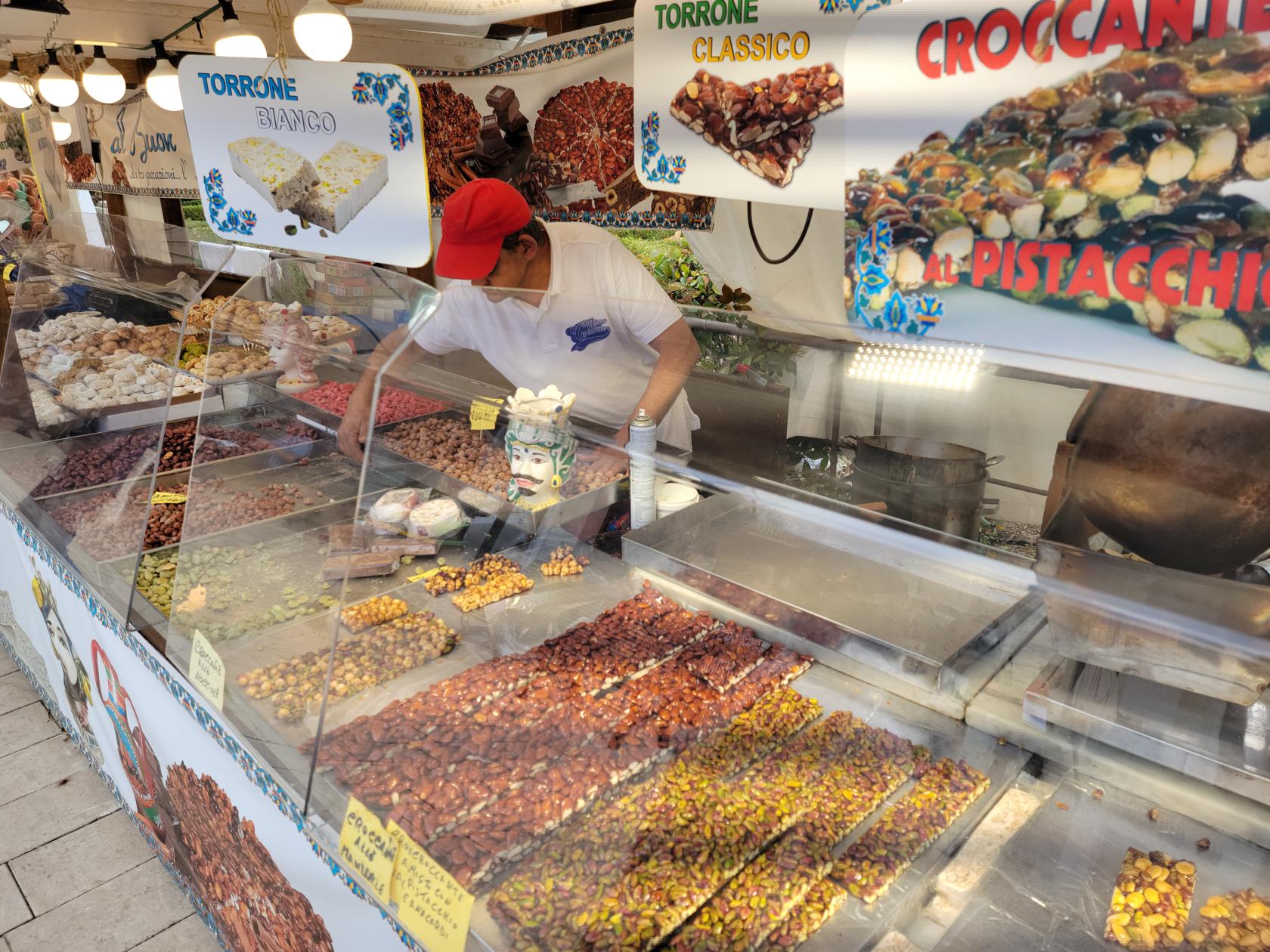
After taking in the flowers, the festival continues down by the Porta Reale Ferdinando and the park Villa Communale off of Corso Victoria Emanuele. Here you can buy all sorts of fair type items, from home-made nutbars, granola bars, specialized candies and other assorted items and drinks.
Porta Reale – Noto, Sicily
Everything pistachio – Noto, Sicily
Festival vendors – Noto, Sicily
Festival vendors – Noto, Sicily
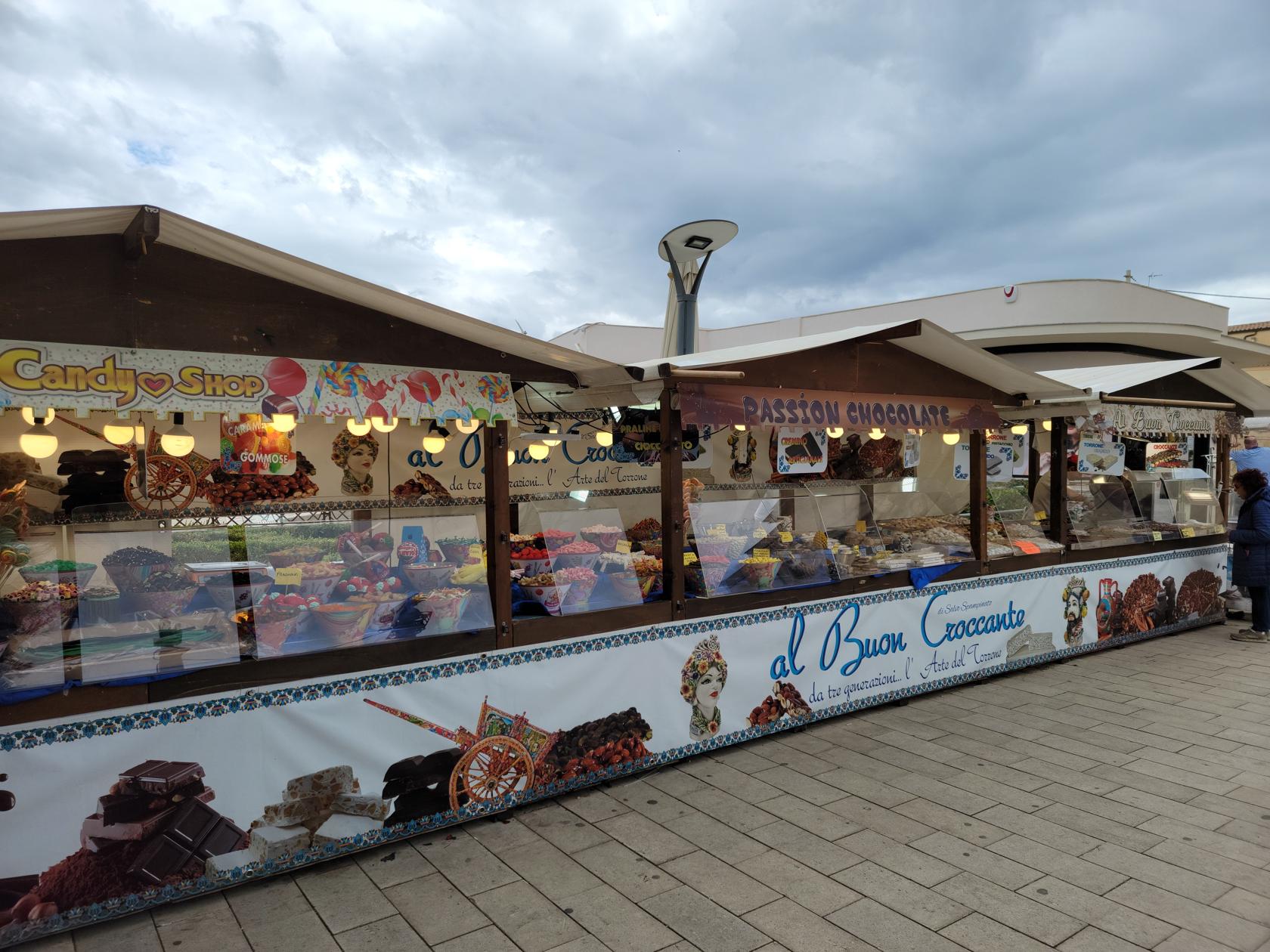
Restaurants
We only ate lunch here, but the place we originally chose was closed on Tuesdays, so we had to adapt and chose another place, which was timely, because the weather was not cooperating again.
Cortes Restaurant
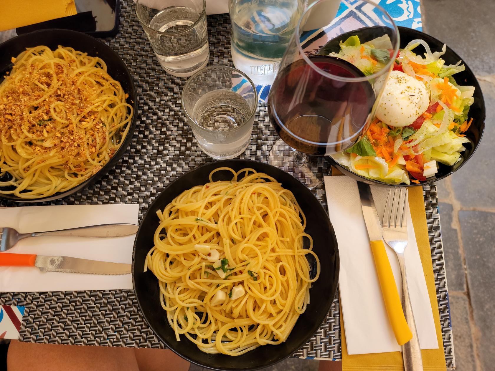
Situated on the main shopping thoroughfare in the middle of town is Cortes Ristorante. Here one may easily find a typical Italian dish to enjoy for lunch. I ordered an Insalate Mista and Spaghetti with garlic and oil, Patti ordered the Spaghetti with garlic and oil along with crushed pistachios. The food was very good and the prices were reasonable.
Cortes Ristorante – Noto, Sicily
Spaghetti with garlic, oil, peppenchini and with and without pistachios. Red Wine and Insalata Mista – Cortes Ristorante – Noto, Sicily
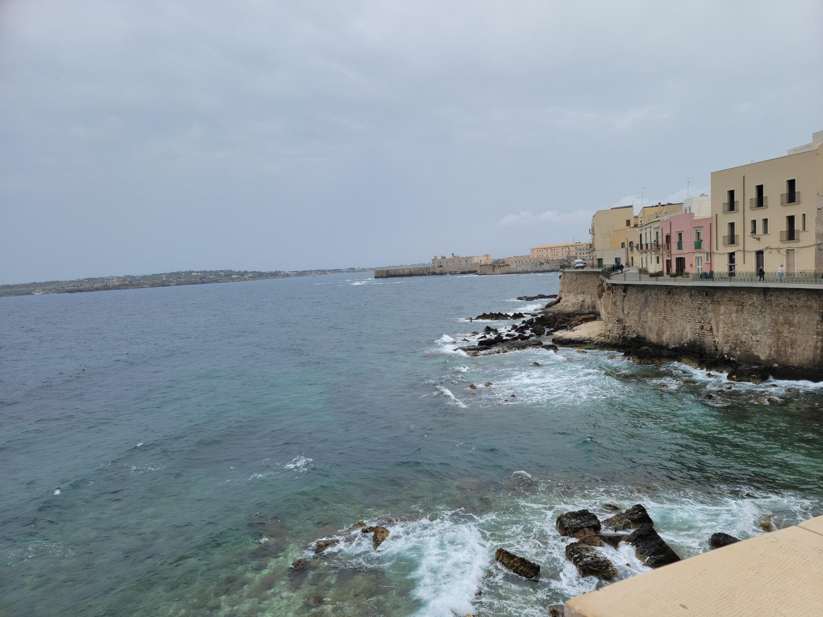
Syracuse, or Siracusa as you will find it readily marked throughout the island, is one of the first places of historic significance within Italy. It was inhabited in ancient times and finally settled by the Greeks in the early eight century BCE.
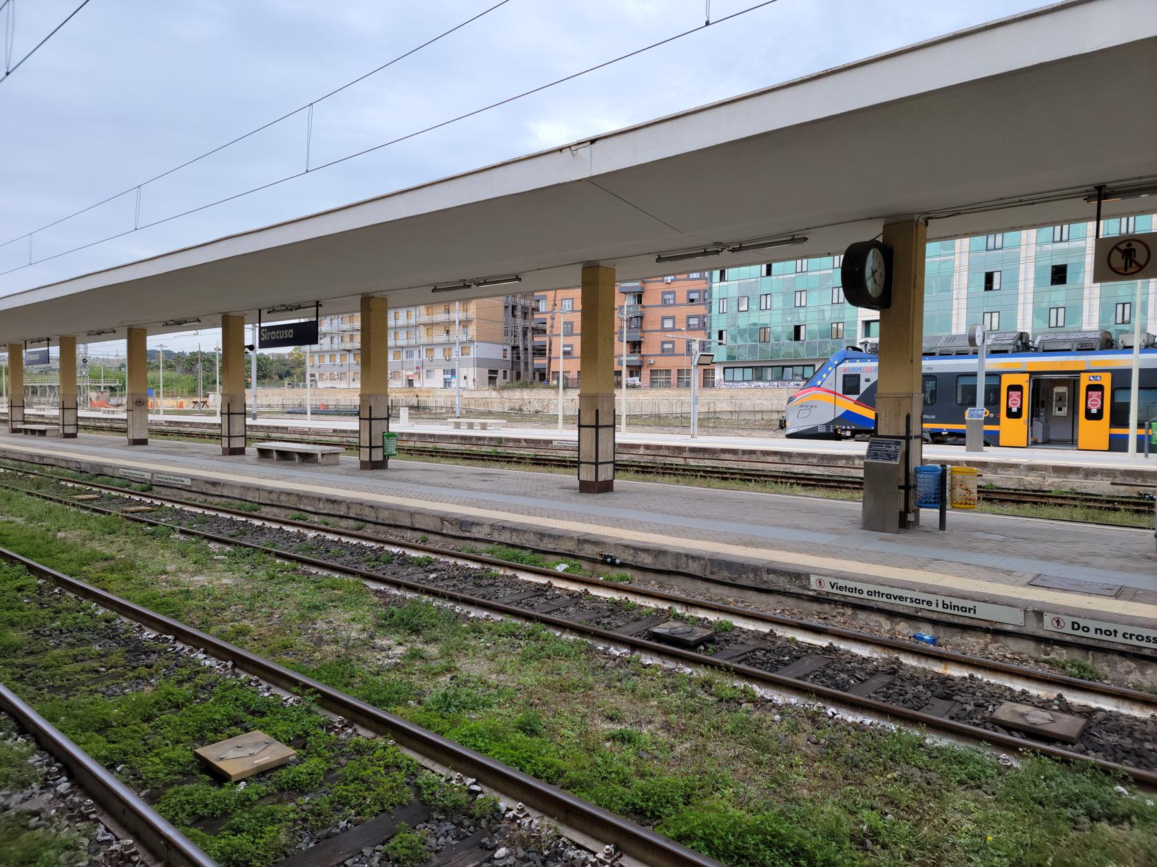
Siracusa Centrale – Siracusa, Sicily
Siracusa Centrale – Siracusa, Sicily
The original settlement of the Greeks was on the small island of Ortigia, which still contains several historical and archaeological artifacts from the Greek and Roman periods. See the Ortigia section below for more on that part of the commune and city.
Church of San Tommaso at the Pantheon – Siracuse, Sicily
Santa Lucia Seplicur – Siracuse, Sicily
Santa Lucia Seplicur – Siracuse, Sicily
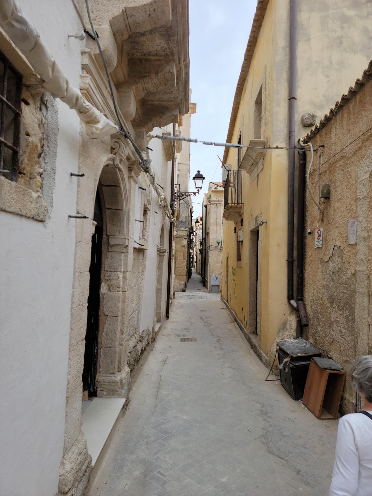
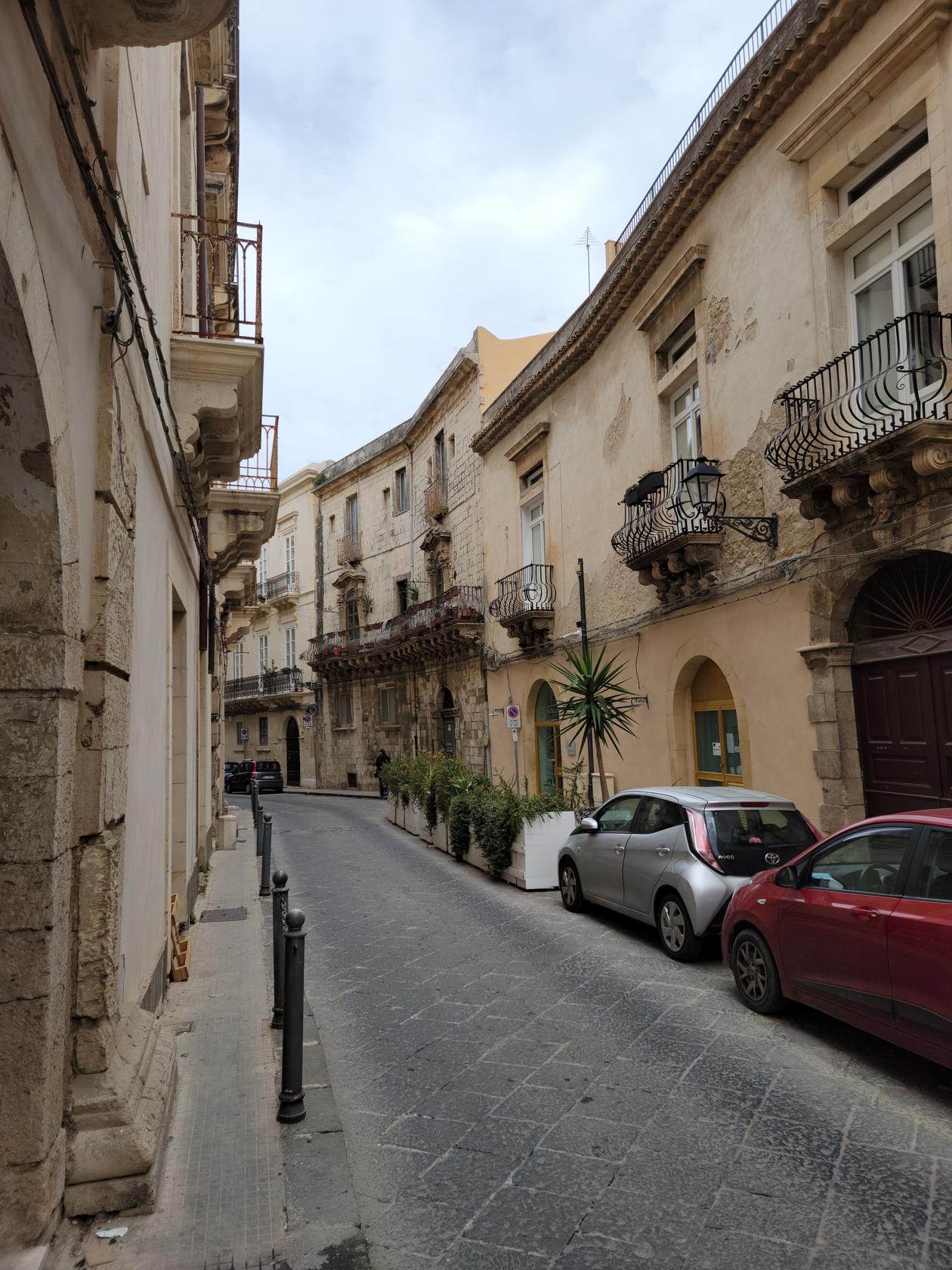
Alley – Ortigia – Siracusa, Sicily
Via Dei Candelai – Ortigia – Siracusa, Sicily
Narrow alley – Siracusa, Sicily
Side street – Siracusa, Sicily
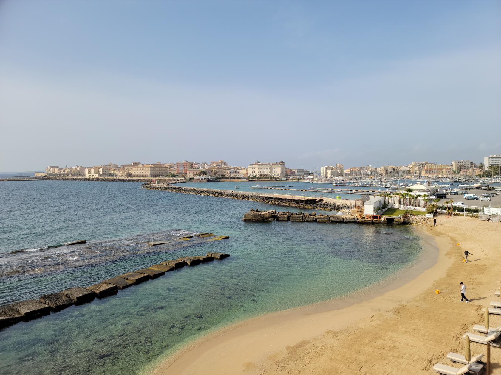
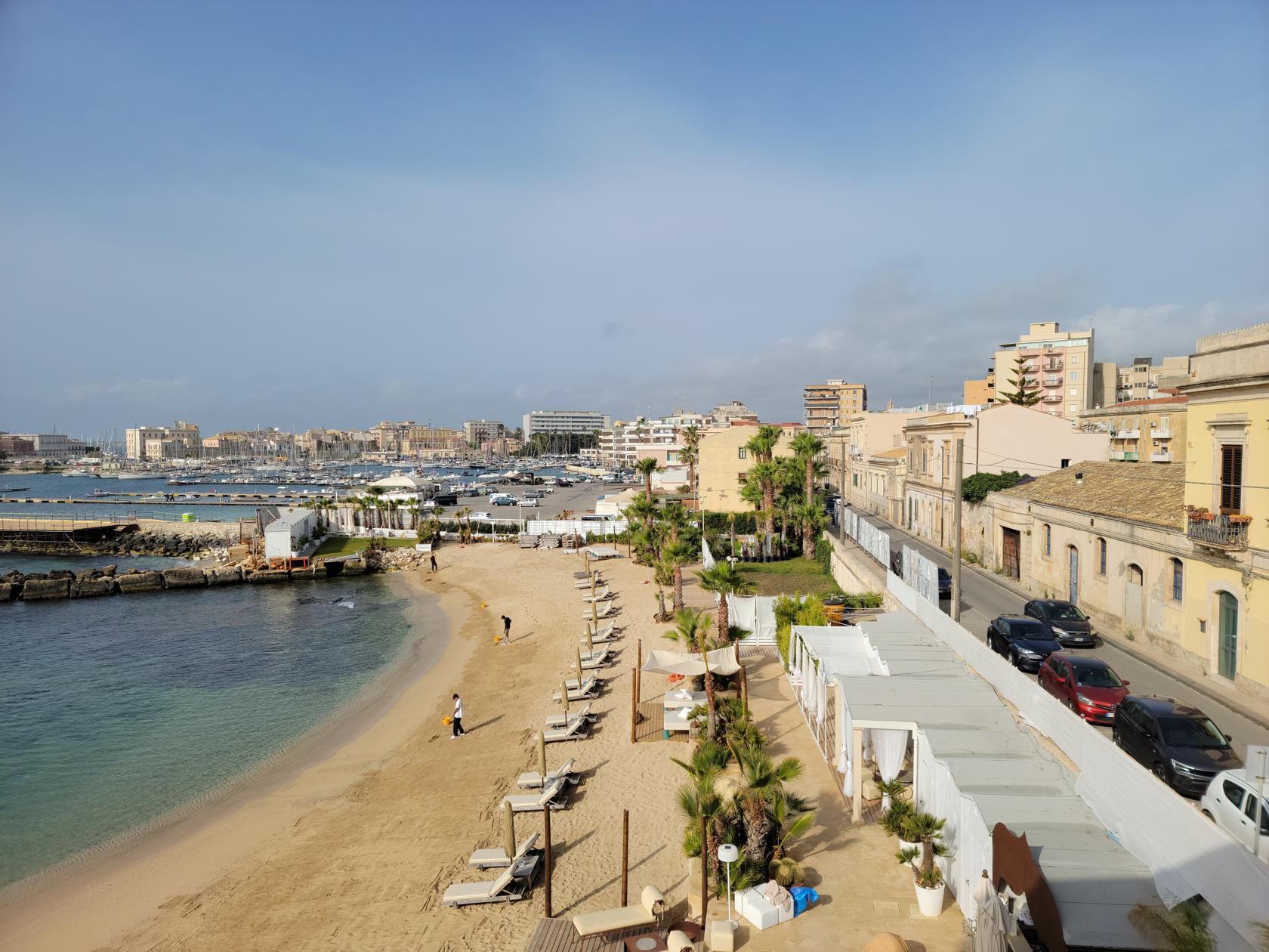
Syracuse is divided into three main parts, Ortigia the island and original Greek settlement, Santa Lucia along the coast and the location of our hotel, and the Neapolis the location of the major Greek and Roman ruins .
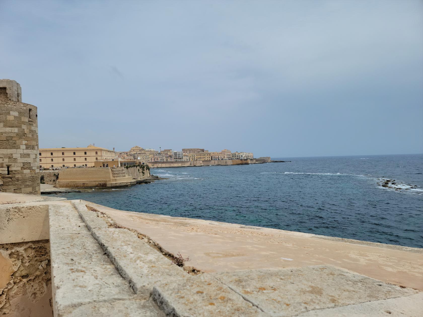
Ionian Sea – Siracusa, Sicily
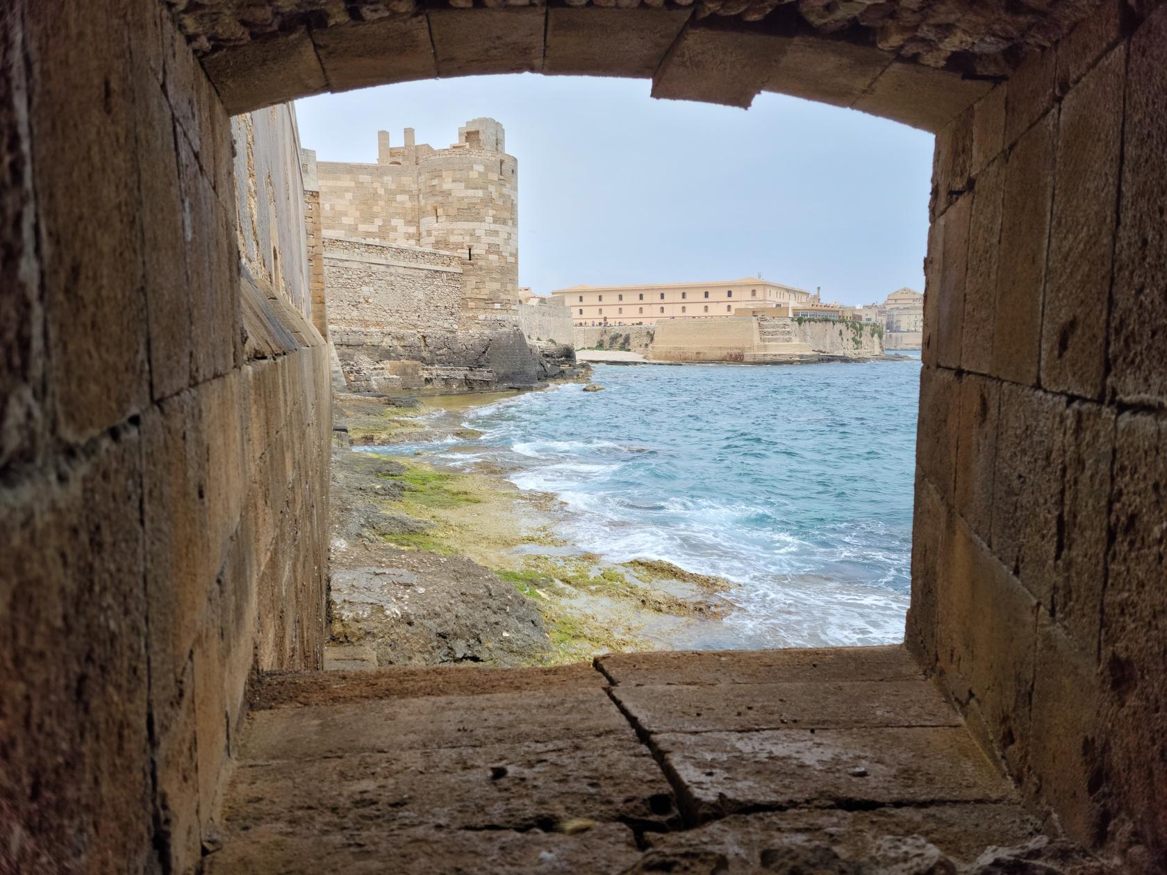
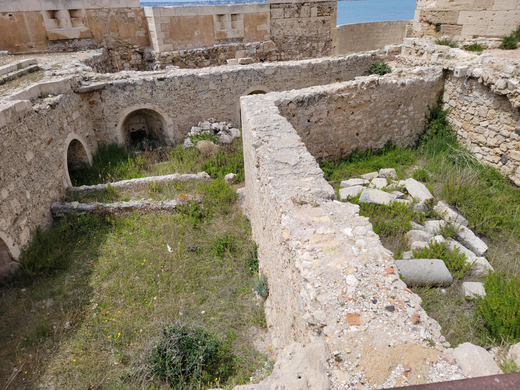
Fort Vigliena – Siracusa, Sicily
Fort Vigliena – Siracusa, Sicily
Fort Vigliena – Siracusa, Sicily
If you are at this point wondering what ash and puppets have to do with Sicily, and in particular Syracuse, read further. Otherwise, just rest assured it has everything to do with being on this quaint and wonderful island.
Note: Purchase the Museum and Park Combination Ticket at 18€. If you purchase them separately, it will cost you an extra 8€. The combination ticket will get you into both, with money left over for a light lunch.
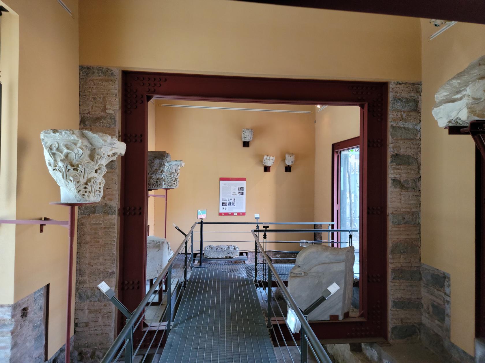
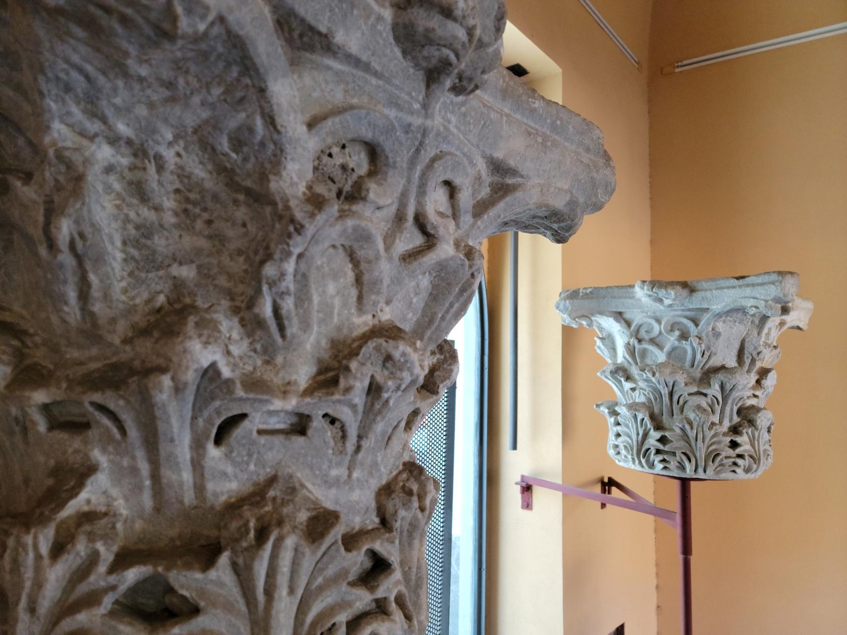
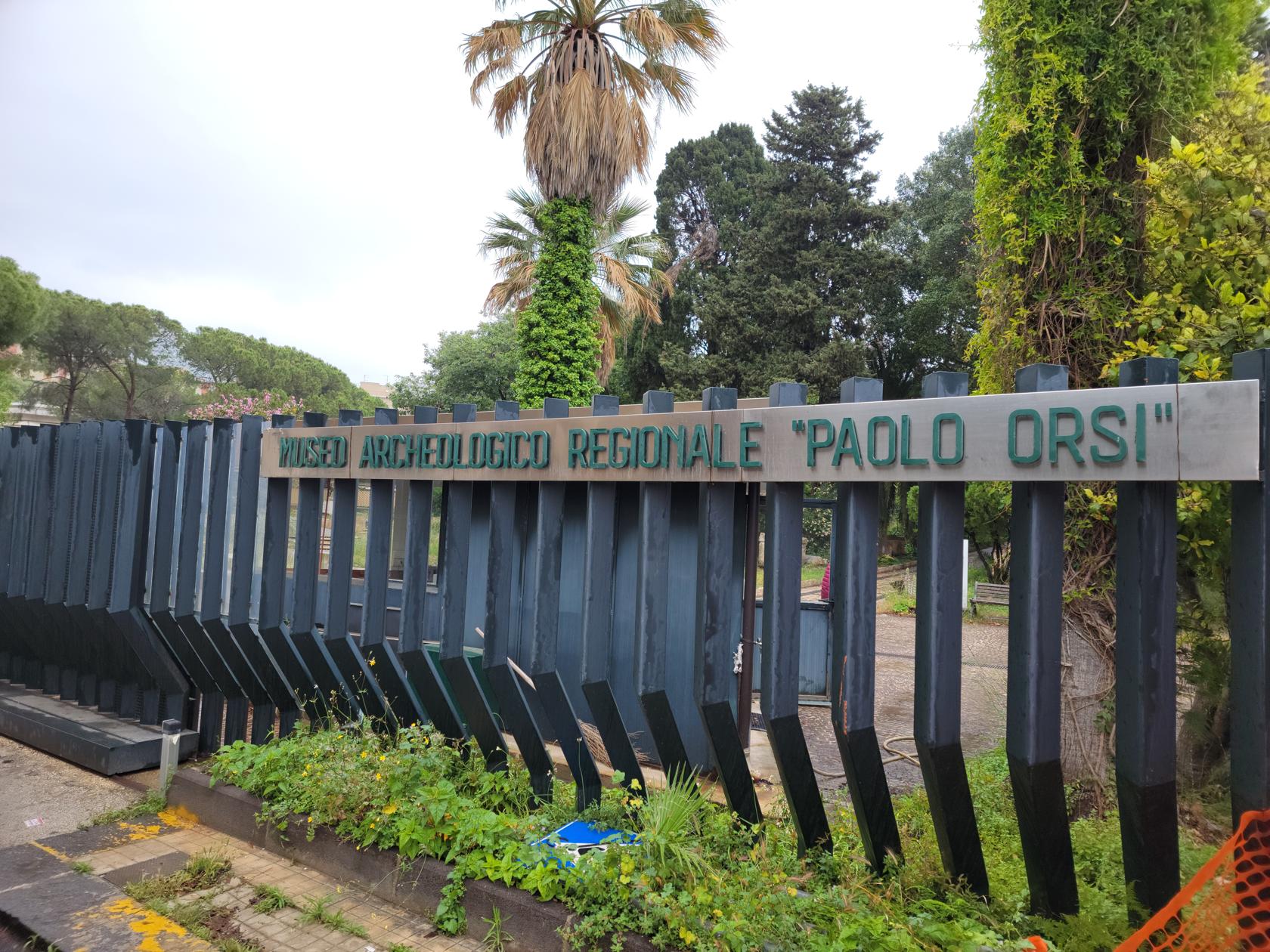
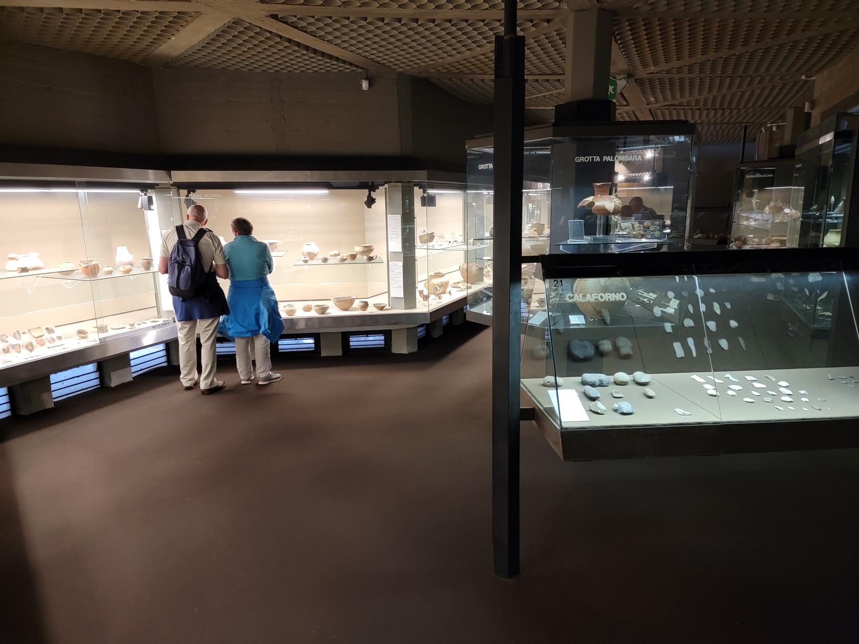
Archaeological Museum
The Archaeological Museum is an impressive collection of ancient, Greek and Roman artifacts dating back to the seventh and eighth centuries.
Entrance – Archaeological Museum Paolo Orsi – Siracuse, Sicily
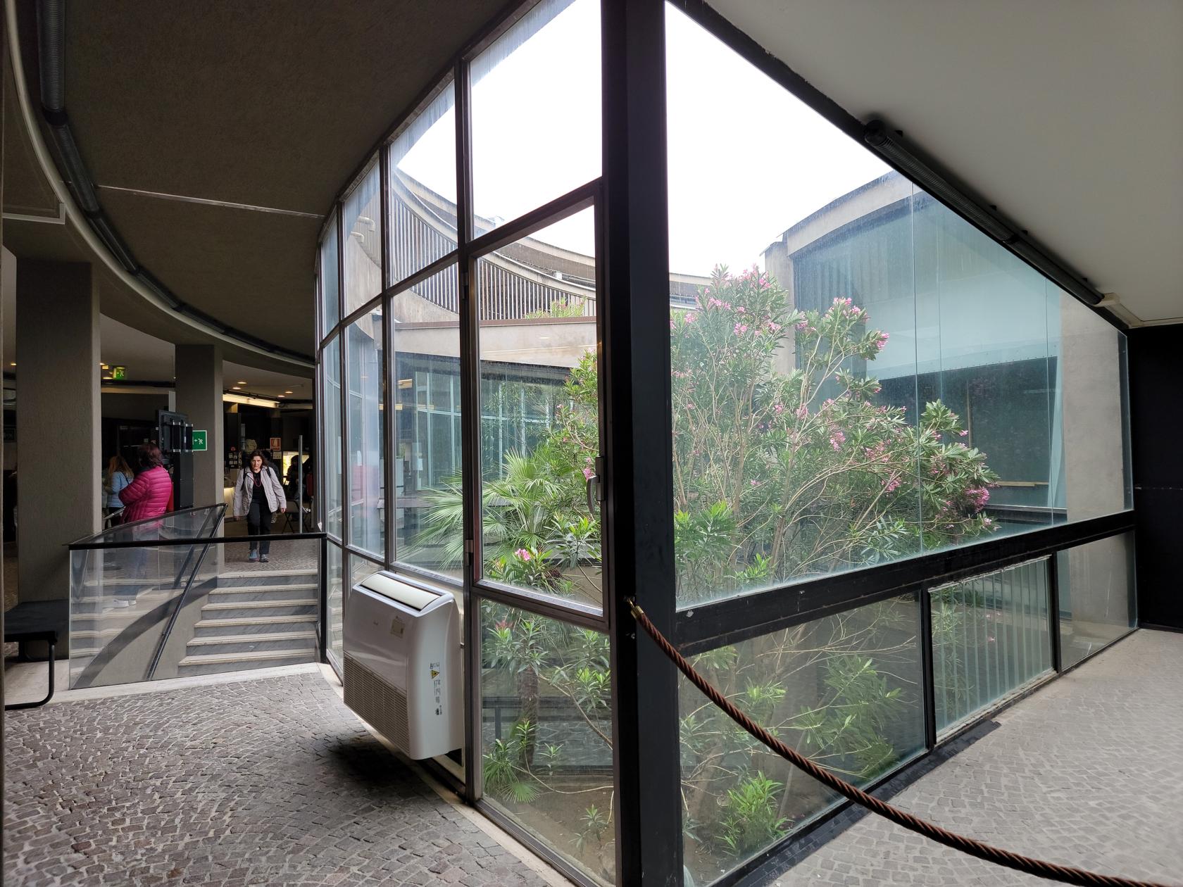
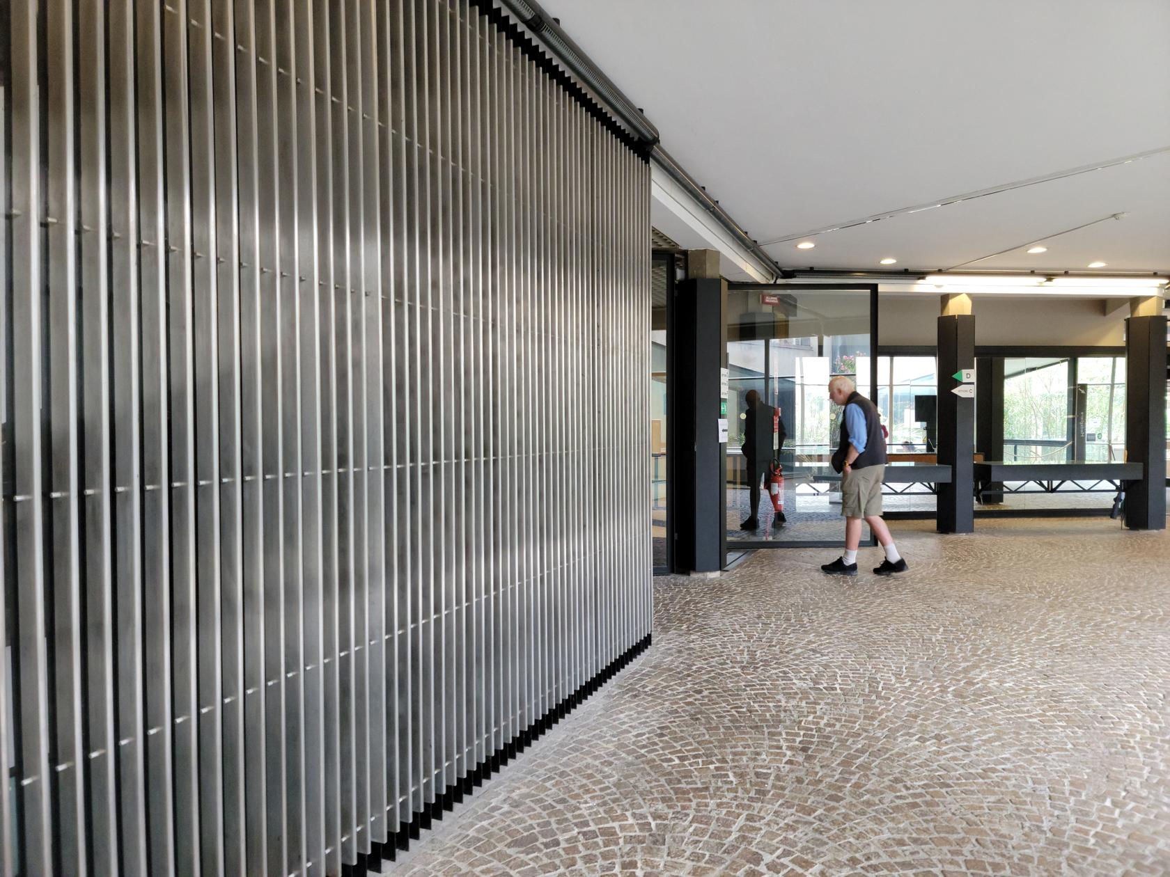
The museum’s interior – Archaeological Museum Paolo Orsi – Siracuse, Sicily
Entrance to one of its sections – Archaeological Museum Paolo Orsi – Siracuse, Sicily
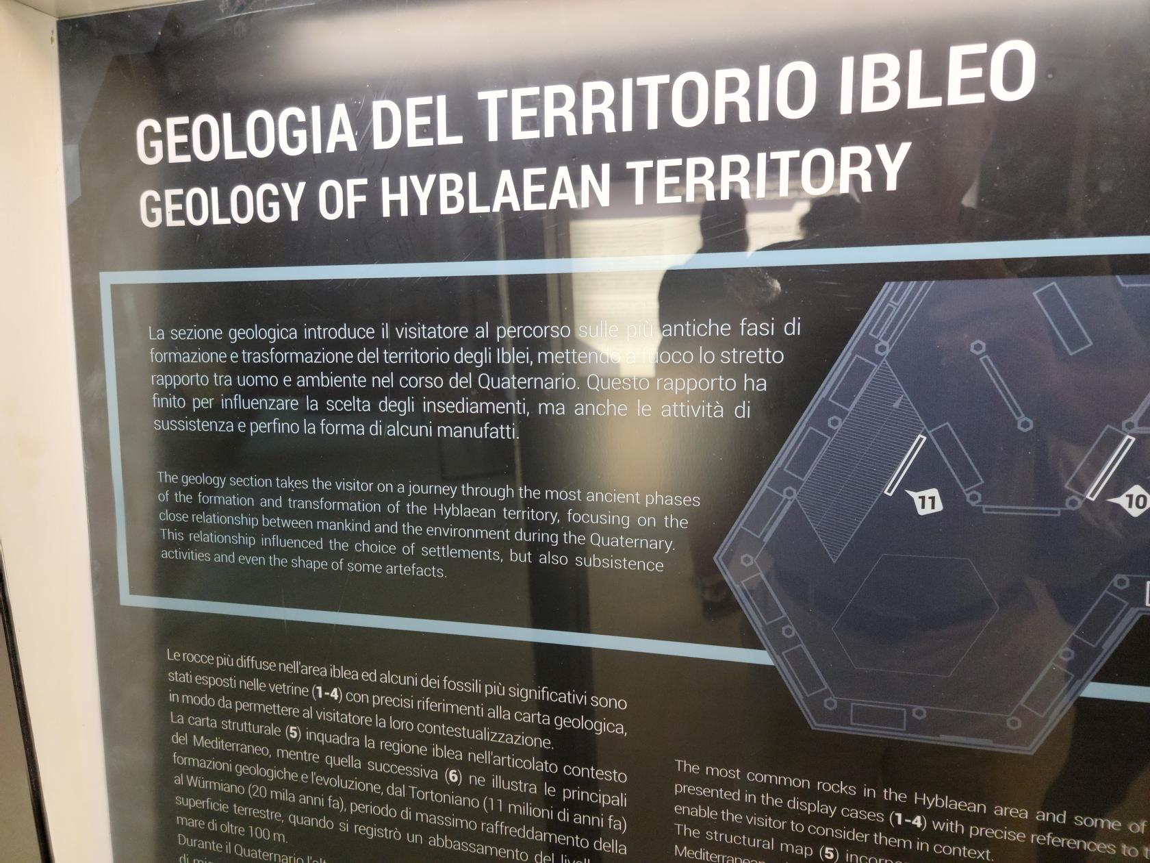
Geology – Archaeological Museum Paolo Orsi – Siracuse, Sicily
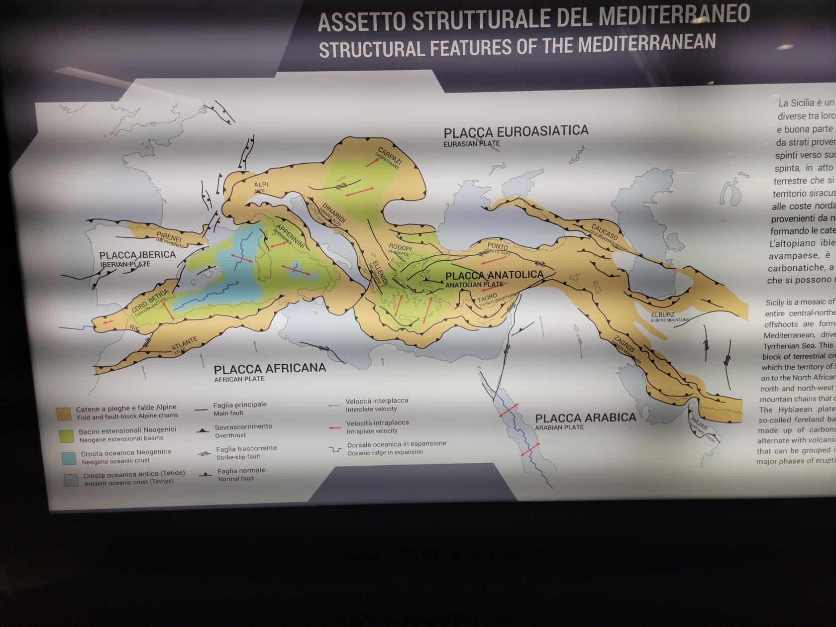
The museum handles each time period in a sequential fashion, starting with the ancient period of the pre-historic animals and tectonic changes to the area, all the way to the arrival of the Greeks and other colonial powers.
Tectonic plates of Italy – Archaeological Museum Paolo Orsi – Siracuse, Sicily
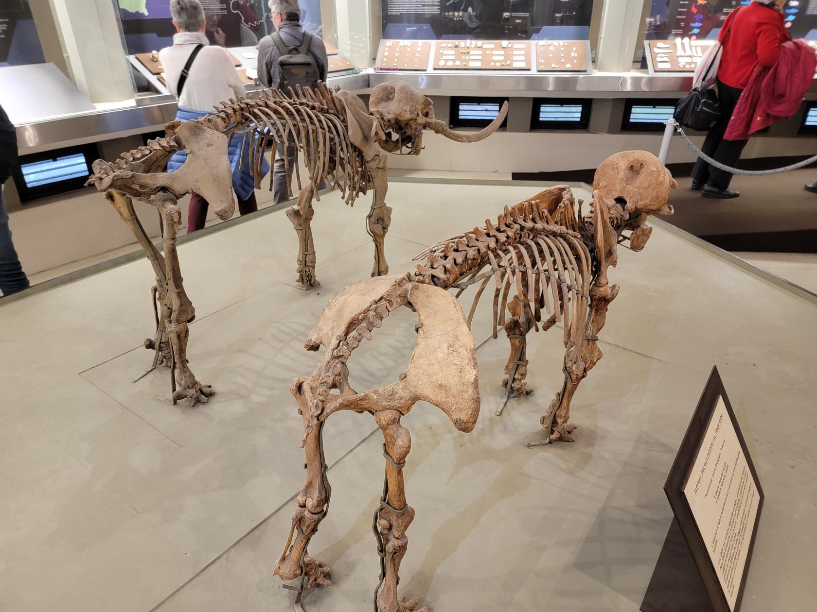
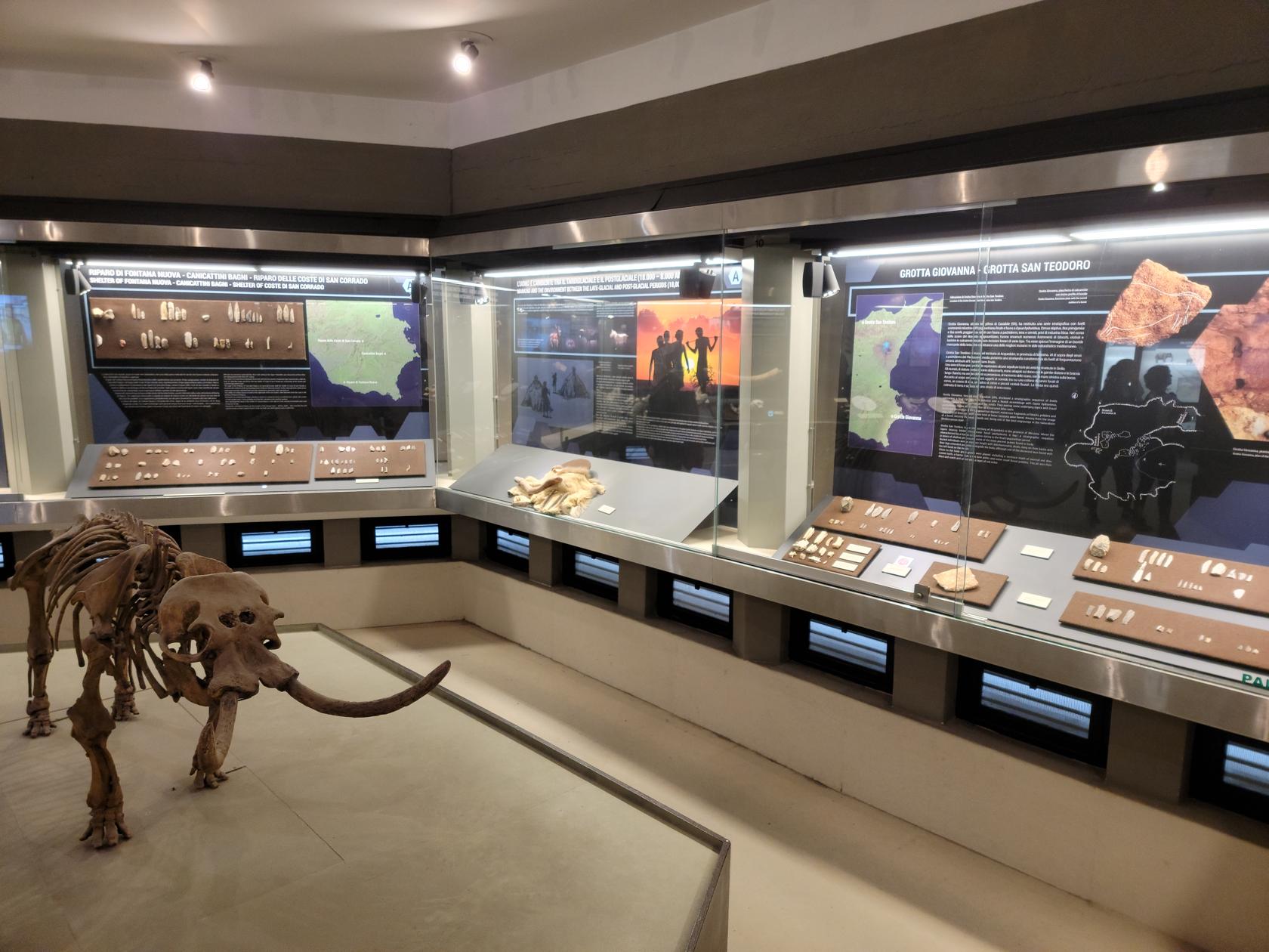
Pygmied elephant and hippopotamus – Archaeological Museum Paolo Orsi – Siracuse, Sicily
Fossils – Archaeological Museum Paolo Orsi – Siracuse, Sicily
Fossil section – Archaeological Museum Paolo Orsi – Siracuse, Sicily
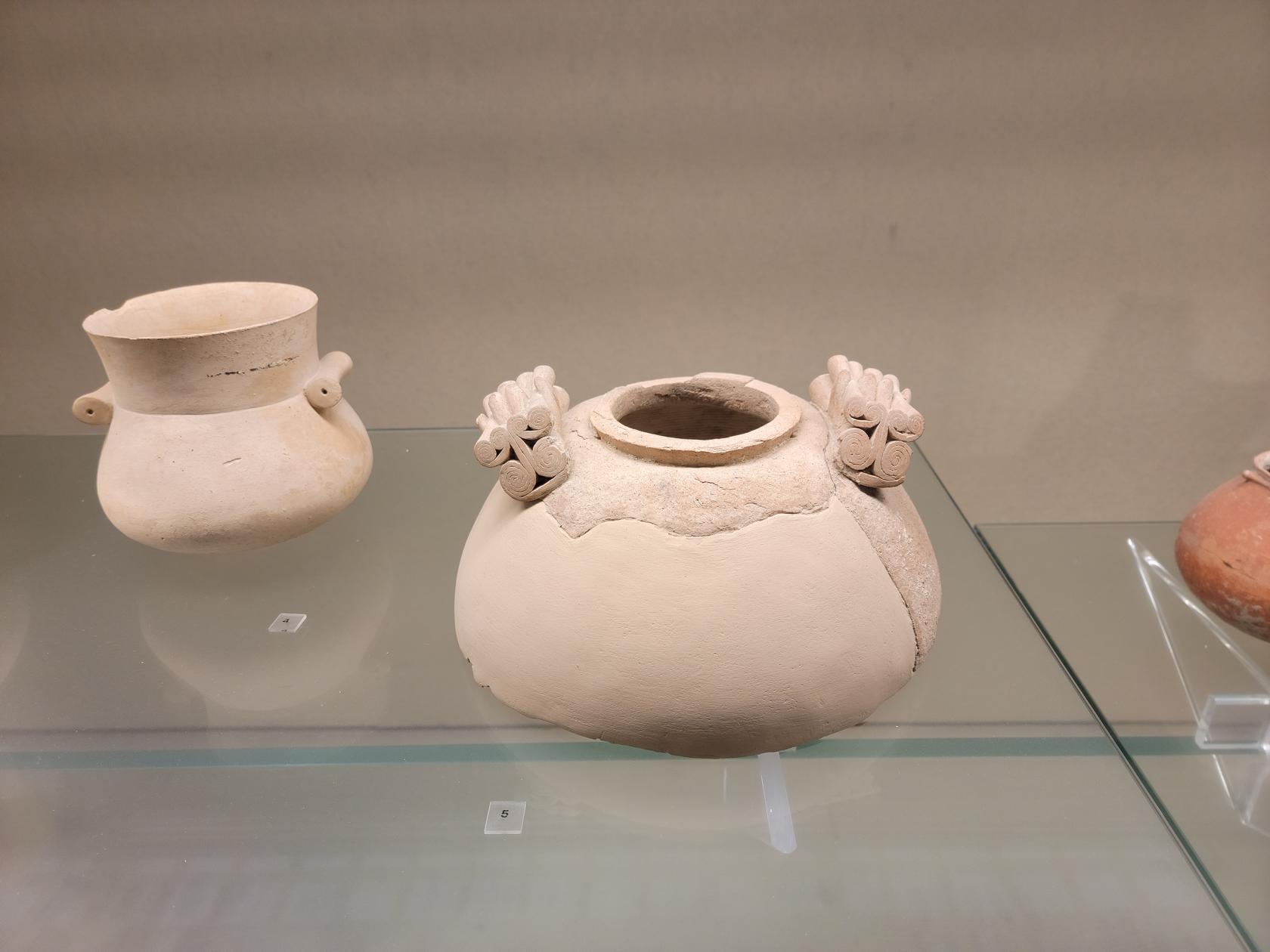
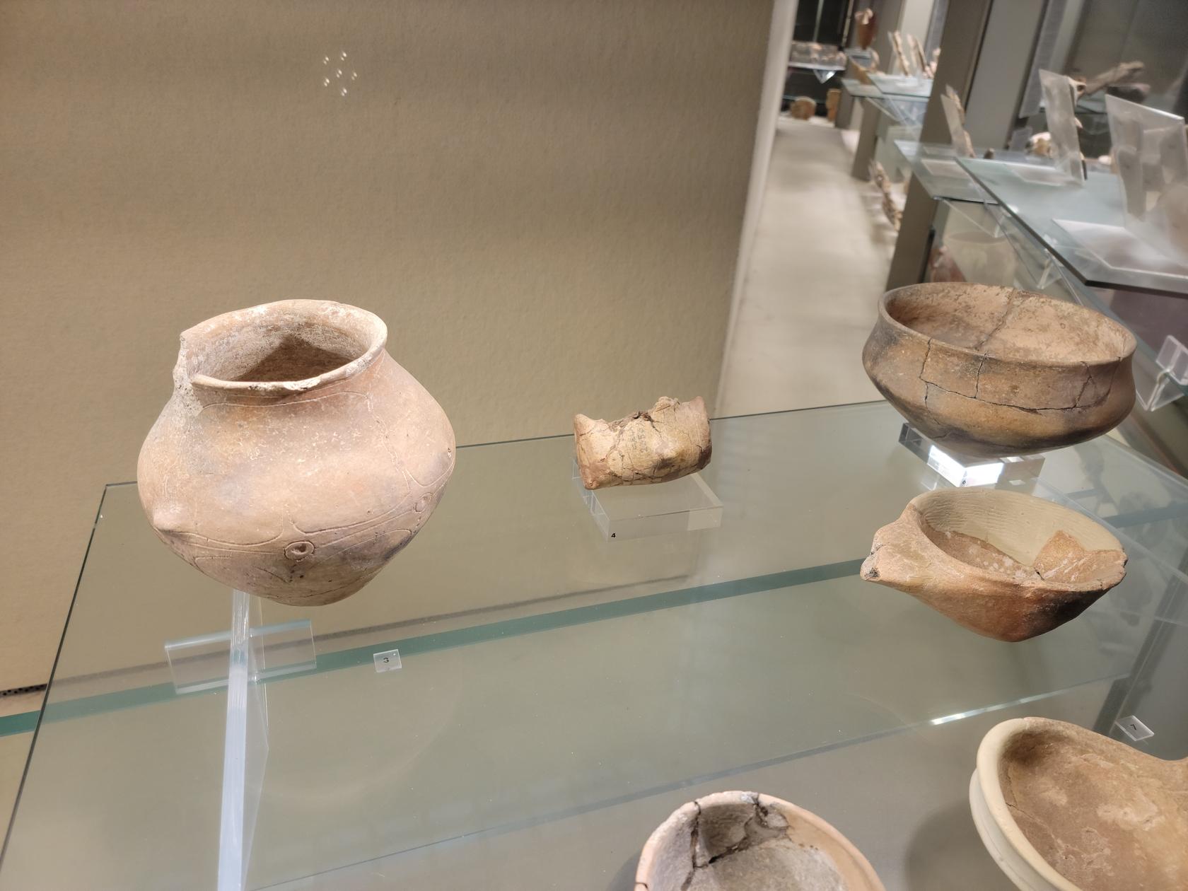
Prehistoric inhabitants jars – Archaeological Museum Paolo Orsi – Siracuse, Sicily
Old vases – Archaeological Museum Paolo Orsi – Siracuse, Sicily
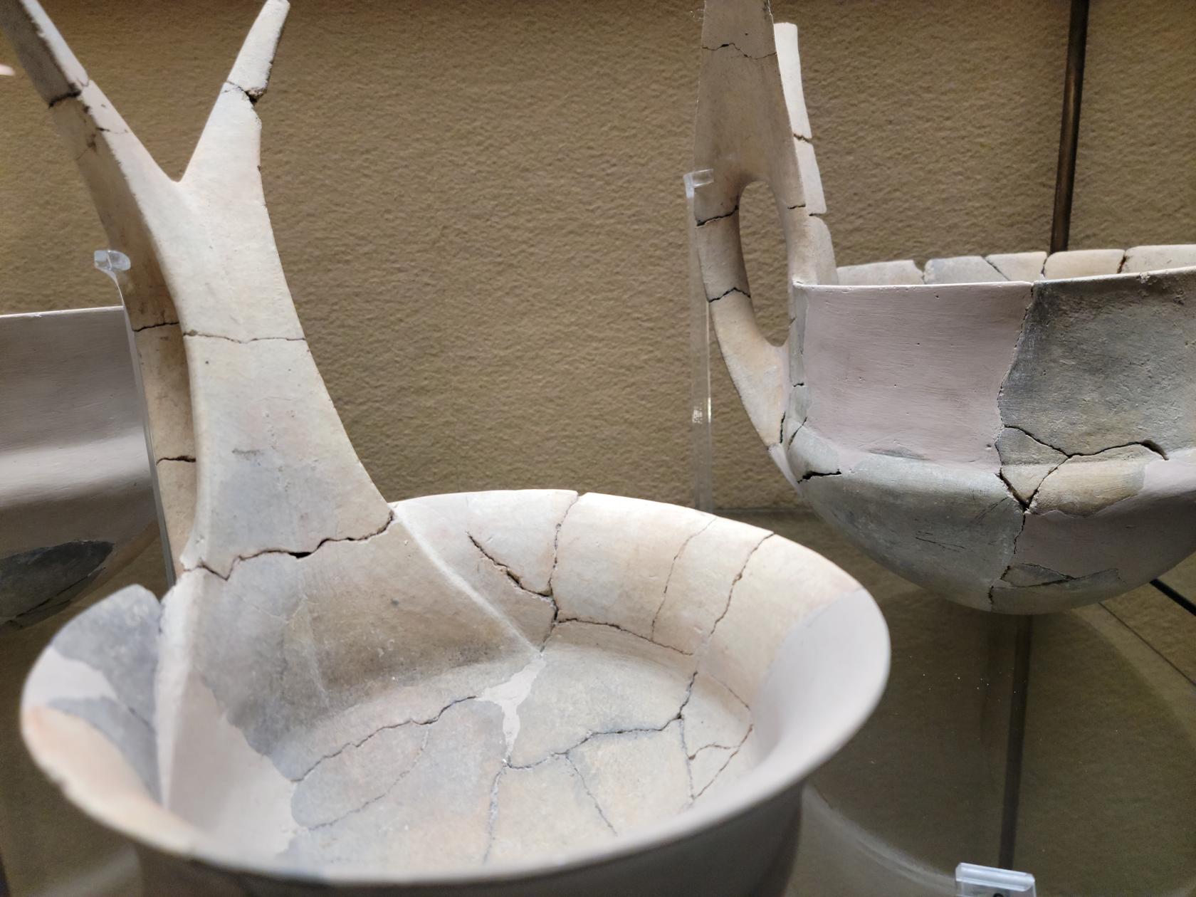
Dipping bowls – Archaeological Museum Paolo Orsi – Siracuse, Sicily
Dipping bowls with stemmed handles – Archaeological Museum Paolo Orsi – Siracuse, Sicily
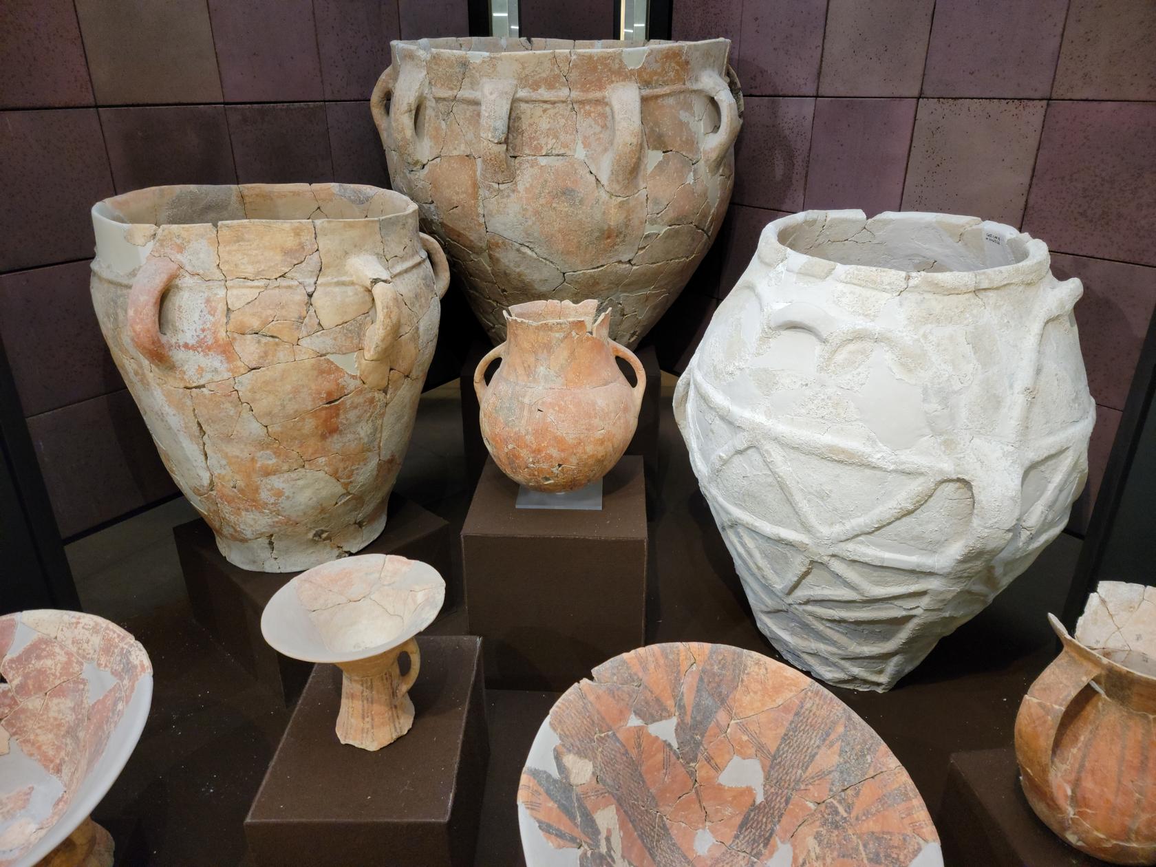
Intricate vases and vessels – Archaeological Museum Paolo Orsi – Siracuse, Sicily
Urns and other vessels – Archaeological Museum Paolo Orsi – Siracuse, Sicily
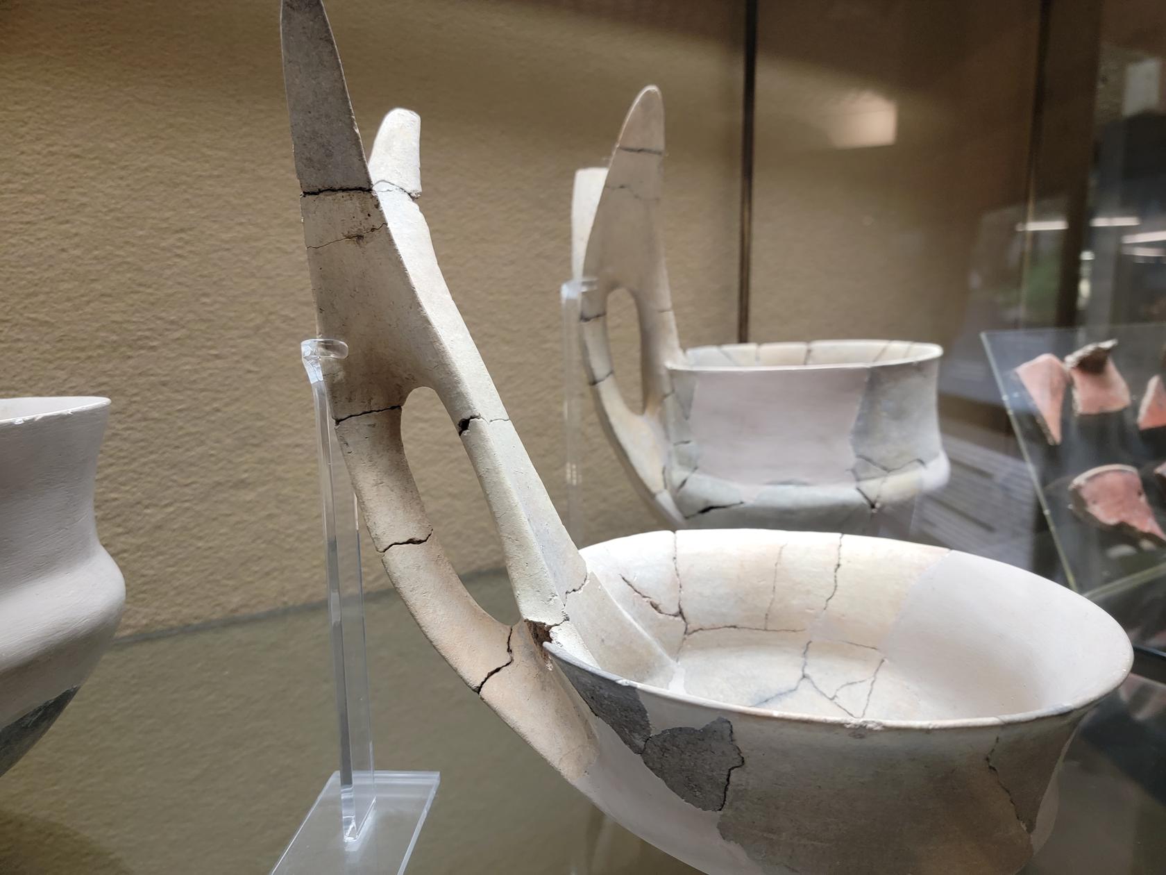
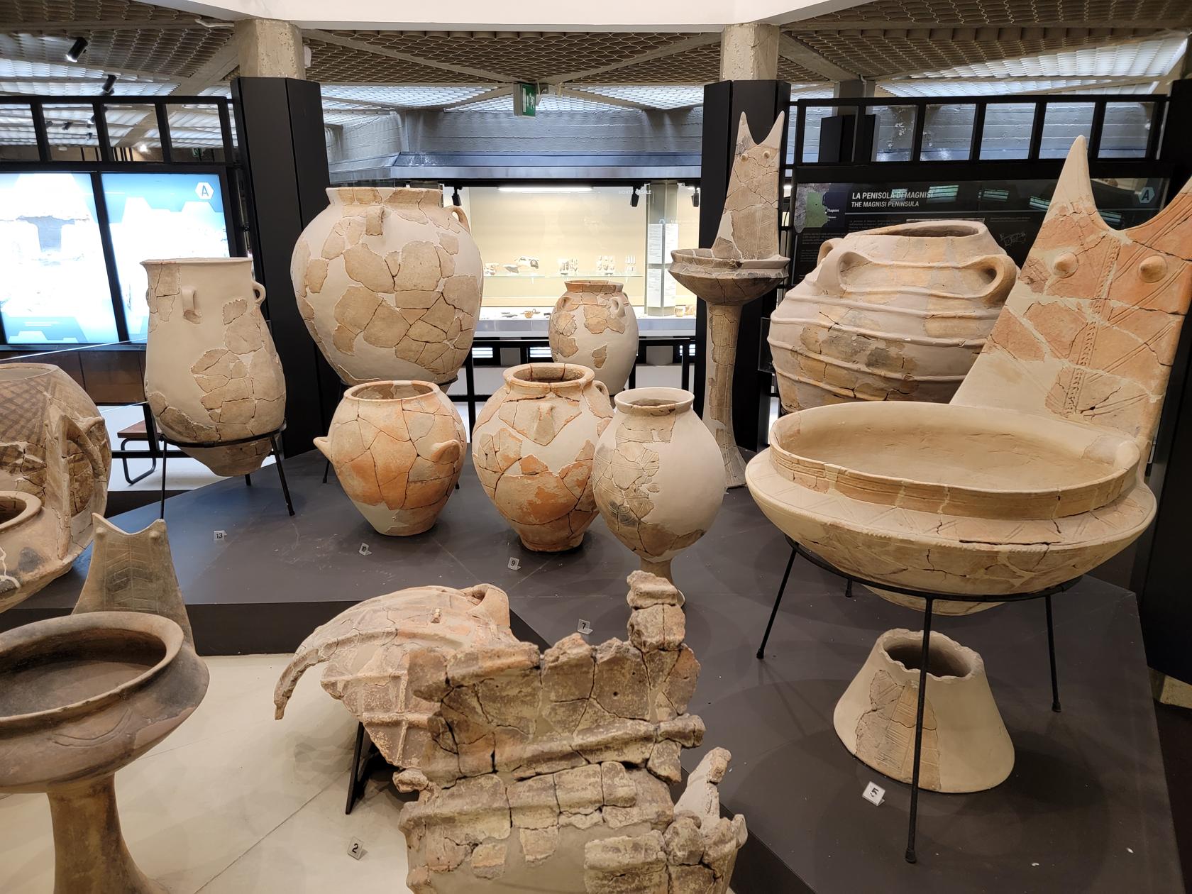
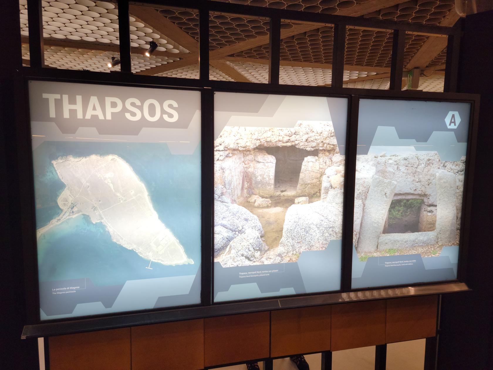
Thapsos collection – Archaeological Museum Paolo Orsi – Siracuse, Sicily
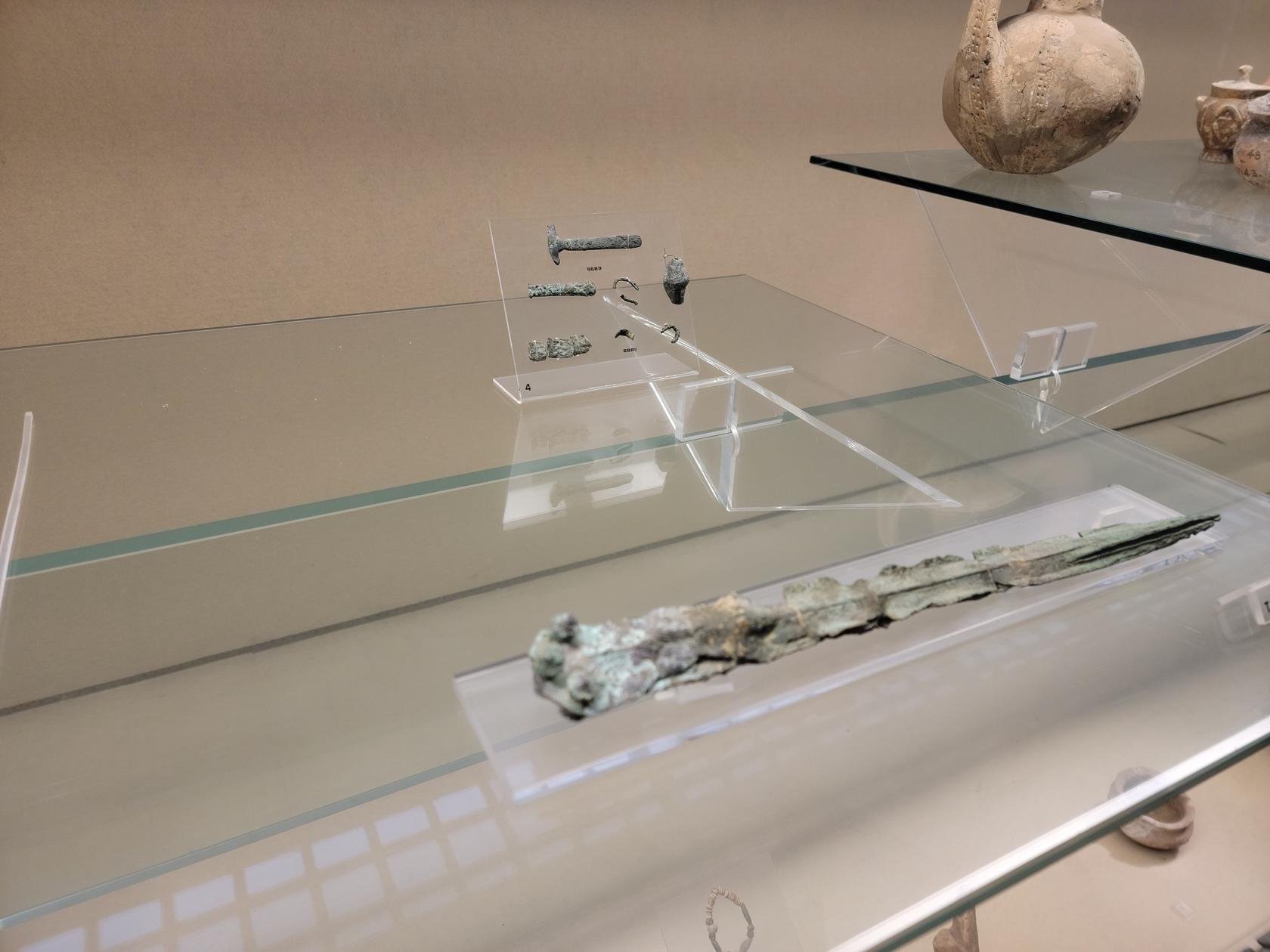
Bronze dagger – Archaeological Museum Paolo Orsi – Siracuse, Sicily
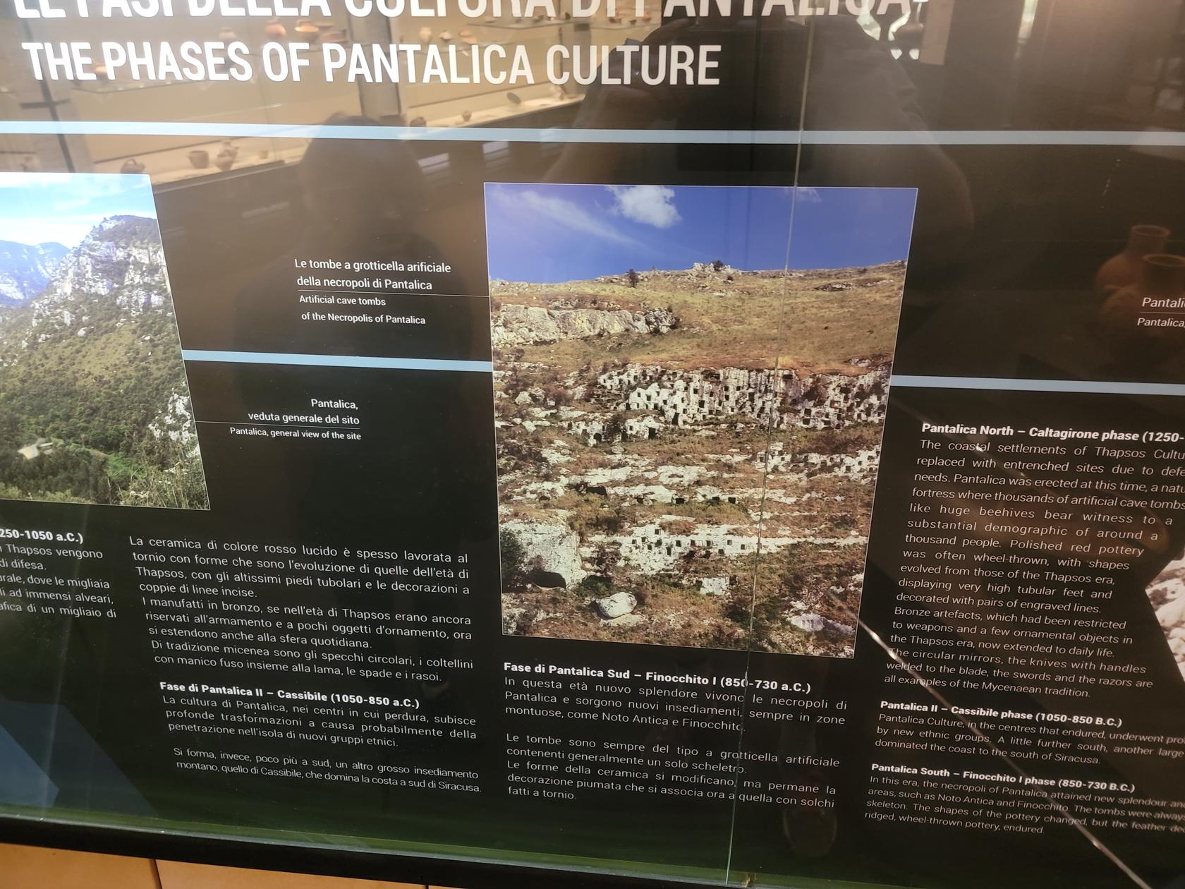
The burial sites of Pantalica – Archaeological Museum Paolo Orsi – Siracuse, Sicily
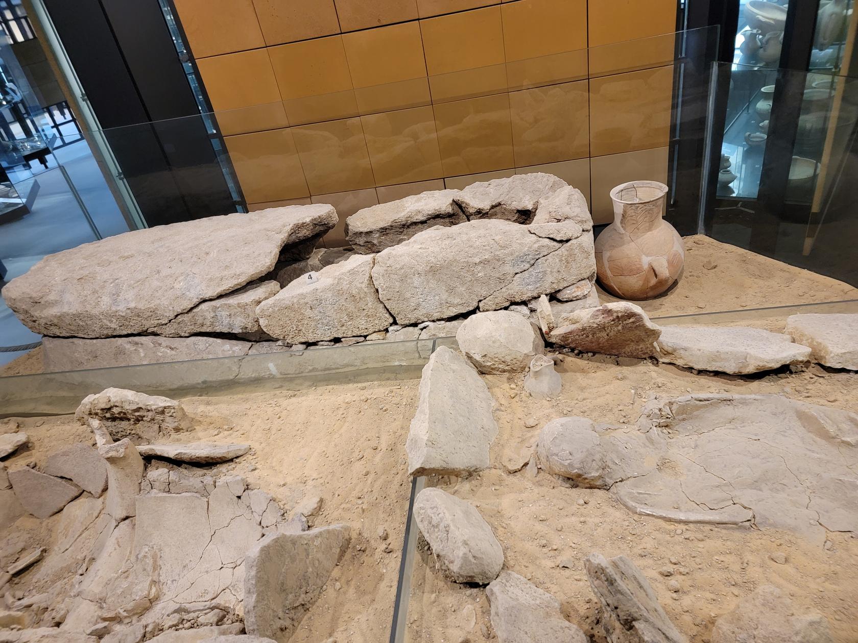
Exhibit of a typical burial – Archaeological Museum Paolo Orsi – Siracuse, Sicily
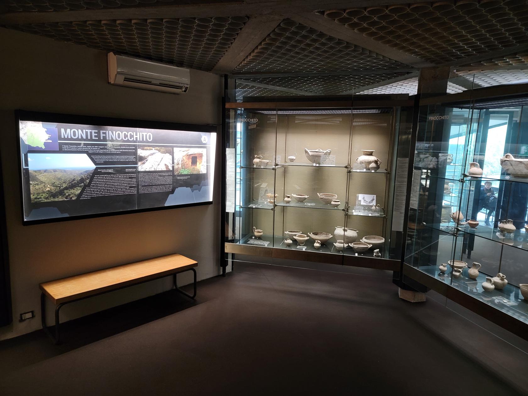
Monte Finocchio – Archaeological Museum Paolo Orsi – Siracuse, Sicily
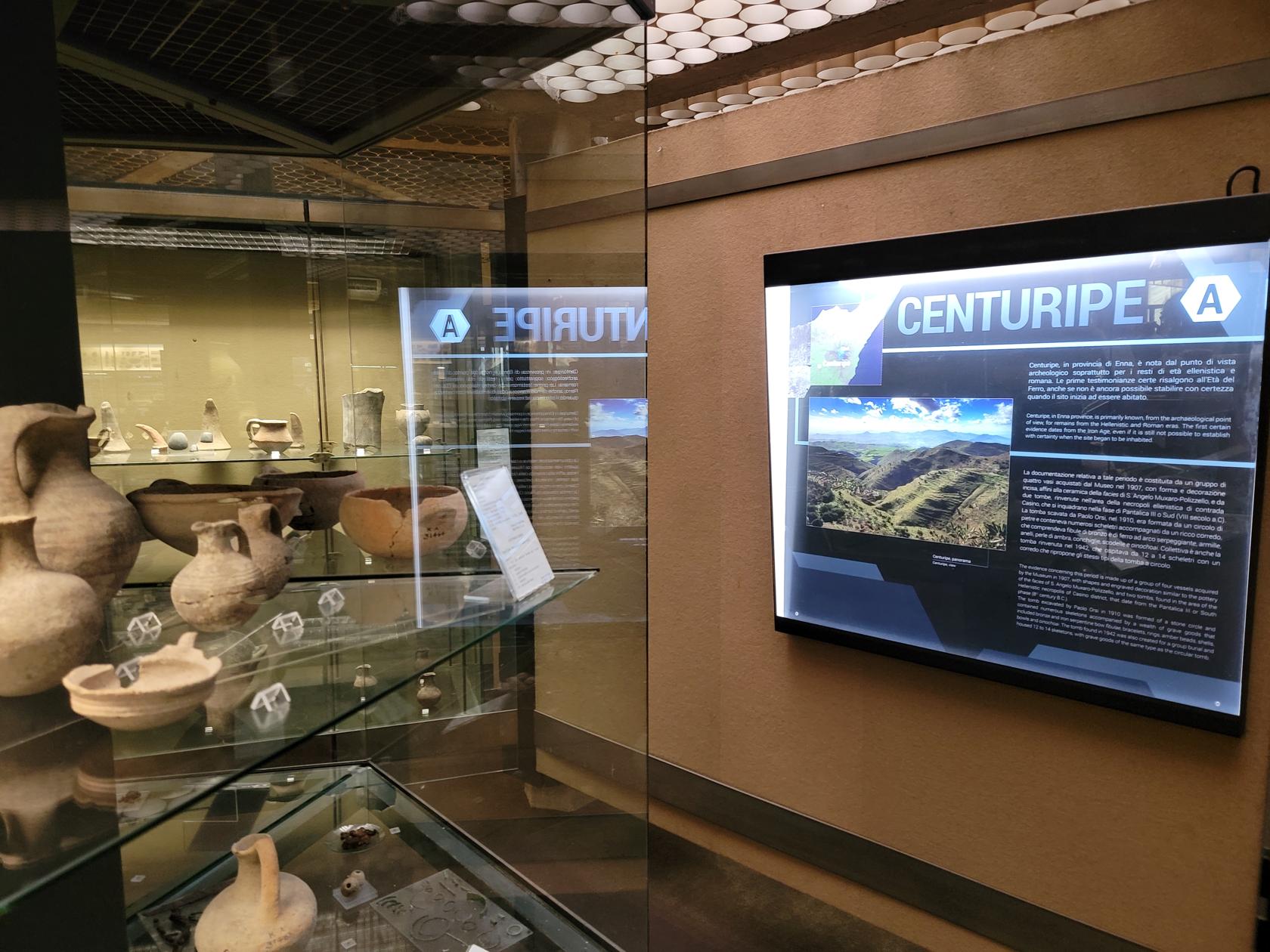
Centuripe exhibit – Archaeological Museum Paolo Orsi – Siracuse, Sicily
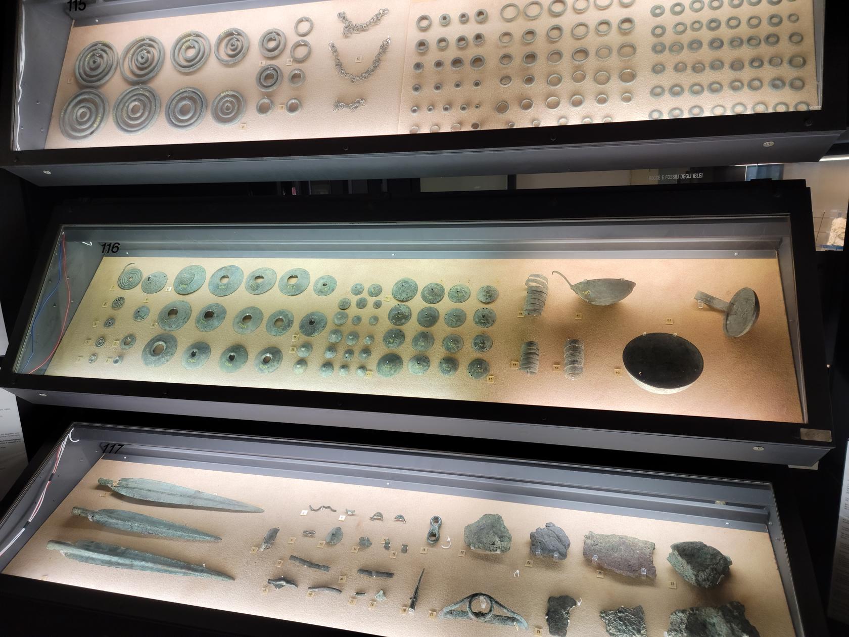
Bronze spear points, buttons and other artifacts – Archaeological Museum Paolo Orsi – Siracuse, Sicily
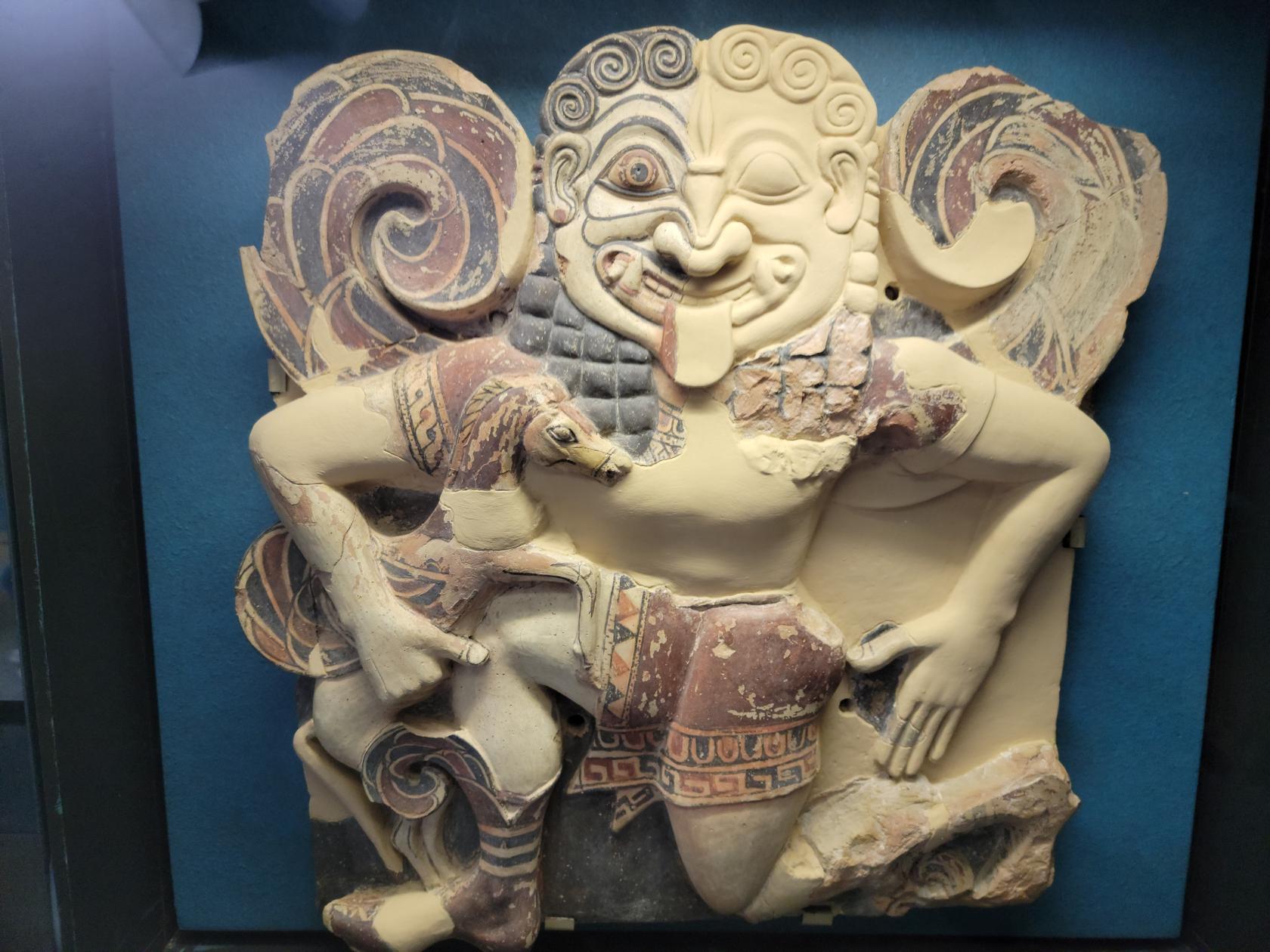
The Gorgone – Archaeological Museum Paolo Orsi – Siracuse, Sicily
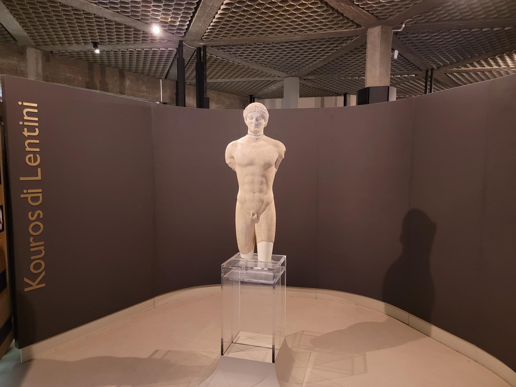
A Greek Kouros – Archaeological Museum Paolo Orsi – Siracuse, Sicily
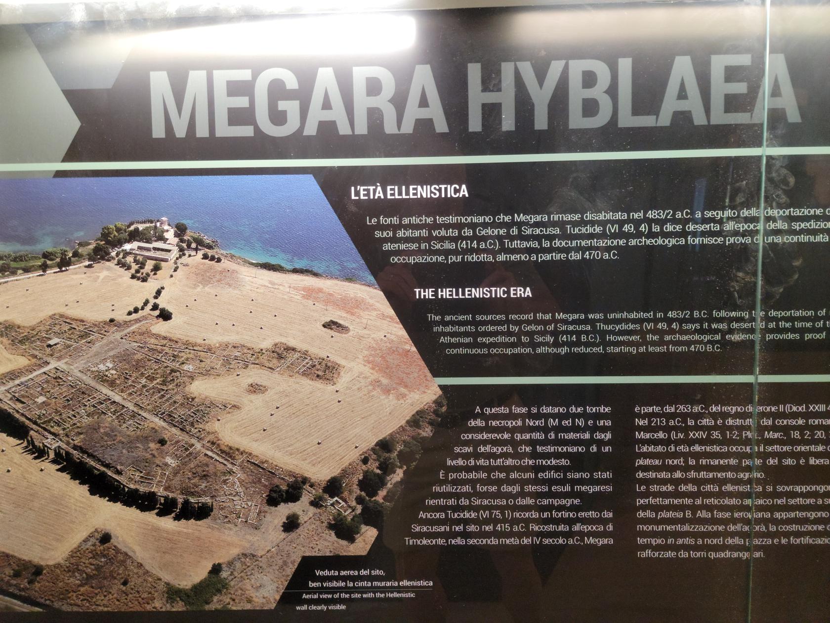
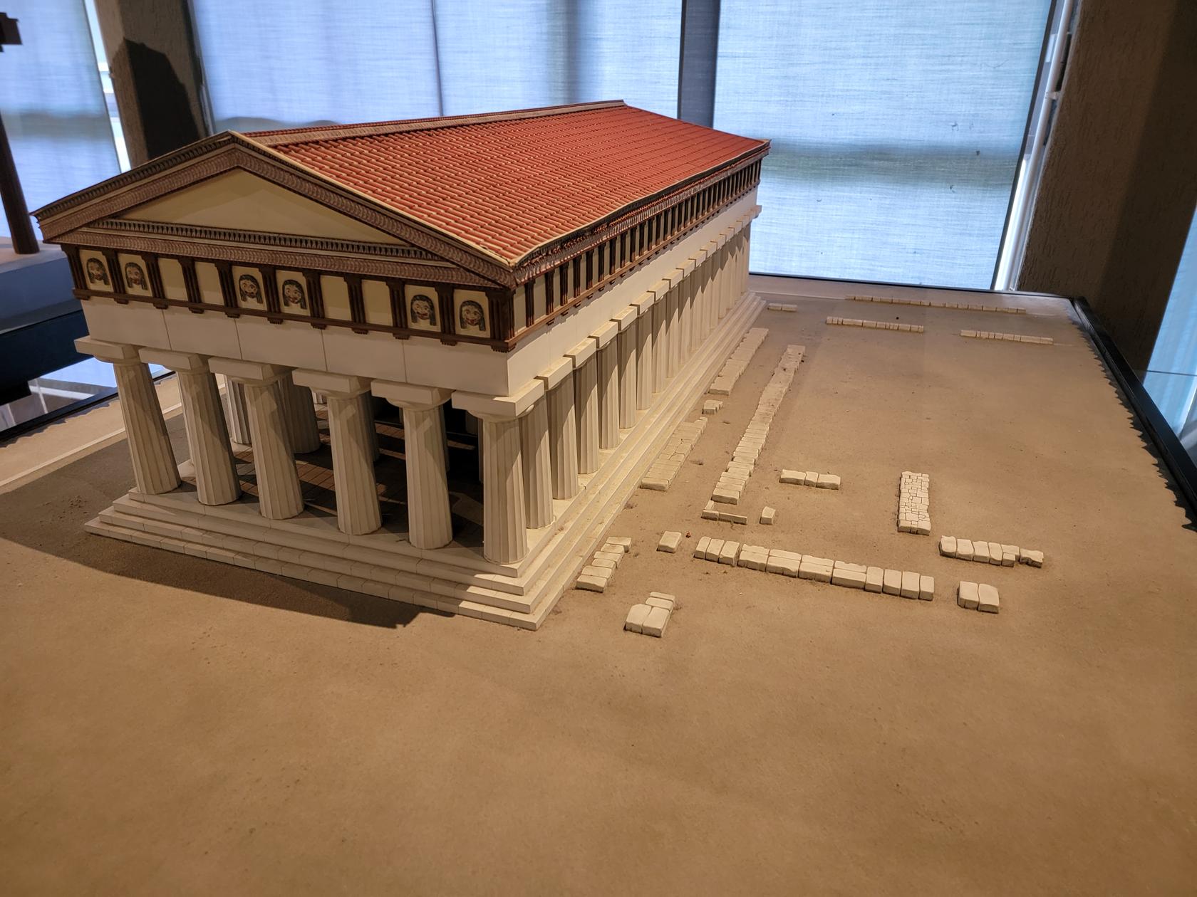
Megara Hyblaea exhibit – Archaeological Museum Paolo Orsi – Siracuse, Sicily
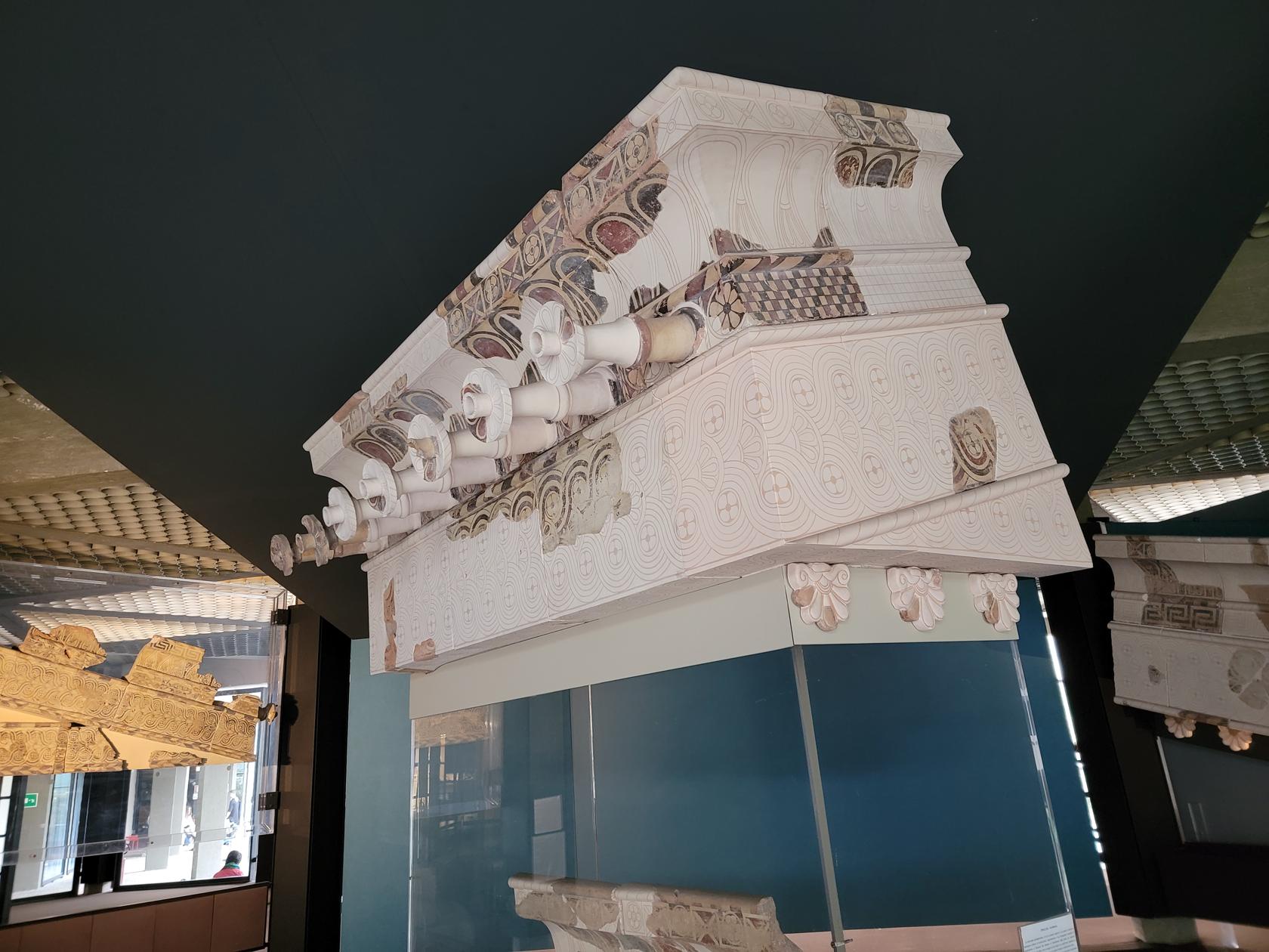
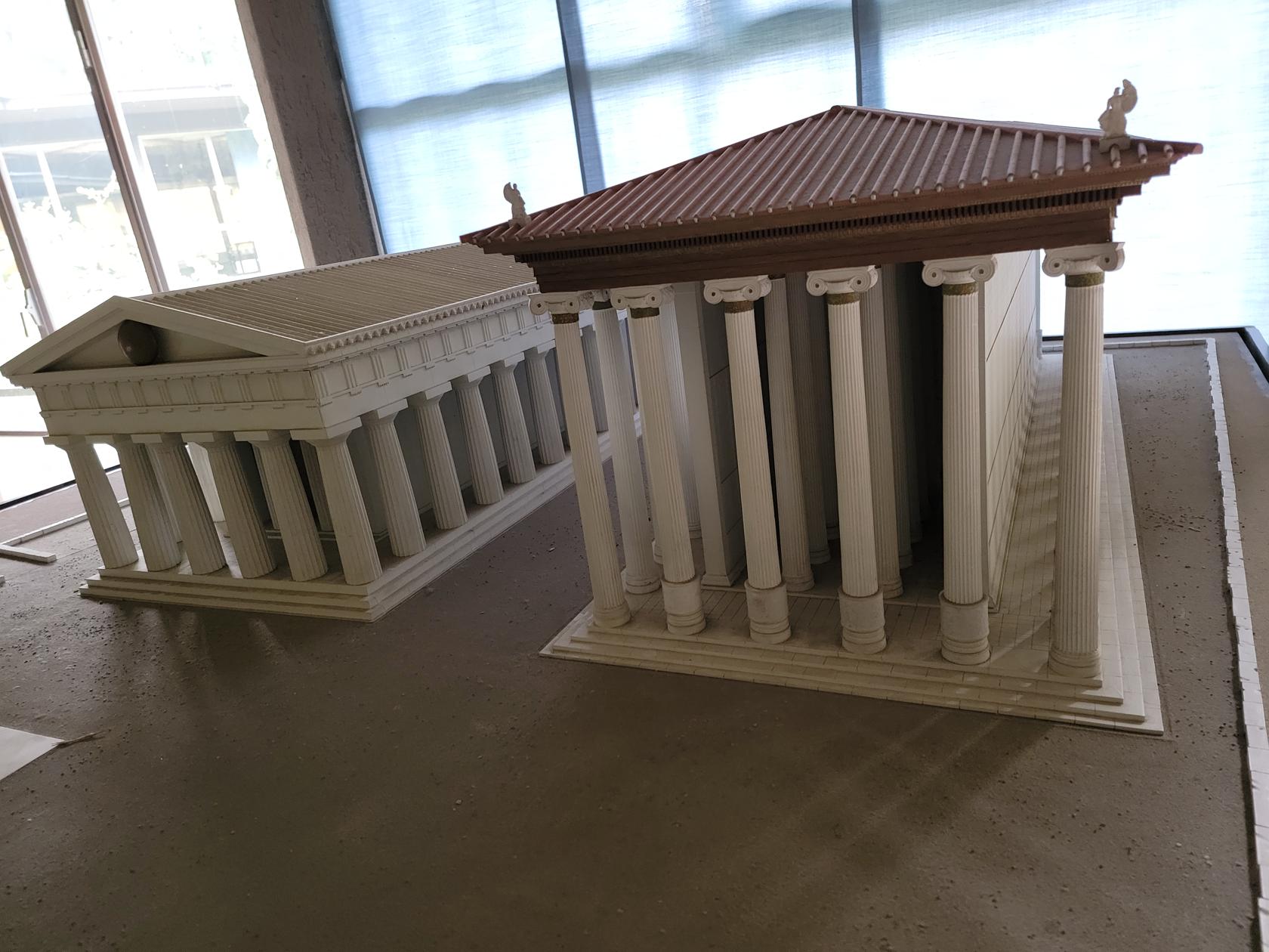
Dioramas of Greek architecture found throughout Sicily – Archaeological Museum Paolo Orsi – Siracuse, Sicily
Exhibit of unusual antiquated gutter system – Archaeological Museum Paolo Orsi – Siracuse, Sicily
Dioramas of ancient Greek Structures on Sicily – Archaeological Museum Paolo Orsi – Siracuse, Sicily
More than one area within the south-eastern coast of Sicily is addressed, as well as other major areas to the north and in the center. In all, the museum provides an excellent historical picture of the island of Sicily.
Archaeological Park
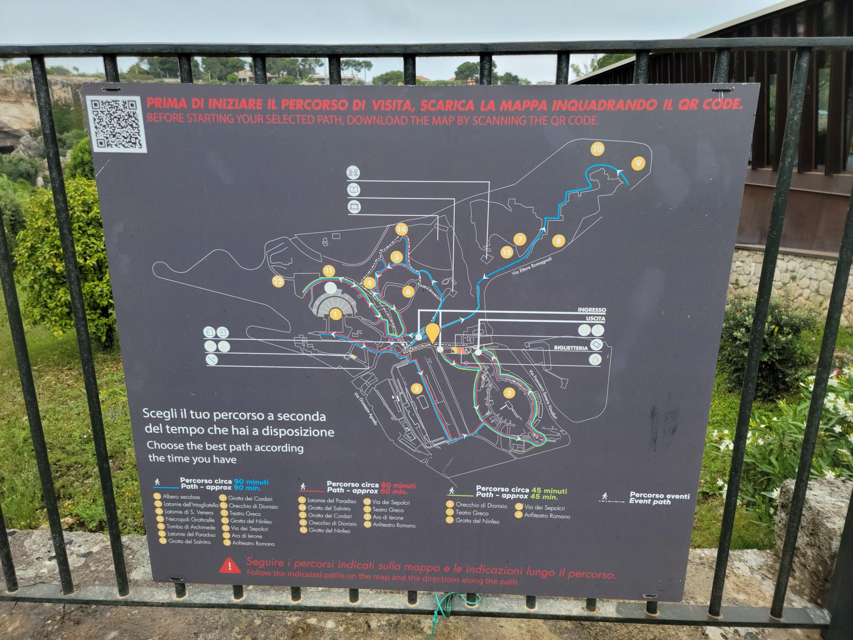
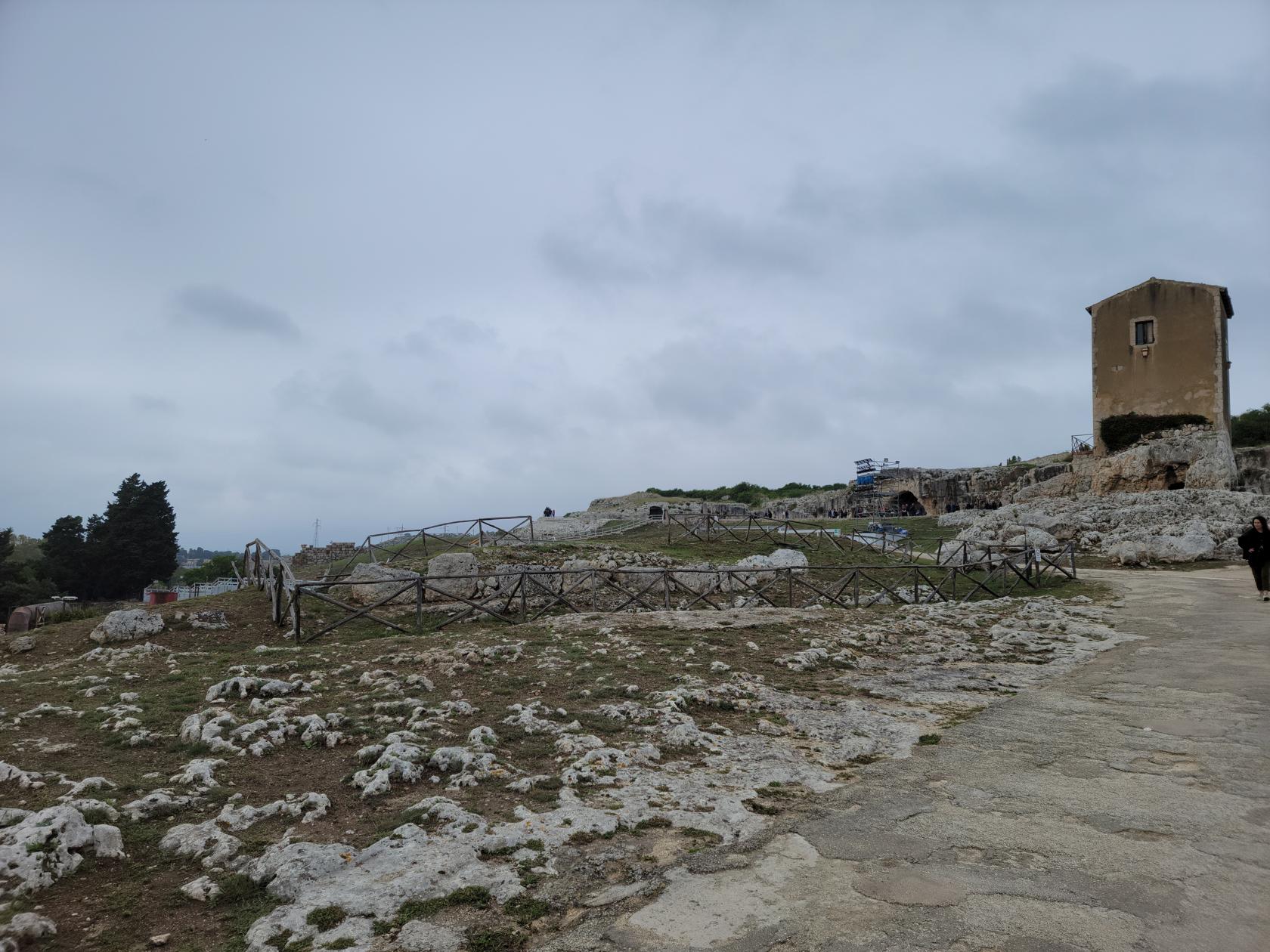
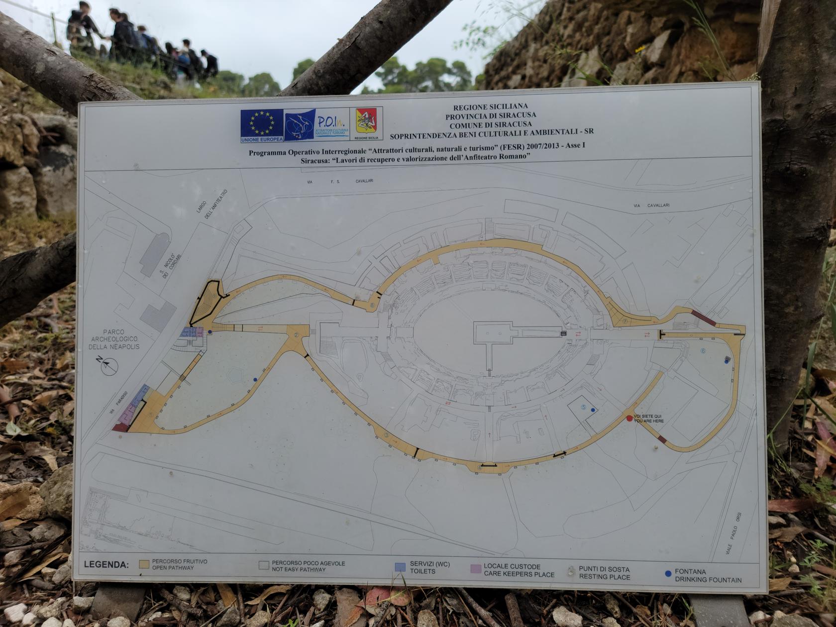
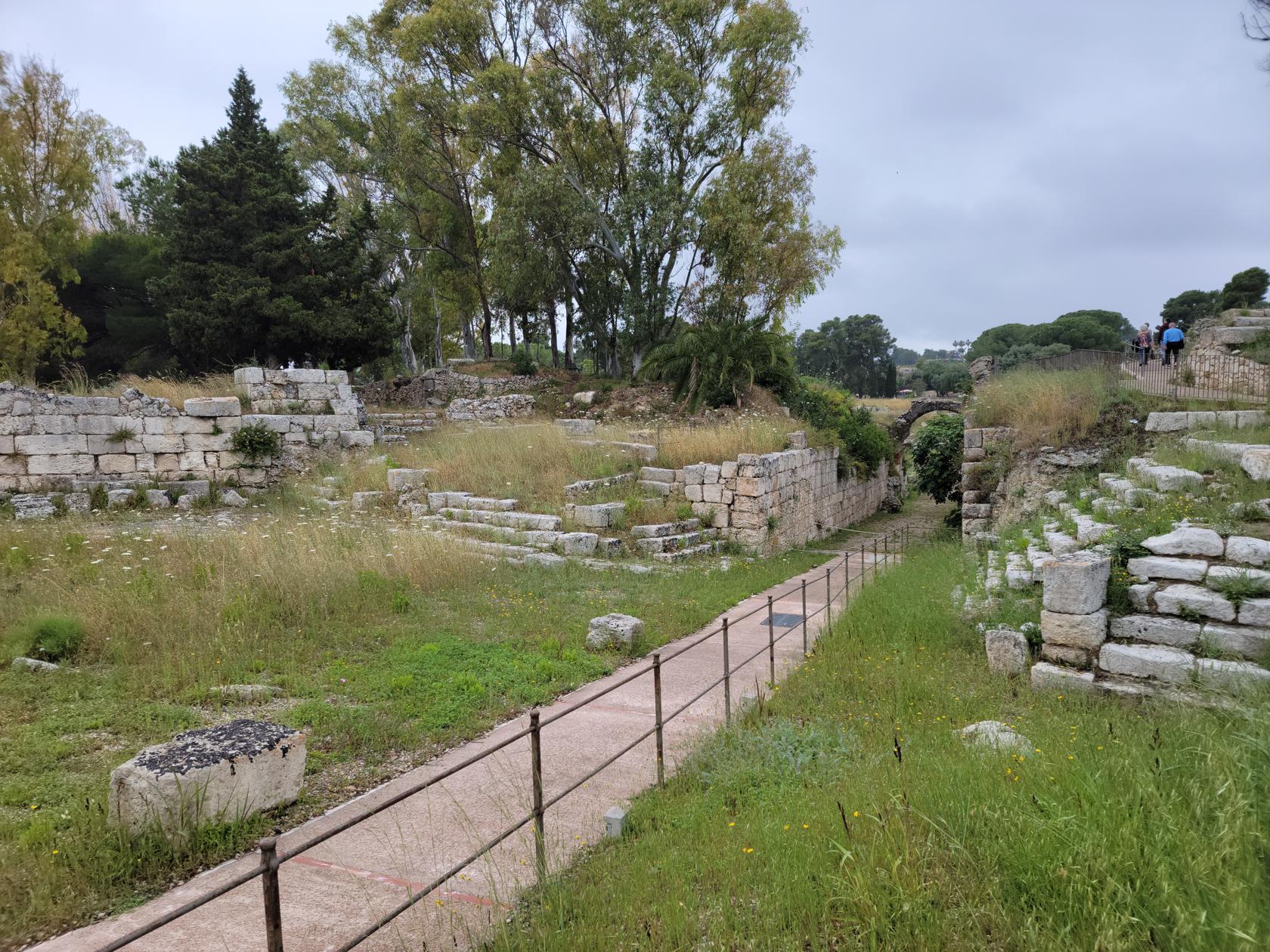
The Archaeological Park, also known as the Neapolis Archaelogical Park of Syracuse, is situated about two and a half kilometers from the island of Ortigia. However, a brisk walk can get you there in about twenty or so minutes.
Entrance walkway – The Neapolis – Archaeological Park – Siracuse, Sicily
The Grotto caverns – The Neapolis – Archaeological Park – Siracuse, Sicily
Tickets may be purchased at the gate, now across the newly blue painted intersection.
The Neapolis – Archaeological Park – Siracuse, Sicily
If you follow the signs, like we did, you will be taken to group ticket sales, which will still sell you tickets, but its out of the way and you will have to walk through a path of vendors before actually finding the ticket booth.
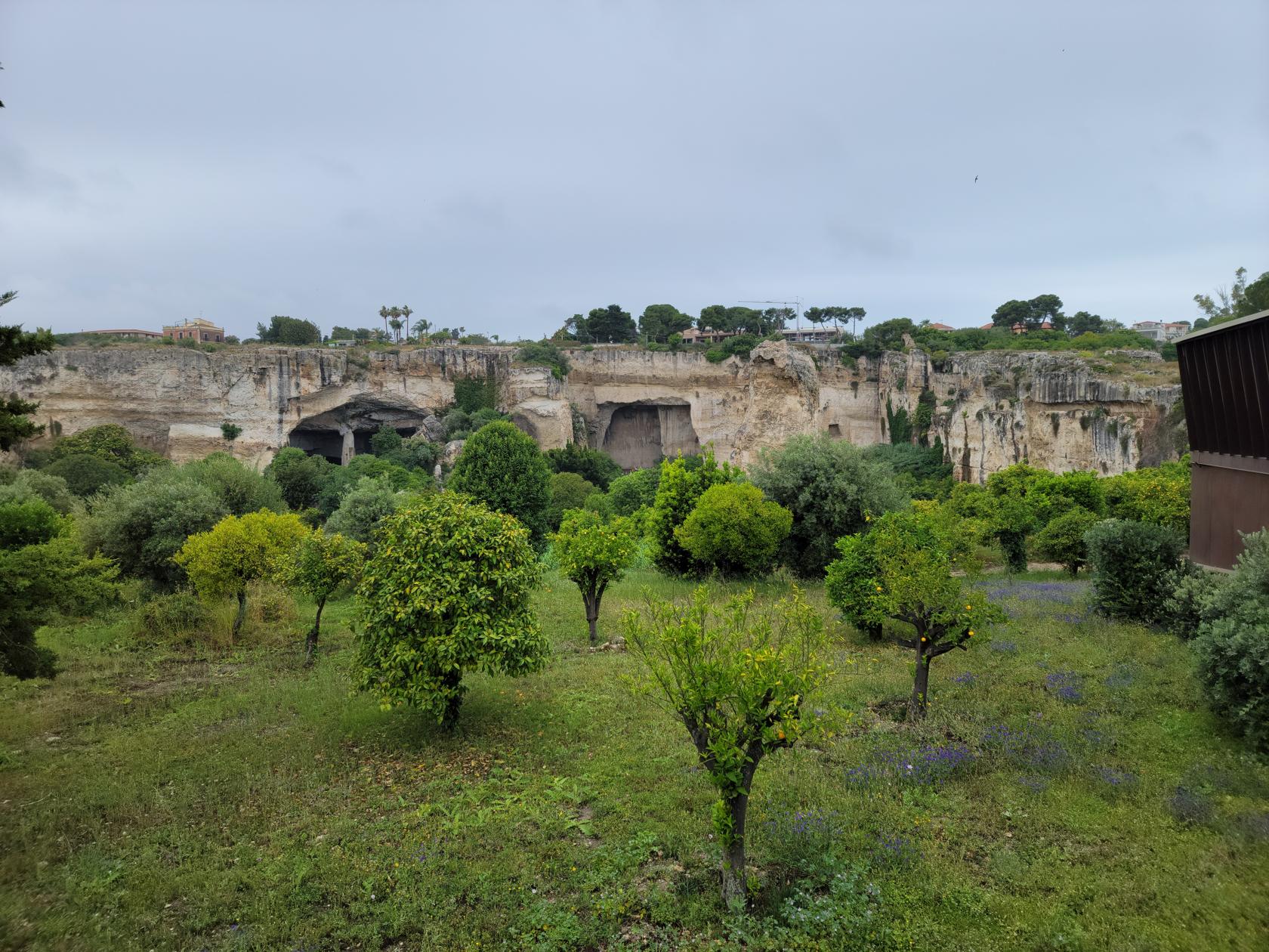
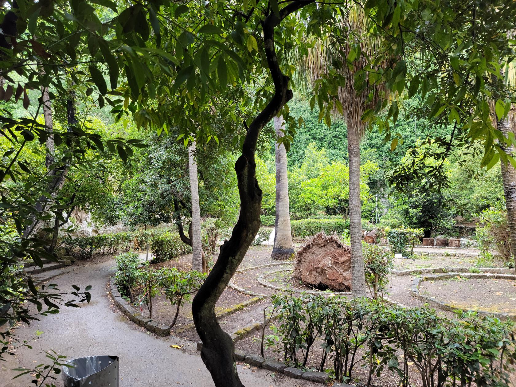
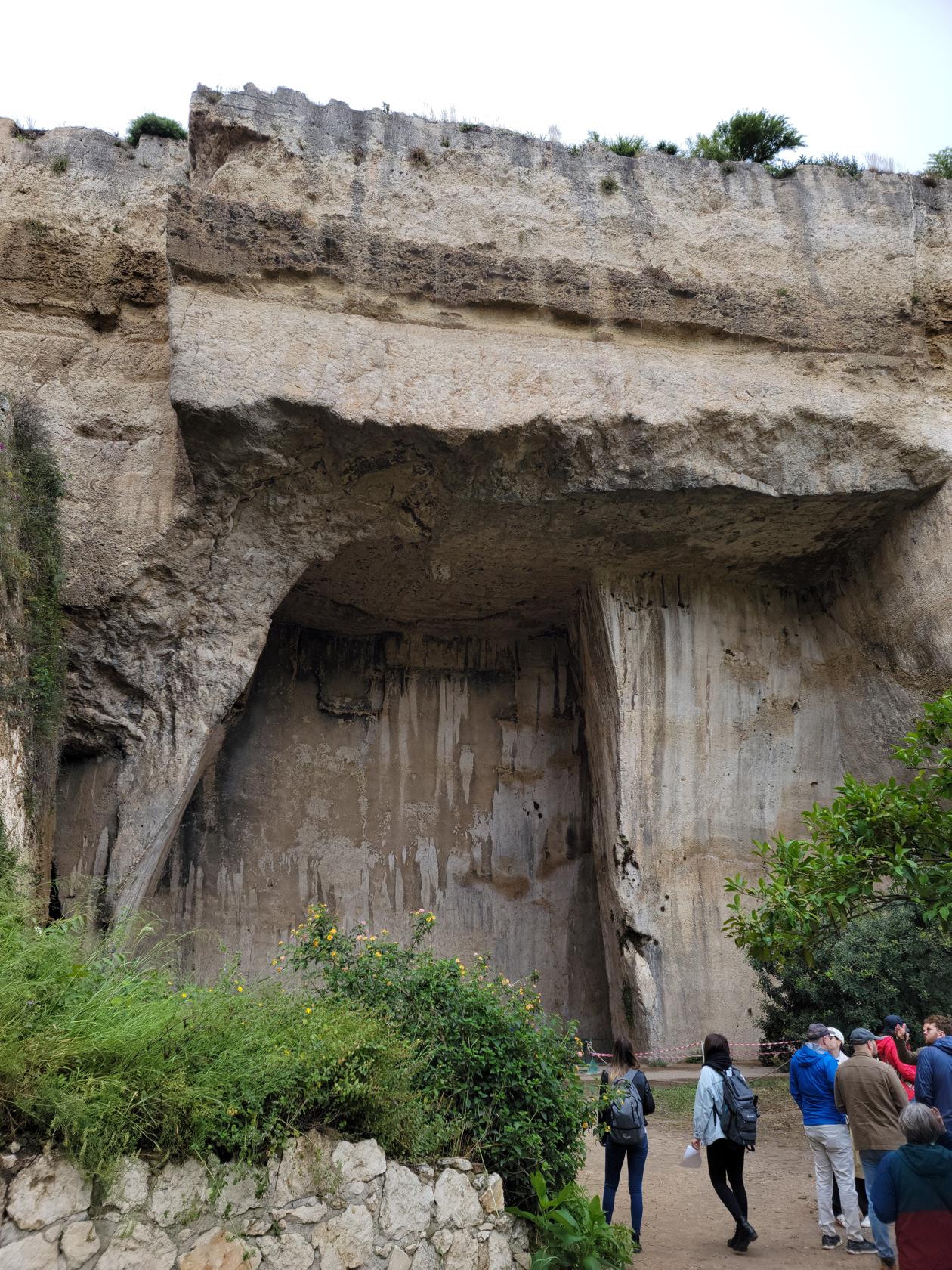
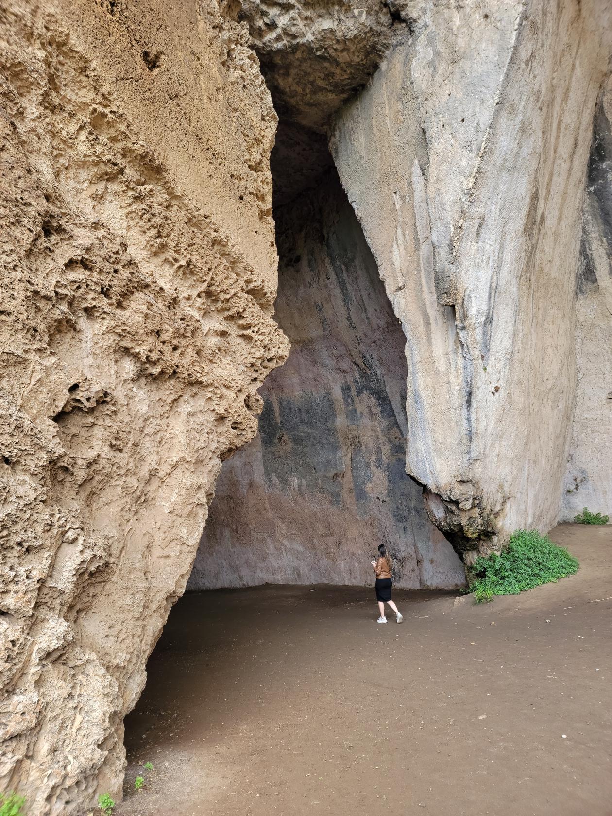
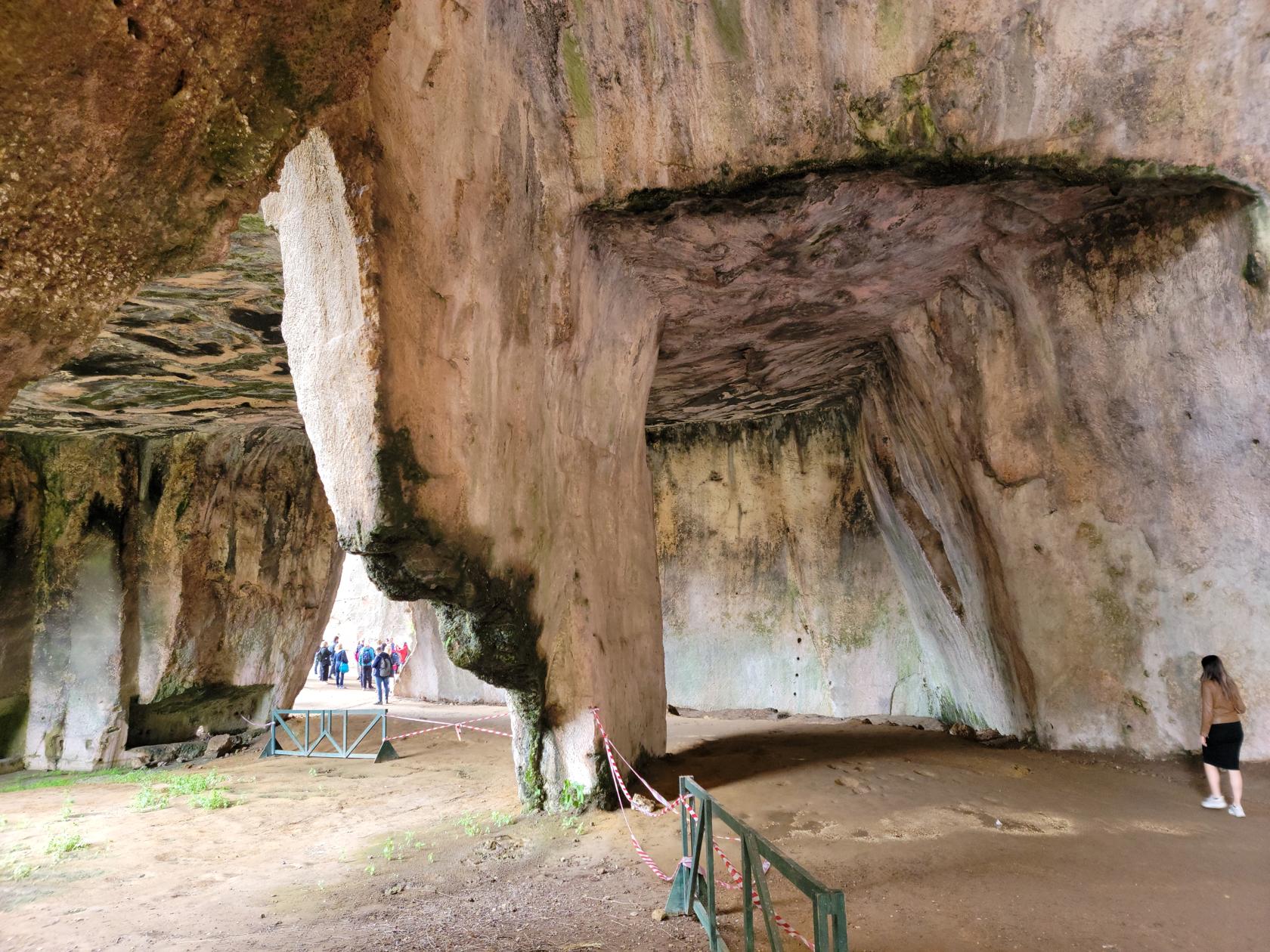
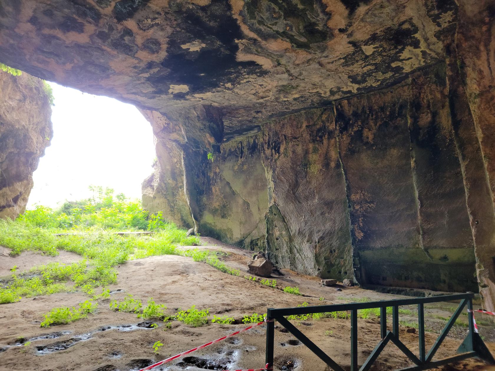
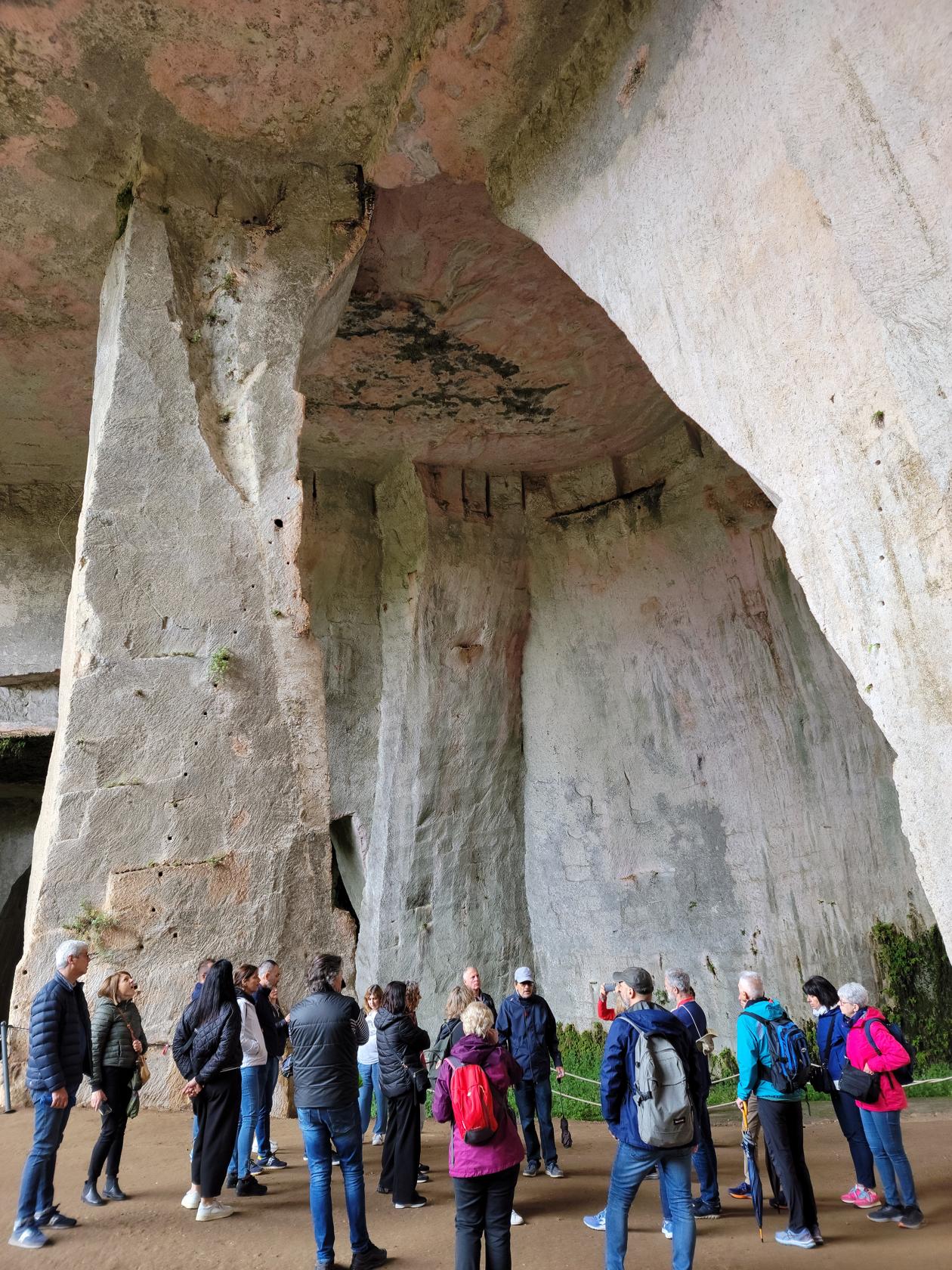
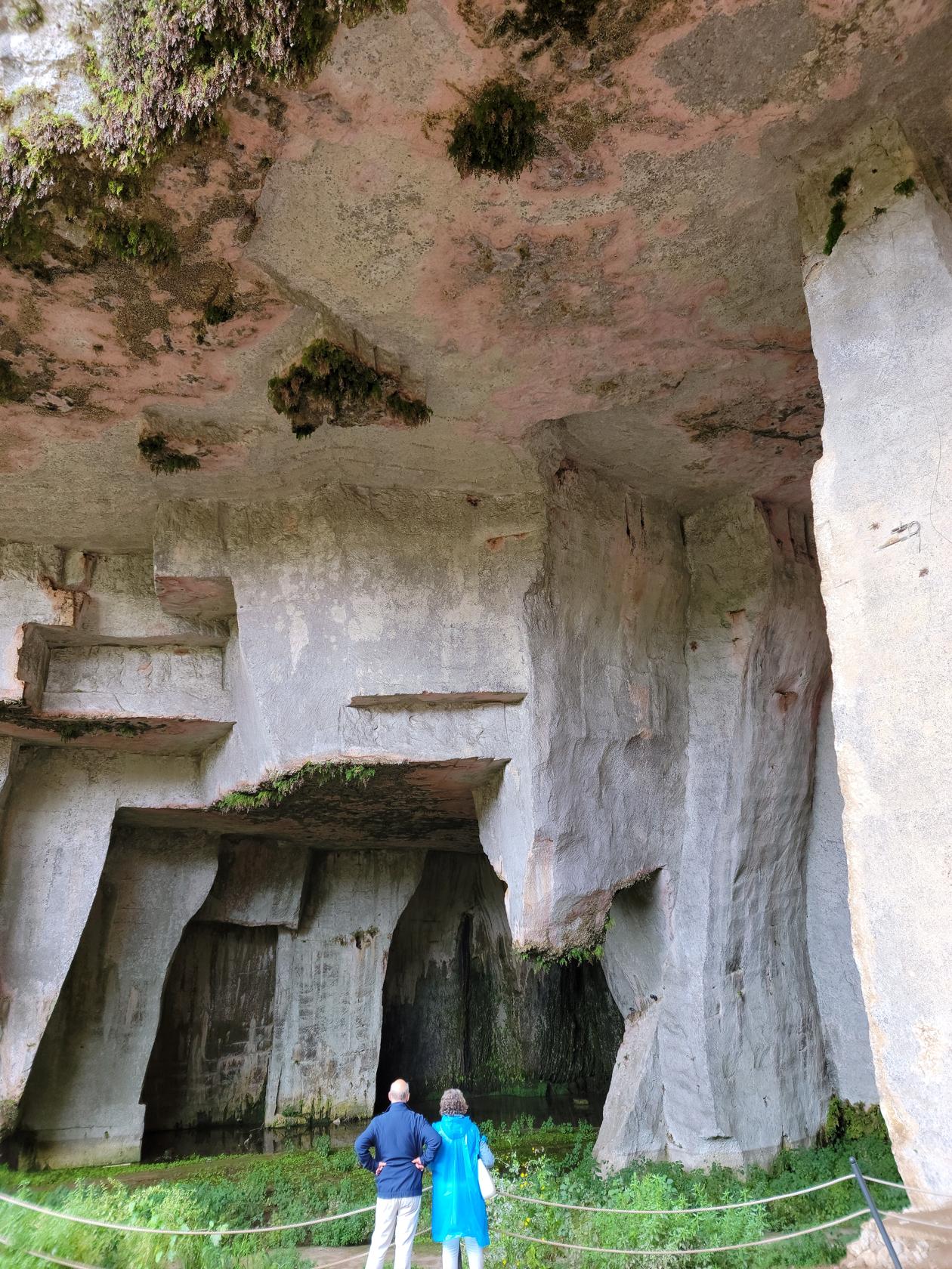
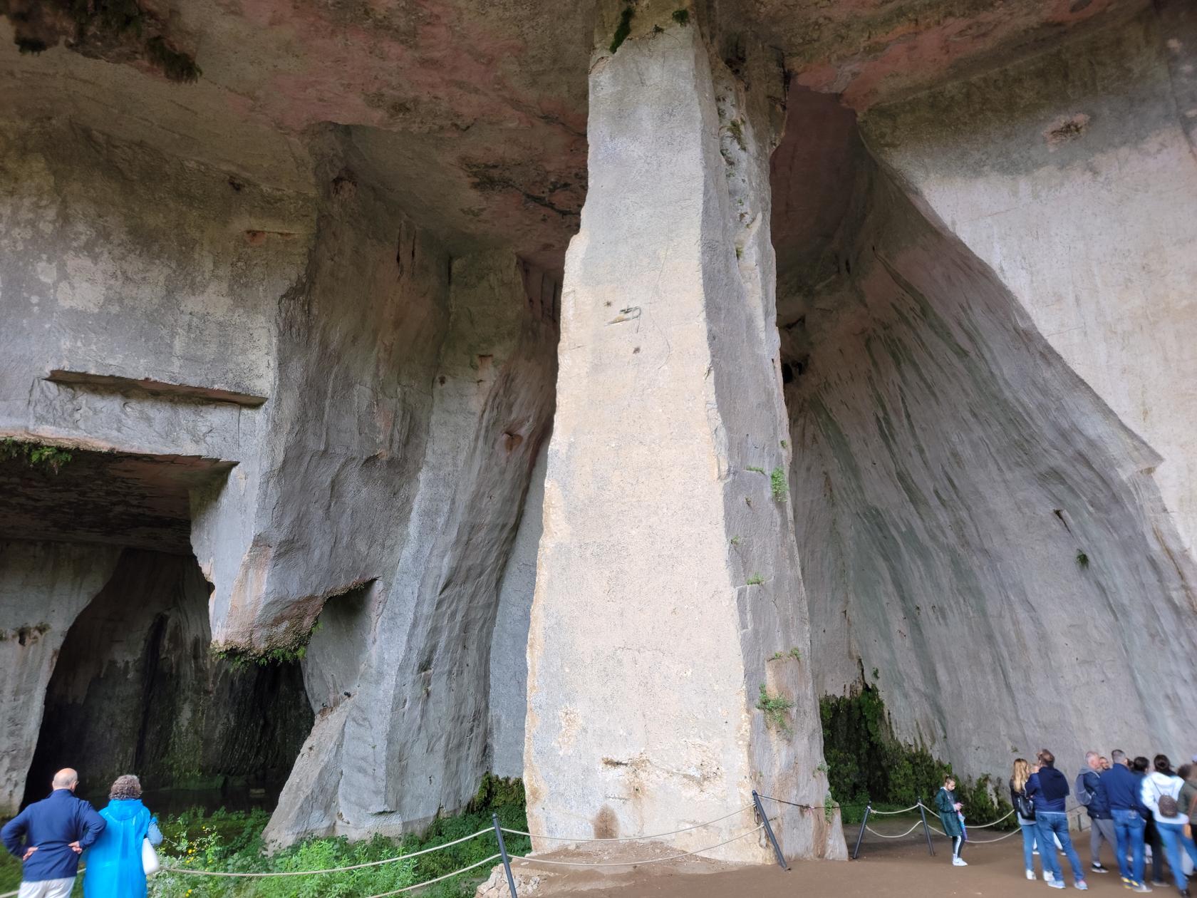
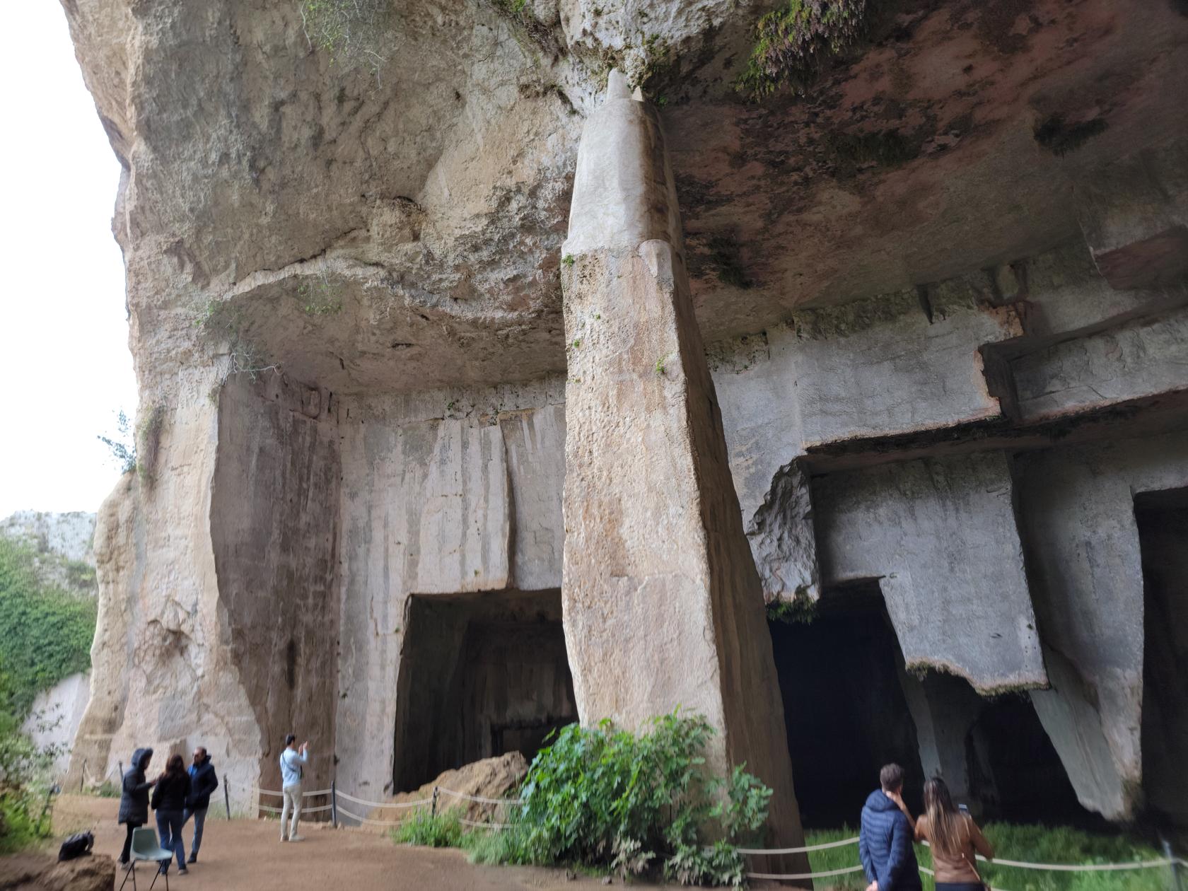
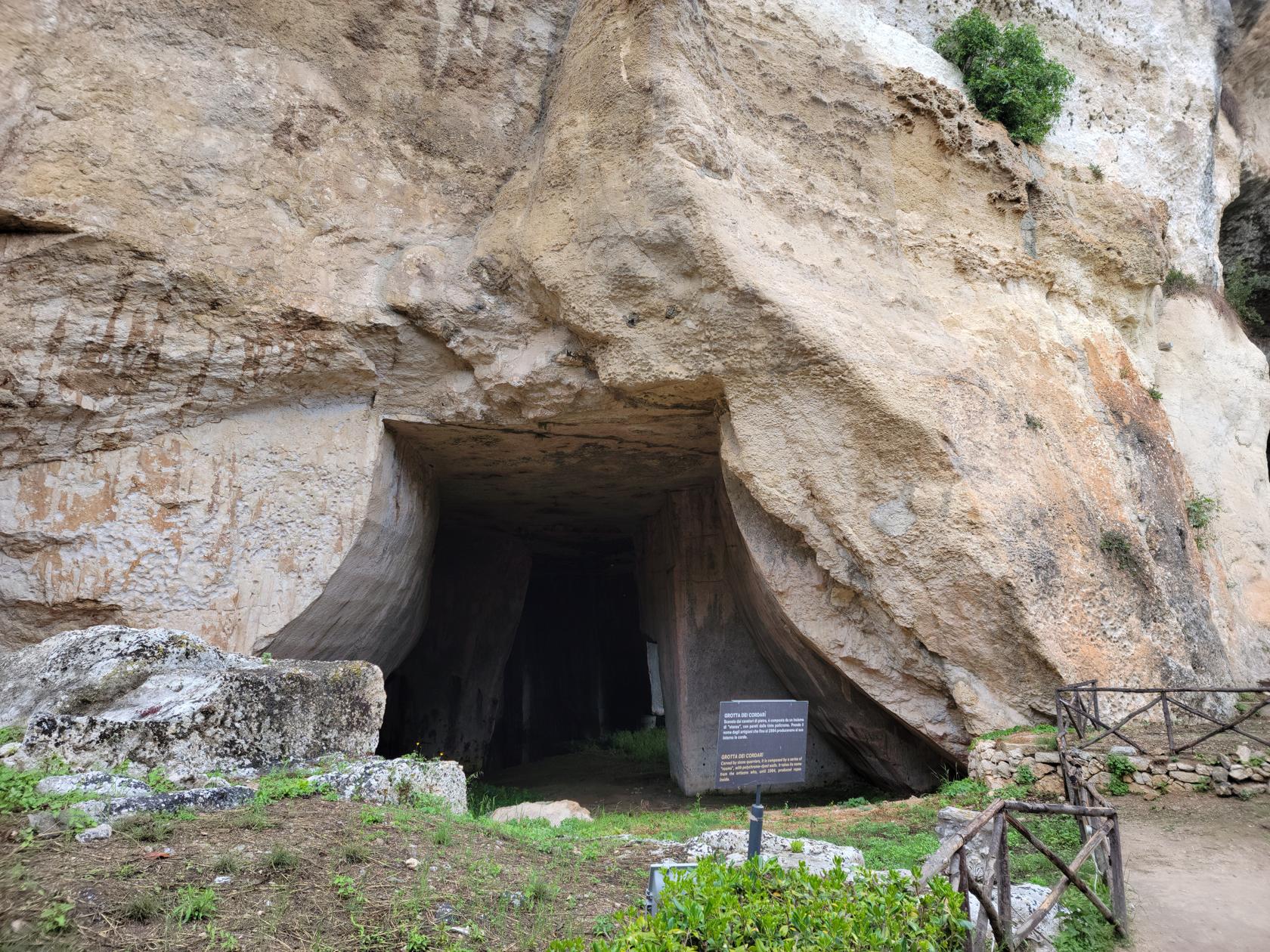
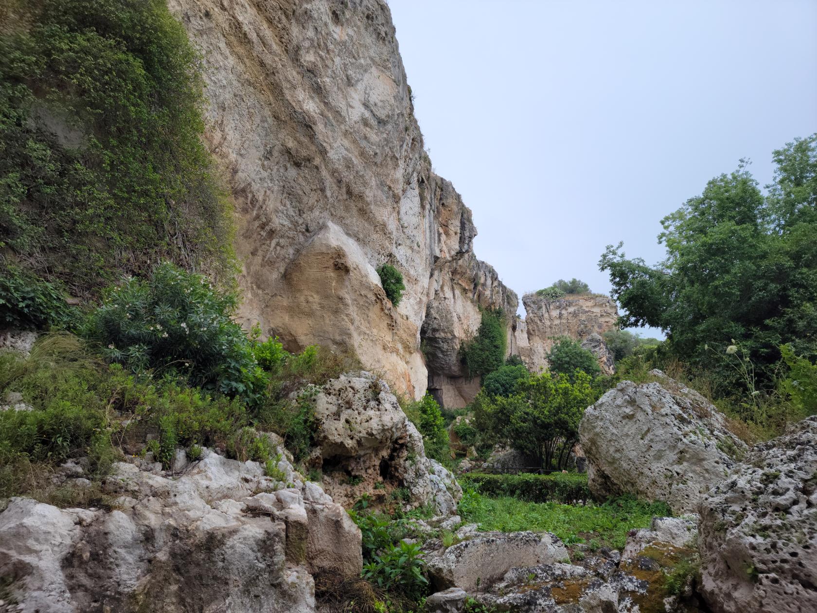
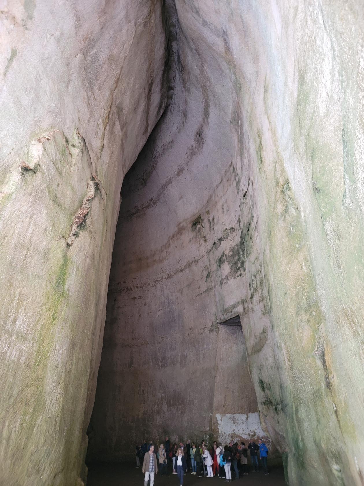
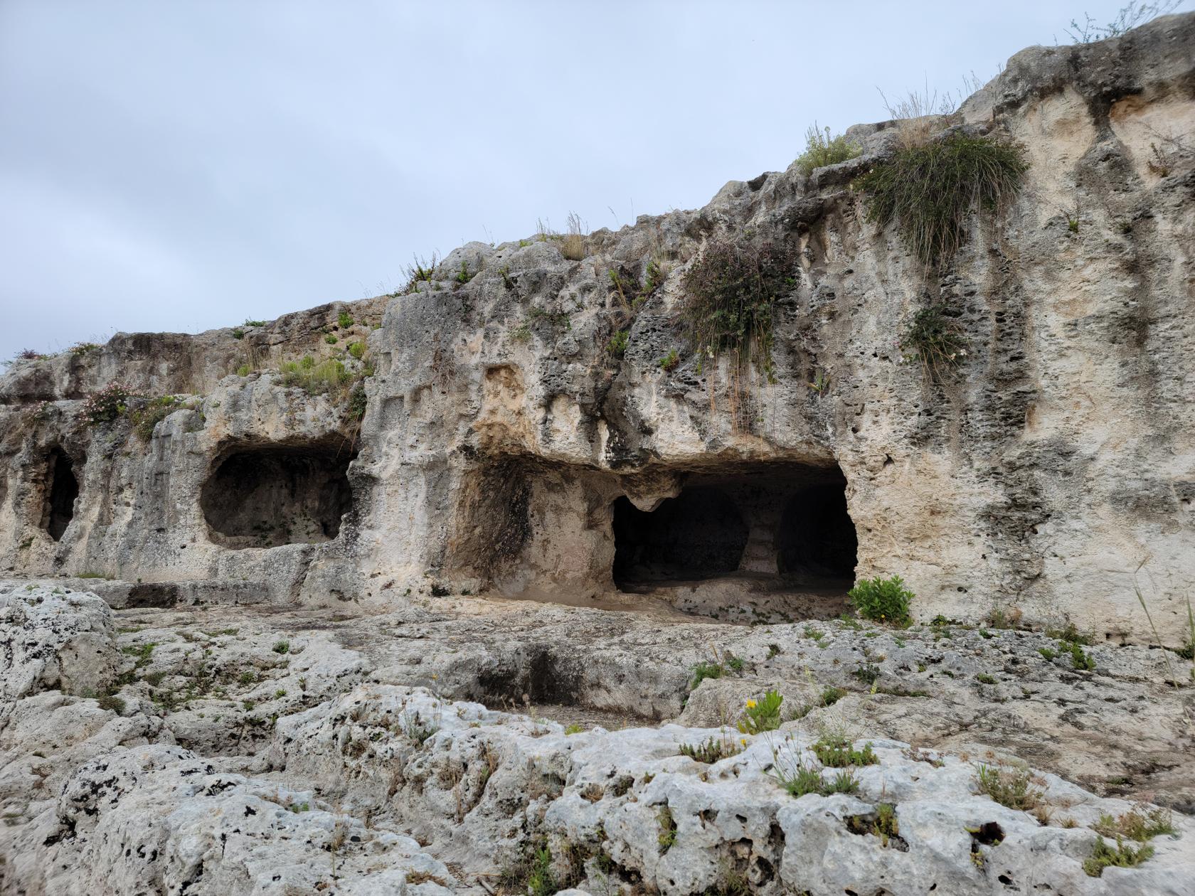
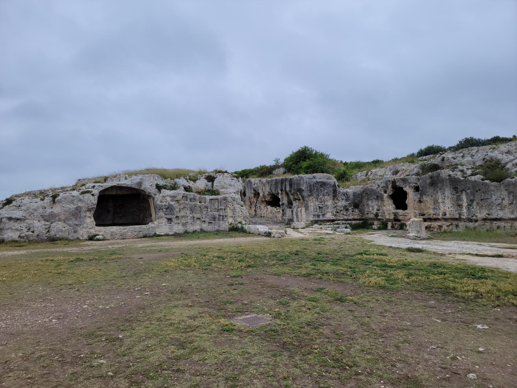
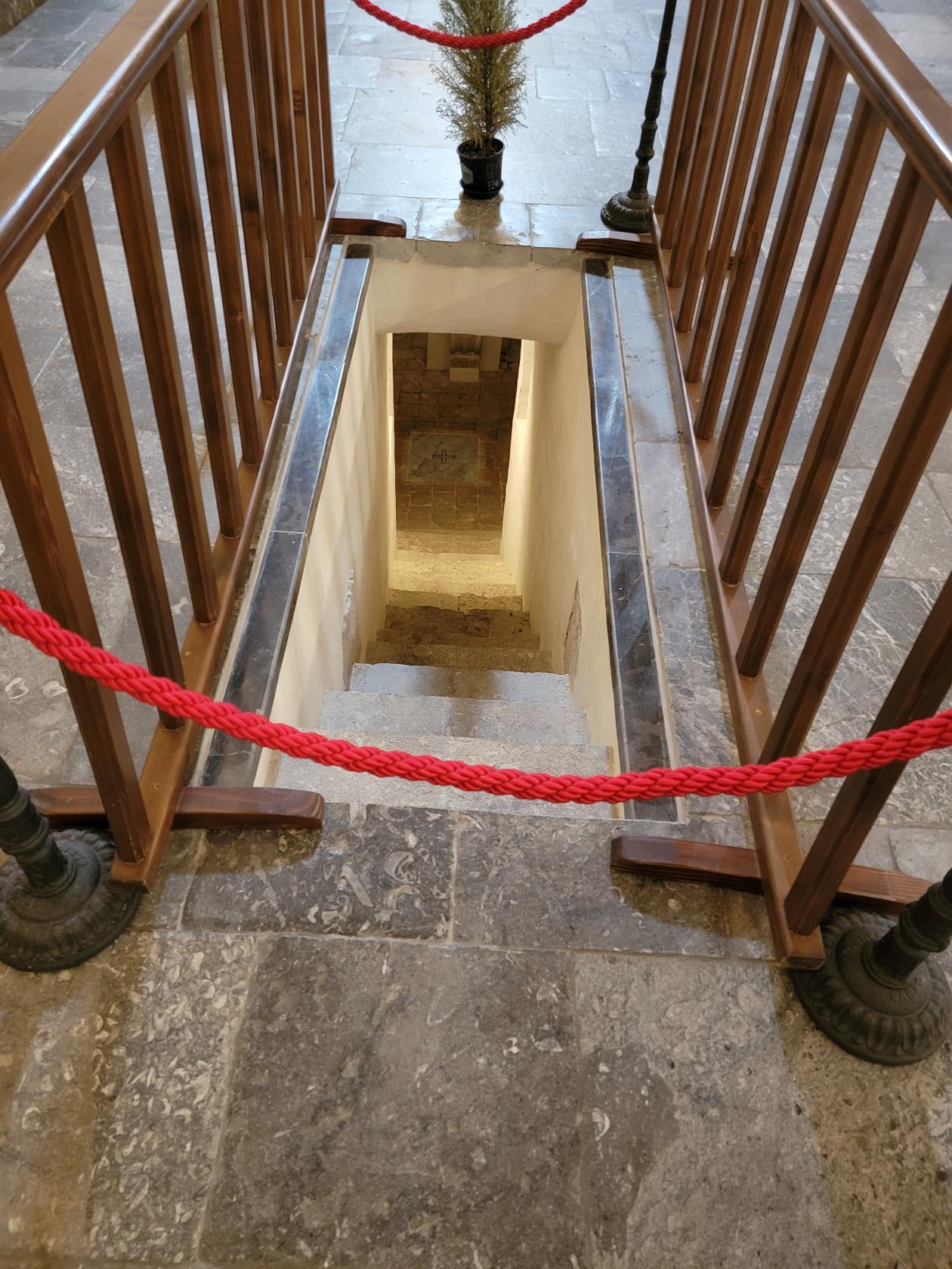
Latomia or Grottos
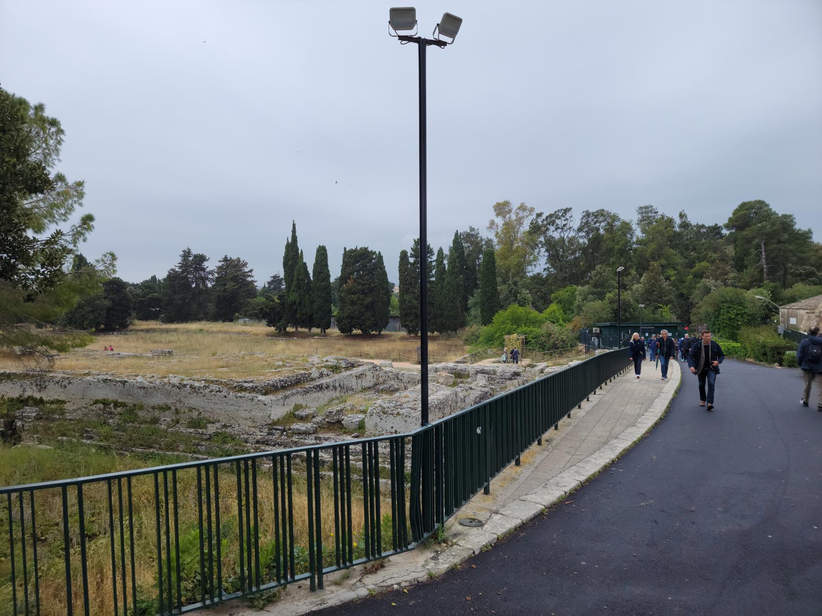
When you enter the Neapolis the first thing to visit is the Grotto, or the large quarry where they used to mine stone for building. This is a huge cutout in the surrounding rock face which is about fifty or so meters in height.
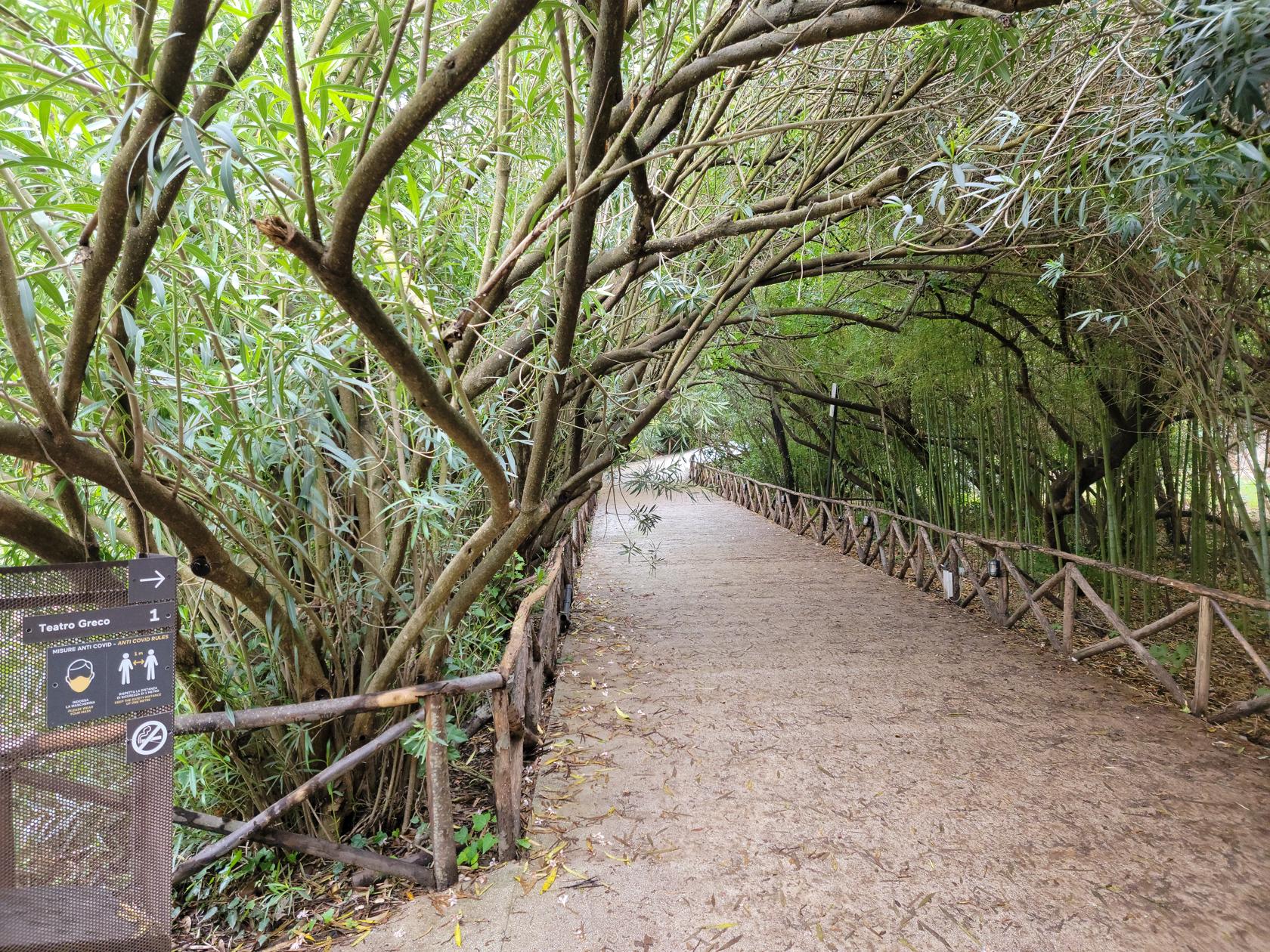
A walk to the Greek Theater – The Neapolis – Archaeological Park – Siracuse, Sicily
Small park area – The Neapolis – Archaeological Park – Siracuse, Sicily
Small park area – The Neapolis – Archaeological Park – Siracuse, Sicily
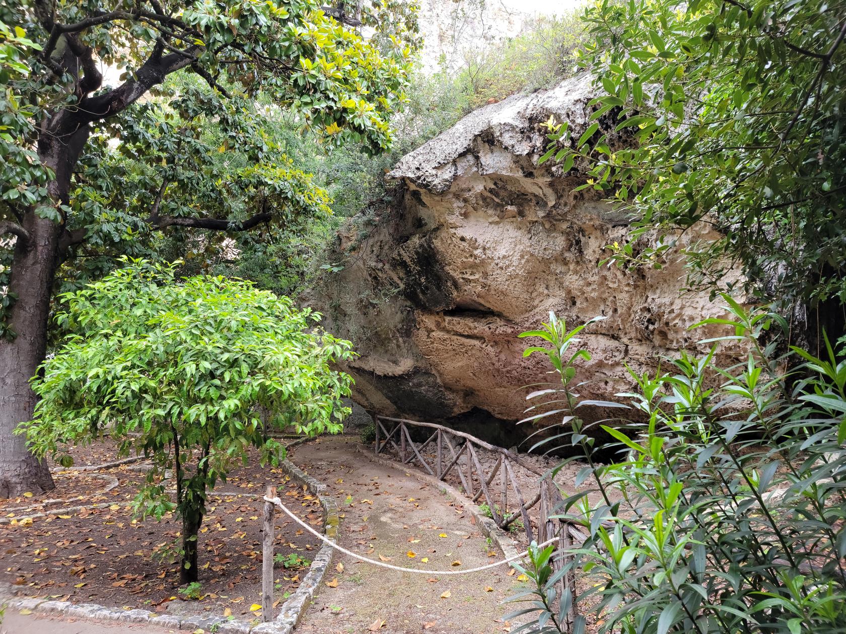
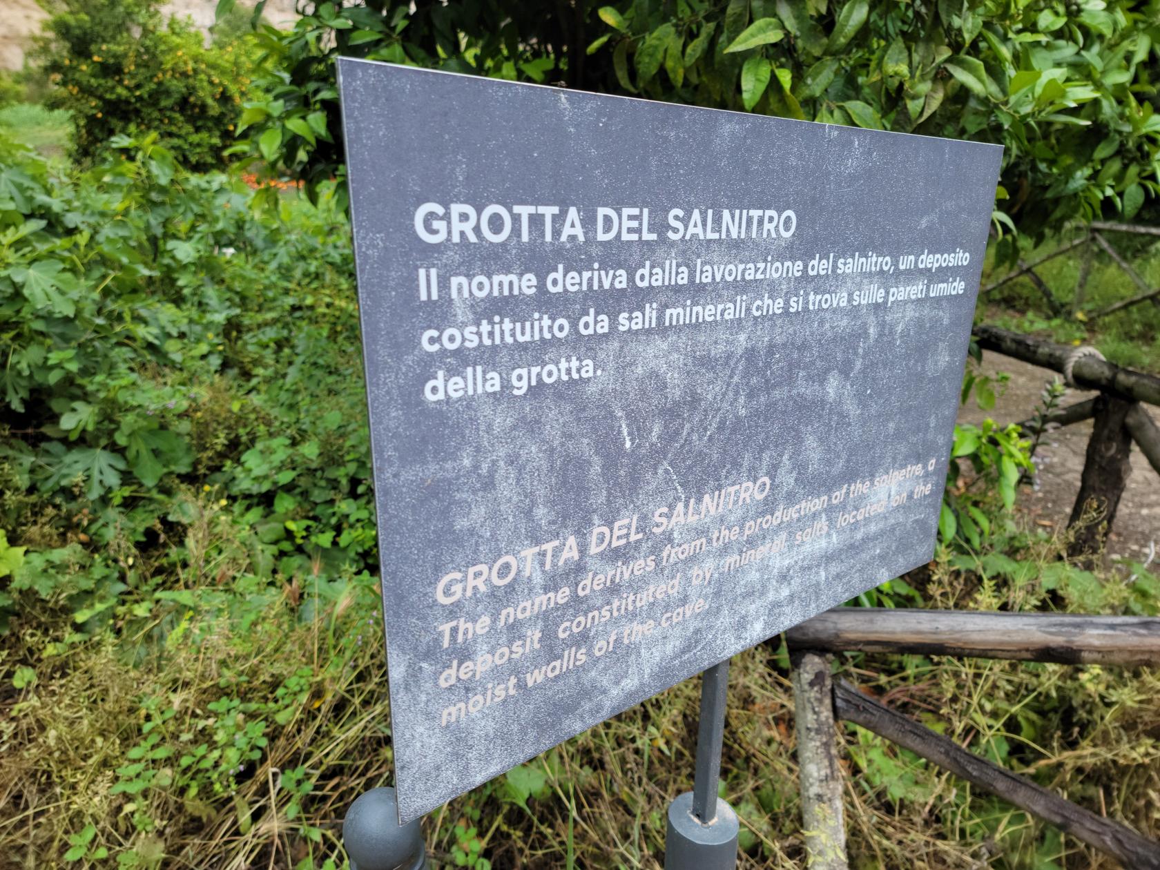
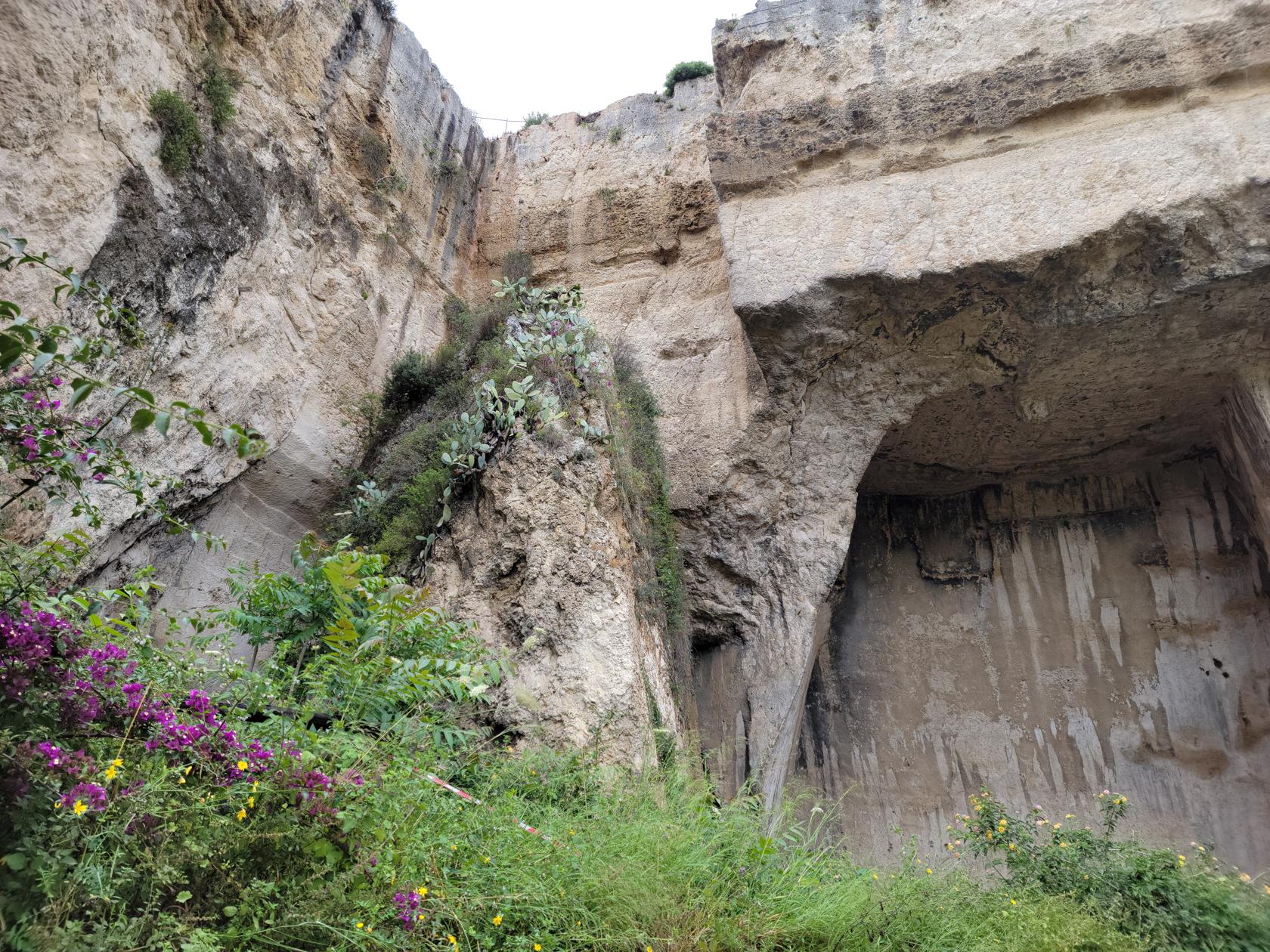
Grotto of Salnitro – The Neapolis – Archaeological Park – Siracuse, Sicily
Grotto of Salnitro – The Neapolis – Archaeological Park – Siracuse, Sicily
Grotto of Salnitro – The Neapolis – Archaeological Park – Siracuse, Sicily
Grotto of Salnitro – The Neapolis – Archaeological Park – Siracuse, Sicily
Grotto of Salnitro – The Neapolis – Archaeological Park – Siracuse, Sicily
Grotto of Salnitro – The Neapolis – Archaeological Park – Siracuse, Sicily
Grotto of Salnitro – The Neapolis – Archaeological Park – Siracuse, Sicily
Grotto of Salnitro – The Neapolis – Archaeological Park – Siracuse, Sicily
Grotto of Salnitro – The Neapolis – Archaeological Park – Siracuse, Sicily
Grotto of Salnitro – The Neapolis – Archaeological Park – Siracuse, Sicily
Grotto of Salnitro – The Neapolis – Archaeological Park – Siracuse, Sicily
It appears to have had several cave-ins in the past, which probably occurred as they were mining the stone. There is evidence of the former inhabitants leaving large columns behind in an attempt to prevent additional cave-ins from occurring. Whether they were successful or not, it is not known, there are no information signs or other historical information provided at the site.
Another section of the Grotto – The Neapolis – Archaeological Park – Siracuse, Sicily
The Grotto entrance – The Neapolis – Archaeological Park – Siracuse, Sicily
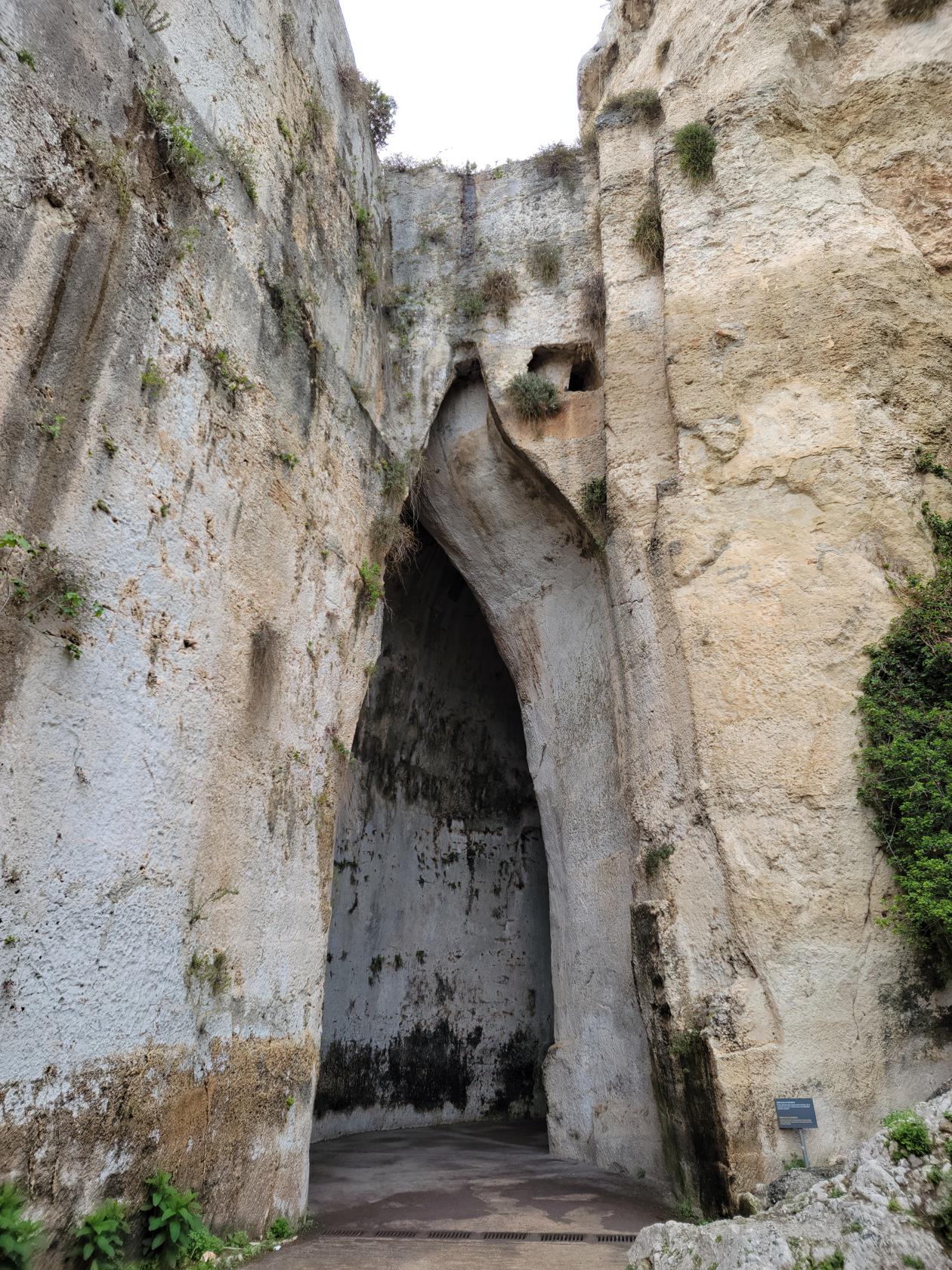
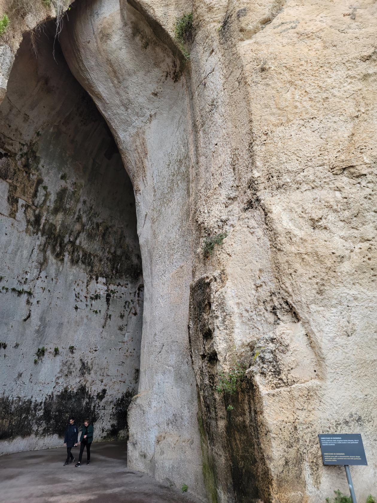
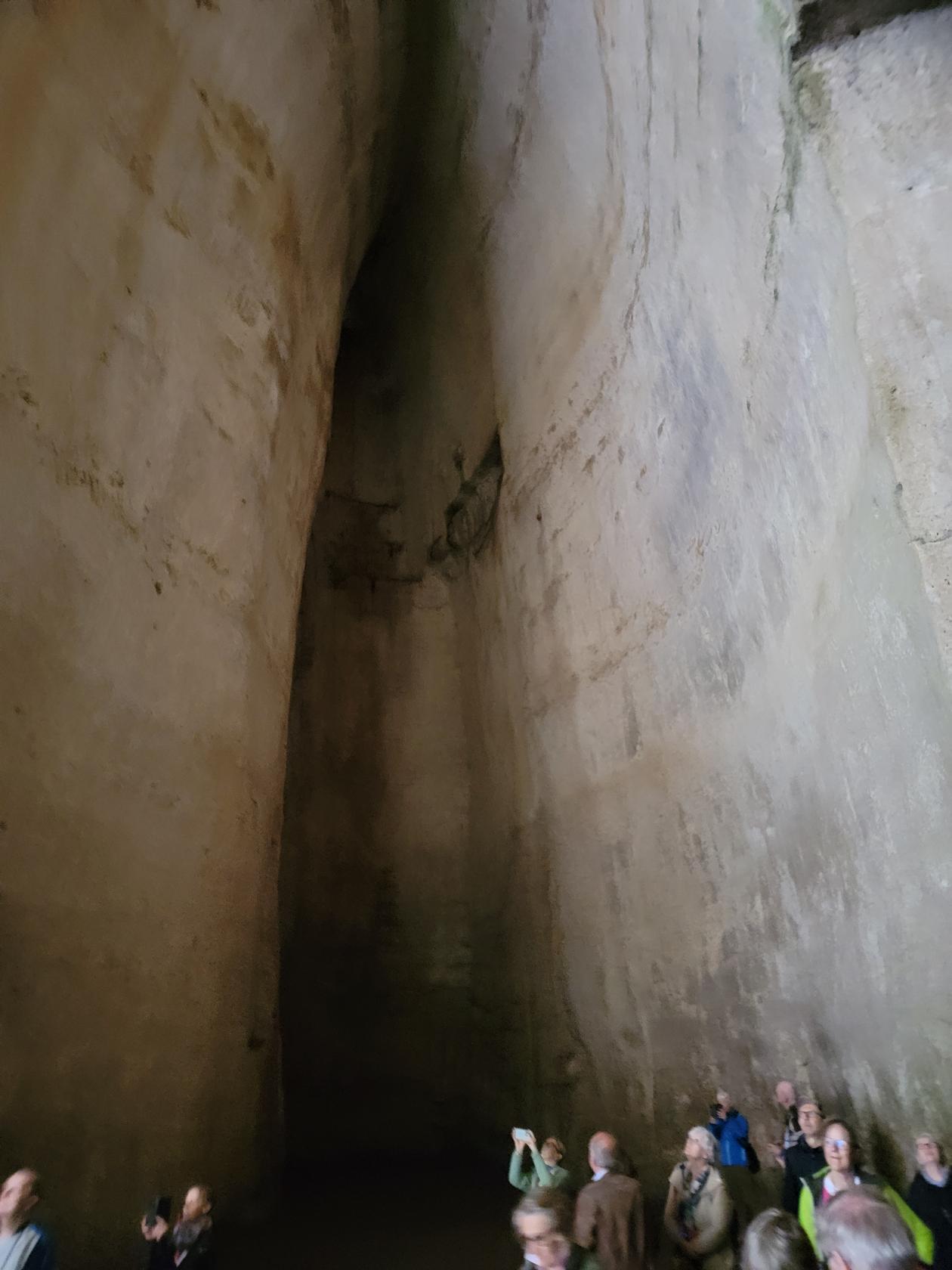
The Ear of Dionysus Grotto – The Neapolis – Archaeological Park – Siracuse, Sicily
The Ear of Dionysus Grotto – The Neapolis – Archaeological Park – Siracuse, Sicily
The Ear of Dionysus Grotto – The Neapolis – Archaeological Park – Siracuse, Sicily
The Ear of Dionysus Grotto – The Neapolis – Archaeological Park – Siracuse, Sicily
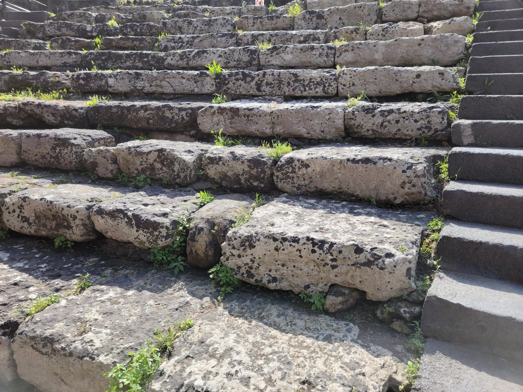
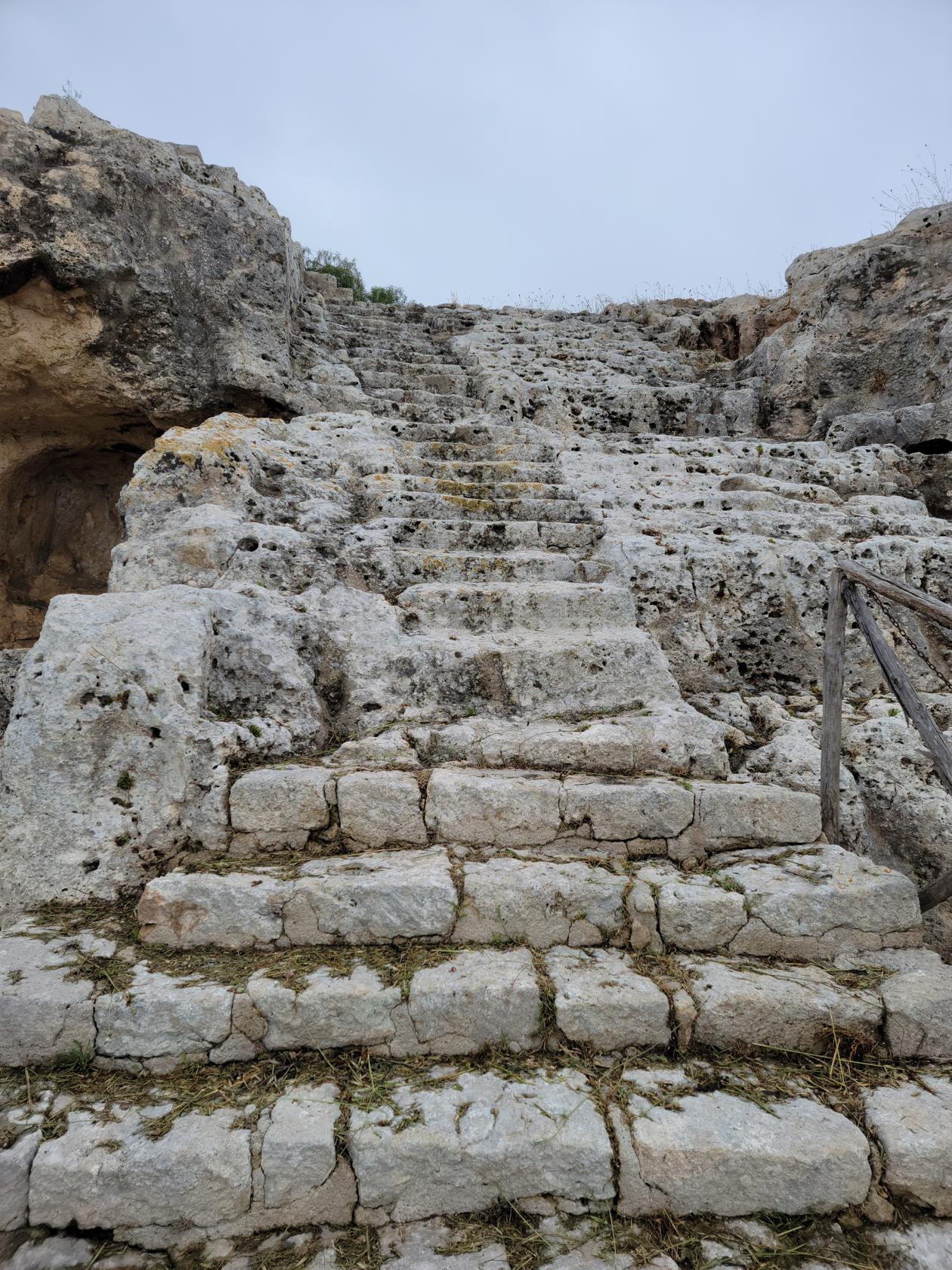
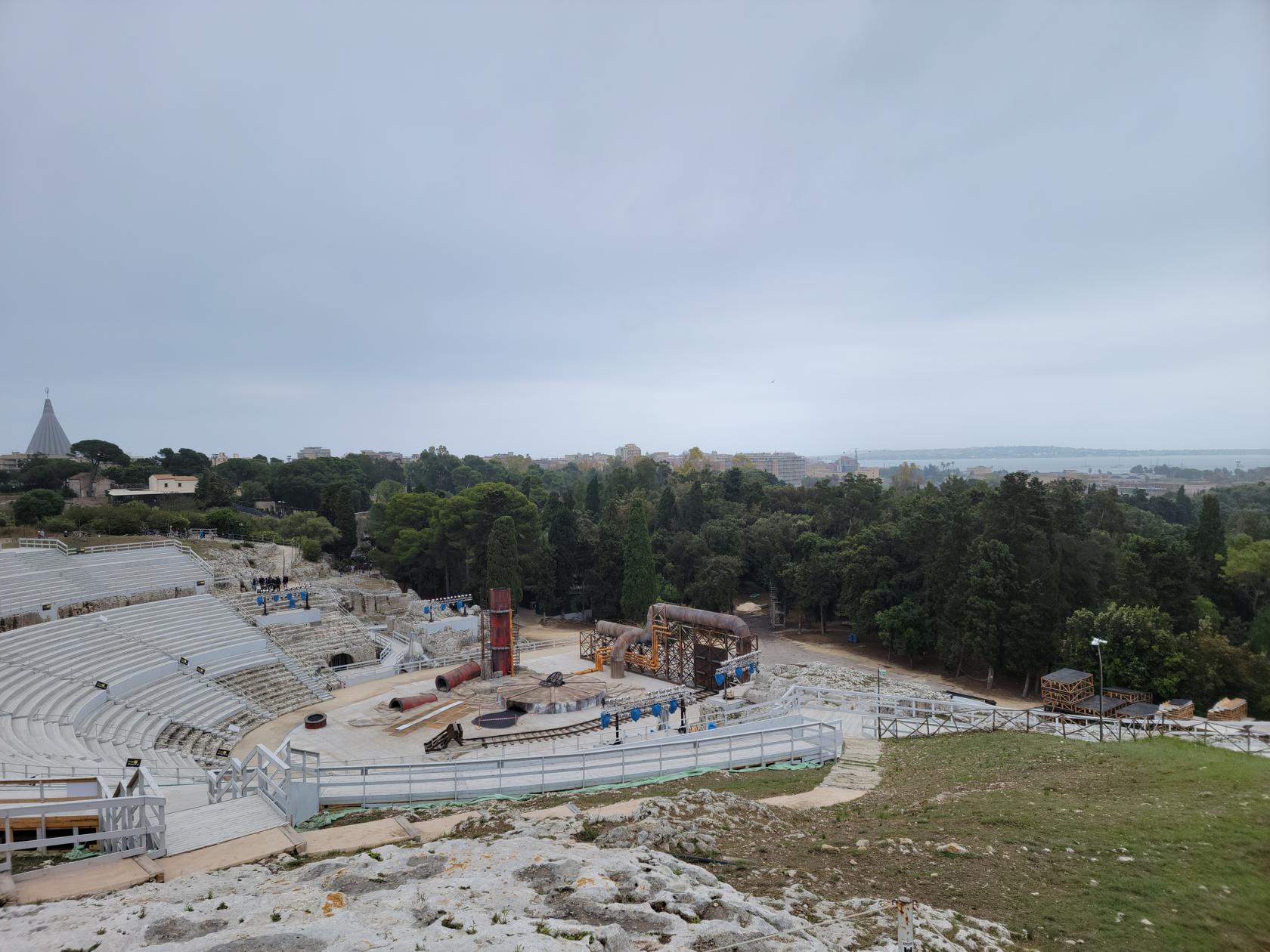
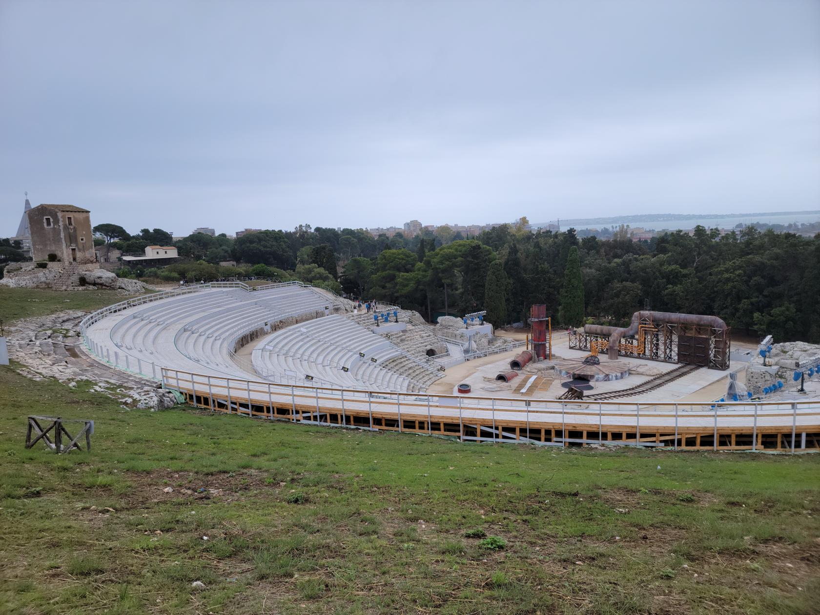
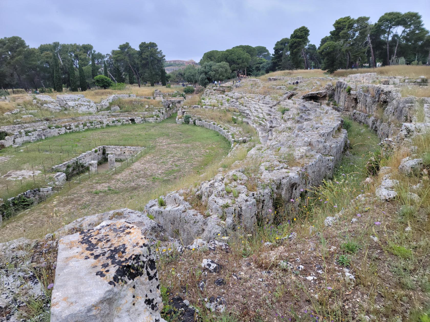
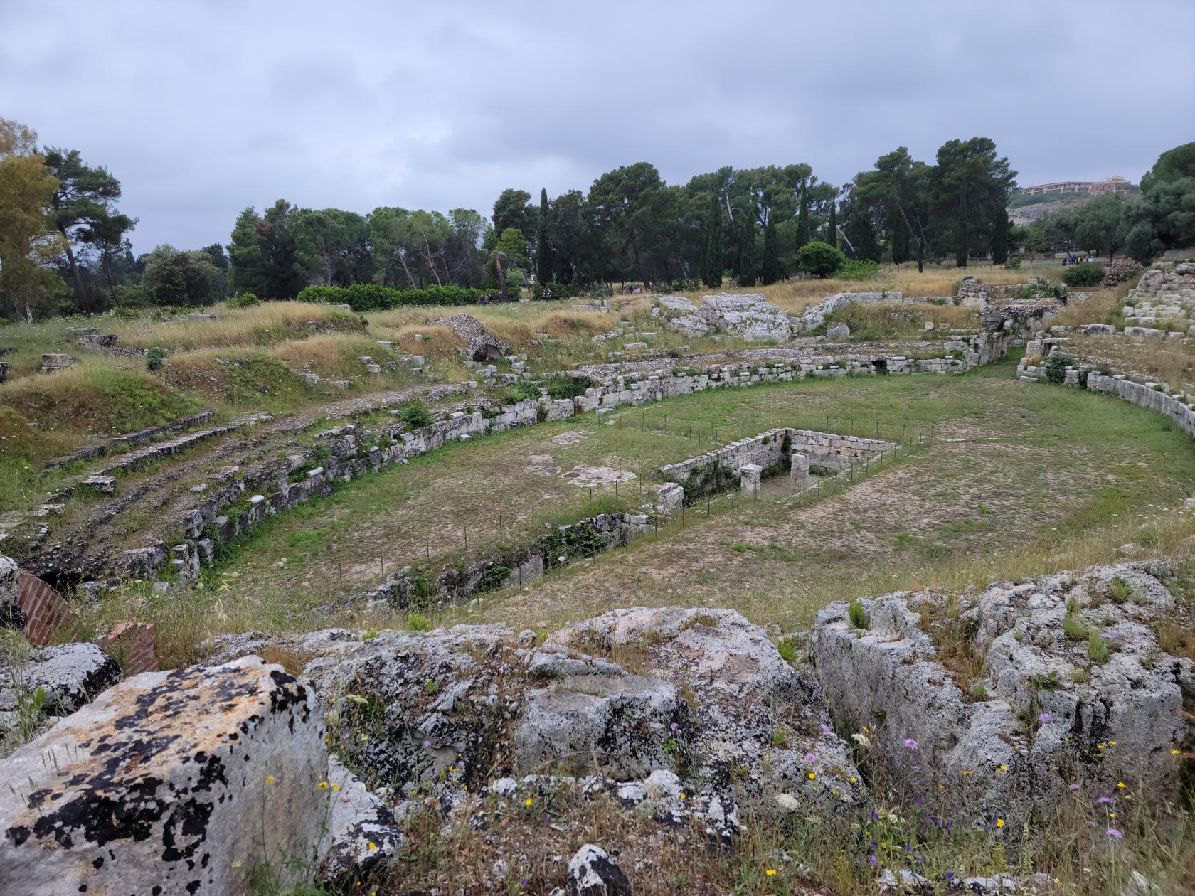
The Greek Theater
Built into the side of the hill, the Greek Theater was originally constructed in the fifth century BCE and later re-constructed several times, including by the Romans. Currently it has been further modified by the contemporary Syracusians for use as a theater again, building a scaffold like theater on top of the pre-existing Greek Theater, in order to have out-door performances and other events.
A walk to the Greek Theater – The Neapolis – Archaeological Park – Siracuse, Sicily
The necropolis near the Greek Theater – The Neapolis – Archaeological Park – Siracuse, Sicily
Ancient stone stairway of the Greek Theater – The Neapolis – Archaeological Park – Siracuse, Sicily
The Necropolis – The Neapolis – Archaeological Park – Siracuse, Sicily
Area around the Greek Theater – The Neapolis – Archaeological Park – Siracuse, Sicily
The renovated Greek Theater – The Neapolis – Archaeological Park – Siracuse, Sicily
The renovated Greek Theater – The Neapolis – Archaeological Park – Siracuse, Sicily
Behind the theater is a necropolis and grotto, both of which may be visited while visiting the structure.
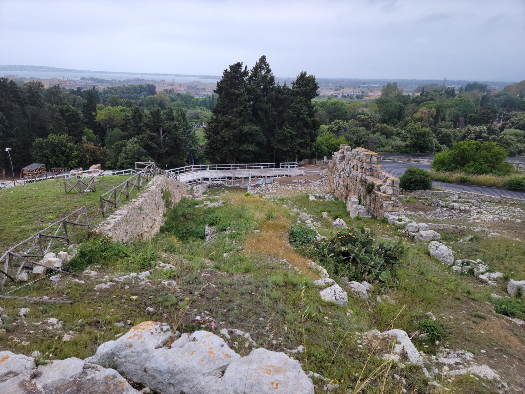
The Roman Theater
The Roman Theater is found on the way out of the park complex and extends to the exit for some way.
A map of the Roman Theater – The Neapolis – Archaeological Park – Siracuse, Sicily
The Roman Theater – The Neapolis – Archaeological Park – Siracuse, Sicily
The Roman Theater – The Neapolis – Archaeological Park – Siracuse, Sicily
Entryway to the Roman Theater – The Neapolis – Archaeological Park – Siracuse, Sicily
The Roman Theater – The Neapolis – Archaeological Park – Siracuse, Sicily
The Roman Theater – The Neapolis – Archaeological Park – Siracuse, Sicily
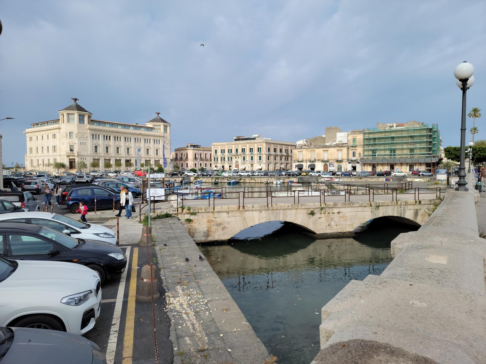
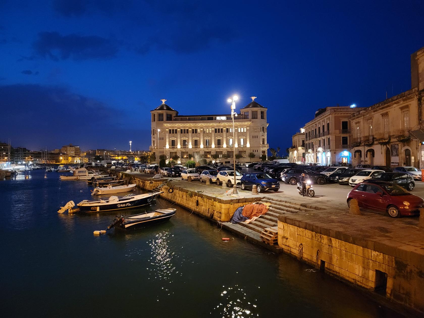
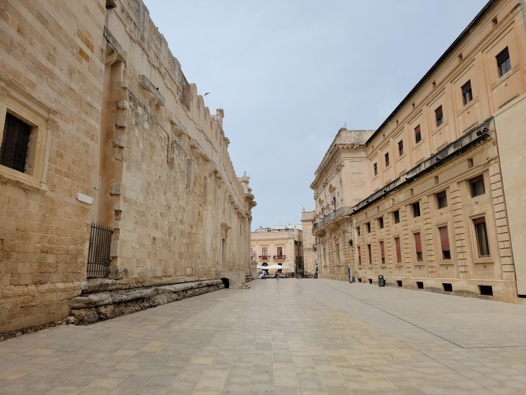
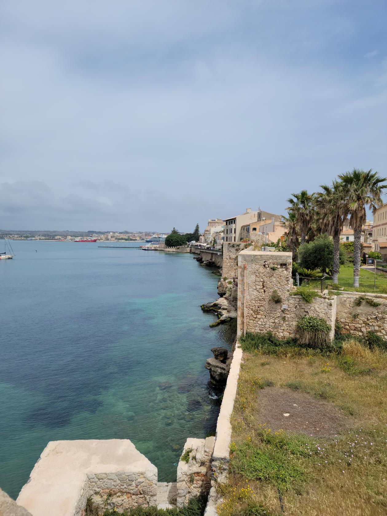
Island Of Ortigia
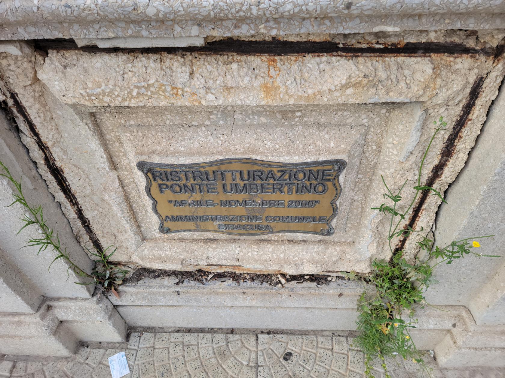
Ortigia, also known as Ortygia or Citta Vecchia (old city), is an island within the city of Syracuse. It is connected to the mainland and the rest of Syracuse by two bridges, the Umbertino Bridge and the Bridge of Santa Lucia.
Umbertino Bridge – Siracusa, Sicily
Umbertino Bridge – Siracusa, Sicily
Ortea Palace Hotel at night – Siracusa, Sicily
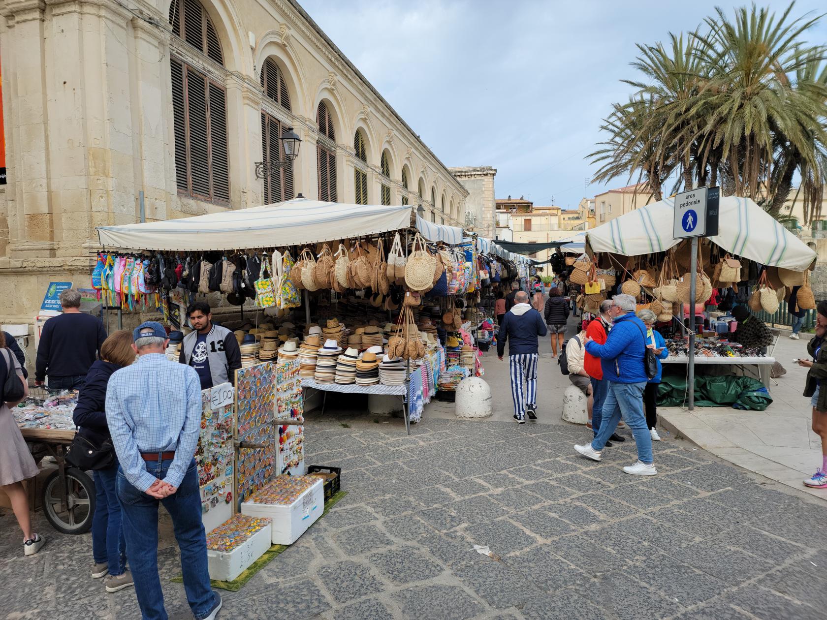
The old market place – Via Emmanuele de Benedictus – Siracusa, Sicily
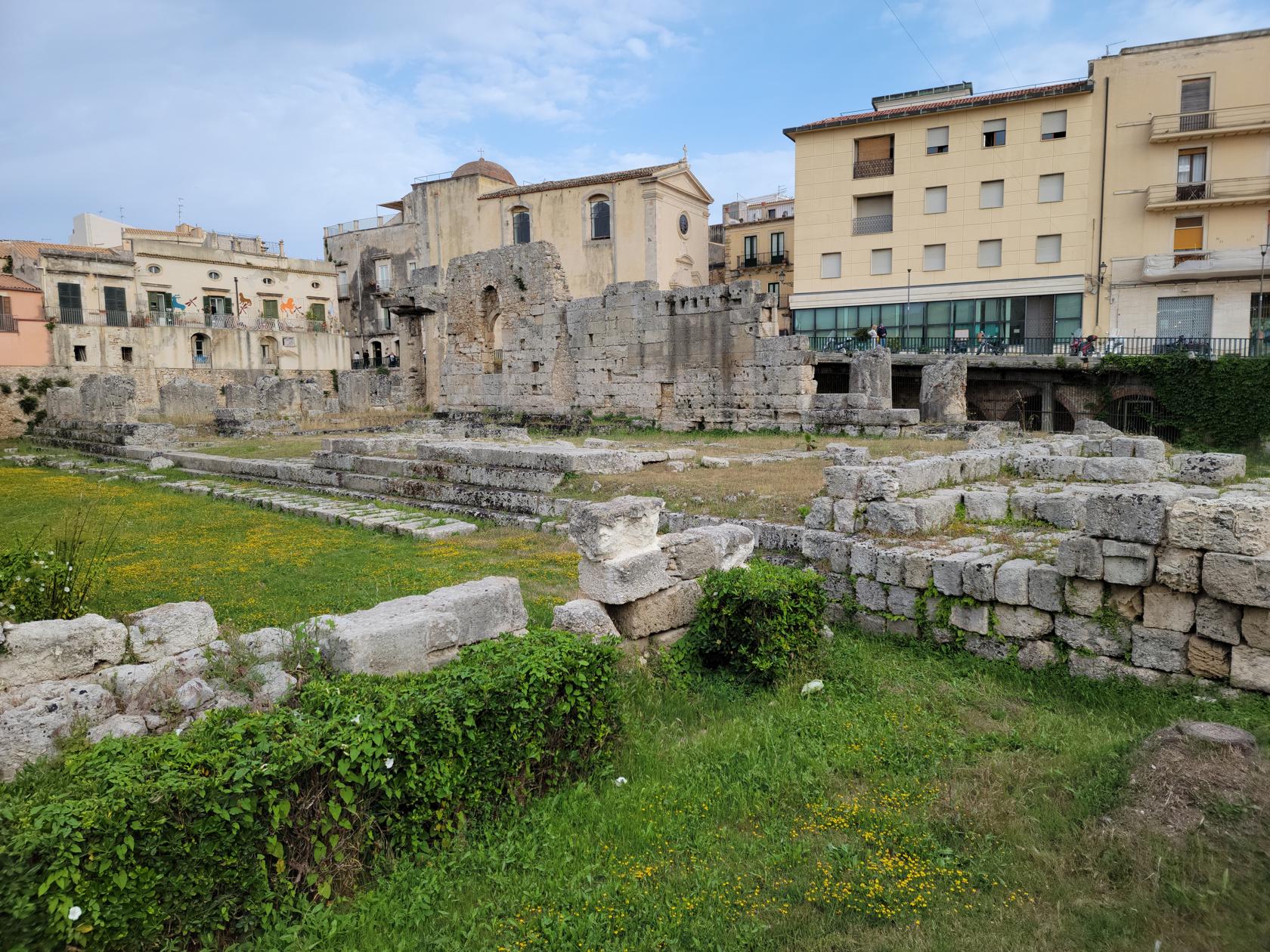
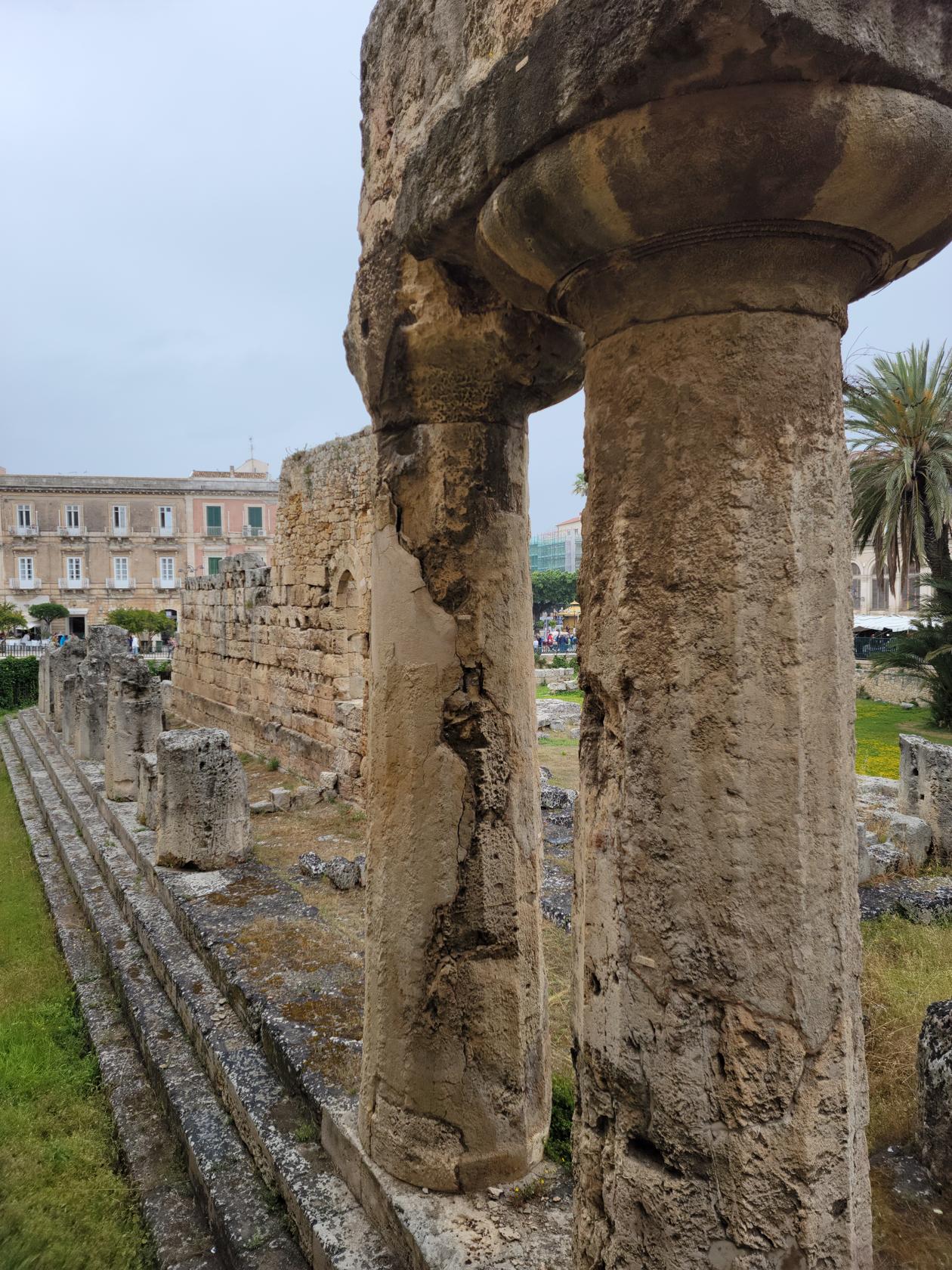
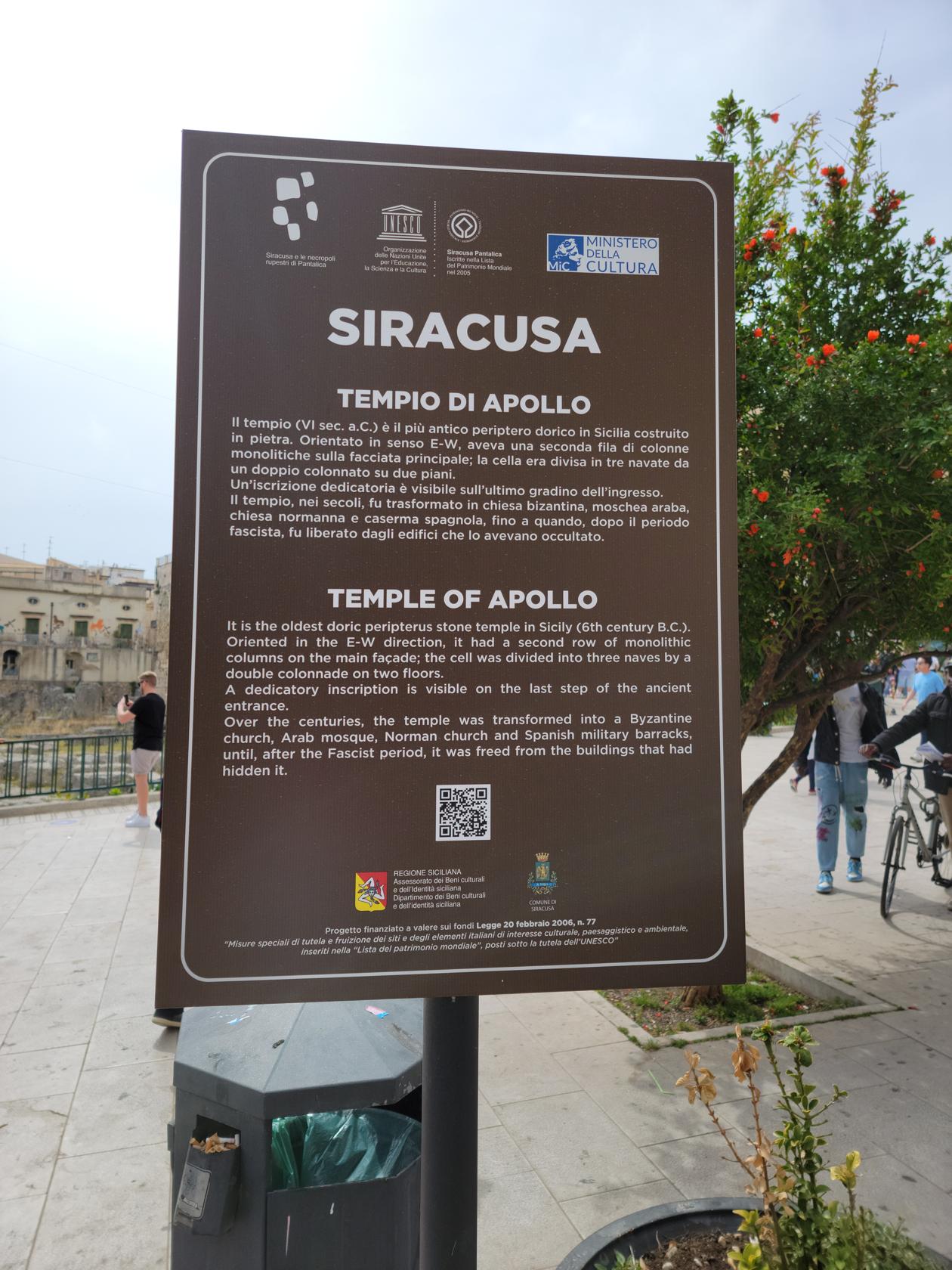
At the entrance of the ancient city is the Temple of Apollo. This is the first site anyone will see upon entering the city. Continuing around the temple visitors will automatically ascend the Corso Giacomo Matteotti, or the main street. This is the main shopping street, containing all contemporary brands and shops and will lead one to the Fountain of Diana.
Syracusae boardwalk – Ortigia – Siracuse, Sicily
Temple of Apollo – Siracusa, Sicily
Statue of Archimedes – Umbertino Bridge – Siracuse, Sicily
Temple of Apollo – Ortigia – Siracuse, Sicily
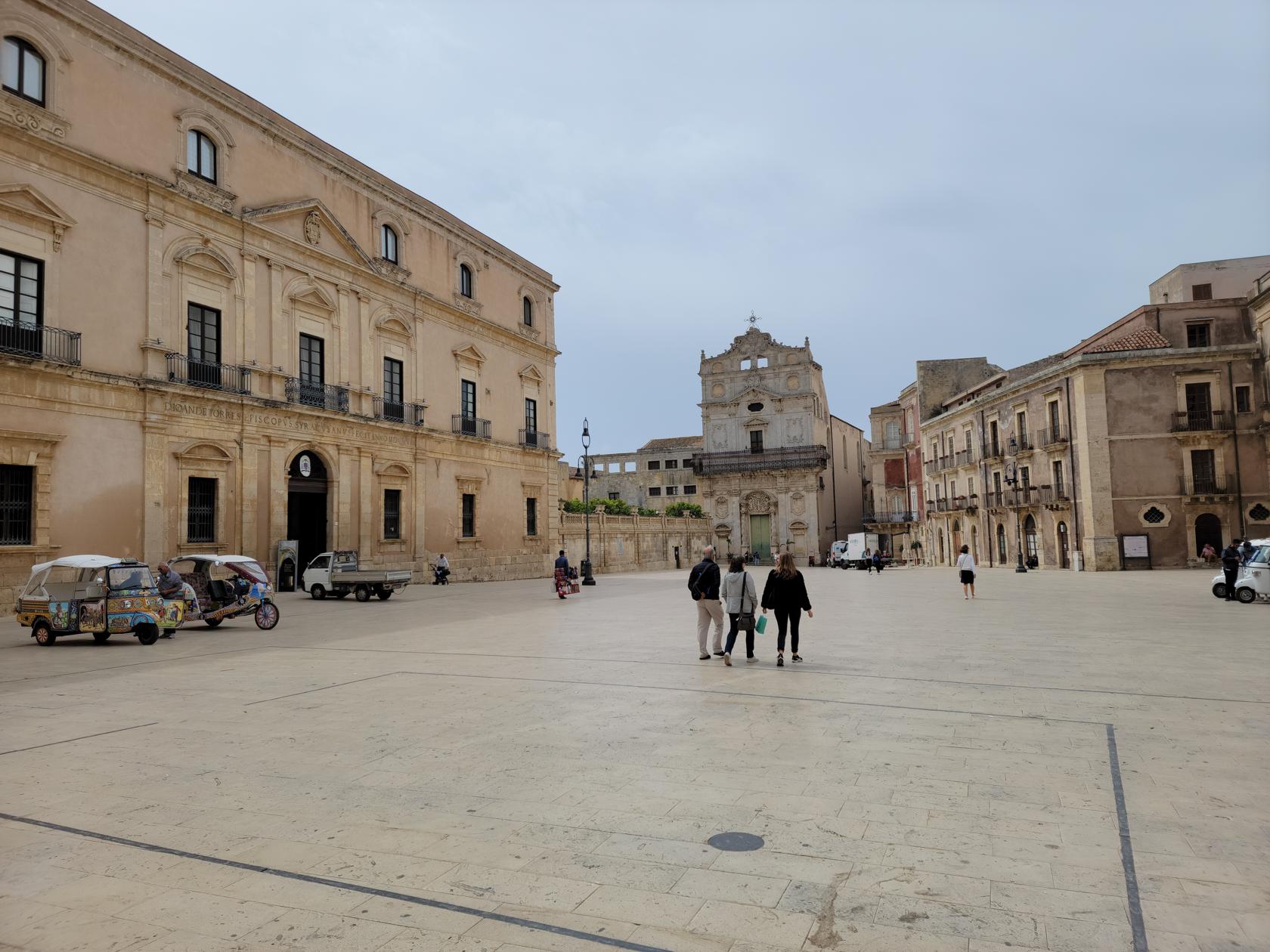
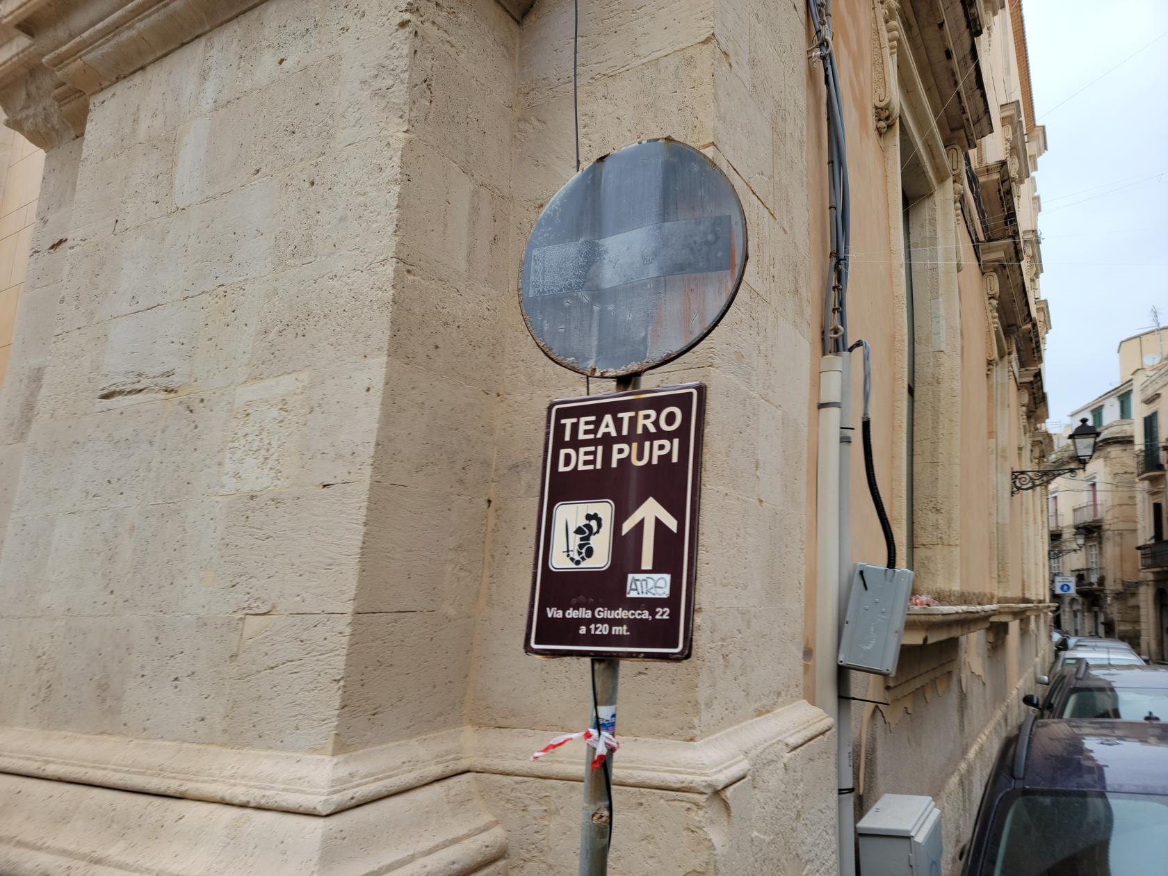
From this traffic-circle; going to the left will take one to the Puppet museum and theater, and the eastern part of the island; going right will take one to the Piazza Duomo and the tourist shopping street, which will also take you to the Syracuse Cathedral.
Temple of Apollo – Siracusa, Sicily
Fountain of Diana – Siracusa, Sicily
Info Center – Siracusa, Sicily
Piazza Minerva – Siracusa, Sicily
Piazza Duomo – Siracusa, Sicily
Santa Lucia Church – Piazza Duomo – Siracusa, Sicily
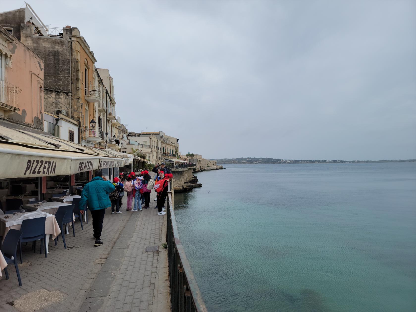
Lungomare Alfeo – Siracusa, Sicily
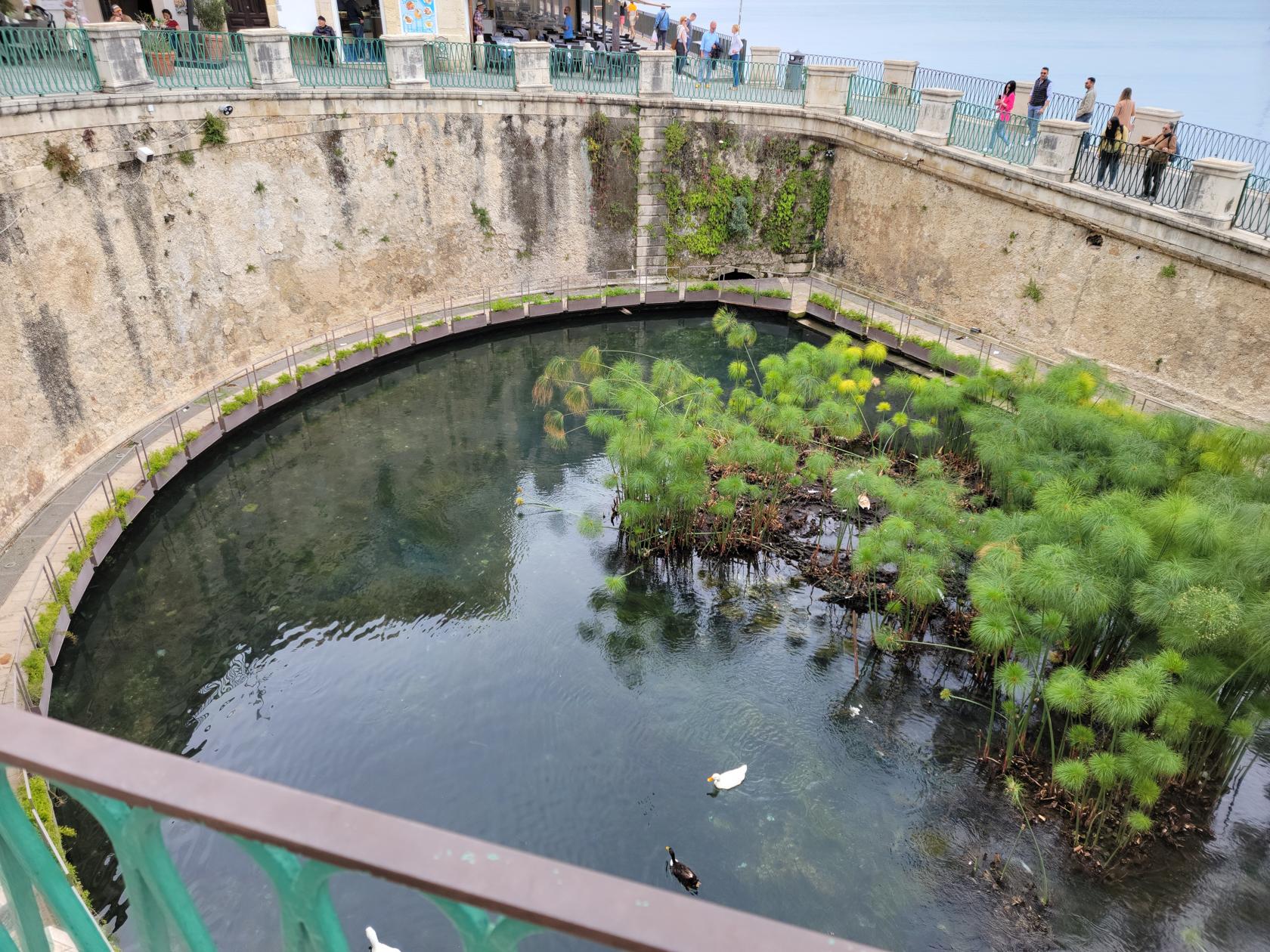
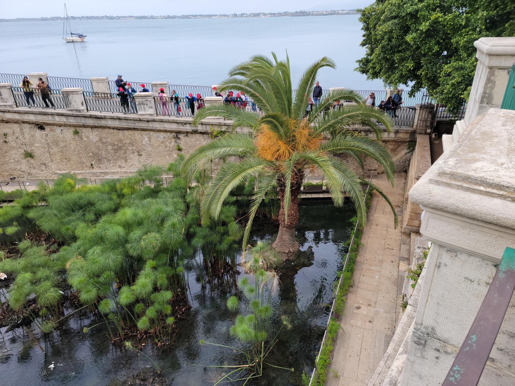
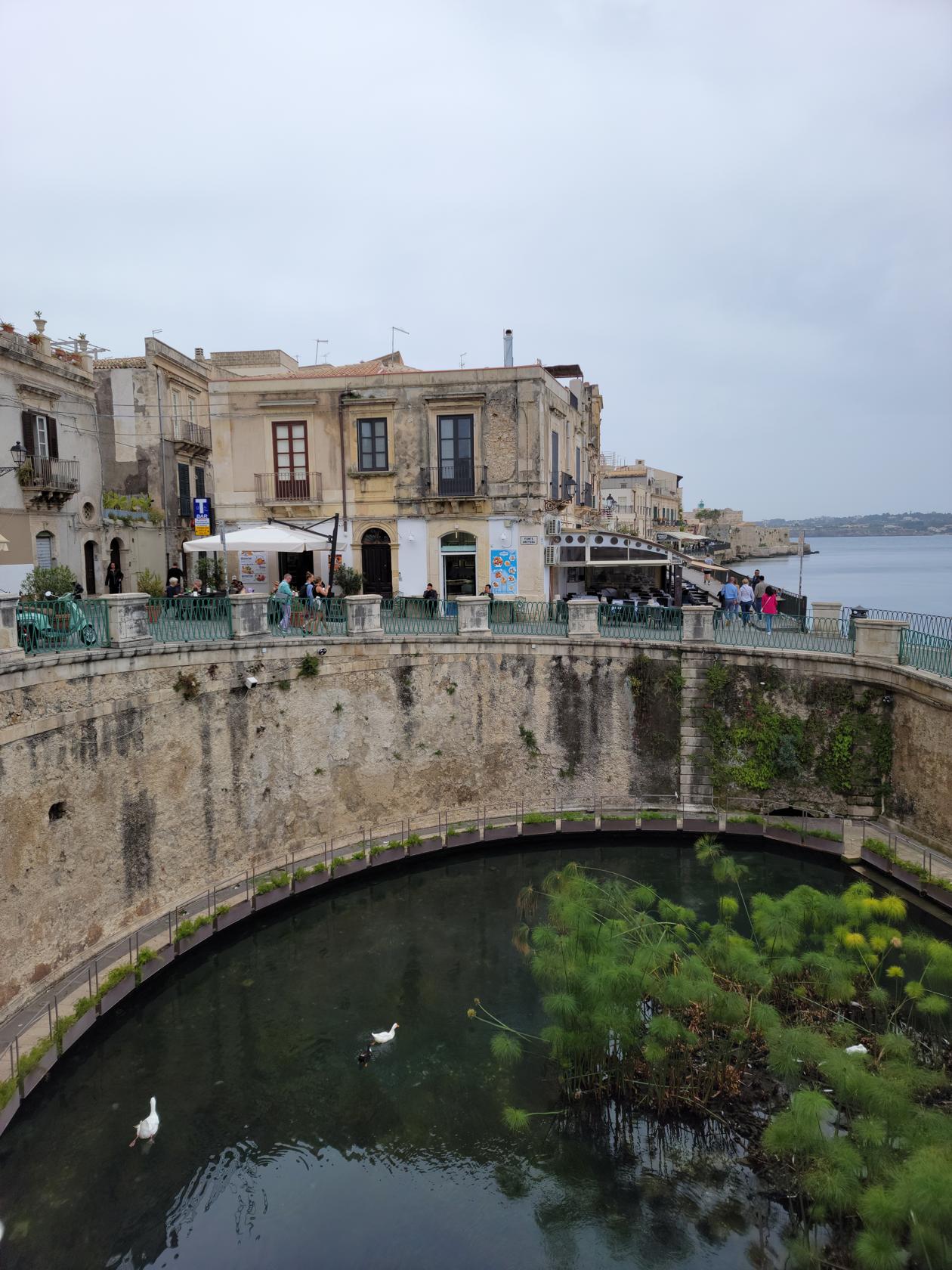
Arethuse Spring – Siracusa, Sicily
Papyrus Grotto – Arethuse Spring – Siracusa, Sicily
Papyrus Grotto – Arethuse Spring – Siracusa, Sicily
Church – Siracusa, Sicily
Side street – Siracusa, Sicily
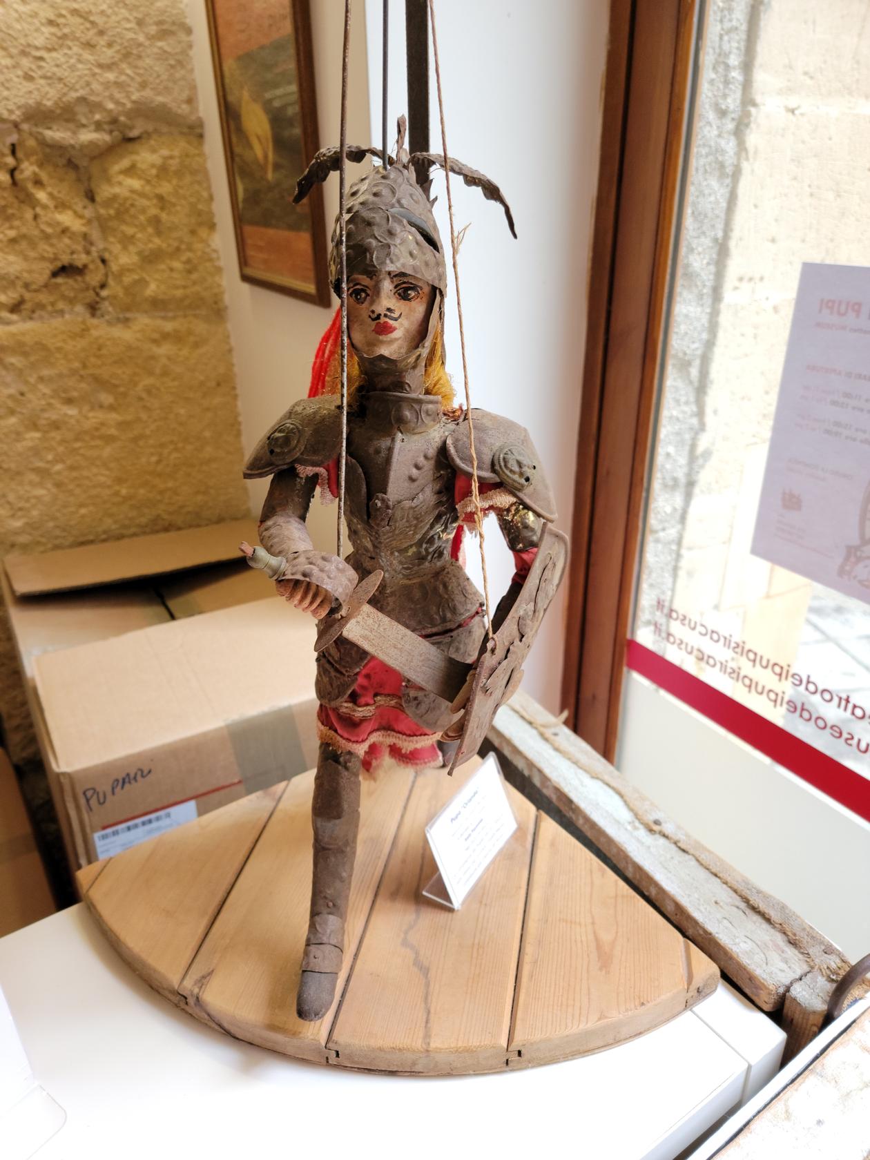
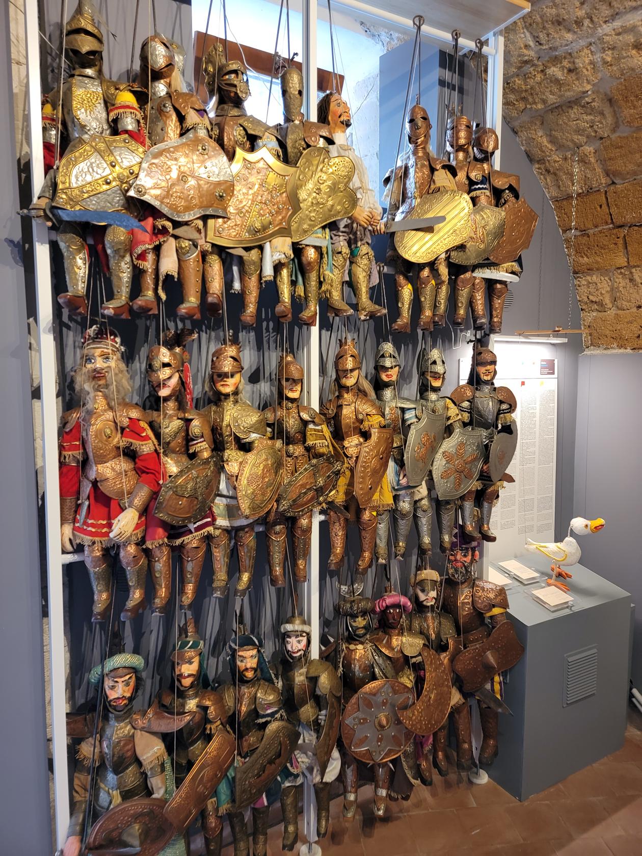
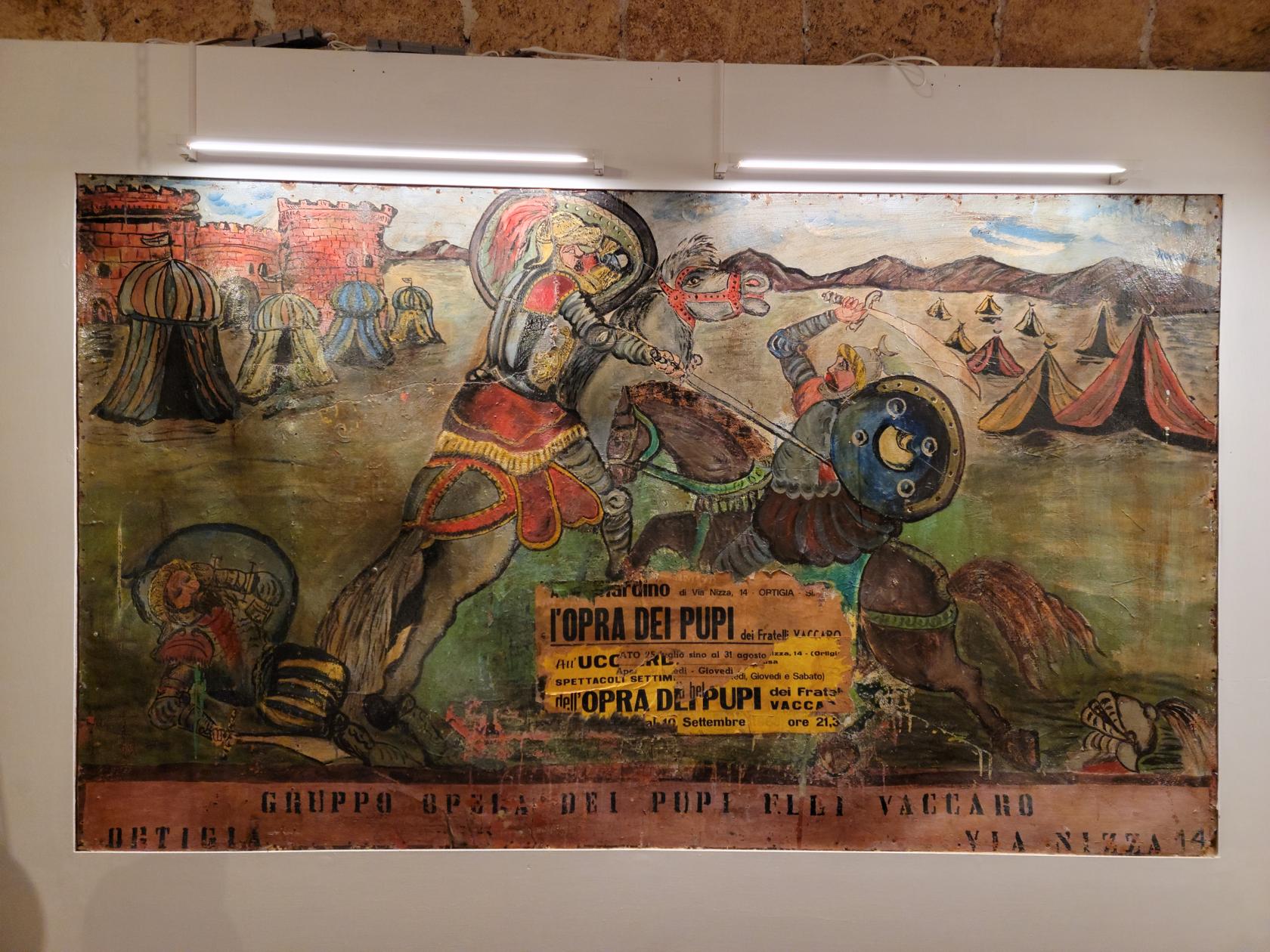
Puppet Museum
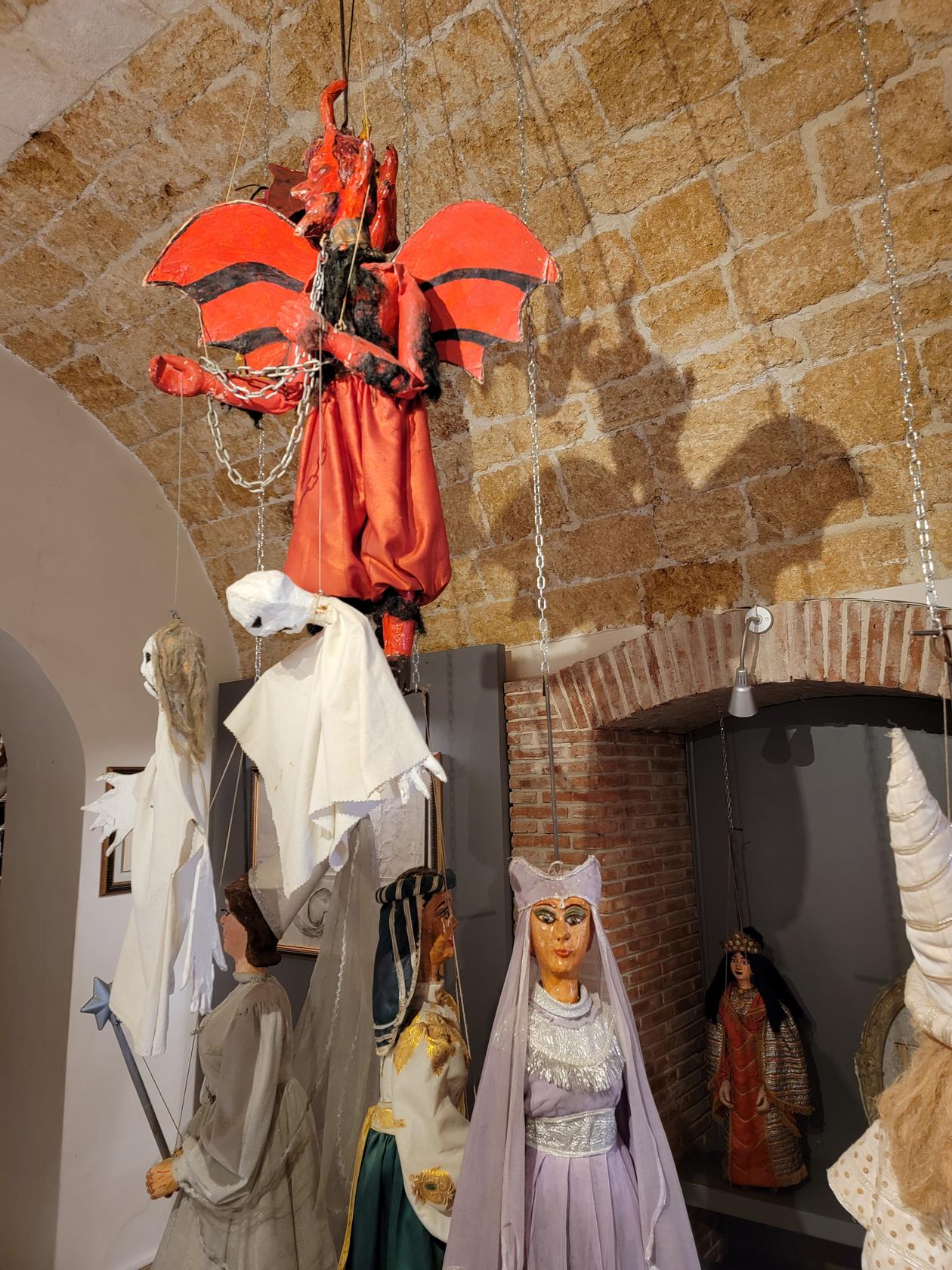
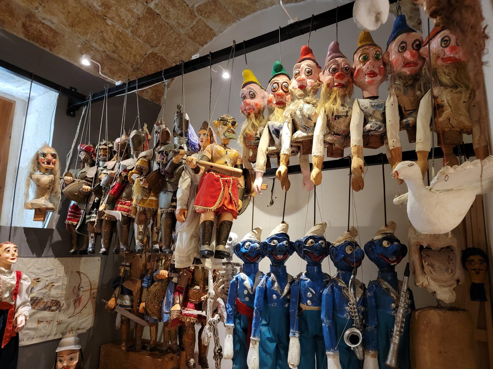
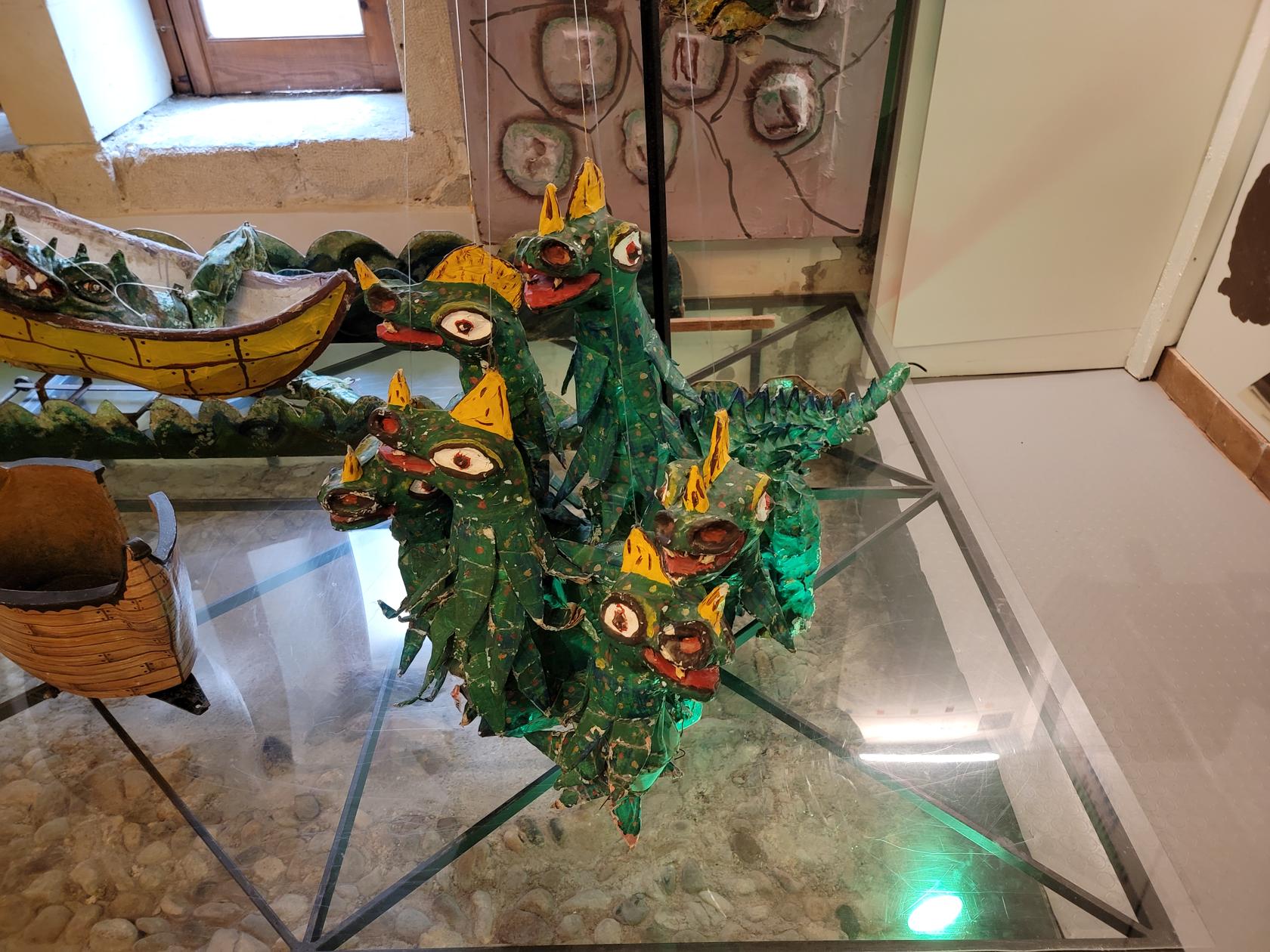
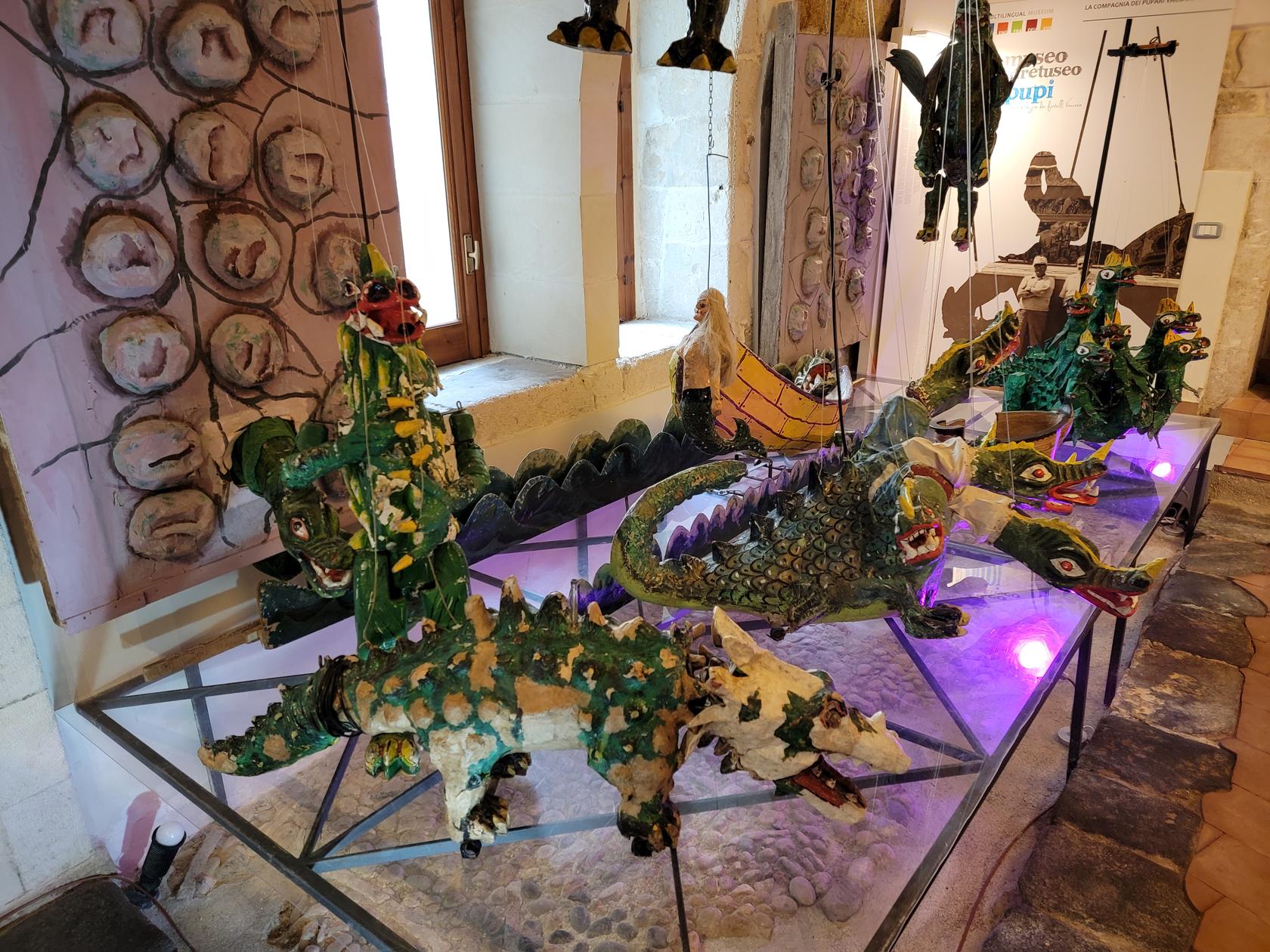
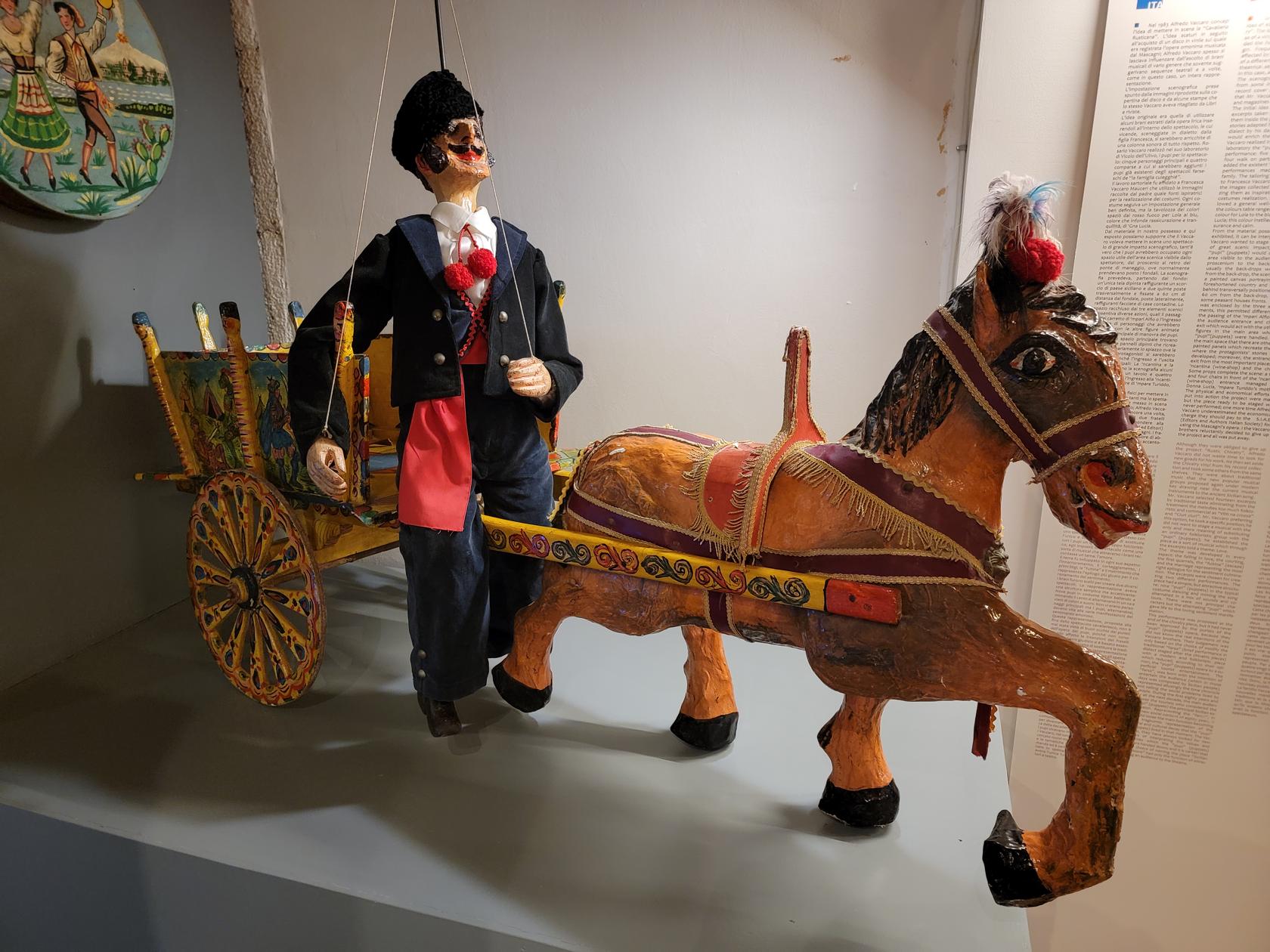
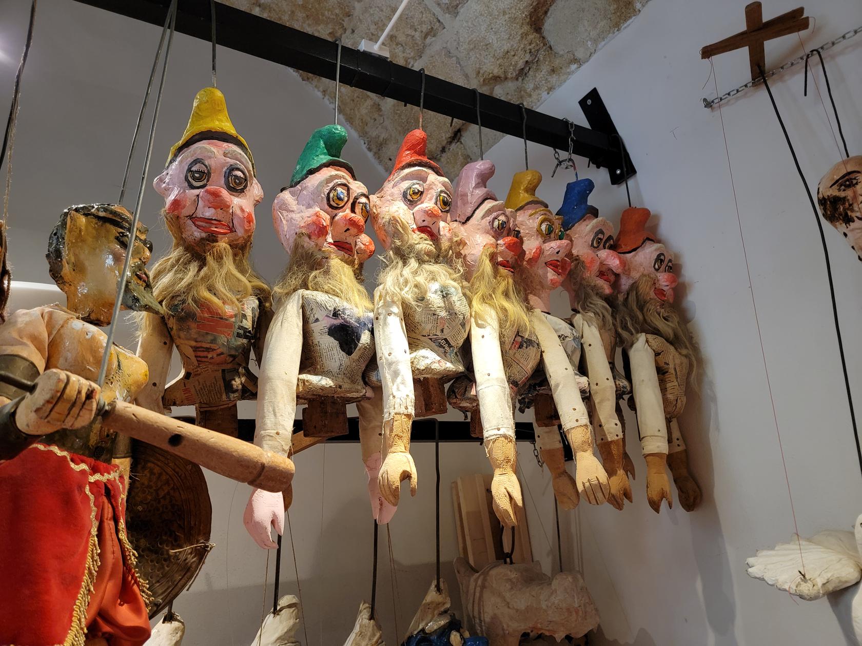
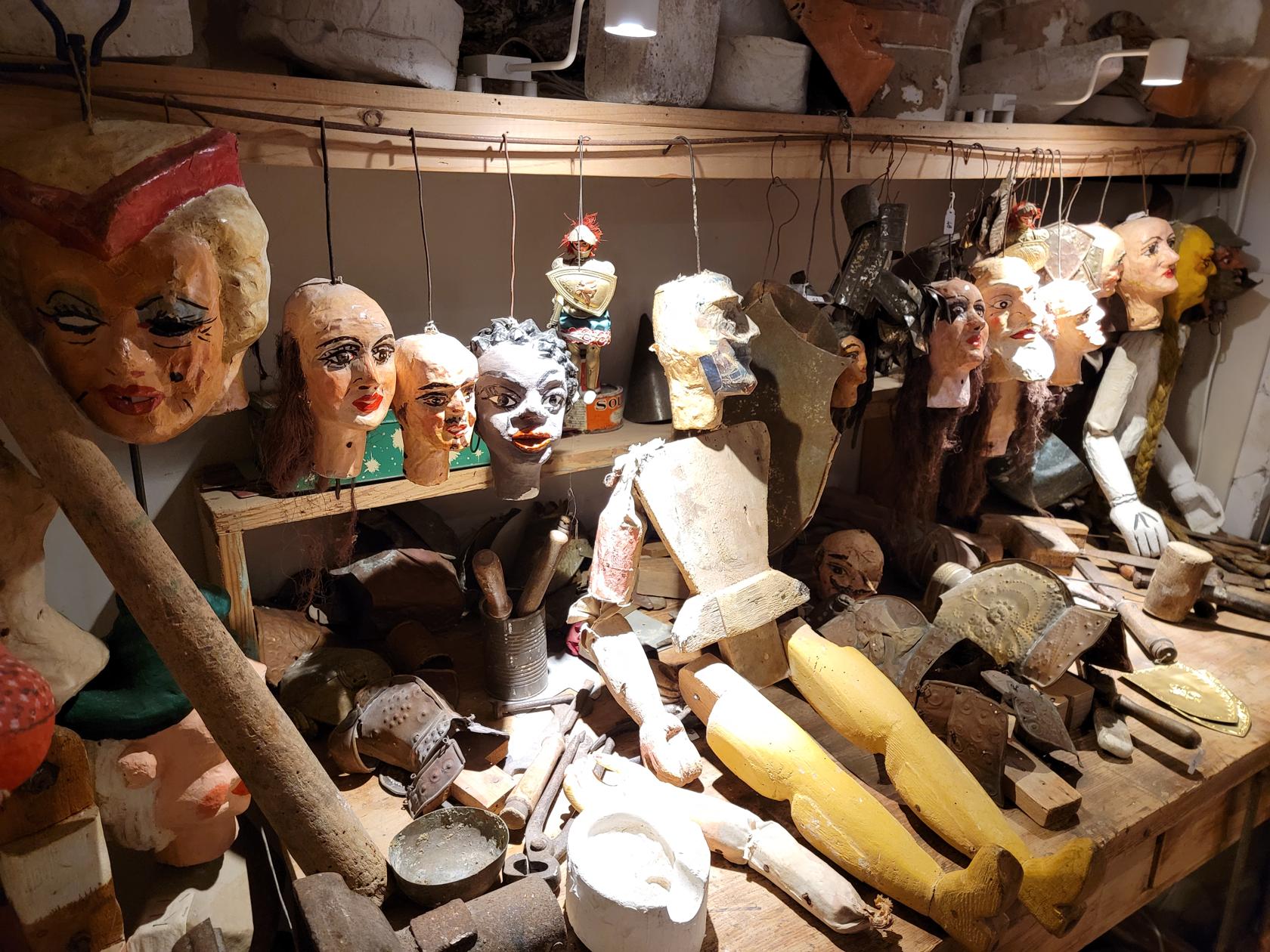
This is an interesting little museum covering the history of a specific heritage of puppet making on the island of Ortigia. Therefore, the puppets are specifically built around tales and folklore of the people of Sicily.
Puppet Museum – Ortigia – Siracuse, Sicily
The puppets range in size from small (approx. 20cm in height), all the way to life size. There are many examples of finished products and some of contemporary origin. One display also shows the progression of making a puppet, from the carving stage through final assembly. All very instructive.
Assortment of small puppets – Puppet Museum – Ortigia – Siracuse, Sicily
Assortment of knight puppets – Puppet Museum – Ortigia – Siracuse, Sicily
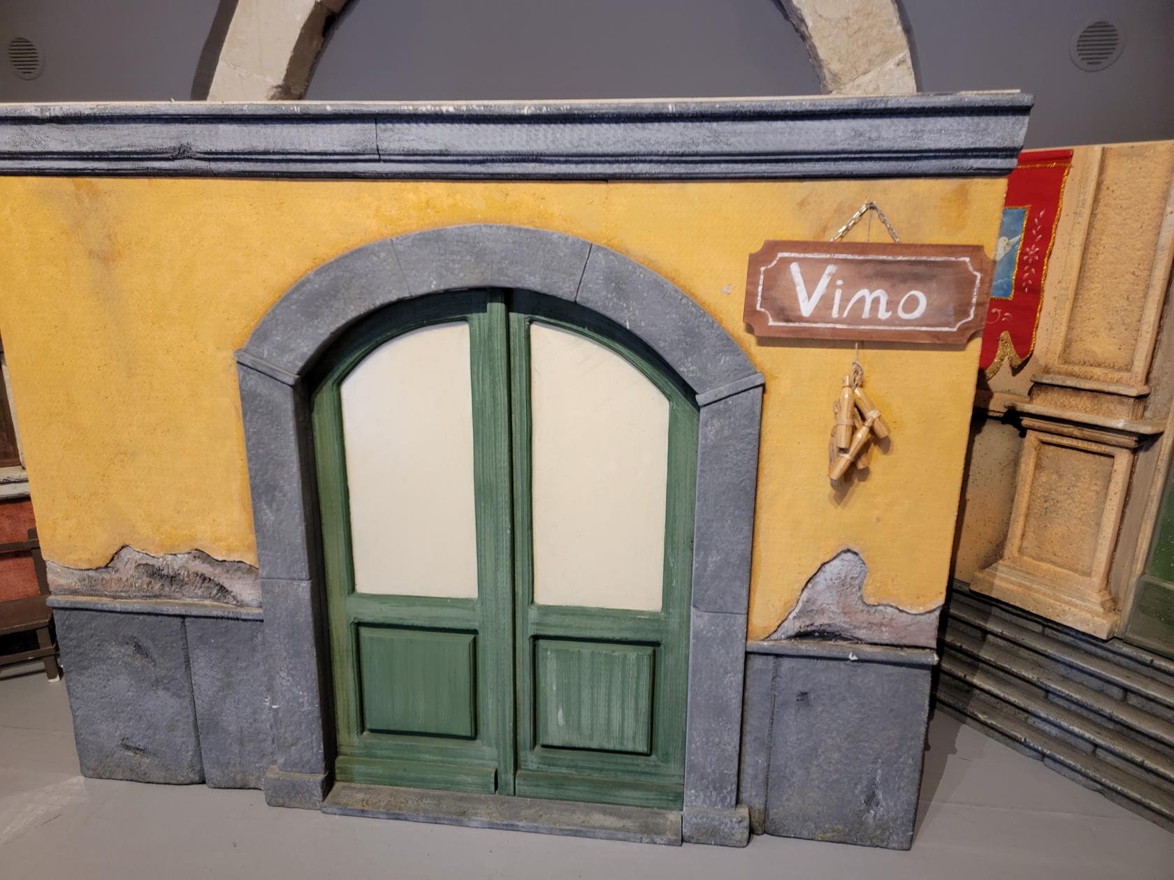
Small store front to scale – Puppet Museum – Ortigia – Siracuse, Sicily
Old advertisement sign – Puppet Museum – Ortigia – Siracuse, Sicily
A favorite puppet antagonist – The devil – Puppet Museum – Ortigia – Siracuse, Sicily
The dwarves, smurfs and others – Puppet Museum – Ortigia – Siracuse, Sicily
The six headed beast – Puppet Museum – Ortigia – Siracuse, Sicily
Dragons – Puppet Museum – Ortigia – Siracuse, Sicily
Horse drawn wagon and driver puppet – Puppet Museum – Ortigia – Siracuse, Sicily
Workshop puppets at different stages of finishing – Puppet Museum – Ortigia – Siracuse, Sicily
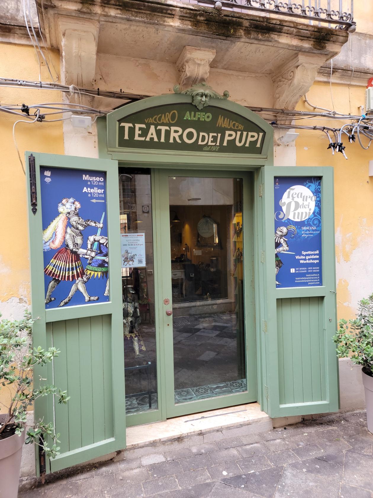
Puppet Theater
Street sign – The Puppet Theater – Ortigia – Siracuse, Sicily
Entrance – The Puppet Theater – Ortigia – Siracuse, Sicily
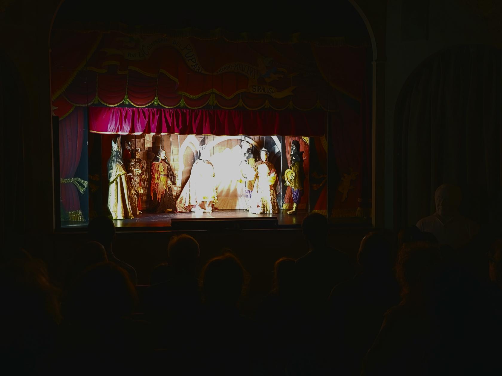
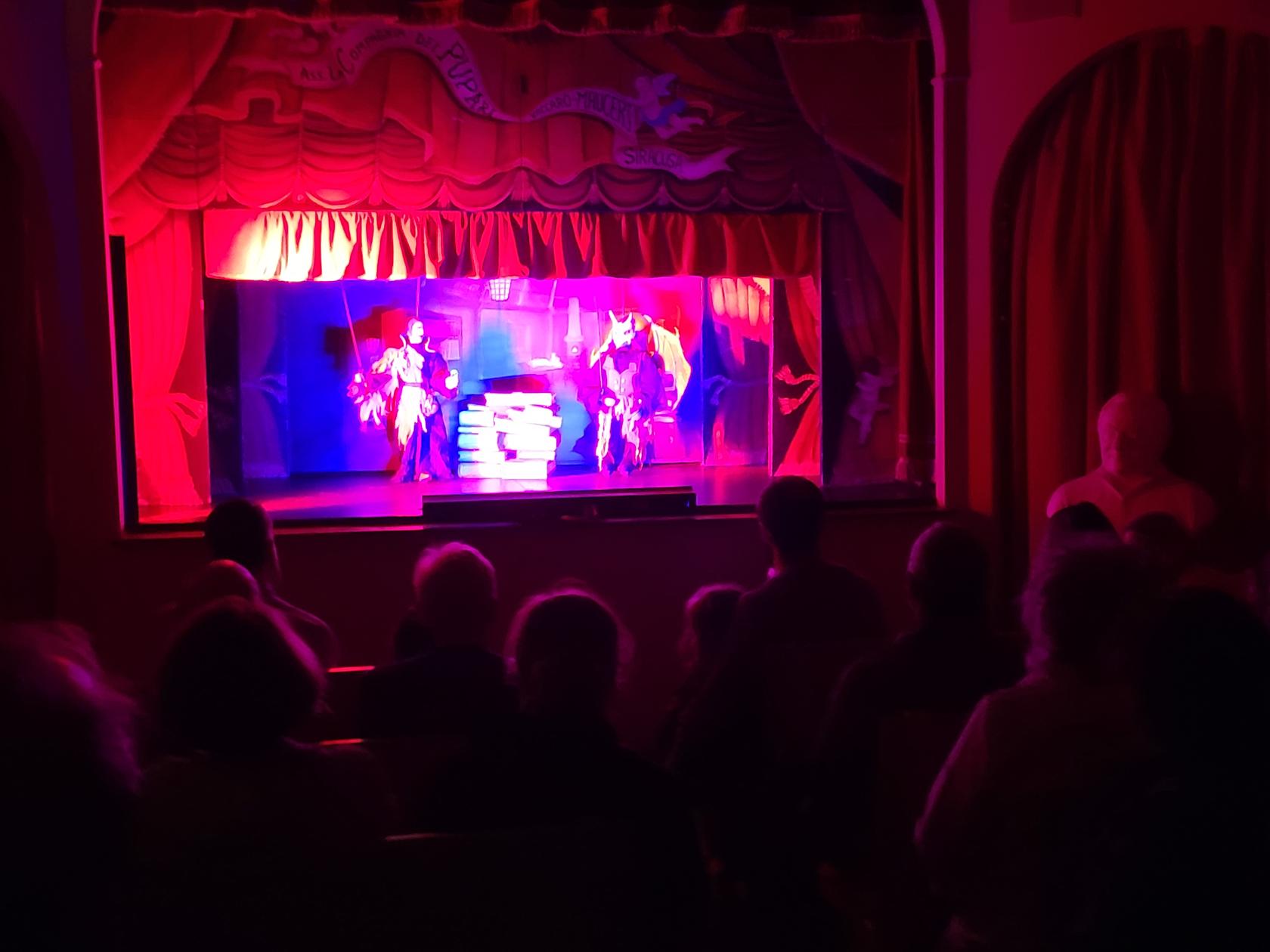
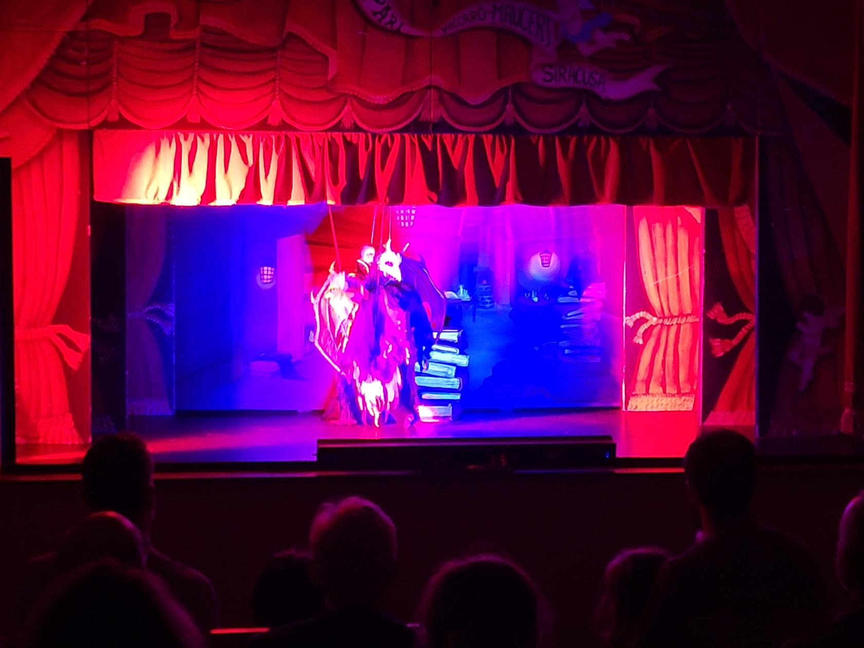
I was originally hesitant to go the Puppet Theater. But after attending a show, I am glad I had. Not only does the host explain the tale in great detail in English, before it is performed. But the actually acting and enactment of the tale was so compelling, I was captivated, even though I had no idea what was being said at many points during the performance.
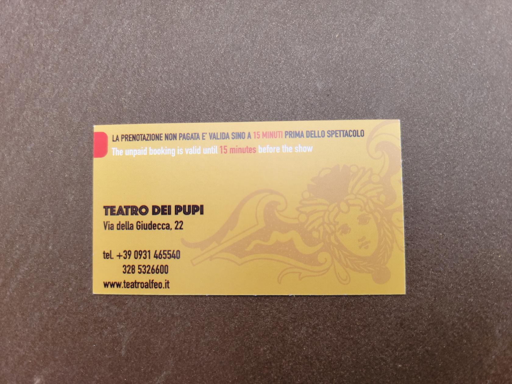
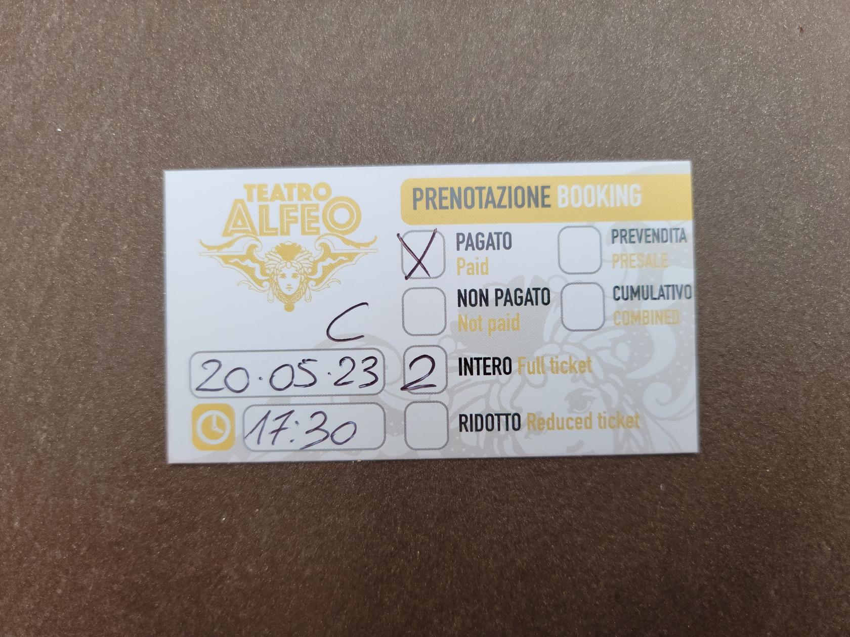
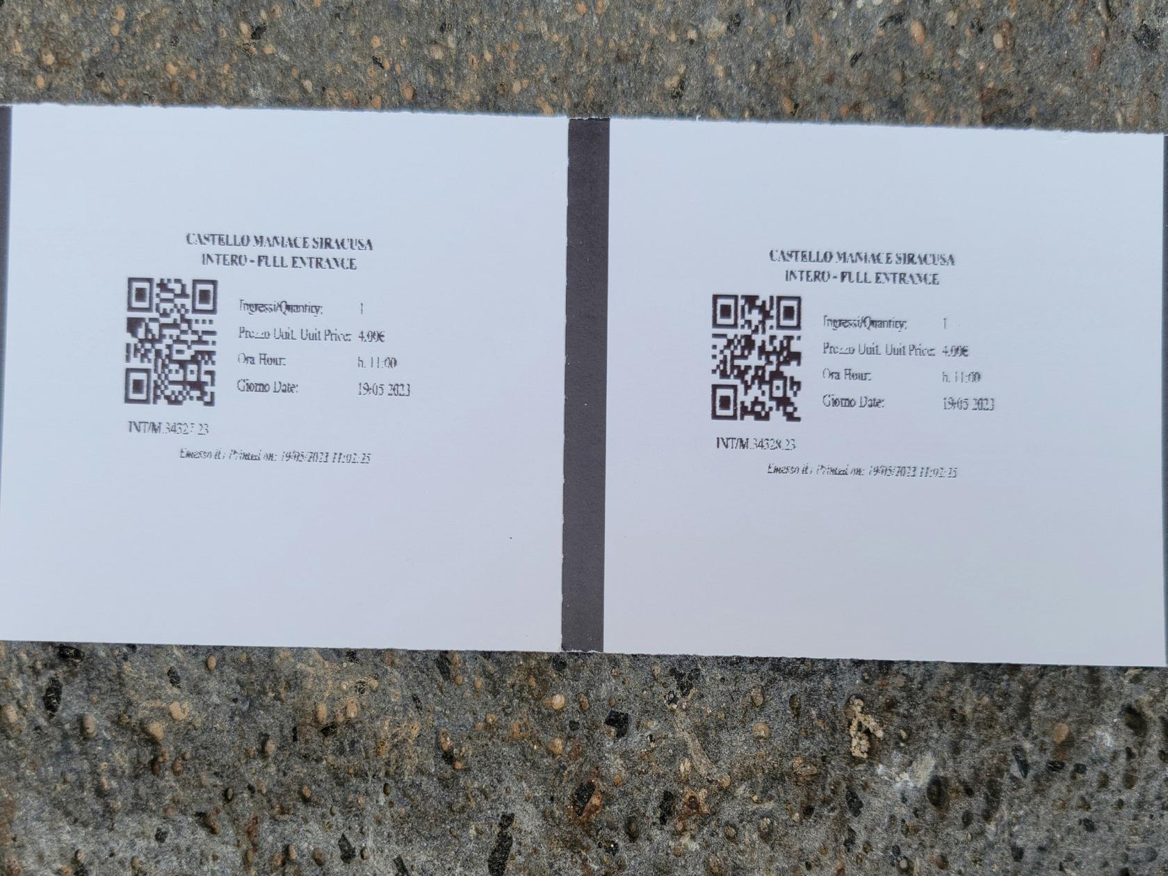
Tickets for Two – The Puppet Theater – Ortigia – Siracuse, Sicily
Tickets for Two – The Puppet Theater – Ortigia – Siracuse, Sicily
The theater space is very personal, with only enough room for about 50-60 people, and they will seat others if needed in the aisle (on the steps). Therefore, if you need to take any medically necessary precautions in cramped quarters, be prepared before you arrive.
The stage in action – The Puppet Theater – Ortigia – Siracuse, Sicily
An ancient Sicilian tale – The Puppet Theater – Ortigia – Siracuse, Sicily
A demon is always close by – The Puppet Theater – Ortigia – Siracuse, Sicily
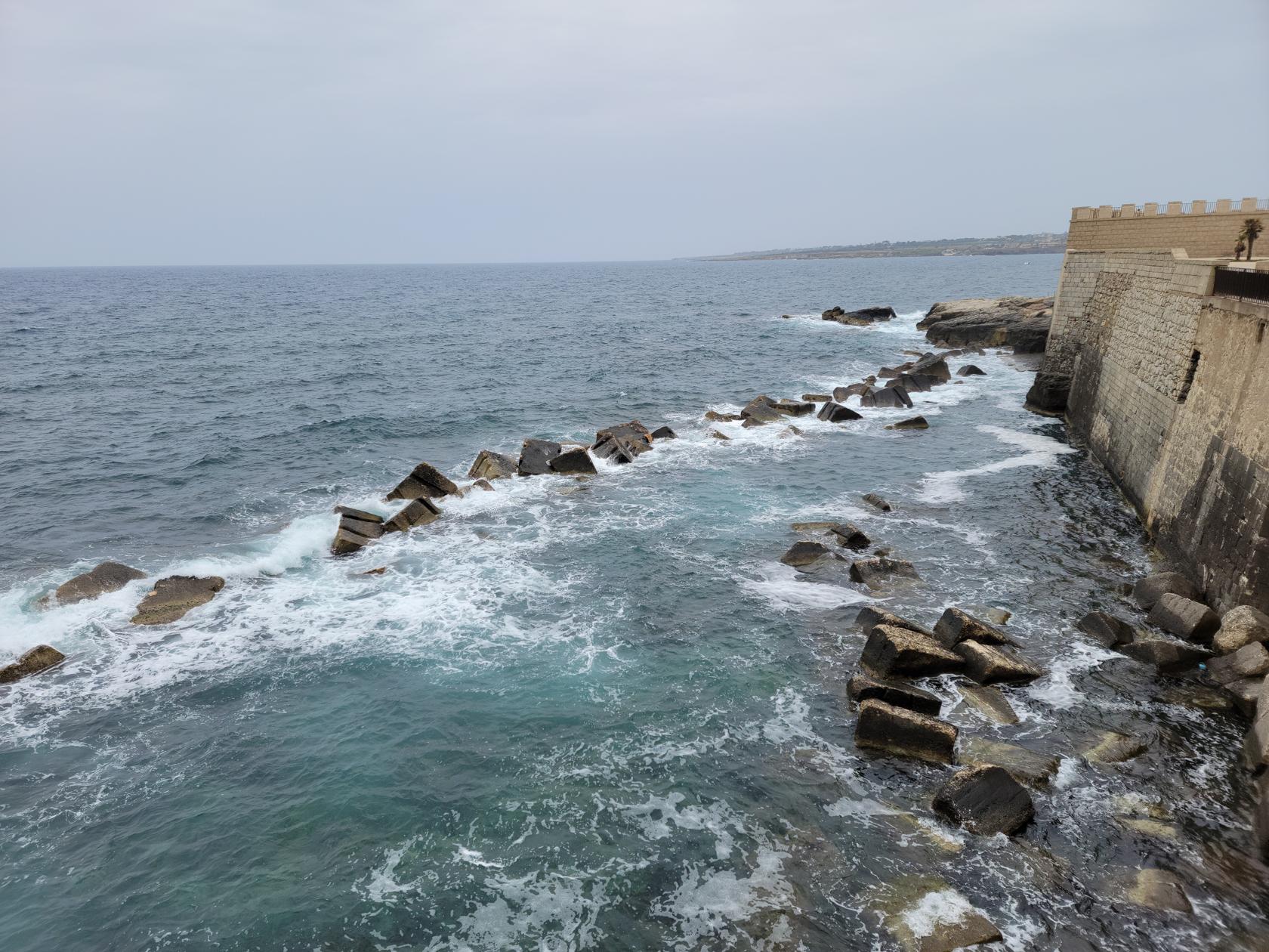
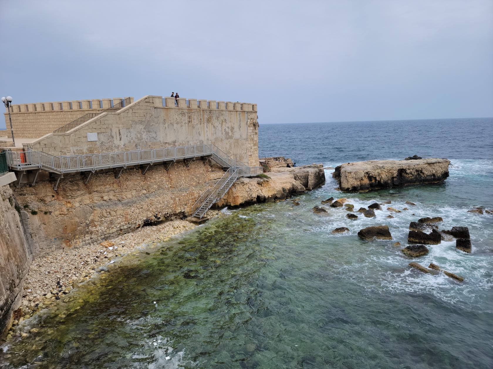
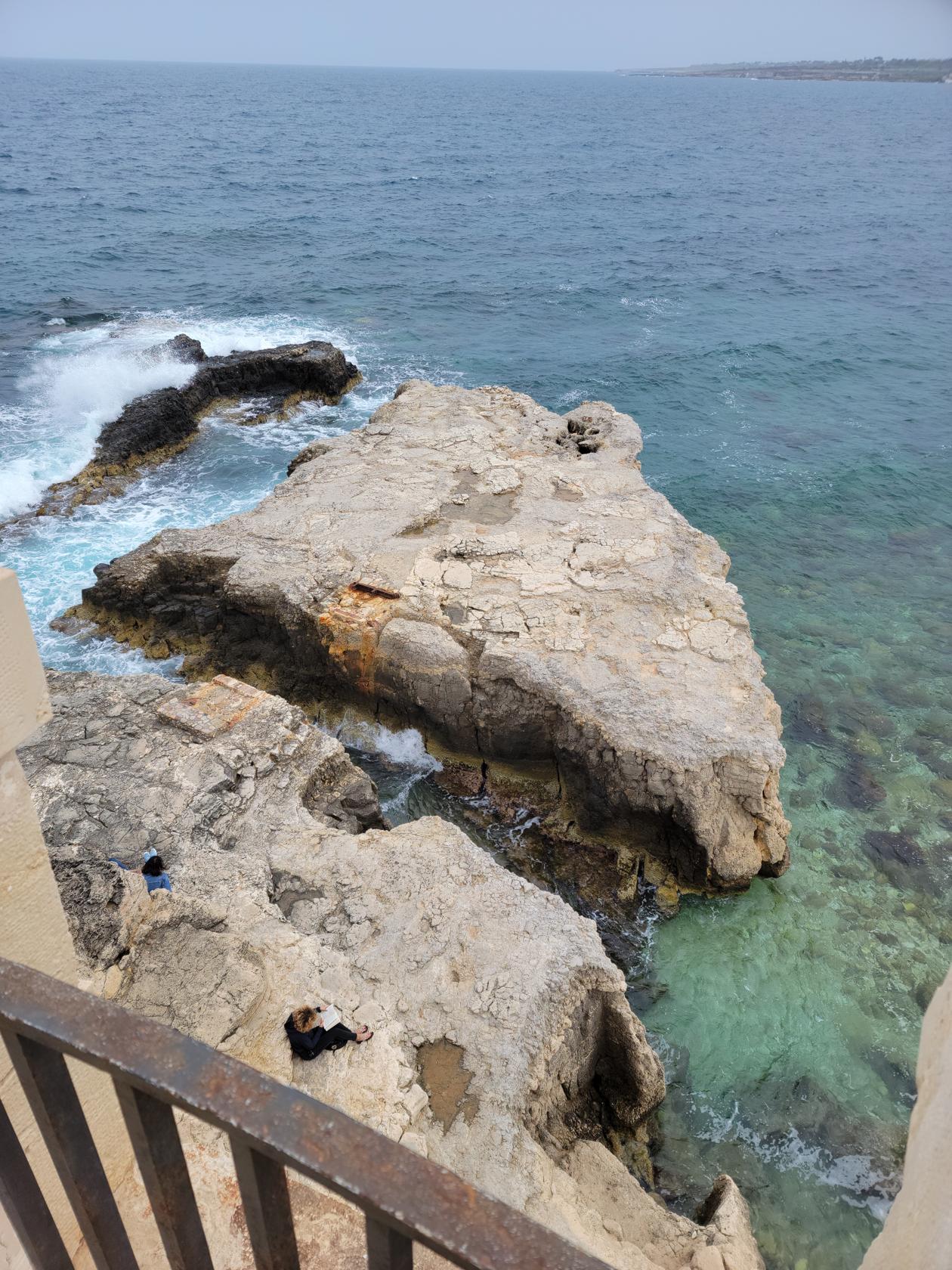
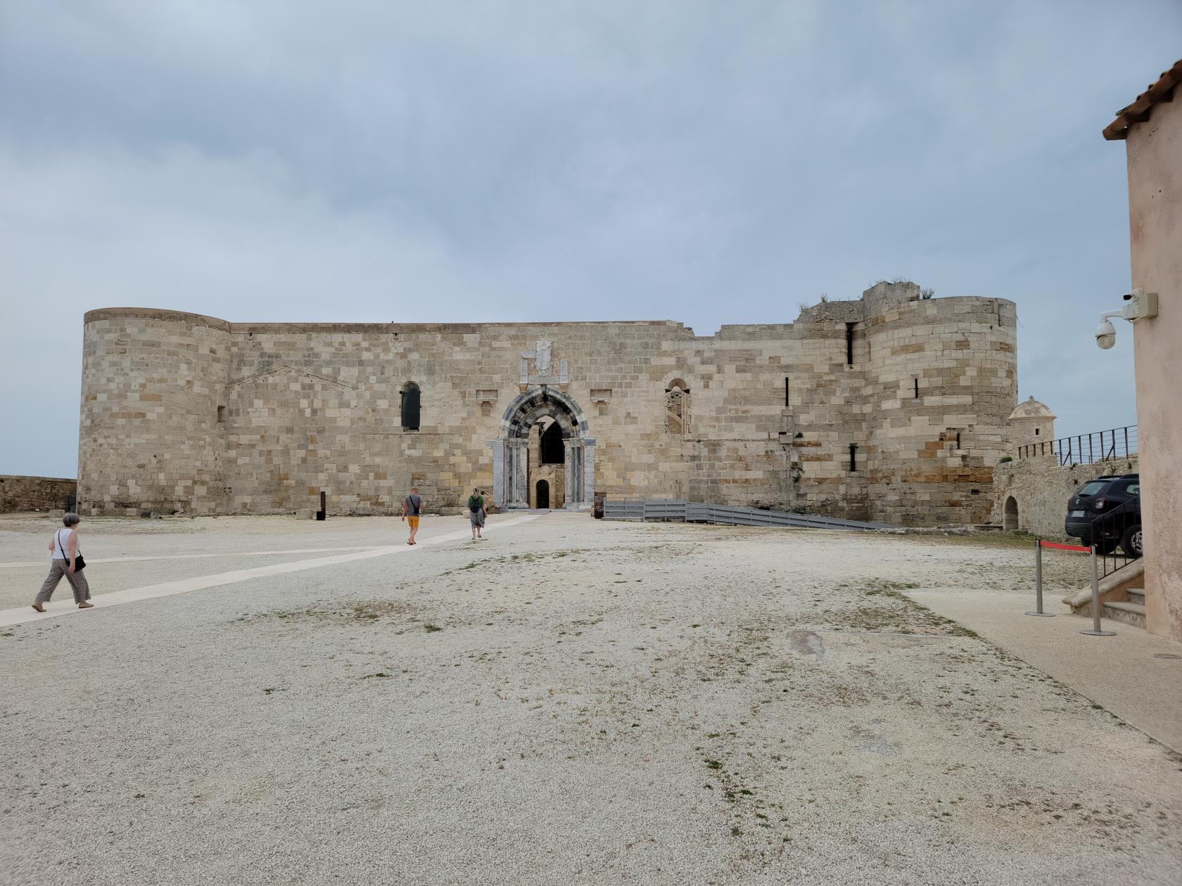
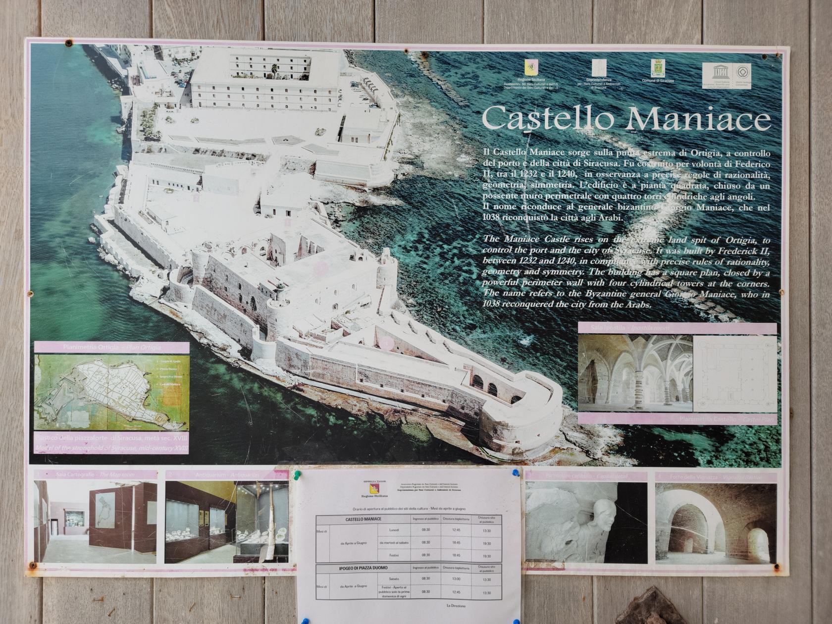
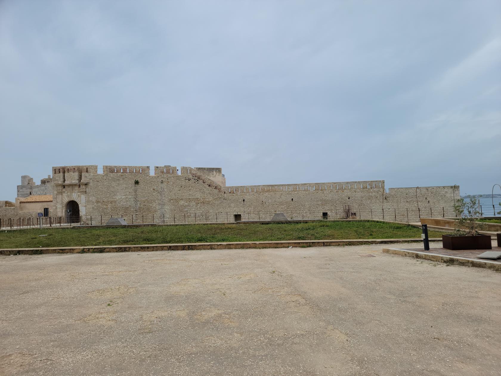
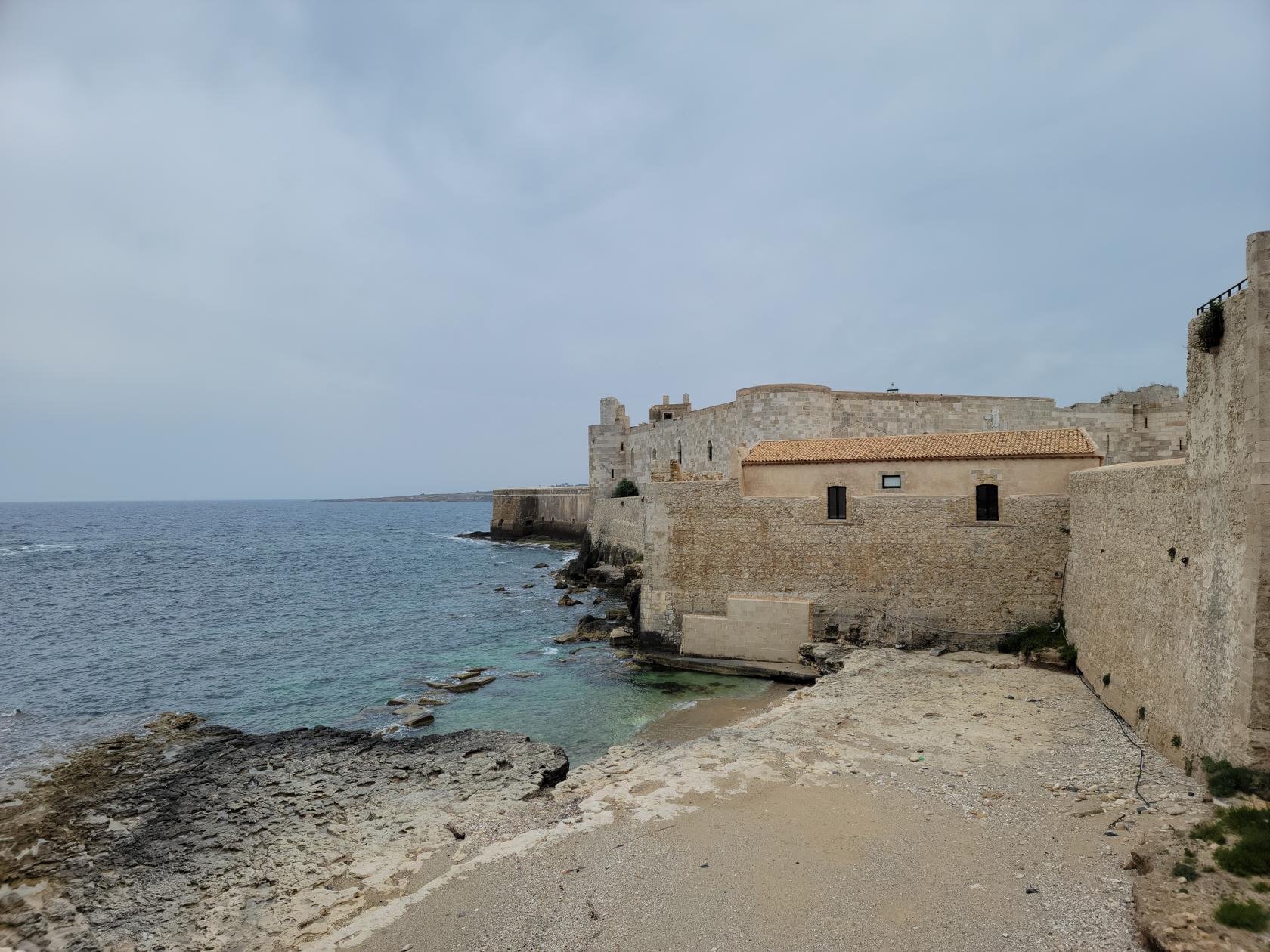
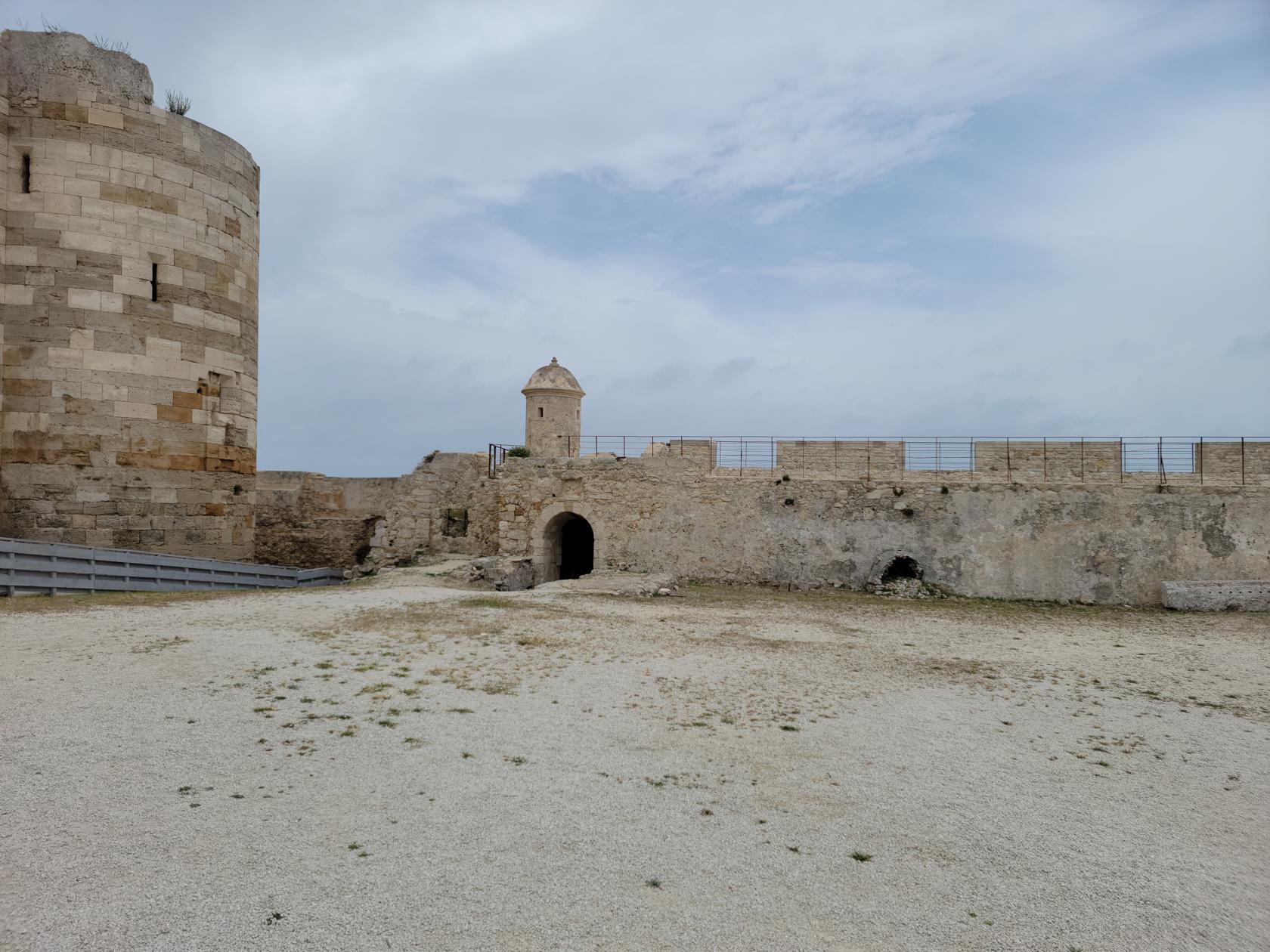
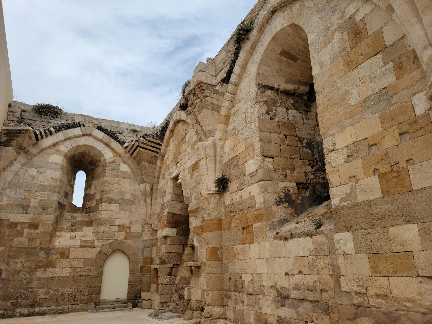
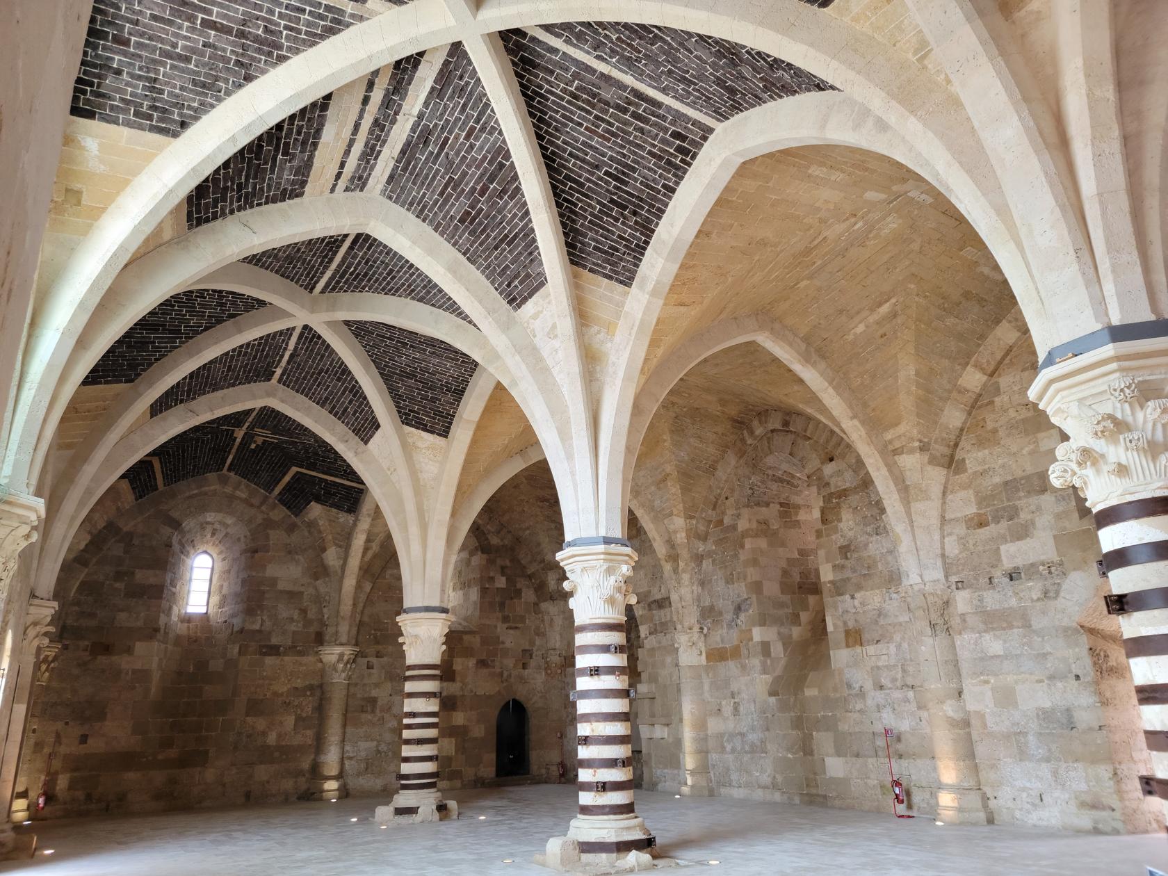
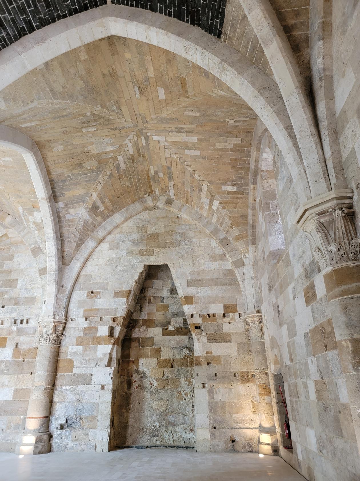
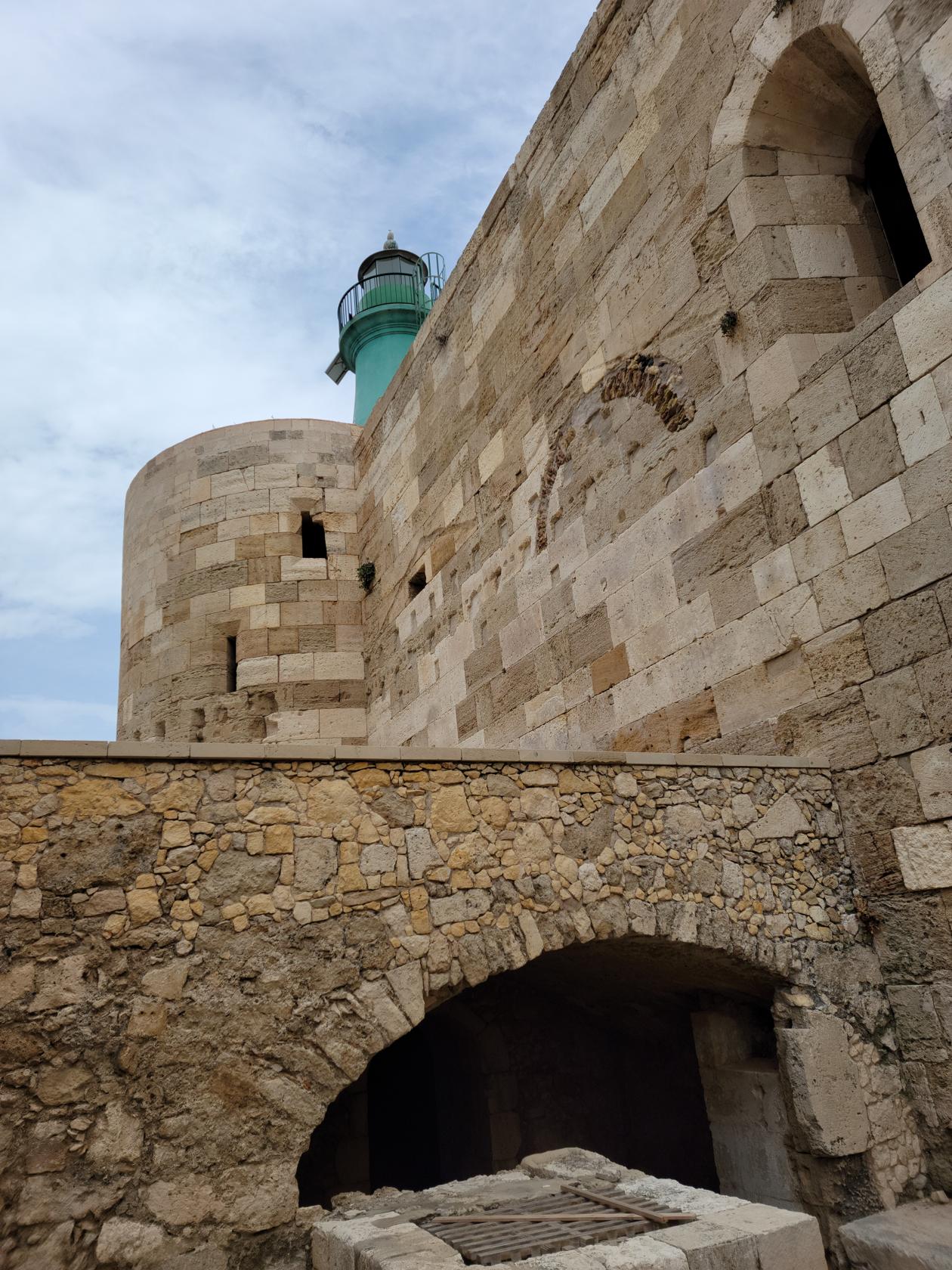
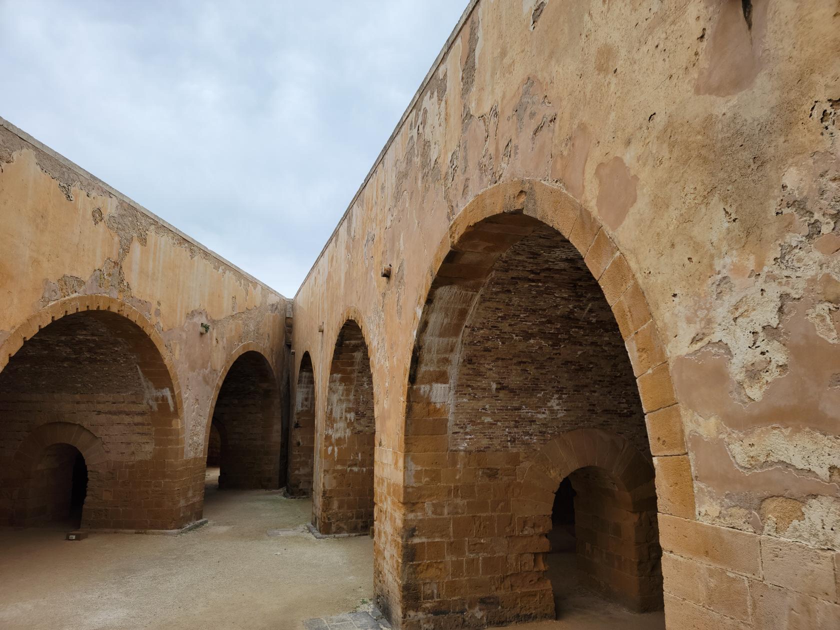
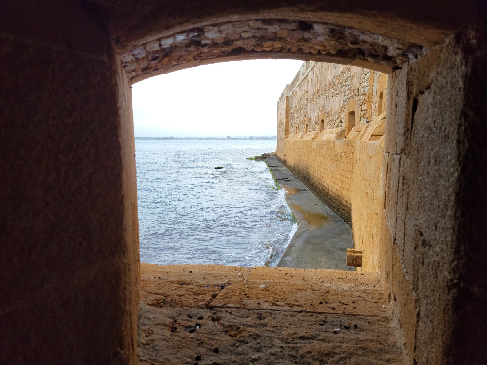
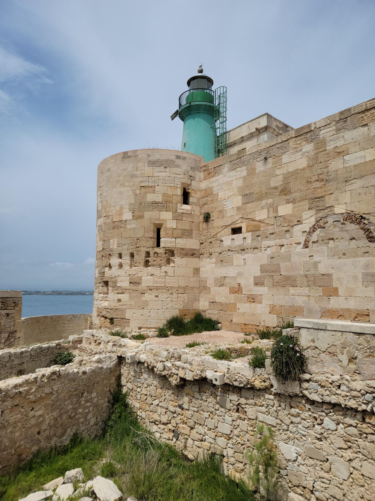
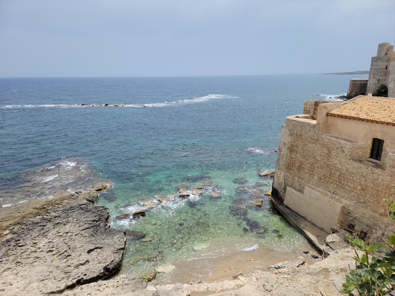
Maniace Castle
The Maniace Castle sits at the tip of Ortigia and commands an open view of the Ionian Sea. It is a rather simple structure in function and betrays itself to its many uses down through the ages by its many apparent modifications, including the installation of the lighthouse.
Tickets of Two – Castle Maniace – Siracusa, Sicily
Entrance – Castle Maniace – Siracusa, Sicily
It is however complete with a moat, or in this case, a large drained sunken area where you can wander and only guess what it used to be like back in the day.
Layout – Castle Maniace – Siracusa, Sicily
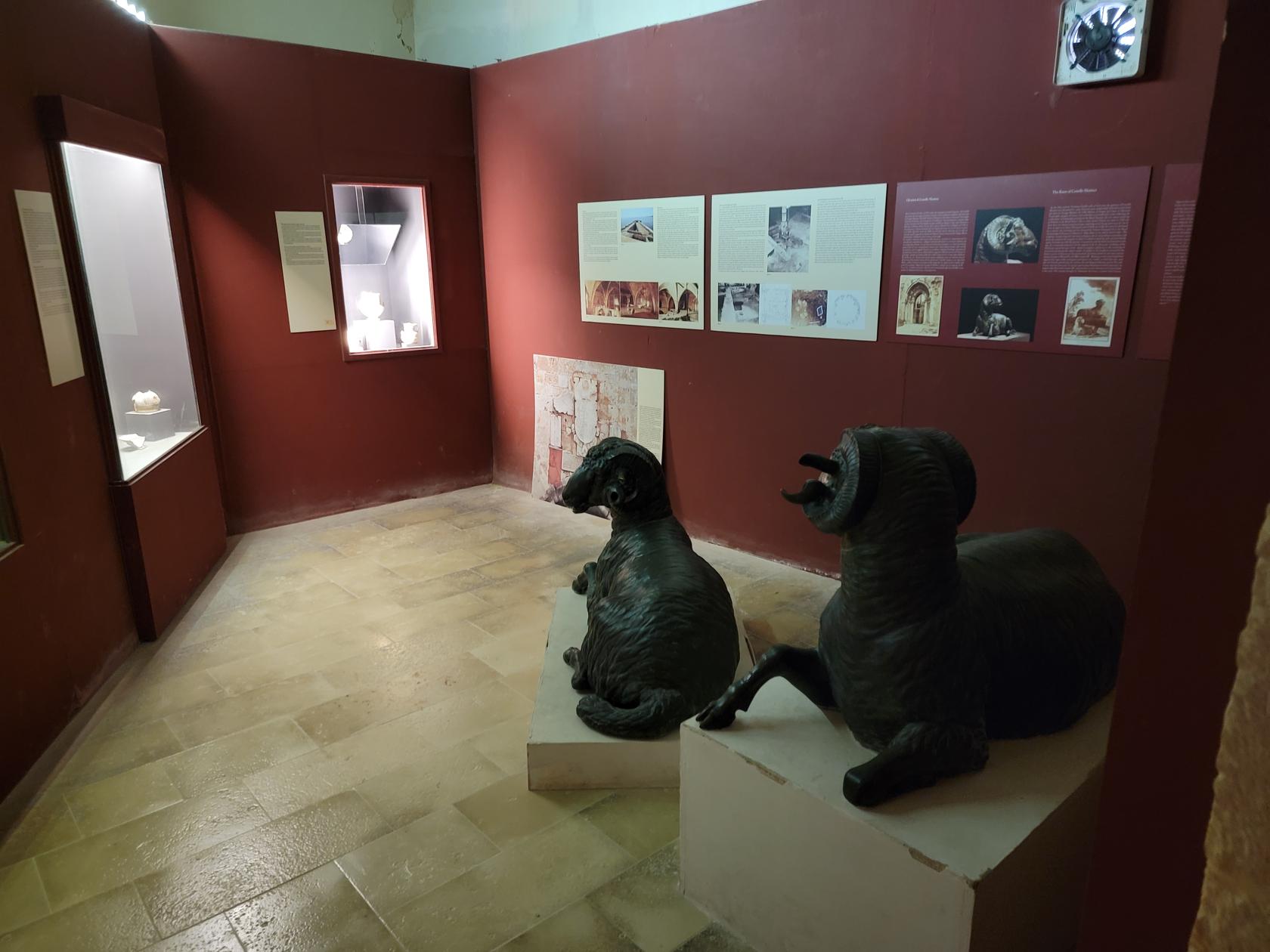
Museum – Castle Maniace – Siracusa, Sicily
From a distance – Castle Maniace – Siracusa, Sicily
The outside walls – Castle Maniace – Siracusa, Sicily
Bay of Ortigia – Castle Maniace – Siracusa, Sicily
Ionian Sea – Castle Maniace – Siracusa, Sicily
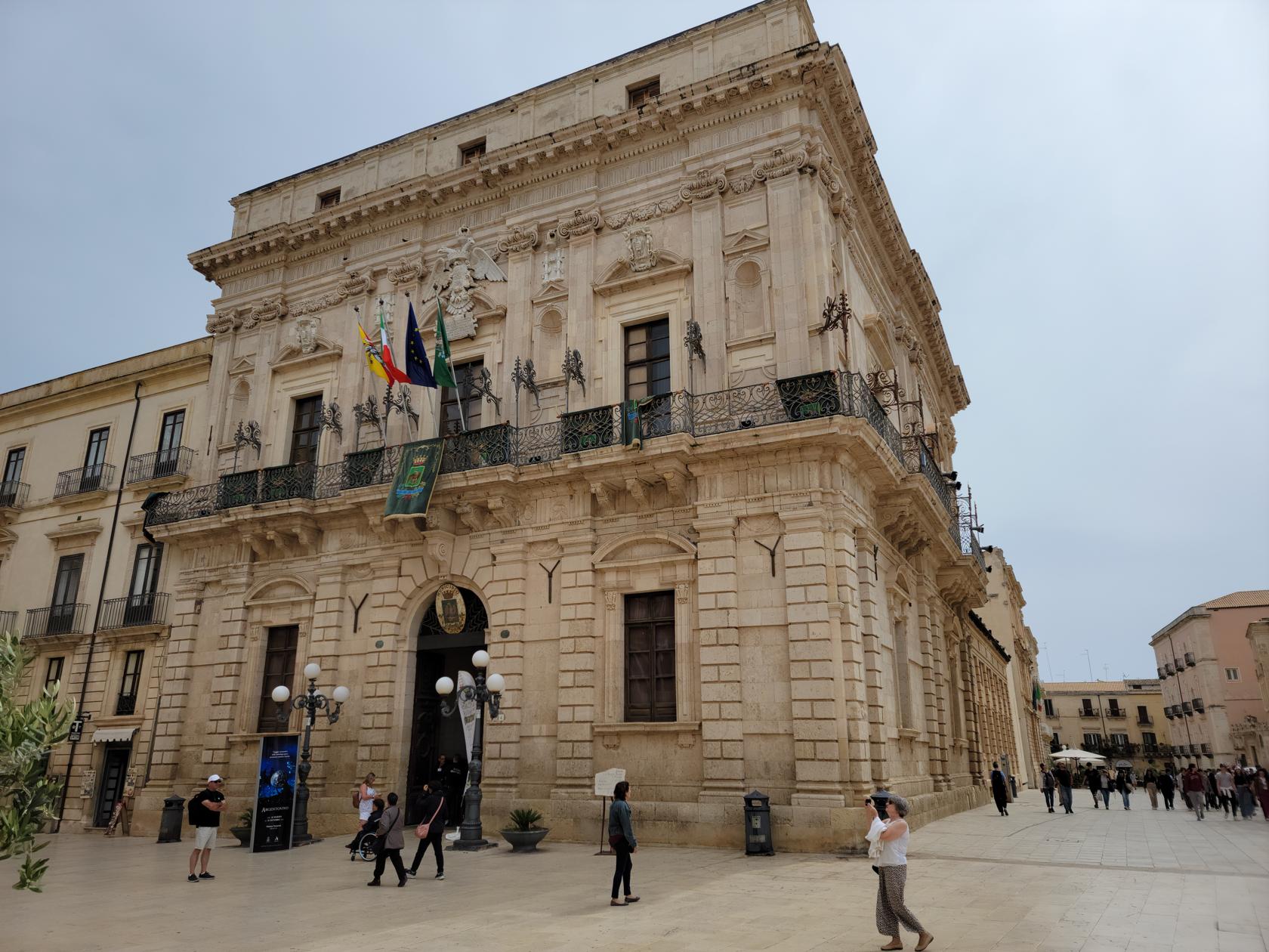
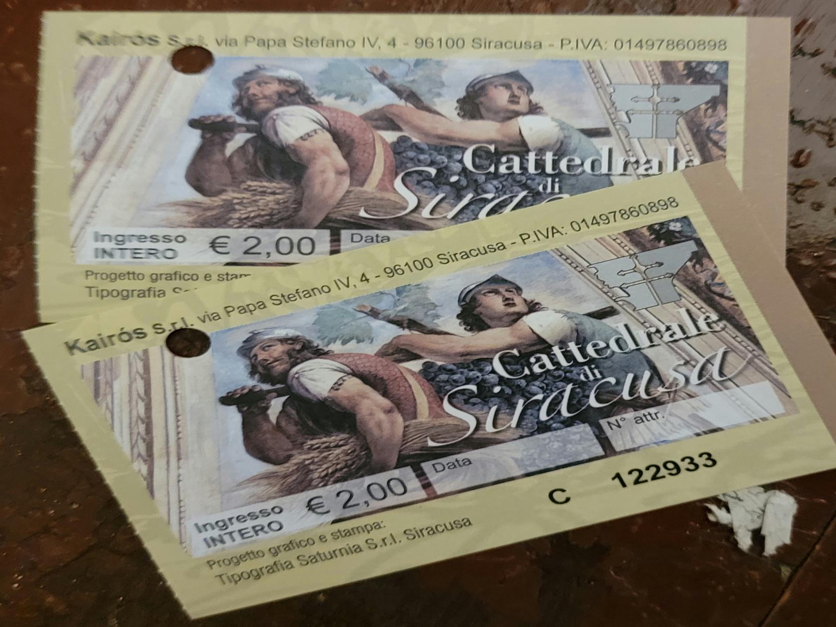
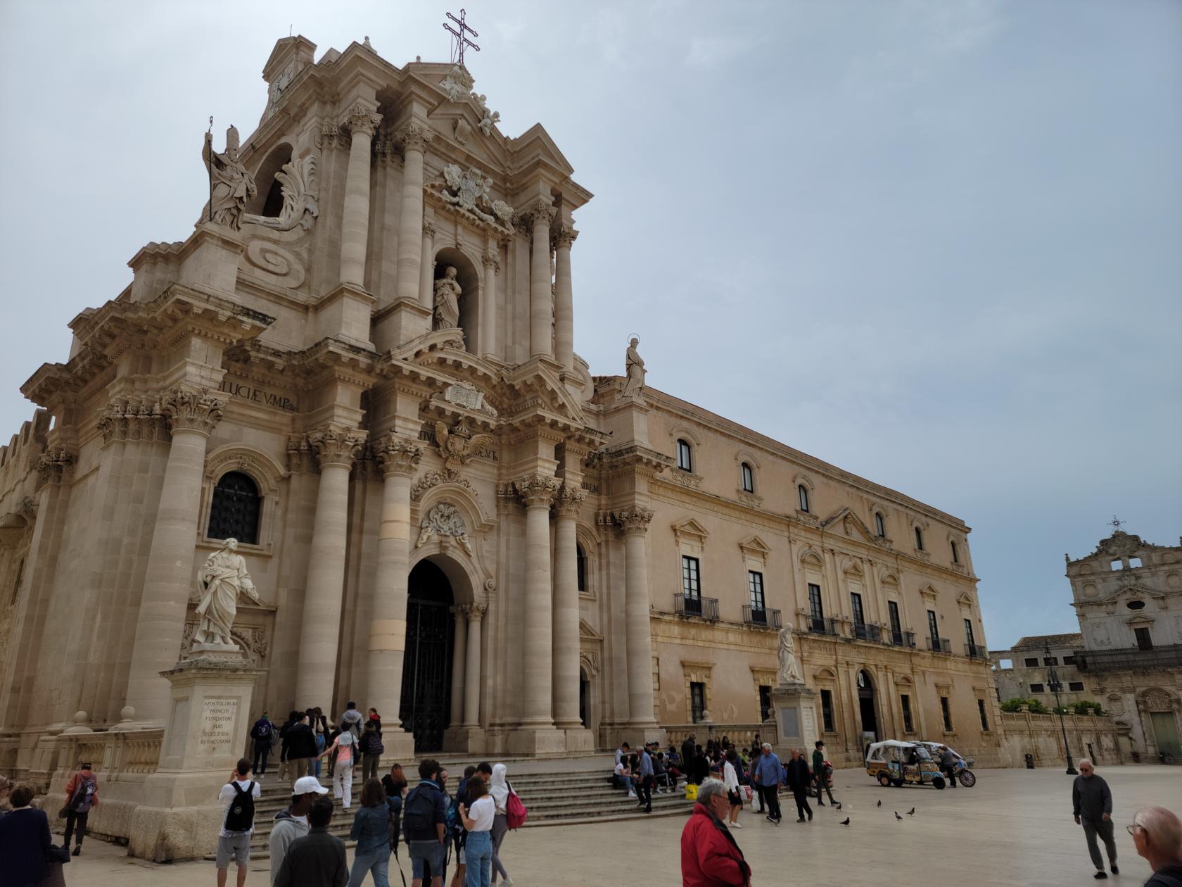
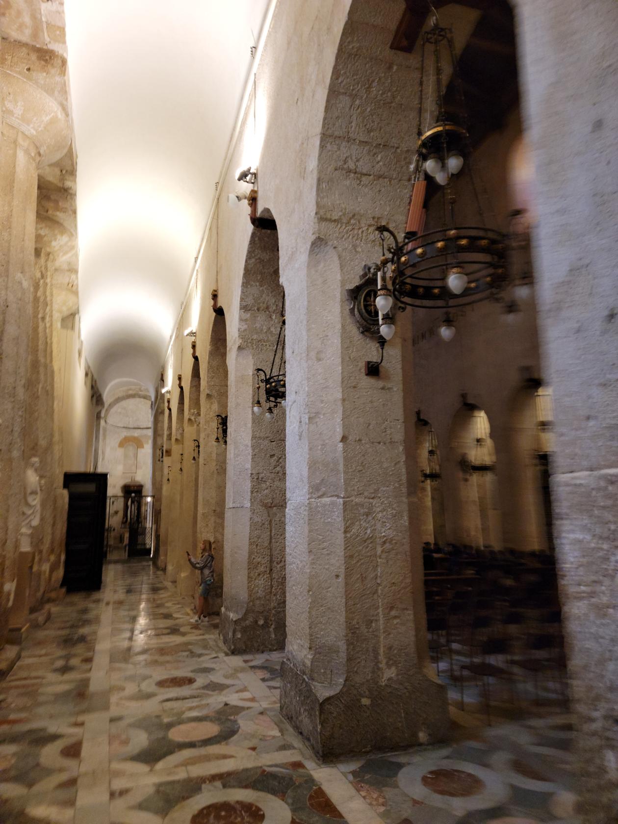
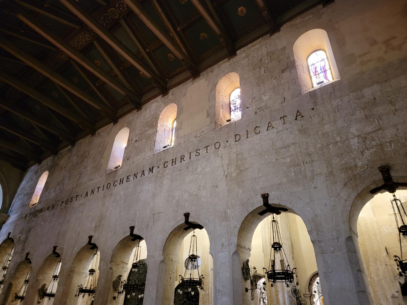
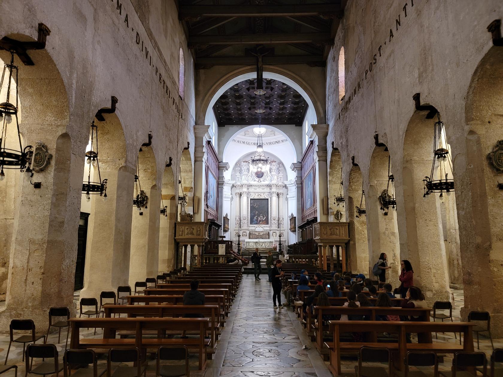
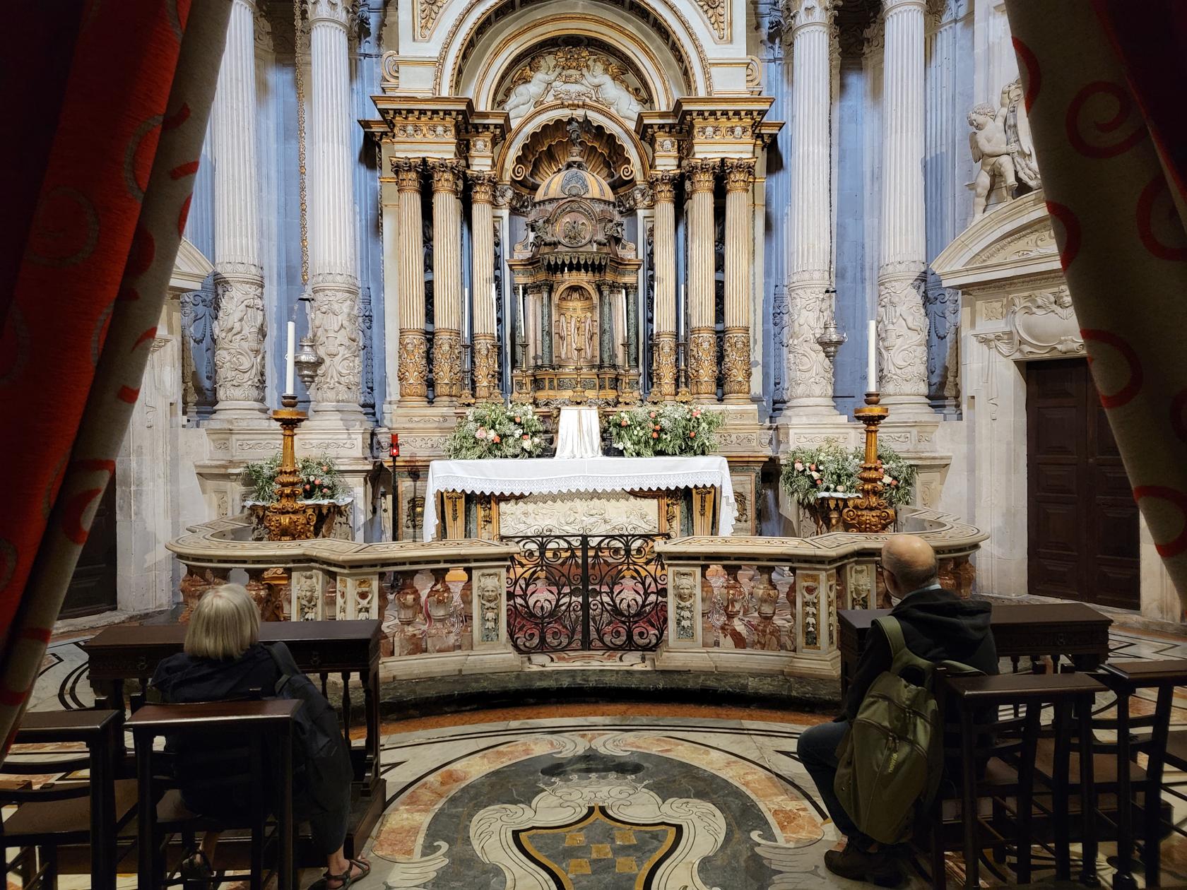
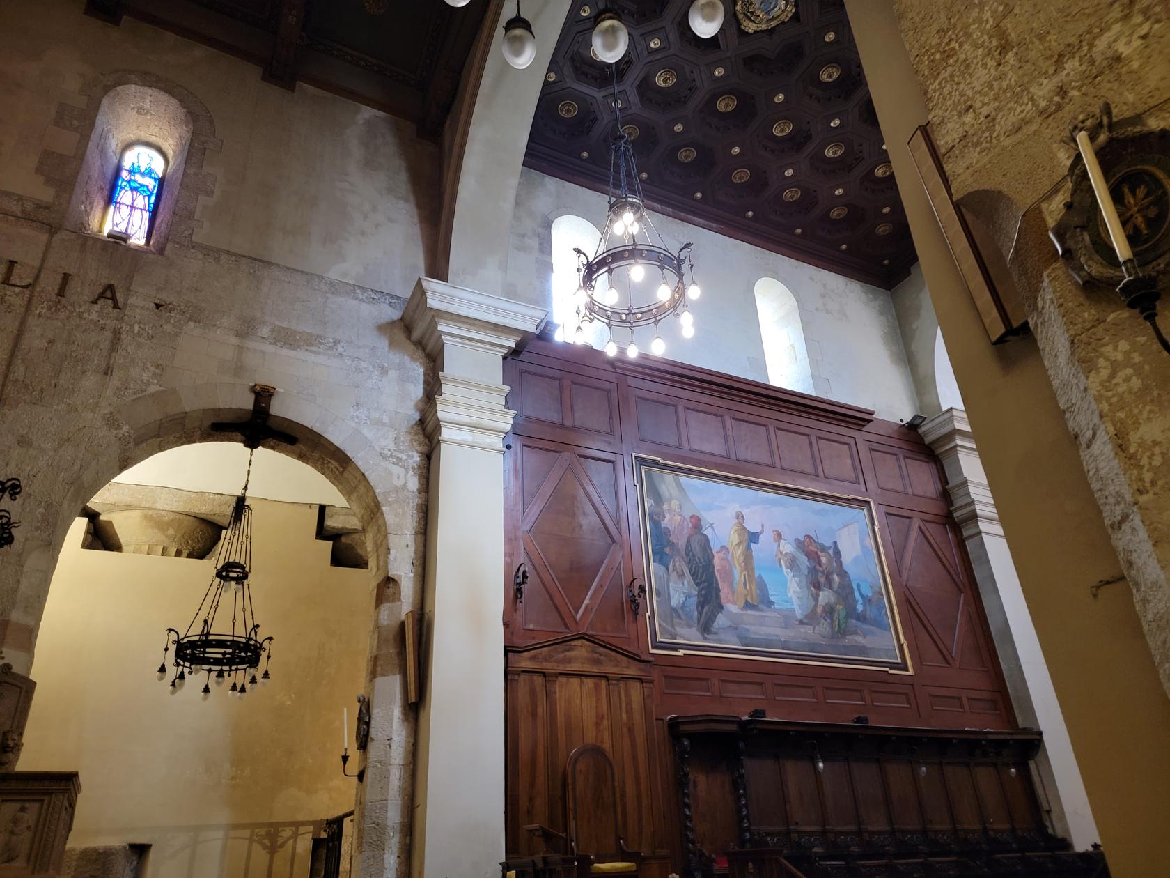
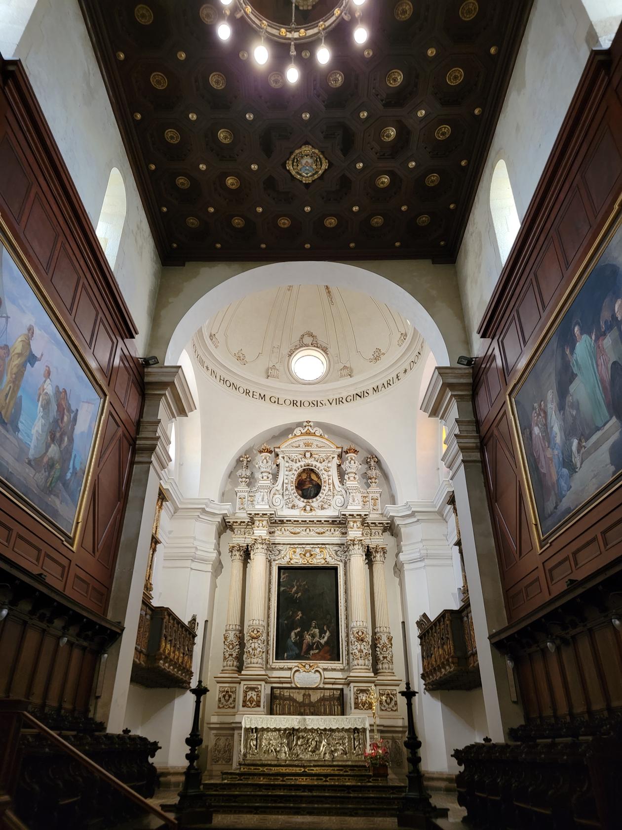
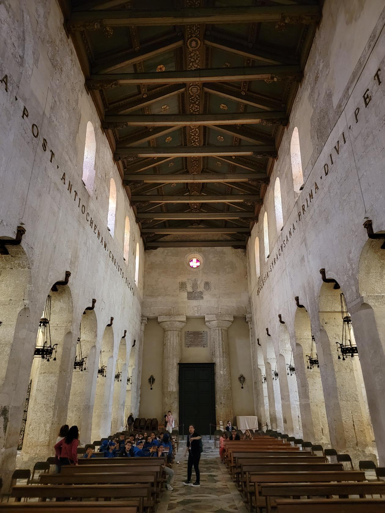
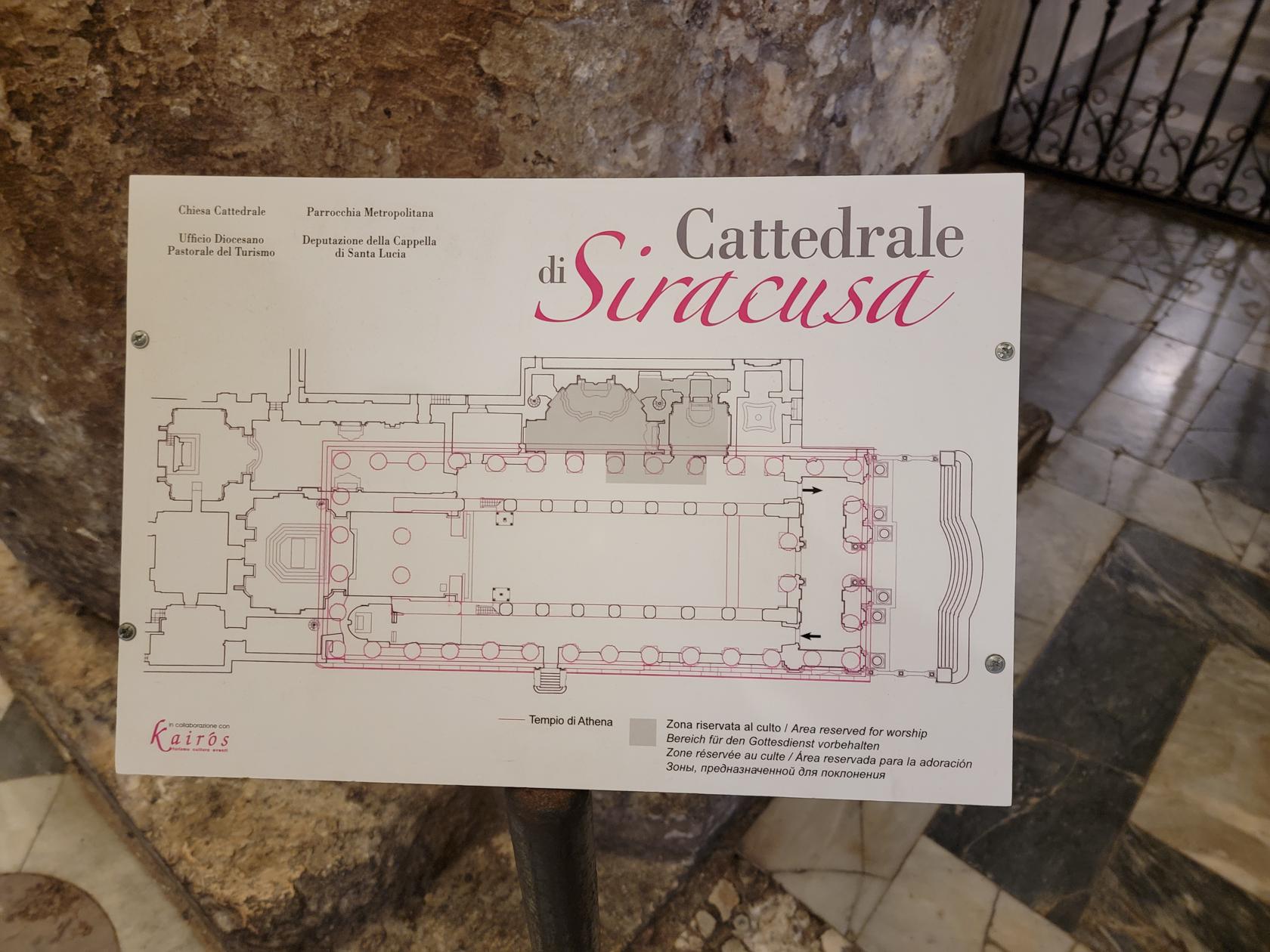
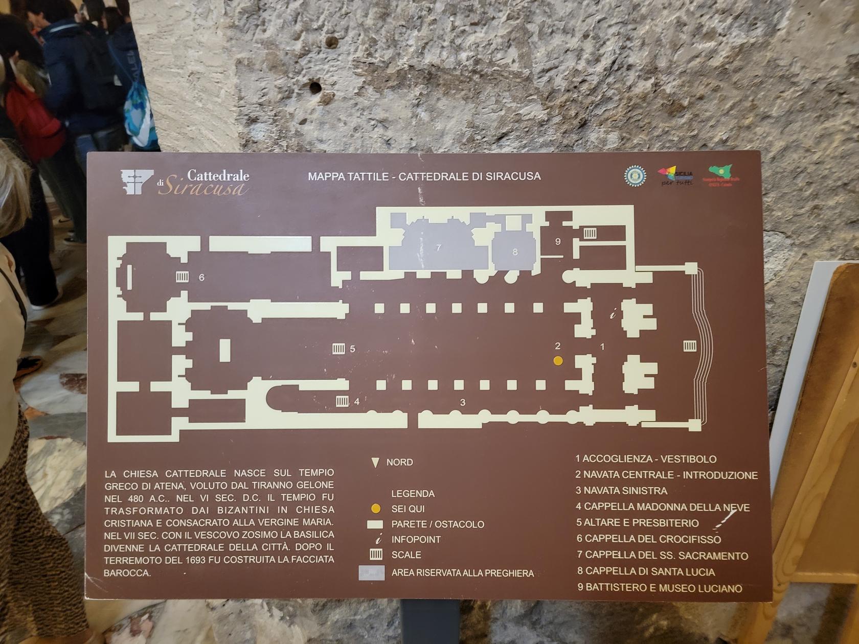
Cathedral Of Syracuse
In the center of Ortigia sits the Cathedral of Syracuse, a large and fairly simple structure as cathedrals go, having no real apse, but only central and left naves.
Tickets for Two – Cathedral of Syracuse – Piazza Duomo – Siracusa, Sicily
Cathedral of Syracuse – Piazza Duomo – Siracusa, Sicily
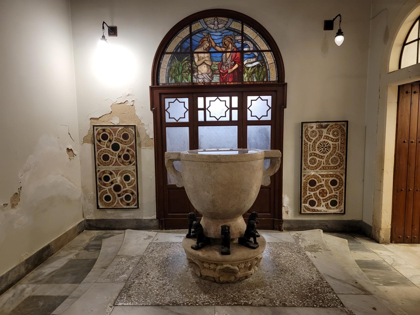
The inside however is impressive and elegant and worth a visit. The outside of the cathedral displays Doric columns of the original Temple of Athena, which stood on this site prior to the building of the edifice.
Cathedral of Syracuse – Piazza Duomo – Siracusa, Sicily
Cathedral of Syracuse – Piazza Duomo – Siracusa, Sicily
Cathedral of Syracuse – Piazza Duomo – Siracusa, Sicily
Cathedral of Syracuse – Piazza Duomo – Siracusa, Sicily
Cathedral of Syracuse – Piazza Duomo – Siracusa, Sicily
Cathedral of Syracuse – Piazza Duomo – Siracusa, Sicily
Cathedral of Syracuse – Piazza Duomo – Siracusa, Sicily
Cathedral of Syracuse – Piazza Duomo – Siracusa, Sicily
Cathedral of Syracuse – Piazza Duomo – Siracusa, Sicily
Cathedral of Syracuse – Piazza Duomo – Siracusa, Sicily
Cathedral of Syracuse – Piazza Duomo – Siracusa, Sicily
Cathedral of Syracuse – Piazza Duomo – Siracusa, Sicily
Cathedral of Syracuse – Piazza Duomo – Siracusa, Sicily
Cathedral of Syracuse – Piazza Duomo – Siracusa, Sicily
Our Hotel
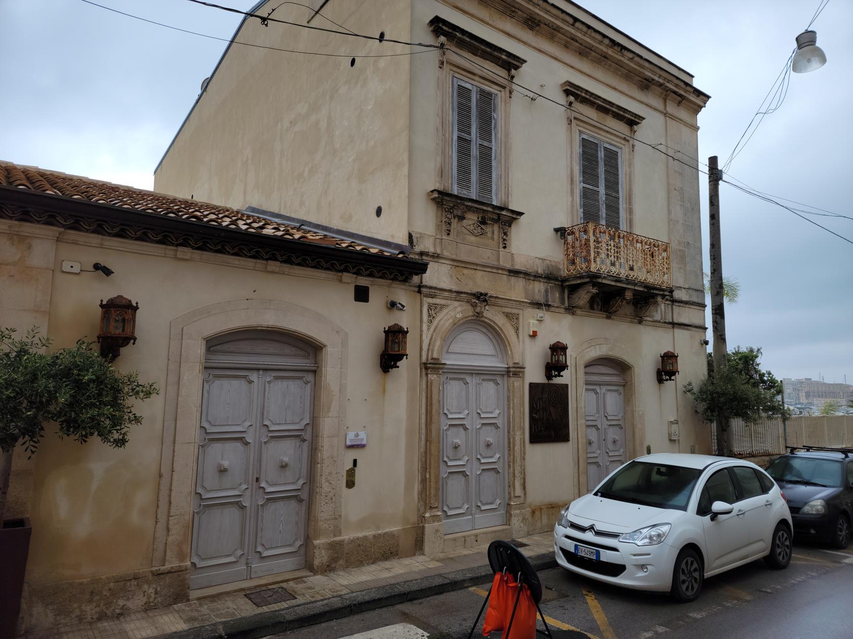
Hotel Musciara Resort
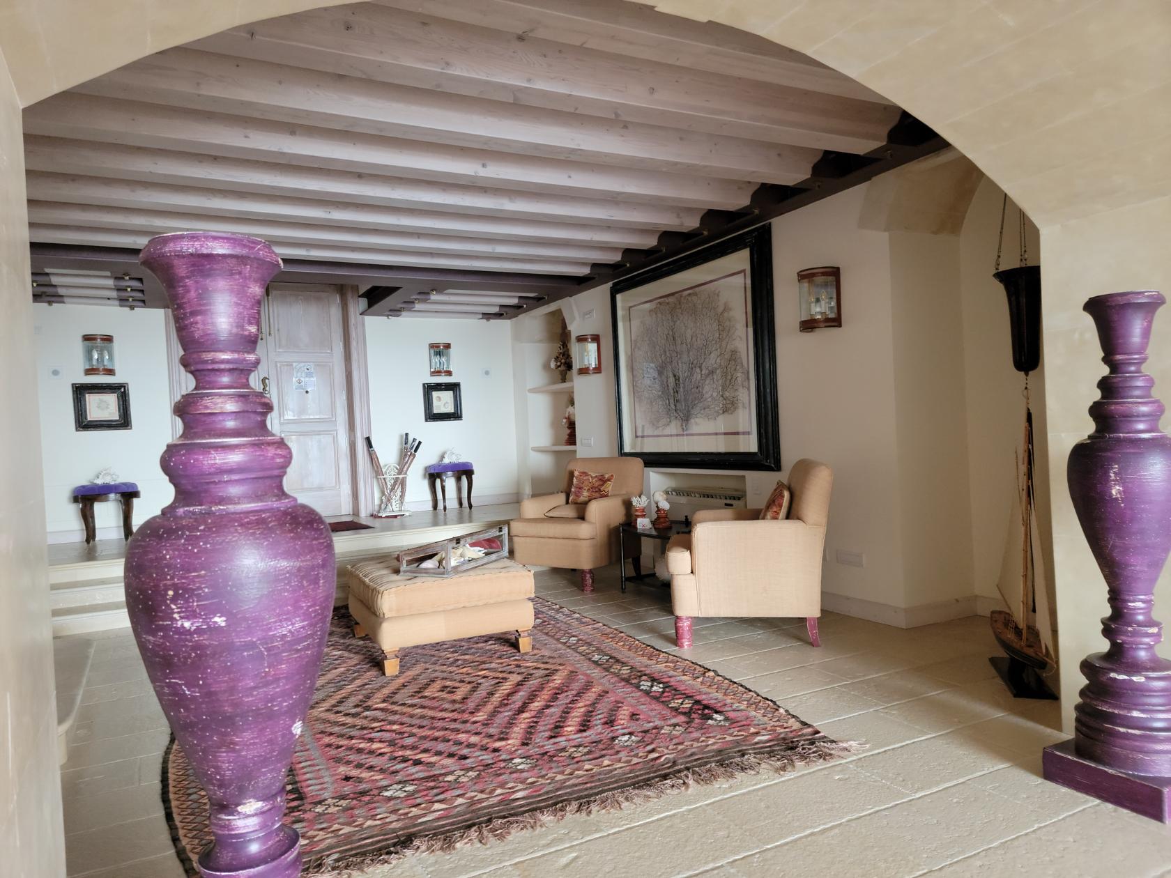
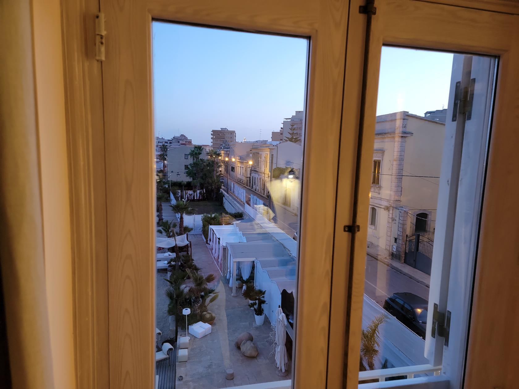
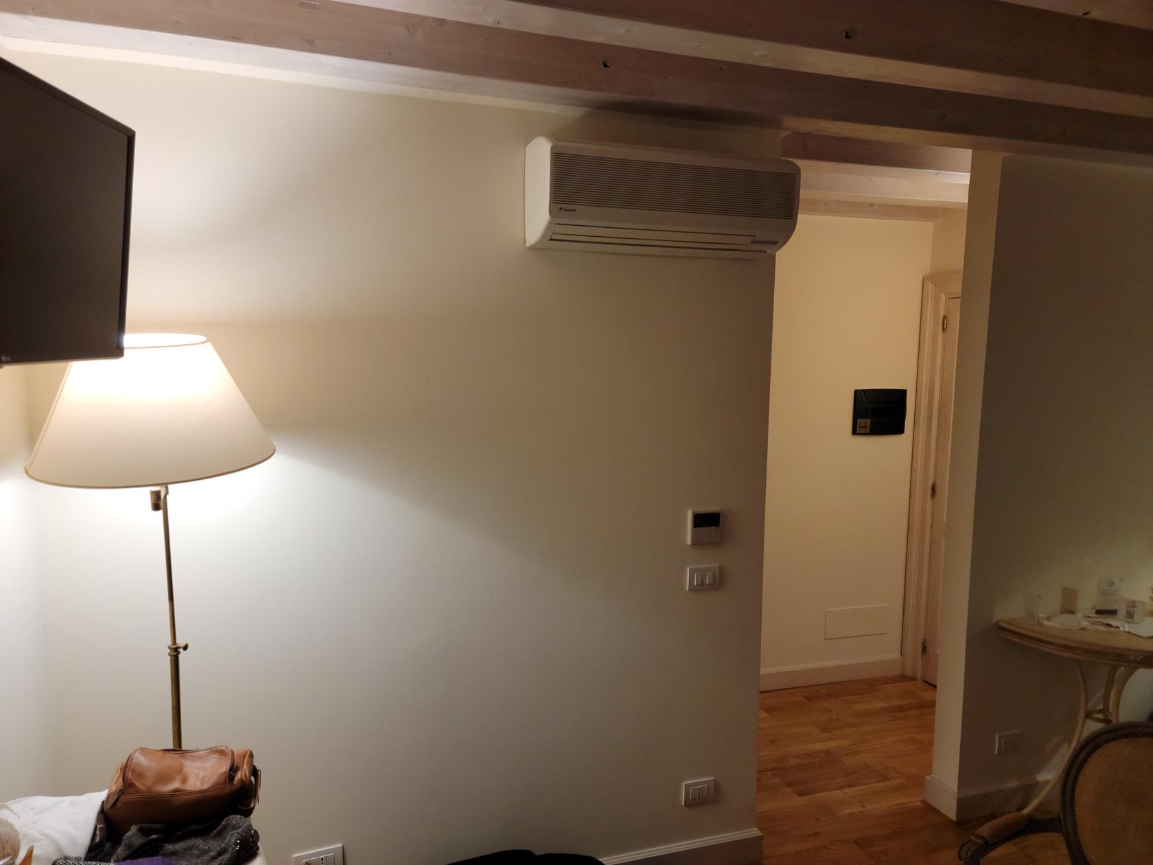
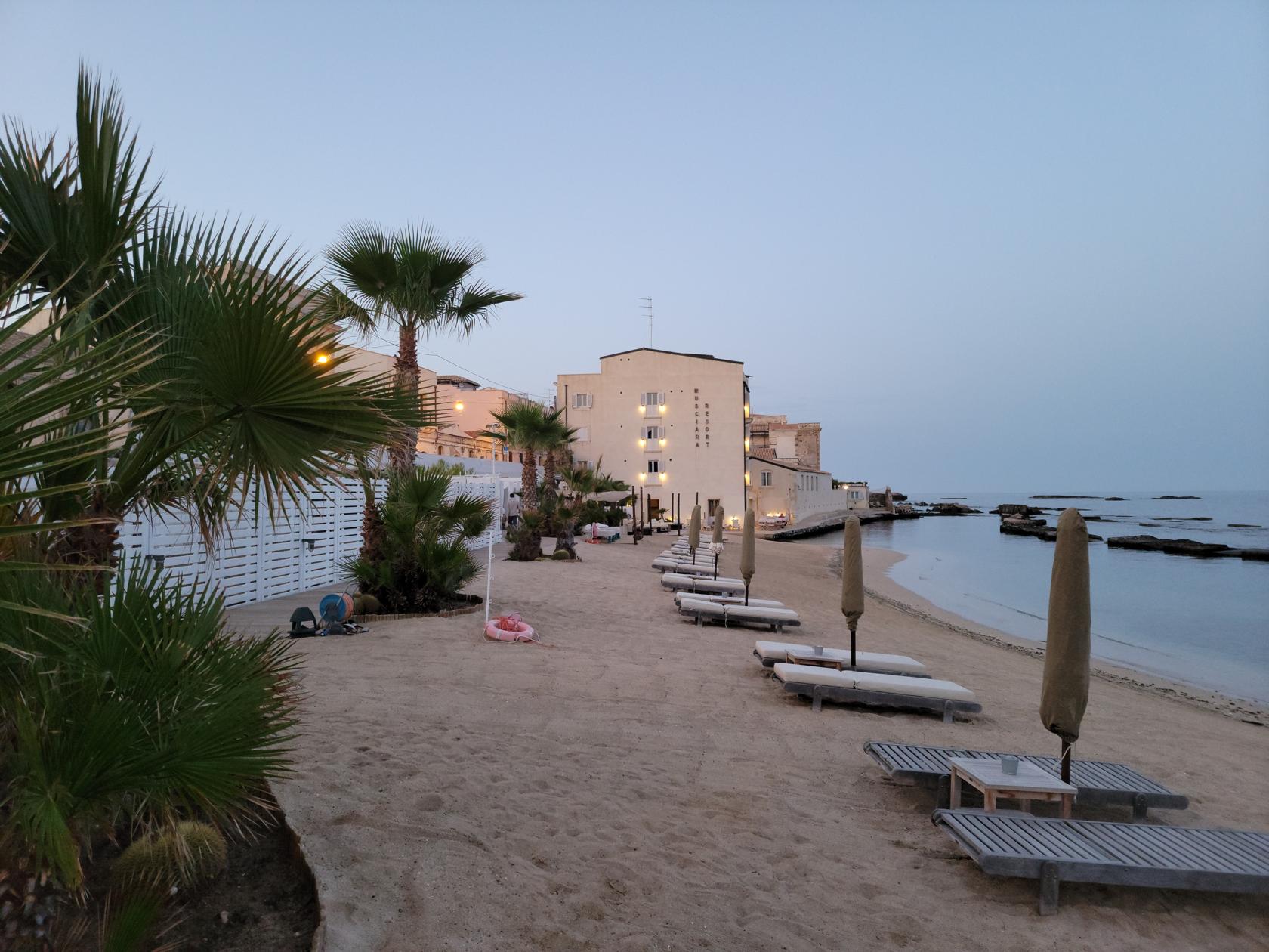
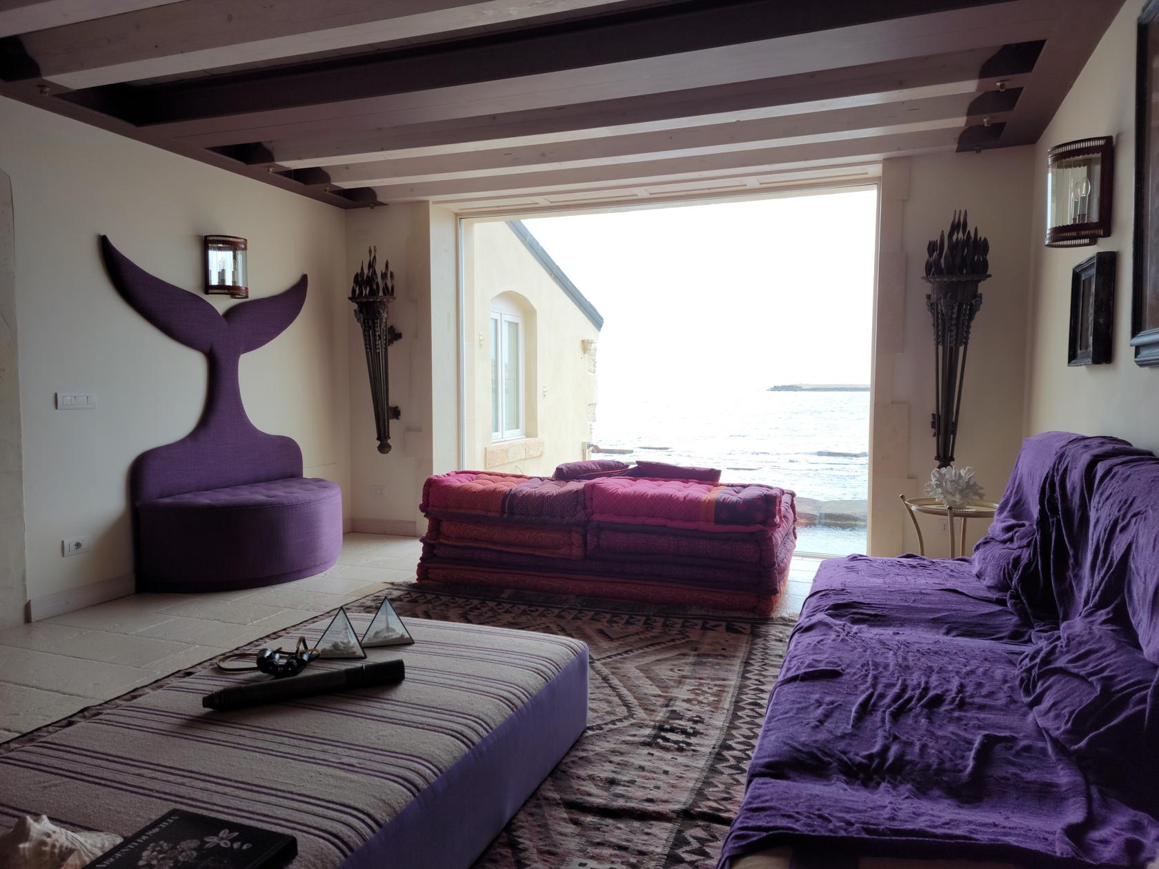
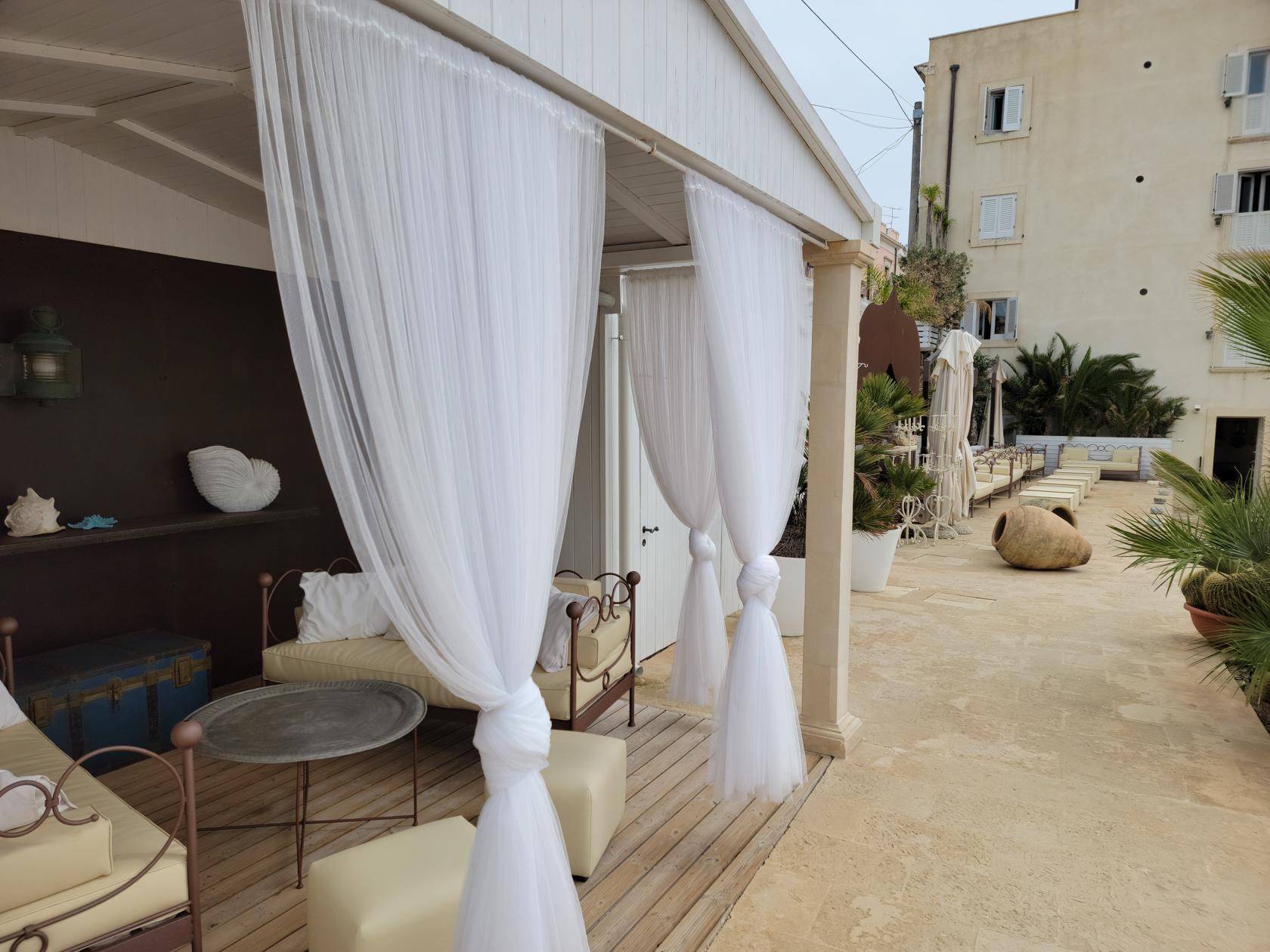
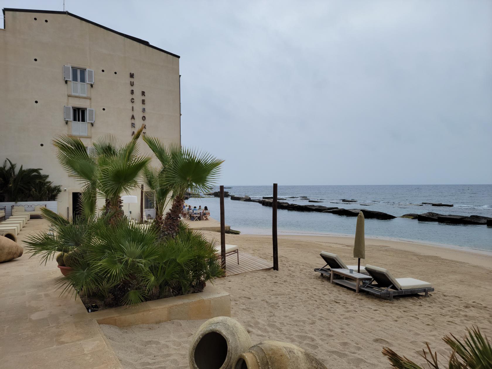
For the six nights we stayed in Syracuse, we stayed at the Musciara Resort. This boutique resort is located about a 15 minute walk from Ortigia Island and has its own beach. It is a three-star hotel, but it is expertly appointed and maintained. There are only about a dozen or so rooms, so book early if interested. It is a on the pricey side, so if you are able, use points.
Entrance – Hotel Musciara Resort – Siracuse, Sicily
Lobby – Musciara Resort – Siracusa, Sicily
Though we did not use the beach at them, since there was a severe upper level low causing rain for many days, we know a set of two lounge chairs and table will cost 110€/day for those wishing to enjoy the water or work on that tan.
The cuisine of Syracuse is of course based mainly on the sea, so people who love fish will definitely enjoy themselves. There are myriads of fish to choose from, as well as octopus, squid, cuttlefish and assorted shell fish.
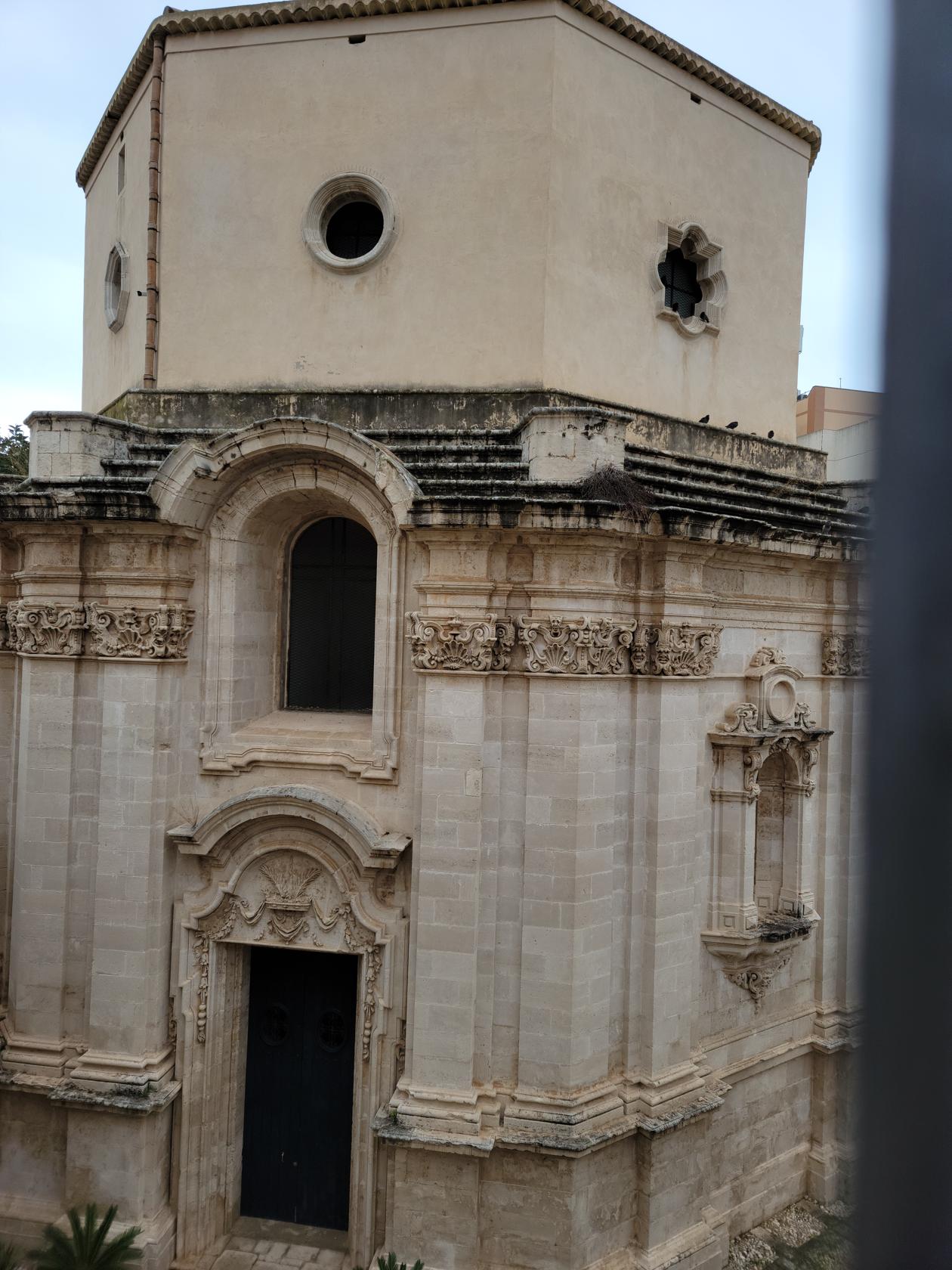
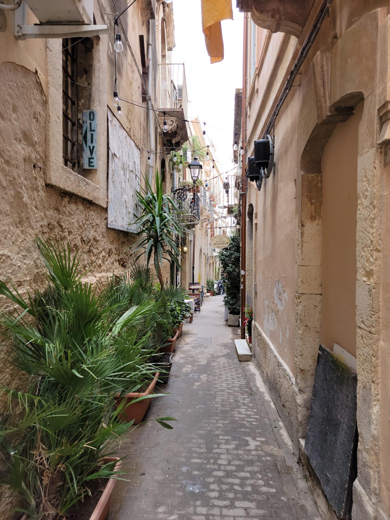
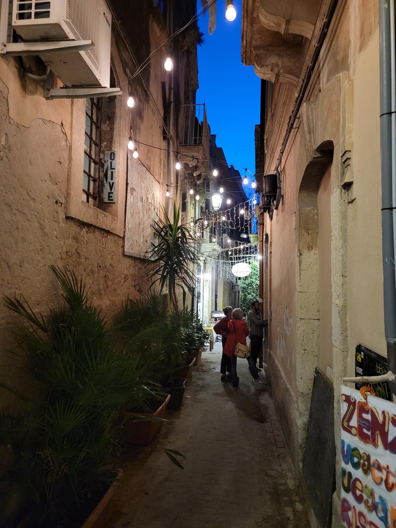
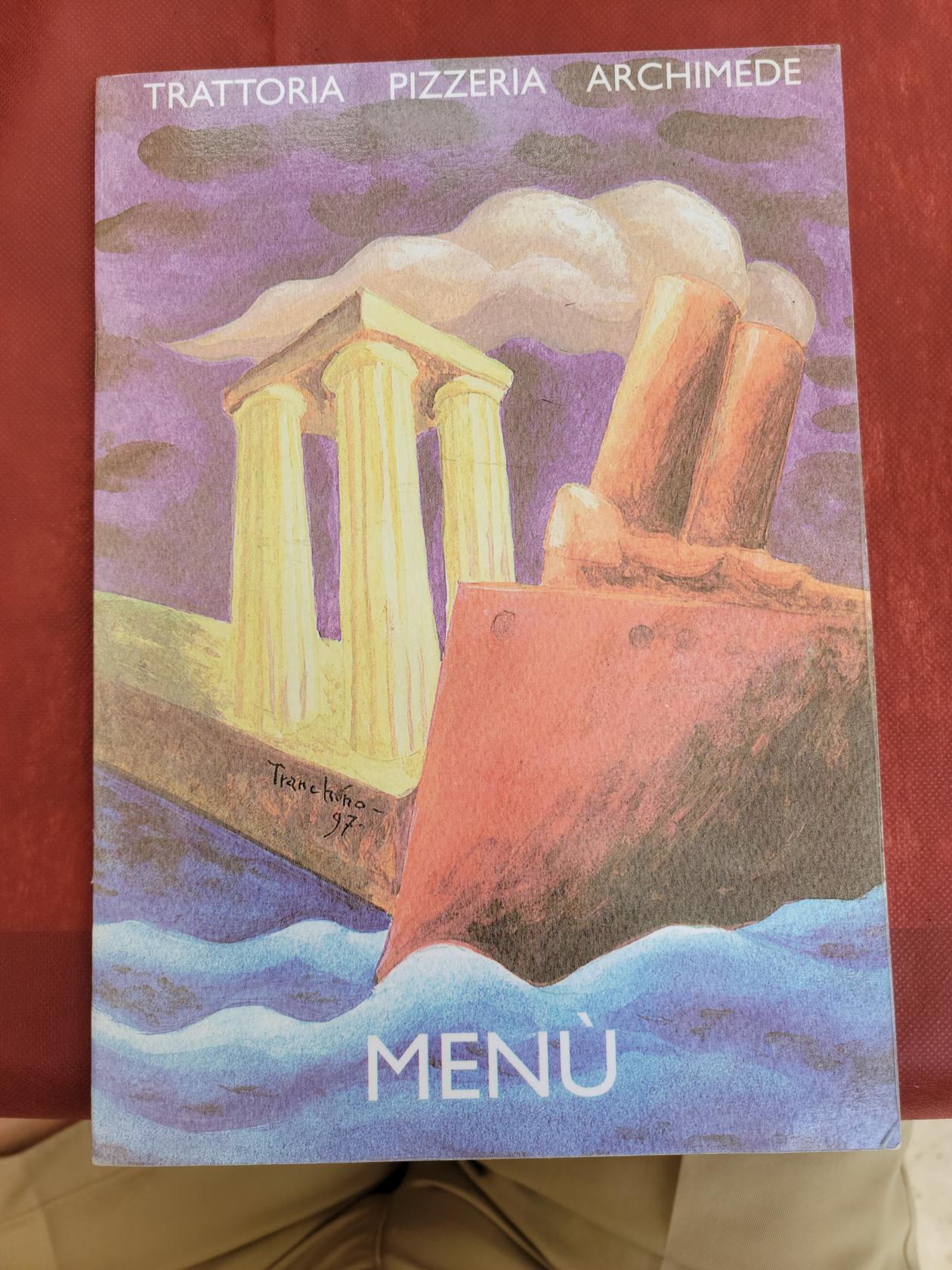
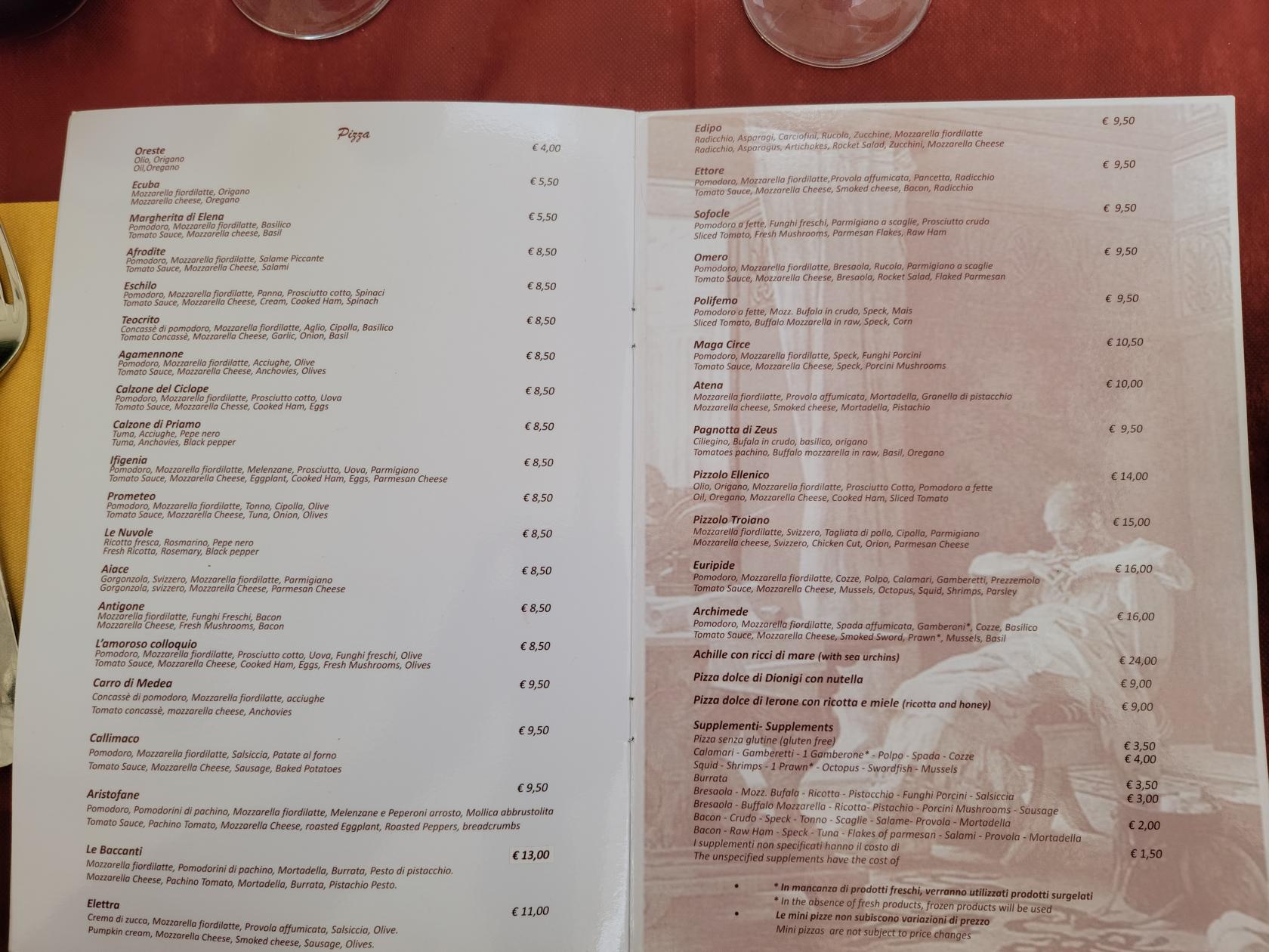
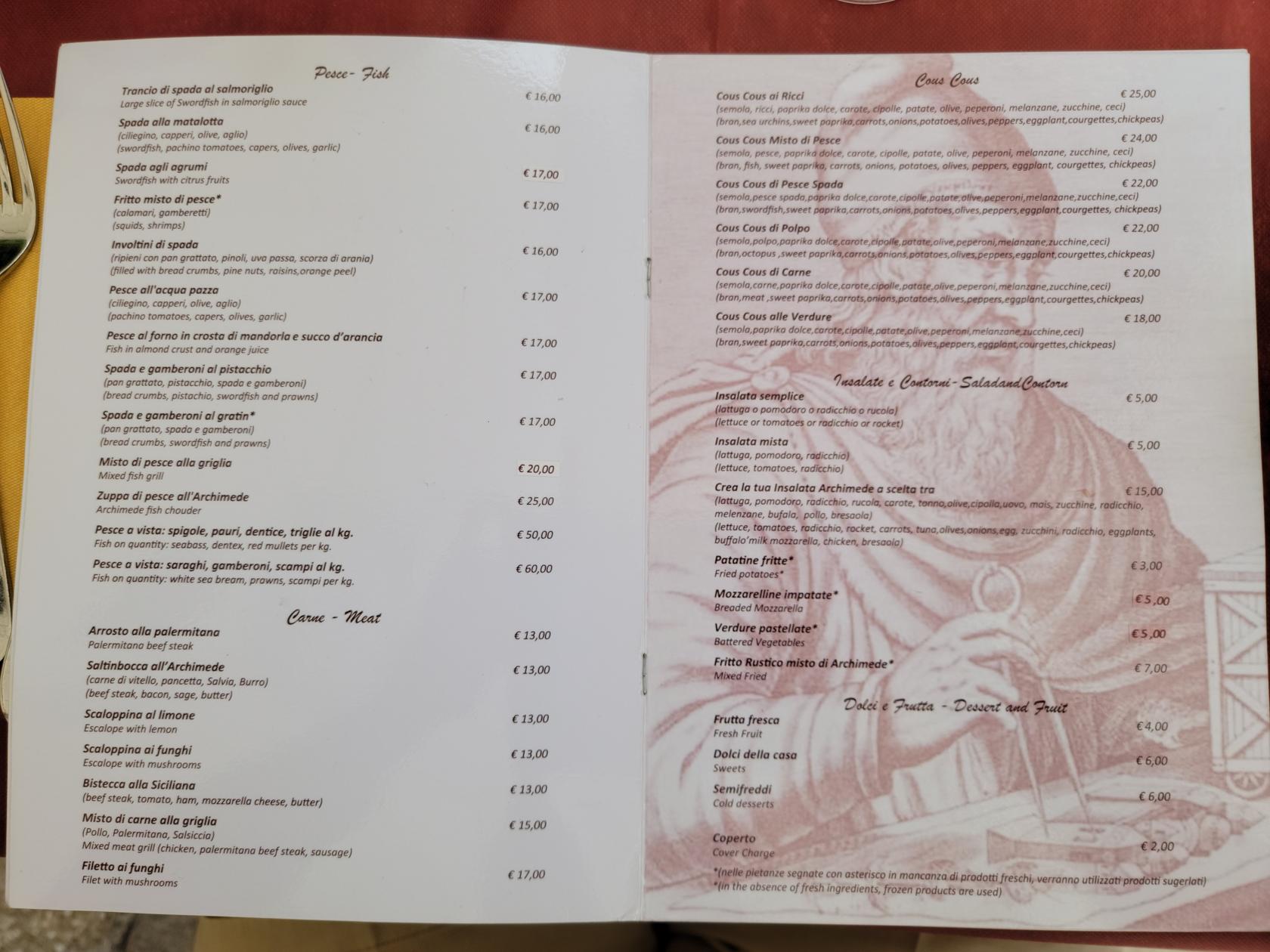
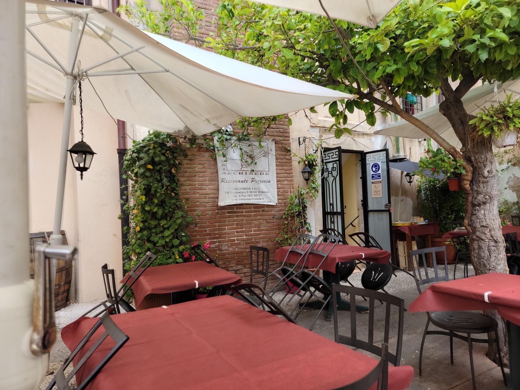
Trattoria Archimede
We ate lunch here and thoroughly enjoyed ourselves. They have a nice garden where one can enjoy an relaxes lunch away from the hustle and bustle of Piazza Duomo.
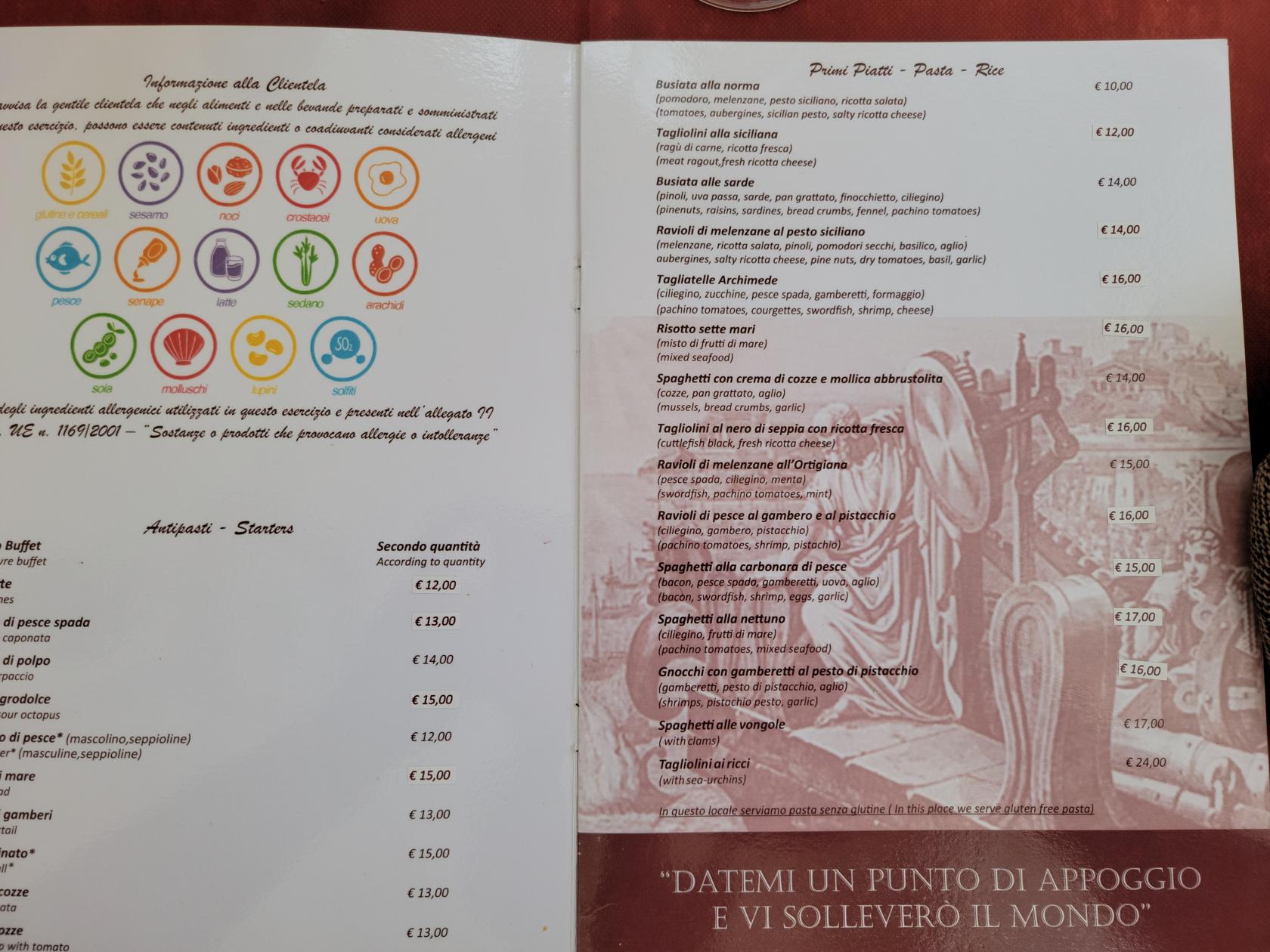
Menu – Trattoria Archimede – Siracusa, Sicily
Menu – Trattoria Archimede – Siracusa, Sicily
Menu – Trattoria Archimede – Siracusa, Sicily
Menu – Trattoria Archimede – Siracusa, Sicily
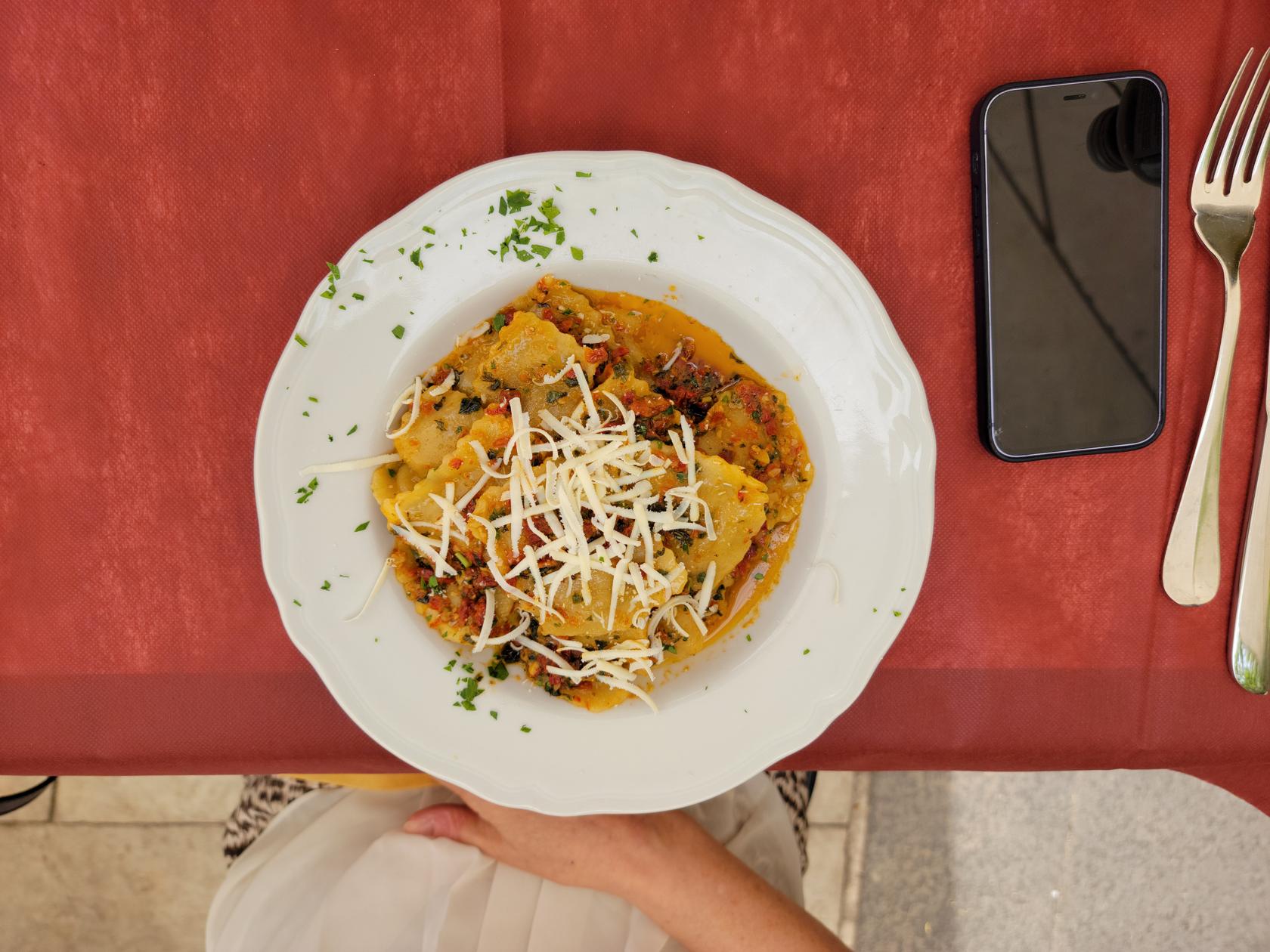
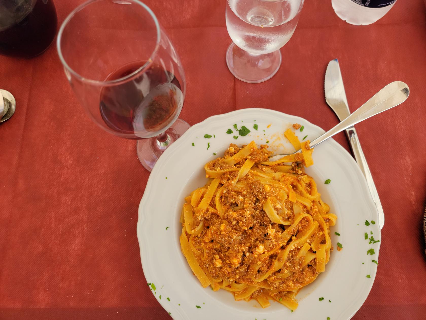
The food is typical and simple for Sicilian cuisine. We picked basic items, along with the house wine and had a very nice lunch. The staff were attentive and had a very good grasp of English, so communicating in my broken Italian, although appreciated, was not totally necessary, our waiter spoke and understood Italian, English, French and German.
Garden – Trattoria Archimede – Siracusa, Sicily
Ravioli – Trattoria Archimede – Siracusa, Sicily
Taglierini e Ragu – Trattoria Archimede – Siracusa, Sicily
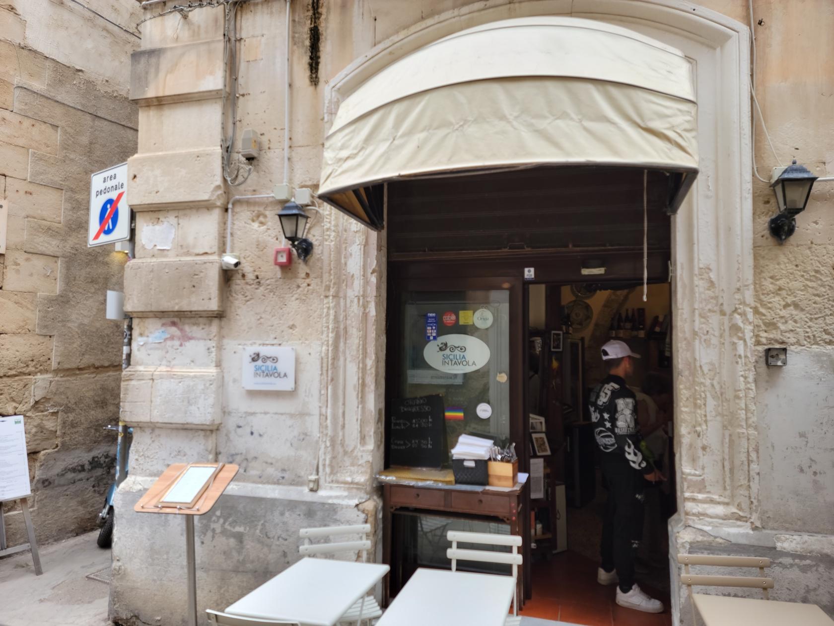
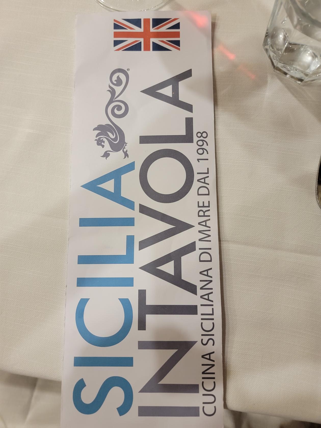
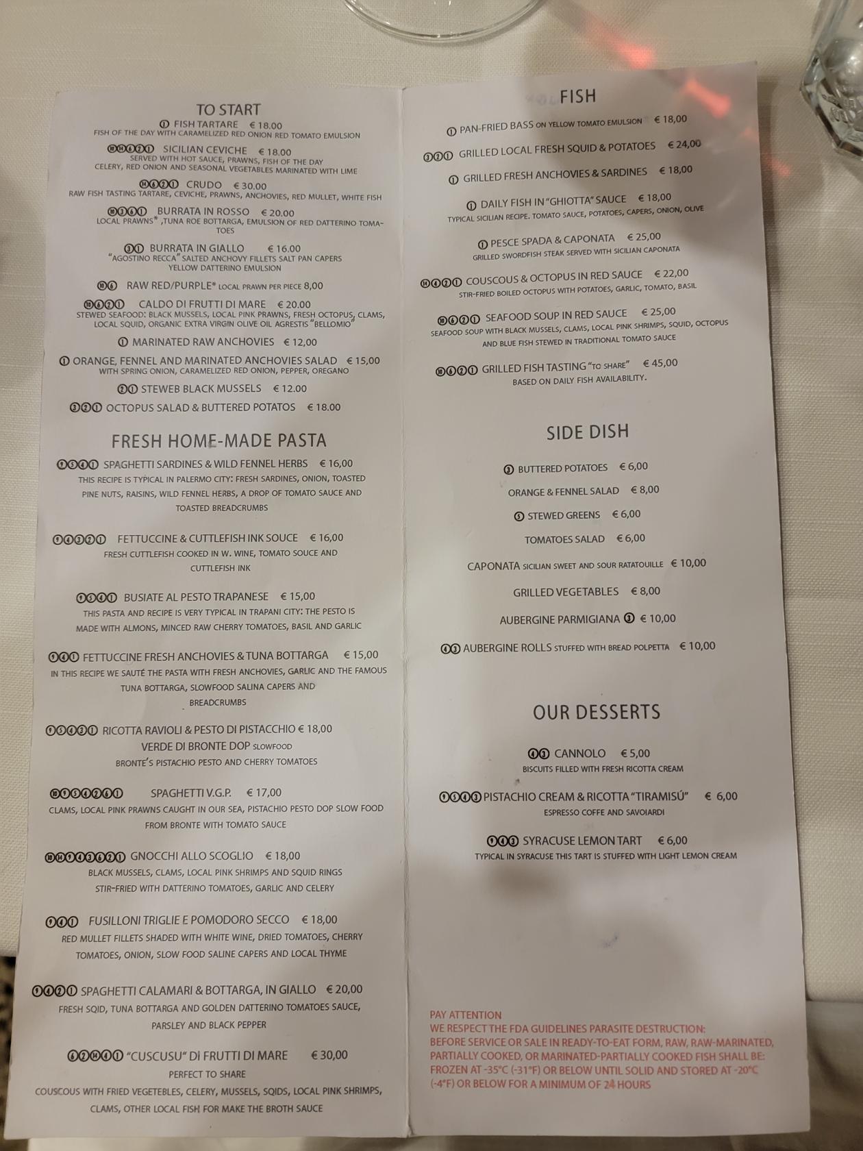
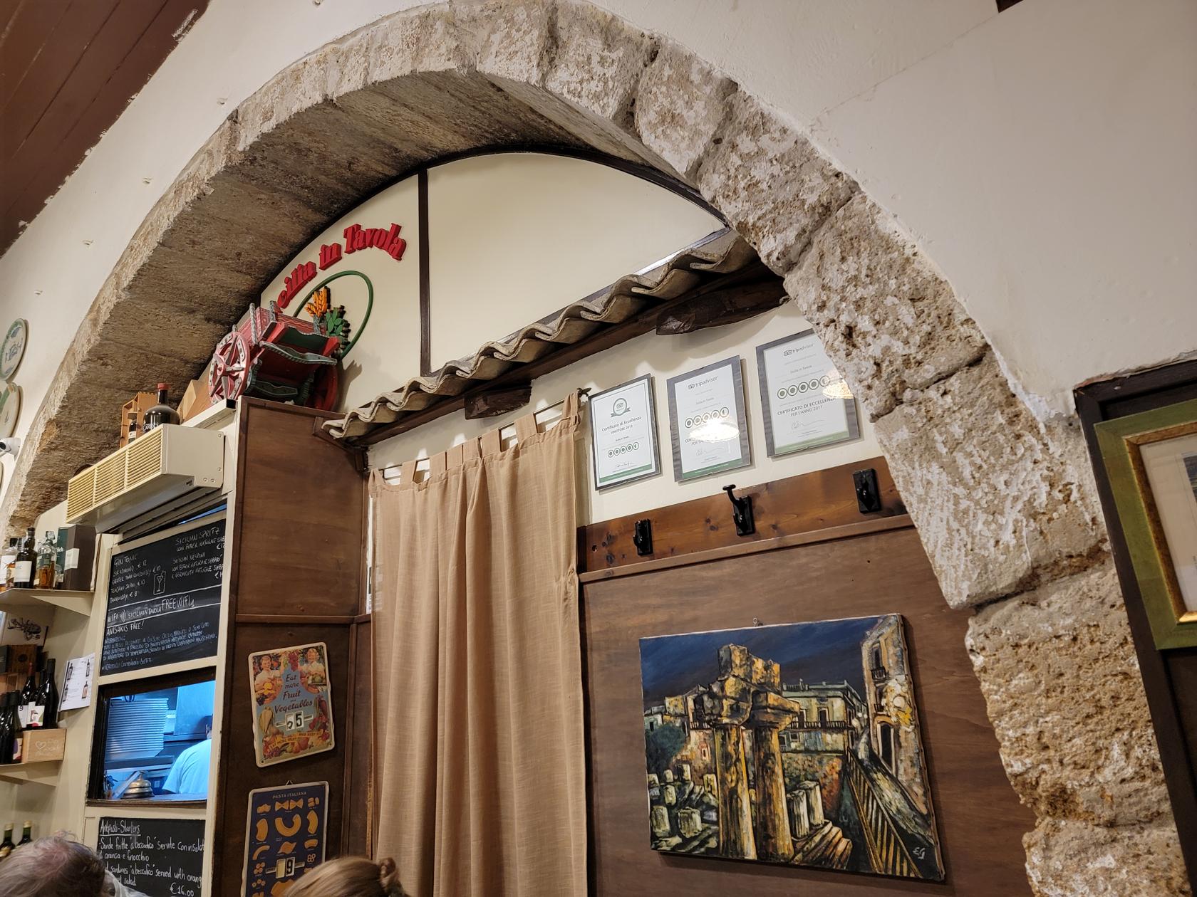
Ristorante Sicilia In Tavola
A gastronomic pleasure with an unpretentious interior is Ortigia’s In Tavola Ristorante.
Ristorante Sicilian In Tavola – Ortigia – Siracusa, Sicily
Via Cavour – Ortigia – Siracusa, Sicily
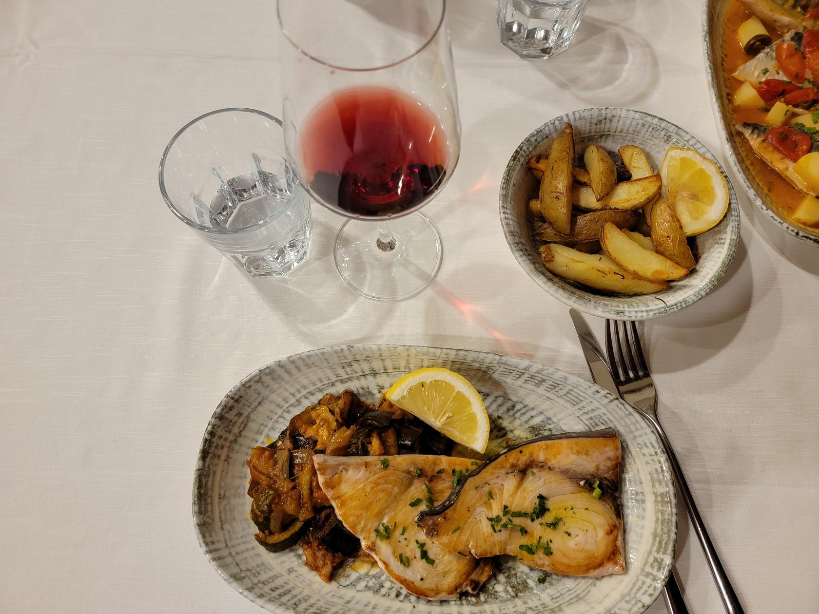
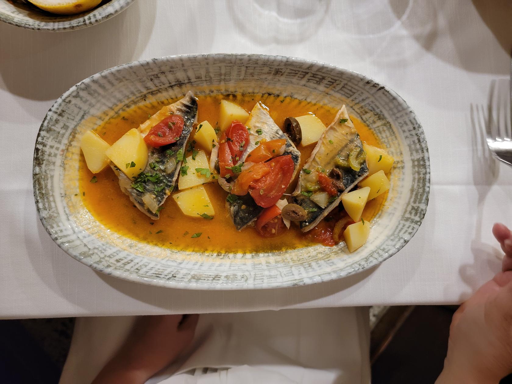
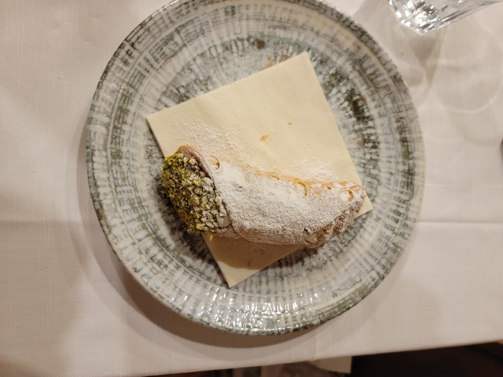
Here, as with many other place, they have home-made pasta and spaghetti. However, we ordered fish, swordfish for me and mackerel for Patti. For dessert we had lemon pie and a cannolo, along with an coffee and an aperitif, the a Sicilian Amaro, for 77€ for two people.
Ristorante Sicilian In Tavola – Ortigia – Siracusa, Sicily
Ristorante Sicilian In Tavola – Ortigia – Siracusa, Sicily
Ristorante Sicilian In Tavola – Ortigia – Siracusa, Sicily
Grilled Swordfish and Componata with roasted potatoes – Ristorante Sicilian In Tavola – Ortigia – Siracusa, Sicily
Mackerel with potatoes and tomatoes – Ristorante Sicilian In Tavola – Ortigia – Siracusa, Sicily
Cannolo with pistachio – Ristorante Sicilian In Tavola – Ortigia – Siracusa, Sicily
Lemon Pie – Ristorante Sicilian In Tavola – Ortigia – Siracusa, Sicily
Ristorante Cine
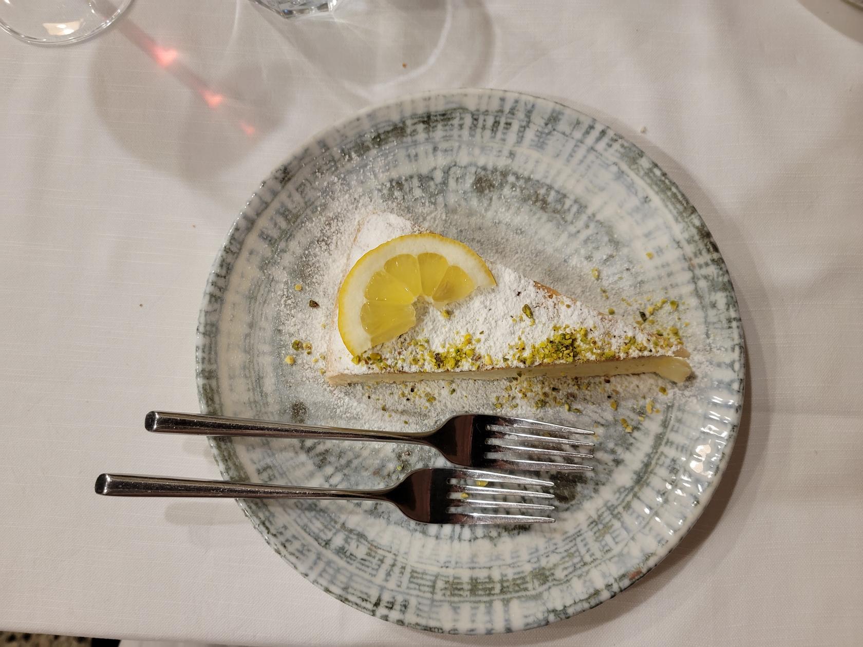
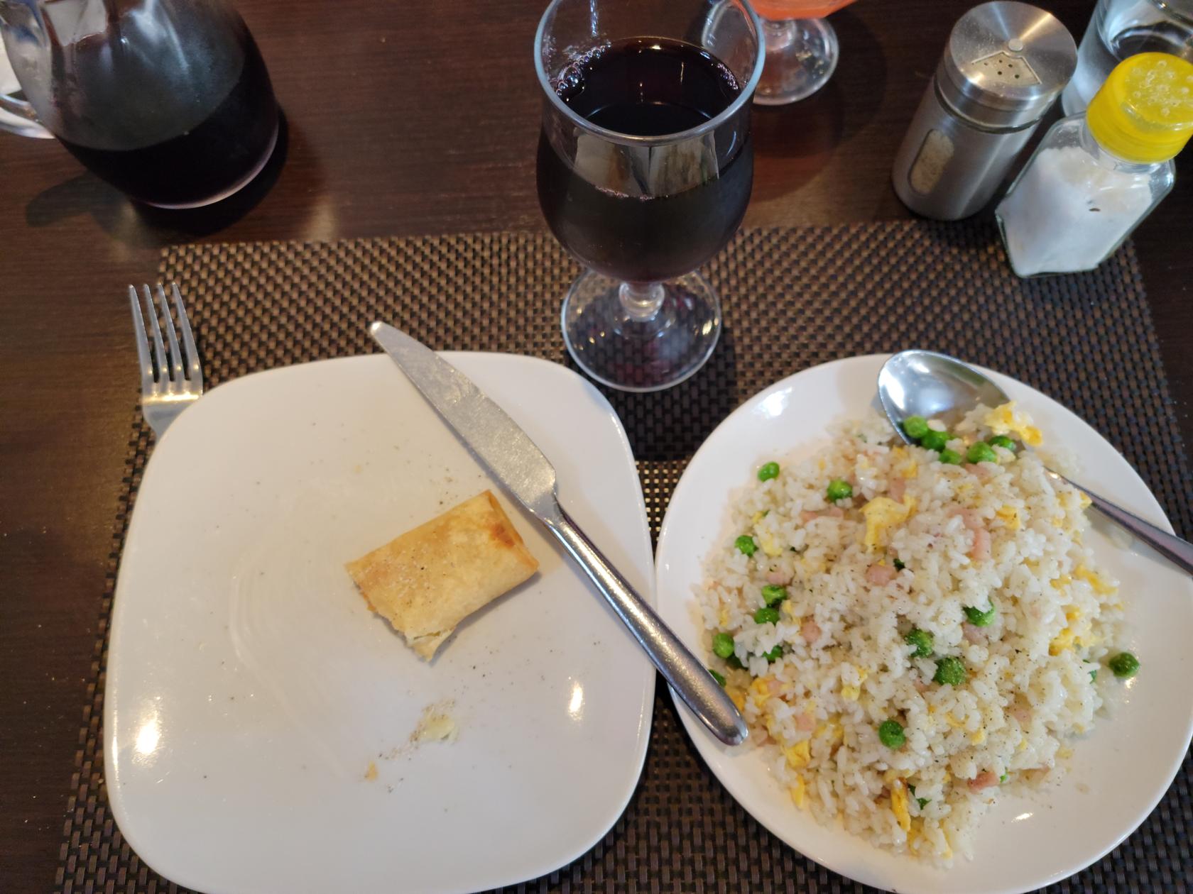
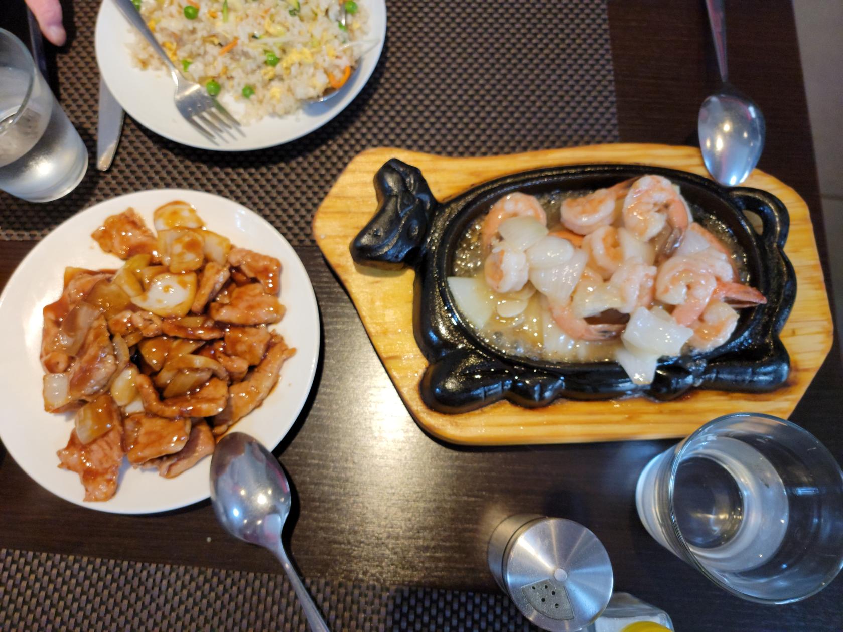
Having been eating Italian and SIcilian food for too long, we tried RIstorante Cine and really like it. Though the ingredients are different from what we are used to in Turin and the States (though not unusual), the owner was more than happy to alter any dishes to our tastes. We only ate lunch here and for two, we were able to order an appetizer, primi (vegetable rice) and secondi (chicken or pork or vegetables in white sauce), along with a half carafe of red wine, water, coffee and sambuca for under 30€! It is hard to beat that in a tourist area.
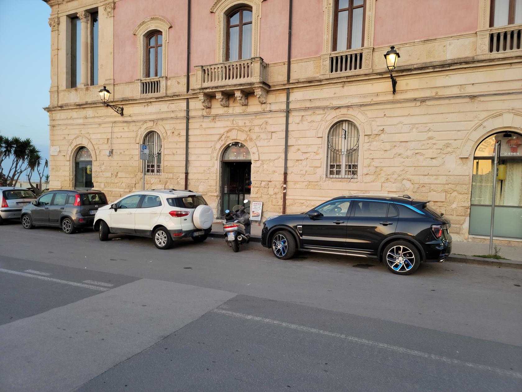
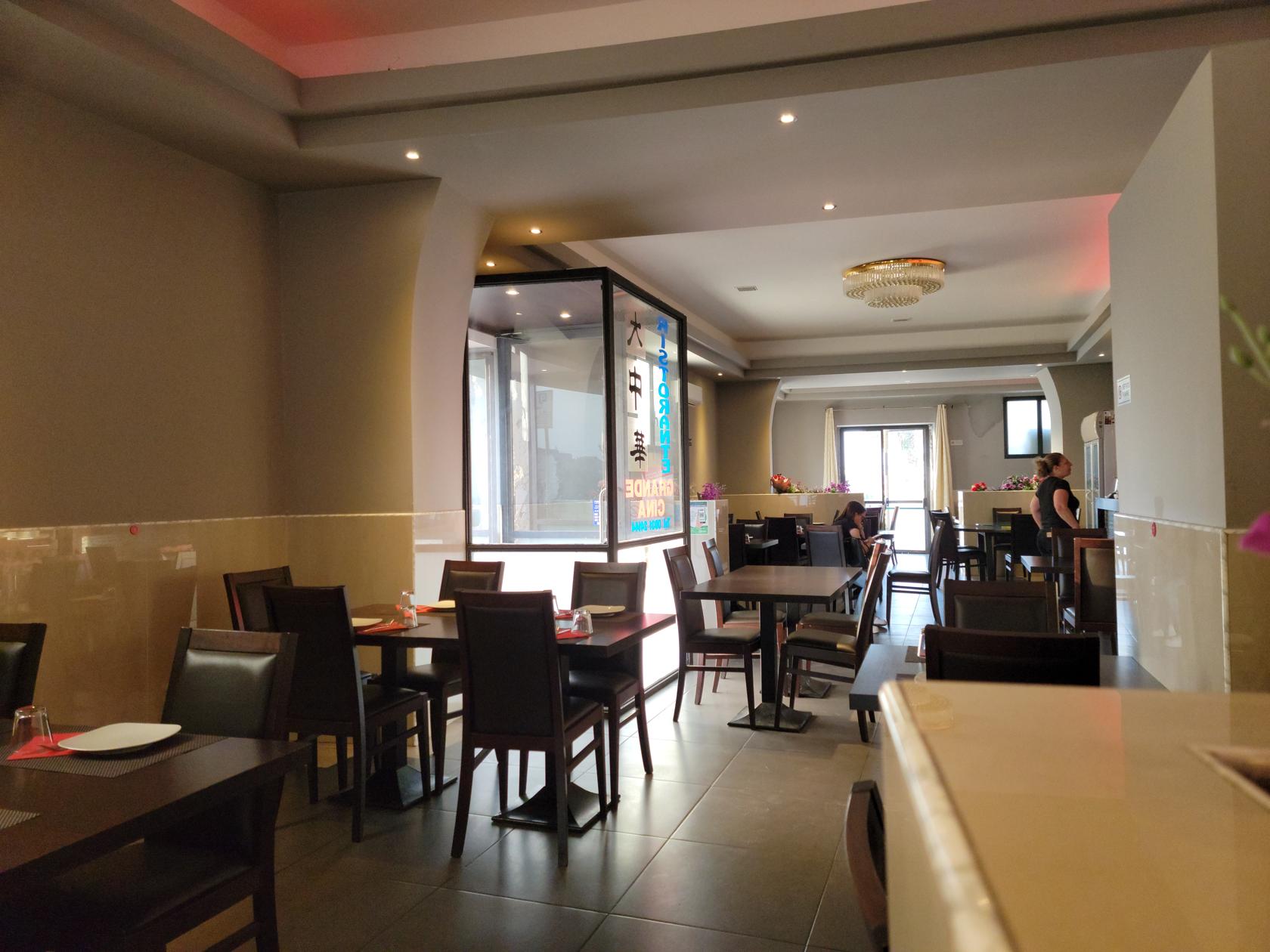
Ristorante Cine – Chinese restaurant – Siracusa, Sicily
Ristorante Cine – Chinese restaurant – Siracusa, Sicily
Involtino and Rice Cantonese – Ristorante Cine – Ortigia – Siracuse, Sicily
Pork and onions in brown sauce, Shrimp and onion in white sauce – Ristorante Cine – Ortigia – Siracuse, Sicily
La Tavernetta Da Piero Fuori Ortigia
We ate lunch here on Sunday, the 21st of May, 2023, after visiting the Archaeological Park and when unbeknownst to us Mount Etna was erupting.
La Tavernetta Da Piero Fuori Ortigia Ristoranta – Ortigia – Siracuse, Sicily
Tagliatella alla pomodoro, bruschetta – La Tavernetta Da Piero Fuori Ortigia Ristoranta – Ortigia – Siracuse, Sicily
After we finished and began walking back to the hotel, we noticed dust getting in our eyes. At the time we had no idea why and surmised that the recent bad storm had brought in dust from Africa, which can occasionally happen. When we read the next day that the Catania Airport had closed due to ash if finally dawned on us that it had been the ash from the volcano all those miles away that was the cause.
Gelateria
If you are looking for gelati in Sicily, do not buy the brightly colored ones, usually they are made of inferior ingredients. Instead, look for the Artiginale label. Though you will pay more for a cone of cup of this, it will be far more worth your while in taste later.
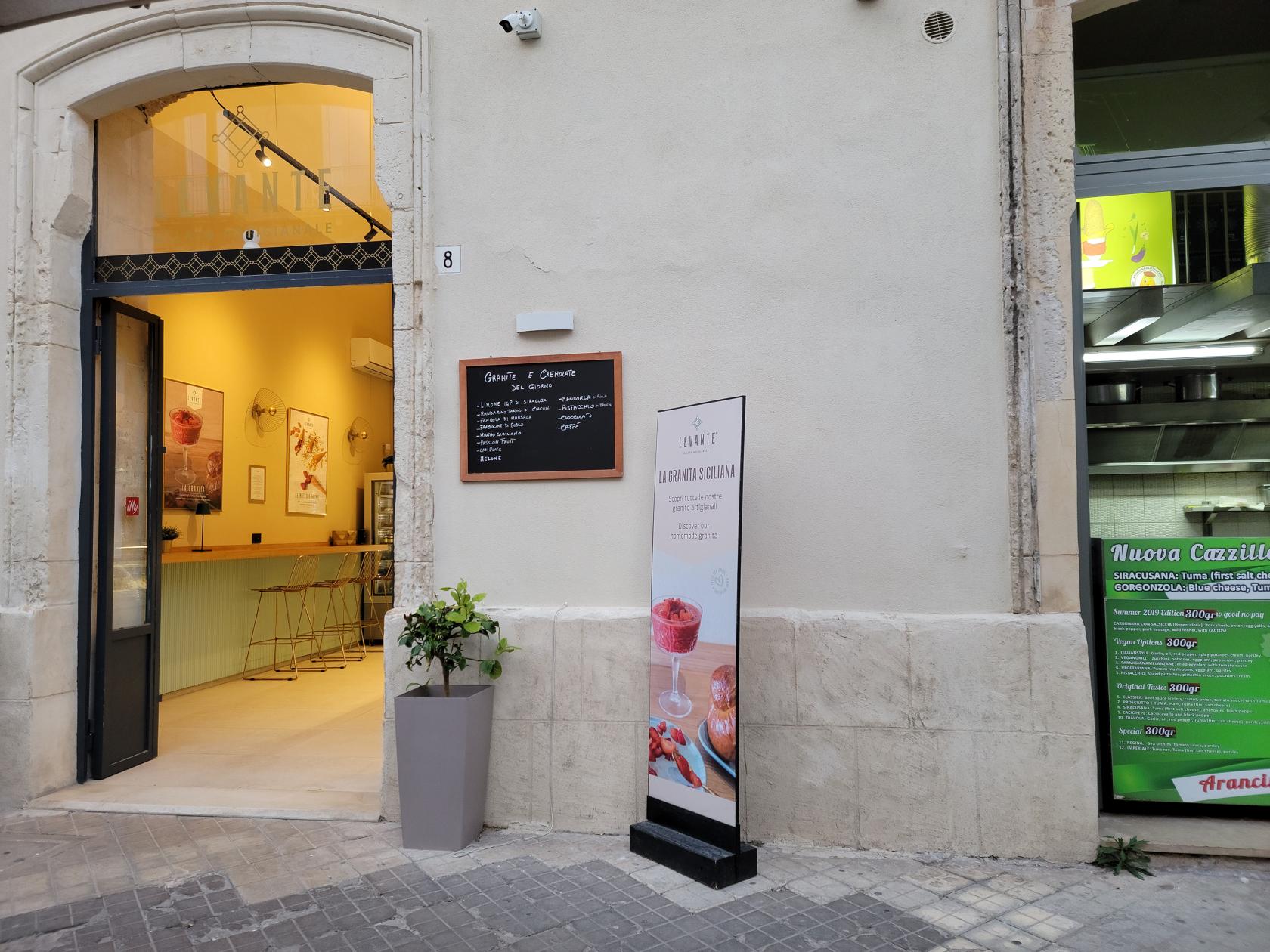
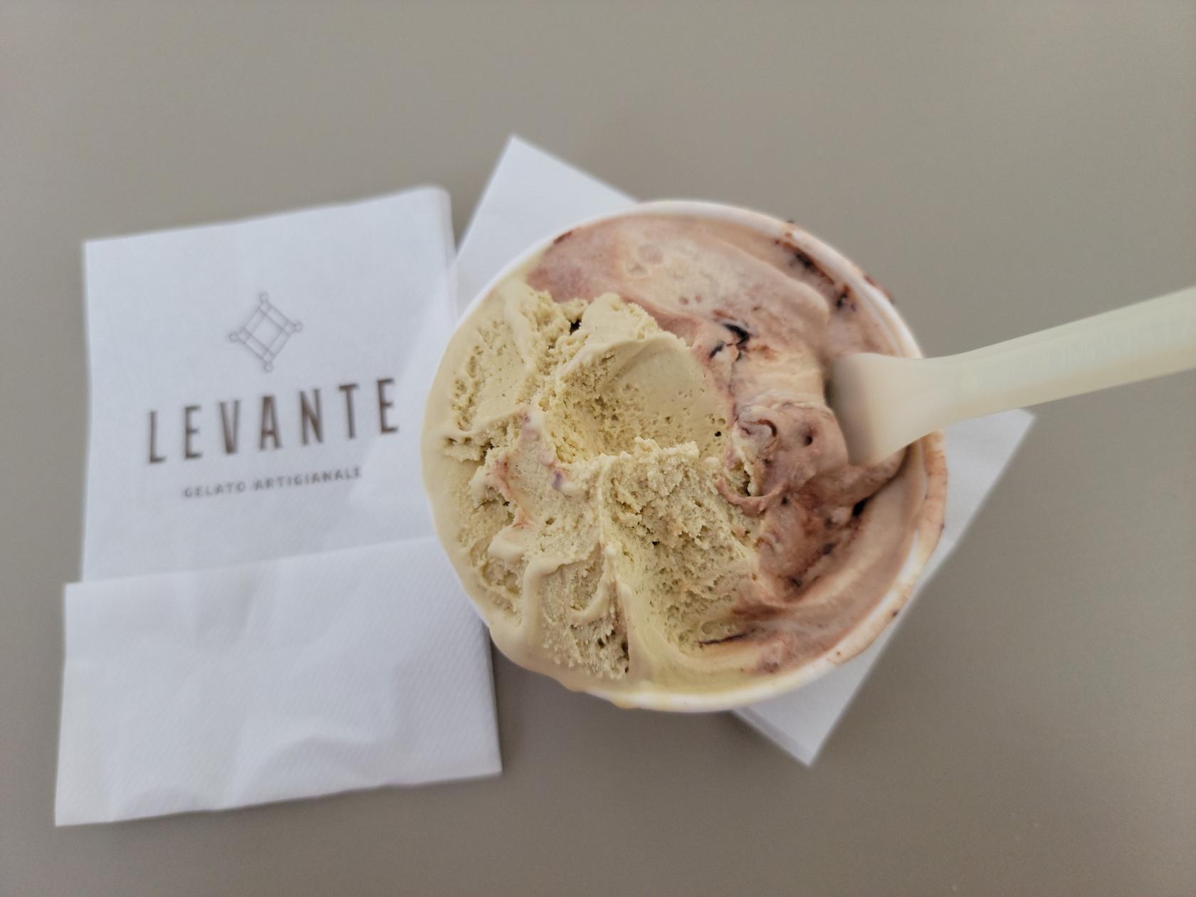
Levante Gelateria
Another good Gelateria, providing excellent artisanal gelati. I was particularly fond of their Amerano and Pistachio flavors.
Levante Gelateria – Siracusa, Sicily
Levante Gelati Artiginale – Pistachio and Amorano – Siracusa, Sicily
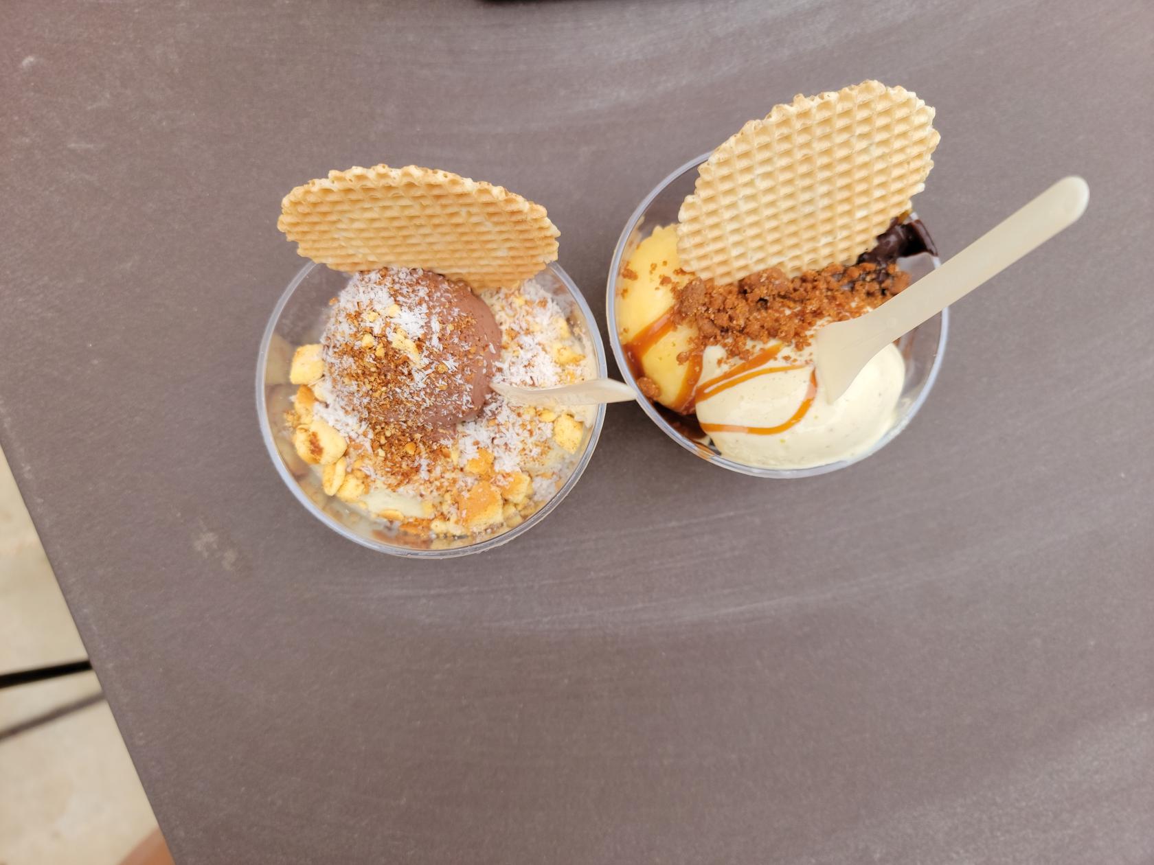
Fior Di Latte Gelati
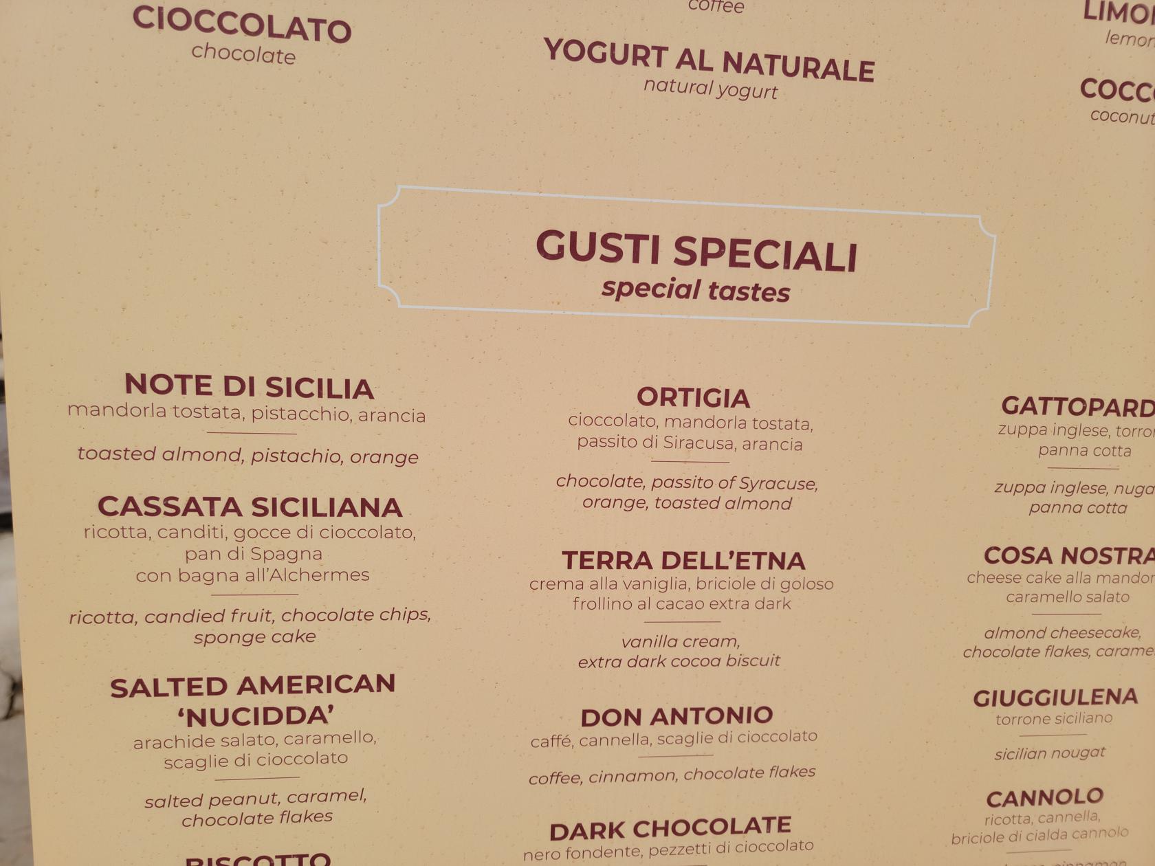
Finding very good gelati anywhere in Italy is not a difficult task, here is no exception. It has great artiginale (artisanal) flavors, I ordered the Ortigia and Note Di Sicilia, and Patti ordered the Note Di Sicilia, Mandarin Orange and Dark Chocolate with a hint of orange.
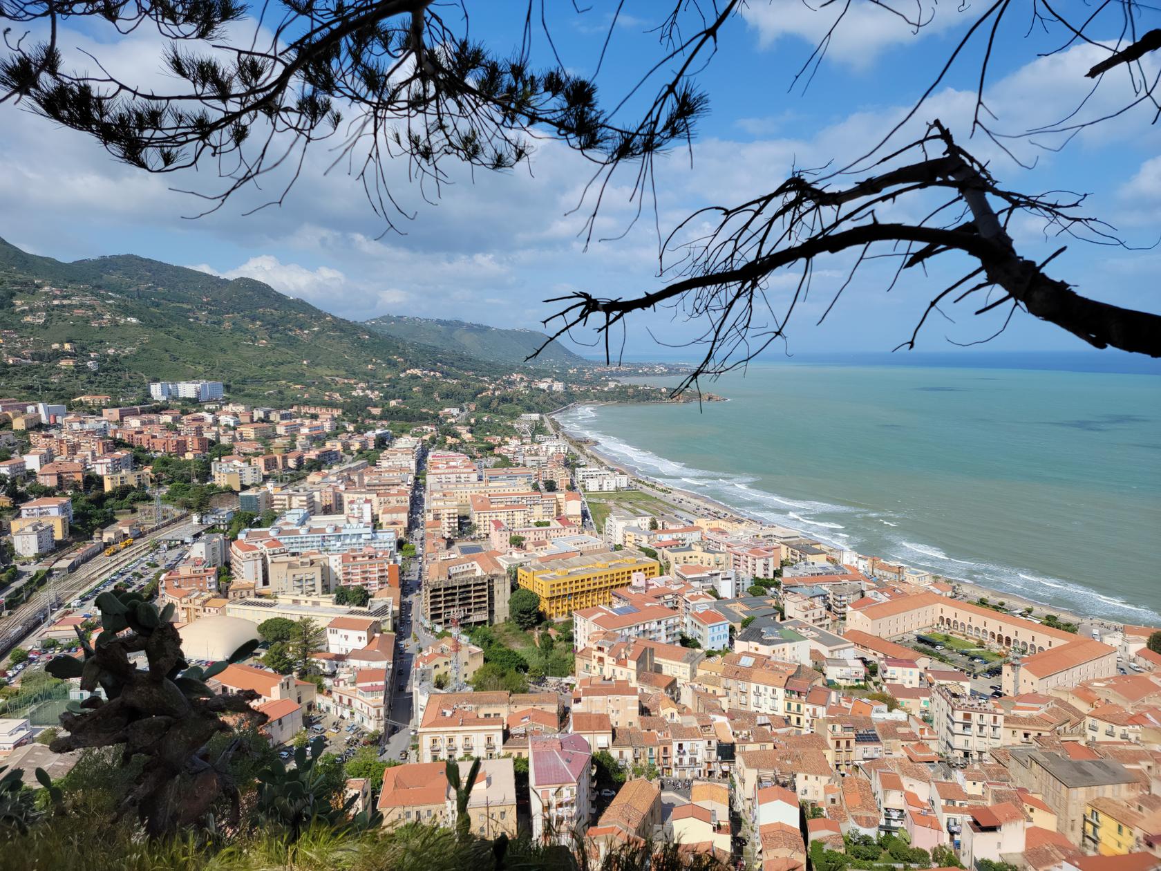
We have traveled a lot throughout Europe and especially Italy and occasionally you will get a rainy or snowy day. But nothing prepared us for our arrival in Cefalù, or as we write it in english, Cefalu; a small touristy town situated on the north side of the island of Sicily.
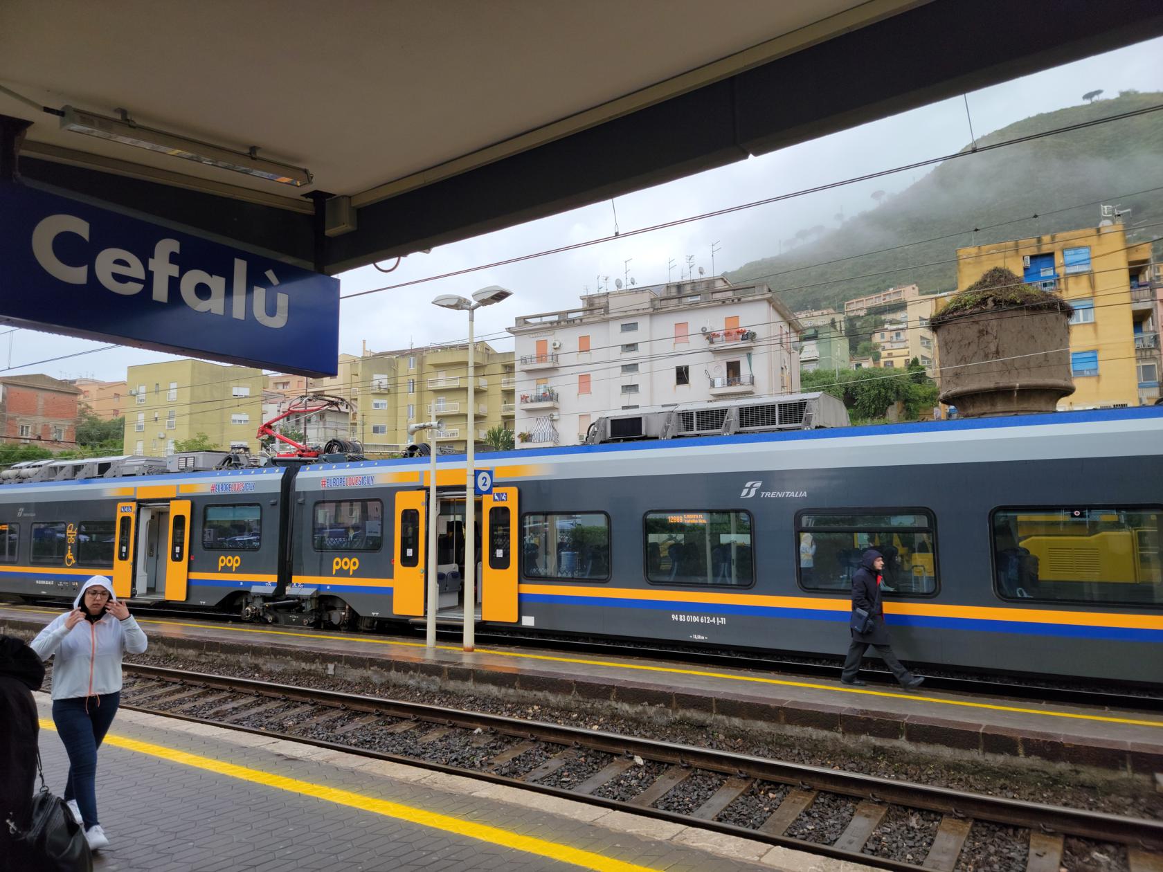
Train Station – Cefalu, Sicily
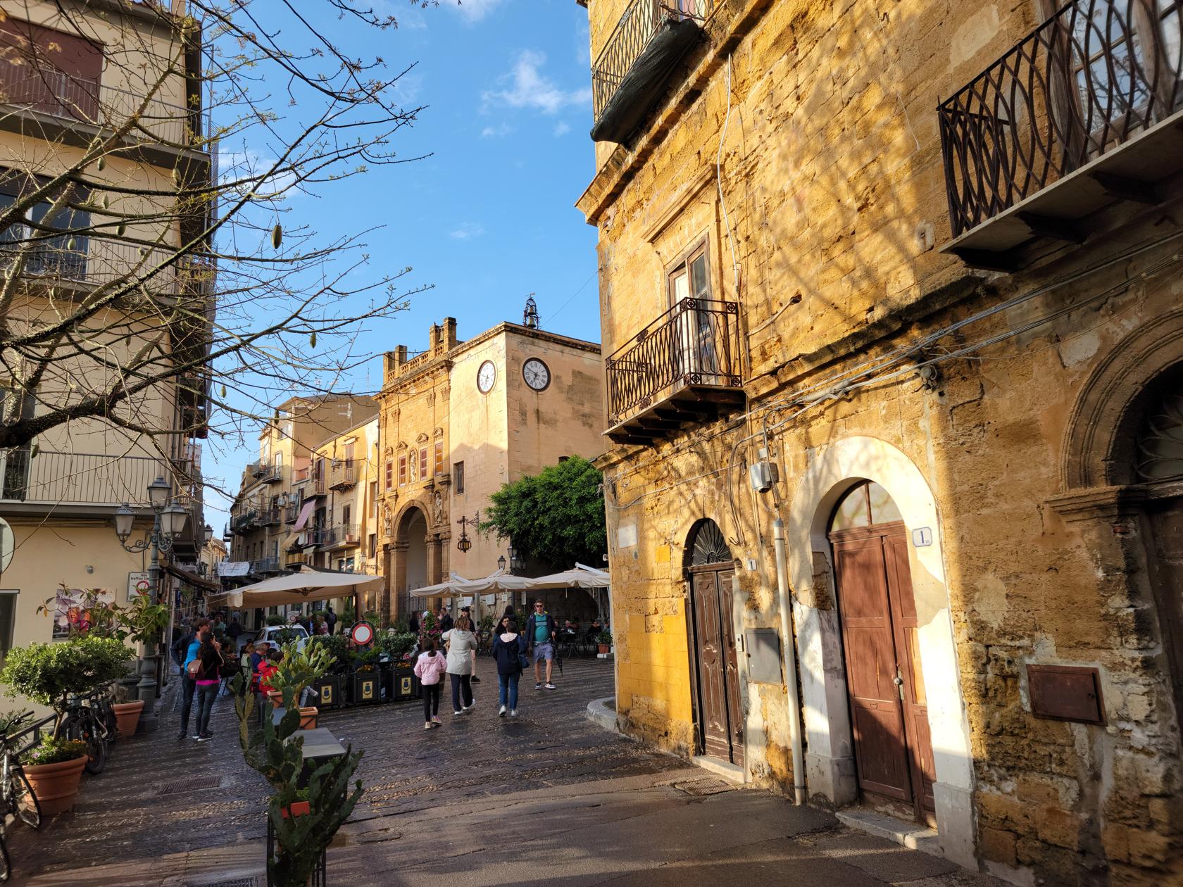
Cefalù
We arrived by Trenitalia’s Pop train from Palermo, which runs approximately every hour and costs around 6.50€/person. These are normally local tourism trains in the major areas and can be called Pop, Jazz, or almost anything. They provide reasonably priced and fast transportation to the coastal tourism spots. If you need to travel a longer distance, you will most likely have to use the normal Trenitalia or Intercity service.
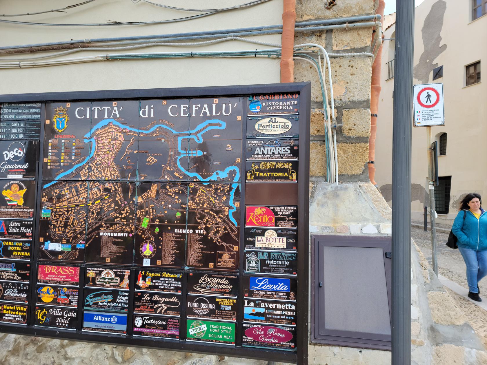
The City Map – Cefalu, Sicily
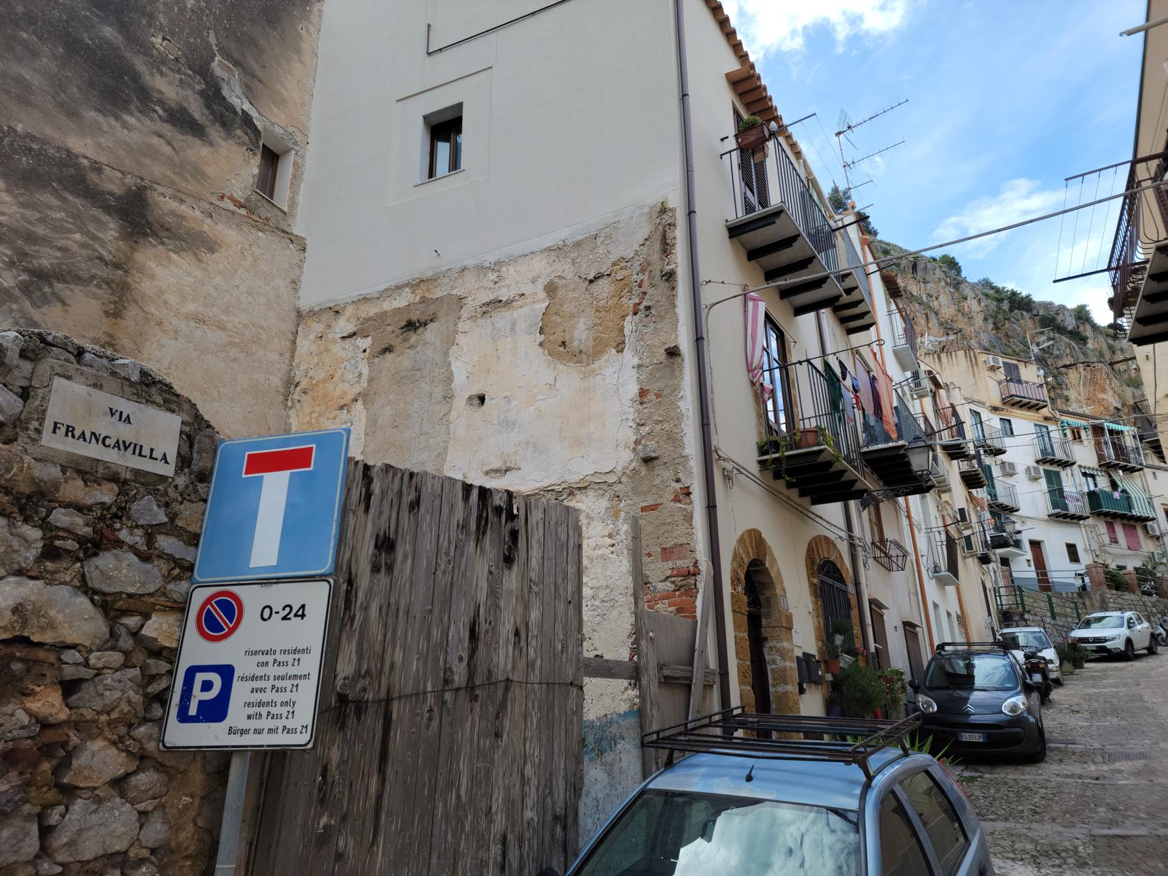
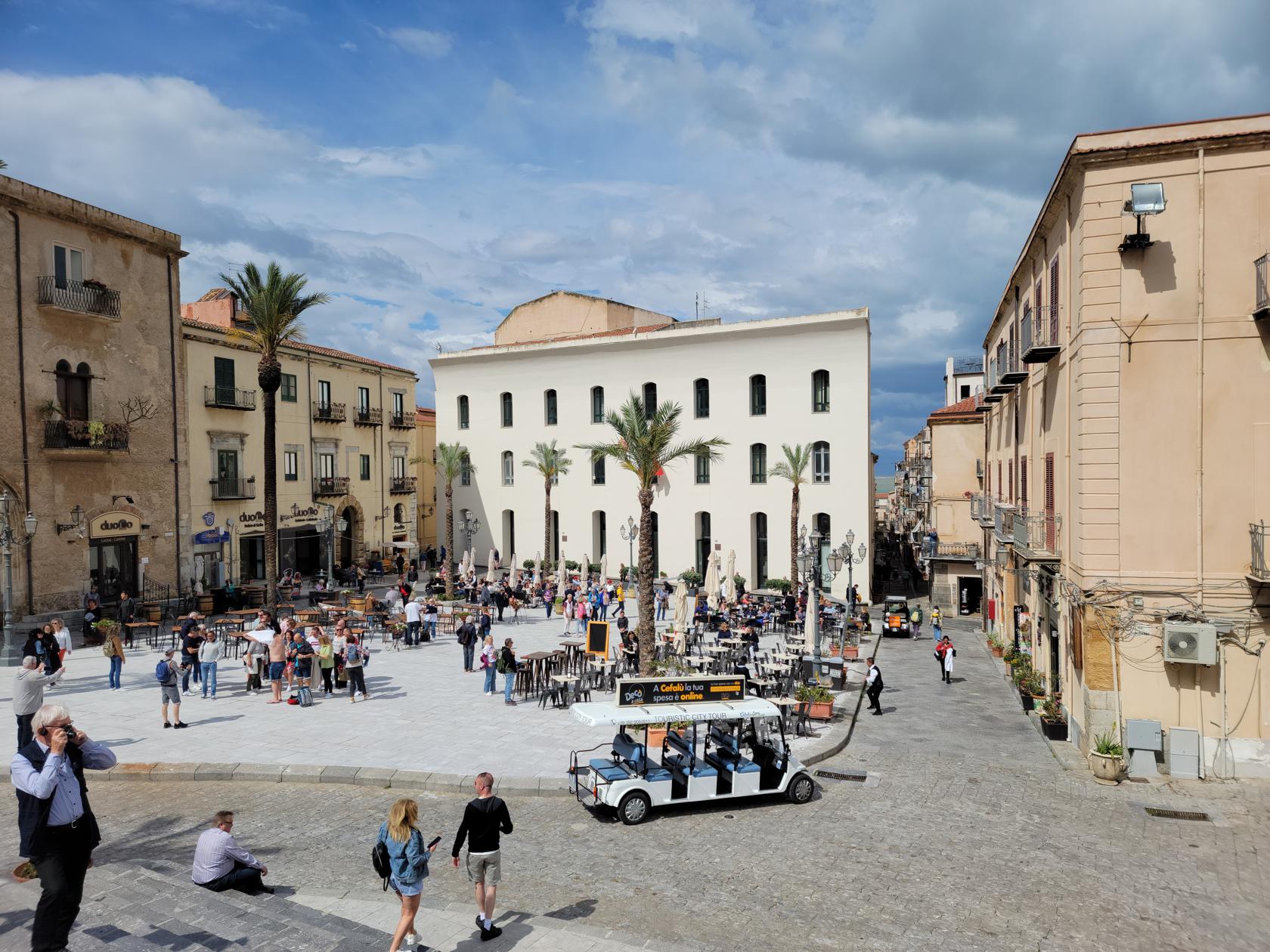
Similar to other touristy spots in the US and other parts of the world, Cefalu is definitely administered and managed for the traveler. Though quiet during these months, I can imagine it can get a bit noisy during the summer months with its extensive beach and boardwalk beckoning travelers on. With the addition of all the shops and artisans in town, you have the perfect recipe for the tourist trap. So, if you are only interested in the historic aspects of the town and area, it probably behooves you to travel earlier or later in the year, in order to avoid its busy potential. Otherwise, if you are a sun lover, this could be a very good destination for you.
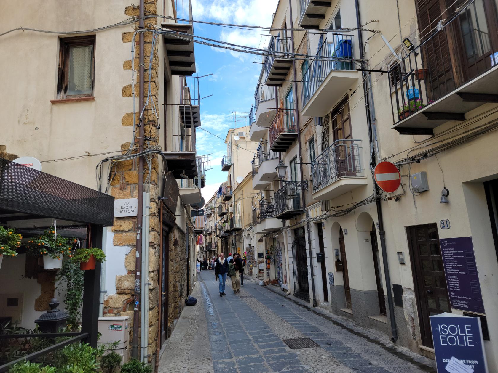
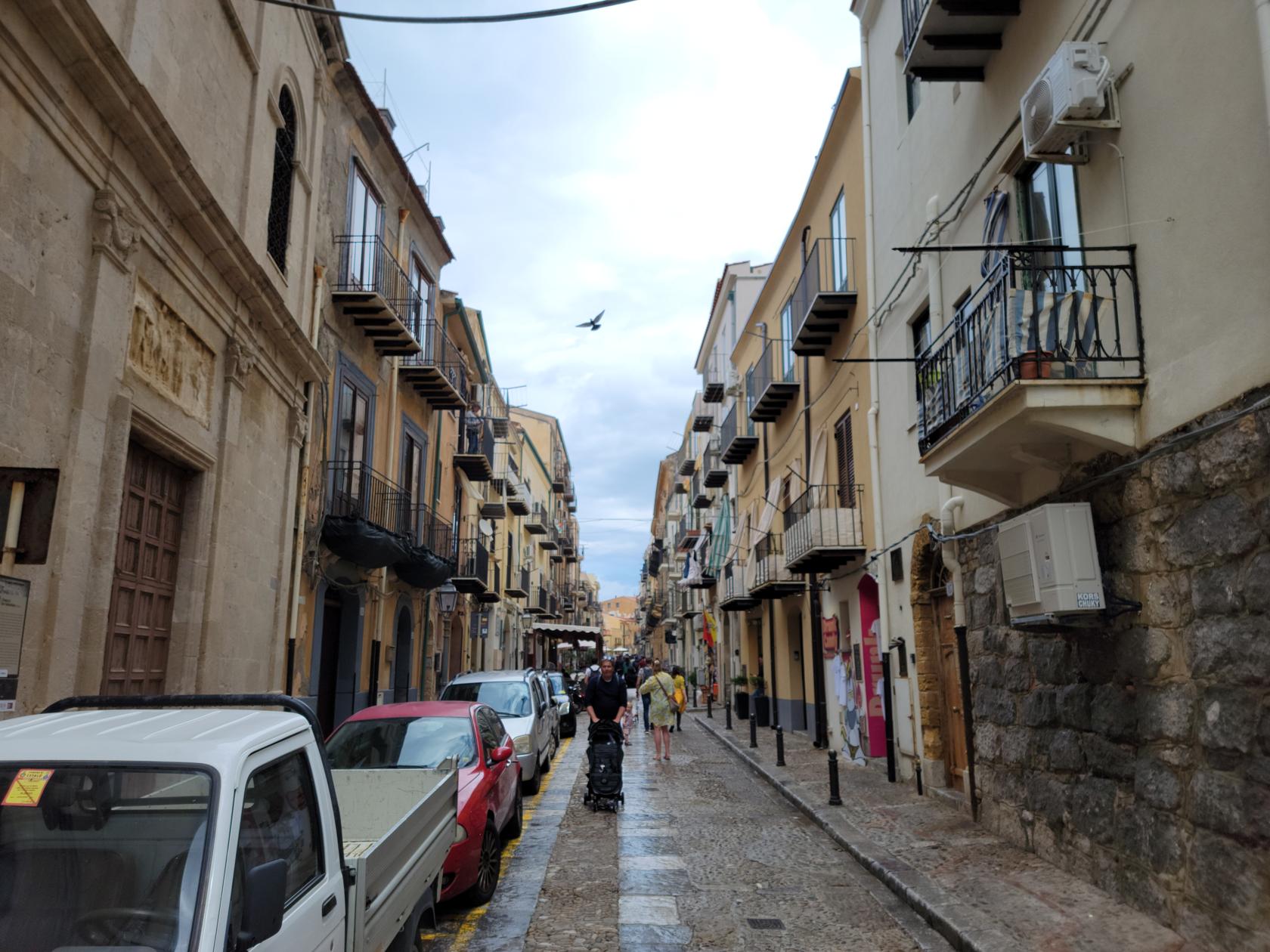
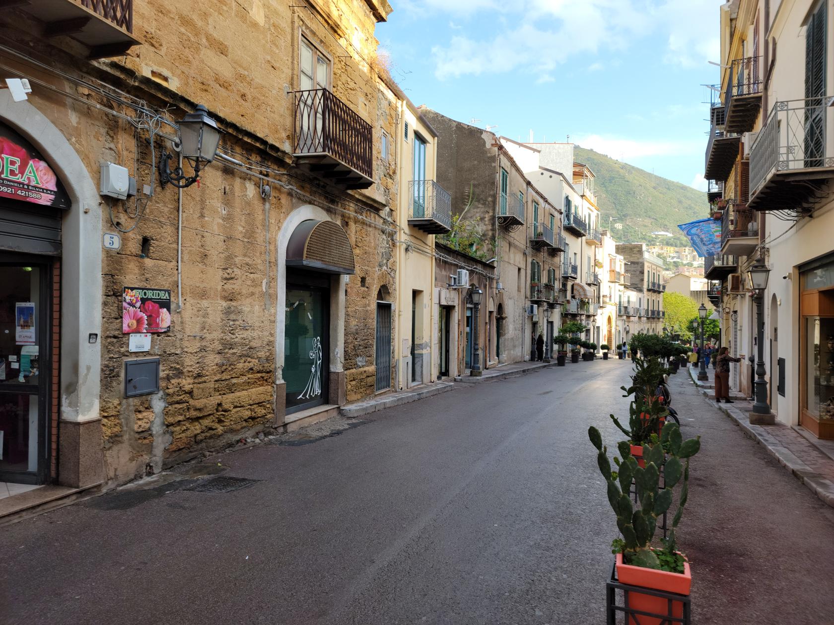
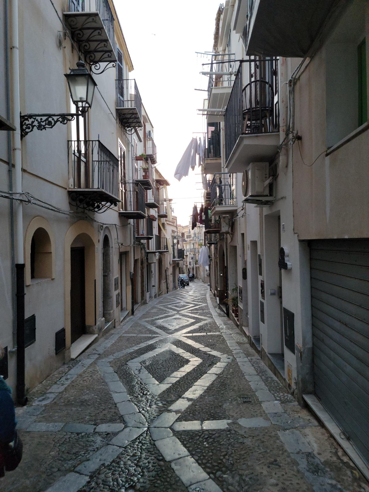
The Town – Cefalu, Sicily
Patti walking the town – Cefalu, Sicily
Cefalu, Sicily
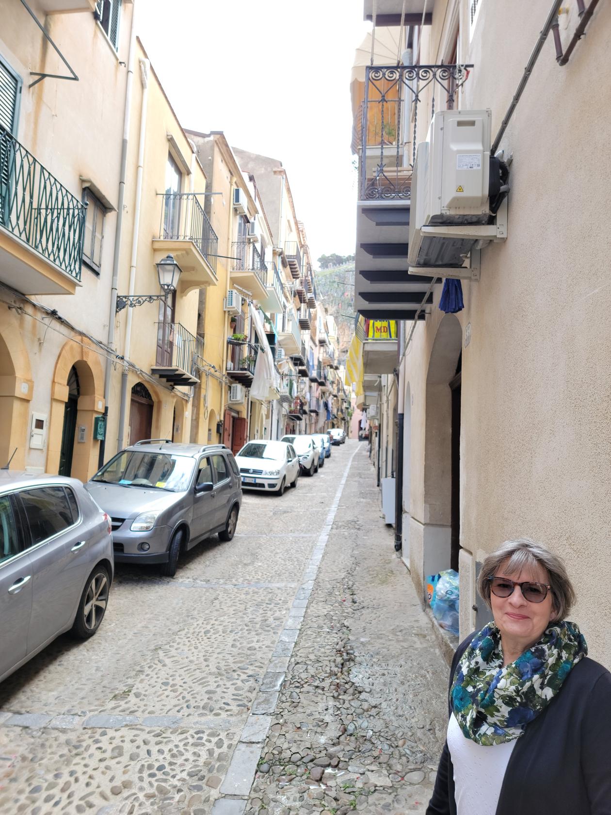
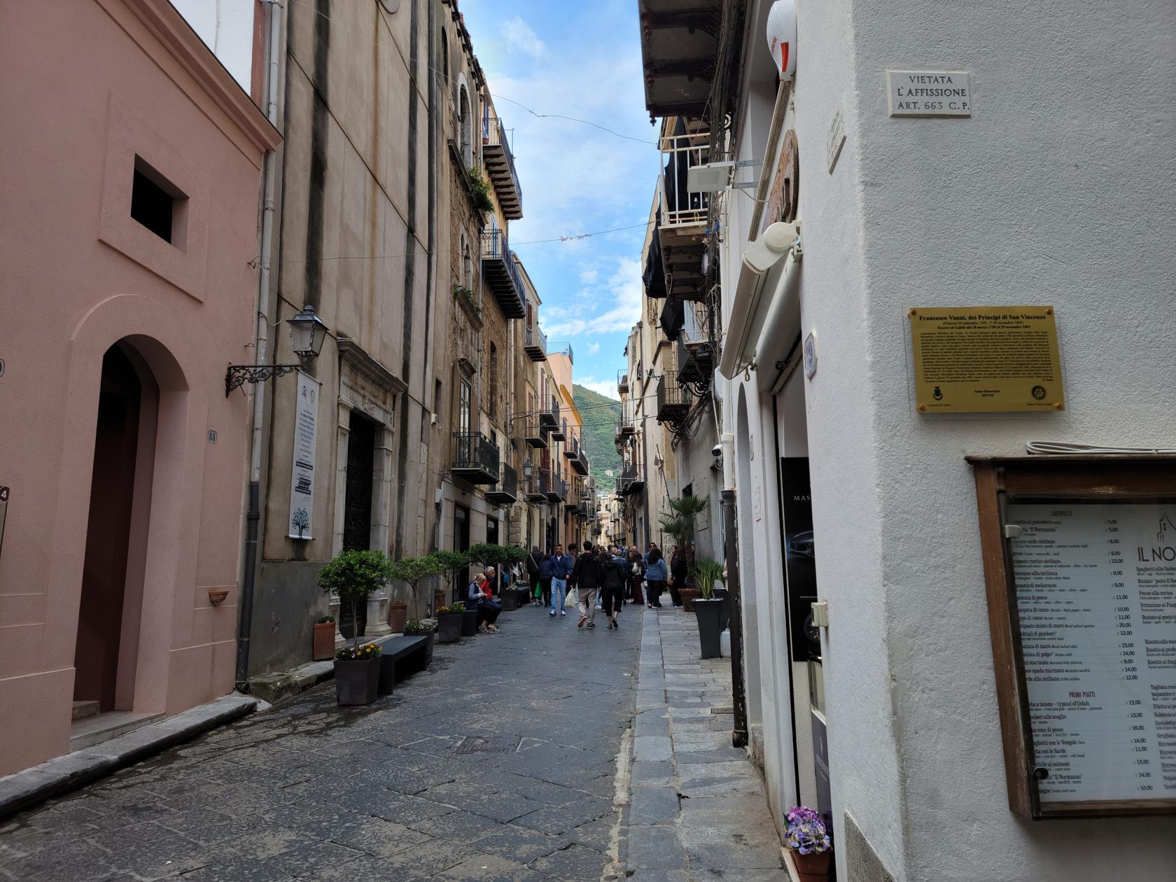
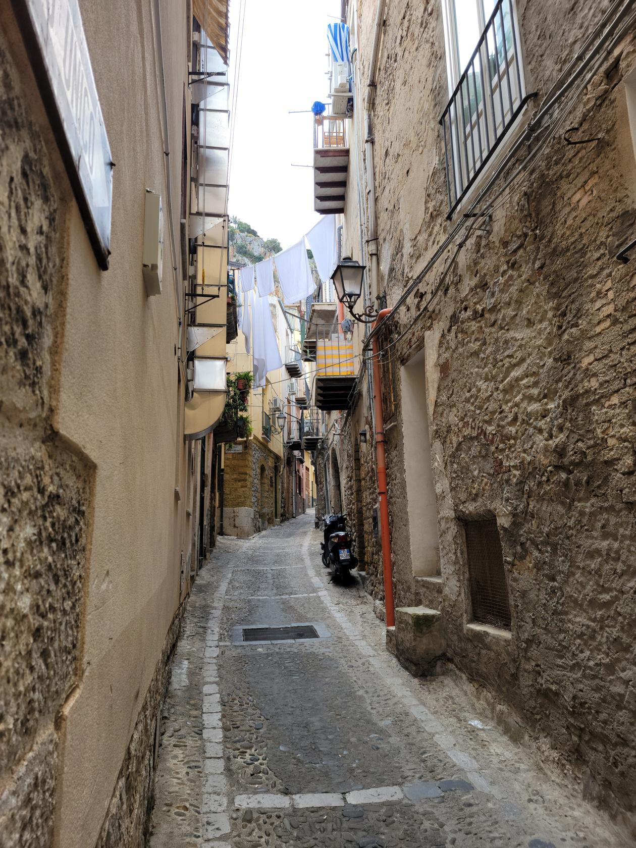
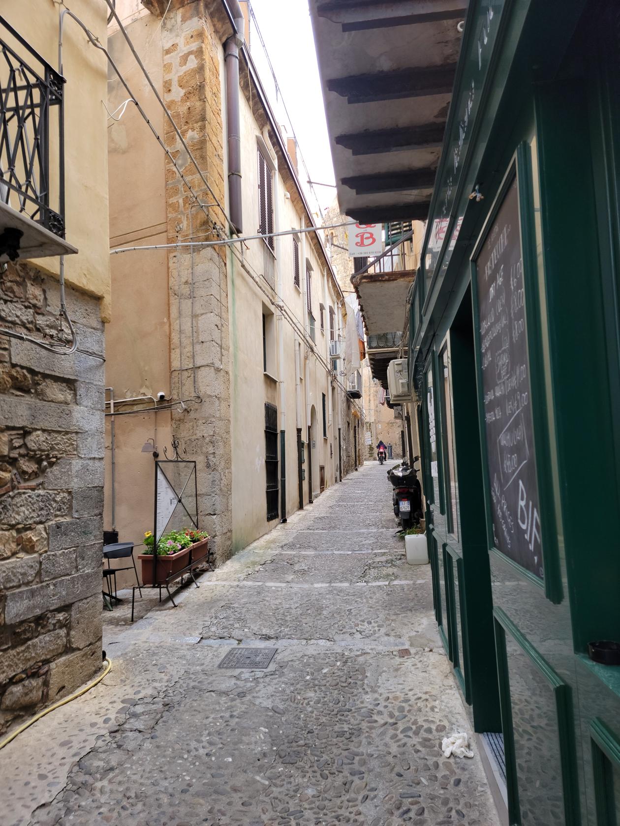
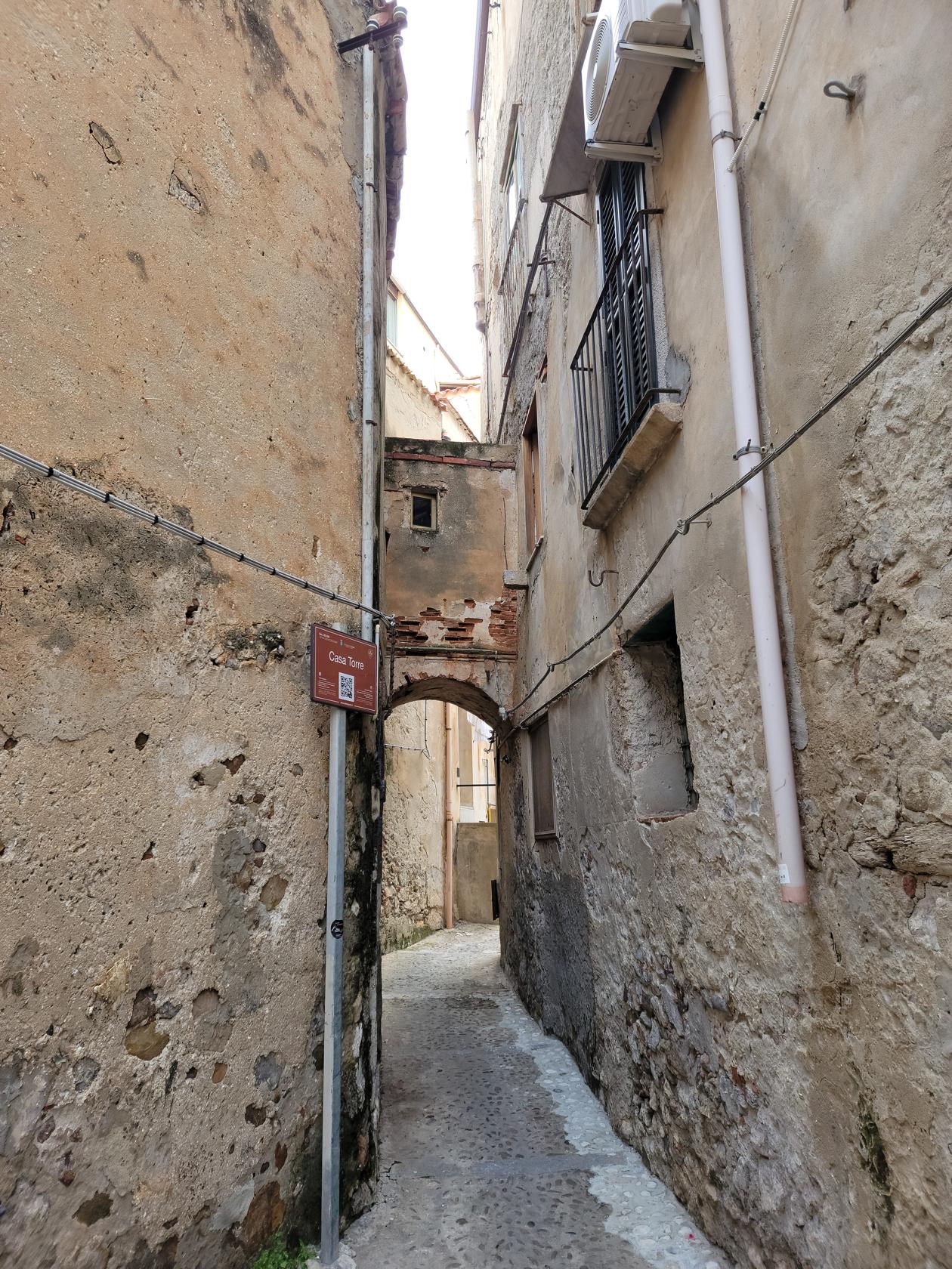
A Narrow Street – Cefalu, Sicily
Another quiet street – Cefalu, Sicily
Quaint side street – Cefalu, Sicily
Cefalu, Sicily
Typical Italian Back Street – Cefalu, Sicily
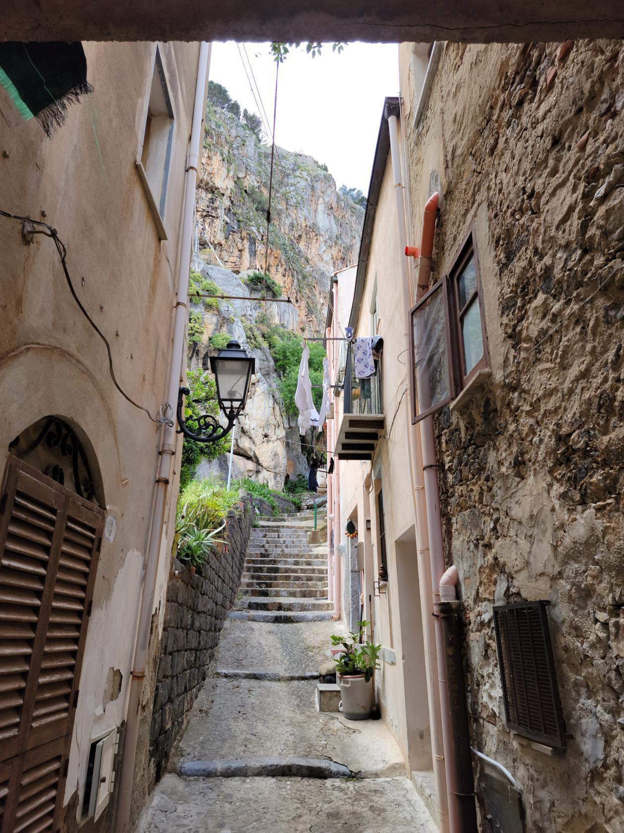
Stairs To Upper Part Of Town – Cefalu, Sicily
Towards The Grotta – Cefalu, Sicily
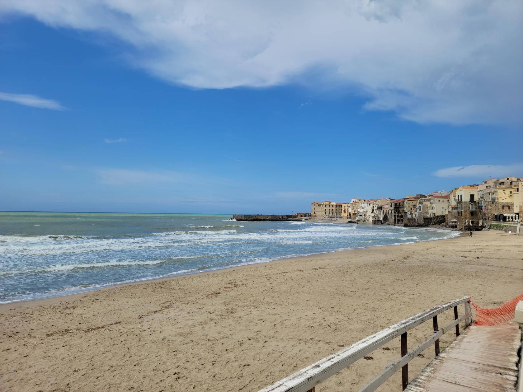
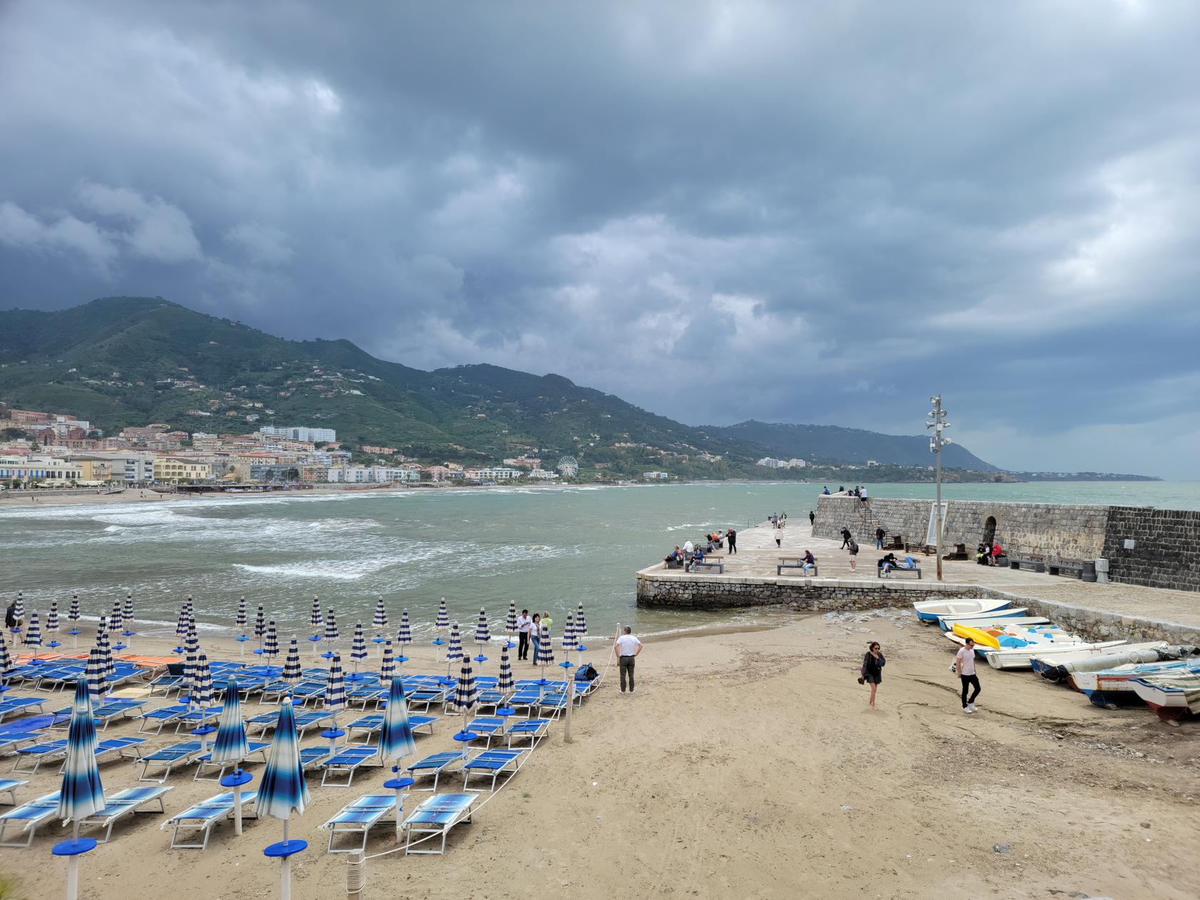
The Beach – Cefalu, Sicily
The Wet City Streets – Cefalu, Sicily
Another Side Street – Cefalu, Sicily
The Molo – Cefalu, Sicily
The Steps Up To Piazza Garibaldi – Cefalu, Sicily
Piazza Garibaldi – Cefalu, Sicily
Piazza Garibaldi – Another View – Cefalu, Sicily
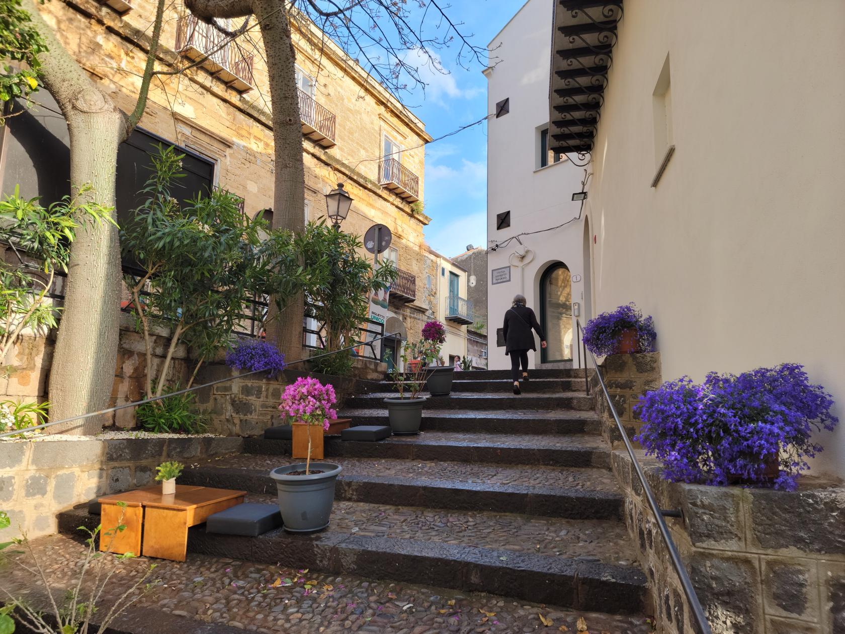
The beautiful paved streets – Cefalu, Sicily
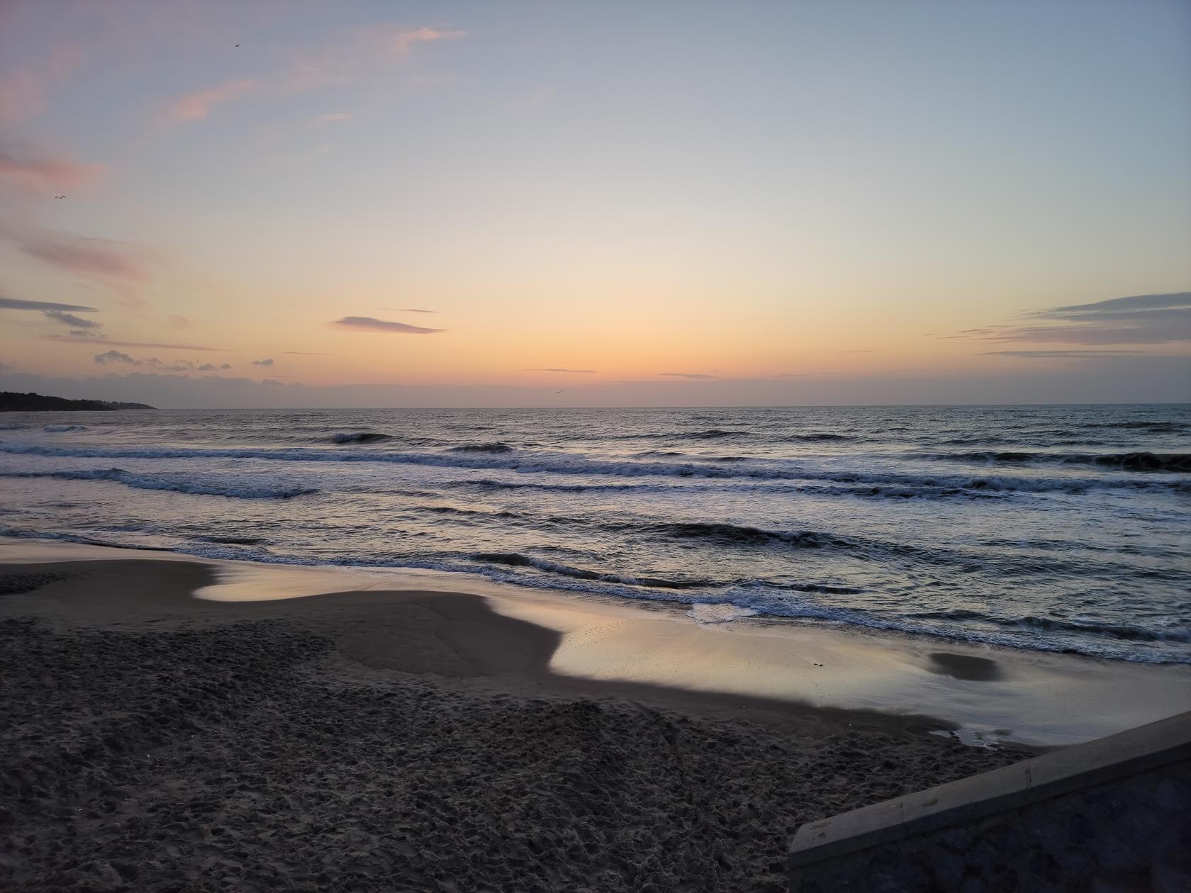
Sunset – Cefalu, Sicily
The begging of our climb – Hiking la Rocca – Cefalu, Sicily
Other than that, we happened to arrive when Sicily was getting one of its worst storm system in twenty years. Not only did it rain incessantly, the wind and the temperatures made for a quite challenging time. If there wasn’t water, water, everywhere, there was always the threat of rain, so you always had to pack an umbrella. We got wet so often, we started debating whether we should go out at all. We were glad we did, otherwise there would have been no way to see everything that we did in such a compressed time.
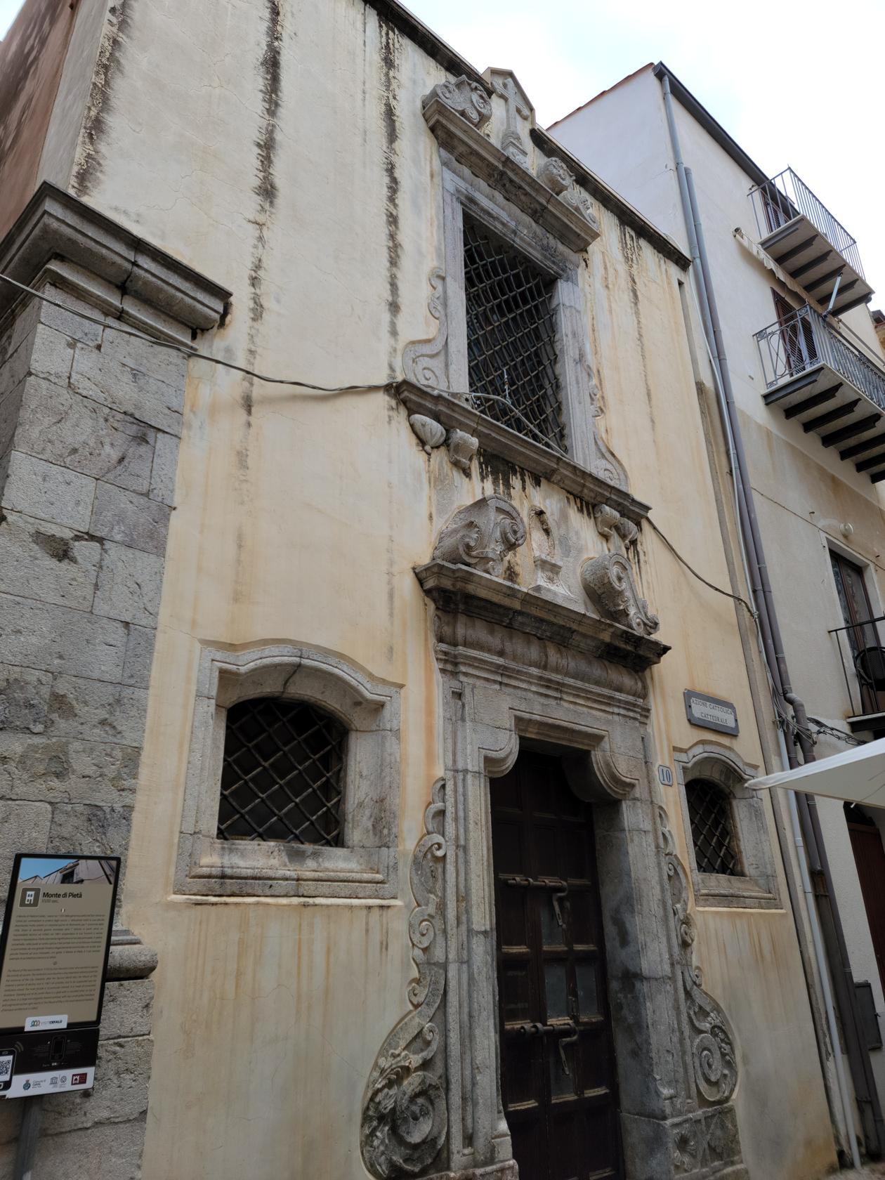
Monte de Pieta
The Mount of Pity was first funded in the early 1700s by Don Vincenzo Costa. The institution became very important to the economy of the city, but after World War II fell into decline. It has elegantly framed windows and a molded lintel and is an example of the advanced baroque architecture in Cefalu.
Monte di Pieta – Cefalu, Sicily
Torre Orologio
Not far from Il Duomo and in Piazza Garibaldi, almost next to Ristorante Porta Terra is the Torre Orologio, or the clock tower. Like most other cities, probably the go to place at one time to set your own timepiece to, but now, though it still functions, appears to be in dire need of some repairs. While we were eating at Porta Terra, we noticed the bells do not function perfectly, even though if you paid attention, it appeared to tell the correct time within a few minutes of the actual, even though the ringing was quite muted.
Torre Orologie – Cefalu, Sicily
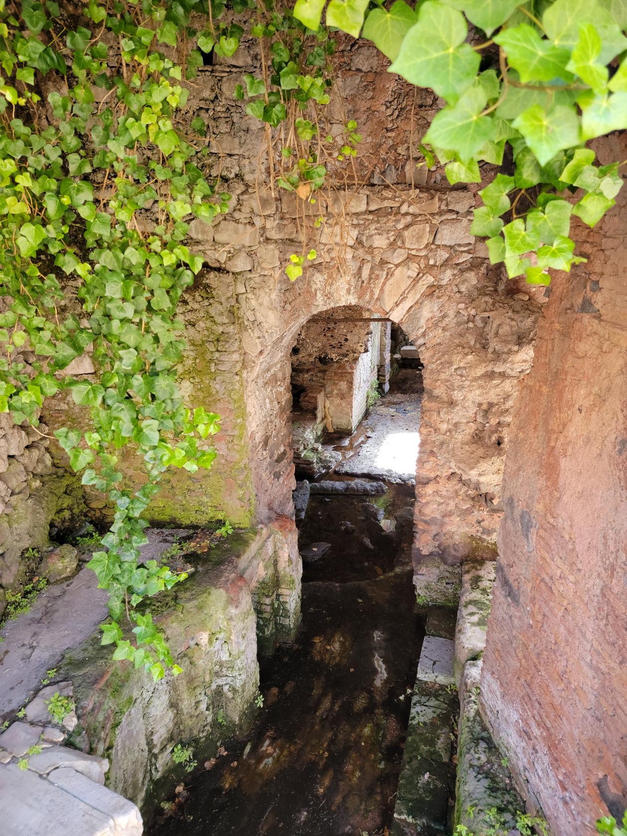
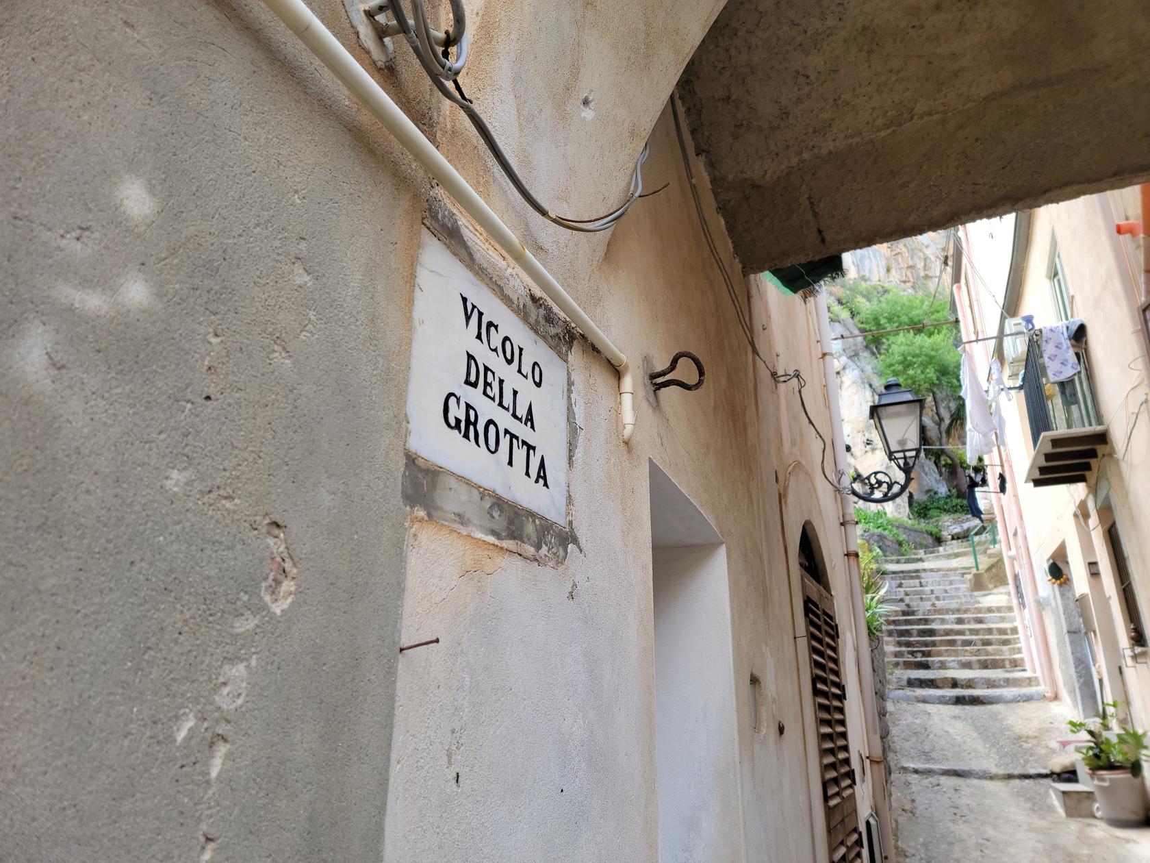
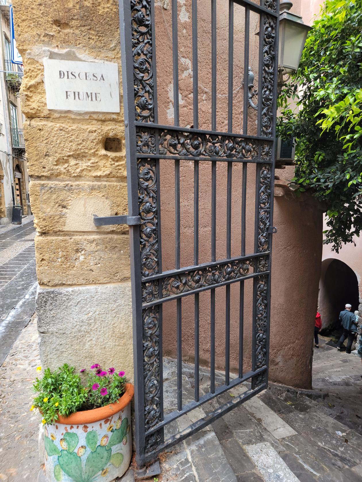
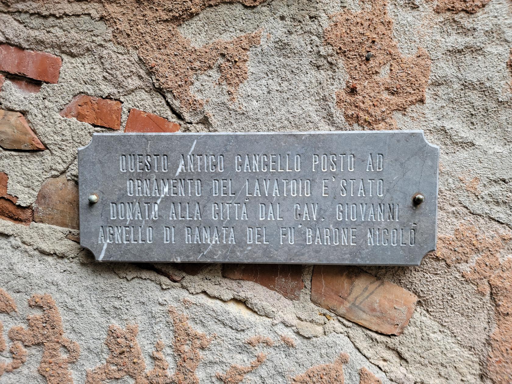
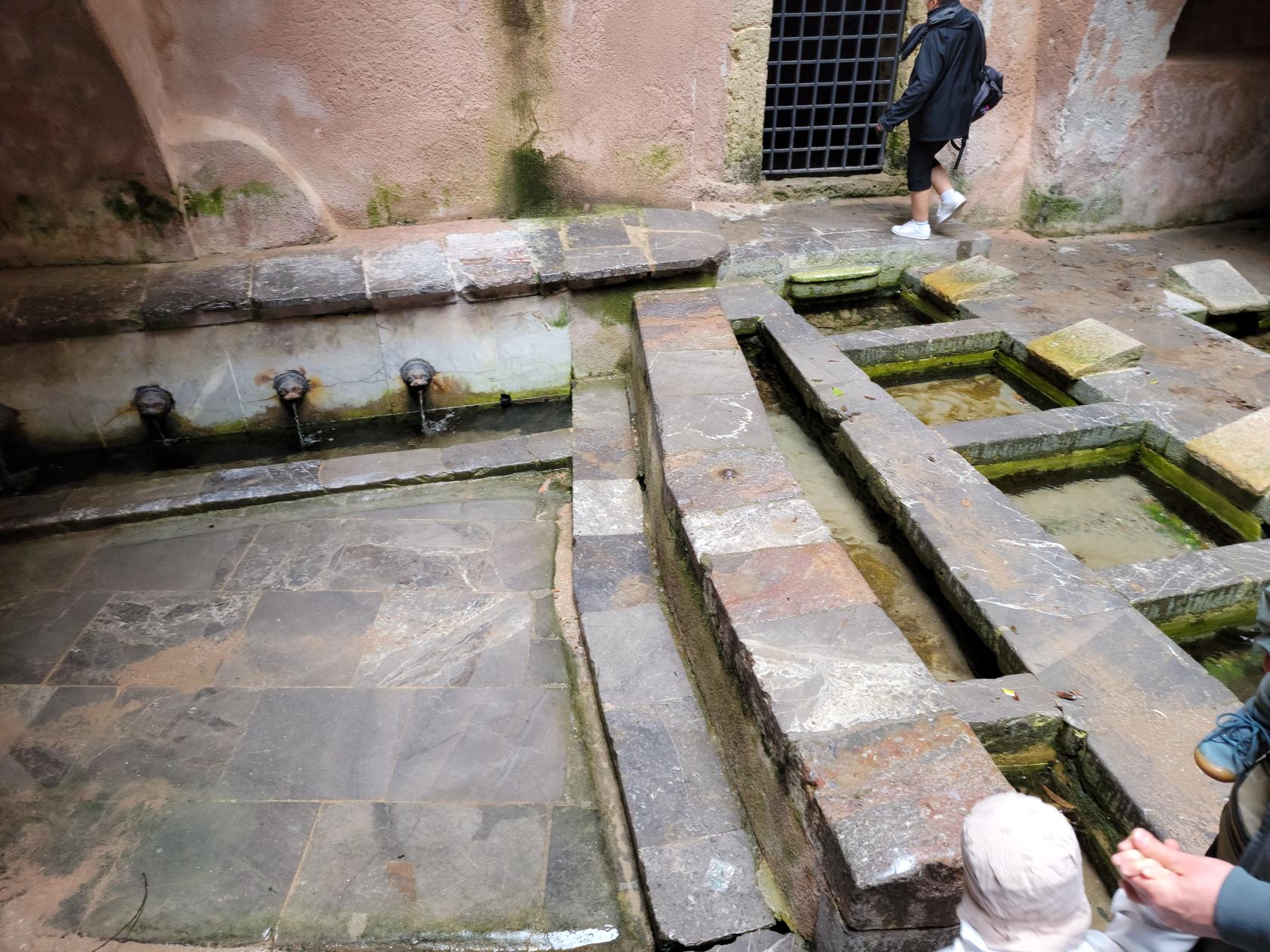
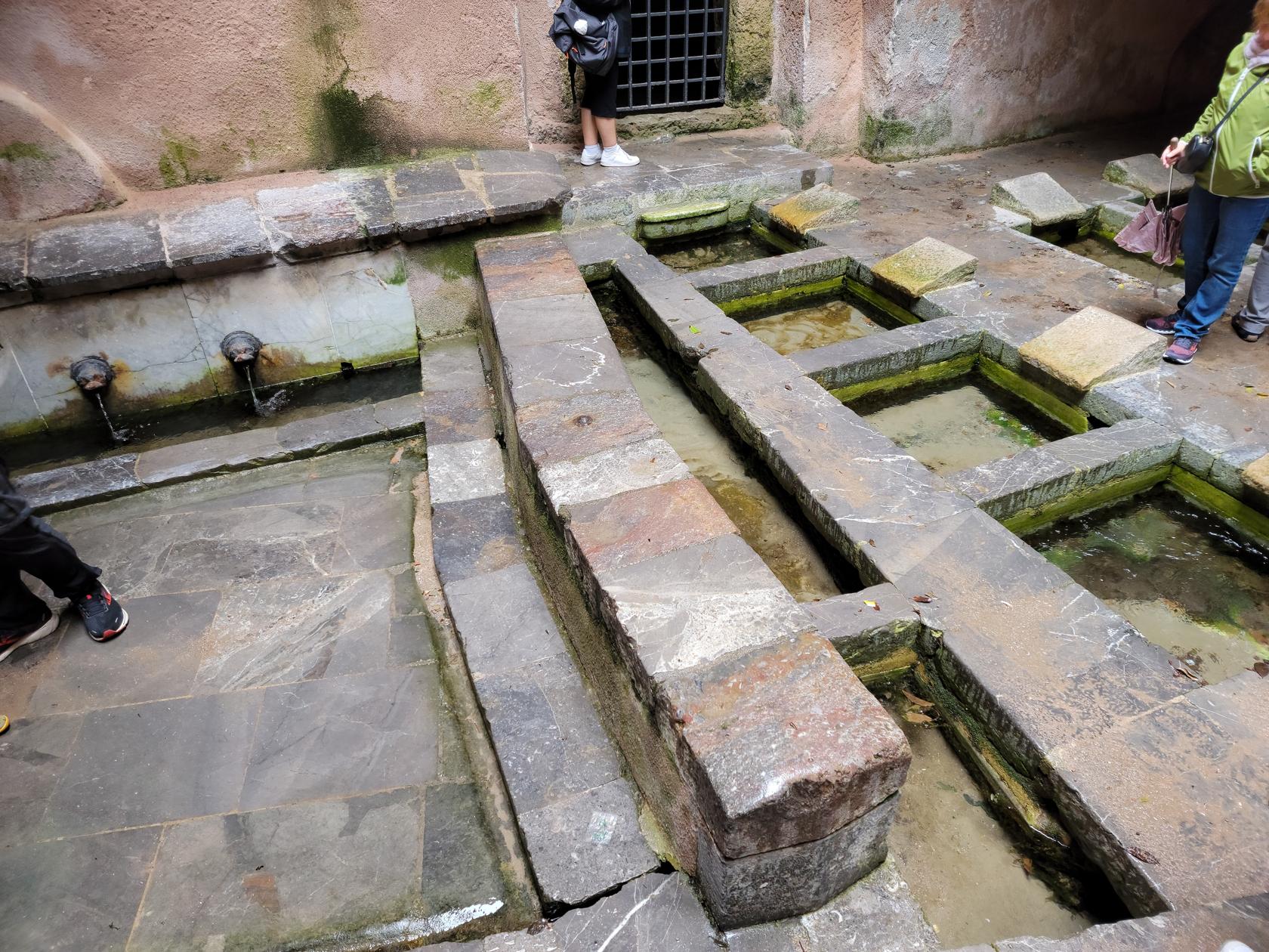
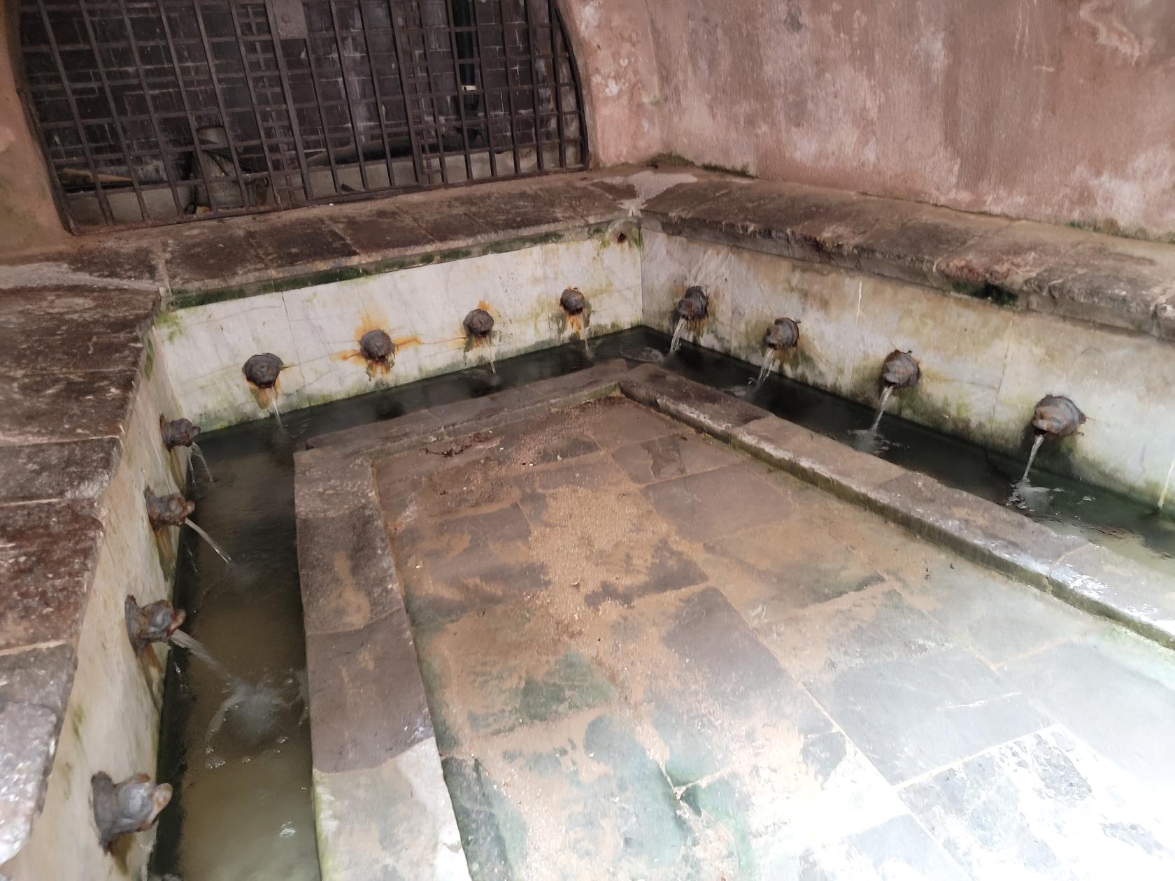
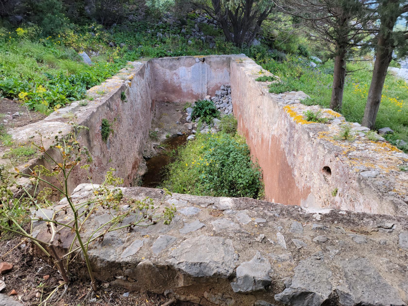
Lavatoio Medievale Fiume Cefalin
This little historic bit, easily missed by the unaware tourist ambling along the via Vittorio Emanuele, is an old laundry.
The Medieval Laundry – Lavatoio Medievale Fiume Cefalino – Cefalu, Sicily
The Medieval Laundry – Lavatoio Medievale Fiume Cefalino – Cefalu, Sicily
The Medieval Laundry – Lavatoio Medievale Fiume Cefalino – Cefalu, Sicily
The Medieval Laundry – Lavatoio Medievale Fiume Cefalino – Cefalu, Sicily
The Medieval Laundry – Lavatoio Medievale Fiume Cefalino – Cefalu, Sicily
Made out of stone and fountains, the town’s people in the old days used to come here to do their laundry. It is still in working order, though modern day appliances make its use today superfluous.
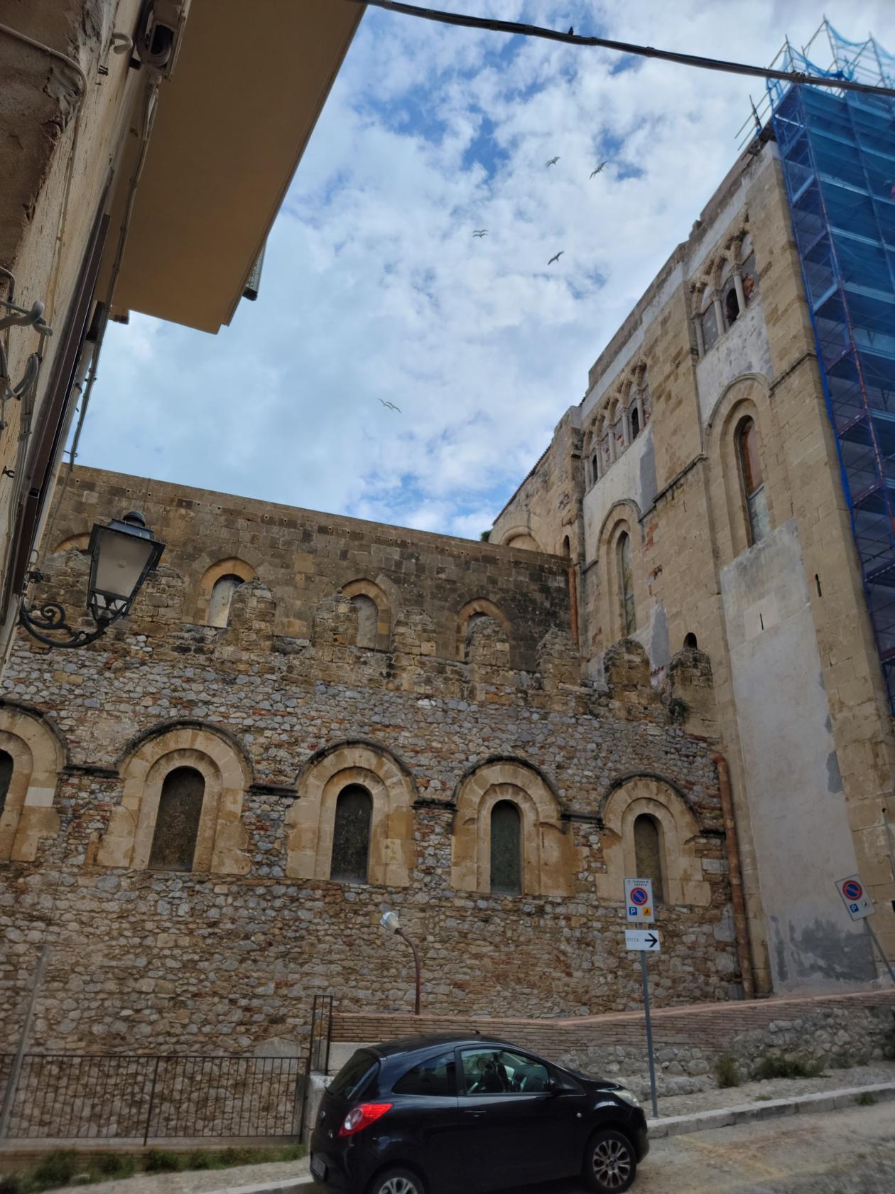
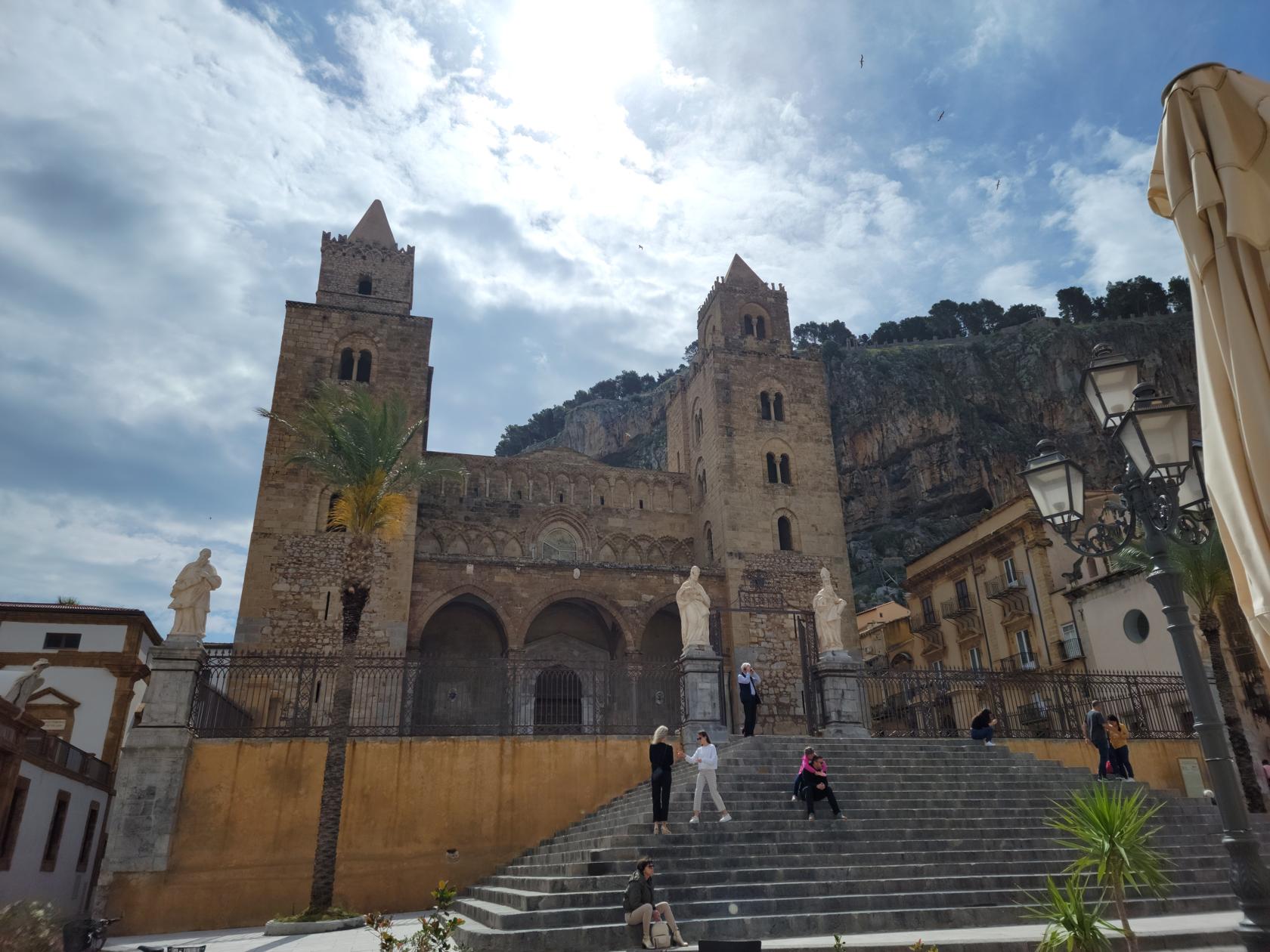
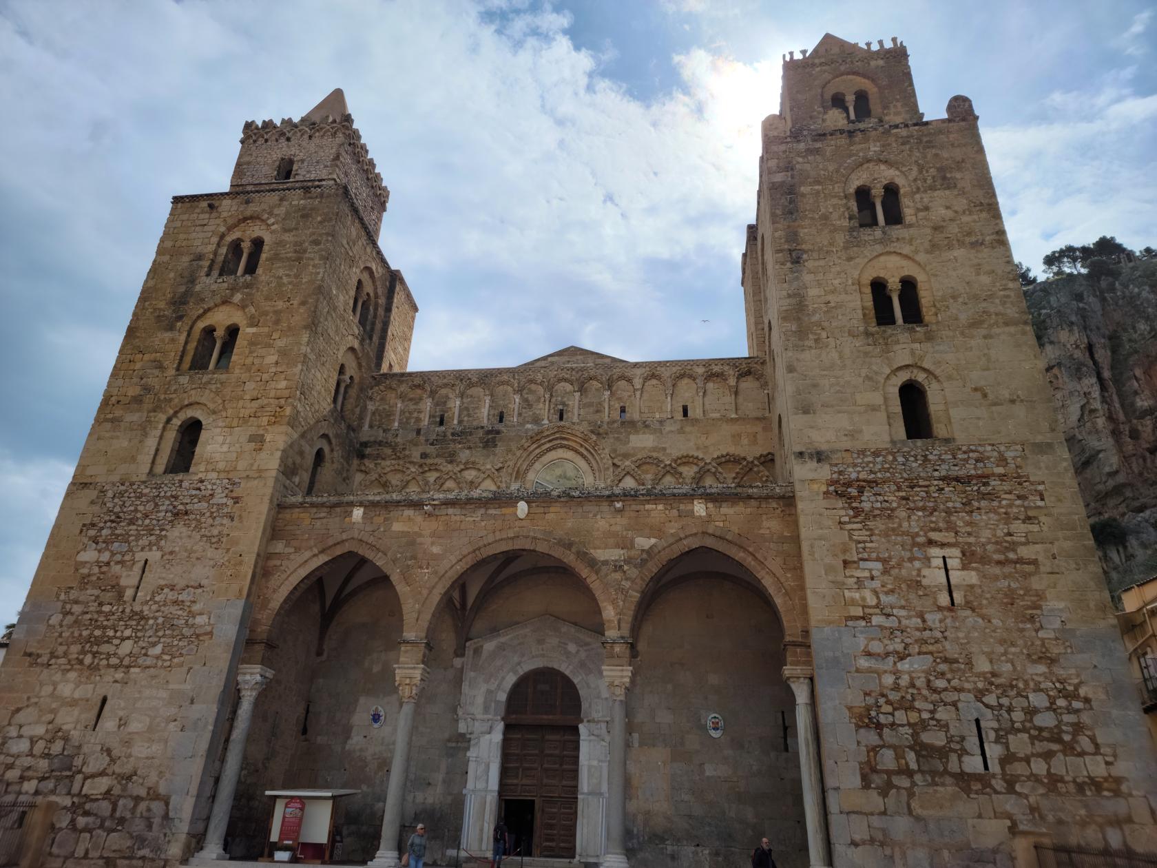
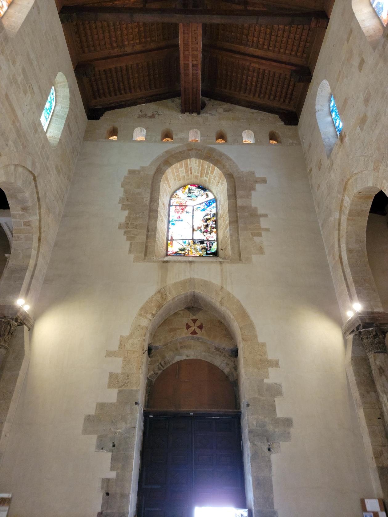
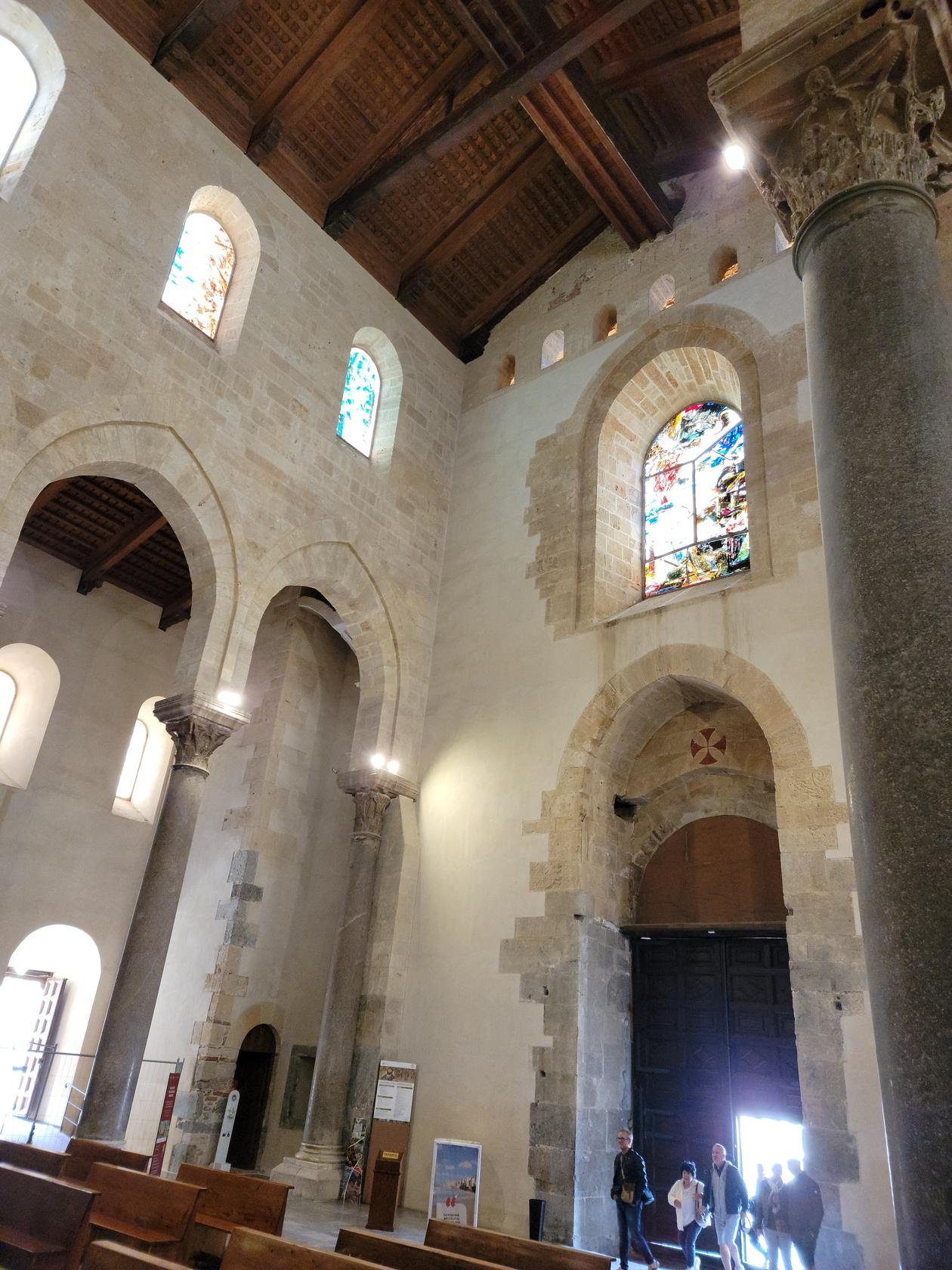
Il Duomo
The Cathedral of Syracuse sits on high ground directly under the La Rocca, or The Rock. It has a large piazza and spacious interior and can be seen from some distance. While we were here, it was under renovation inside, so we were unable to see it in all its glory.
The Towers and Facade from a distance – Il Duomo – Cefalu, Sicily
The Courtyard – Il Duomo – Cefalu, Sicily
The Piazza Il Duomo – Il Duomo – Cefalu, Sicily
Main Entrance – Il Duomo – Cefalu, Sicily
Main Entrance Stained Glass – Il Duomo – Cefalu, Sicily
Main Entrance Stained Glass – Il Duomo – Cefalu, Sicily
A Chapel – Il Duomo – Cefalu, Sicily
The Cathedral Inside – Il Duomo – Cefalu, Sicily
The Old Wooden Roof – Il Duomo – Cefalu, Sicily
The Crypt Entrance – Il Duomo – Cefalu, Sicily
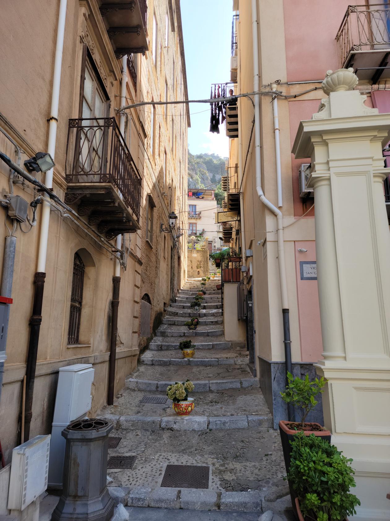
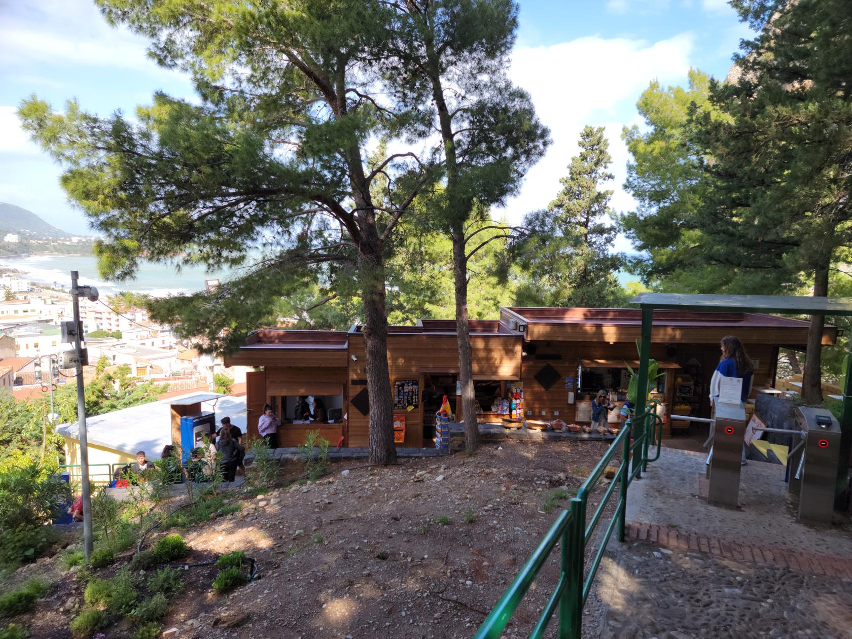
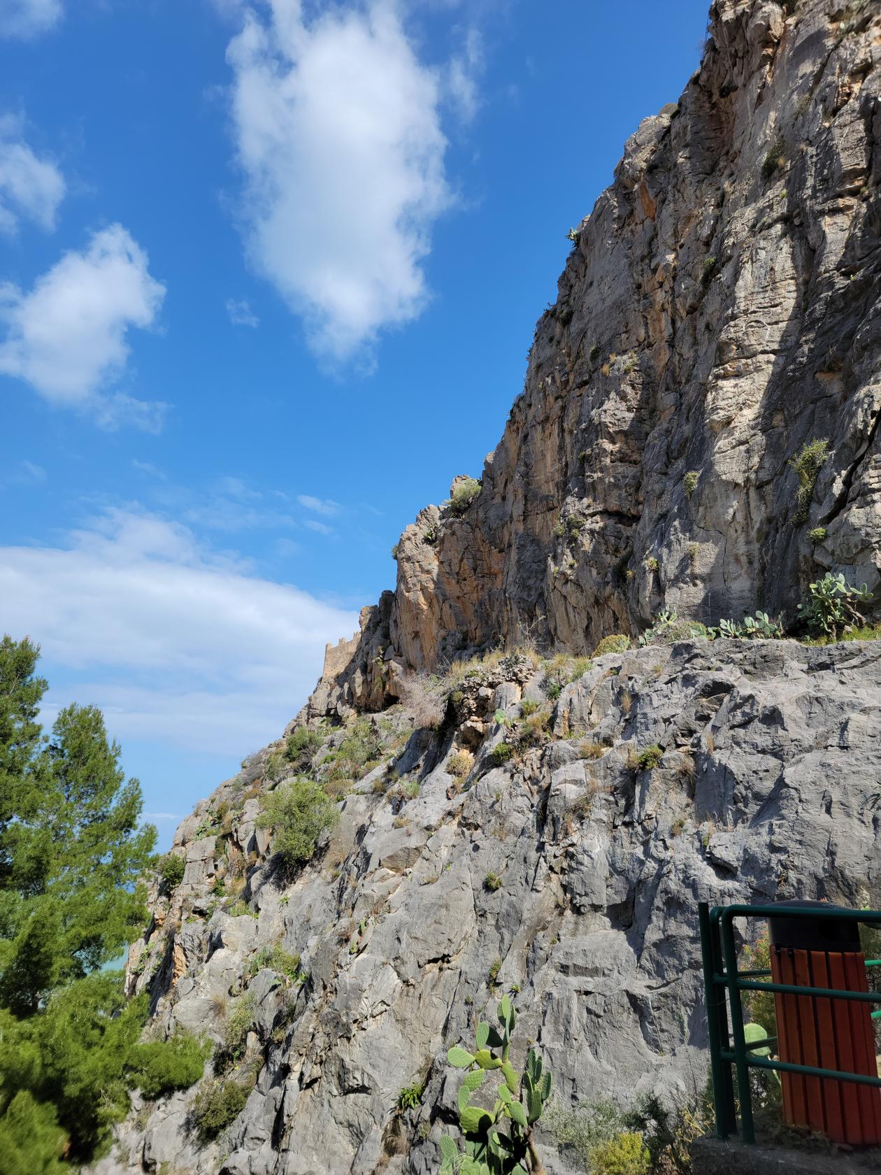
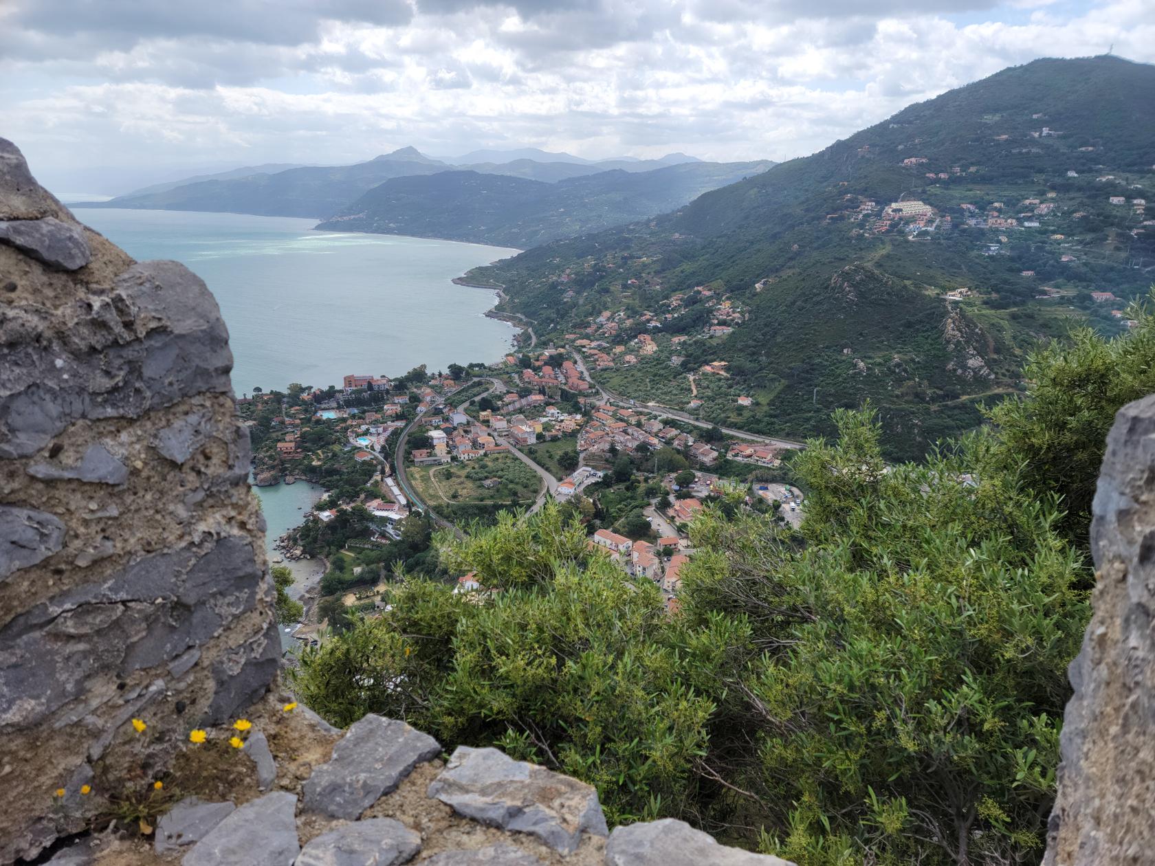
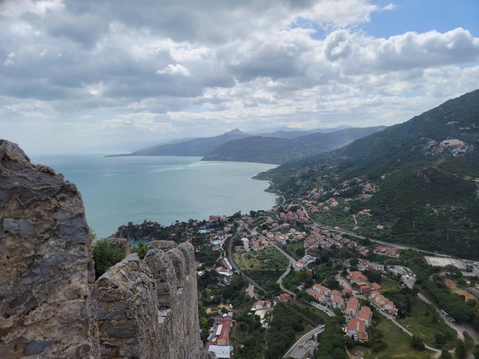
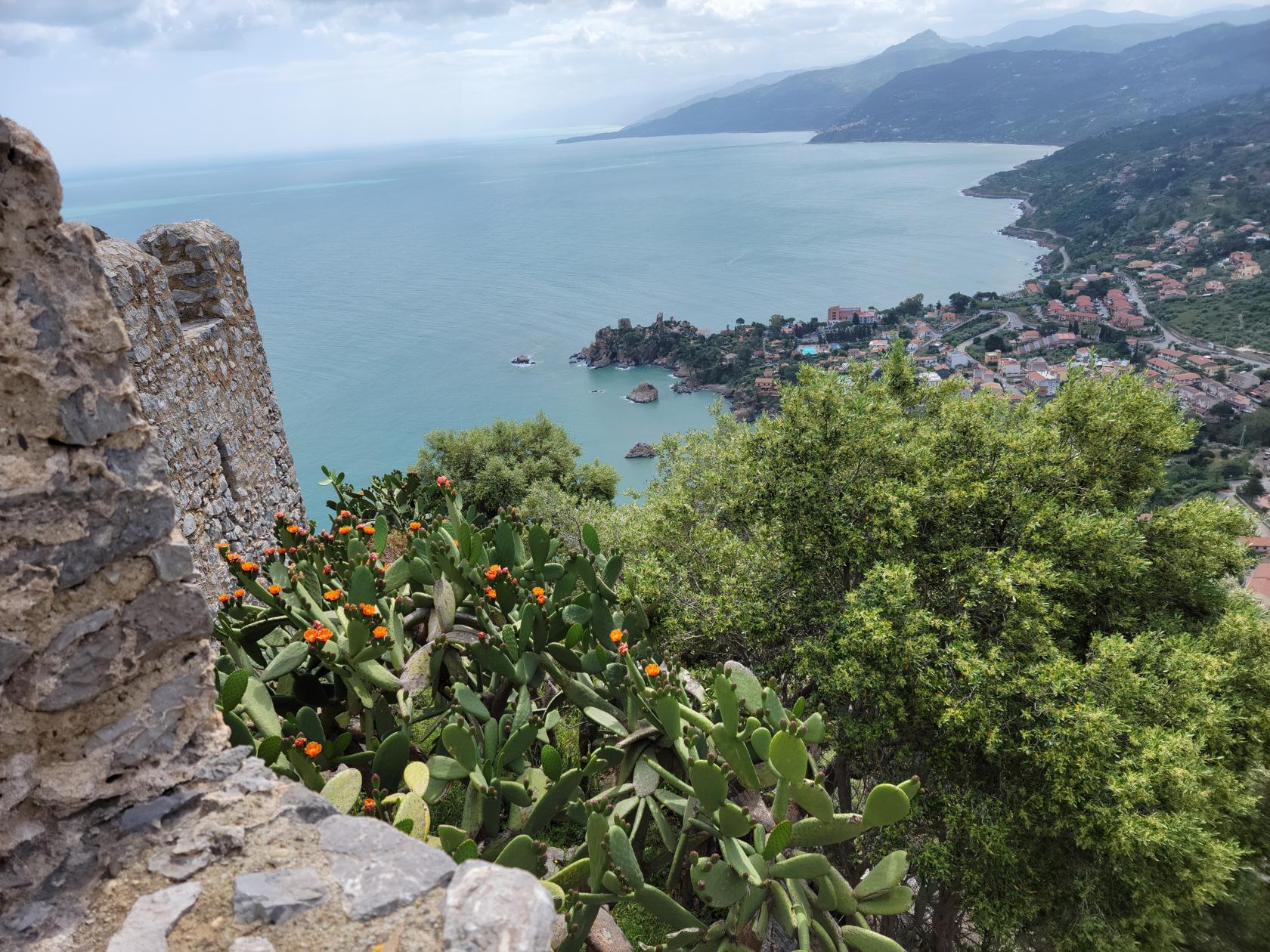
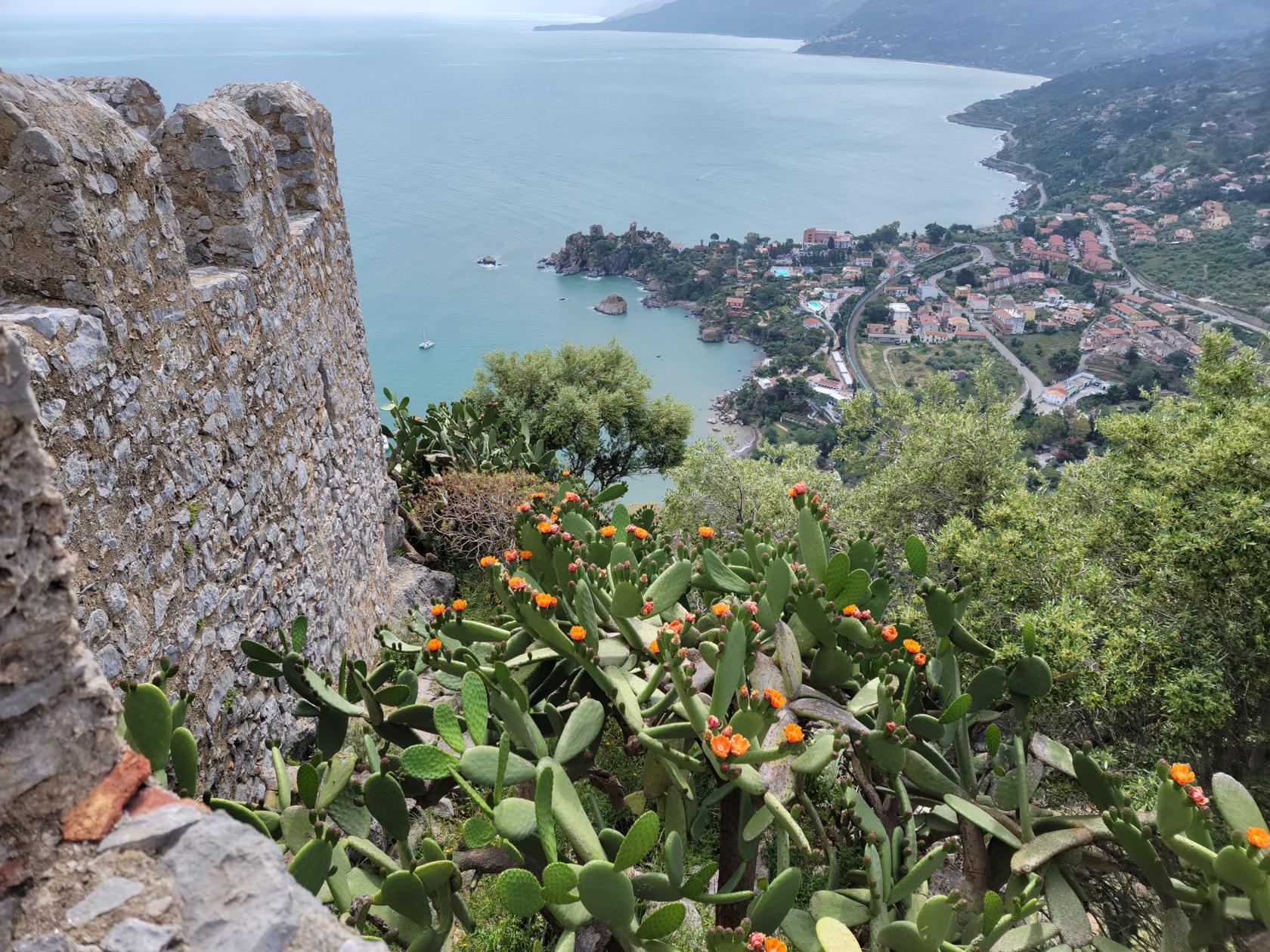
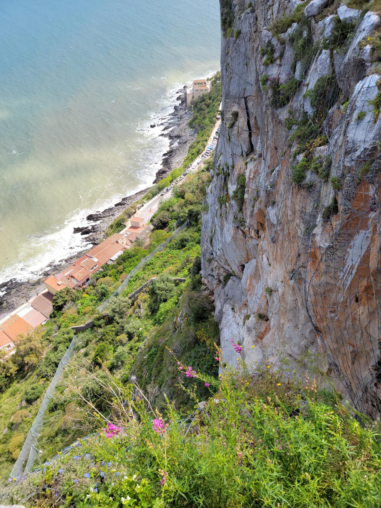
Castello di Cefalu
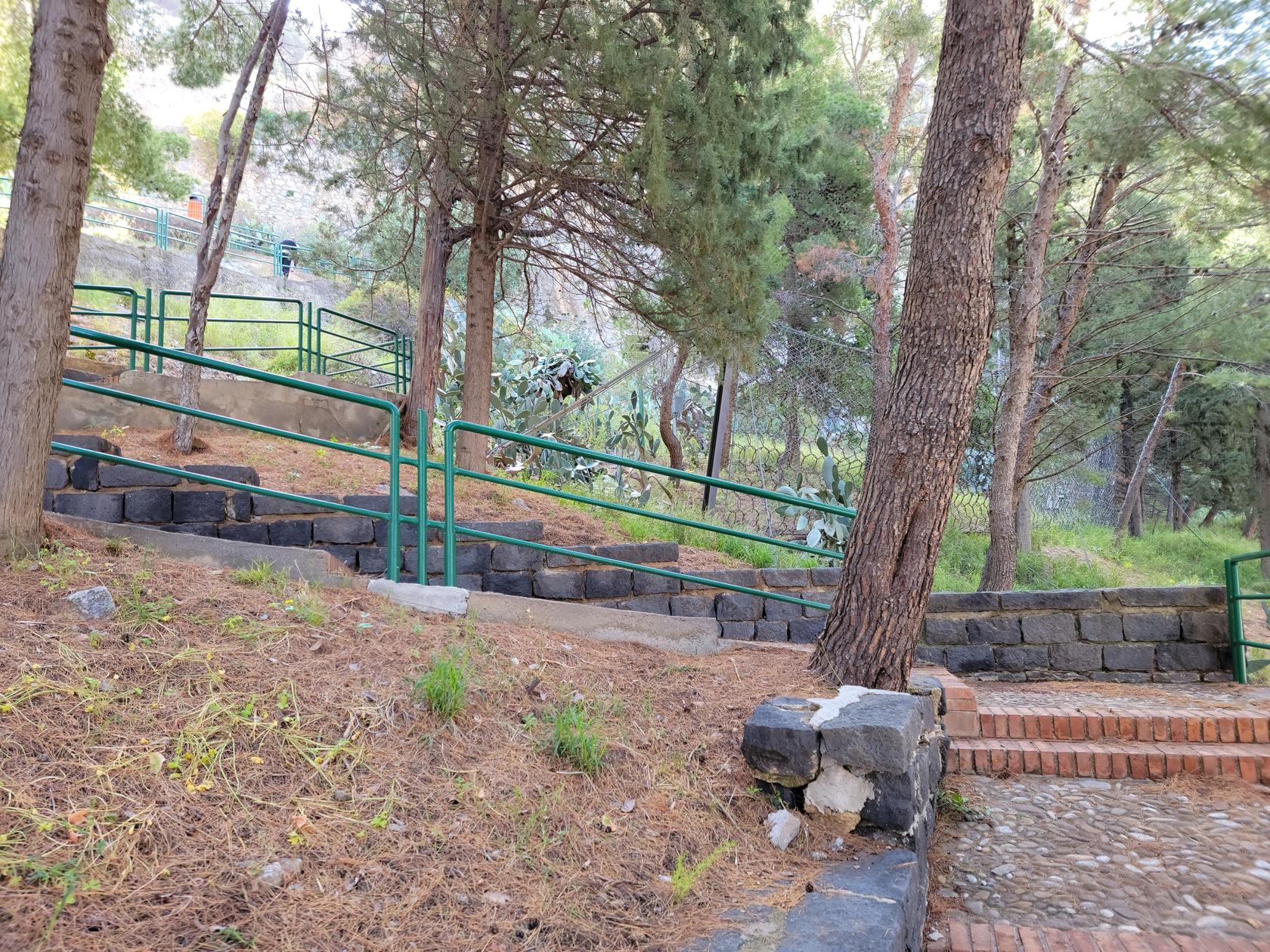
You enter the hike to the caste via the Rocca di Cefalu. It starts out with finely paved stairs and steps, that one would typically find in any Italian town with hills in it.
The Ticket booth and entrance – Hiking la Rocca – Cefalu, Sicily
Ascending – Hiking la Rocca – Cefalu, Sicily
The initial path – Hiking la Rocca – Cefalu, Sicily
The first cliff ledge – Hiking la Rocca – Cefalu, Sicily
More cliffs – Hiking la Rocca – Cefalu, Sicily
The steep cliff and cacti – Hiking la Rocca – Cefalu, Sicily
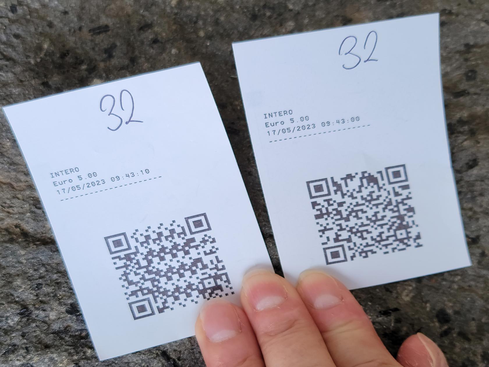
The entrance fee is 5€/person and the experience will definitely introduce one to the true meaning of Italian bureaucracy. Not only is there a self-service machine, but someone there that actually asks you what you want, takes your money, purchases the ticket for you, then hands it to someone else in the kiosk who is there to tabulate the number in a book. This number is again used when you leave, so do not throw your ticket out. Once your ticket is returned, another person is waiting to take it from you and helps you scan it in the automated turnstile. All in today’s times totally unnecessary. There is obviously either some abstruse Italian or municipal law that probably requires them to do so.
The steps through the second entrance – Hiking la Rocca – Cefalu, Sicily
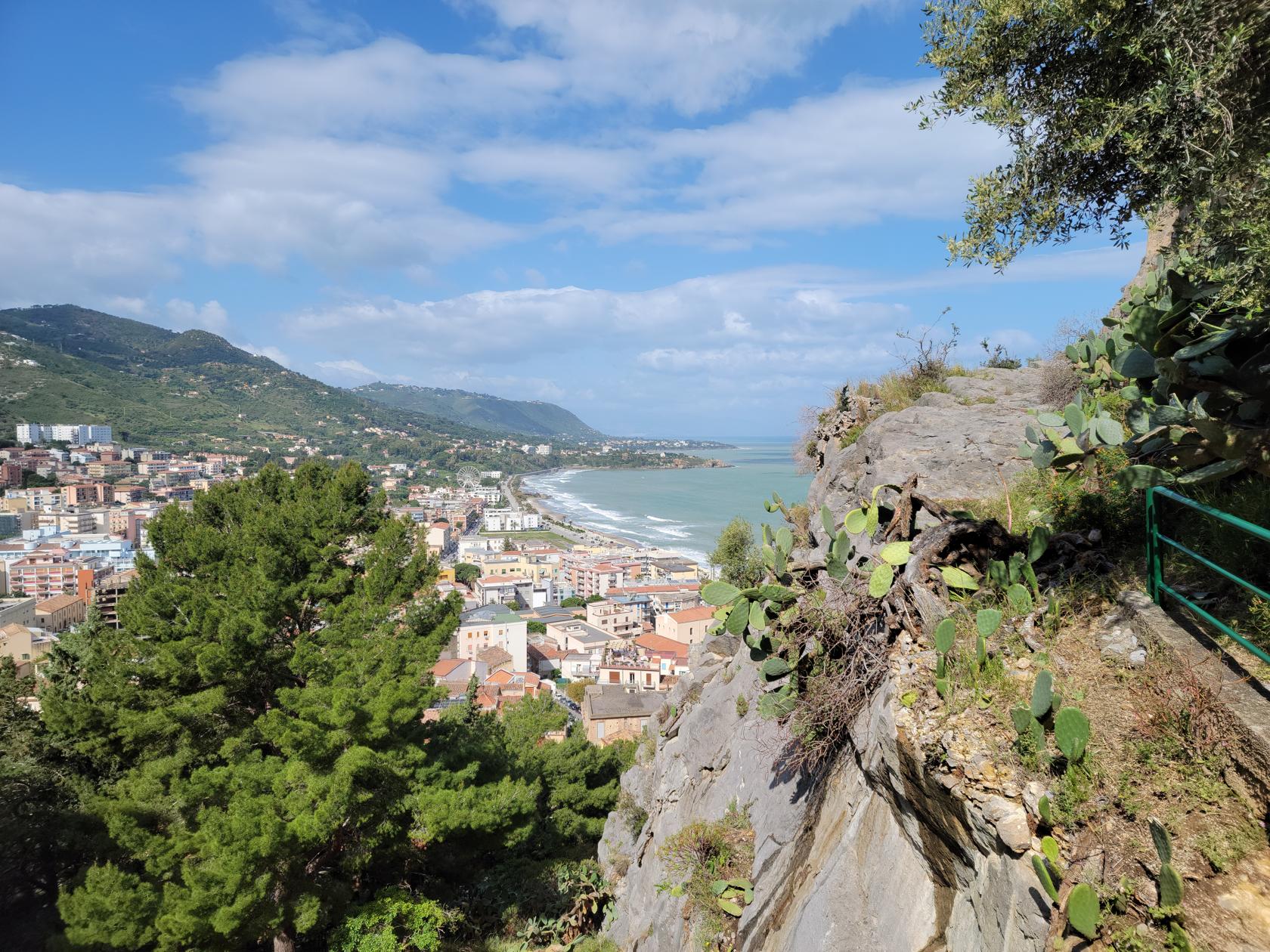
Over the main cliff face – Hiking la Rocca – Cefalu, Sicily
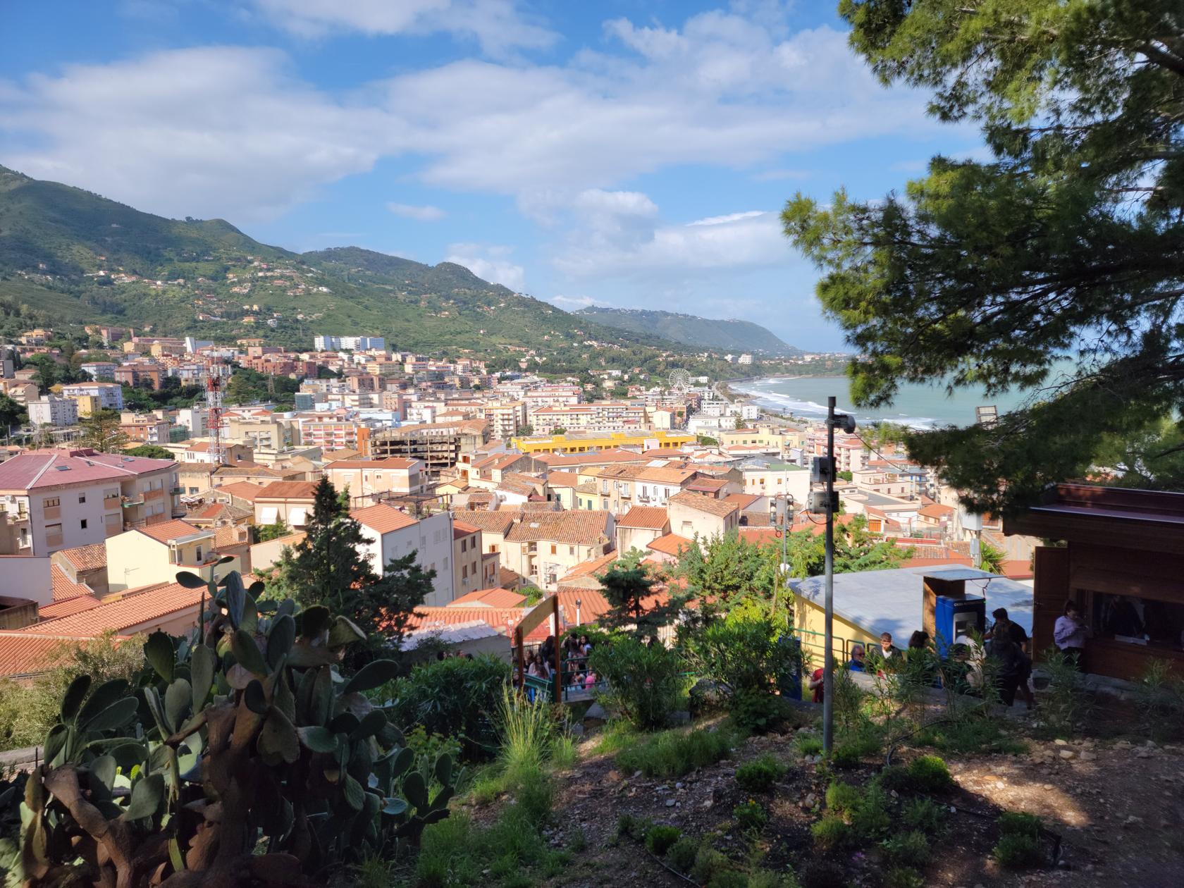
The town below – Hiking la Rocca – Cefalu, Sicily
Storm damage and mud mixed up by the waves – Hiking la Rocca – Cefalu, Sicily
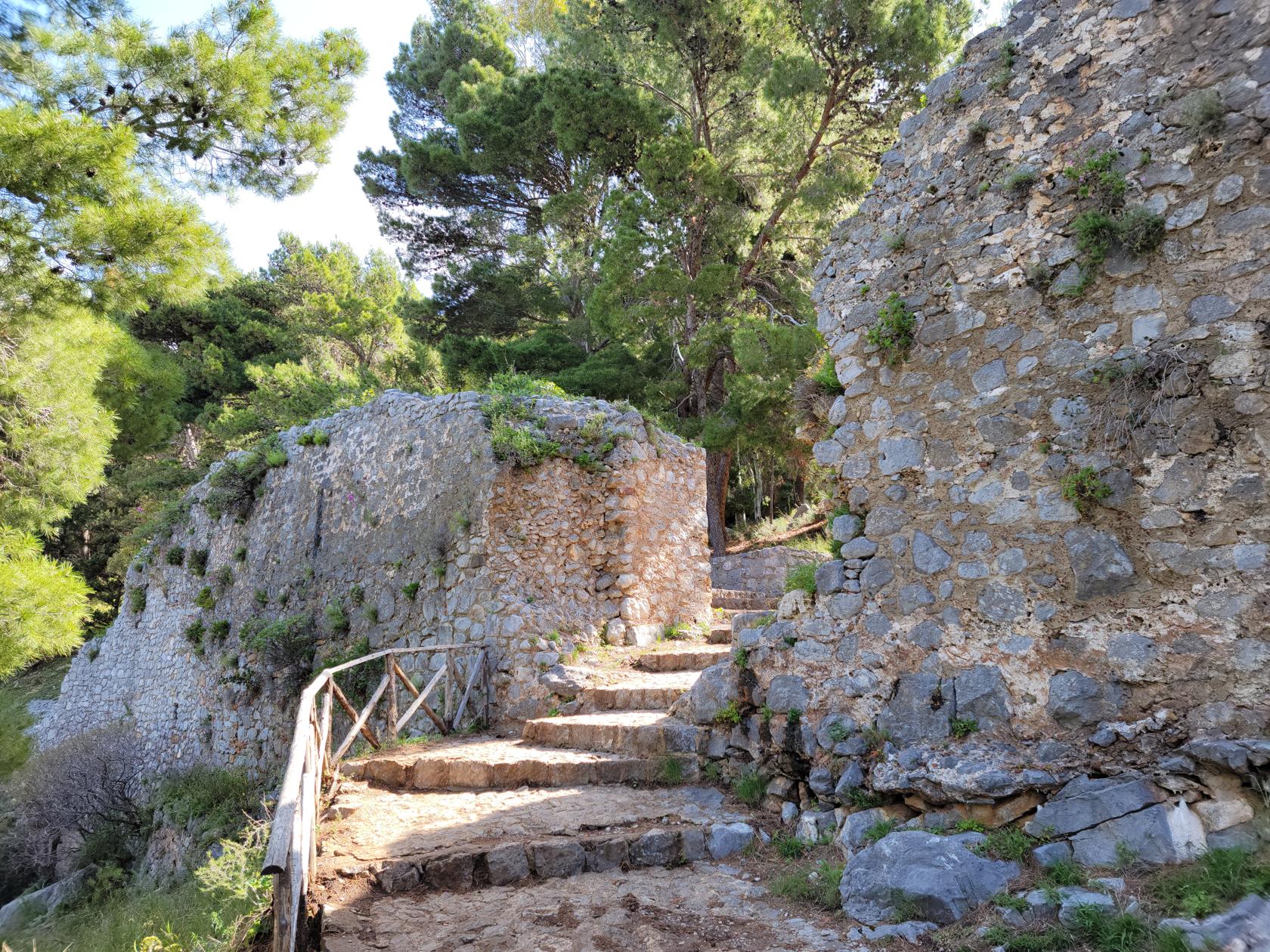
After the turnstile, the hike starts immediately to climb. There are hairpins all along the way up until you enter the first set of walls and gates, which were the first line of defense. This was a perfect point in which to take a few photographs and enjoy the view of Cefalu from above.
Tickets For Two – Hiking la Rocca – Cefalu, Sicily
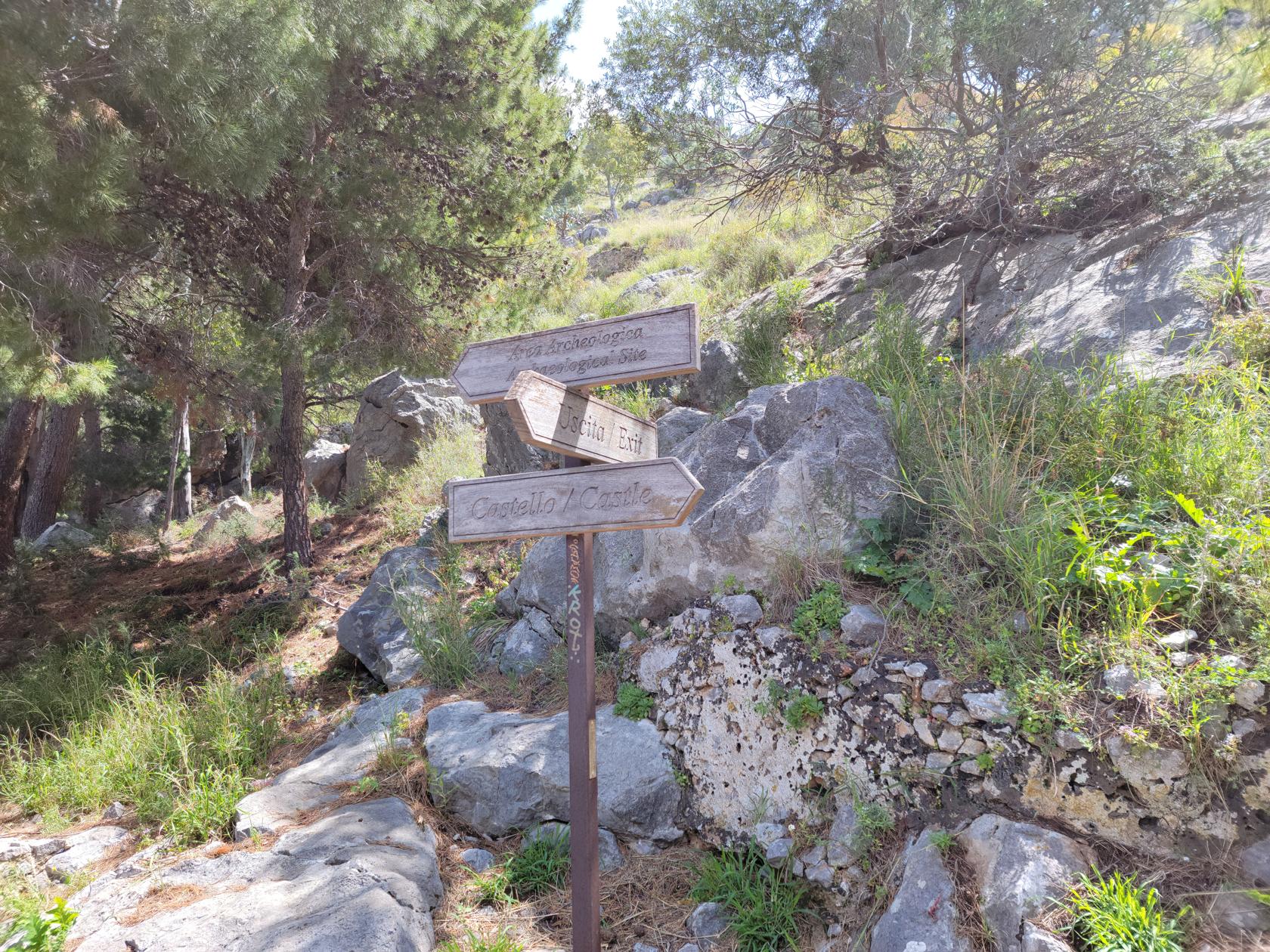
The trail signs – Hiking la Rocca – Cefalu, Sicily
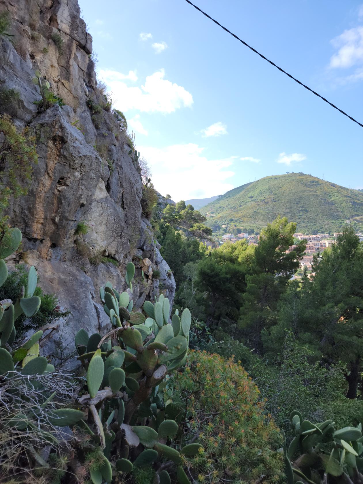
The hike then brings you to a fork in the road with a sign, archeological ruins left, castle right, we chose the right route, figuring we wanted to see it first. It then continues and enters a steep area of tree and grass along sheer walls of stone, home to a large number of goats. If you pay attention, you can hear their calls and see them climbing the stone walls as if to mock you.
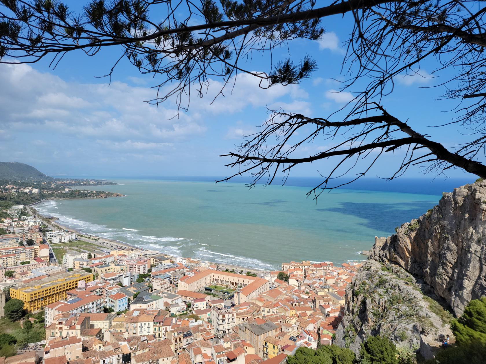
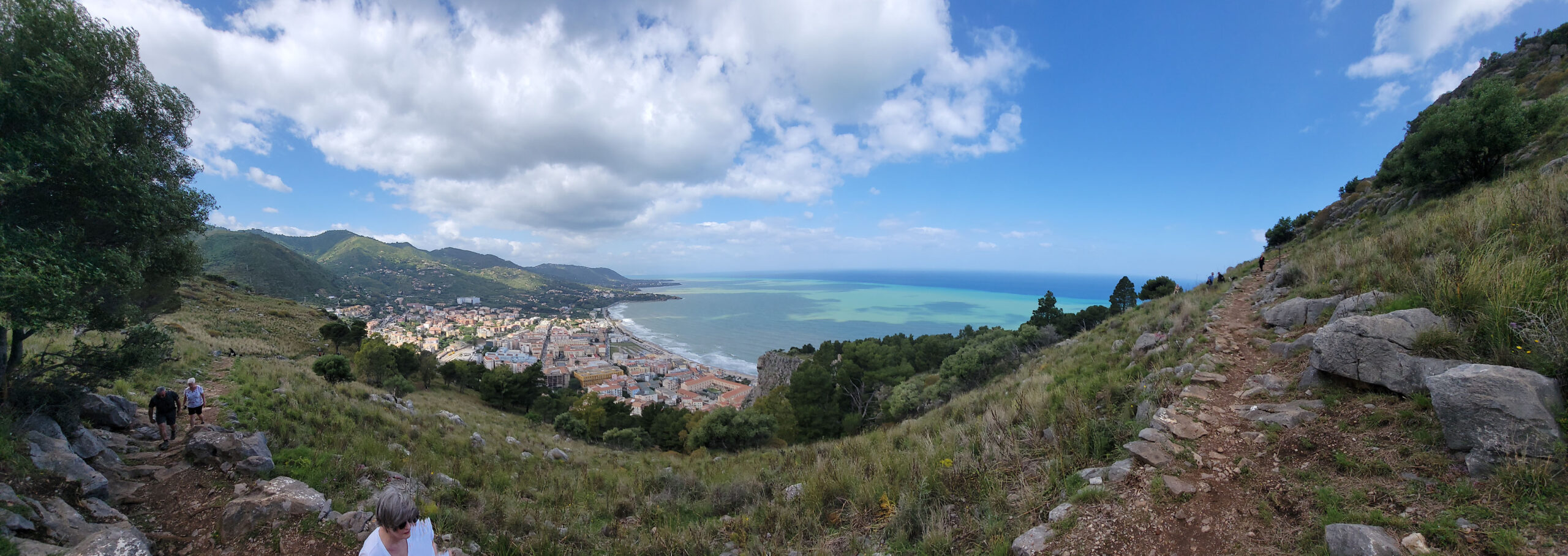
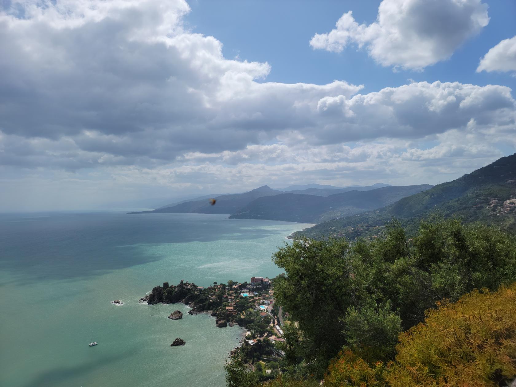
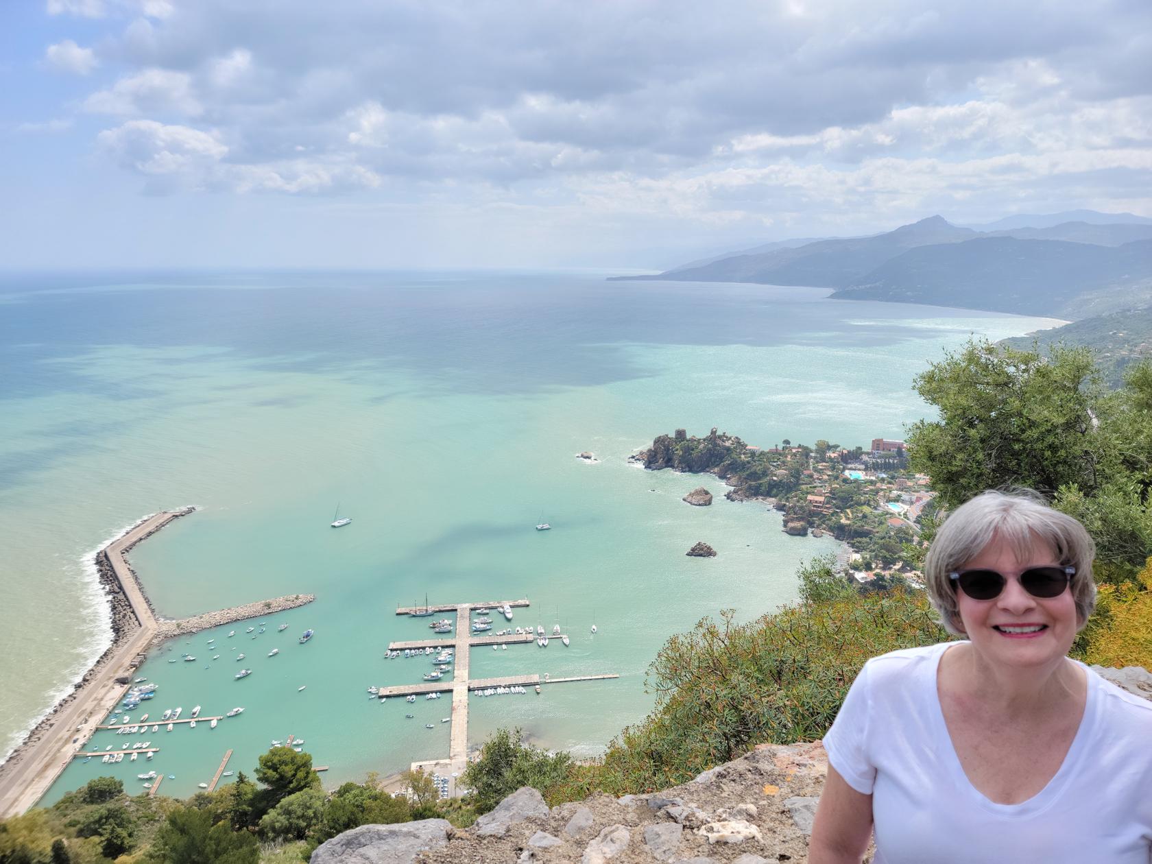
A panorama of the town and trail – Hiking la Rocca – Cefalu, Sicily
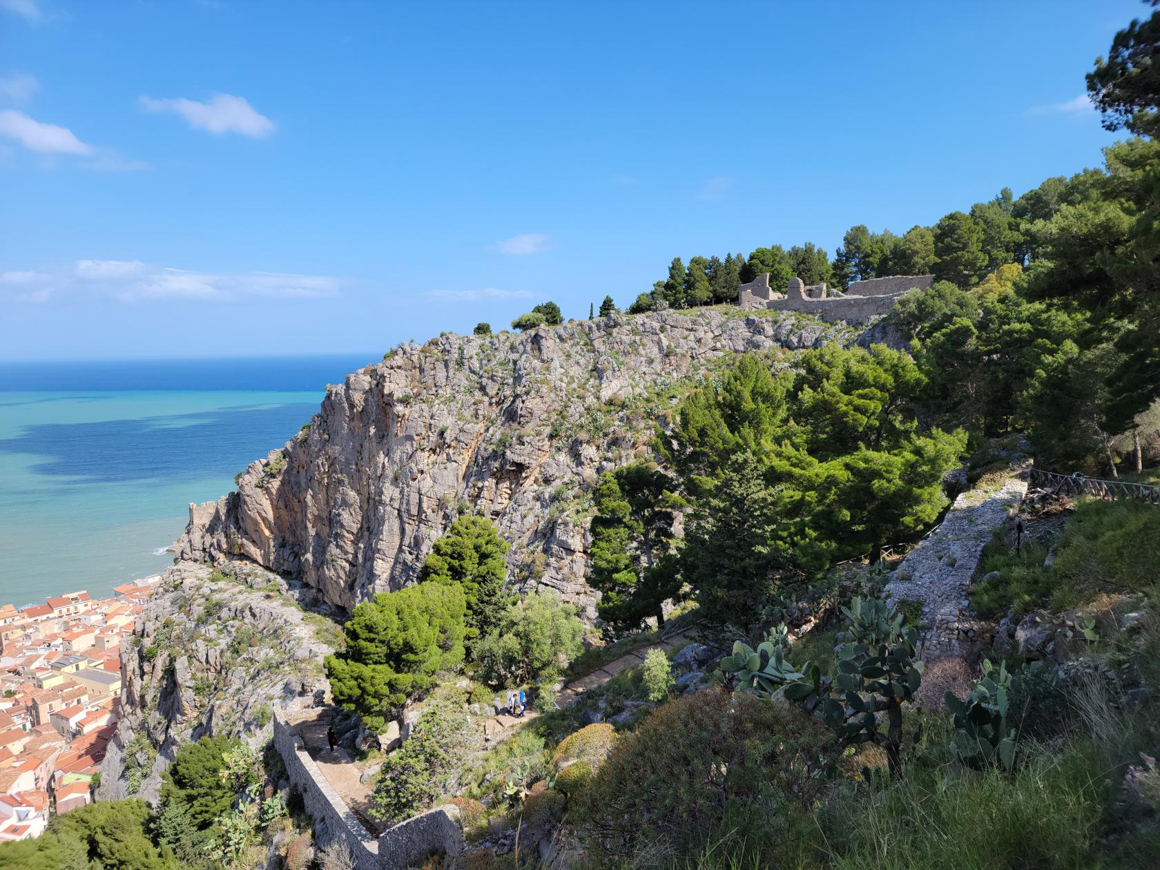
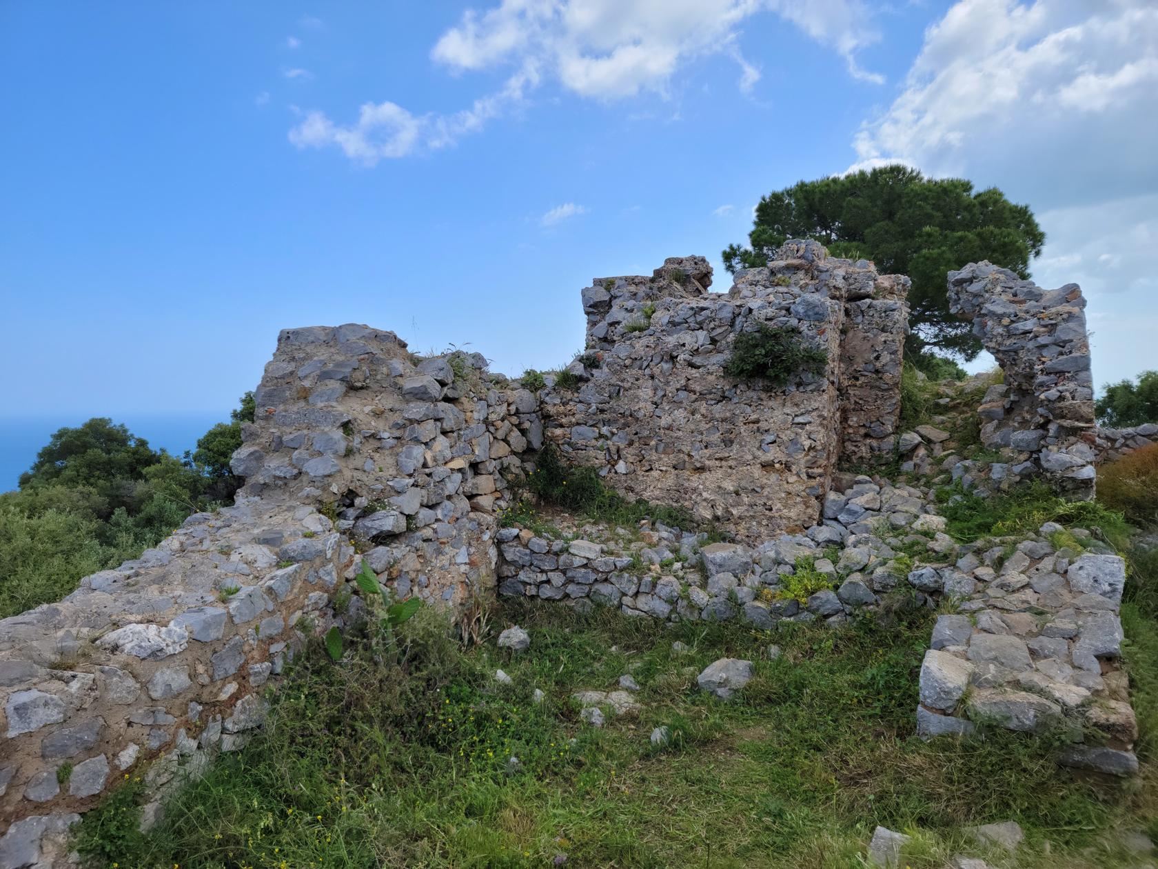
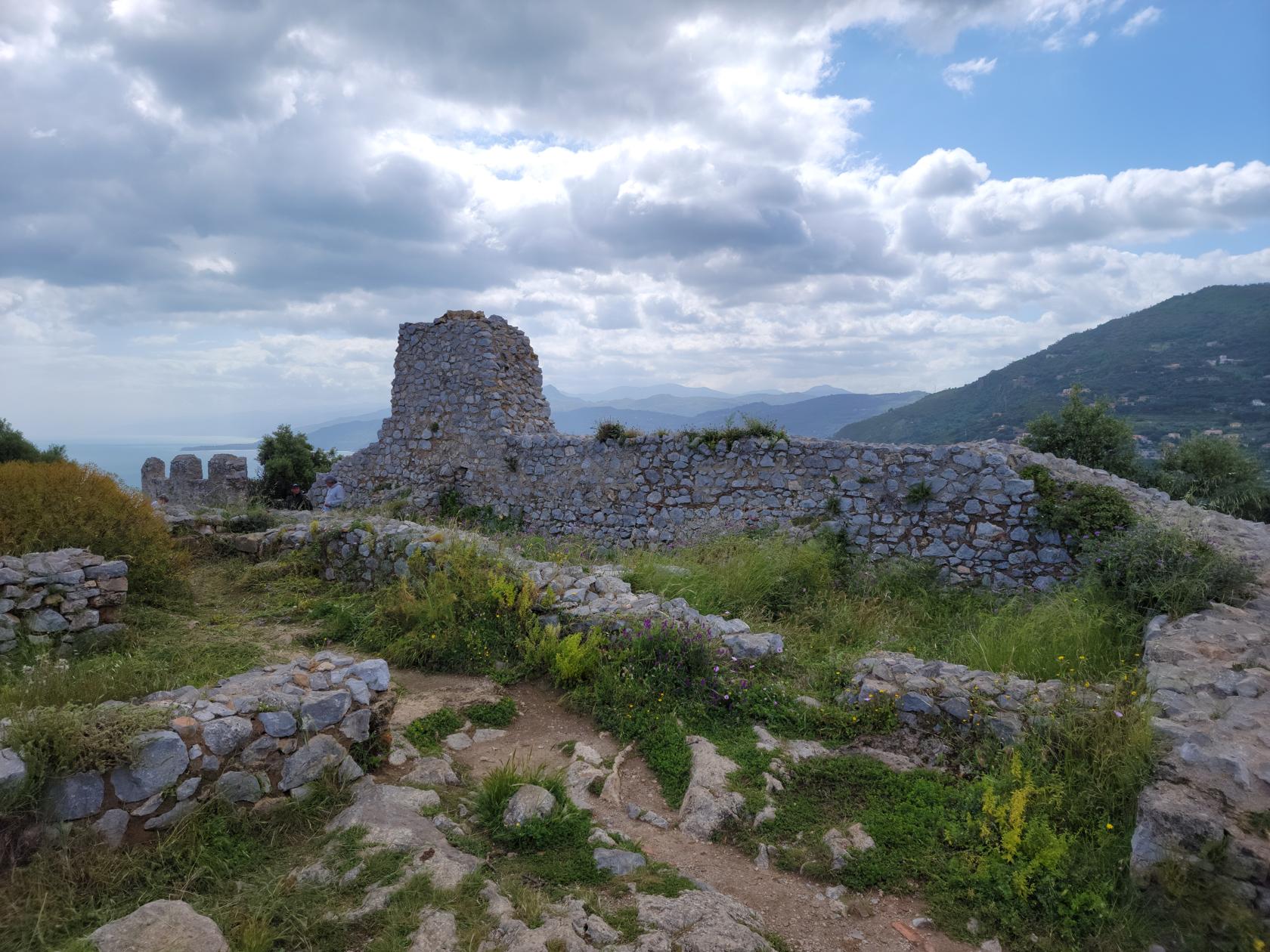
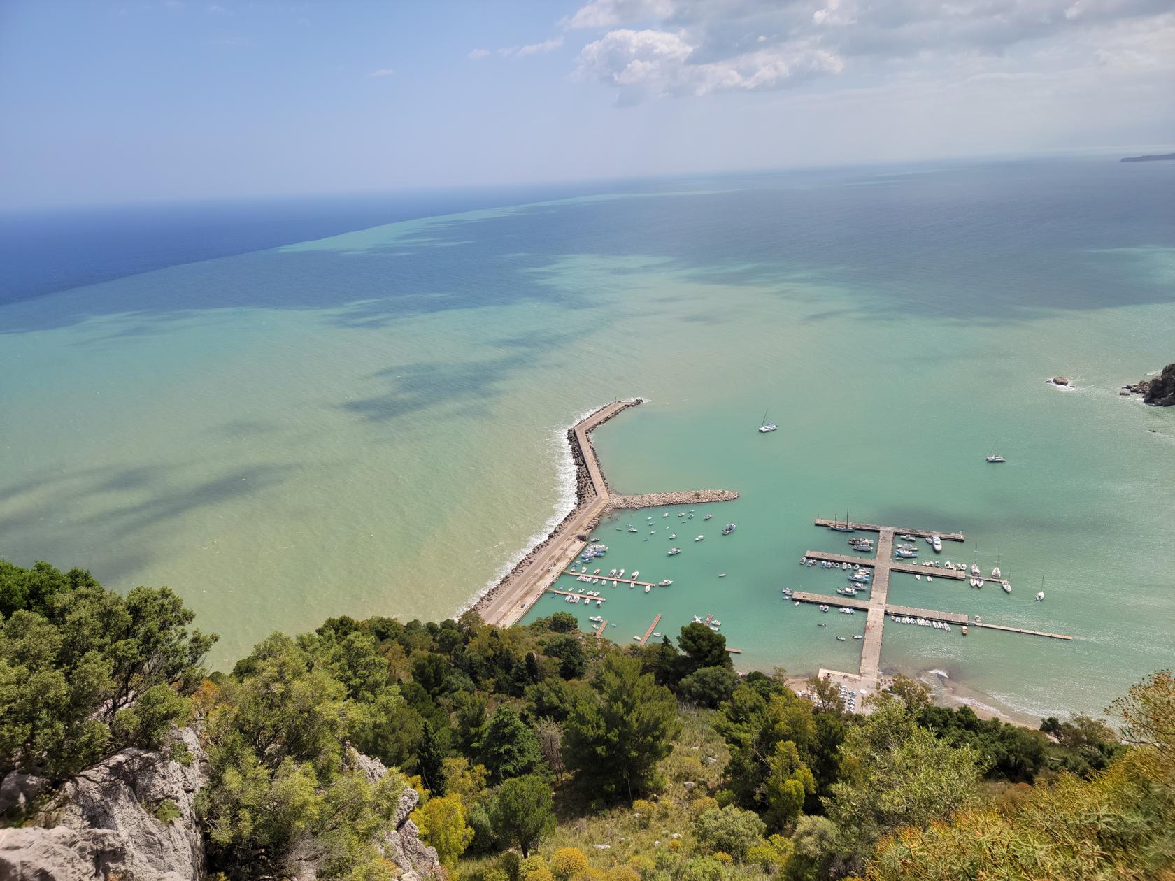
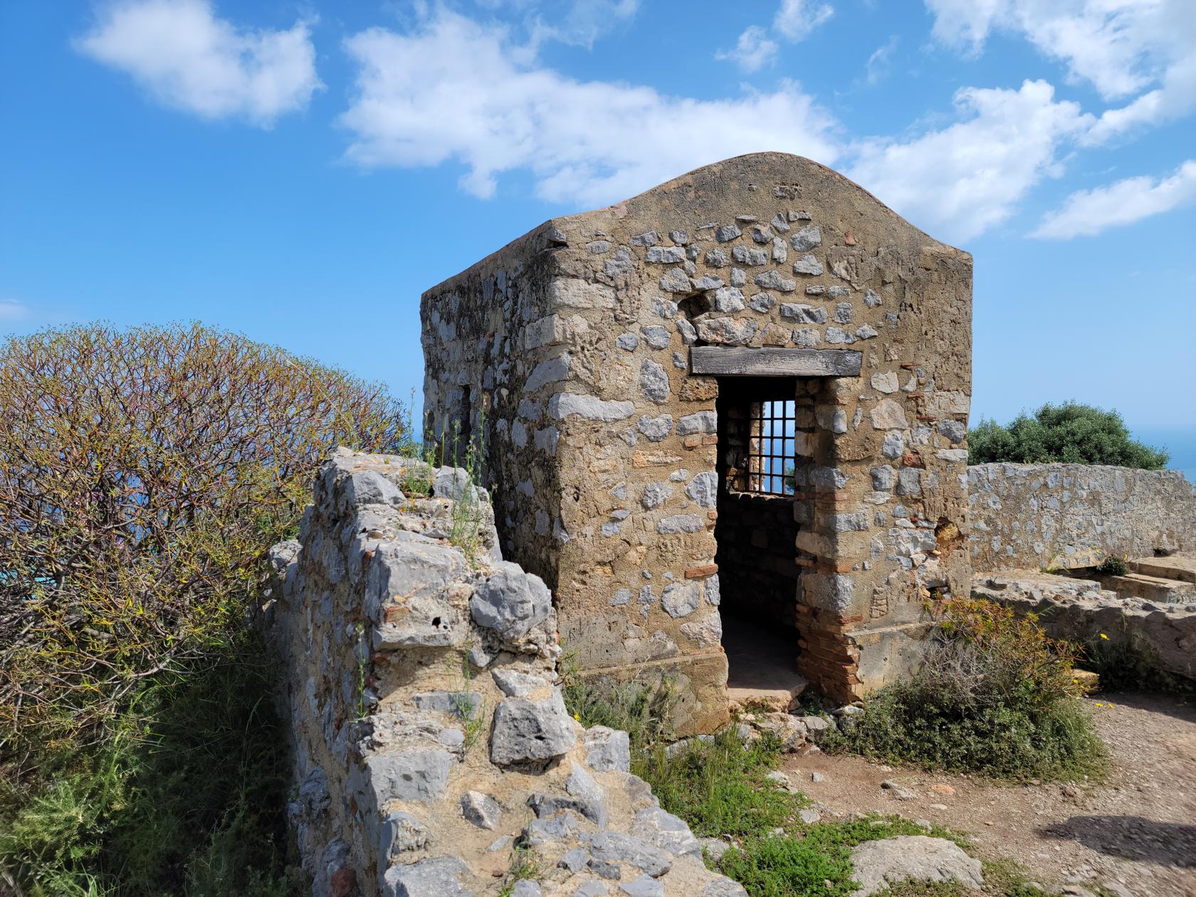
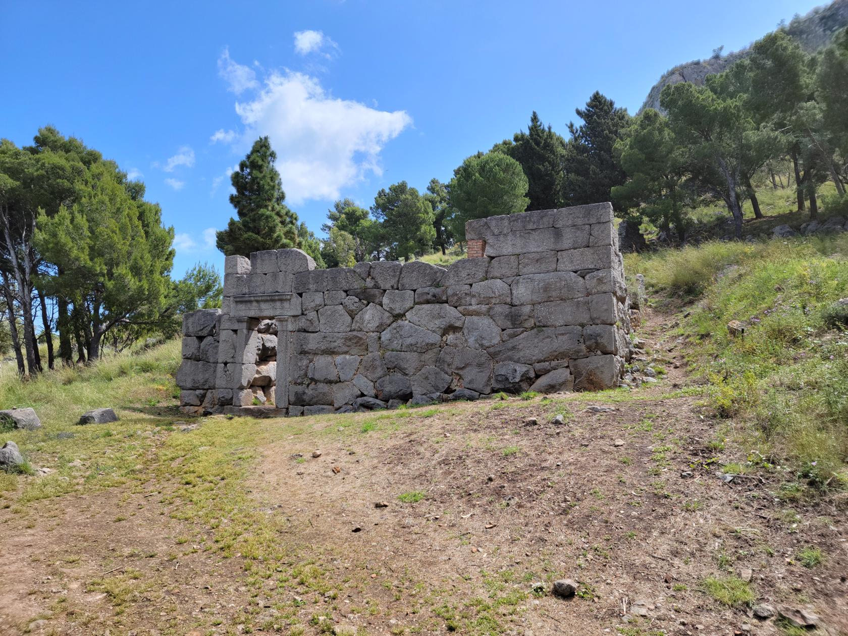
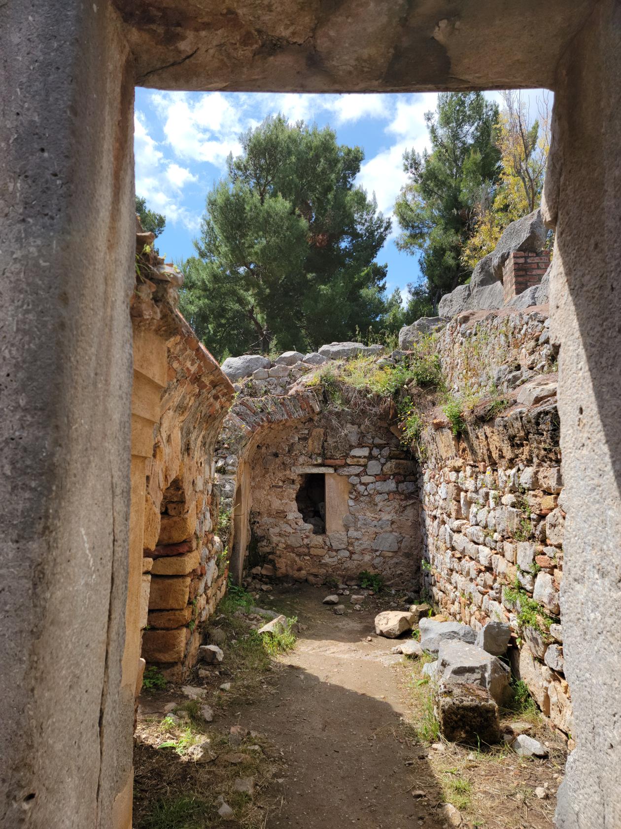
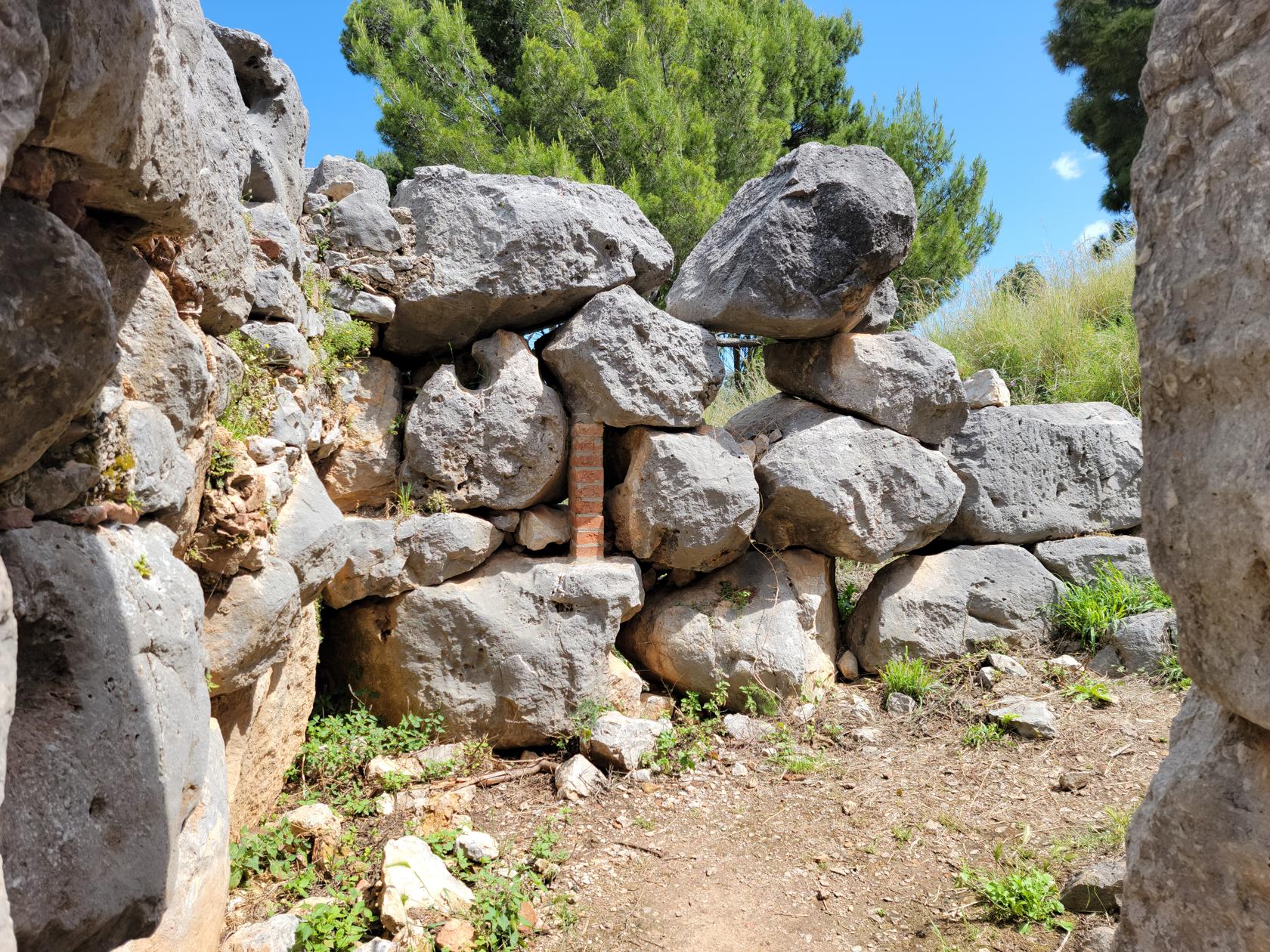
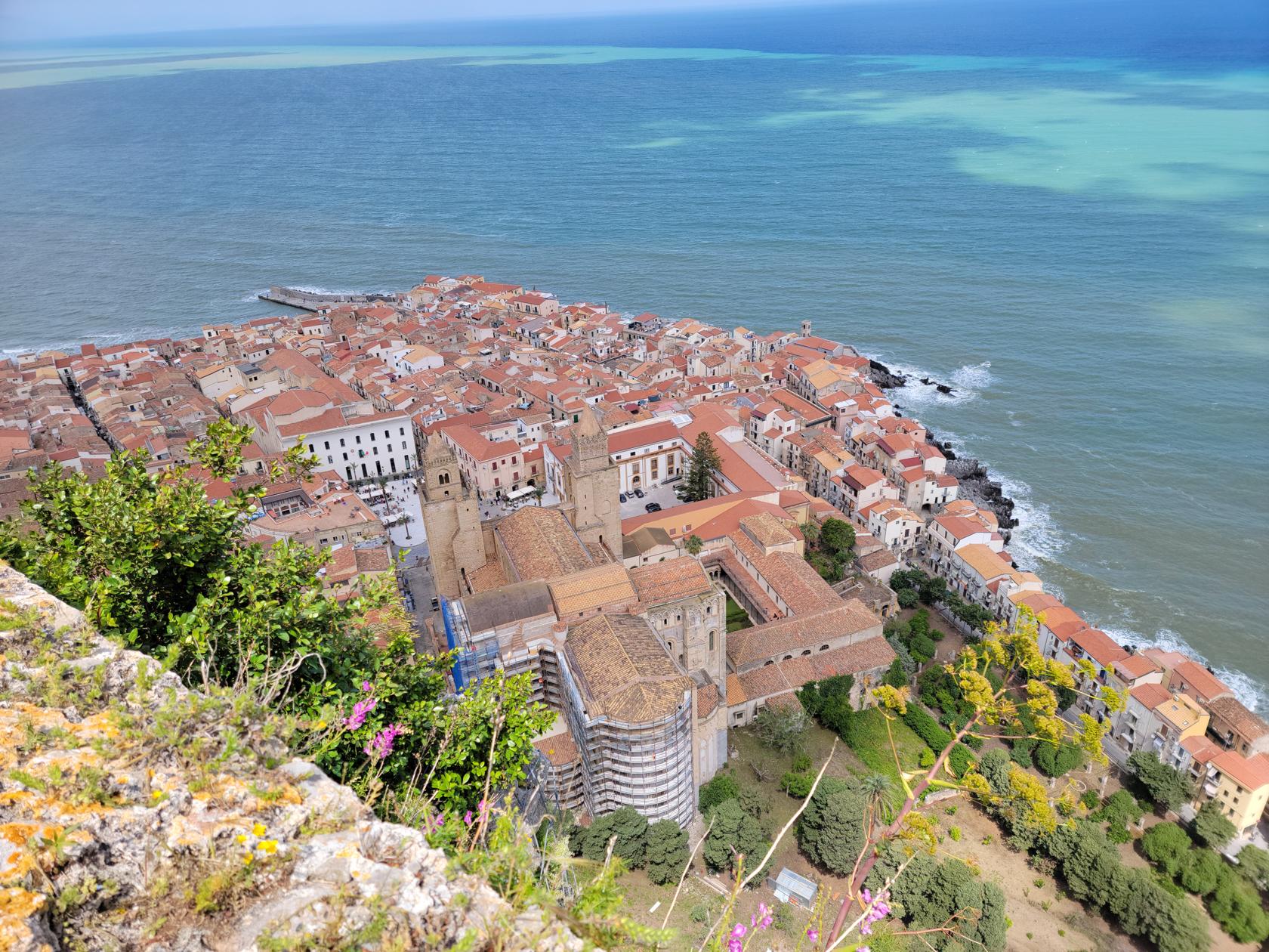
After what seems like another half an hour of switching back and forth along the trail you enter the area of the castle. Here are the remnants of the once grand Cefalu Castle, Perched high above the town, it had a commanding view of the countryside and in its time, must have been unassailable. From here one can take amazing photographs of the town below, the sea and the beautiful countryside below.
An old cistern – Hiking la Rocca – Cefalu, Sicily
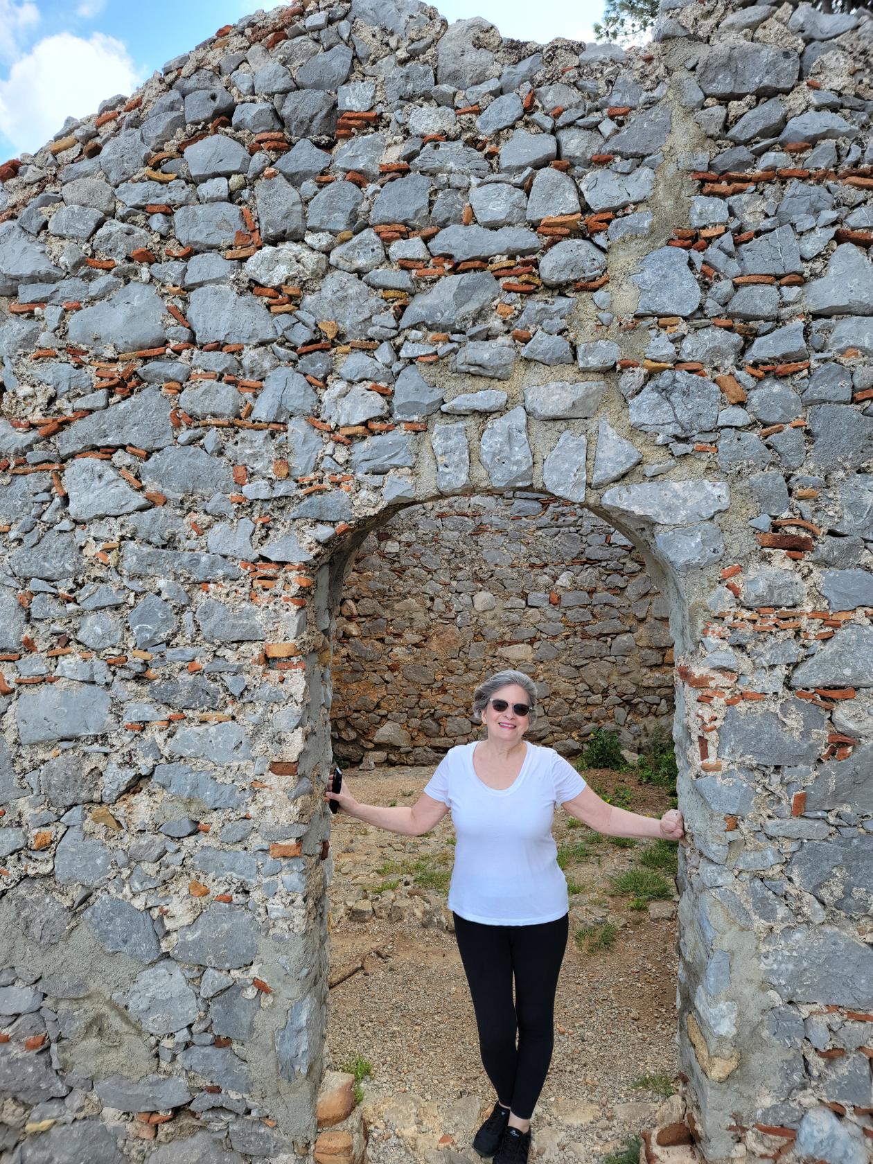
Old guard post buildings – Hiking la Rocca – Cefalu, Sicily
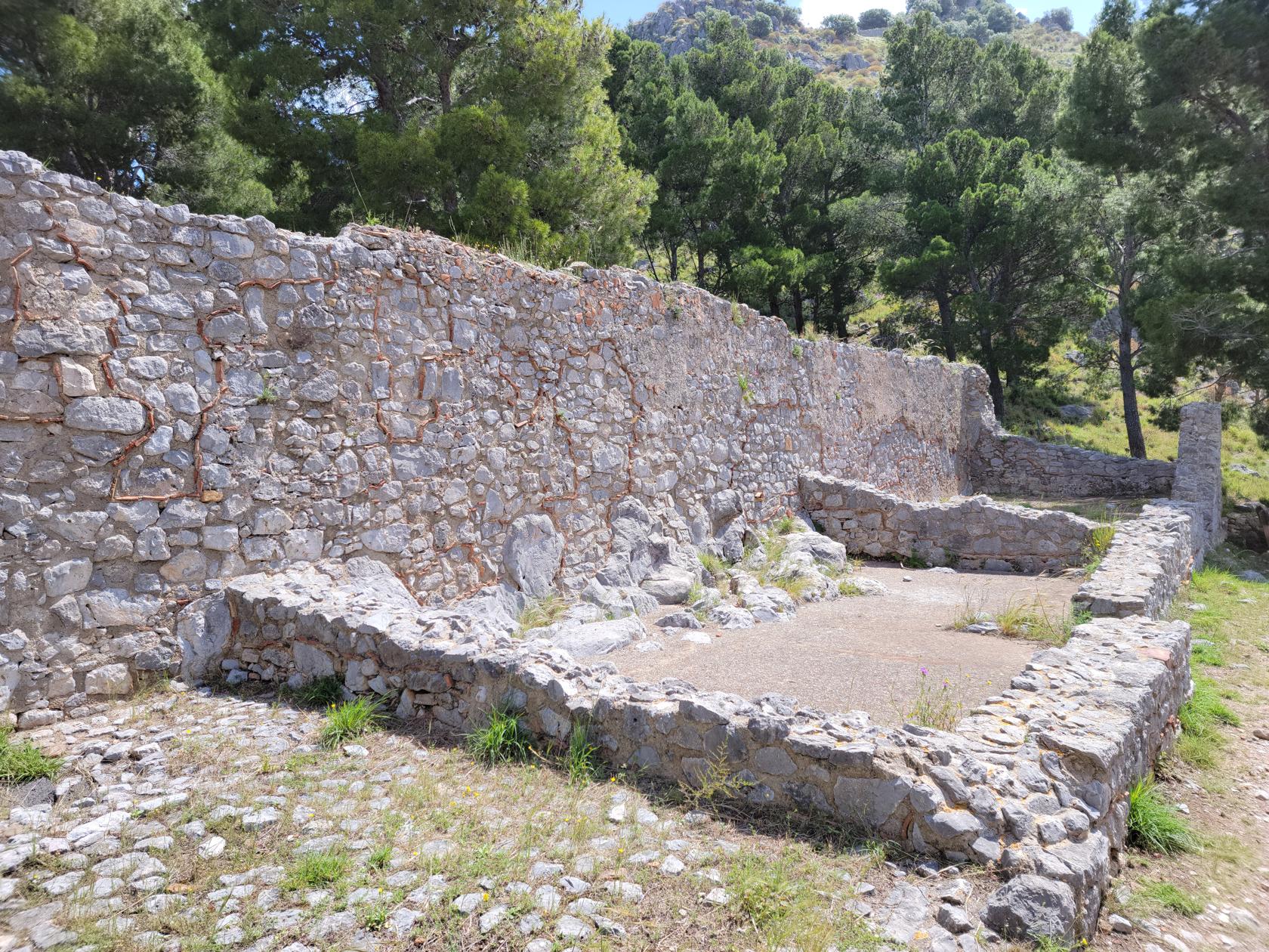
The fortress walls – Hiking la Rocca – Cefalu, Sicily
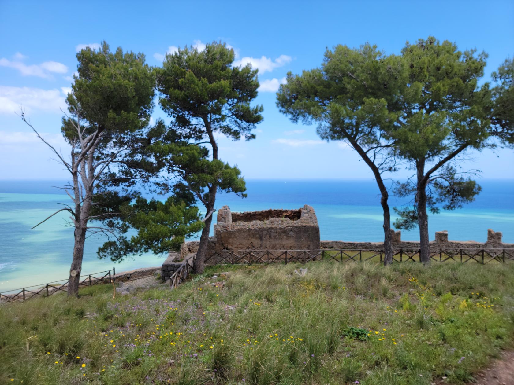
A view of La Kalura – Hiking la Rocca – Cefalu, Sicily
A view of La Kalura – Hiking la Rocca – Cefalu, Sicily
Torre Caldura – Hiking la Rocca – Cefalu, Sicily
Torre Caldura – Hiking la Rocca – Cefalu, Sicily
Another jetty – Hiking la Rocca – Cefalu, Sicily
Torre Caldura – Hiking la Rocca – Cefalu, Sicily
Patti – Hiking la Rocca – Cefalu, Sicily
Guard outpost – Hiking la Rocca – Cefalu, Sicily
Temple of Apollo – Hiking la Rocca – Cefalu, Sicily
Archeological ruins – Hiking la Rocca – Cefalu, Sicily
More ruins – Hiking la Rocca – Cefalu, Sicily
Guard outpost – Hiking la Rocca – Cefalu, Sicily
The sheer cliff face – Hiking la Rocca – Cefalu, Sicily
Il Duomo and Cefalu below – Hiking la Rocca – Cefalu, Sicily
Patti in the ruins – Hiking la Rocca – Cefalu, Sicily
On the way down we bore right in the direction of the archeological site. The path was somewhat muddier and steeper then the other path we ascended upon. However, we descended quickly and enjoyed visiting the Temple of Demeter and an old cistern that is onsite. There is also a cafe here, were you can purchase something small to eat or drink. From here the descent is rapid and soon enough you will be handing the ticket back to the office so they can record your departure, or whatever useful information they derive from it.
Patti in the ruins – Hiking la Rocca – Cefalu, Sicily
The last ruins – Hiking la Rocca – Cefalu, Sicily
The giant cistern, 50 meters deep – Hiking la Rocca – Cefalu, Sicily
More ruins – Hiking la Rocca – Cefalu, Sicily
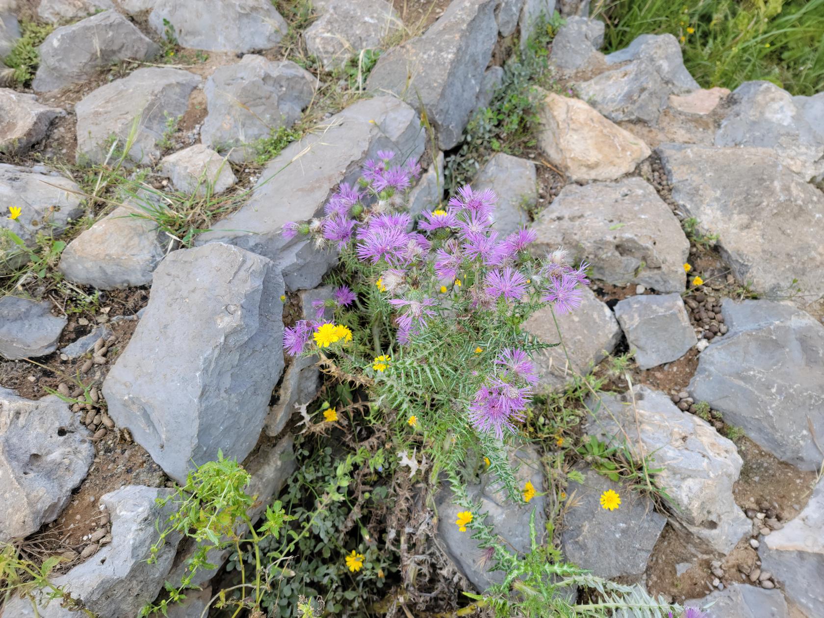
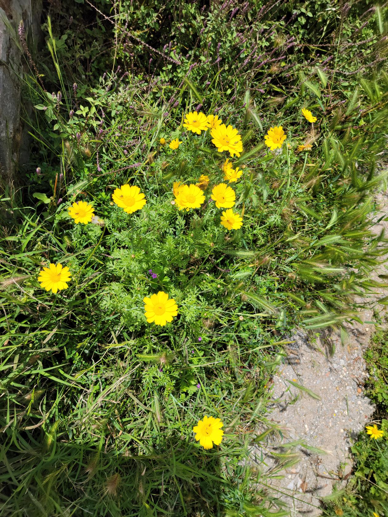
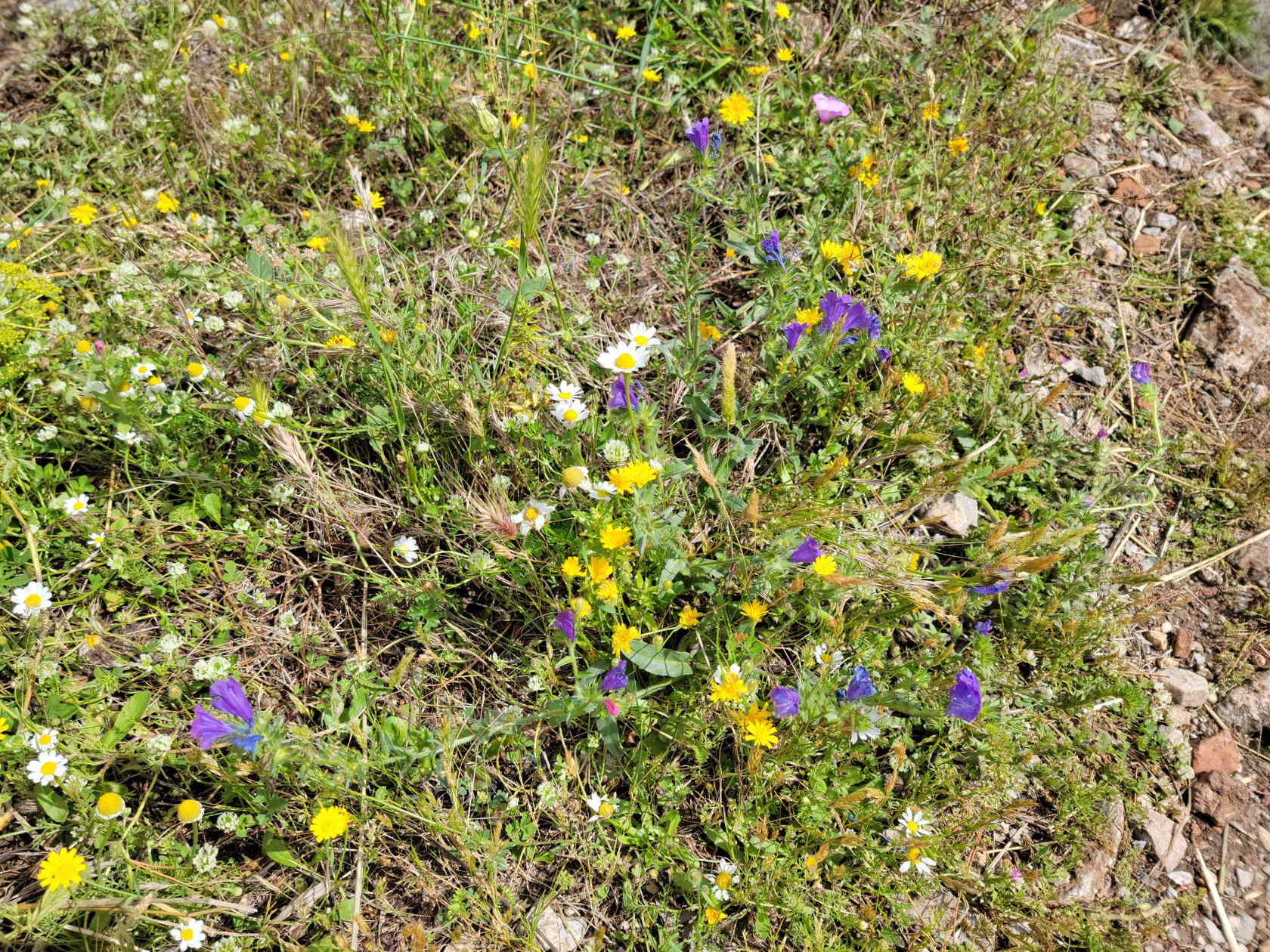
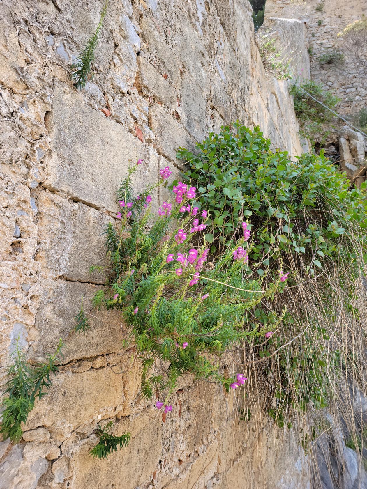
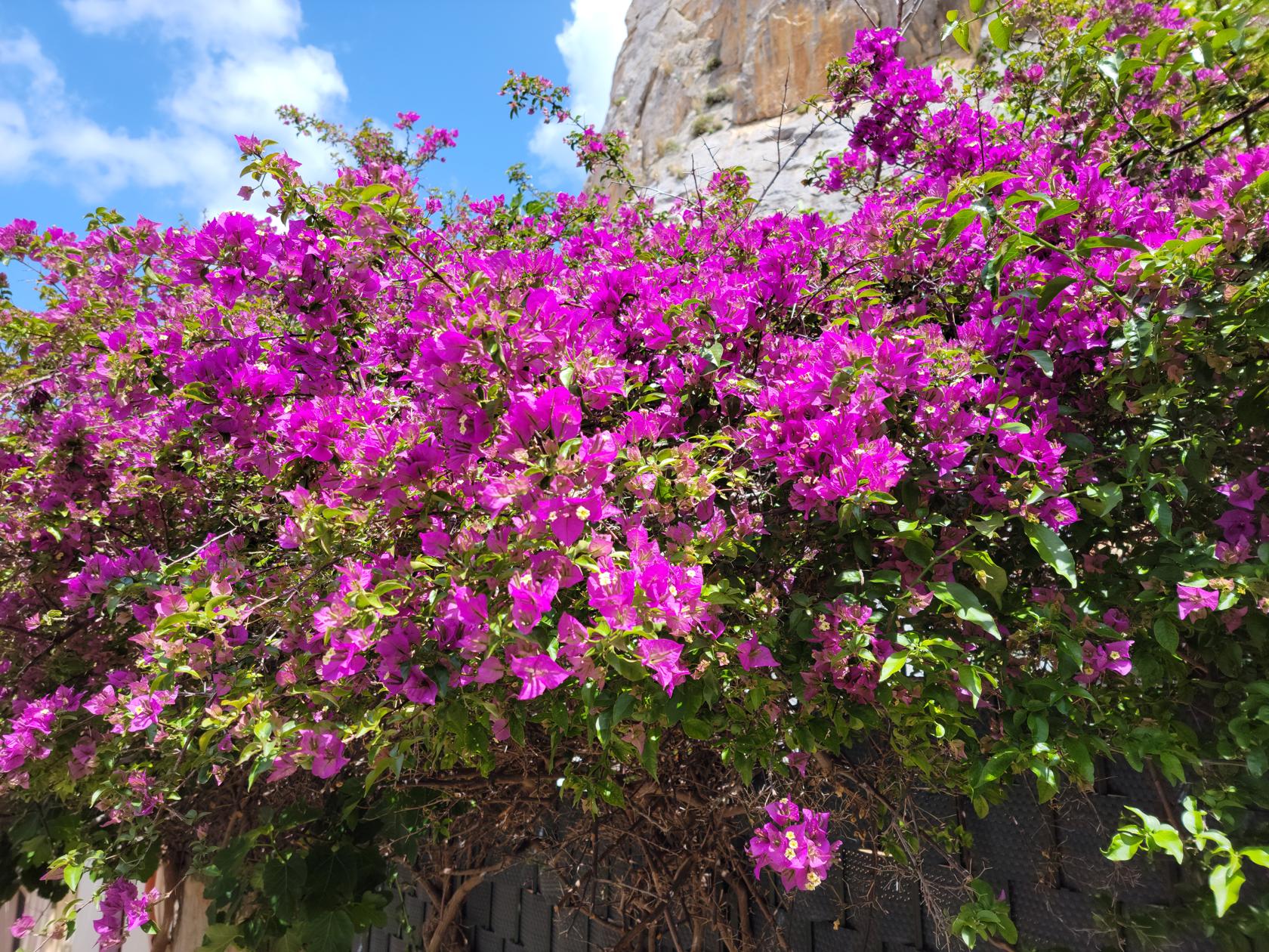
One of the many pleasures of the Italian countryside and its parks, are the flowers. Italy goes out of its way not to poison things, so there are numerous flowers and other blossoming things around, where bees and other pollinators can feed. Here is a short slideshow with some examples on this hike.
Wild flowers – Hiking la Rocca – Cefalu, Sicily
Wild flowers – Hiking la Rocca – Cefalu, Sicily
Wild flowers – Hiking la Rocca – Cefalu, Sicily
More wild flowers – Hiking la Rocca – Cefalu, Sicily
WIld flowers – Hiking la Rocca – Cefalu, Sicily
Wild flowers – Hiking la Rocca – Cefalu, Sicily
More flowers growing from the ruins – Hiking la Rocca – Cefalu, Sicily
More flowers – Hiking la Rocca – Cefalu, Sicily
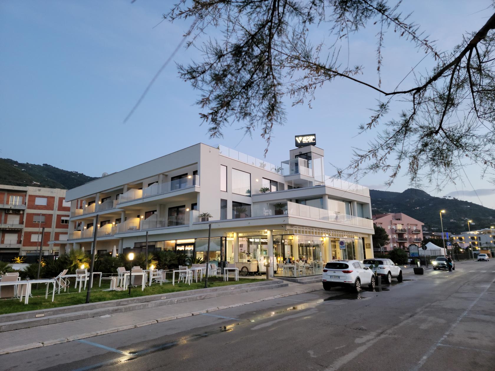
Hotel Victoria Palace
Our hotel was situated right across the street from the boardwalk and the sea. The views were very nice and we found it especially convenient, instead of being directly in town, where the streets are more confining and more difficult to move around in. The rooms here are fairly spacious and have most of the amenities that Americans are used, with the exception of an ironing board and a few other things. All and all, the staff is very friendly and welcoming and the downstairs cafe has excellent coffee and also a gelato bar, which we frequented more than once.
Hotel Victoria Palace – Cefalu, Sicily
Restaurants
The White Horse
We ate dinner here the first night in Cefalu. We chose this restaurant due to the threat of rain and because it was right up the street and very close. Unfortunately at the time, we didn’t realize that being in the vicinity would help much staying dry.
The White Horse Restaurant – Cefalu, Sicily
Nero D’Avola – A nice Sicilian wine – White Horse Restaurant – Cefalu, Sicily
Sicilian Calzone with onion – White Horse Restaurant – Cefalu, Sicily
The food here is typical Italian pizzeria, very good and very reasonable prices. They have pizza, calzone, spaghetti and pasta dishes, and a wood fired brick oven to cook it all in.
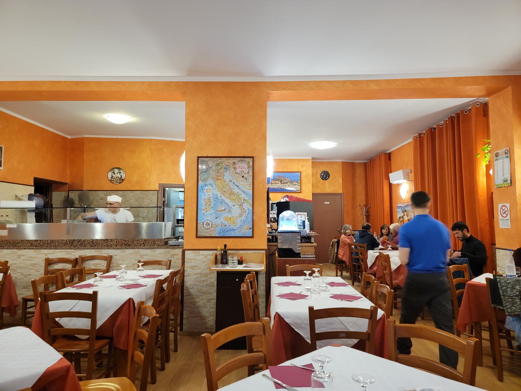
Il Gabbiano
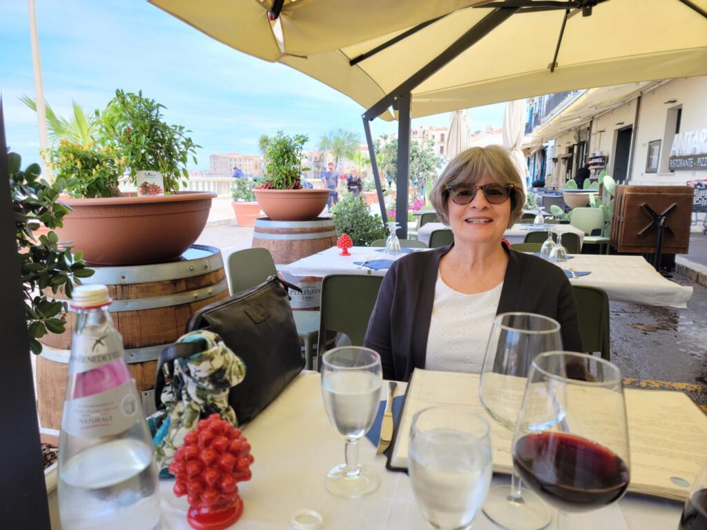
We actually ate here twice, once for lunch and once for dinner.
Ristorante – Al Gabbiano – Cefalu, Sicily
For lunch we ate outside, since the weather was trying to improve and it was rather nice out. I ordered the Zuppa di Verdure and the Spaghetti al Pomodoro and Patti had a mixed salad.
Patti Ready For Lunch – Ristorante – Al Gabbiano – Cefalu, Sicily
Erick Ready For Lunch – Ristorante – Al Gabbiano – Cefalu, Sicily
For dinner we ate inside, since the evenings in May can be rather cool, especially with the breeze from the sea blowing inland. I ordered the the mixed salad and the Spaghetti Bolognese, Patti order the Spaghetti al Pomodoro I had the day before. Both were delicious and with wine and water came to a reasonable 35€.
Zuppa di Verdura – Ristorante – Al Gabbiano – Cefalu, Sicily
Spaghetti al Pomodoro – Ristorante – Al Gabbiano – Cefalu, Sicily
Insalata Mista – Ristorante – Al Gabbiano – Cefalu, Sicily
A View Before The Rain – Ristorante – Al Gabbiano – Cefalu, Sicily
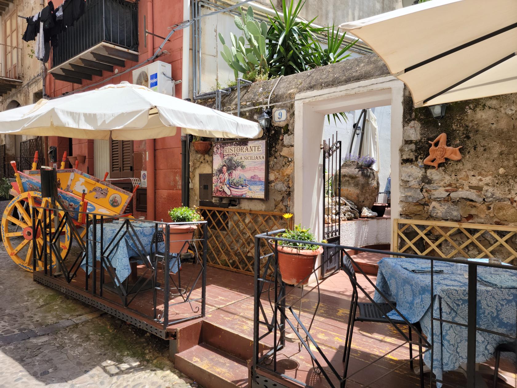
La Siciliana
This is a delightful restaurant for lunch and is located within the town on via Gioeni. It has a full manu and will please seafood and land lovers alike.
The entrance – Ristorante La Siciliana – Cefalu, Sicily
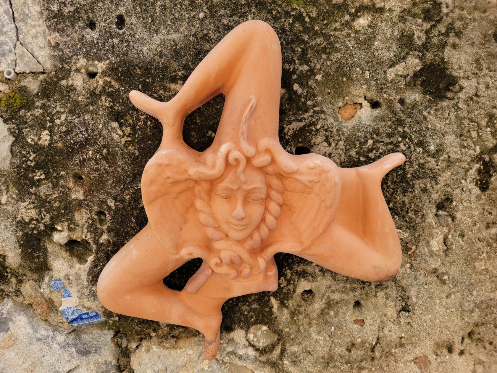
A Sicilian Medusan Symbol – Ristorante La Siciliana – Cefalu, Sicily
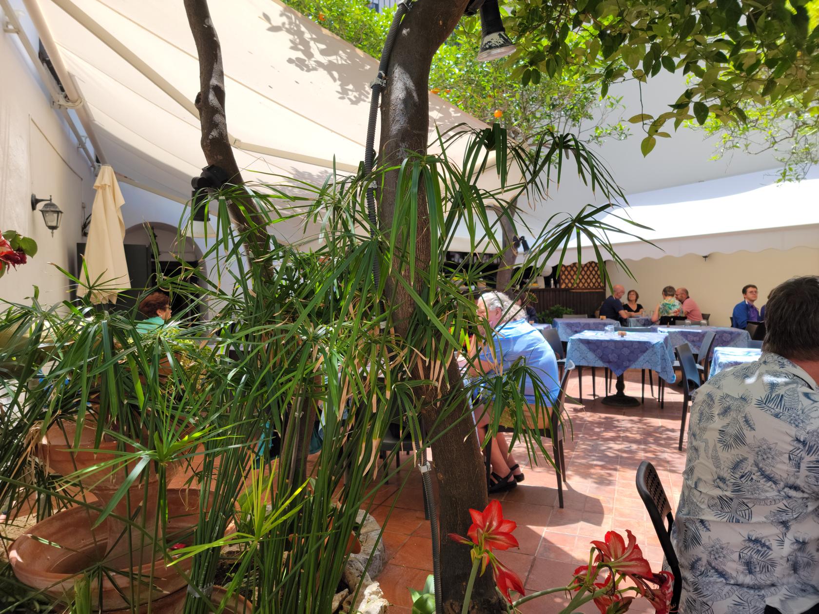
The restaurant’s courtyard – Ristorante La Siciliana – Cefalu, Sicily
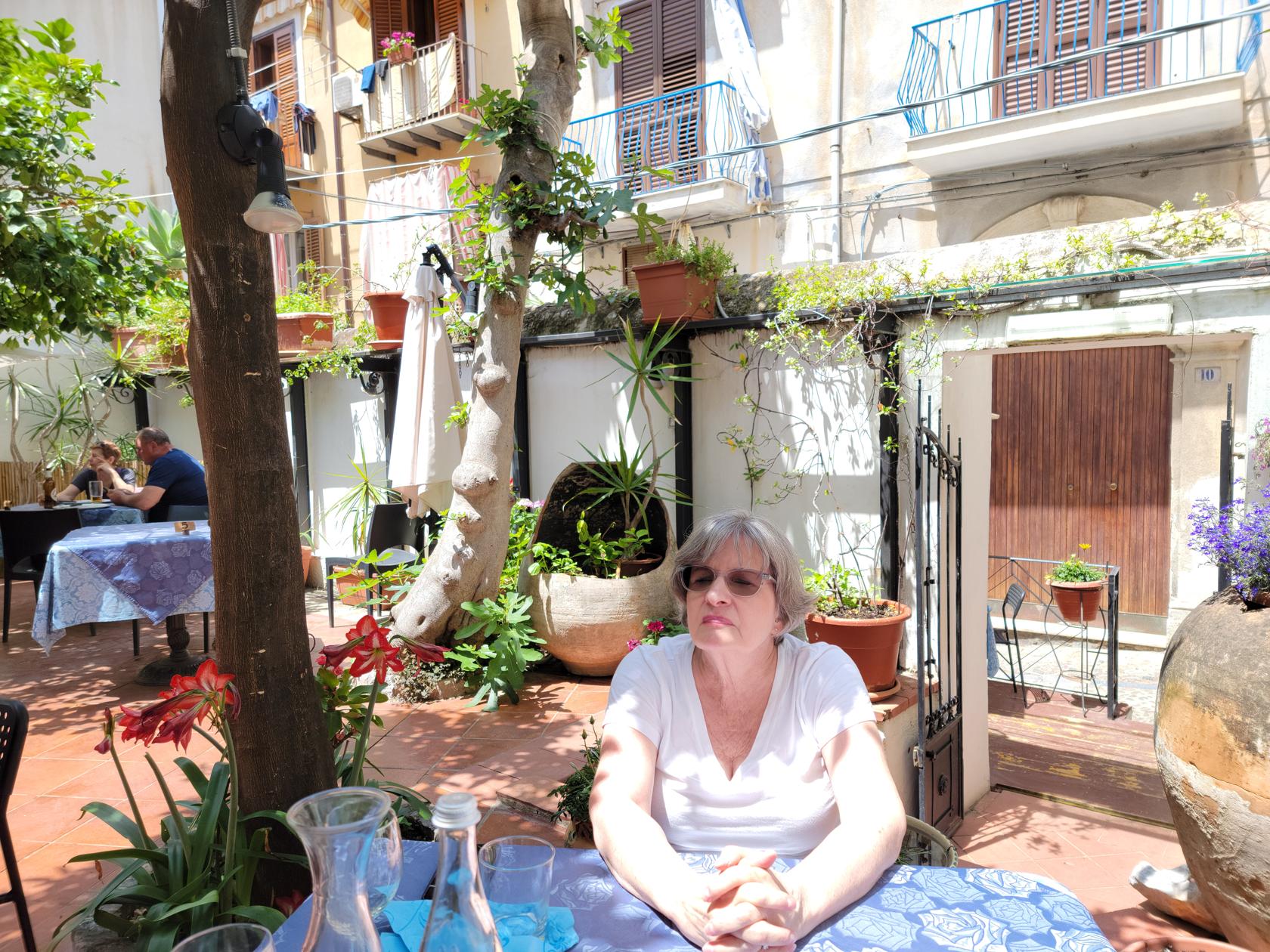
Patti waiting for her food – Ristorante La Siciliana – Cefalu, Sicily
I had the Zuppa di Verdura con Legumi and the Lasagna, while Patti finally found here Aranchini on the menu and ordered a sampler plate of that. Both were delicious. With food, a hald liter of wine, water and coffee, it came to a reasonable 37€ for two.
Vino rosso della casa and aranchini – Ristorante La Siciliana – Cefalu, Sicily
Aranchini – Deep fried cheese and rice, ham and rice, cuttlefish ink and rice – Ristorante La Siciliana – Cefalu, Sicily
Zuppa di Verdura – Ristorante La Siciliana – Cefalu, Sicily
Lasagna – Ristorante La Siciliana – Cefalu, Sicily
Patti – Ristorante La Siciliana – Cefalu, Sicily
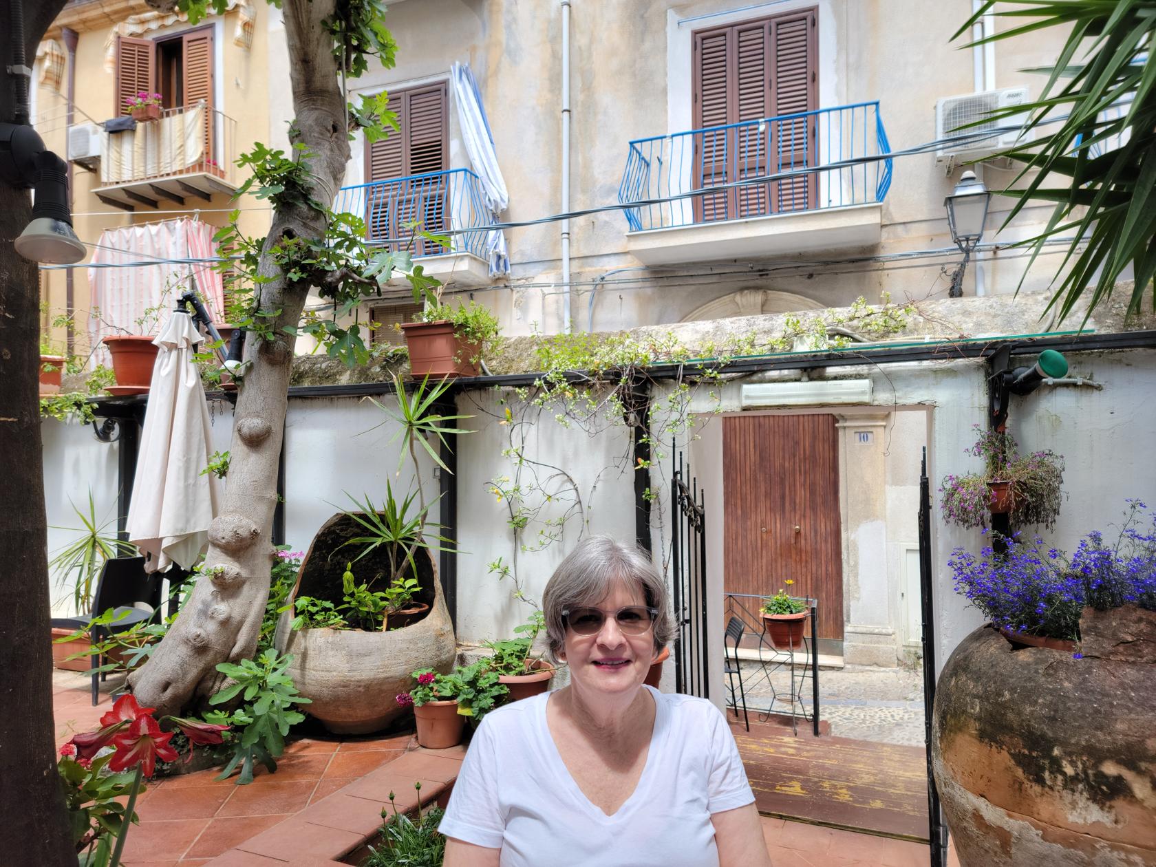
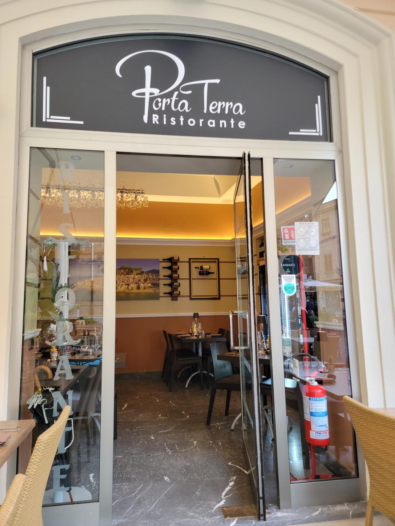
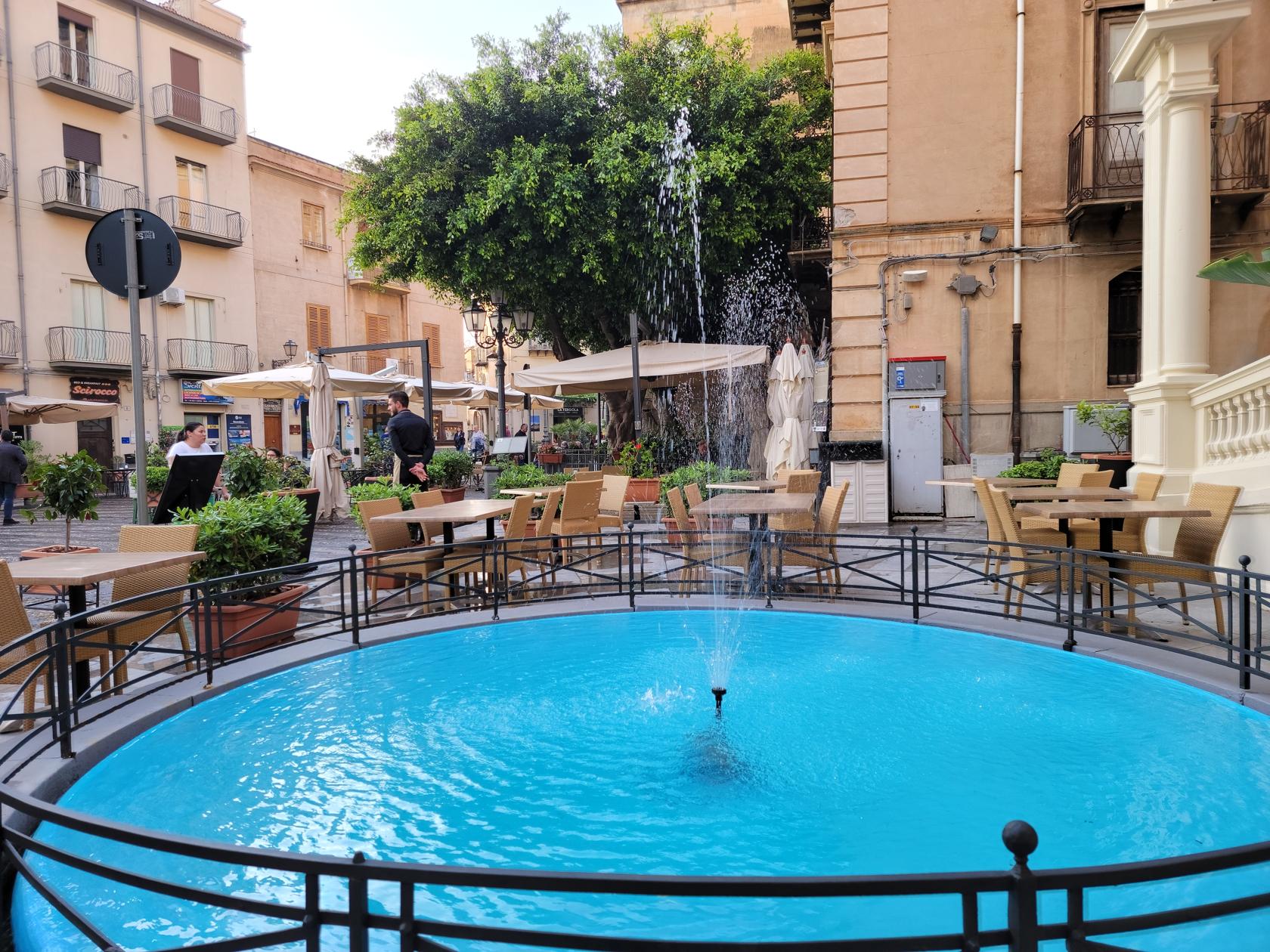
Porta Terra
A fine restaurant located in the Piazza Garibaldi in the upper part of town. We booked our reservations using The Fork and got a free hors d’oeuvres of Cherry Tomato, Mozzarella and Pistachio Cream in a small baked bread cup.
Ristorante Porta Terra – Cefalu, Sicily
The Fountain – Ristorante Porta Terra – Cefalu, Sicily
Ristorante Porta Terra – Cefalu, Sicily
Our Special hors d’oeuvres from The Fork – Cherry Tomato, Mozzarella and Pistachio Cream – Ristorante Porta Terra – Cefalu, Sicily
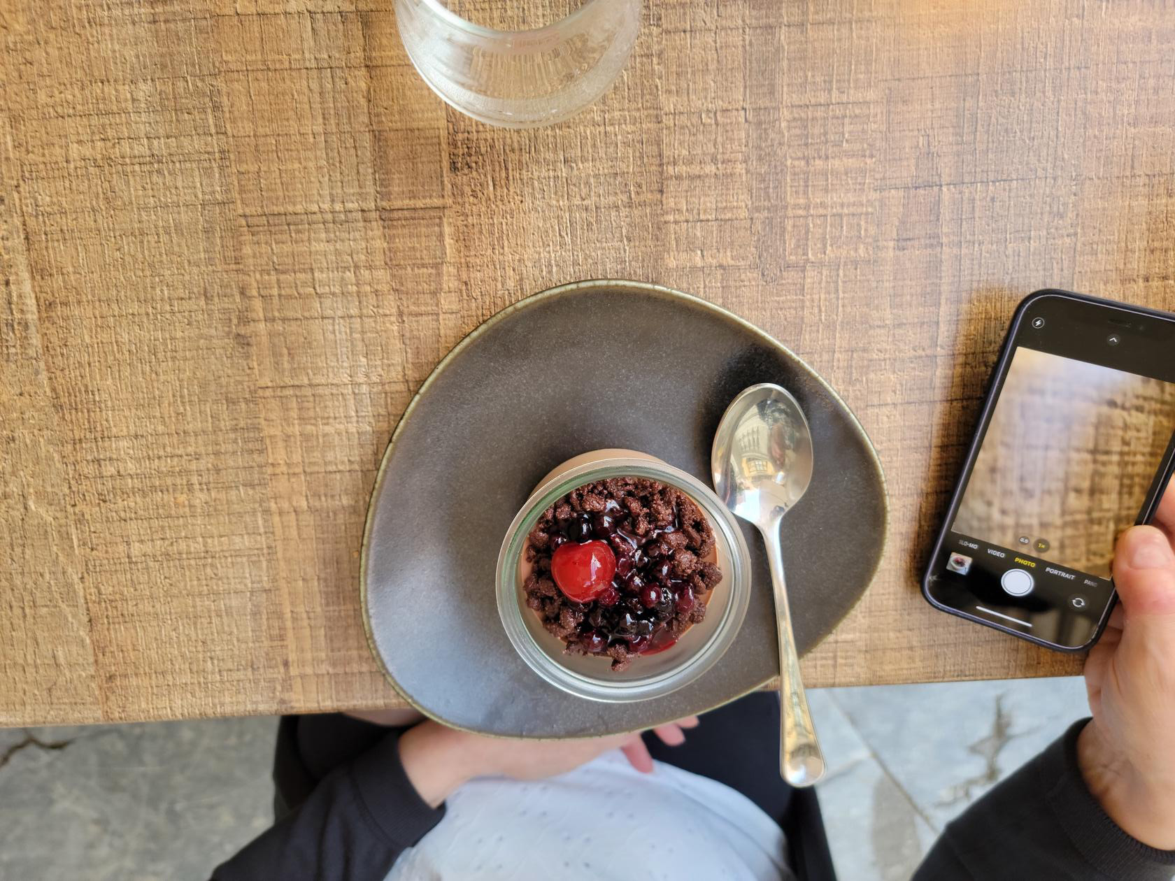
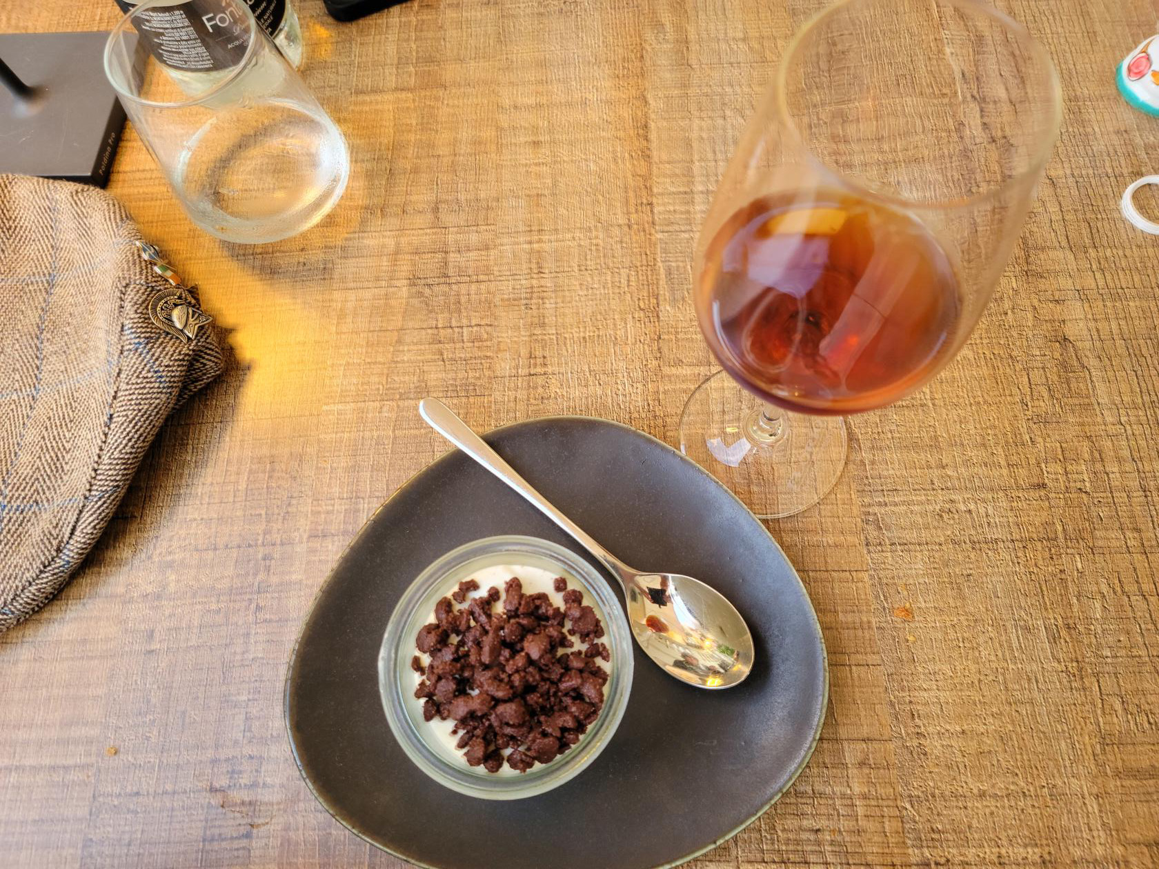
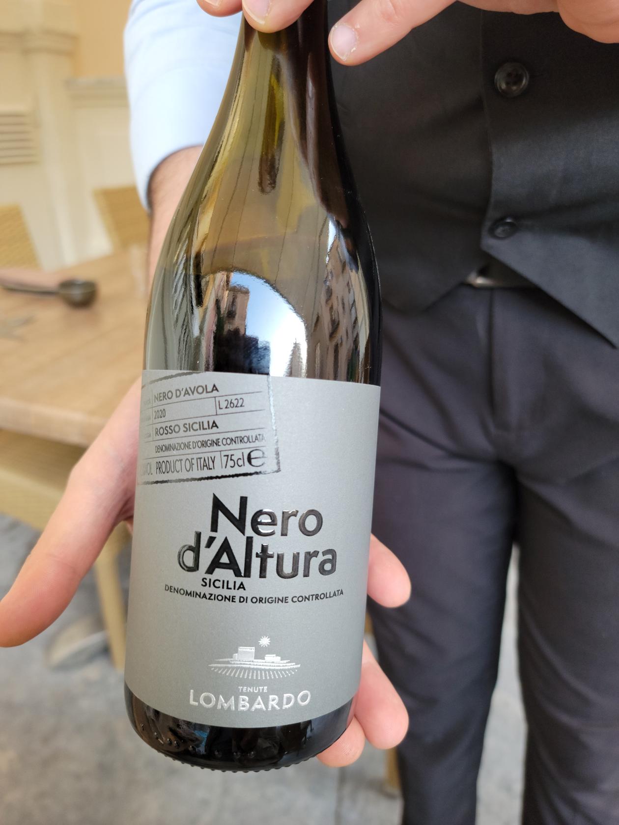
I ordered a glass of a fine red Sicilian wine called Nero d’Altura. Patti had the breaded tuna with Mango and avocado sauce, and I had the baked cod with a reduction of pinoli nuts, raisins and kalamata olives over mashed potatoes, both of which were delicious. The dinner was a bit on the high side at 71€ for both of us, but the food was worth every cent.
Breaded Tuna with Mango and Avocado sauce – Ristorante Porta Terra – Cefalu, Sicily
Baked cod with a reduction of pinoli nuts, raisins and kalamata olives over mashed potatoes – Ristorante Porta Terra – Cefalu, Sicily
Chocolate cream with red berries and crunchies on top – Ristorante Porta Terra – Cefalu, Sicily
Tiramisu with chocolate crunchies and Marsala wine – Ristorante Porta Terra – Cefalu, Sicily
A Fine Red Sicilian Wine – Nero d’Altura – Ristorante Porta Terra – Cefalu, Sicily
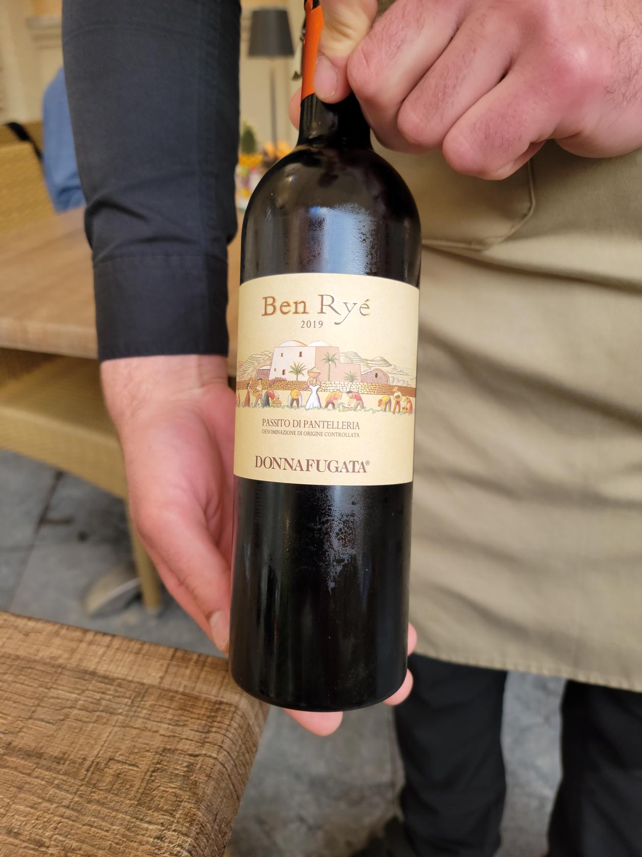
A fine sweet Marsala wine – Ben Rye – Ristorante Porta Terra – Cefalu, Sicily
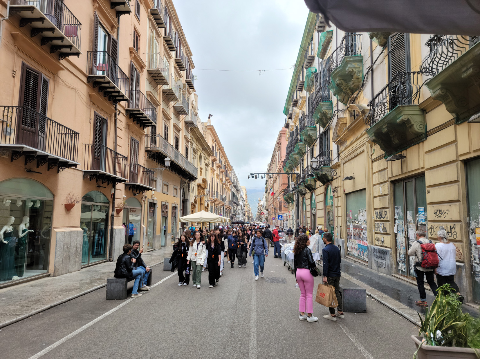
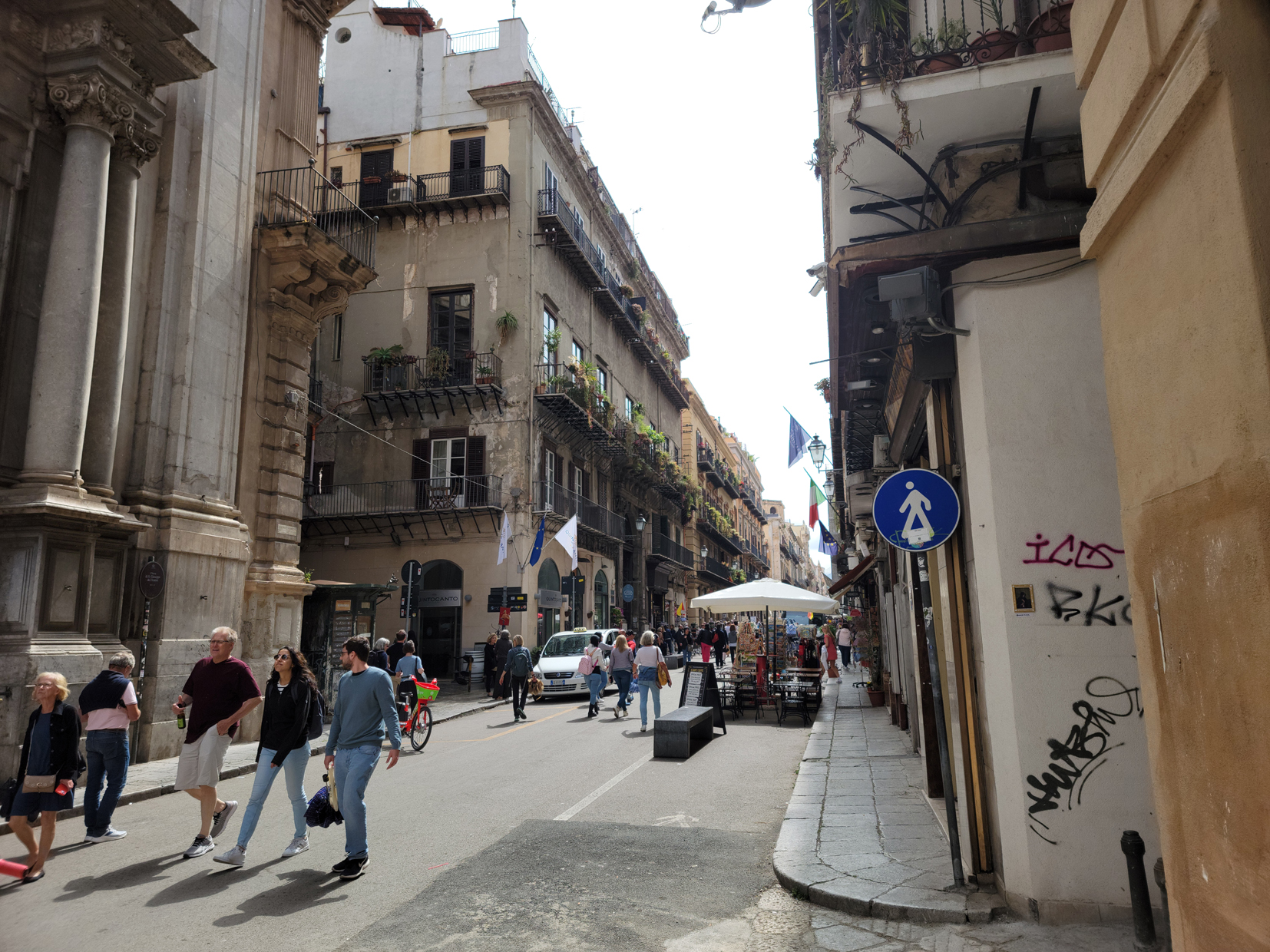
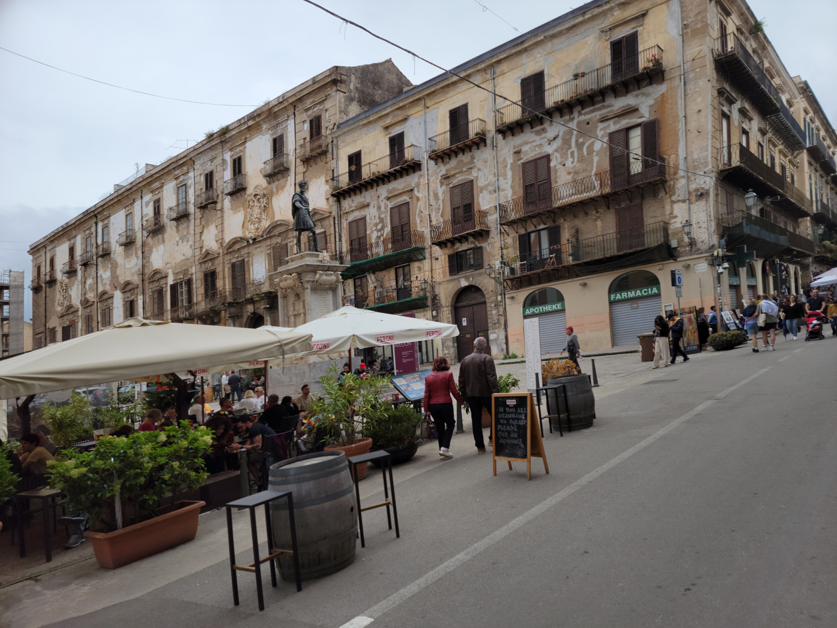
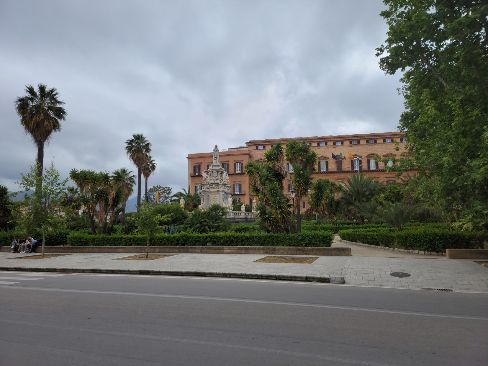
Situated on the north coast of the autonomous region of Sicily is Palermo, both the capital of the province and of the region itself. It is an ancient city which has been ruled over its long history by many different powers. It was once a nexus for essential trade routes in the Mediterranean Sea.
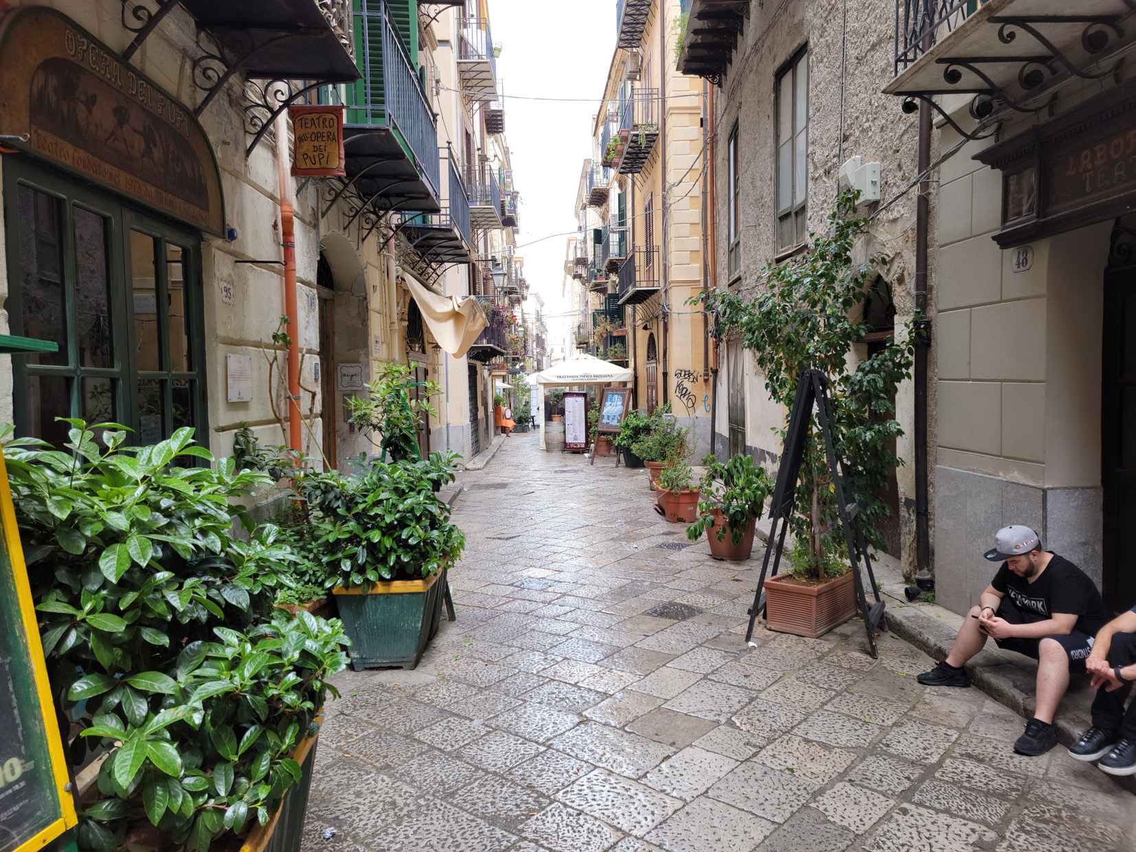
Via Bara All’Olivella – Palermo, Sicily
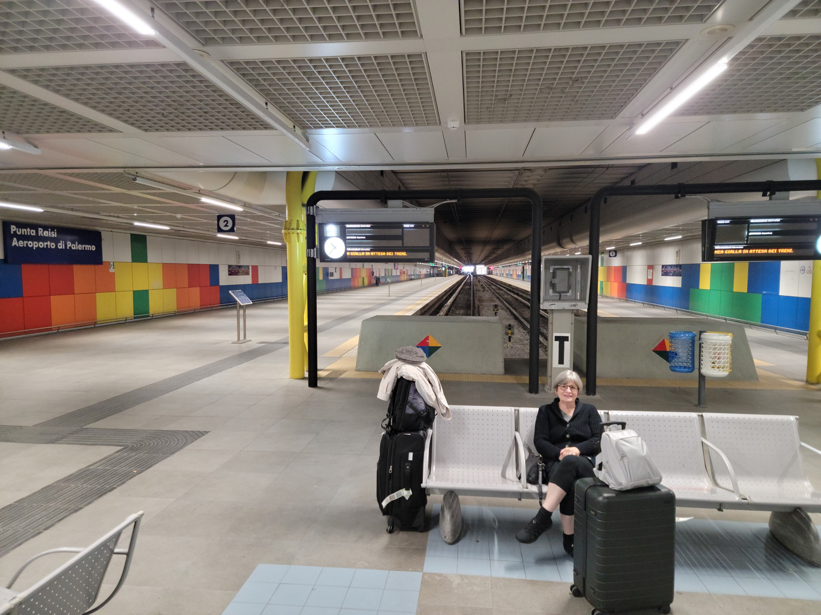
We arrived at the Palermo Airport, which is actually not in Palermo, but in Punta Raisi. There are many options one can take in order to get to Palermo, ranging from the train at 6.50€/person, all the way up to private shuttle service starting at 50€/person. Being from a family of railroad workers, I prefer to take a train when possible. Not only is a far cheaper, but in Italy they almost always run on time.
Patti – Punta Raisi Station – Palermo Airport – Sicily, Italy
One last thing, unfortunately our Tickets For Two were electronic, so it does not make sense to show, nor take a photograph of them. Let us just say, we had two tickets on a Ryanair flight from Turin to Palermo at a very reasonable rate.
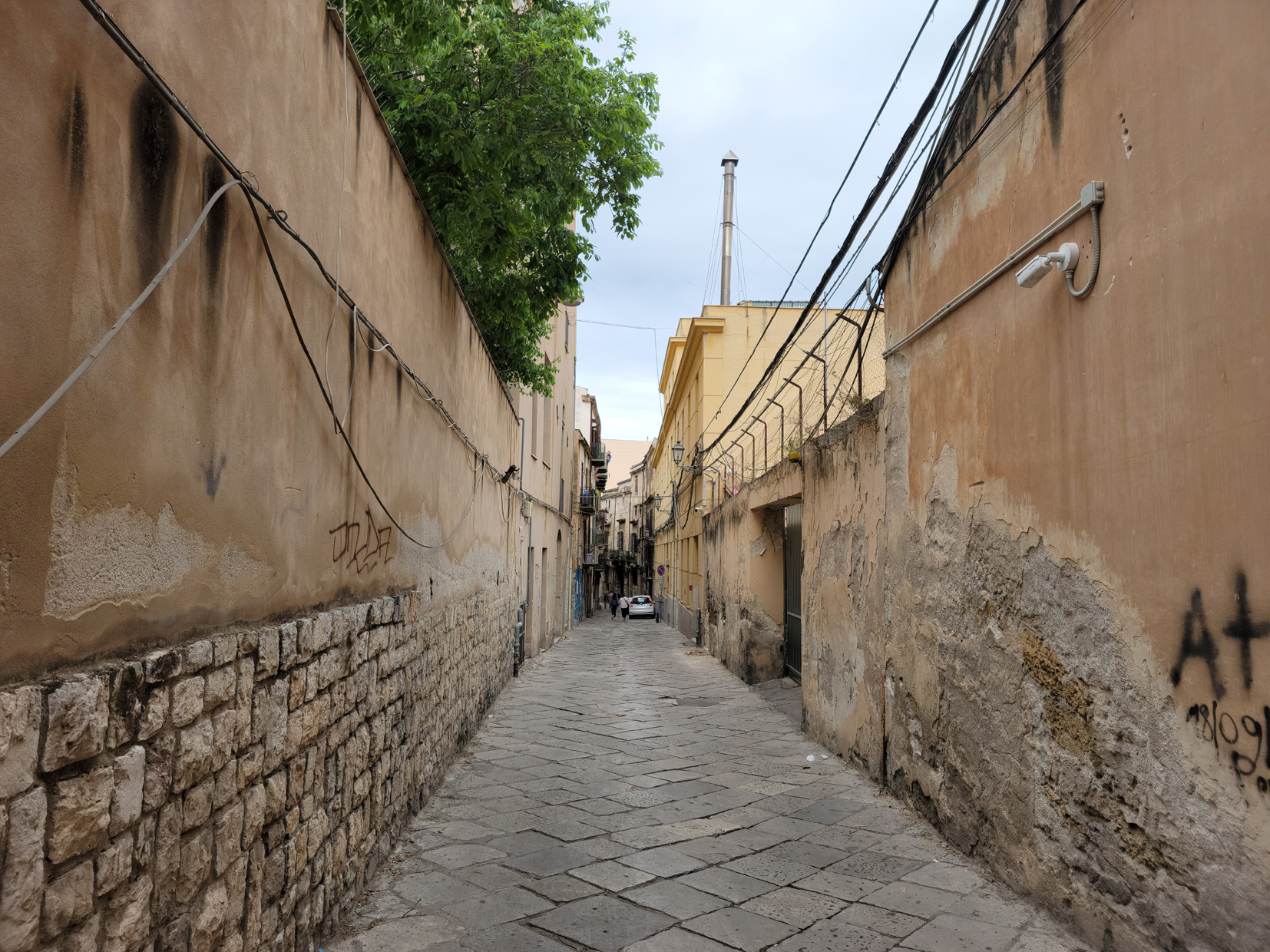
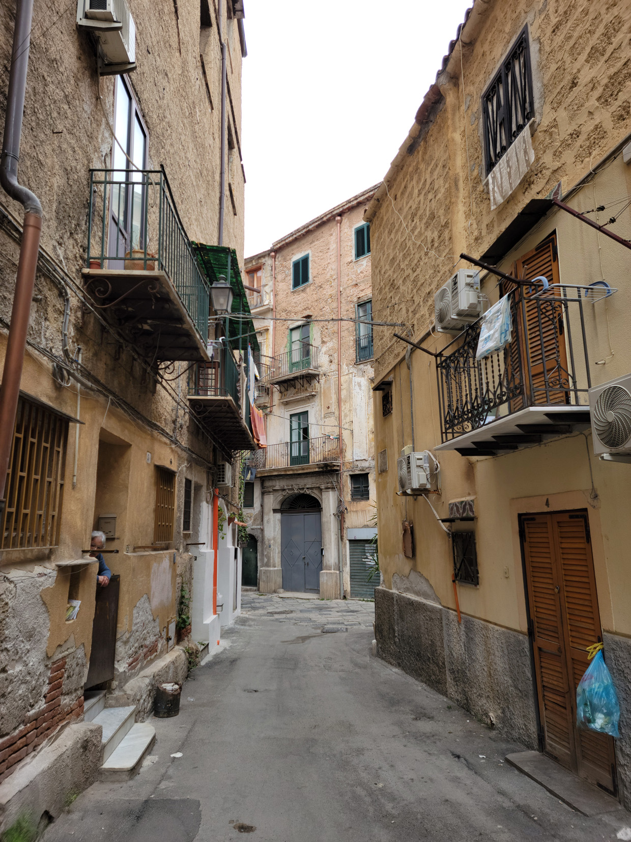
A Working City
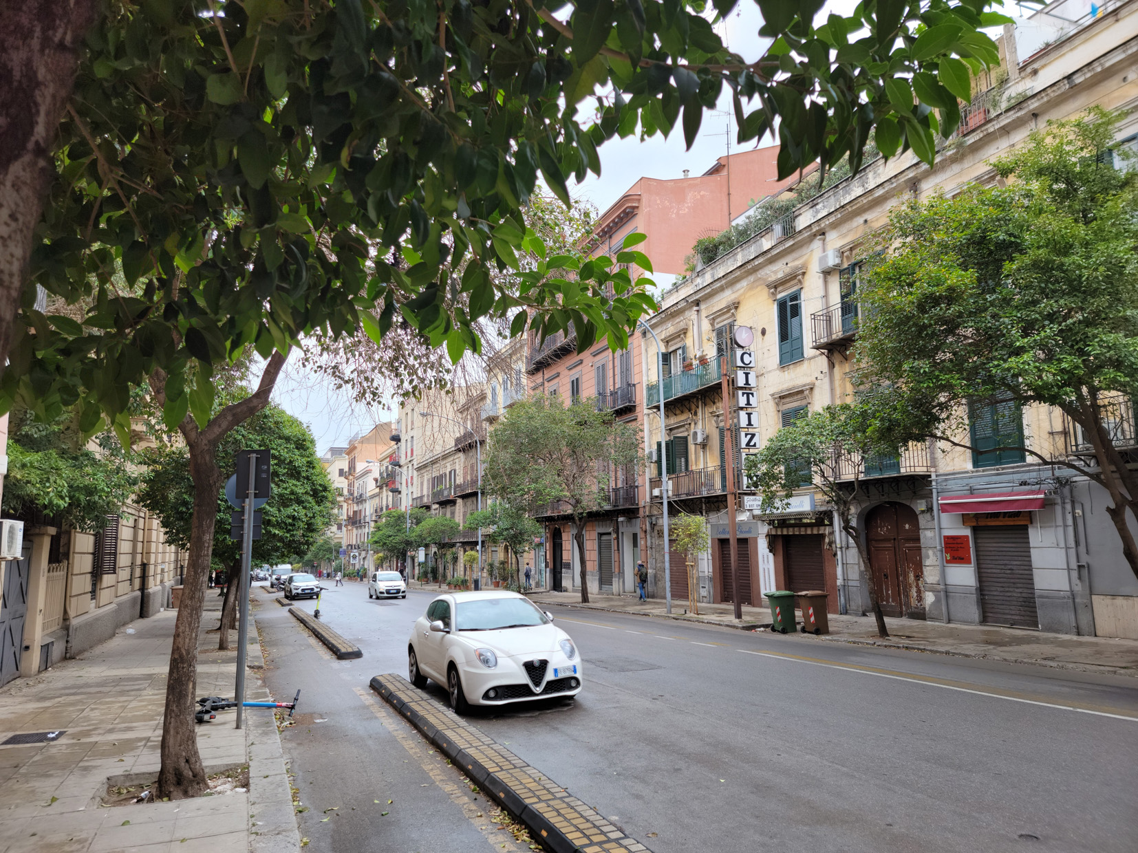
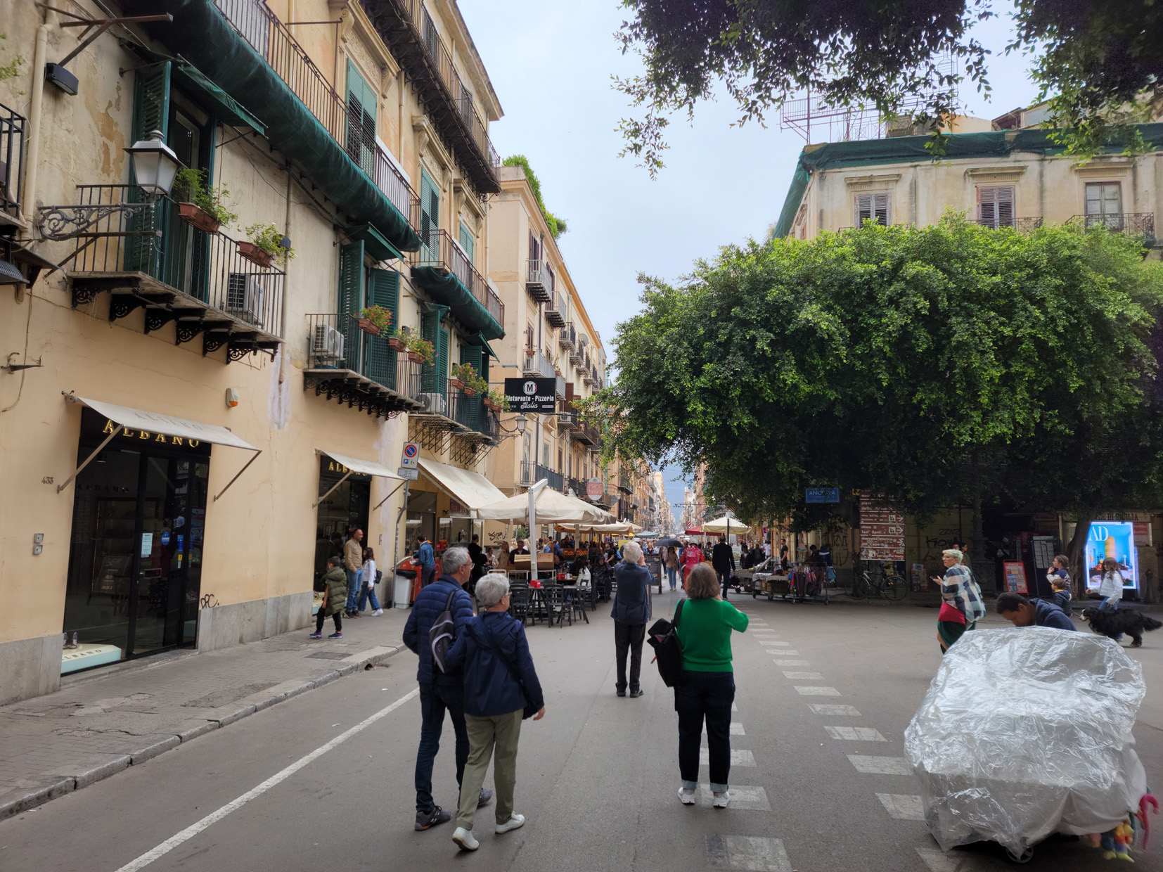
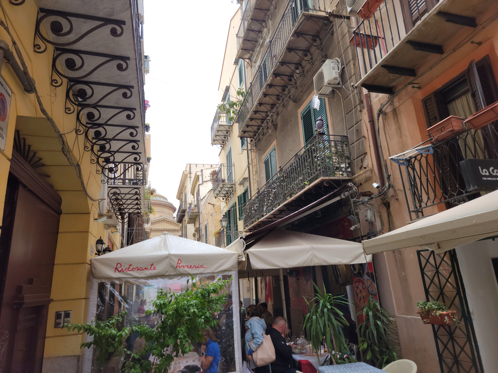
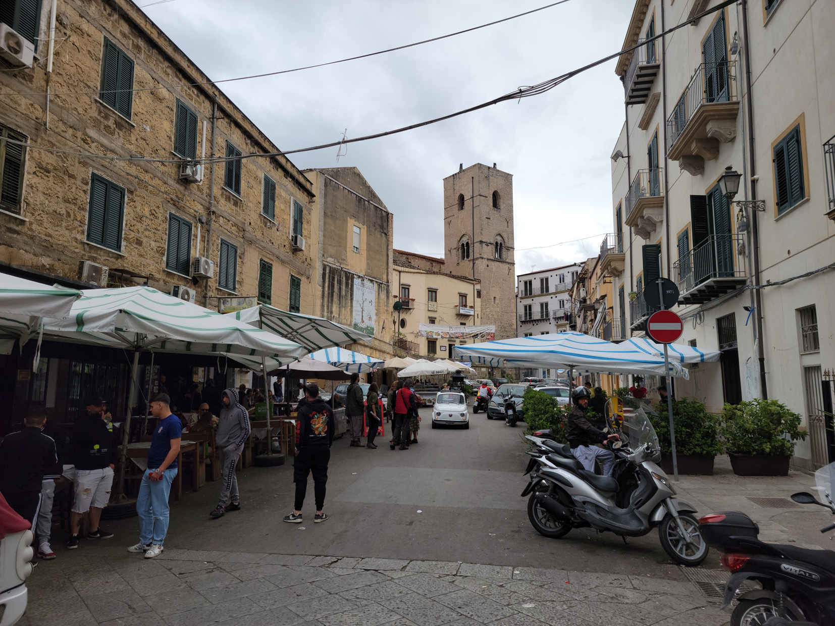
In our contemporary time, I would say the city of Palermo is struggling between its ancient roots, as with many other parts of Italy, and its desire to be modern. This is reflected in many ways as you walk through its narrow alleyways and marbled streets. Some of which are well worn with centuries of wear.
The Streets of Palermo – Sicily, Italy
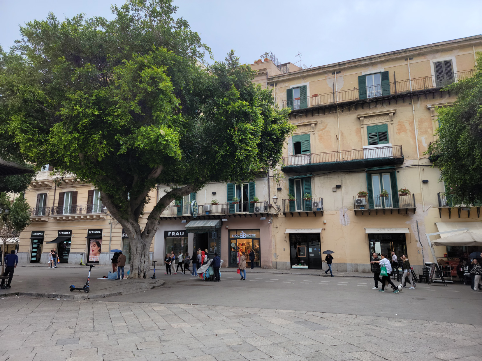
Via Maqueda outside our hotel – Piazza Massimo – Palermo, Sicily
Via Maqueda – Piazza Massimo – Palermo, Sicily
The Streets of Palermo – Palermo, Sicily
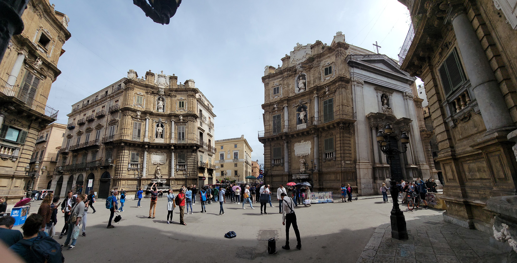
Quattro Canti via Marqueda – Palermo, Sicily
Via Vittorio Emanuelle – Palermo, Sicily
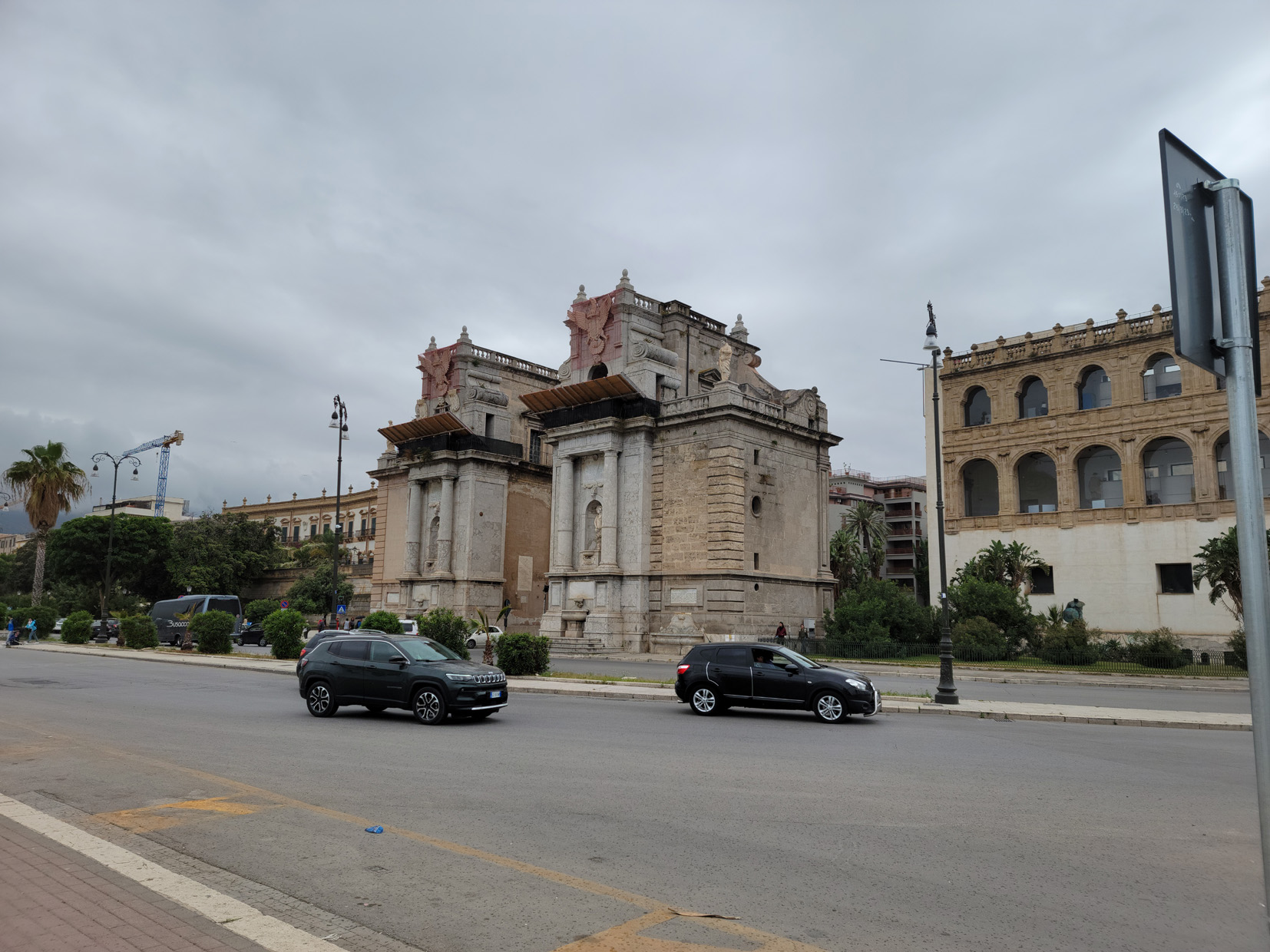
Porta Felice – Palermo, Sicily
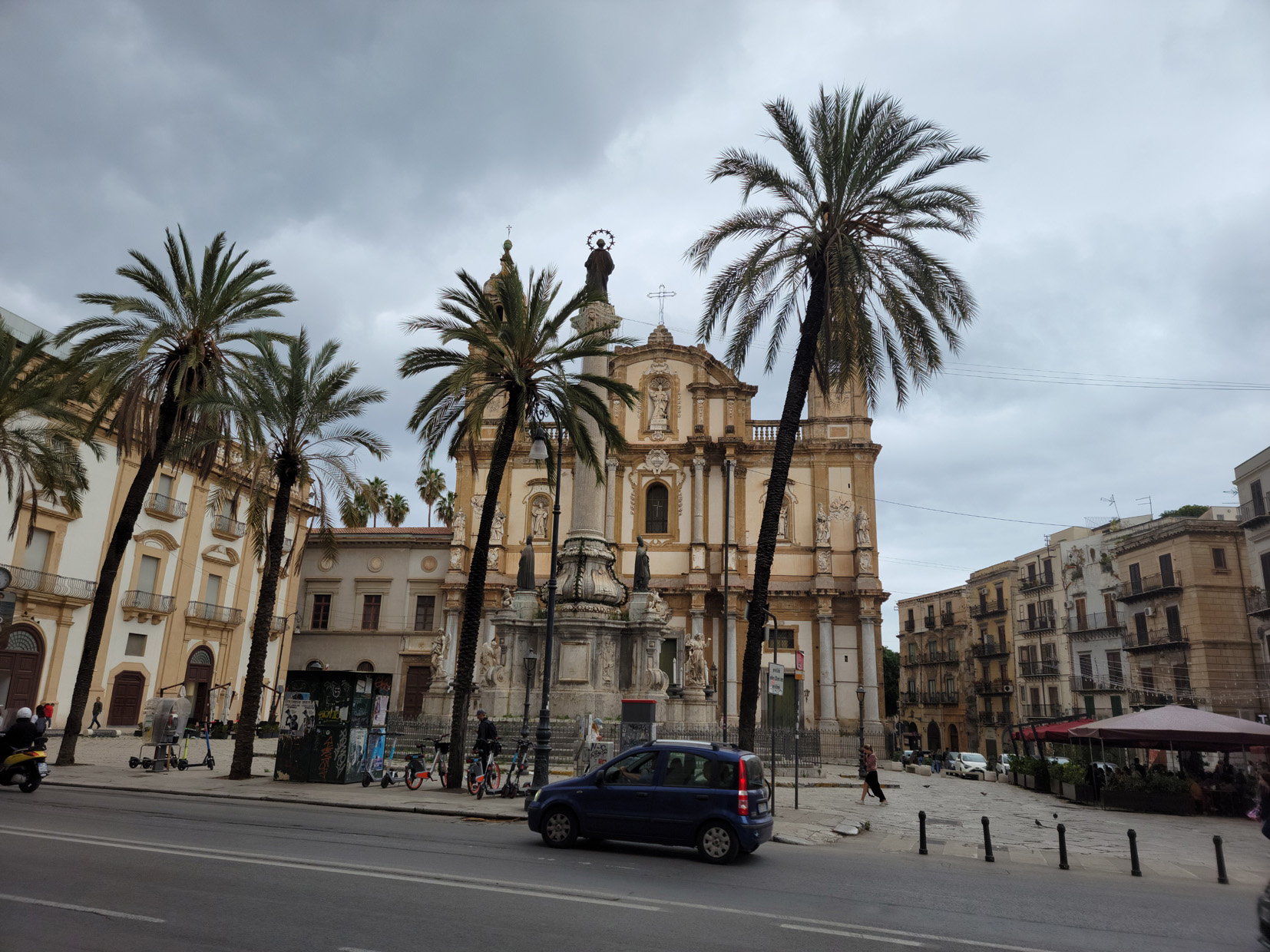
Colonna dell’Immacolata – Church of Saint Domenico – Palermo, Sicily
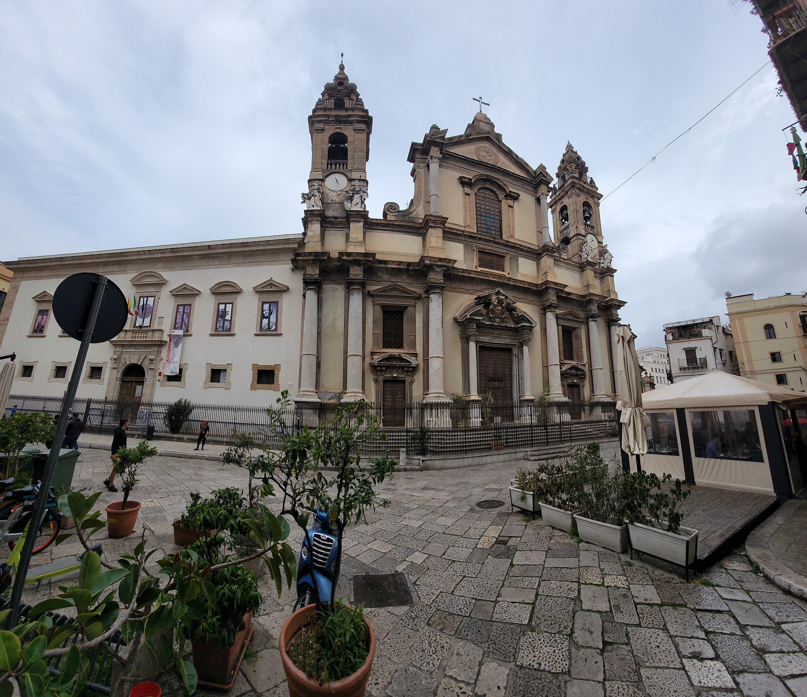
Churches of Palermo
Palermo sports amazing architecture and a church around almost every corner. The Gesu Church and the Palermo Cathedral, may be of particular interest.
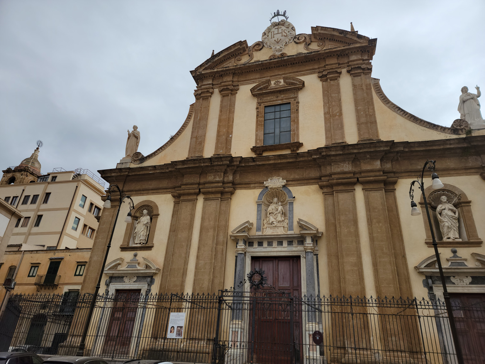
Gesu Church – Palermo, Sicily
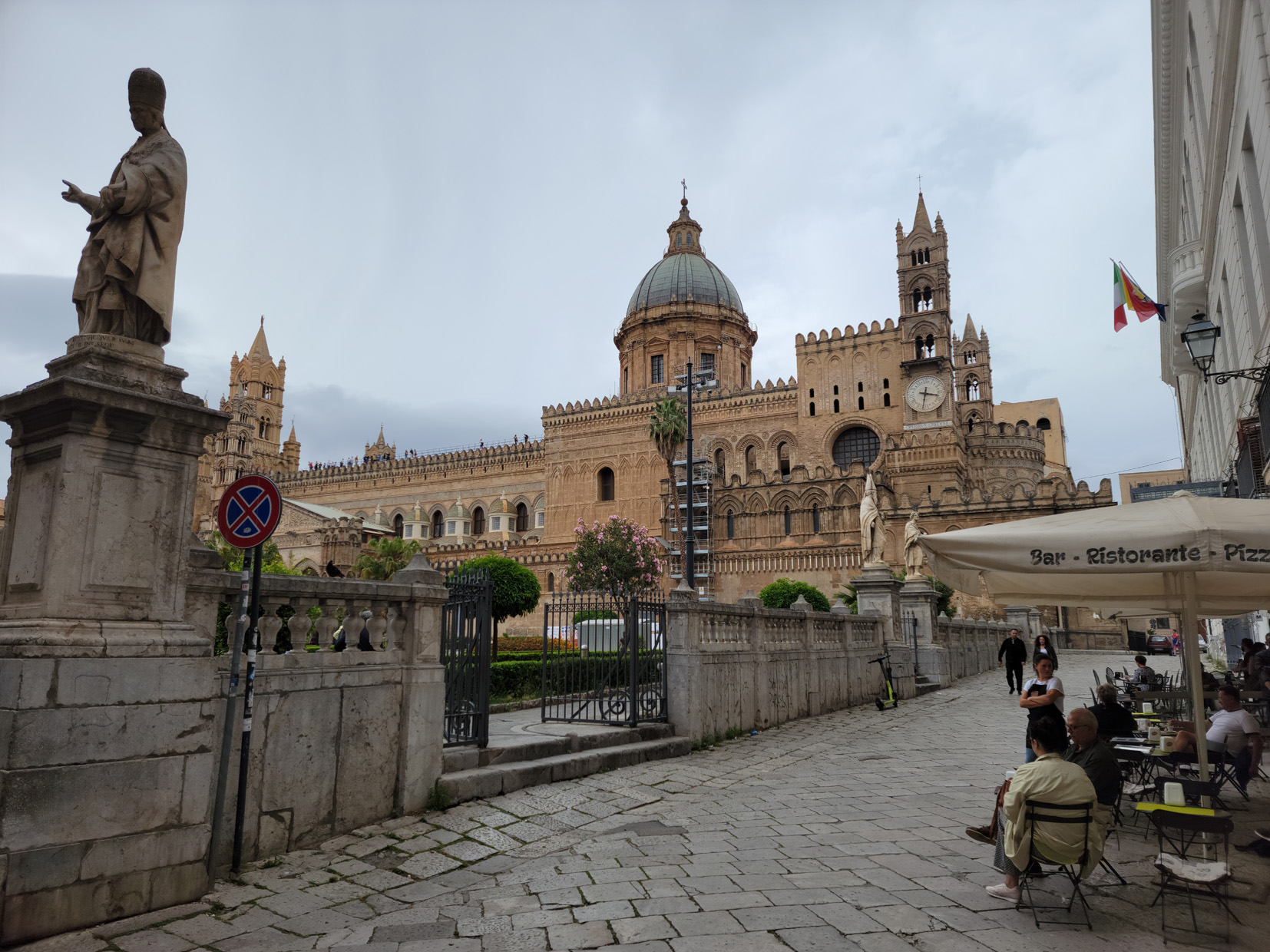
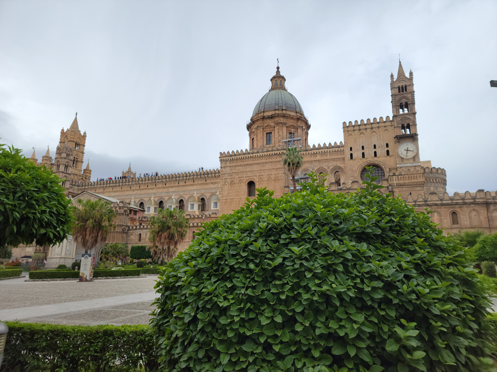
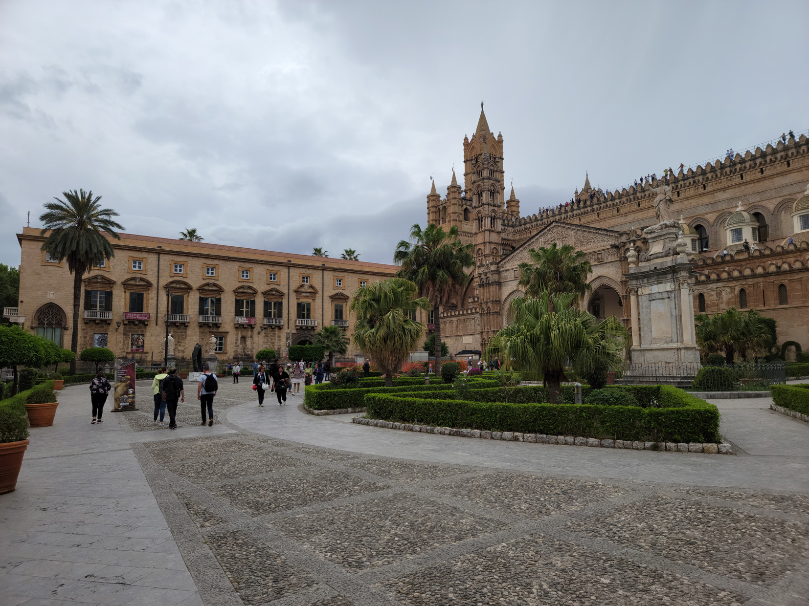
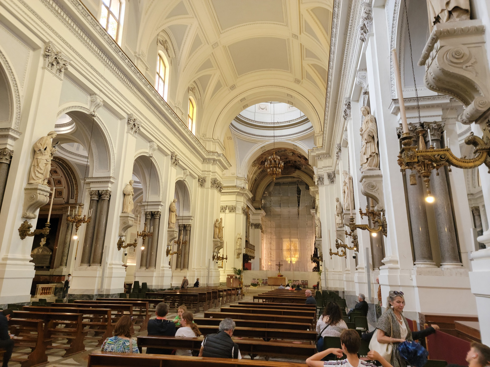
Palermo Cathedral – Palermo, Sicily
Palermo Cathedral – Palermo, Sicily
Palermo Cathedral – Palermo, Sicily
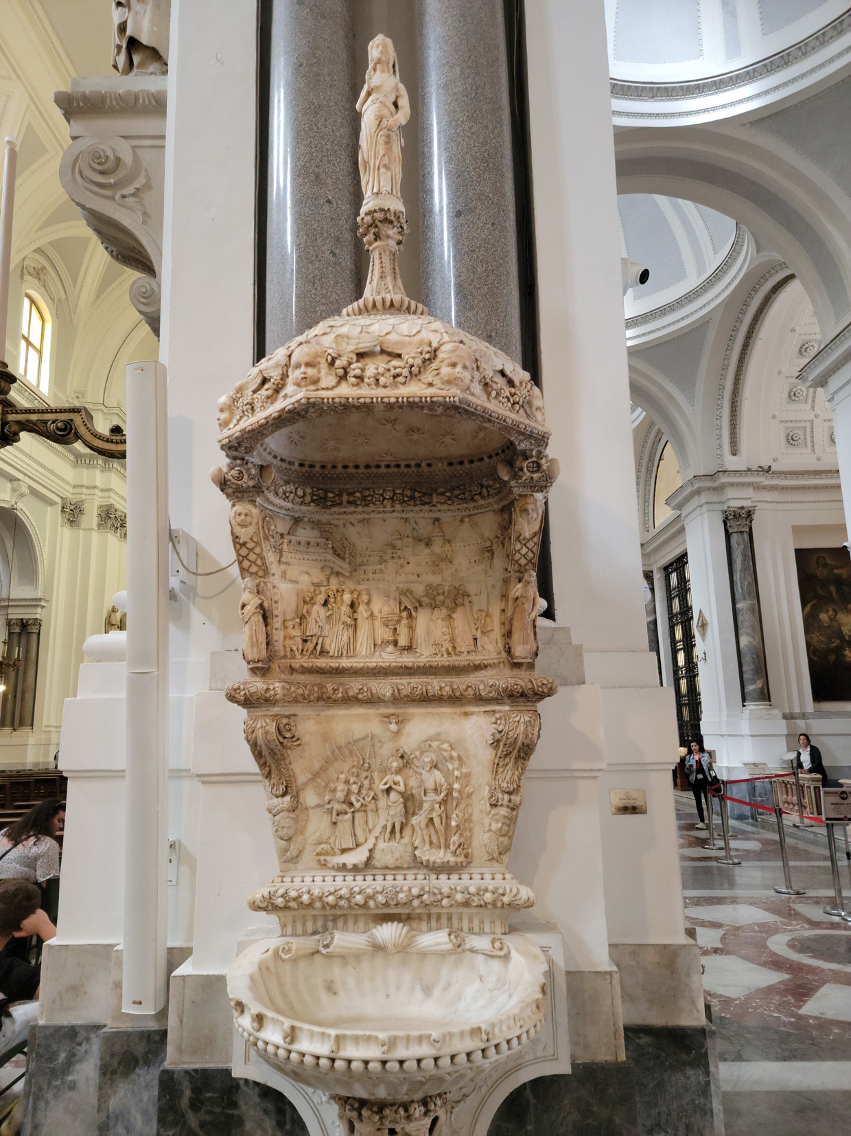
Baptism Font – Palermo Cathedral – Palermo, Sicily
VIa Matteo Bonello – Palermo Cathedral – Palermo, Sicily
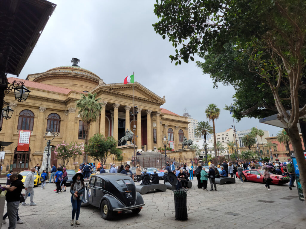
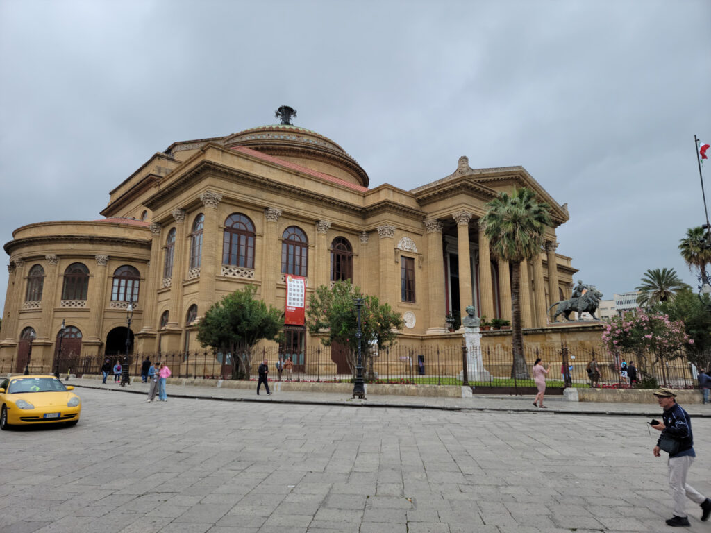
The Massimo Theater
On the other cultural side of things, there is the Massimo Theater. An impressive building that is named after the piazza in which it resides.
Another view of Massimo Theater – Piazza Massimo – Palermo, Sicily
Other Parts of the City
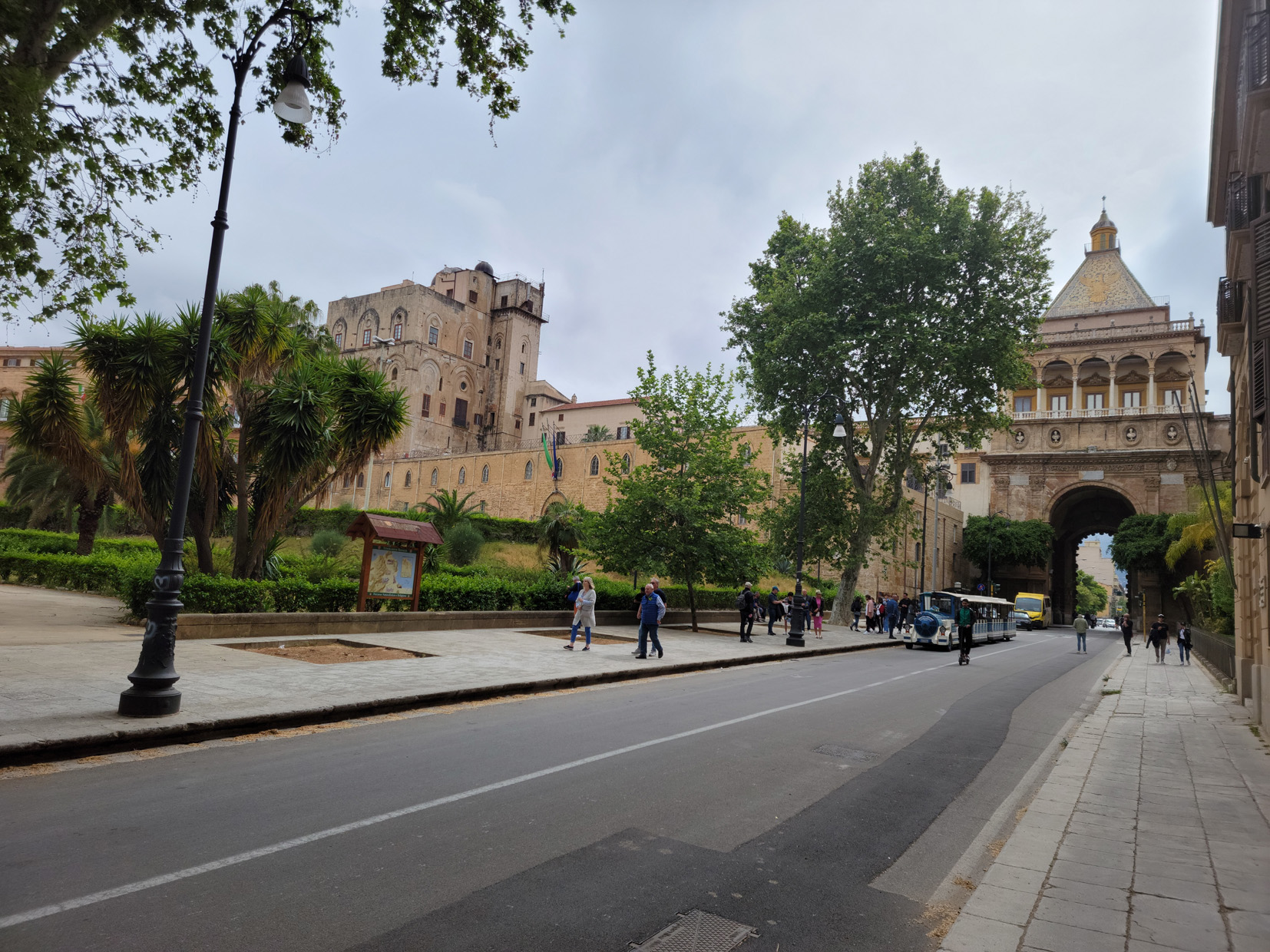
A few other interesting sites include the Porta Nuovo and several parks, one of which has a magnificent example of an Australian Banyan tree. However, there are many site to enjoy while strolling the city streets, sometimes it pays just to get lost, even if your favorite map is uncooperative.
Via Bara All’Olivella – Palermo, Sicily
Side Street – Palermo, Sicily
Piazza – Palermo, Sicily
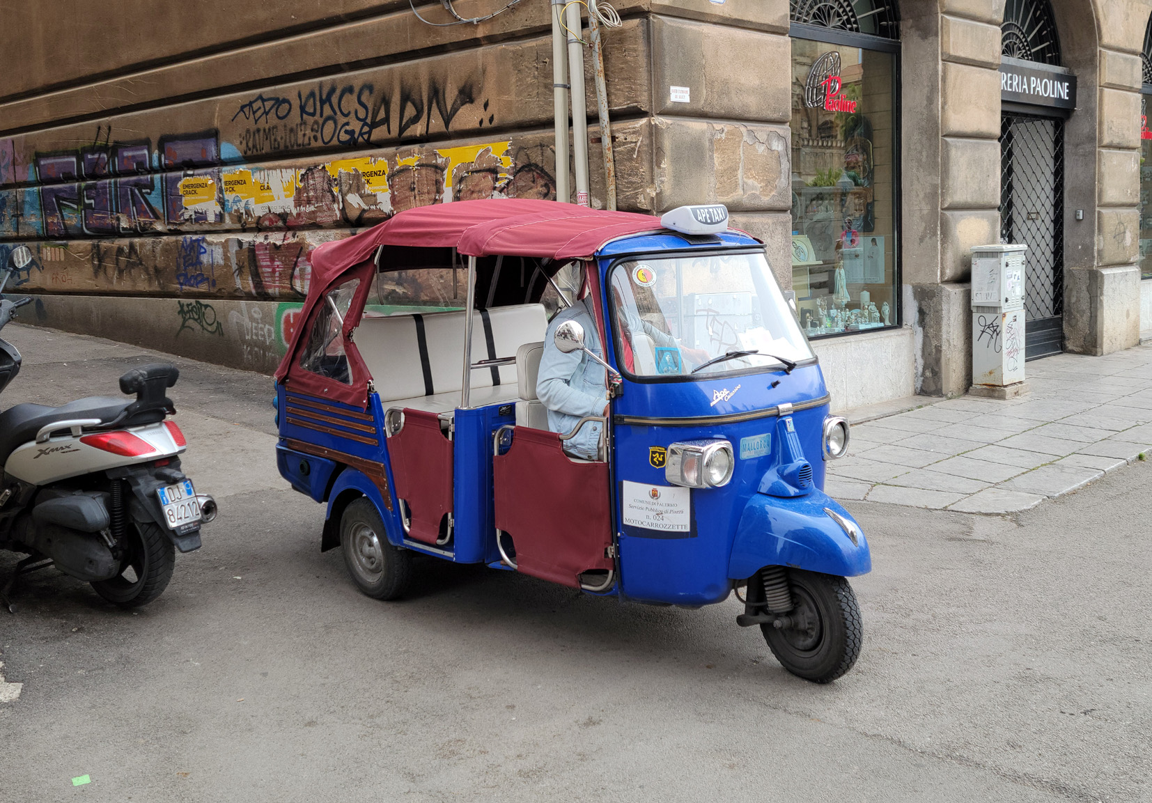
How To Get Around – The Appi Taxi – Palermo, Sicily
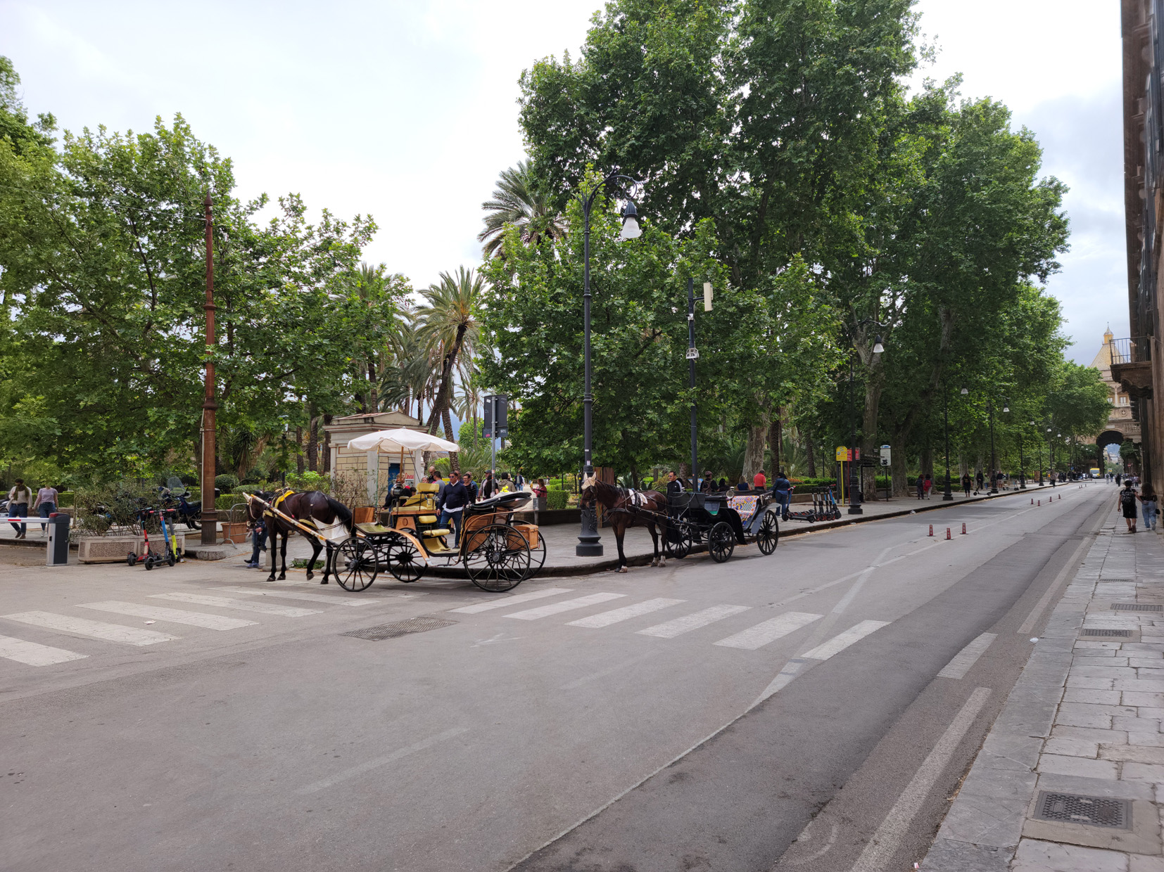
Horses – Via Bonnano – Palermo, Sicily
Porta Nuovo – Palermo, Sicily
Marmoreo Theater – Palermo, Sicily
Side Street – Palermo, Sicily
Side Street – Palermo, Sicily
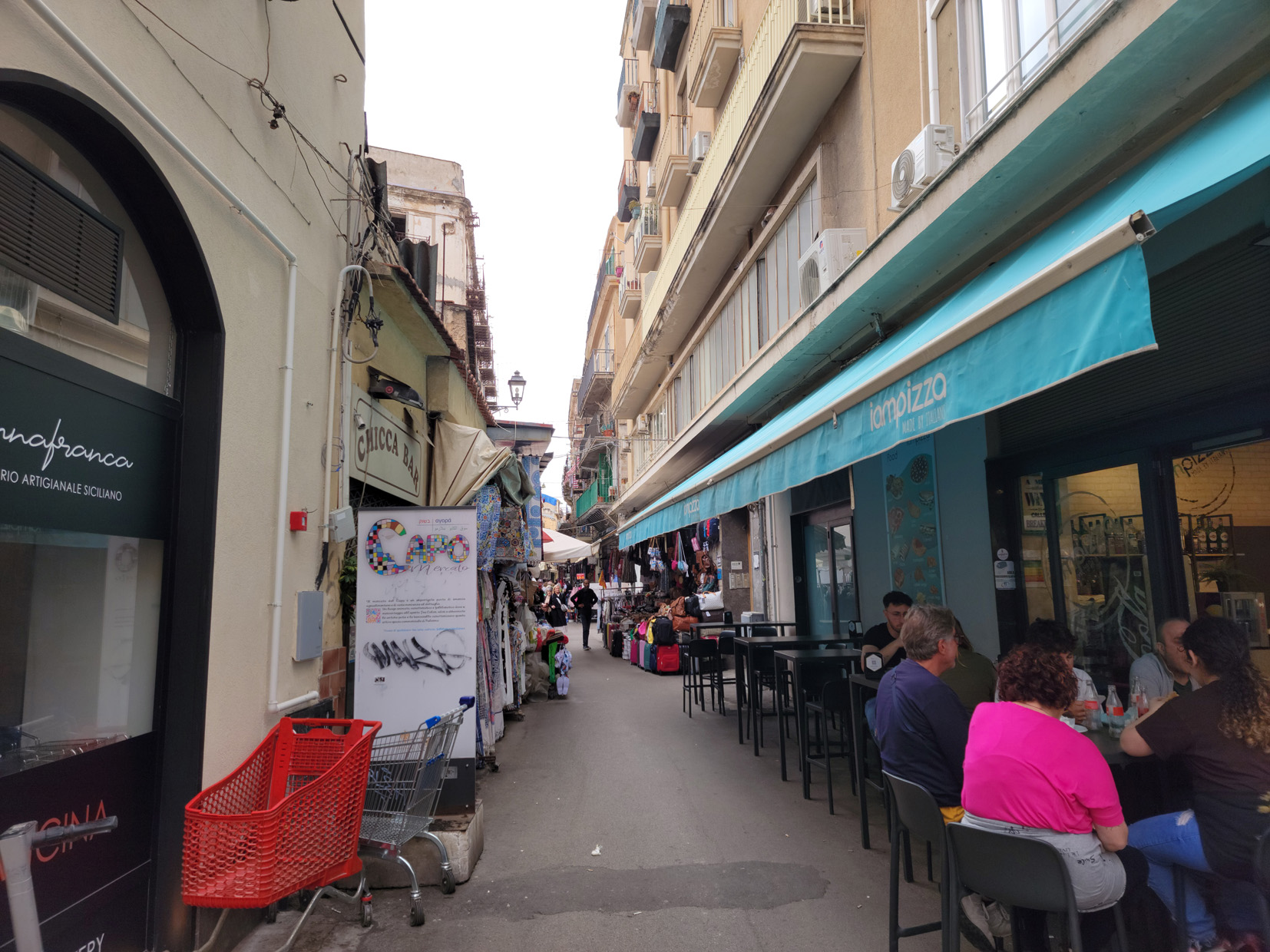
Market on via Ballero – Palermo, Sicily
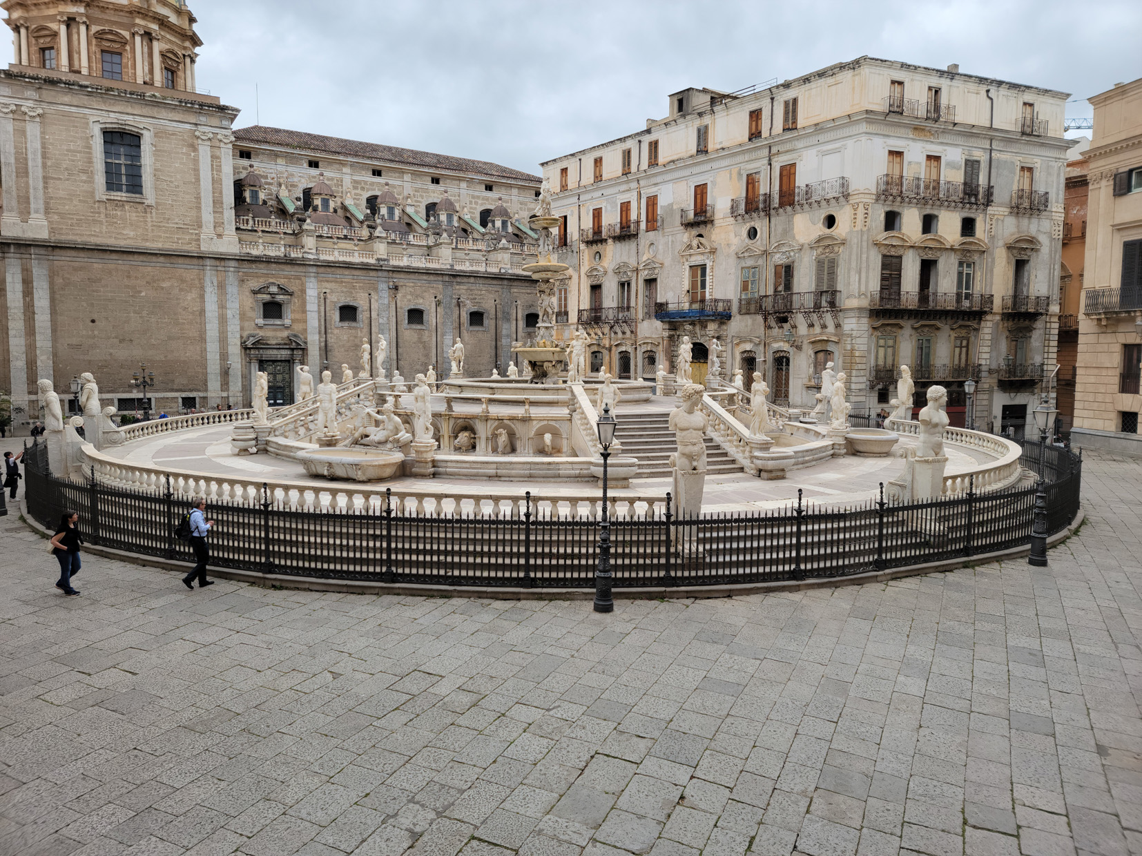
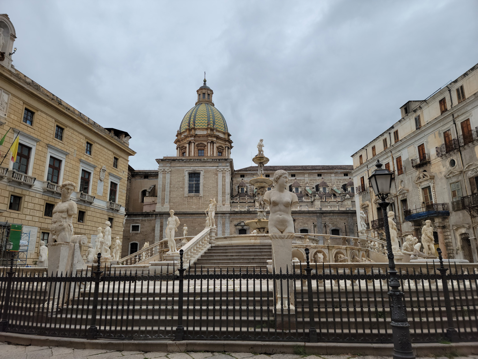
Piazza Pretoria and Fountain – Palermo, Sicily
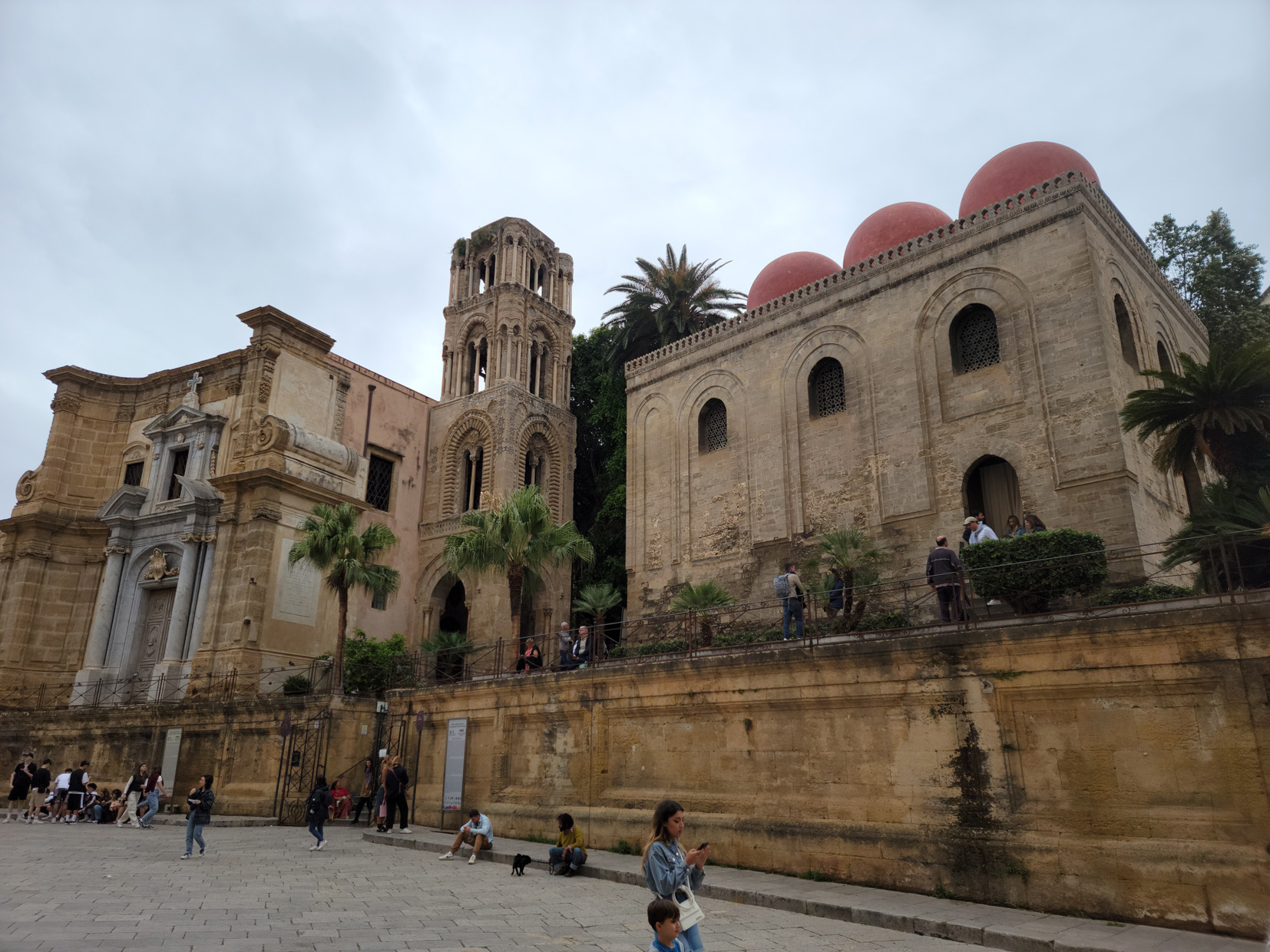
San Caltaldo Church – Palermo, Sicily
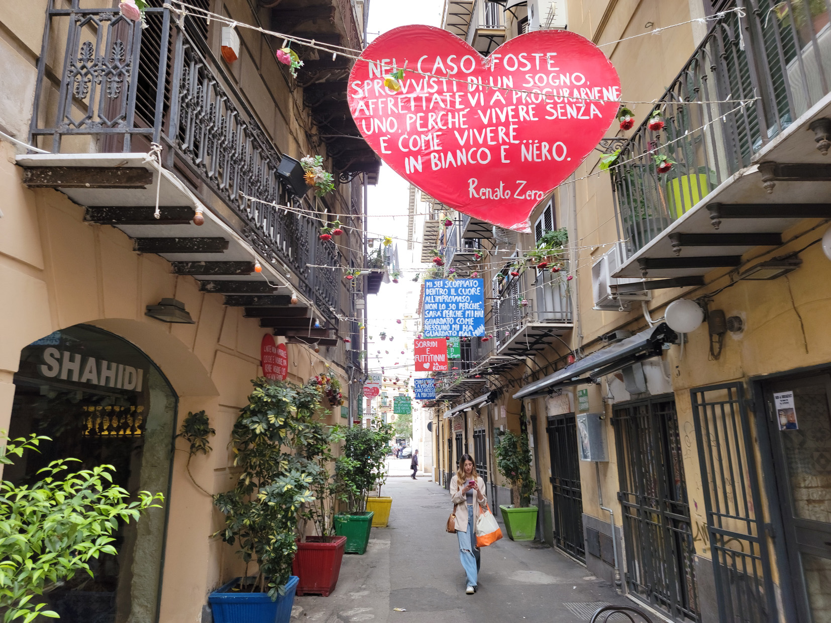
Street with Crazy Signs – Palermo, Sicily
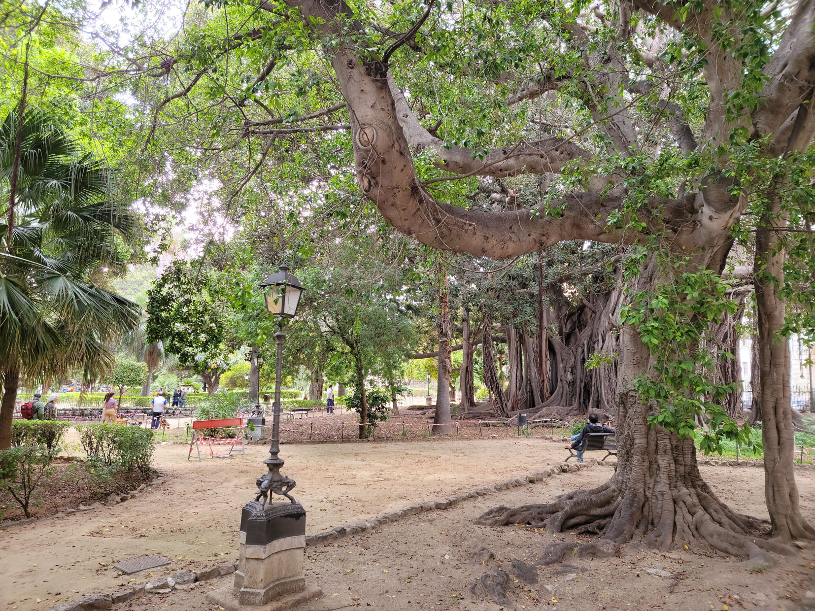
Garibaldi Park – Palermo, Sicily
Old Australian Banyan Tree – Ficus Macrophylla – Garibaldi Park – Palermo, Sicily
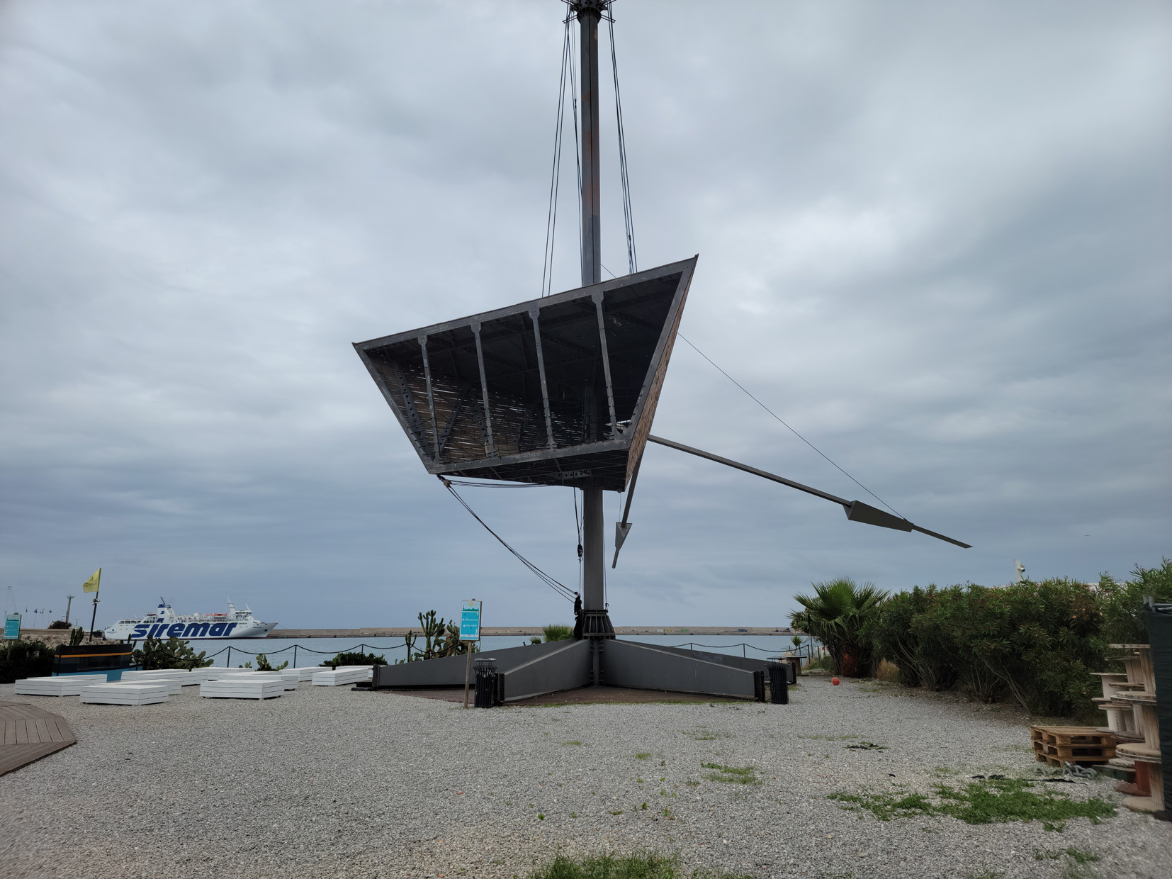
Odd Structure – Nauto – Palermo, Sicily
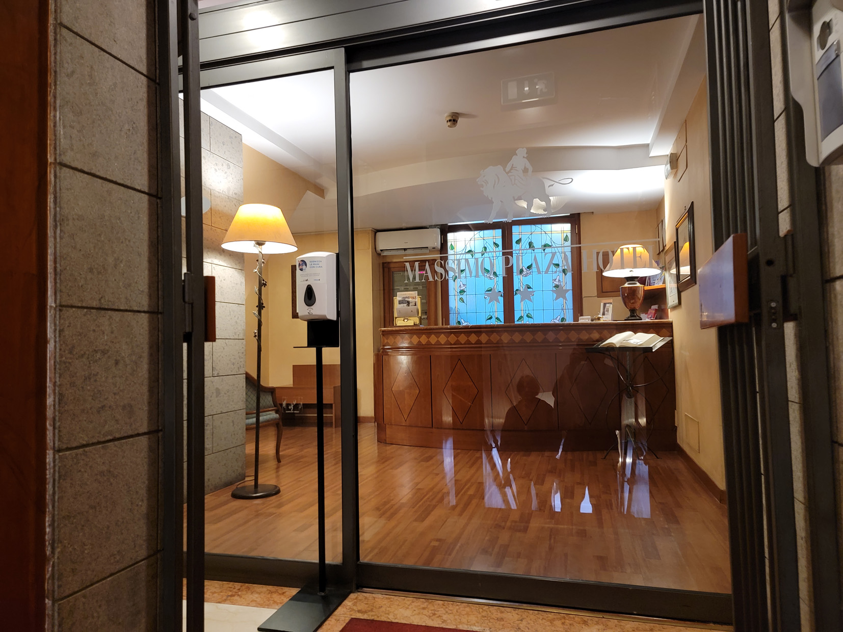
Hotel Massimo Plaza
Situated in the Piazza Massimo, almost at the start of the pedestrian zone on via Maqueda, was our unassuming hotel, Hotel Massimo Plaza. The staff was very helpful and our breakfast was served in our room, which we often find very helpful, especially when the weather is not cooperating, like it wasn’t on this trip.
Our Hotel – Massimo Plaza Hotel – Piazza Massimo – Palermo, Sicily
Restaurants
In our short stay in Palermo, we found the following restaurants noteworthy. The cuisine of Palermo is typical for a southern Italian port city, most restaurants having plenty of fish and seafood on the menu. However, there are plenty of pizza places and small cafes as well, where one can purchase smaller items for takeout or to eat as they walk.
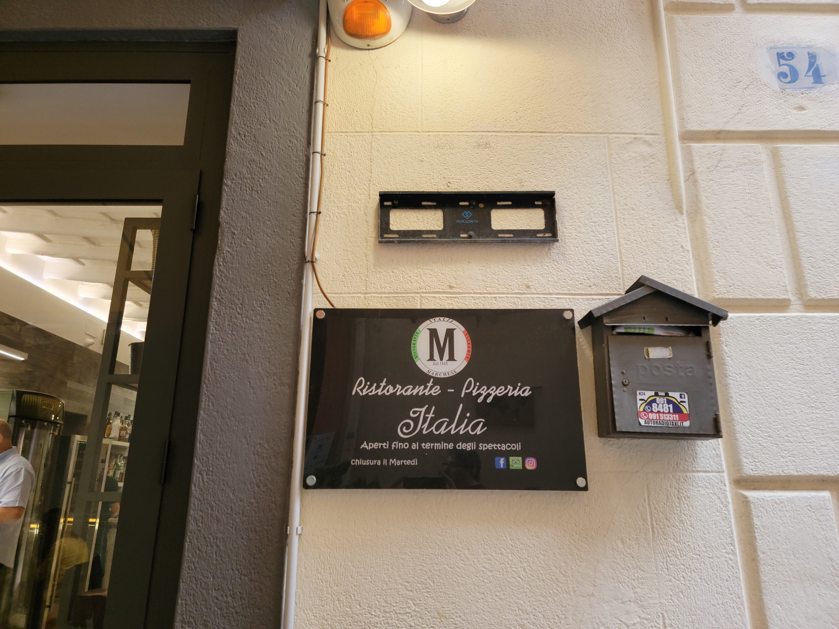
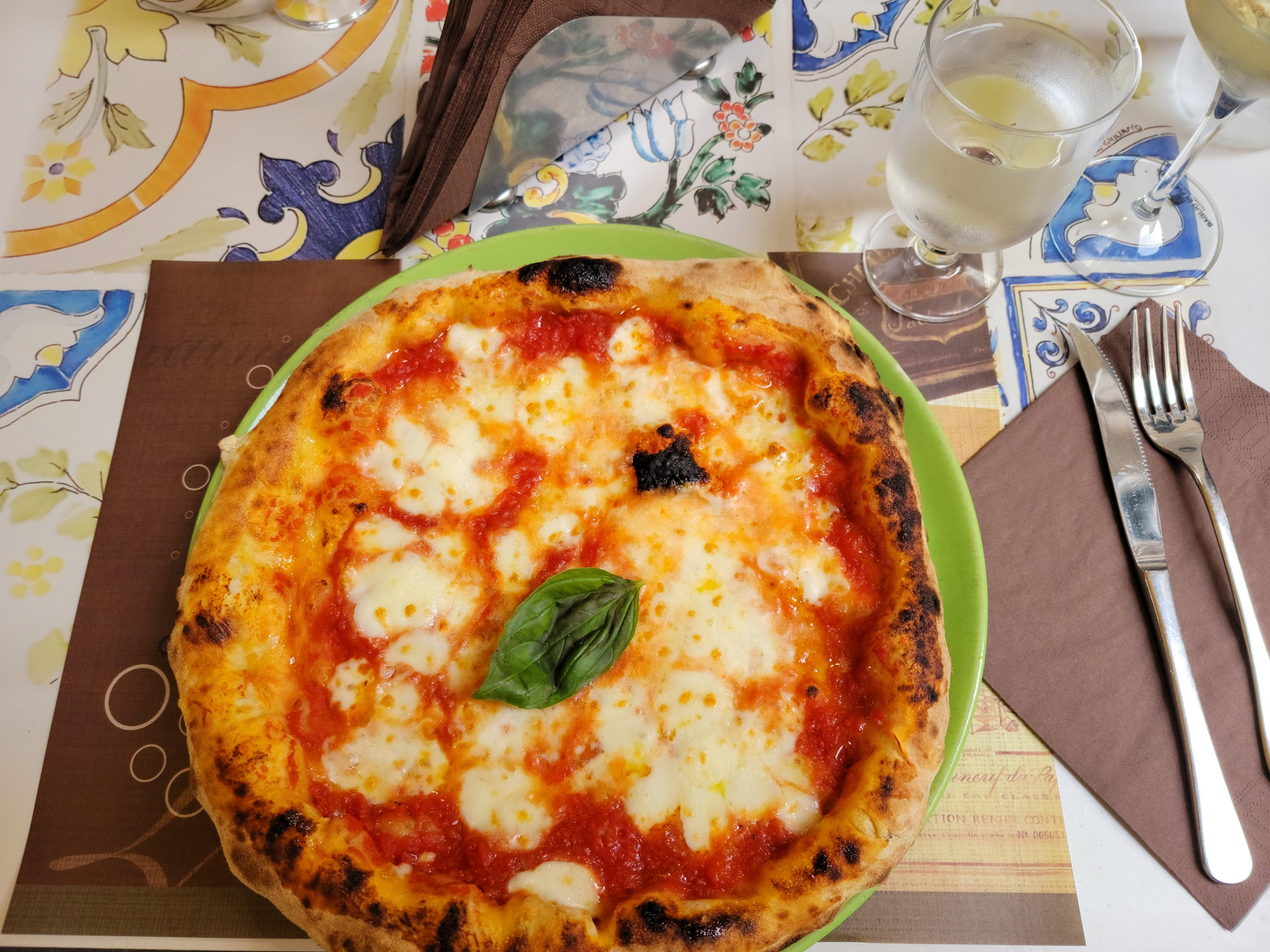
Ristorante Pizzeria Italia
This restaurant was just around the corner of our hotel and offers authentic and excellent southern Italian pizza. You may see the term pizze in your travels, but do not be deterred, that is just the plural form in Italian for more than one pizza, it’s the same thing.
Ristorante Pizzeria Italia – via Orologio – Palermo, Sicily
We ordered a caprese and a pizza each, I had a glass of wine and we ordered a bottle of water and the bill came to 25€ with 4€ coperto.
Margherita Pizza – Ristorante Pizzeria Italia – via Orologio – Palermo, Sicily
On To Cefalu
After our short stay here, it was on to the real start of our trip, Cefalu. Although there is plenty more to see and do in Palermo, our trip itinerary did not allow us any more time here. So using our senior discount cards, we purchased two more Trenitalia tickets and we were on our way.
Palermo Central Station – Palermo, Sicily
In the event we do return, we plan to stay here longer and perhaps see more of the western portion of the island as well. Aside from the rain, we still had a pretty good time here and enjoyed the city of Palermo for its sites, cuisine and true grit.
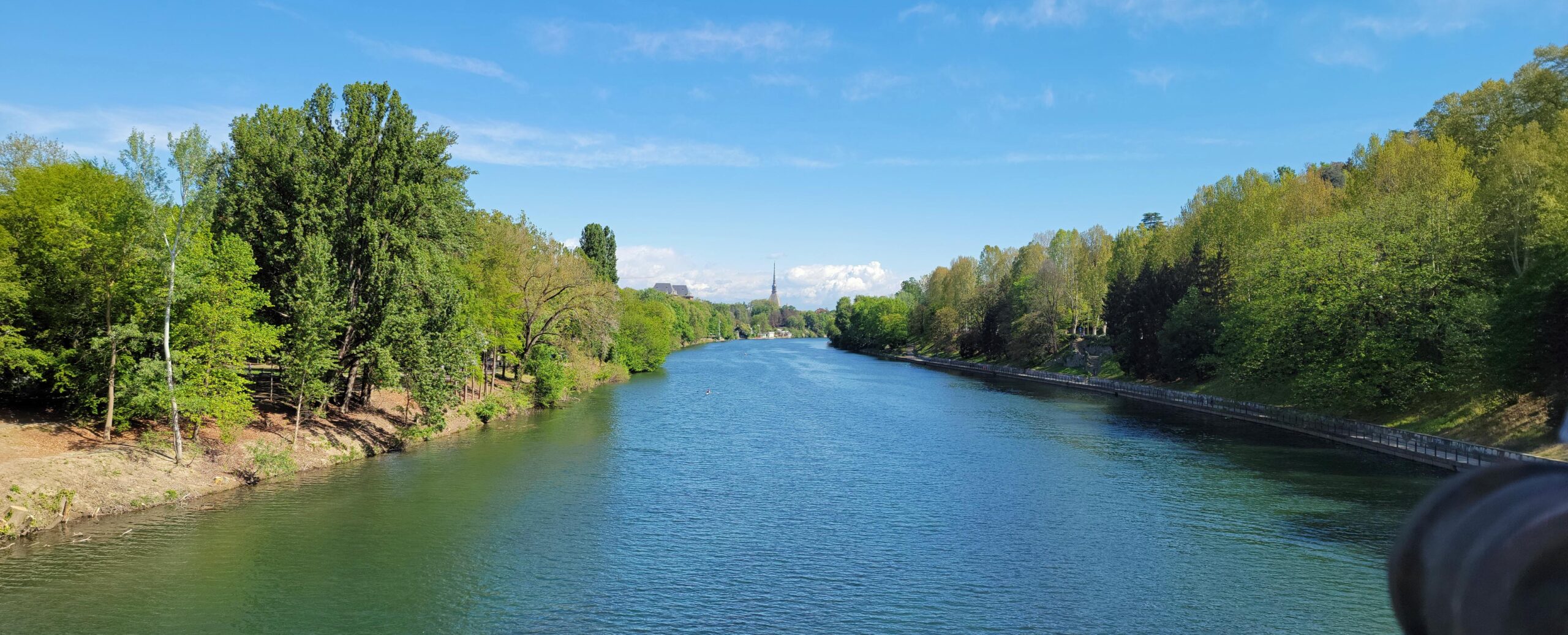
Perhaps one of the best times to visit Turin is in the spring. The wind is still blowing from the north, the rivers are full, the trees are in bloom and the swallows and swifts are returning from their long winter stay in Africa. We live close to the river and found you do not need insecticide here, just a healthy population of these birds and you will rarely be bitten.
Springtime – River Po – Turin, Italy
A great time to walk the city and visit its many restaurants and cafes as well as the river Po and Valentino Park. On weekends and holidays there is always activity on the river.
Restaurants
For my readers, some secrets that will help you beat the tourist lines in Turin at the other places and make your stomach very happy.
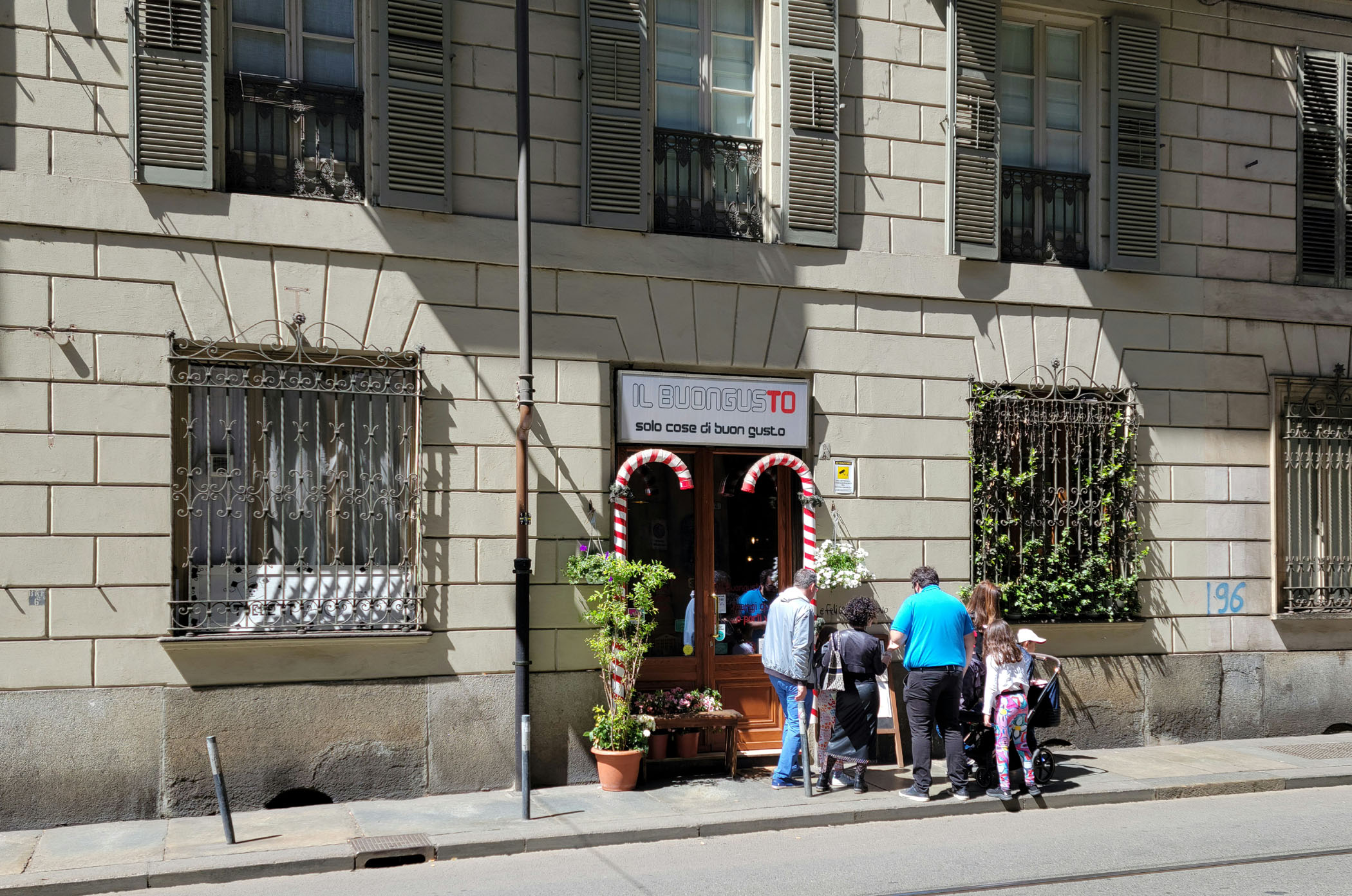
Il Buongusto
One of our new favorites and right around the corner from our apartment at via Alfonso Bonafous is the local secret, Il Buongusto. Definitely not for tourists, in fact I would encourage only those seeking a Piedmontese experience to drop in. Everything is fresh and made in the kitchen, which is actually open to the restaurant.
IL Buongusto – Turin, Italy
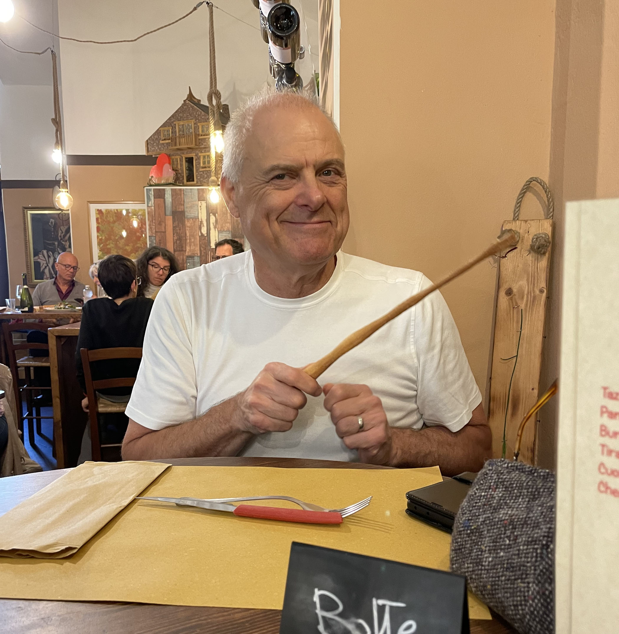
Be patient, gastronomy takes time and preparation. If you want to be in and out, select something like a salad and water, or frankly go to a fast food place on via Po. Good food takes time and this little restaurant gets very busy. When all else fails, use your Grissini fishing rod to reel in your waitress or waiter for more drinks.
Erick with Fishing Pole Grissini Torinesi – IL Buongusto – Turin, Italy
The food is very good, the prices are reasonable and the wine list satisfactory, so you can always select a reasonably good wine to keep you busy while waiting. The local house selection includes Dolcetto, Nebbiolo, or Barolo by the glass, which suffice nicely.
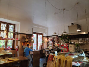
Inside – IL Buongusto – Turin, Italy
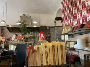
Kitchen – IL Buongusto – Turin, Italy
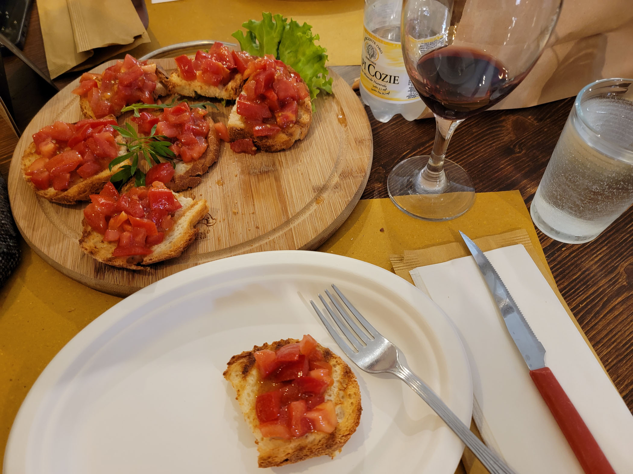
Speaking of which, if you really love tomatoes, order the Bruschetta. For the price you get about seven large pieces of bread covered with garlic infused tomatoes and basil, with an olive oil drizzle. Yum.
Bruschetta – IL Buongusto – Turin, Italy
Our food was cooked perfectly, the spaghetti sauce here is uncomplicated and delicious, the cook preferring the amazing Italian tomatoes to tell their own story. I love Italian pasta, um.
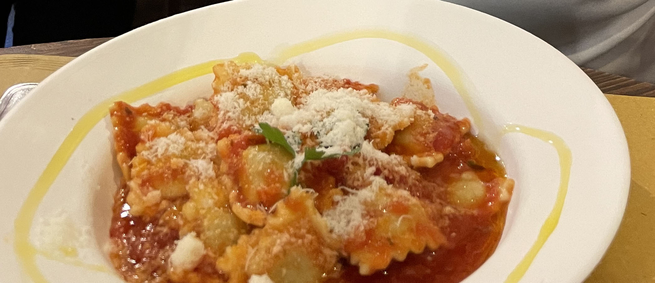
Agnolotti with Parmigiano – IL Buongusto – Turin, Italy
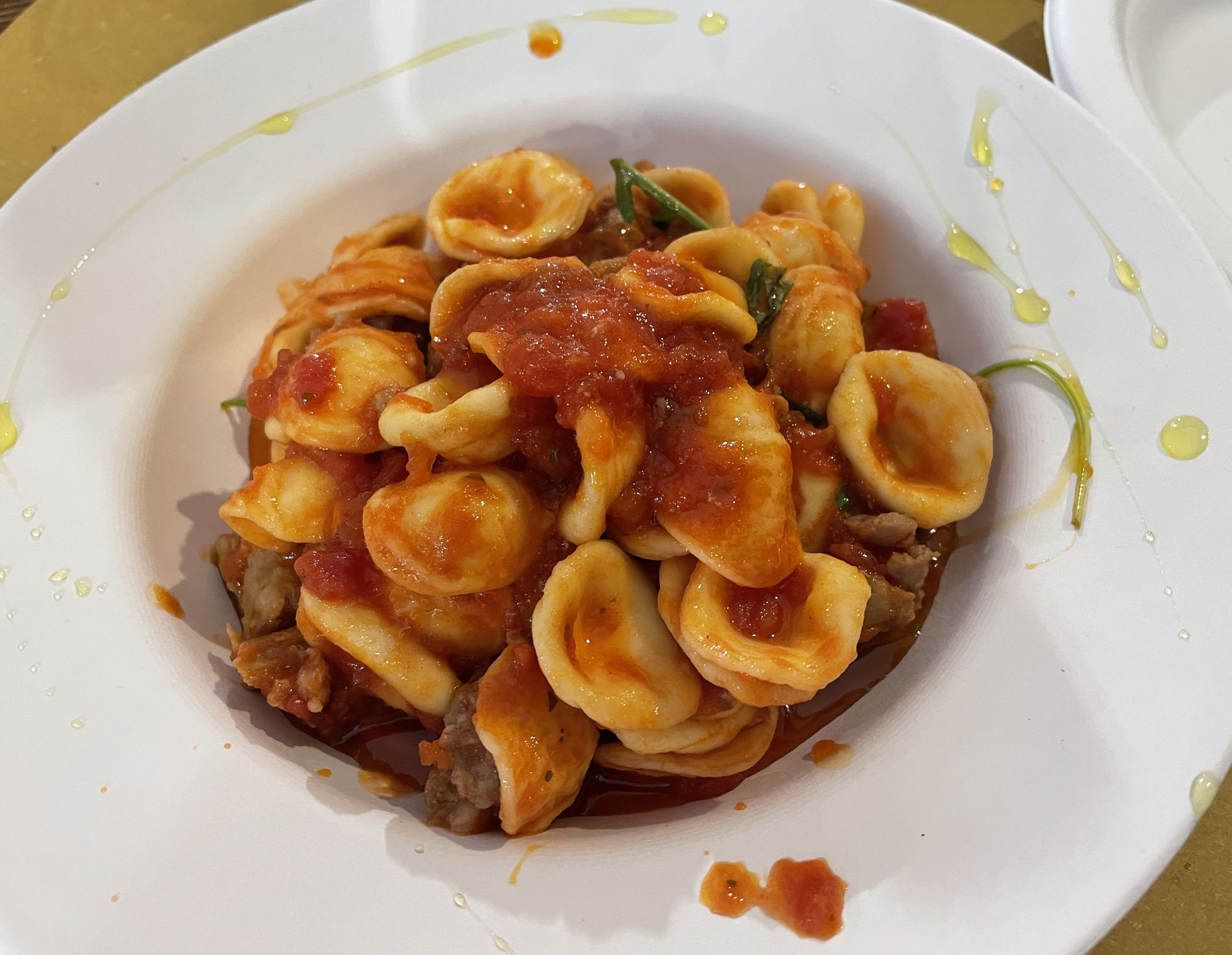
Orecchiette with Sausage – IL Buongusto – Turin, Italy
Lunch for (2) two: 30+ to 40+€
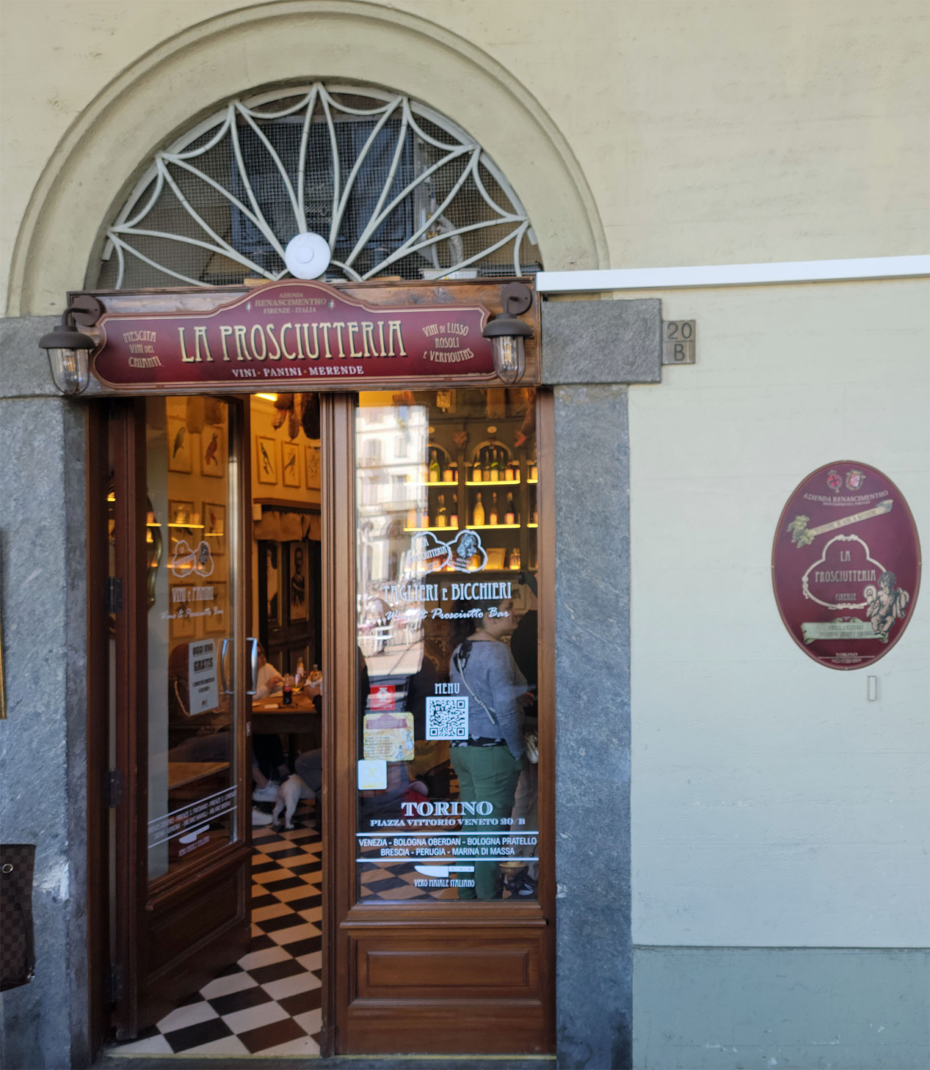
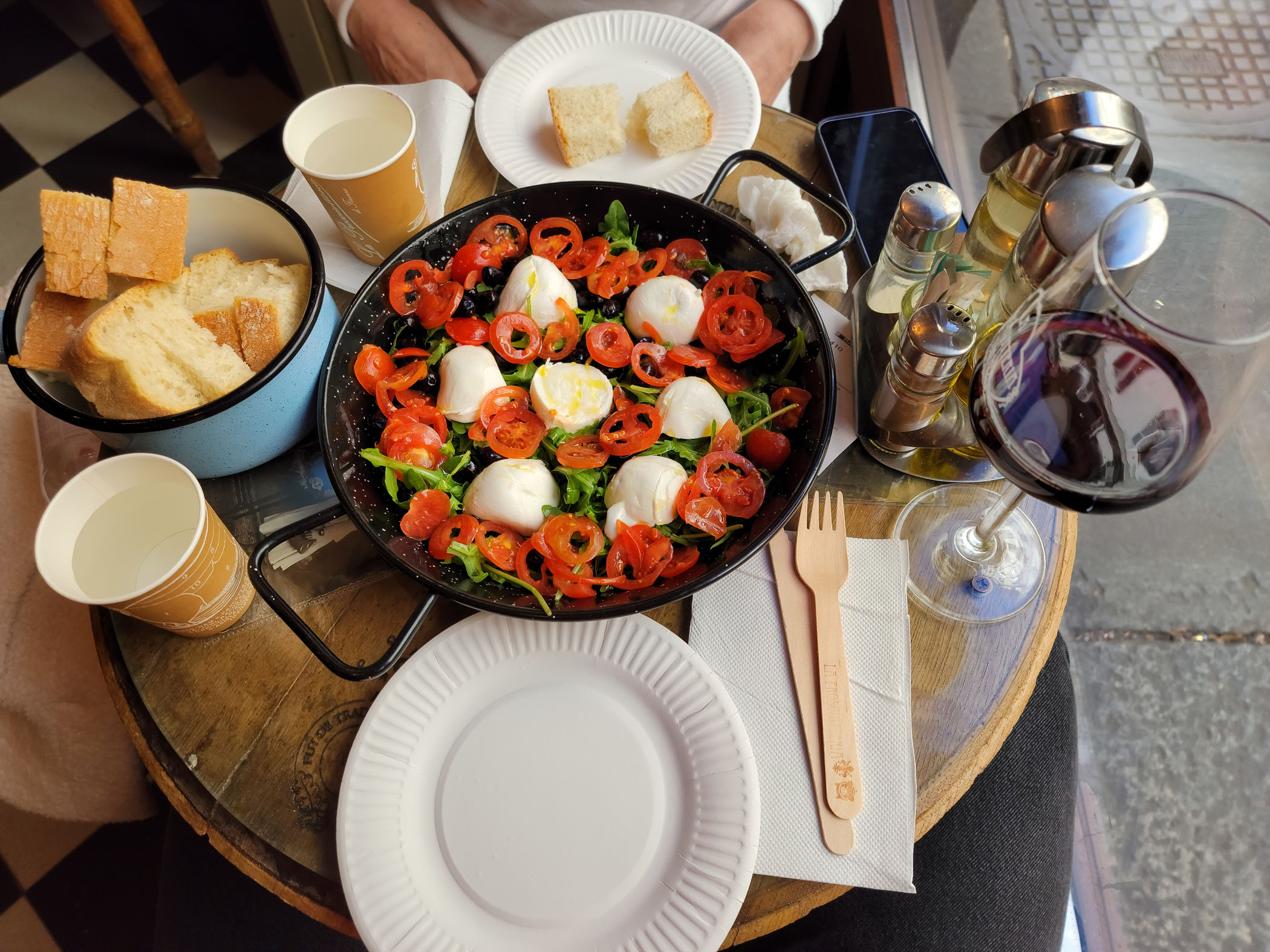
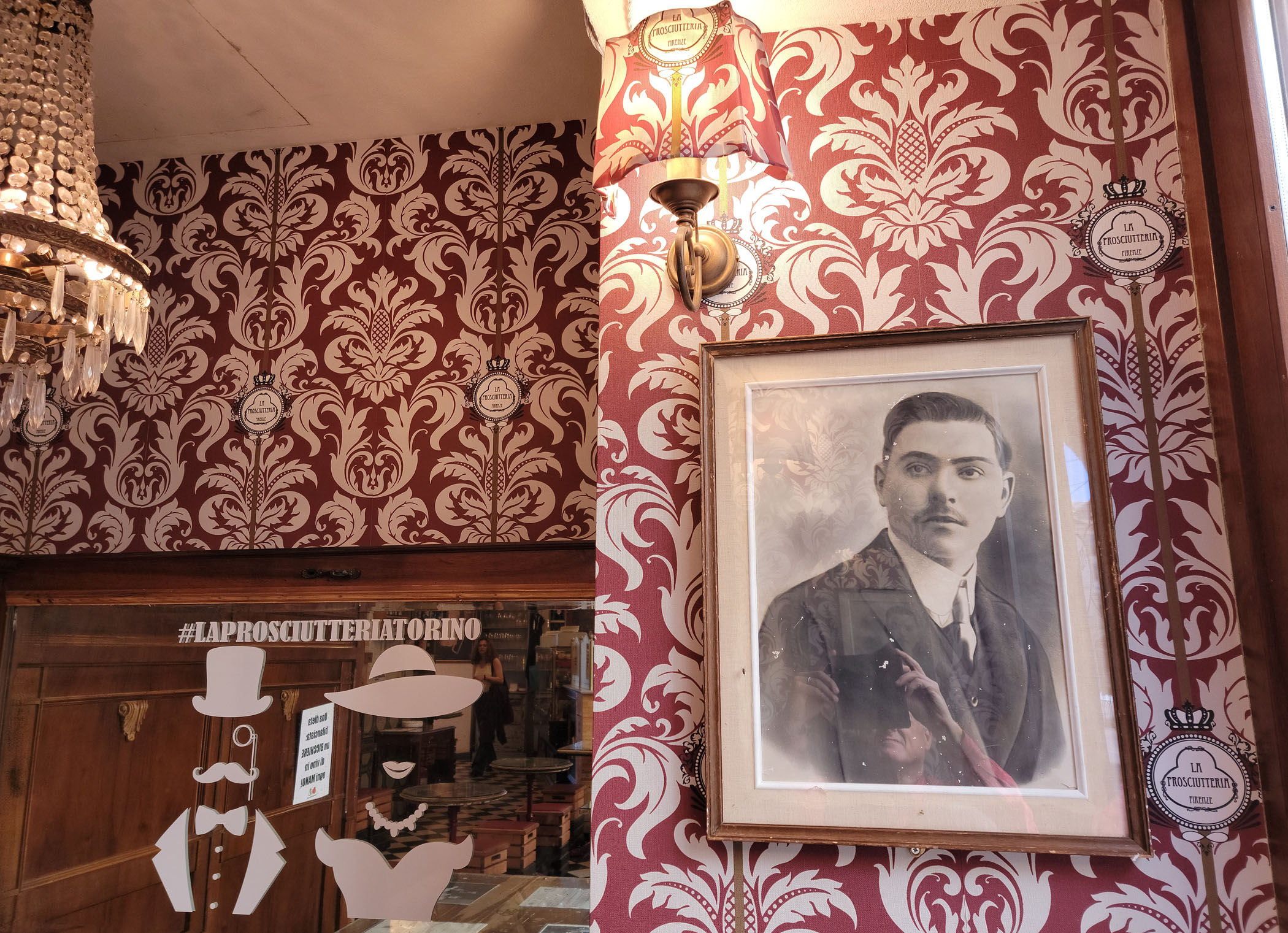
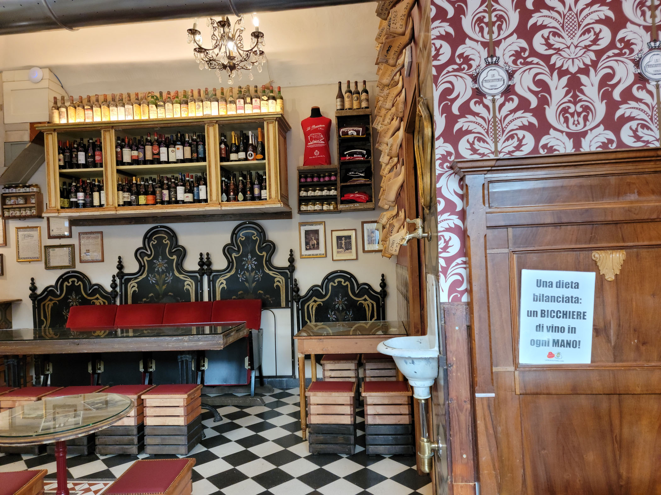
La Prosciutteria
On a lark and after a long walk through the Valentino Park and along the other side of the river, we tried La Prosciutteria on Piazza Vittorio Veneto and via Alfonso Bonafous.
Entrance – La Prosciutteria – Turin, Italy
We ordered water, wine, a bruschetta and a charcuterie board. The bruschetta was good, the little olives they used were very tasty.
Bread, Bruschetta and Brunello – La Prosciutteria – Turin, Italy
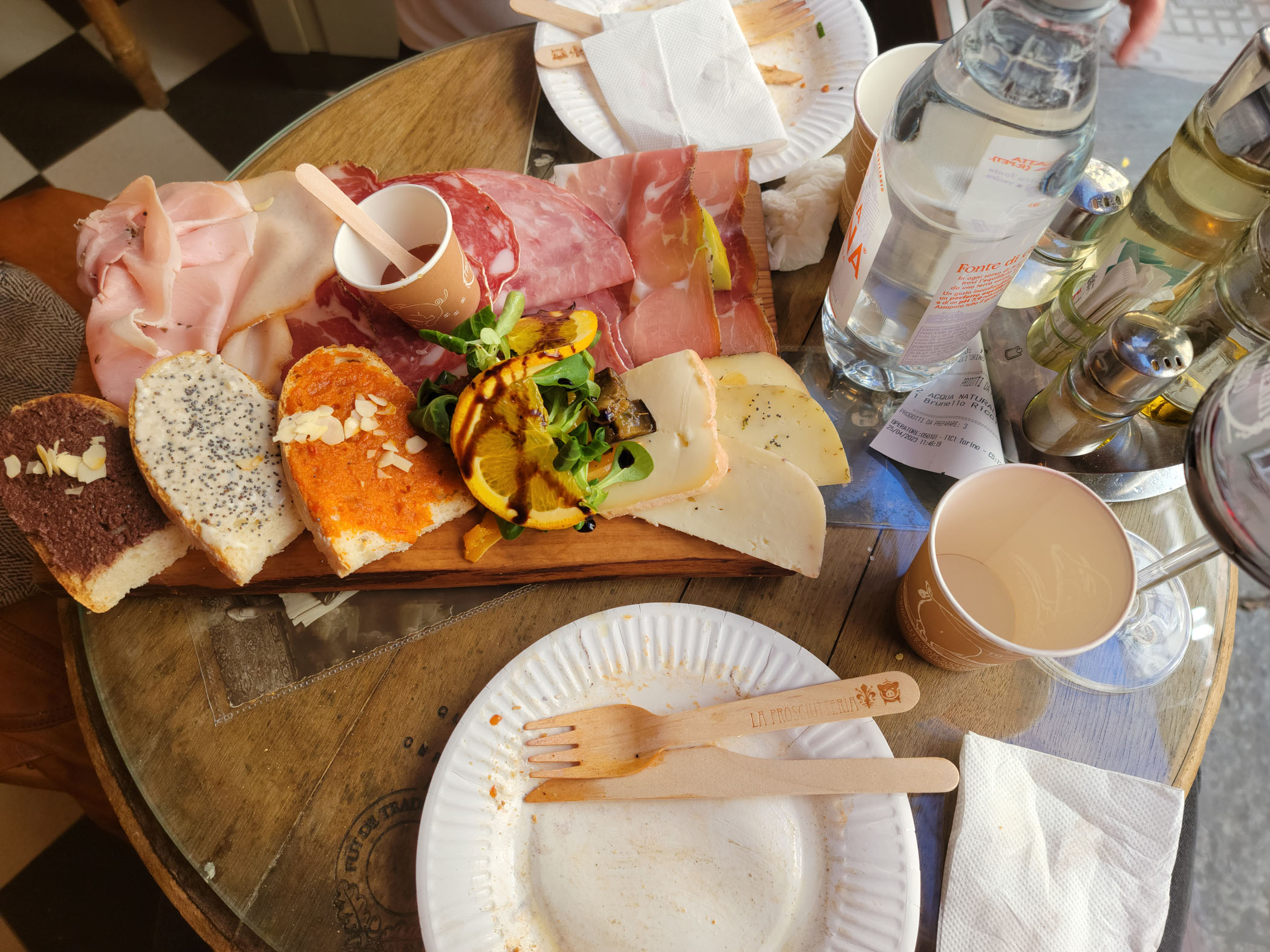
Charcuterie Board – La Prosciutteria – Turin, Italy
Though I am not a meat eater by nature, the charcuterie here is quite good, especially the Tuscan cheese selections. I would suggest trying the cheeses first au natural, many are exceptional and have delicate flavors. Smearing the honey they provide I found masked their flavors, since none were blue cheeses and were not very strong. The honey by itself was delicious and would be great with a Roquefort, a Blue or similar cheese, but not much with the ones we were given.
Charcuterie Board – La Prosciutteria – Turin, Italy
Back Wall – La Prosciutteria – Turin, Italy
Esoteric Inside – La Prosciutteria – Turin, Italy
In the end our bill was a bit on the high side, but not bad for a place on the Piazza Vittoria Veneto. Below is an example of what you can expect for two people. The two glasses of wine being the most expensive, similar to what you would find in the States now (it was never like this before, some prices are crazy, though I would say most glasses of local wines are frequently around 4-5€).
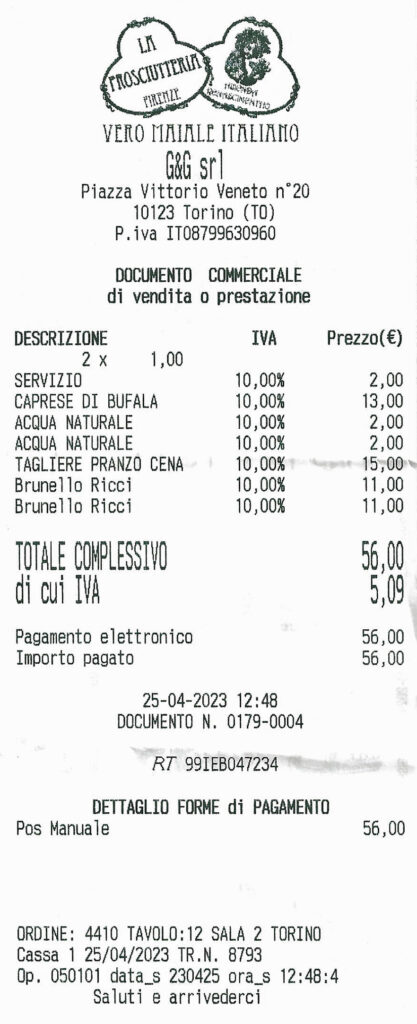
Il Konto (Our Bill) – La Prosciutteria – Turin – April 2023
To return to Turin this year, we chose to depart from the Raleigh-Durham area using Delta Airline’s RDU (Raleigh Durham International airport) to CDG (Paris Charles de Gaulle airport, located in Roissy-en-France) flight, as we had done occasionally before Covid-19 hit the world and Delta subsequently cancelled the service. Now that Covid-19 is more or less forgotten, let’s just say travel is back in full swing and with it – other changes, delays and of course cancellations. So if you are planning any international travel this year to Europe or anywhere for that matter – grit your teeth, hold onto to your hats and try to be flexible.
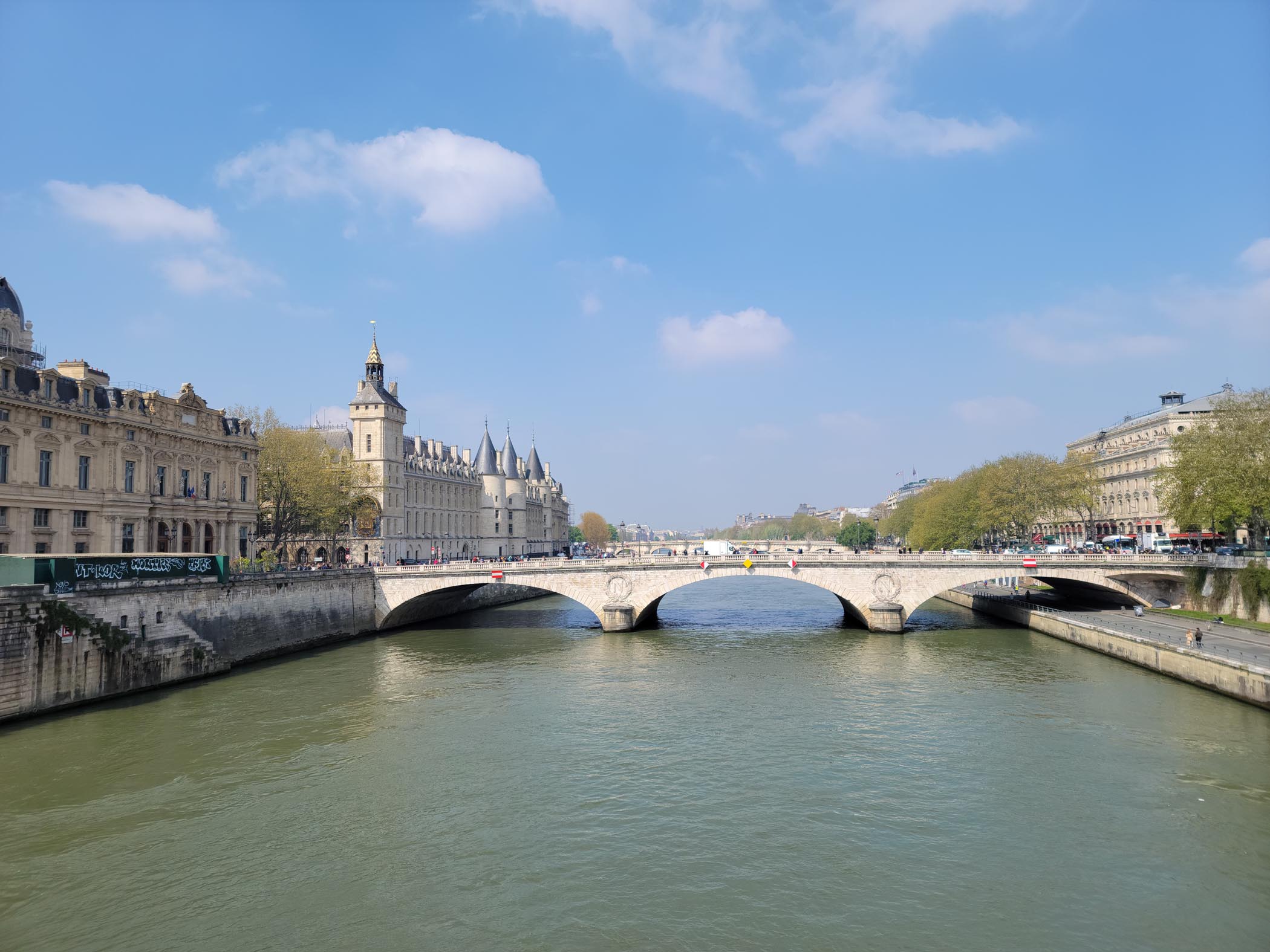
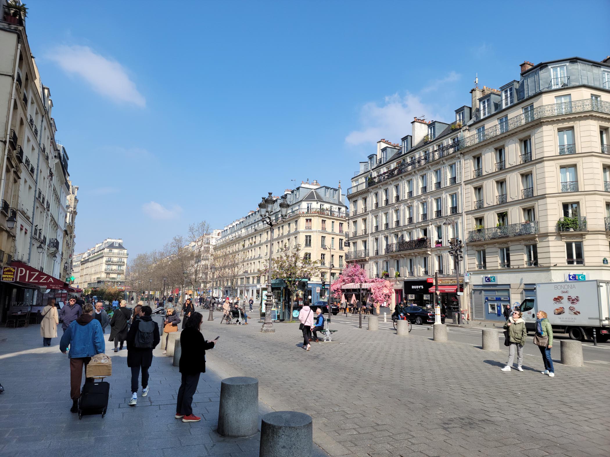
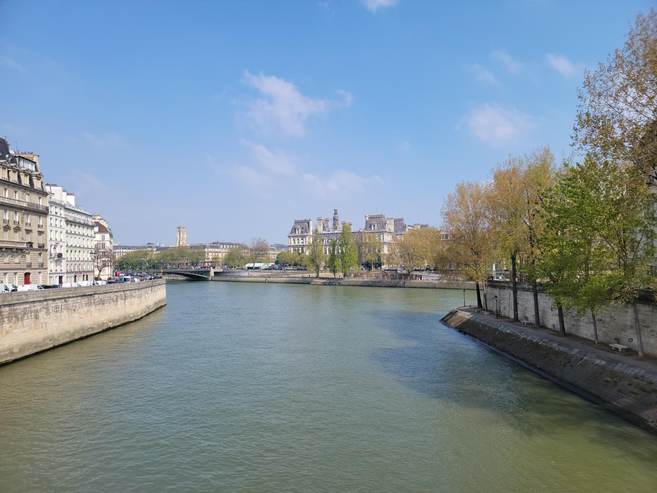
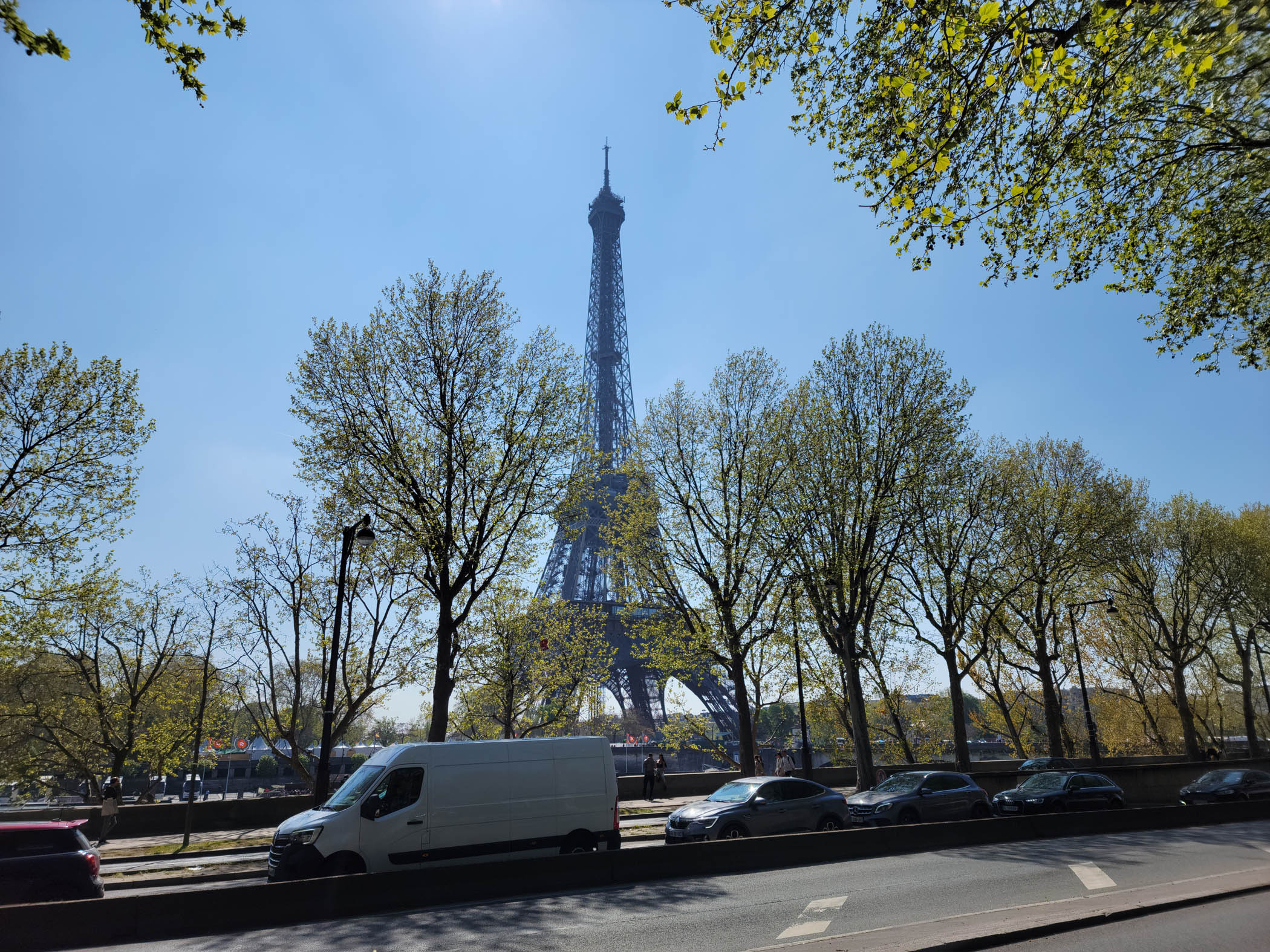
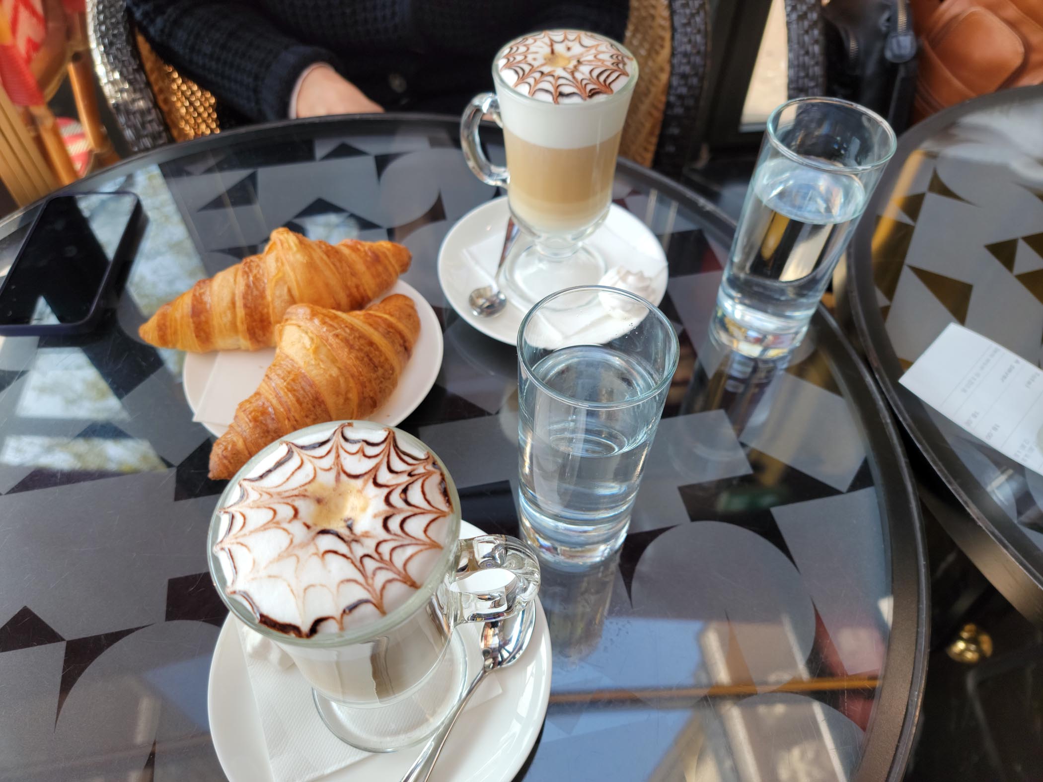
River Seine – Pont Marchand and Pont Neuf (behind) – Paris
The Disadvantages Of Flying From A Small International Hub
One of the major disadvantages of flying out of a minor or small international hub like RDU, is that, if there is any type of problem, any delay longer than an hour or so, especially due to a mechanical issue, can and often do become cancellations. This happened to us early last week after we boarded our plane. About ten minutes after being on board, Delta discovered what they thought was a refrigerant condensation leak, which in the end turned out to be a fuel leak. Really?! The plane had landed hours before and was being turned around for its return trip and they discovered this issue only moments before we were planned to take off. My wife and I could not believe what we were hearing. In fact, the flight crew were also so surprised, the pilot came out to address us personally and answered any questions.
Well I guess it’s better they discovered the issue before we left, then while we were over the Atlantic. It just makes one wonder if we should be worrying more about the inspection schedules of these aircraft, regardless of their safety records. In any event, our delay of one hour turned into three hours, then five and then they finally cancelled to flight within an hour of the first announcement. The primary reasons; no spare flight crews available locally and they could not fix the plane in Raleigh.
Luckily, we had already left the gate and decided to get our luggage pulled from the plane, which is a long story in and of itself (we ended up only getting one and had to come back the next day for the other one). Even after getting the jump on everyone else, we still left the airport around midnight to return our son’s apartment and rescheduled our flight out a week (Delta was not pleased with us, but it was their fault and they still paid with extra points, etc.).
Six days later we arrived in Paris without incident and took a taxi into the city to our hotel. Since we are IHG members we booked and stayed at the Holiday Inn – Gare de Lyon. Rated a four star hotel, it is more likely a three star hotel posing as a four star. We have stayed at many privately run three star hotels that were better run and better appointed. However, it was clean, the rooms are fairly spacious and there is easy access to the metro and plenty of restaurants nearby. Moreover, it is away from the most tourist visited areas of the city. Given all this, I still would NOT recommend it. There have to be better hotels and choices available, if one has the time to look. Plus it is missing some important amenities for an American hotel, if you look close enough to notice.
Tickets For Two, Metro – Paris
Though we took a taxi from and to the airport, I would recommend the RER instead. Traffic in Paris is a nightmare. Though the taxi is not in itself expensive, the travel time will be at least an hour each way. Almost all the roads coming into Paris on many phone map apps will be red or worse yet, dark red, and for twenty or so minutes of our ride we were motionless.
Paris – The City of Light
Our original plans were to spend a week in Paris, but with our cancellation, those plans had to be altered and we only got to spend two days. However, with all of uproar over raising the retirement age here and the never ending threats of strikes, train and venue cancellations, and all of the protesting; it was probably a good idea to cut this trip short and just plan it for another time. In any event, since I have already been to Paris a few times, I was able to show my wife a few of the most notable sightseeing locations, while occasionally enjoying the food.
The Bastille – Paris
Our Short Tour Of The City
The city is eminently walk-able and has an excellent metro. The metro can take you almost anywhere and everywhere you want to go, including back to the airport via the RER. However, in order not to miss anything, you will find walking the best option. We found walking out and taking the metro in between to be the best combination.
Rue de Rivoli – Paris
The Seine and Hotel de Ville – Paris
Hotel de Ville – Paris
House of the Moyen Age – Paris
House of the Moyen Age, Closeup – Paris
Rue Francois Miron, House of the Moyen Age – Paris
The Champs Elysees
This large boulevard is a common venue for the final day of the Tour de France. With its rectangular trimmed trees along each side and four lanes of traffic, it connects two of the city’s main points of interest – the Arc de Triomphe and the Place de la Concorde.
Champs Elysees – Paris
Arc de Triomph – Paris
The Eiffel Tower
Unfortunately we were unable to see the tower at night due to scheduling constraints, and even then, only at a distance. Even from across the Seine it is still impressive.
The Eiffel Tower – Paris
Notre Dame
Yet another reason to come back at a later time, the poor Notre Dame, victim of a senseless fire, being reconstructed. Being complacent about anything, will always get you in the end. Yet sometimes to get politicians to act on anything requires a tragedy.
Construction, Notre Dame – Paris
Side Repairs, Notre Dame – Paris
Notre Dame – Paris
Restaurants and Cafes
Due to our shortened stay, we were only able to visit one restaurant of note and it wasn’t even French. However, we were able to stop at several small cafes for breakfast and lunch. All were reasonable priced and the food was very good.
Breakfast, Coffee and Croissants – Cafe Francais – Paris
Patti at a Cafe for Breakfast – Cafe Francais – Paris
Onion Soup, Lunch – Cafe Gribouille – Paris
Ristorante Spiga
A very small Italian restaurant a block away from our hotel on the Rue Parrot. It has very little room inside or out, so get there early.
Ristorante Spiga – Paris
The food is very good and ostensibly traditional Sardinian. Italians may find it odd that they have pasta dishes with meatballs, instead of separately. Not a show stopper for me, their sauce was very good and the pasta was cooked to perfection.
Ristorante Spiga – Paris
Rigatoni with Polpetti (meatballs), Ristorante Spiga – Paris
With the weather getting nicer, my son and I have been having amazing rides to Jordan Lake and back. Here are some of many rides in early 2023 that we have taken, these were especially great due to the beautiful weather we enjoy with modest temperatures in North Carolina.
Our Routes
The graphic below shows the basic route. We try to select roads based on overall condition, but we usually to go to Jordan Lake or that area and back.
Morrisville to Jordan Lake route
Our Rides
The below videos are from numerous rides we have taken thus far, especially when the route is a bit different. I will be updating this list, as we add new rides throughout the spring.