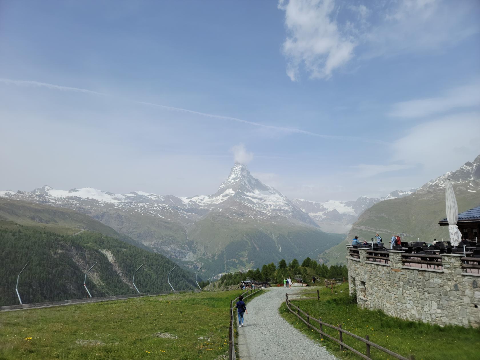
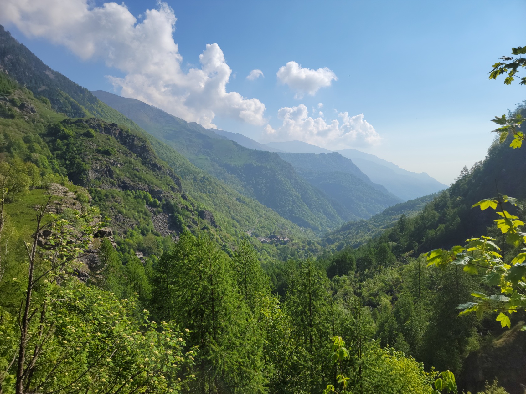
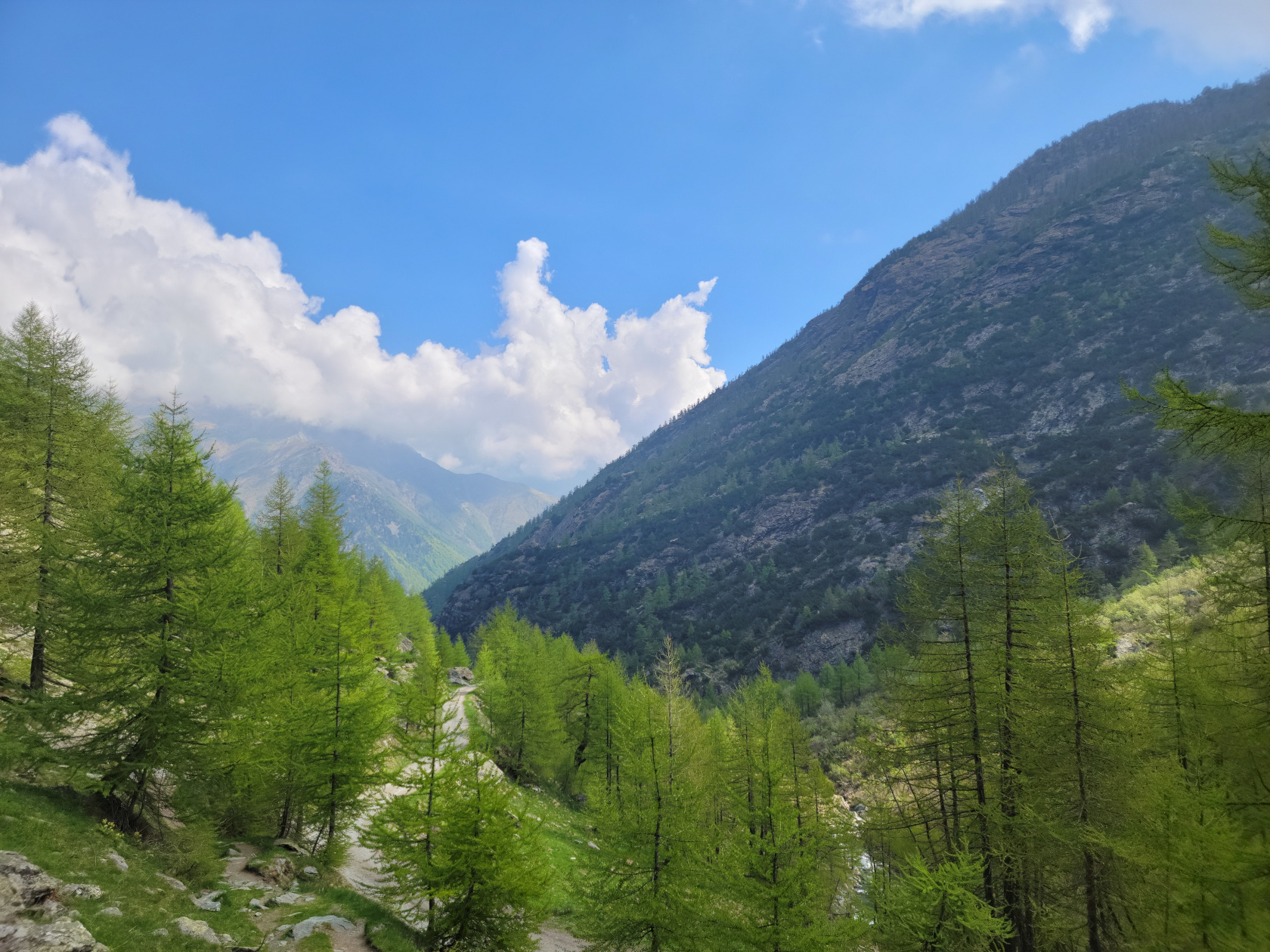
Part of the reason for even going to Zermatt has to be the hiking. Not only are the views breathtaking, even on a marginal day, but the air is fresh and clean and very enjoyable. And then there are the mountains, Zermatt has them and much more.
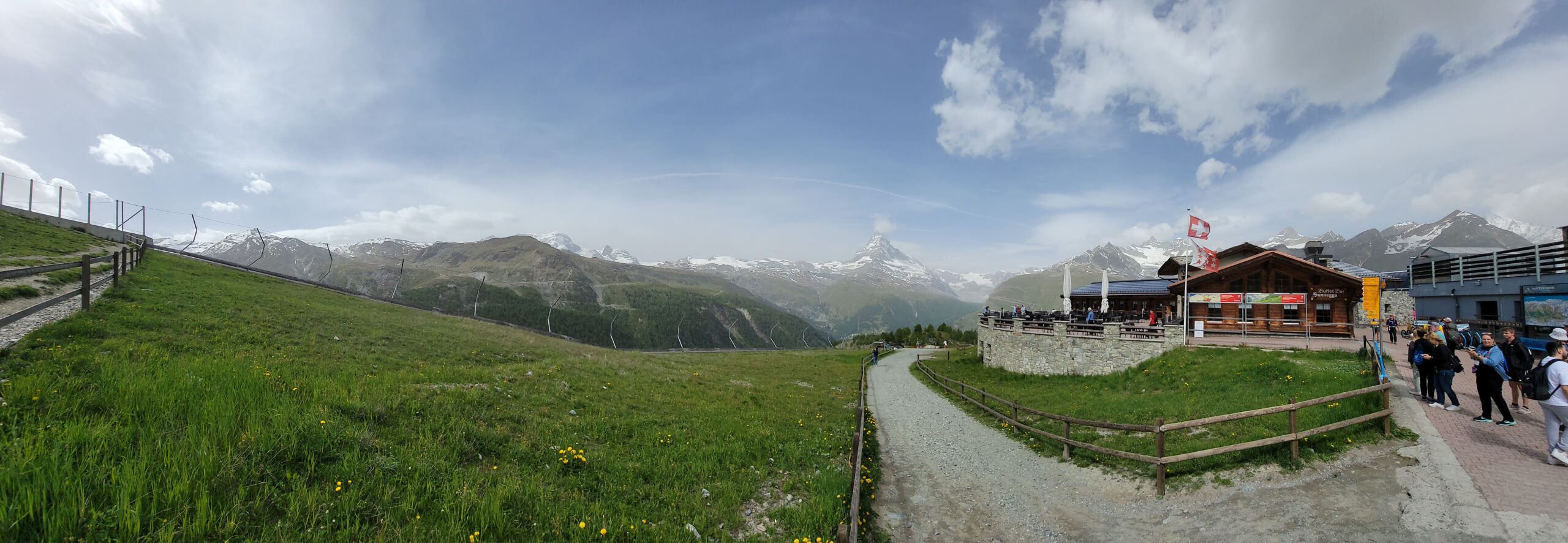
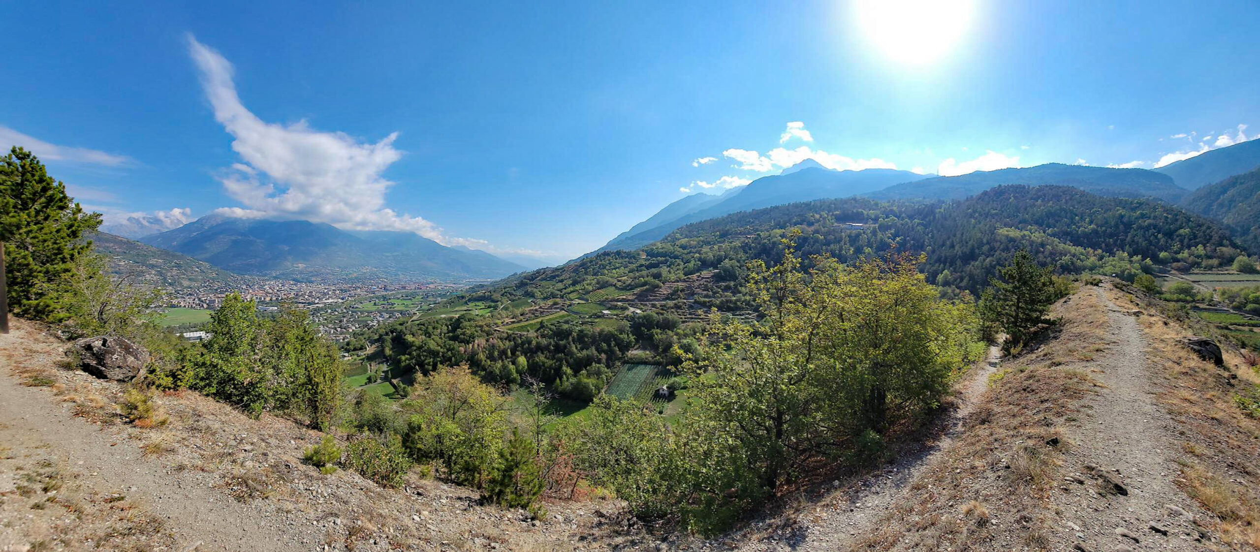
Panorama at Sunnegga – Zermatt, Switzerland
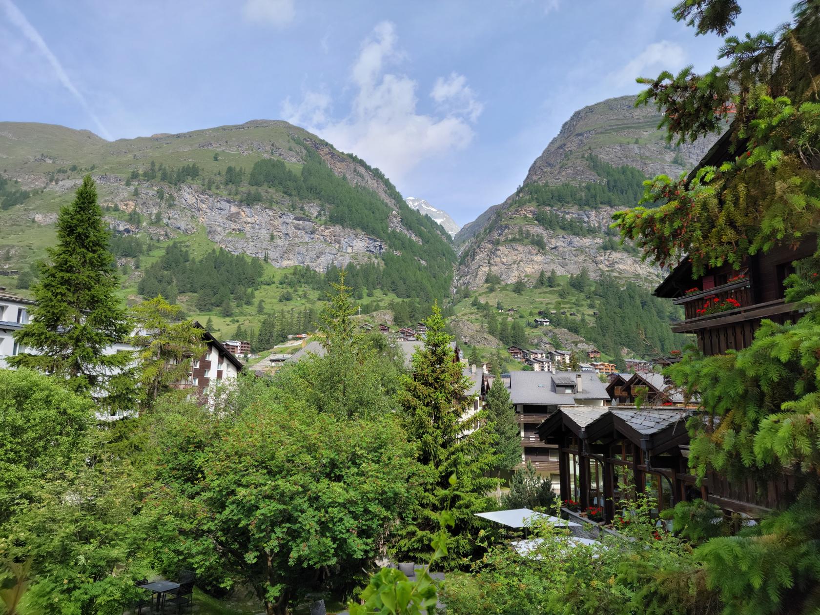
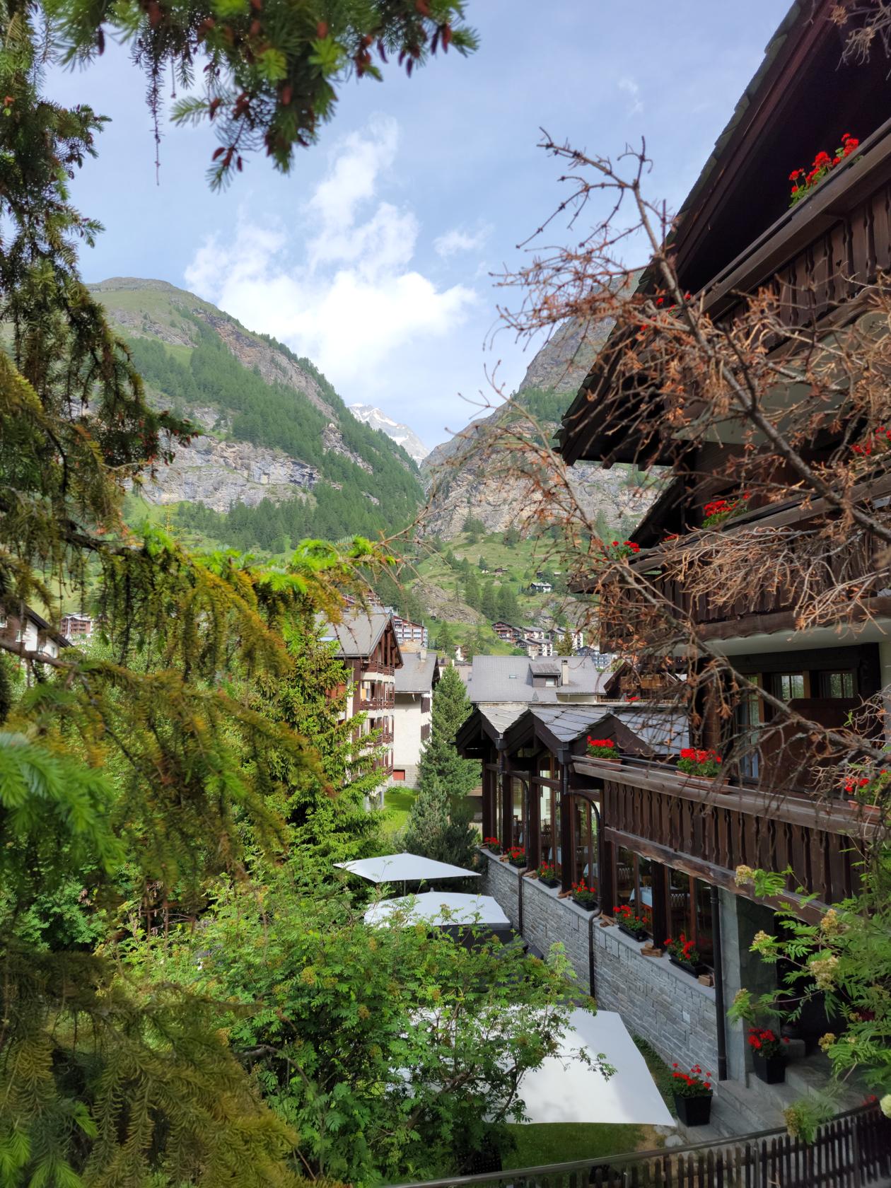
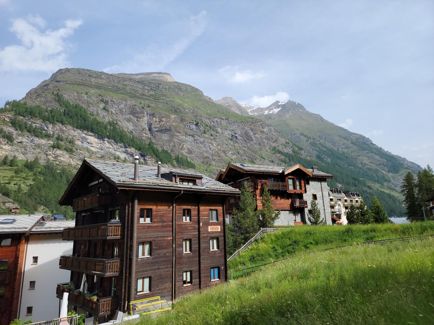
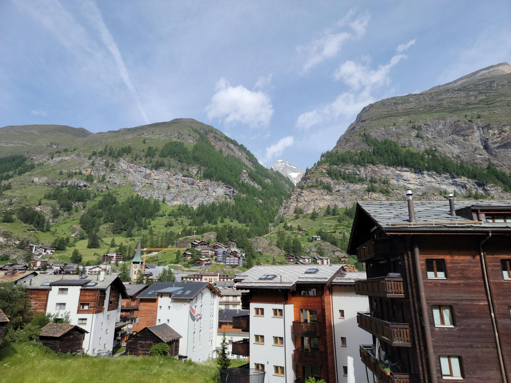
Zermatt
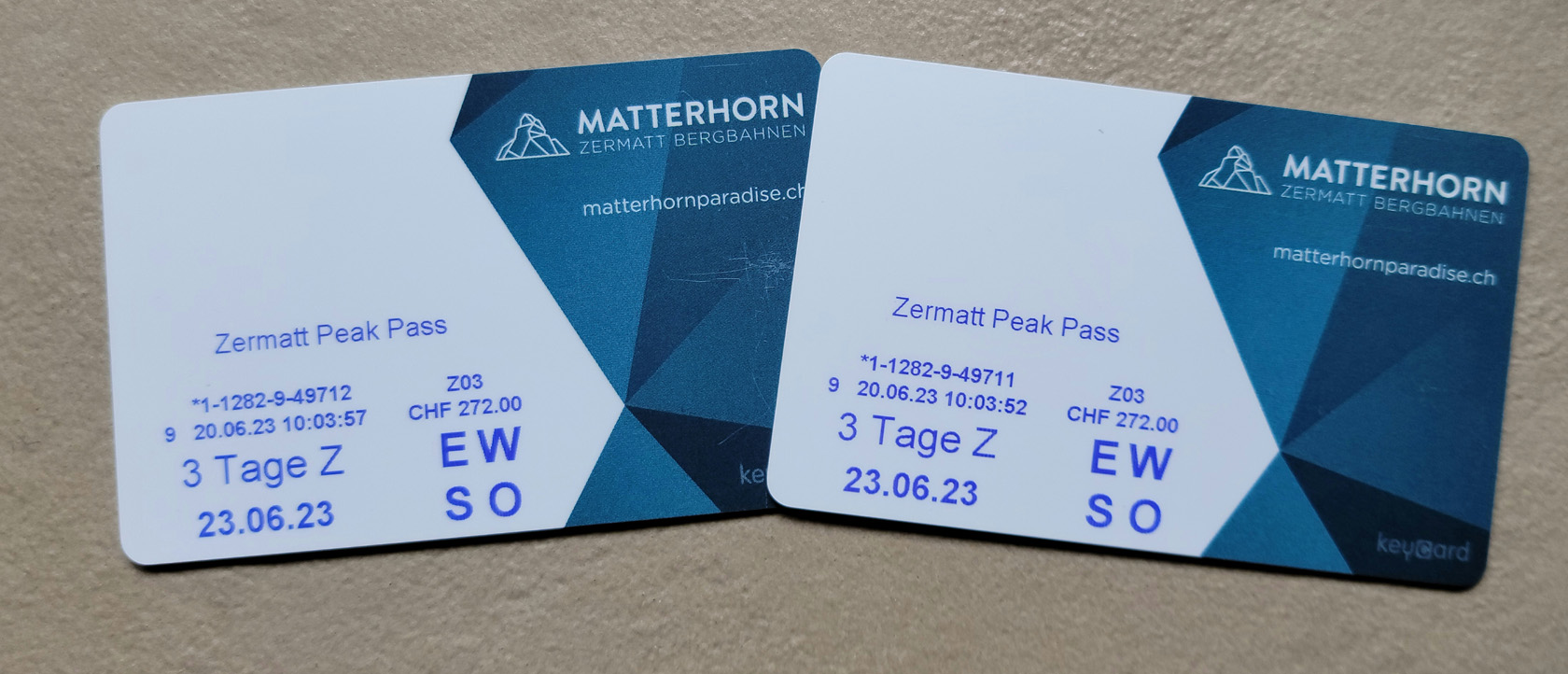
To get anywhere, aside from the town, will require time, energy and a lot of walking. Or, you can purchase tickets to get up the mountains. These can be purchased separately, multi-day pass or the flexi-pass. We found the multi-day pass to be perfect for our needs, since we had no intention of skipping any days (they get a small premium for the flexi-pass, not sure why). The Peak Pass that we purchased, allowed us to travel to all three experiences, the Rothorn (Sunnegga-Blauherd), Gornergrot and the Matterhorn Glacier Experience.
The Peak Pass – Tickets For Two – Zermatt, Switzerland
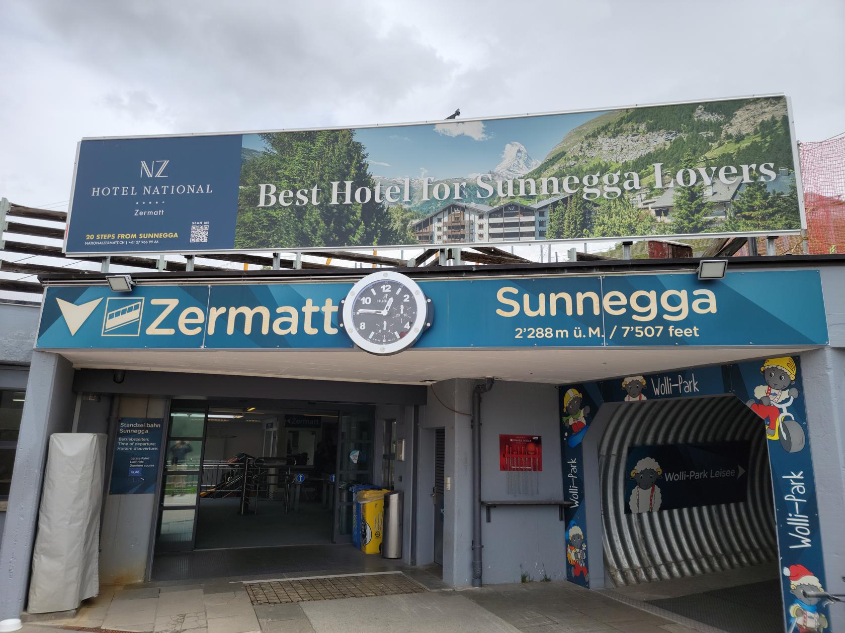
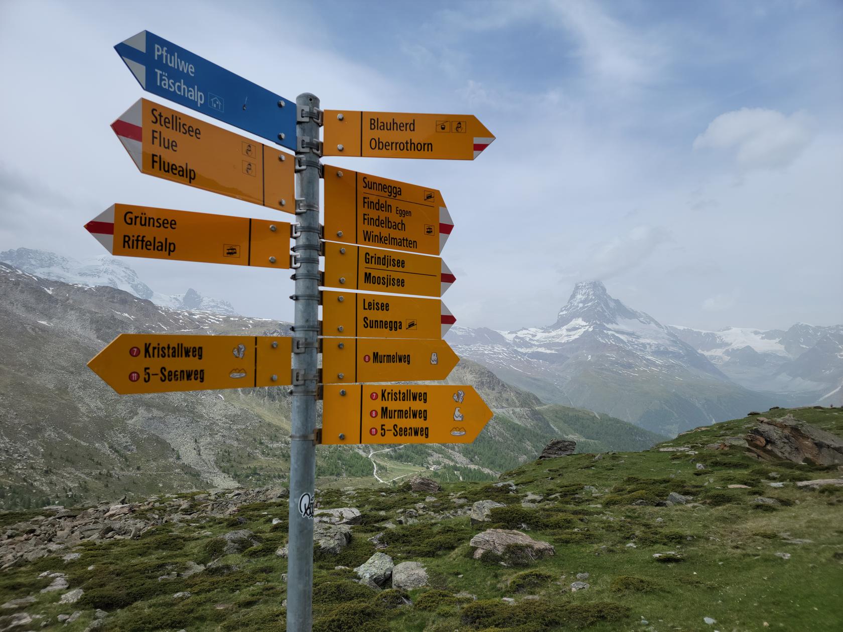
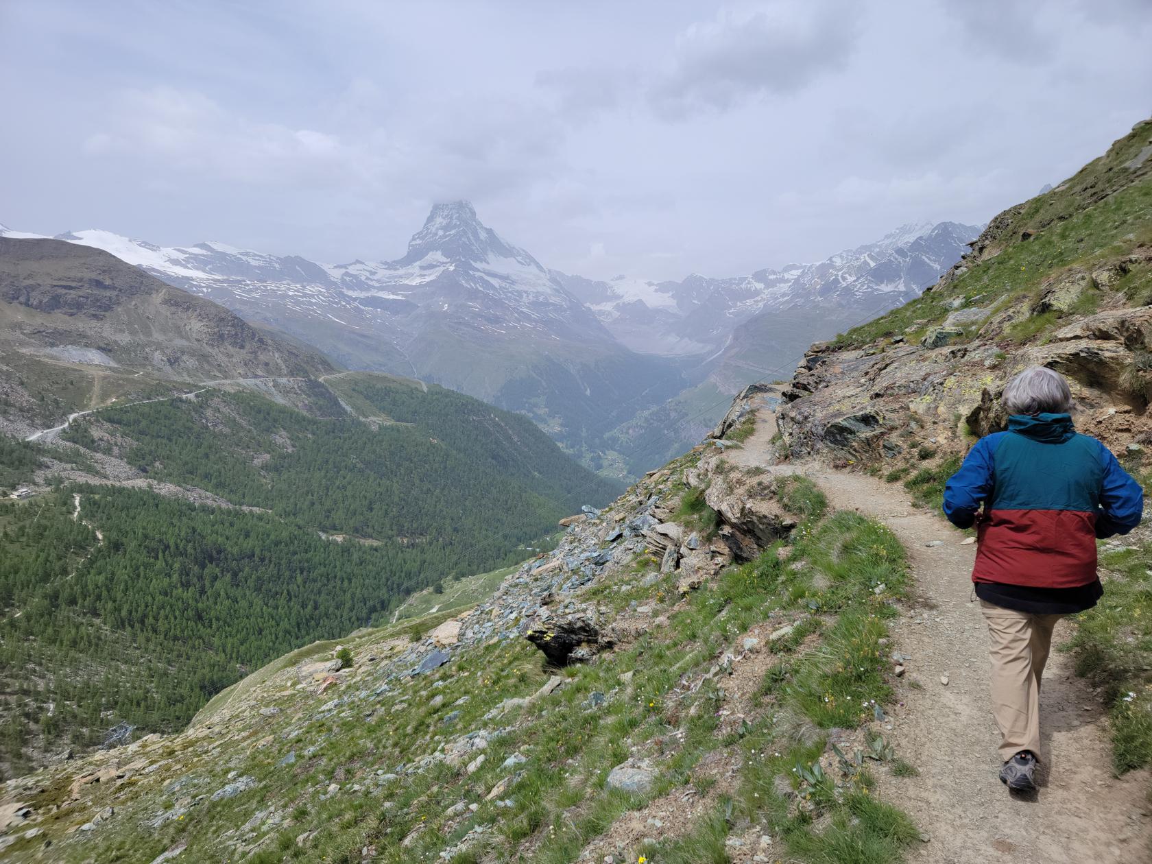
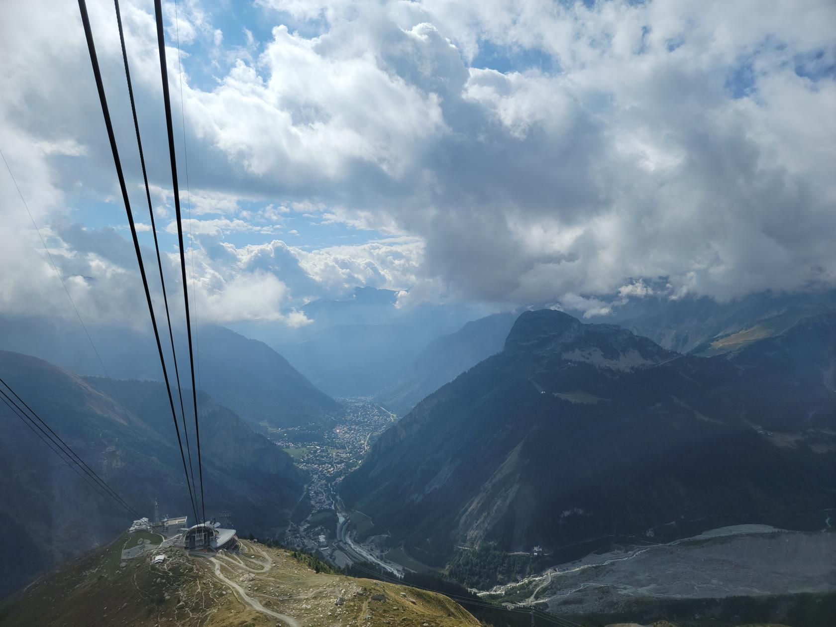
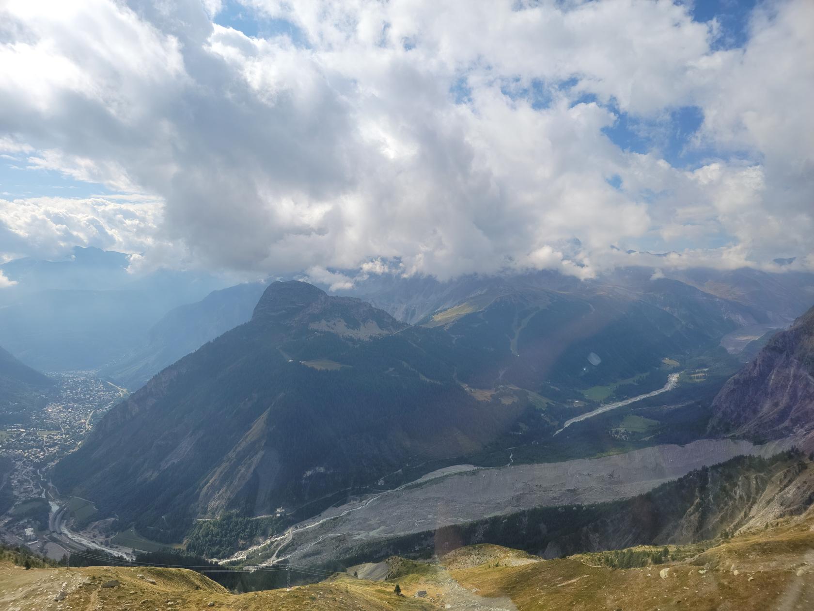
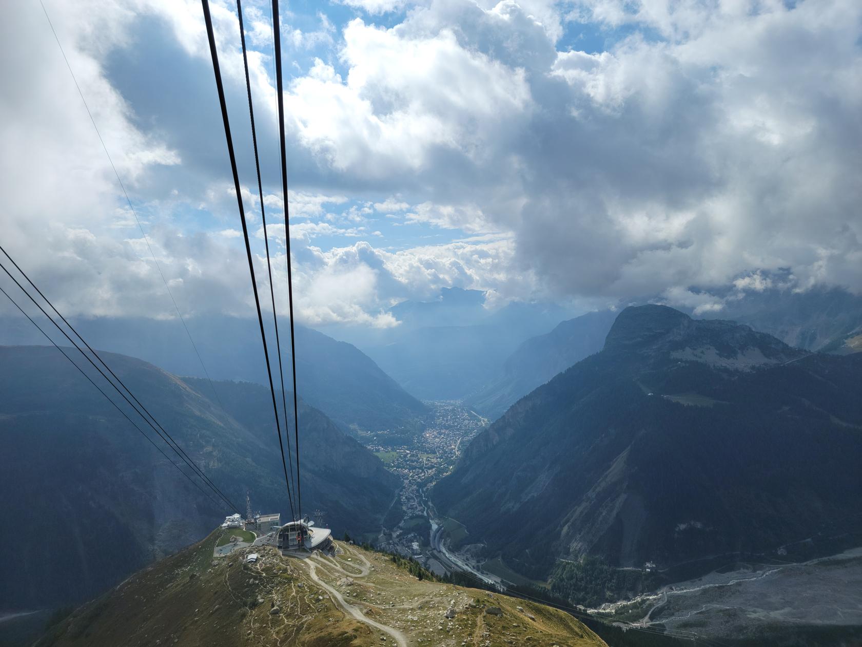
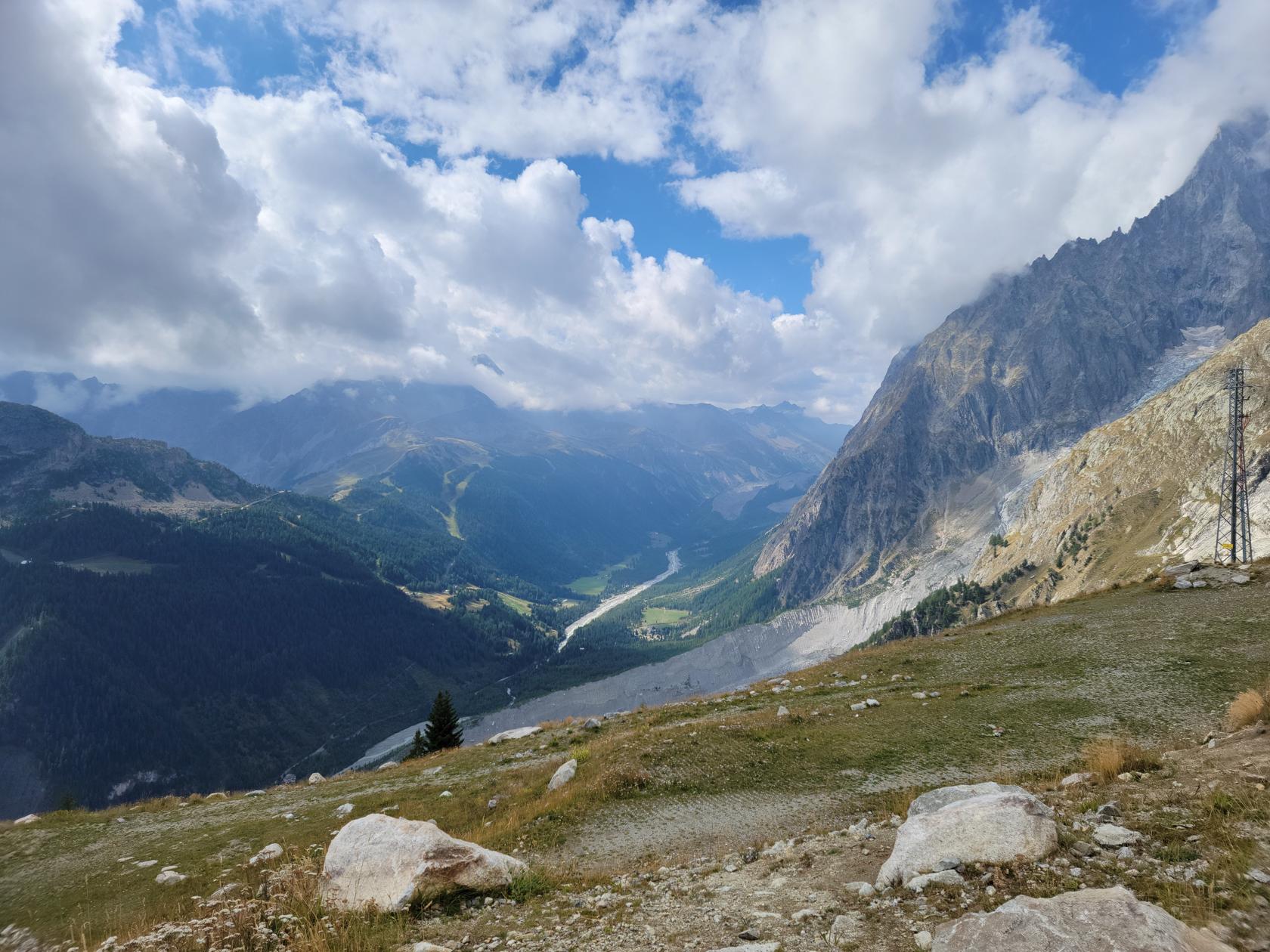
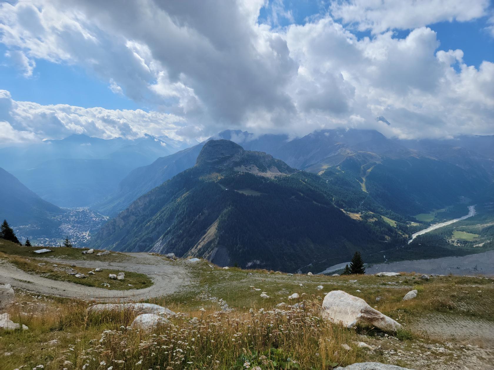
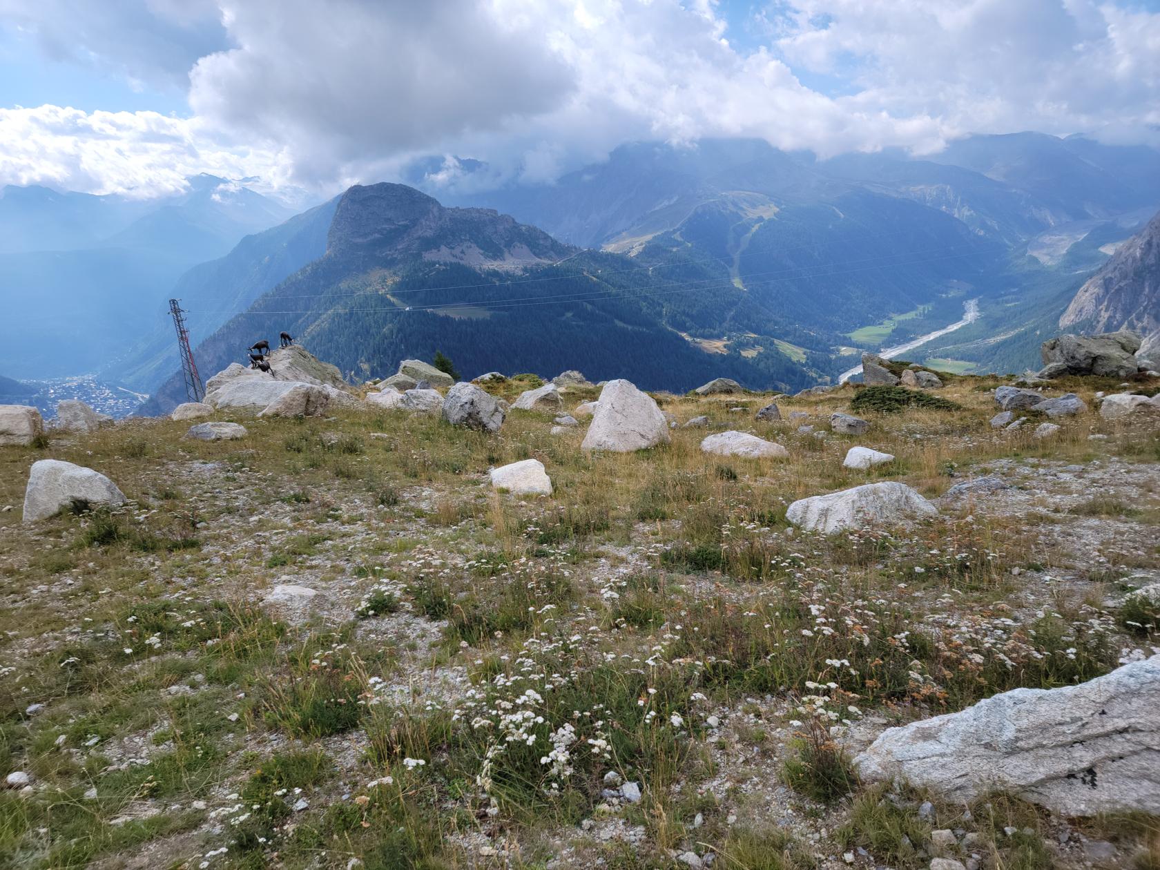
Sunnegga
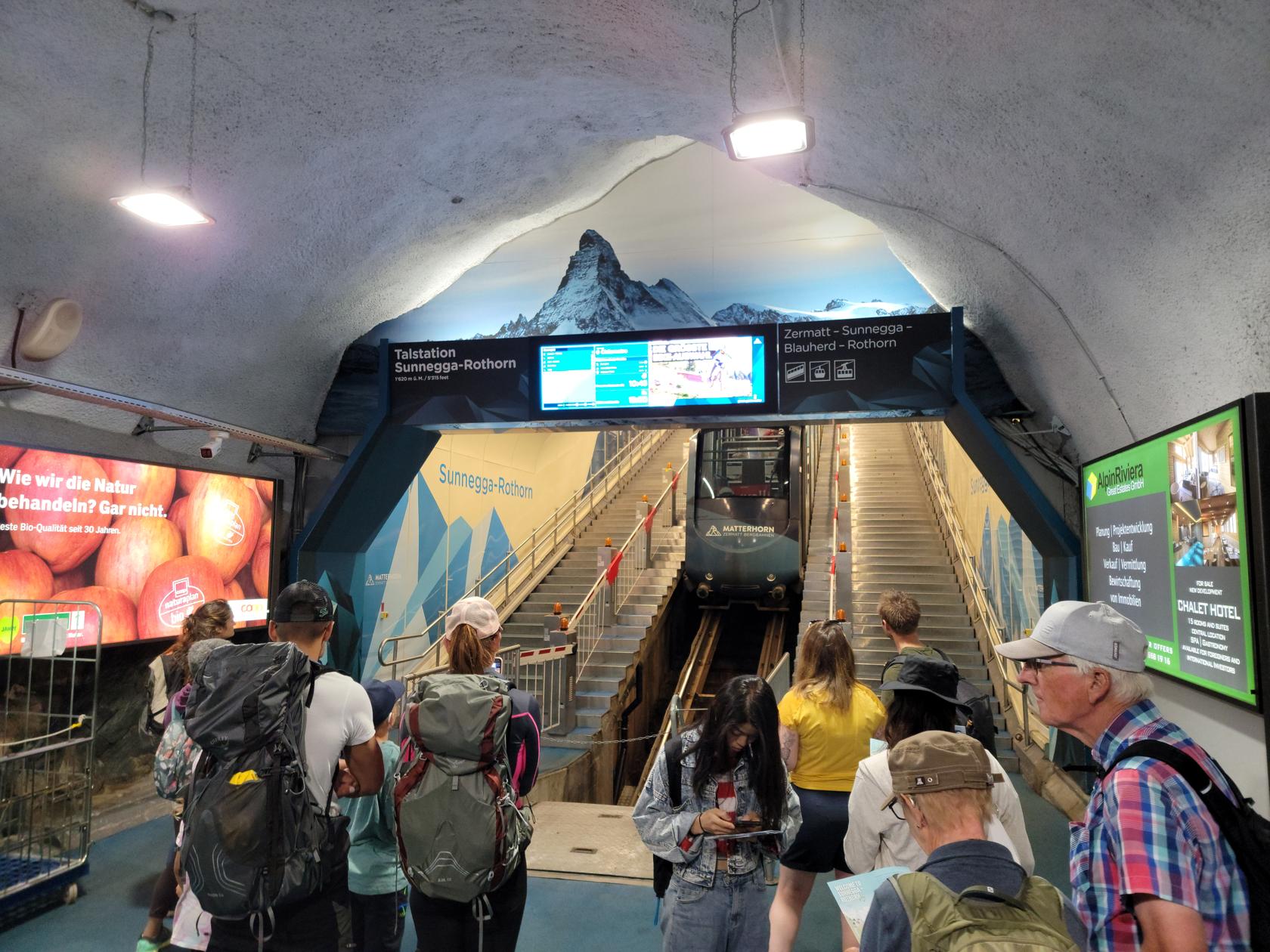
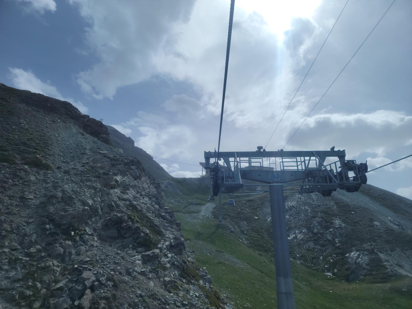
To get to Sunnegga and Blauherd you can either employ one of the hiking trails or take the cable car up to Sunnegga. From there you can start your hike or take a gondola ride to Blauherd, which gets you closer to the Stellisee, if that is your destination. From there however, you will have to hike.
The gondola ride goes up and down over some very treacherous terrain. So we decided we would take the gondola ride up and hike back down to Sunnegga.
Sunnegga station – Zermatt, Switzerland
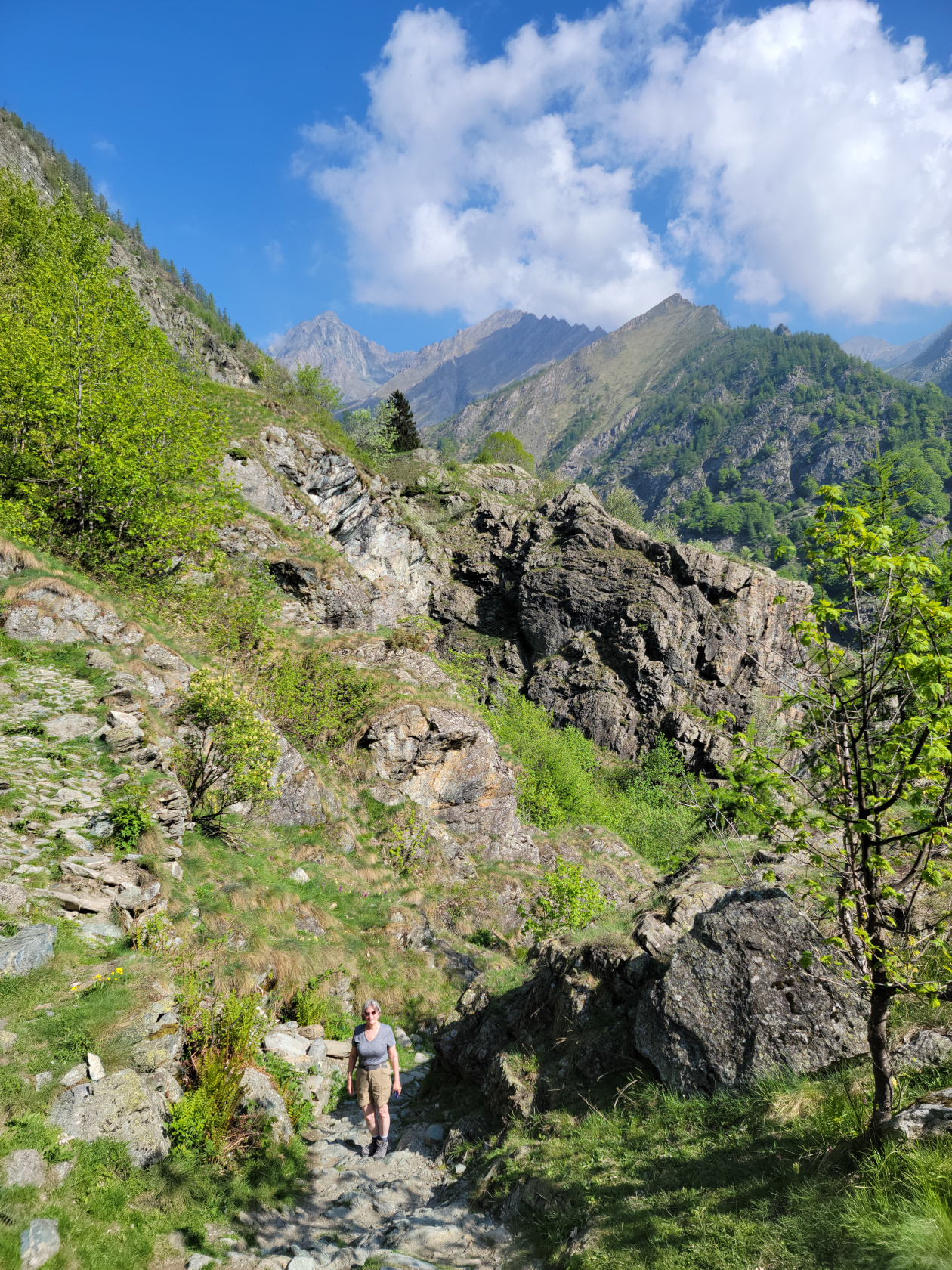
Blauherd – Stellisee
The Stellisee is a good fifteen minute hike from the Blauherd gondola terminal over rather even, if not slightly downward sloping terrain. It is rather easy and should afford most people no difficulties.
Road and hiking trail to Stellisee – Zermatt, Switzerland
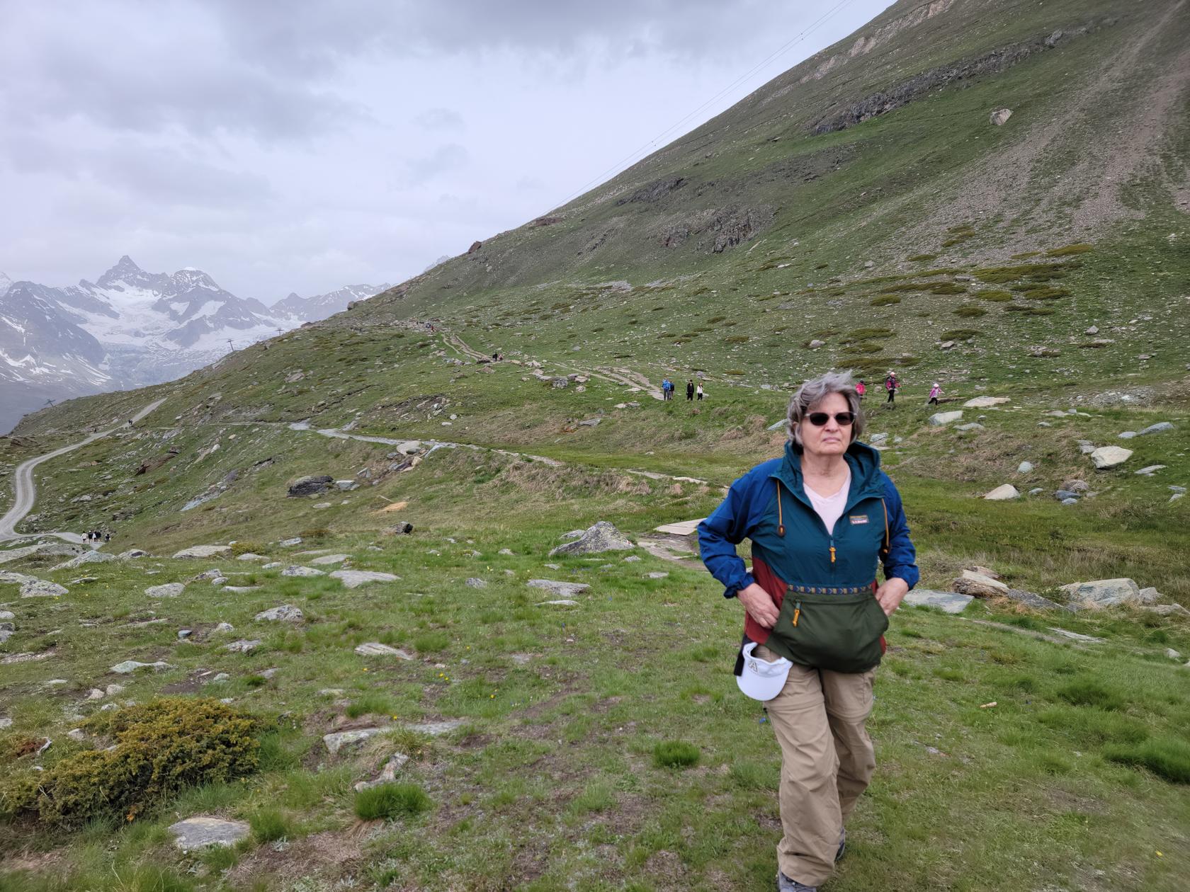
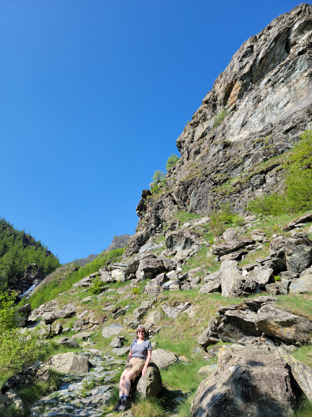
Patti ready to hike – Blauherd – Zermatt, Switzerland
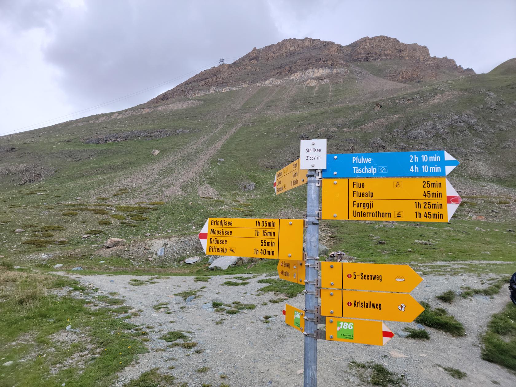
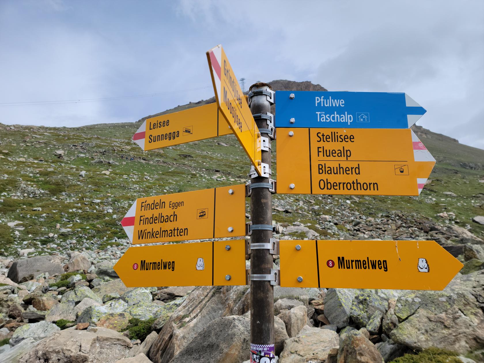
Stellisee hiking sign – Zermatt, Switzerland
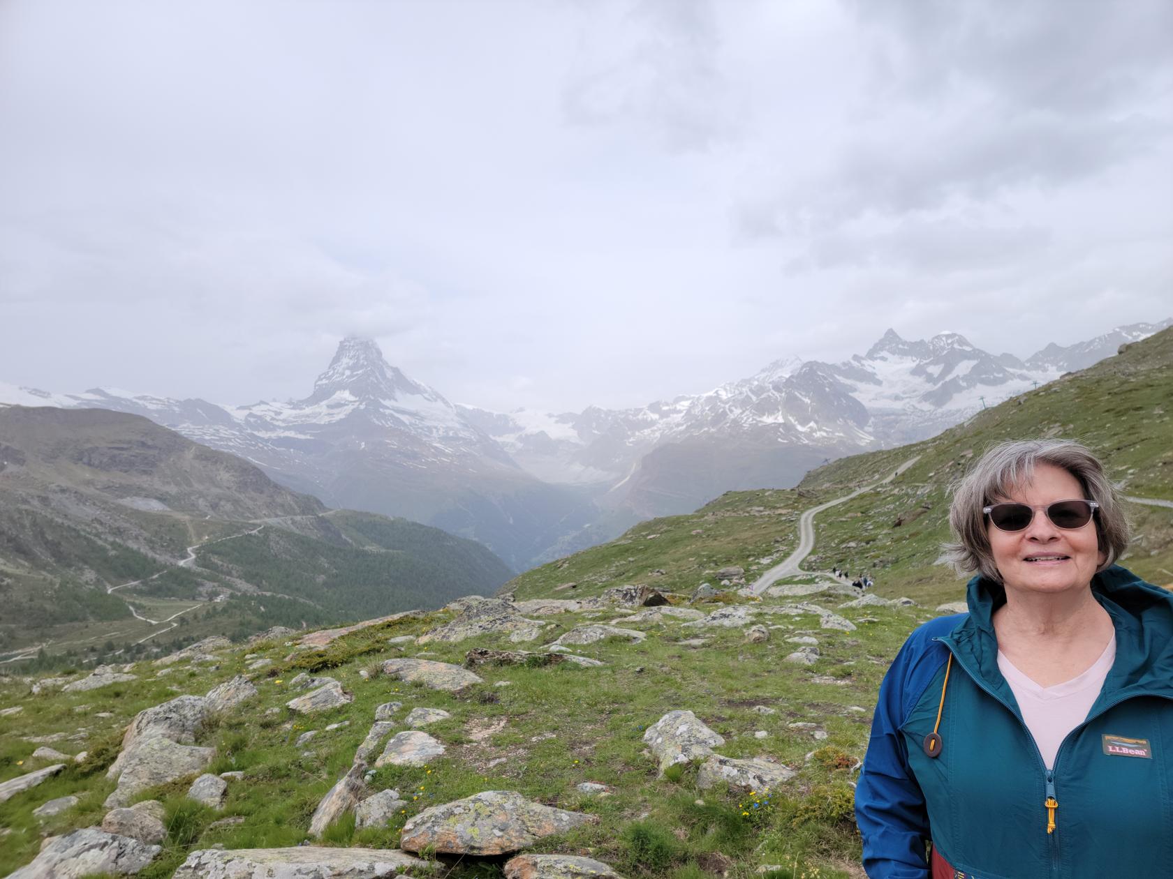
Patti with Matterhorn backdrop – Zermatt, Switzerland
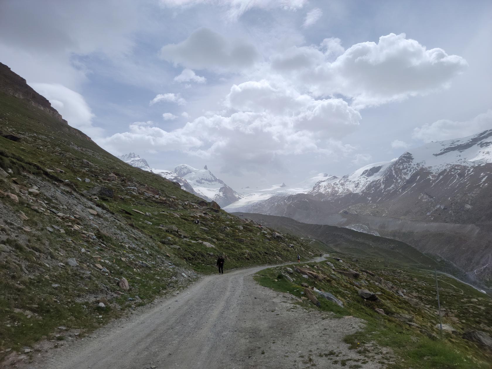
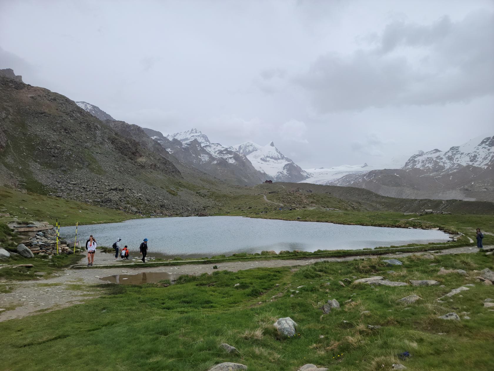
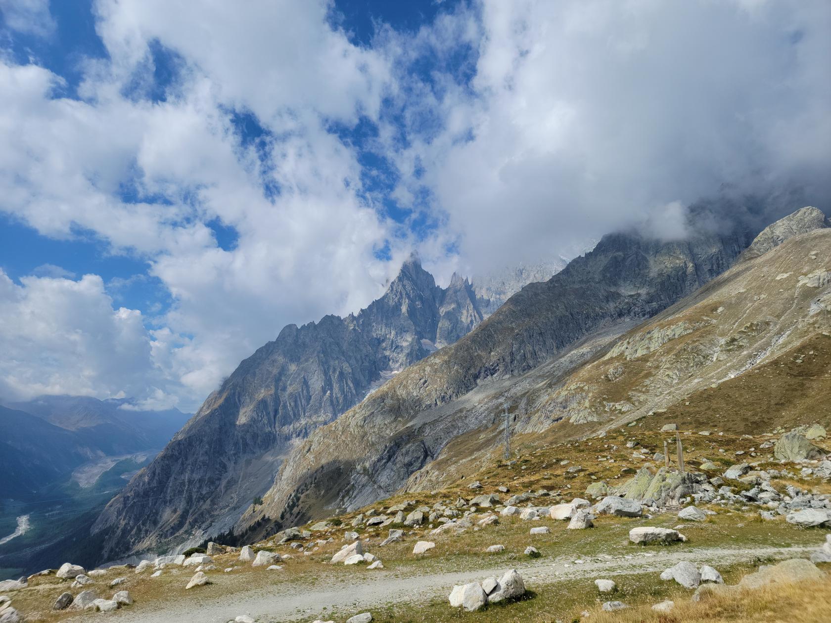
The Stellisee is a rather barren, pristine alpine lake nestled on the side of the Unterrothorn. Many people will usually hike up to the refuge on the other side, but since the conditions were not ideal, we decided to just take a photograph of it and start our hike back down.
Stellisee – Zermatt, Switzerland
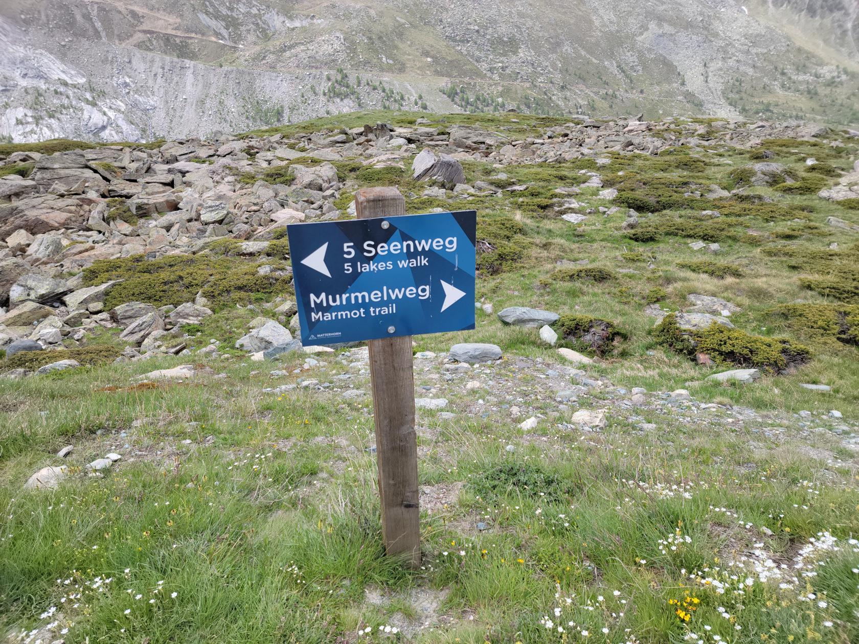
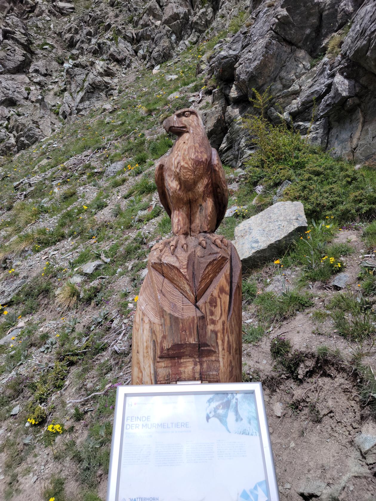
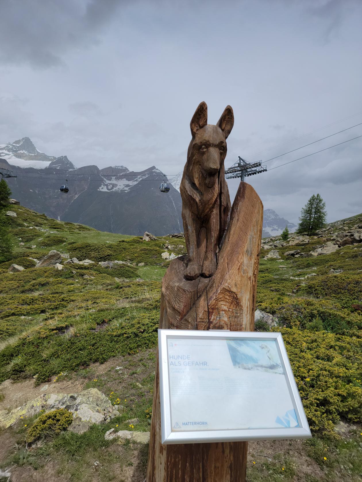
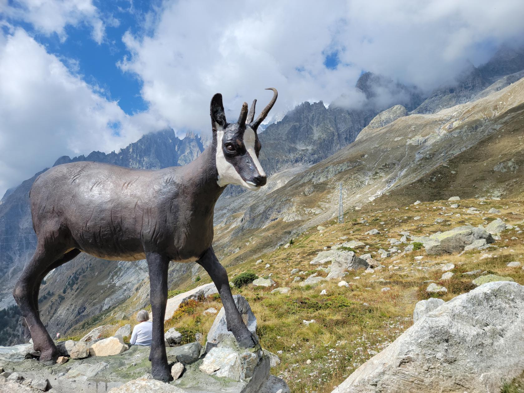
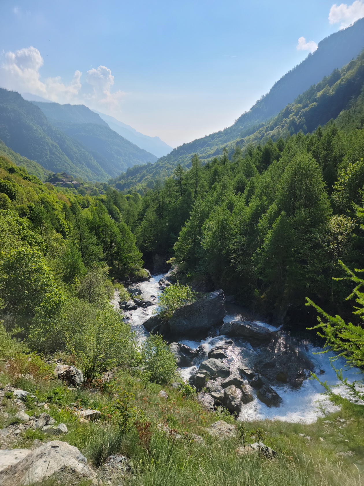
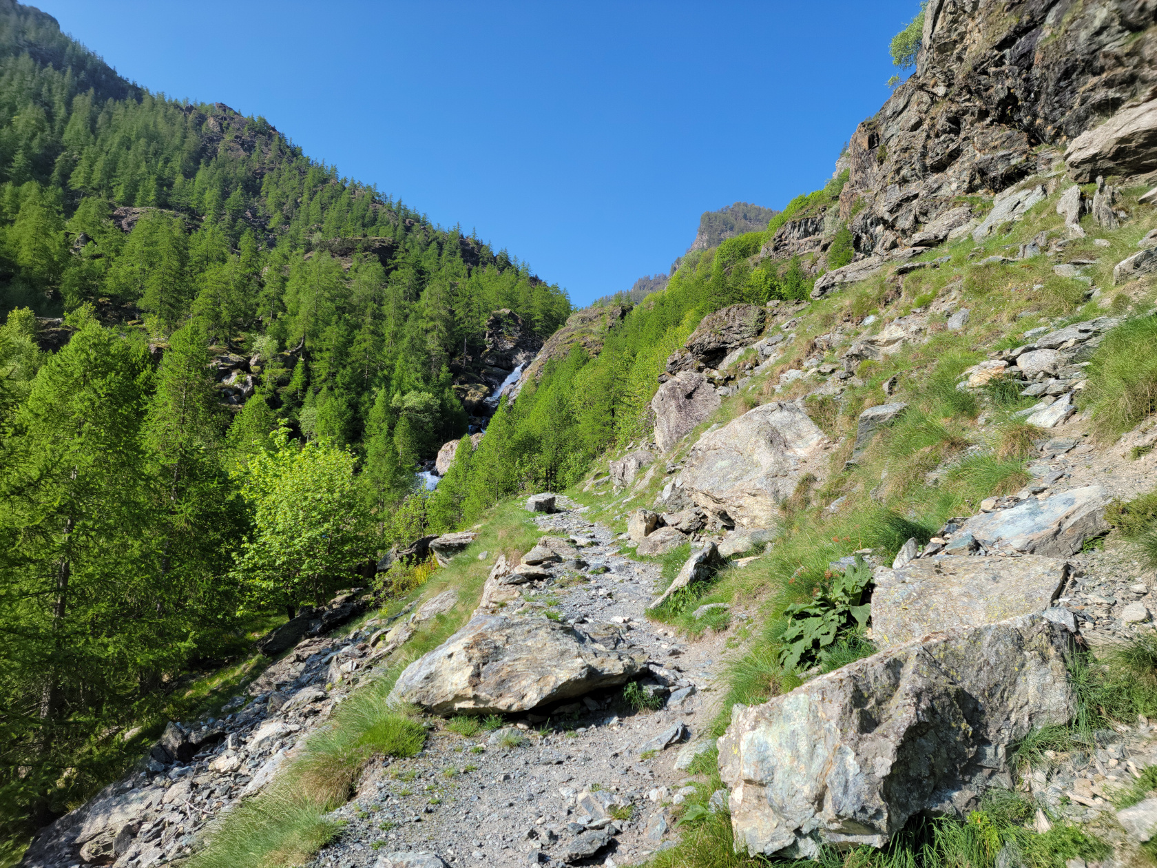
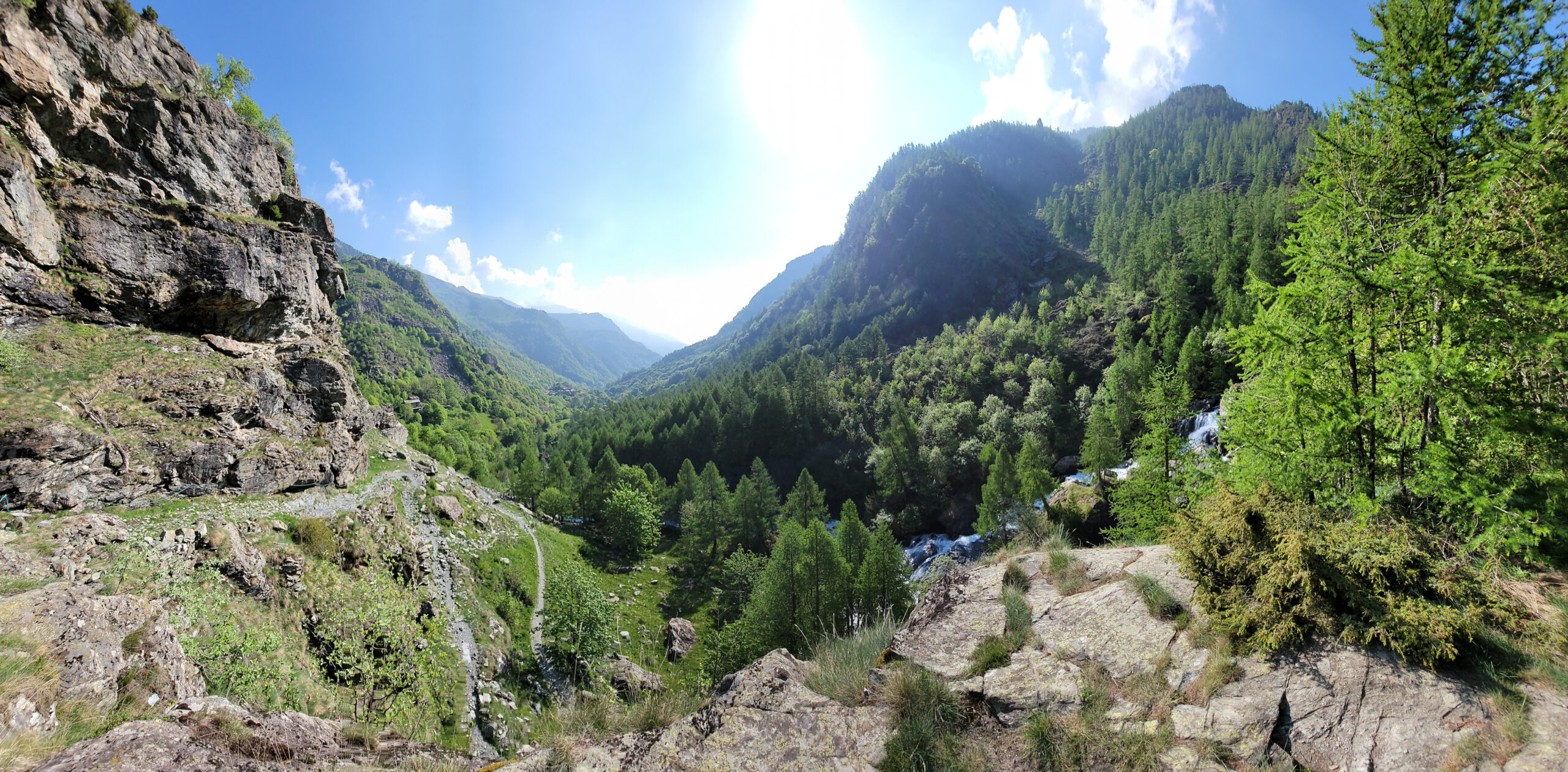
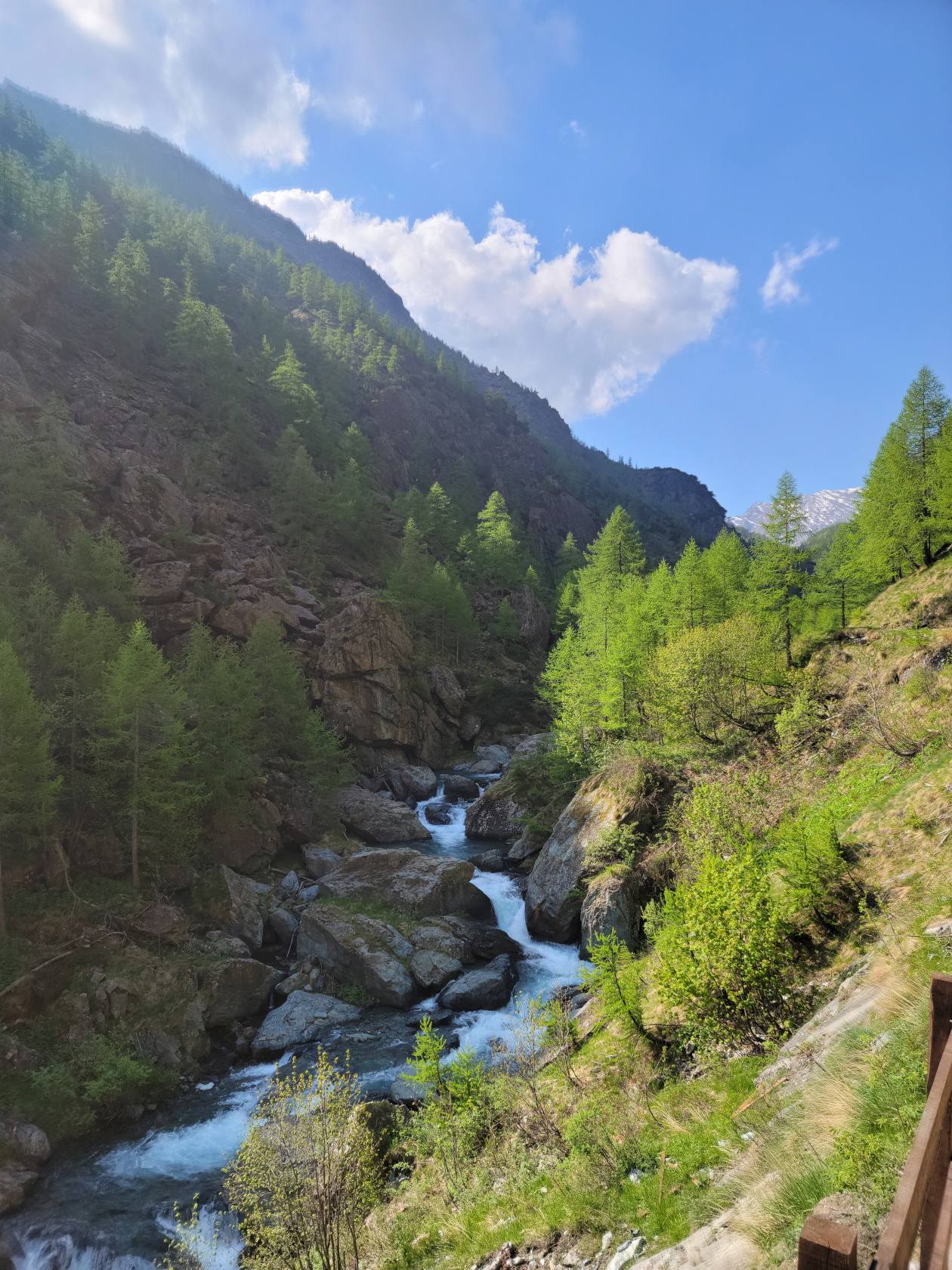
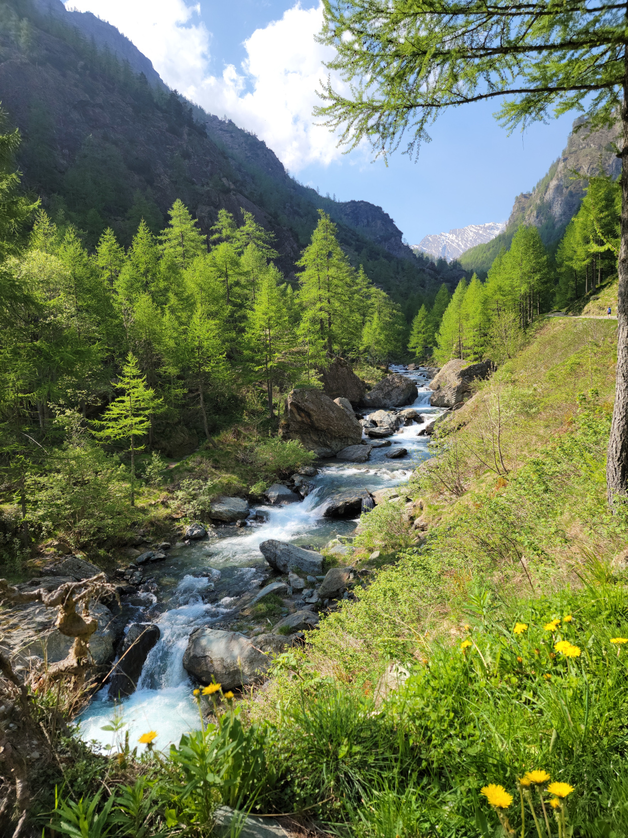
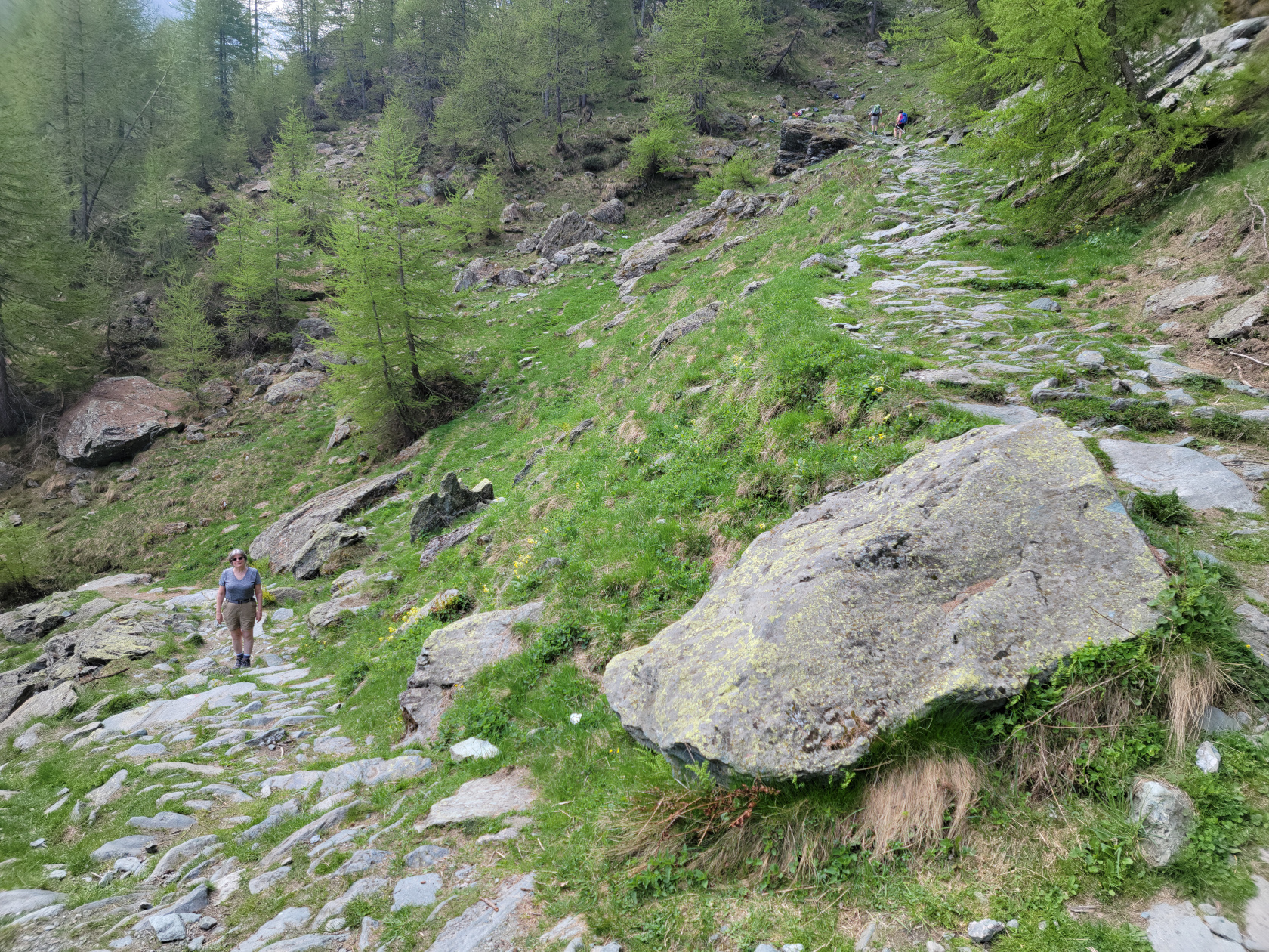
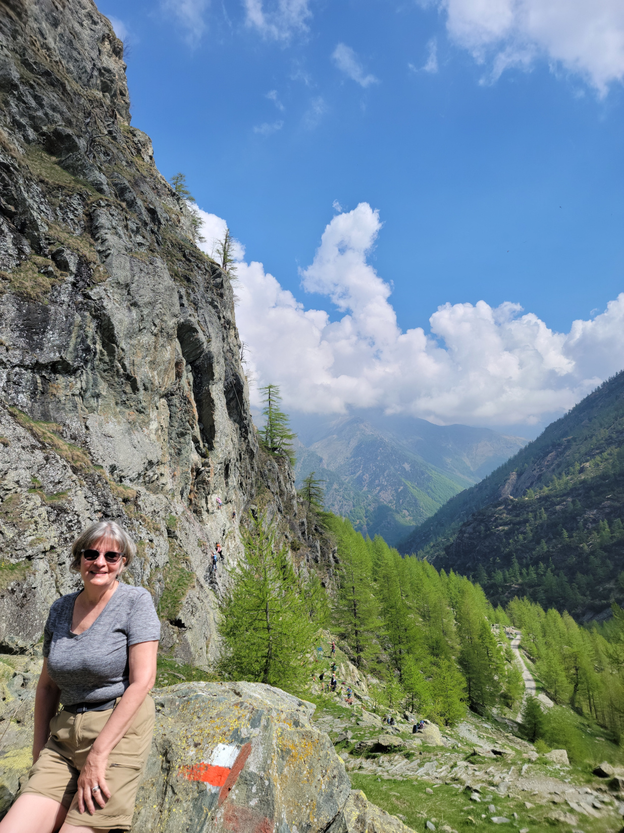
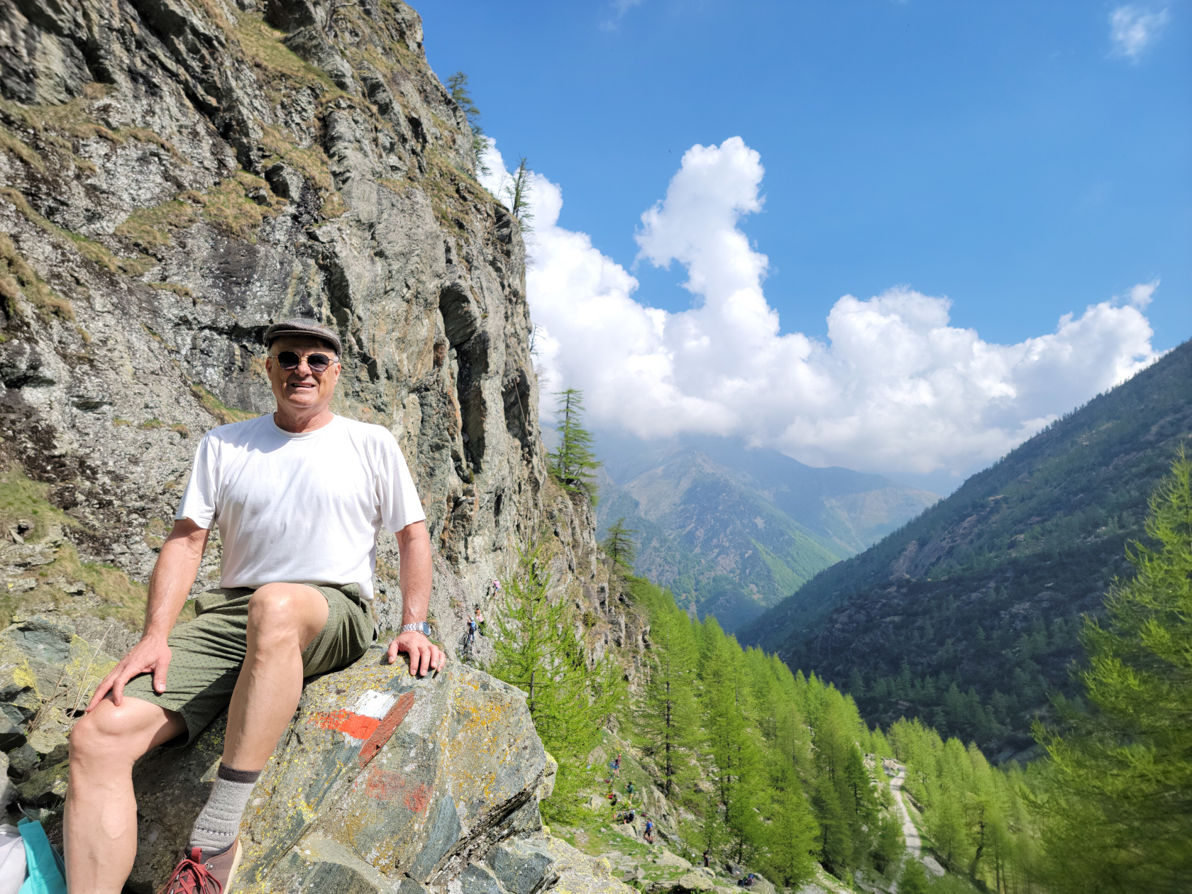
Murmelweg
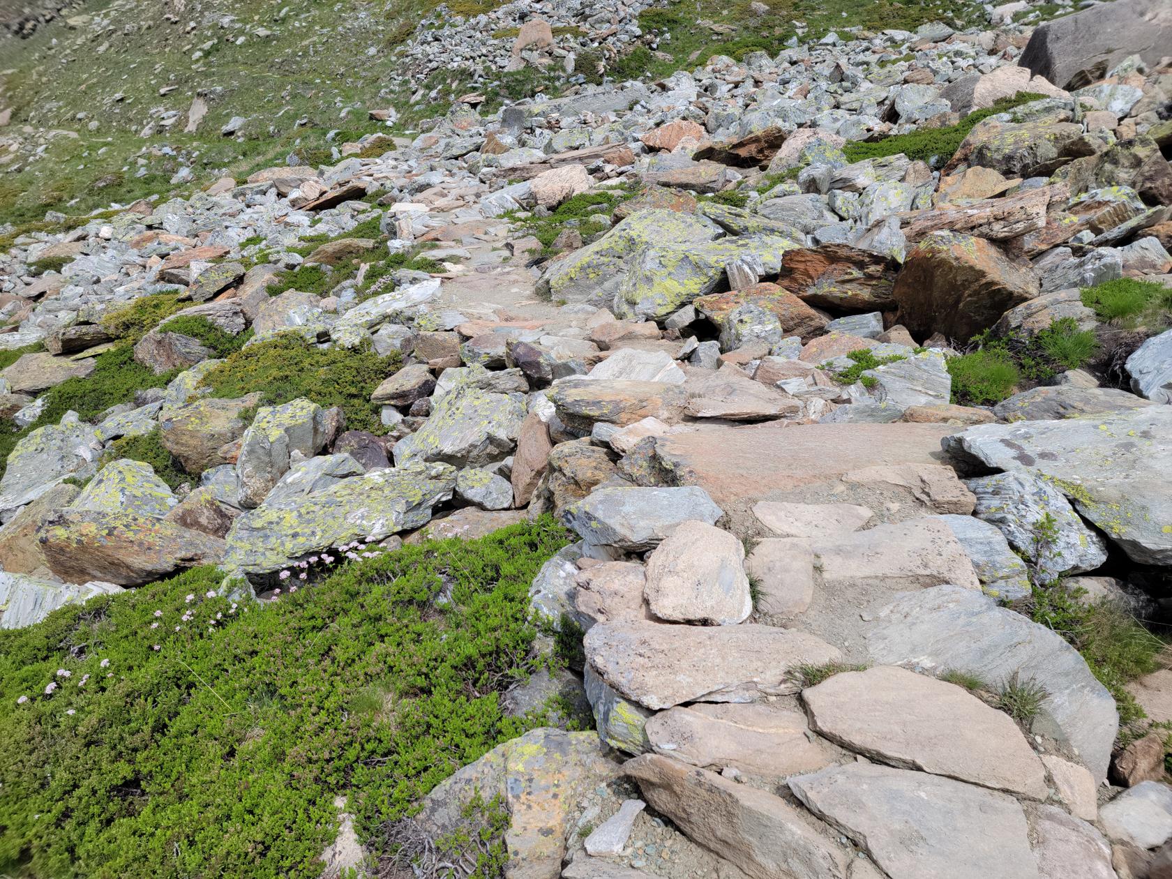
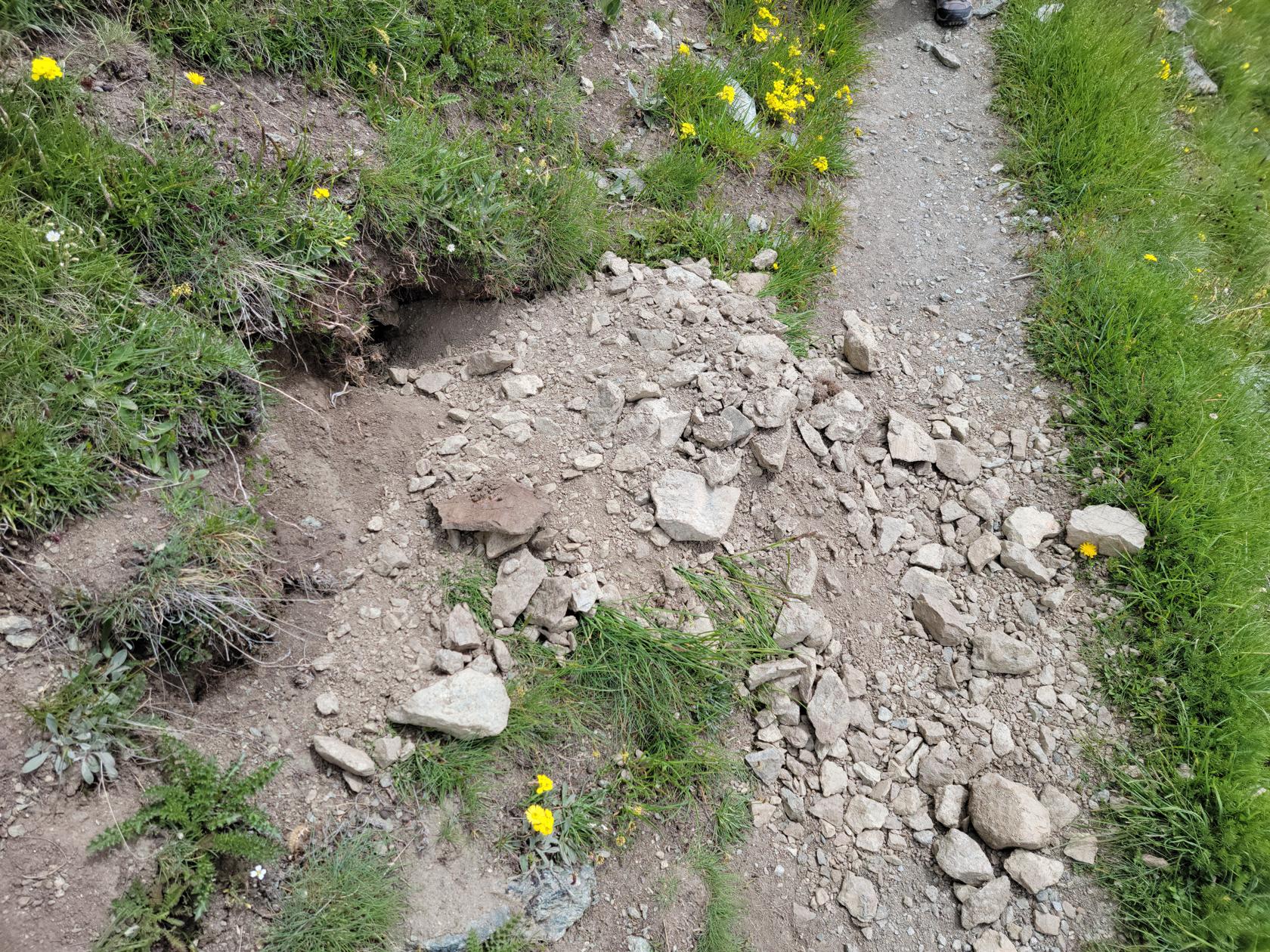
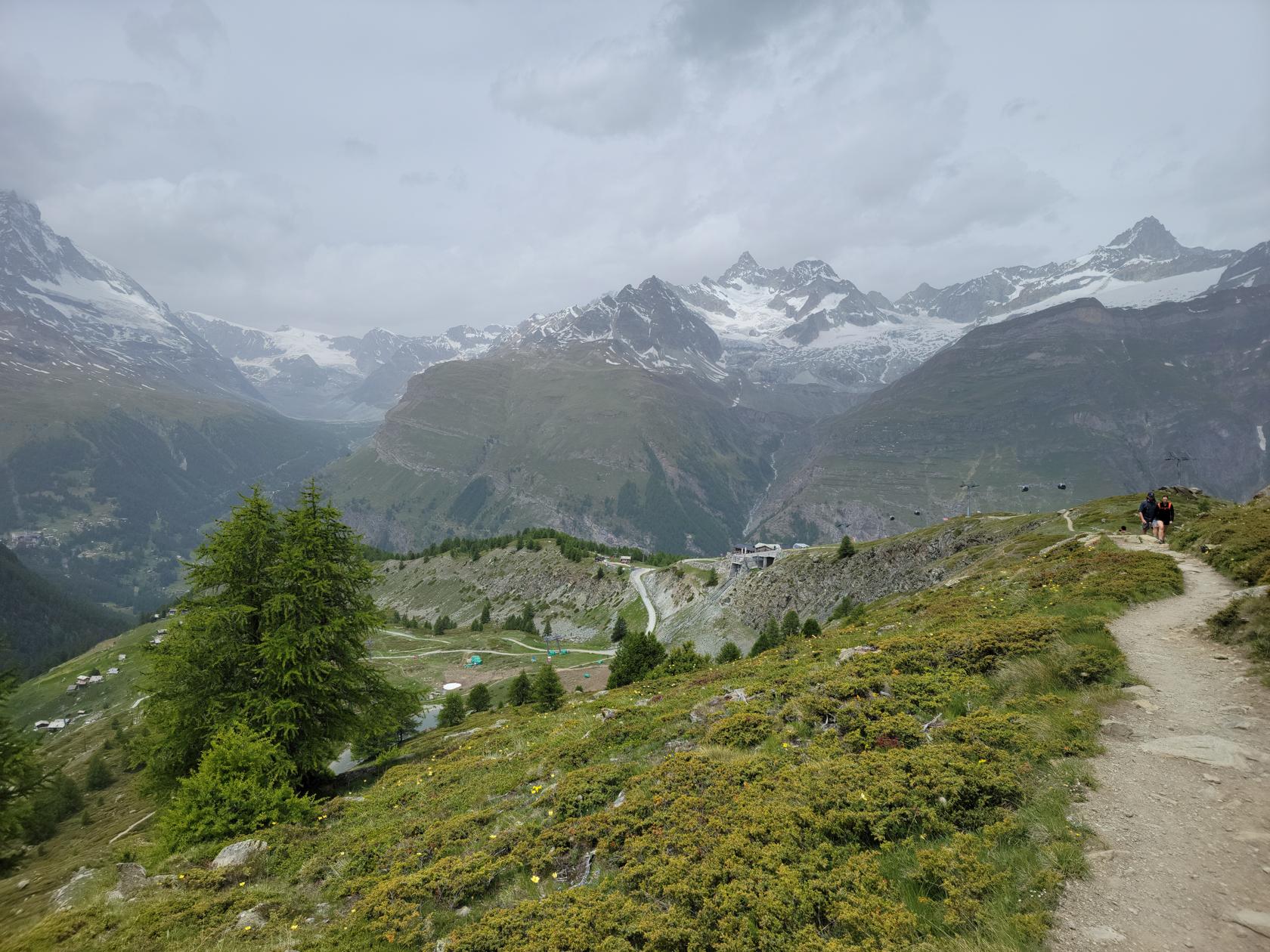
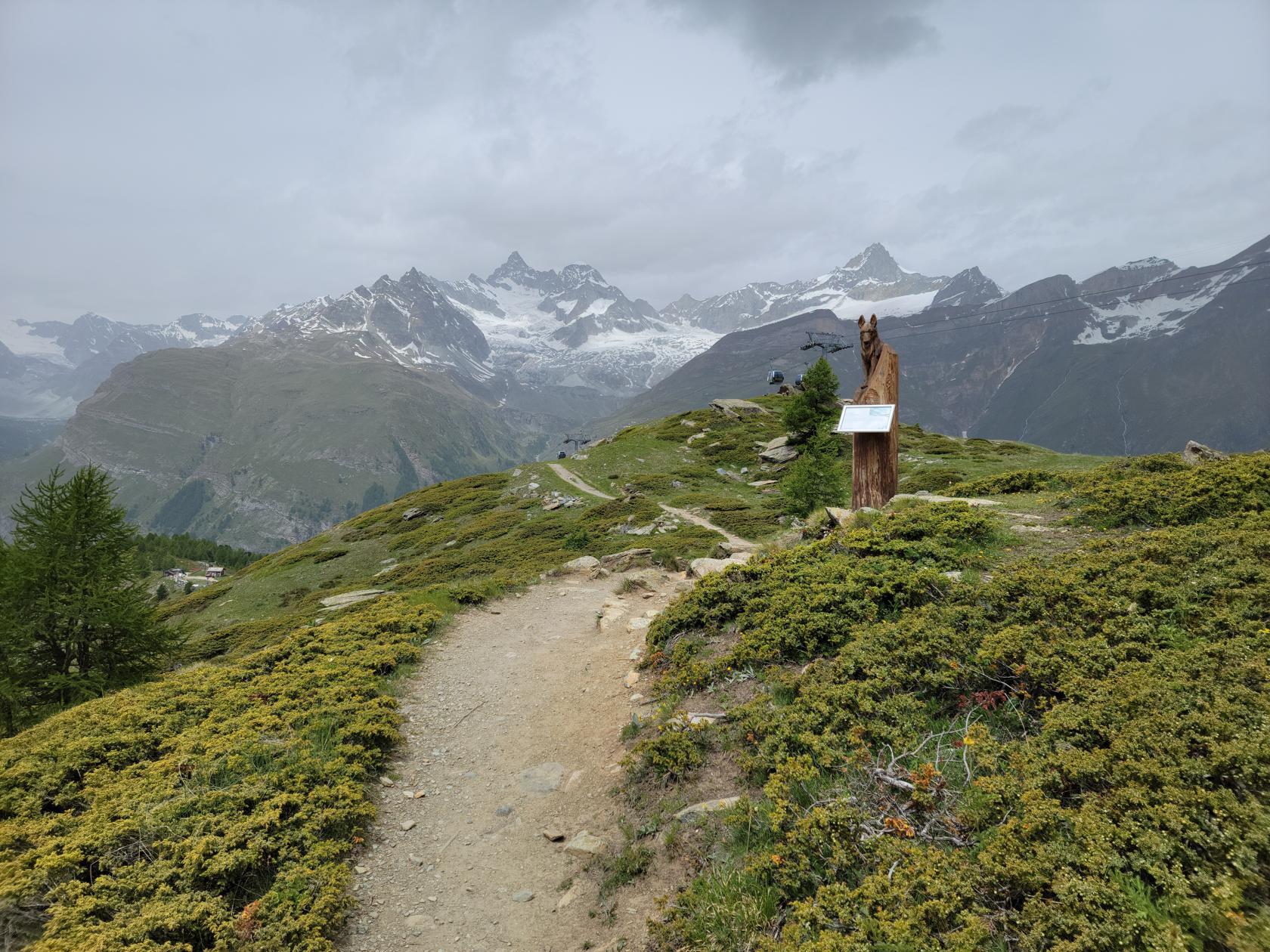
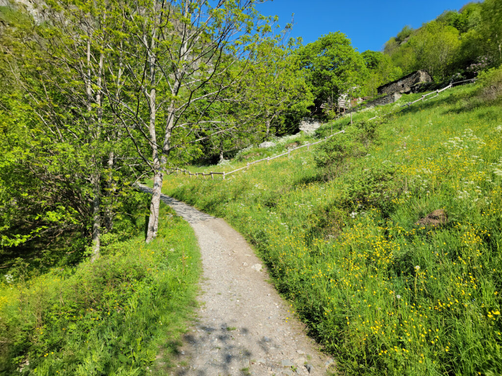
Named for the eponymous animal that has made the territory it goes through its home, the Murmelweg is a casual, if not easy hiking trail back to Sunnegga. There are a few technical areas, but nothing that most people will find impossible to pass. I would wear hiking boots though, the trail goes over rocky terrain and a good boot will help stabilize your ankles and aid your hike.
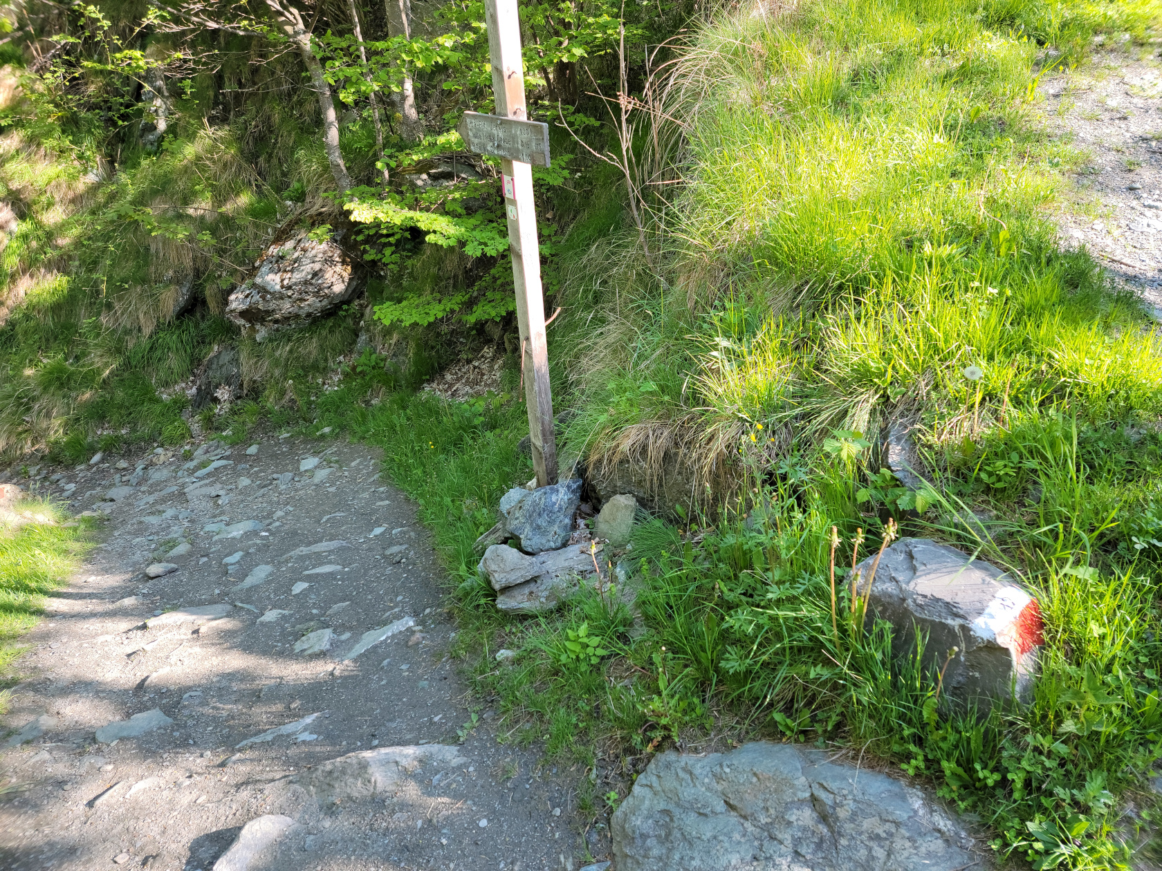
Hiking sign back to Sunnegga – Blauherd – Zermatt, Switzerland
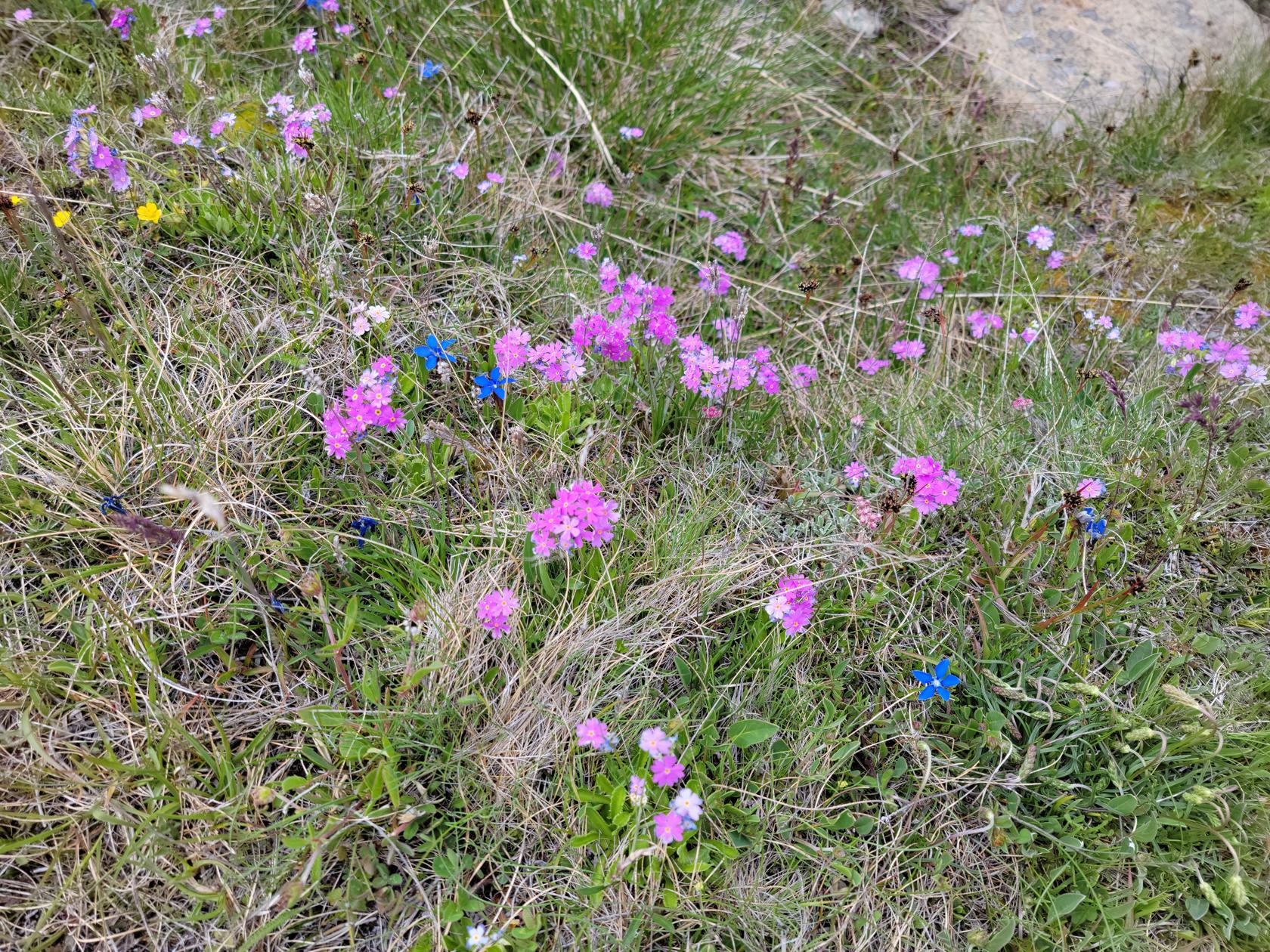
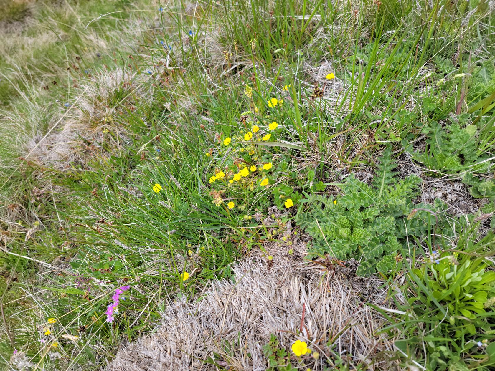
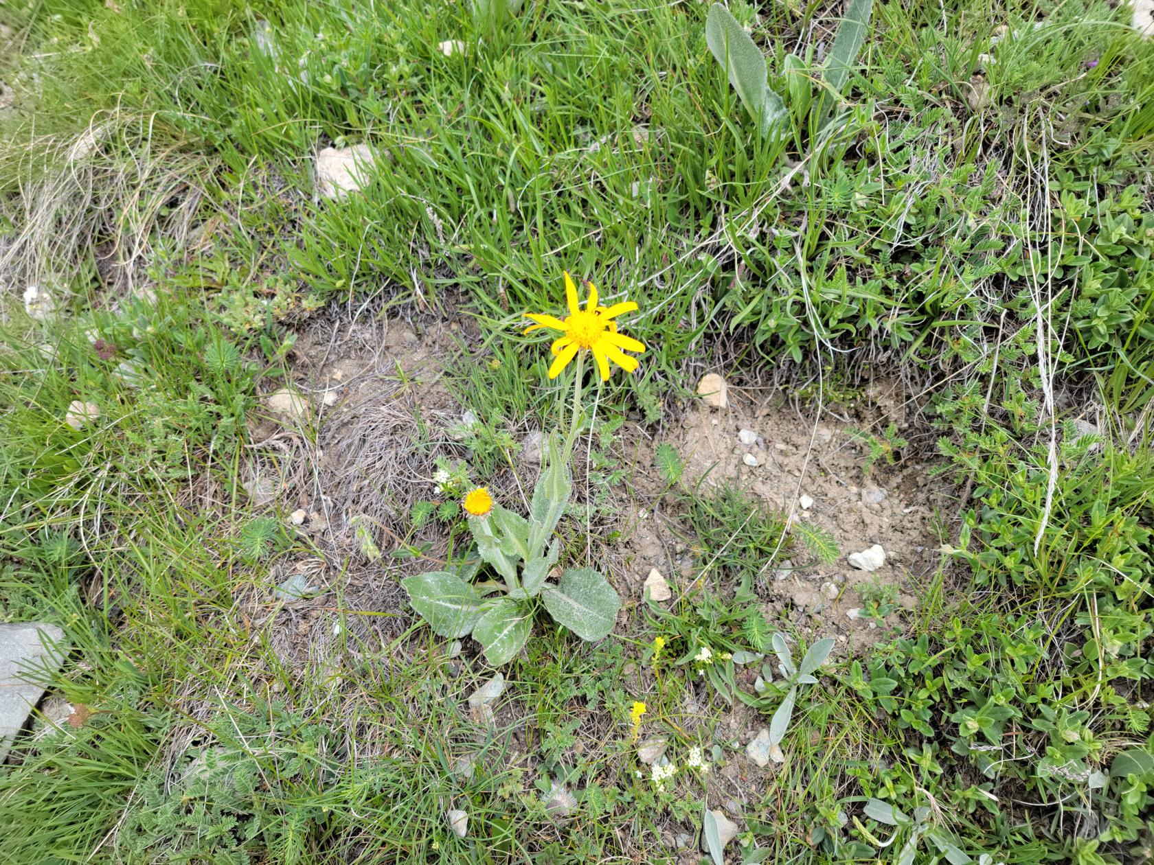
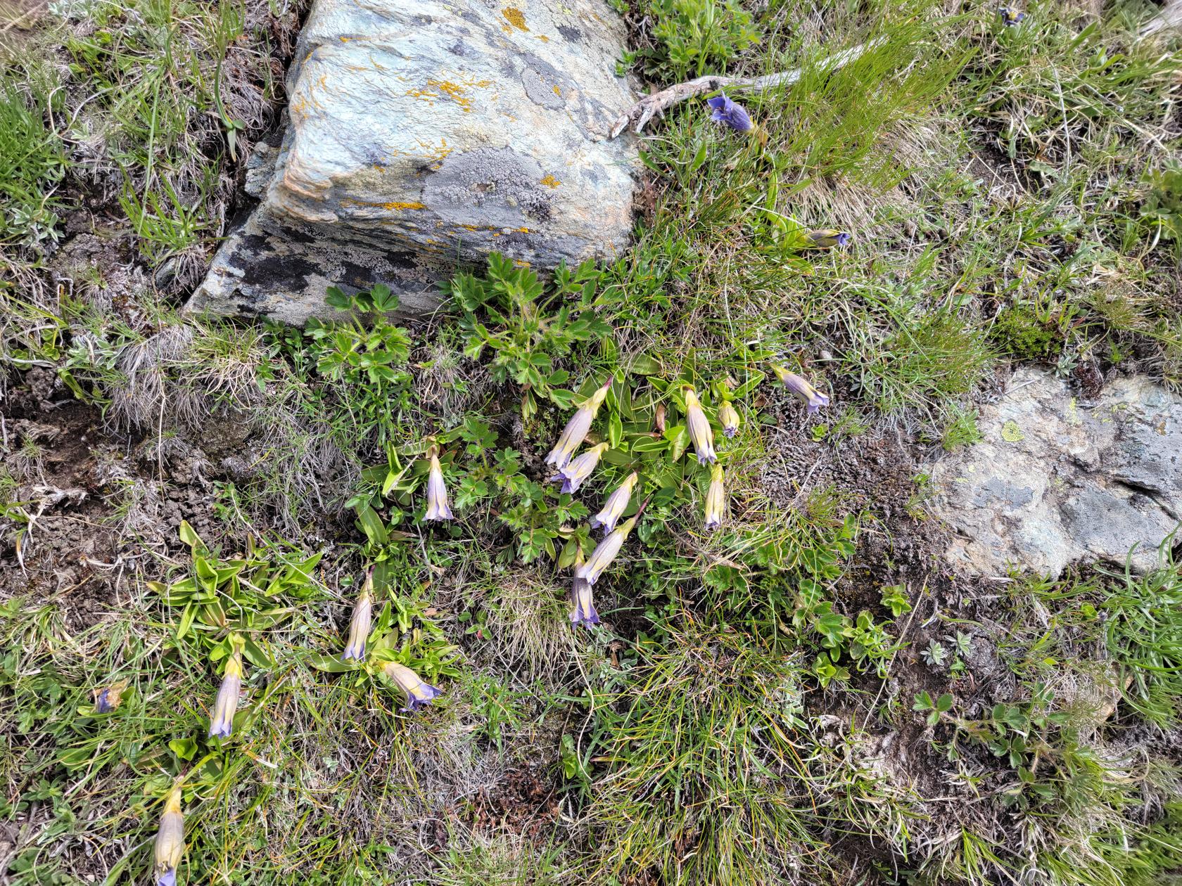
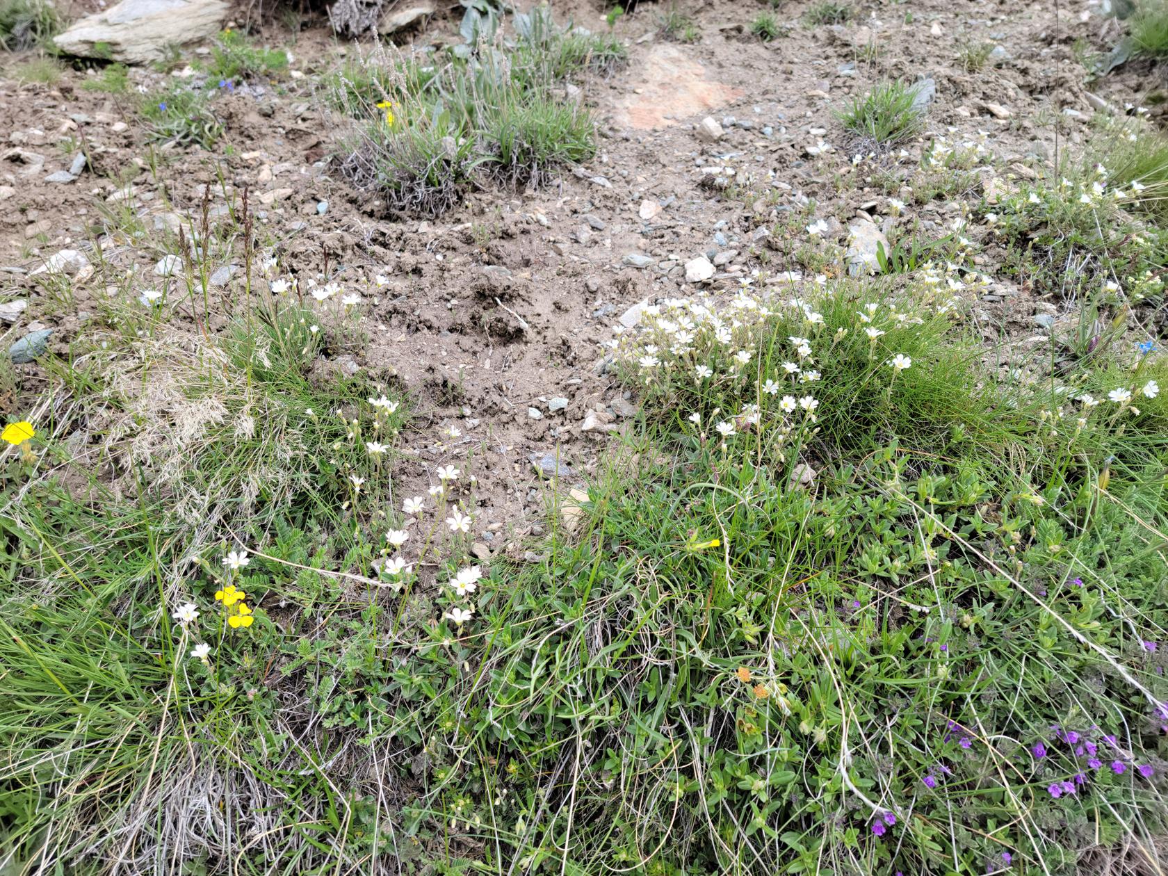
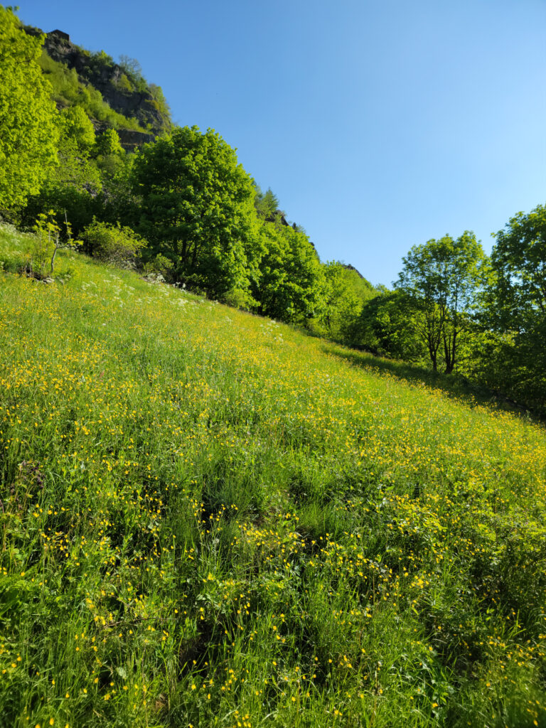
Alpine flowers – Blauherd – Zermatt, Switzerland
Alpine flowers – Blauherd – Zermatt, Switzerland
Alpine flowers – Blauherd – Zermatt, Switzerland
Alpine flowers – Blauherd – Zermatt, Switzerland
Alpine flowers – Blauherd – Zermatt, Switzerland
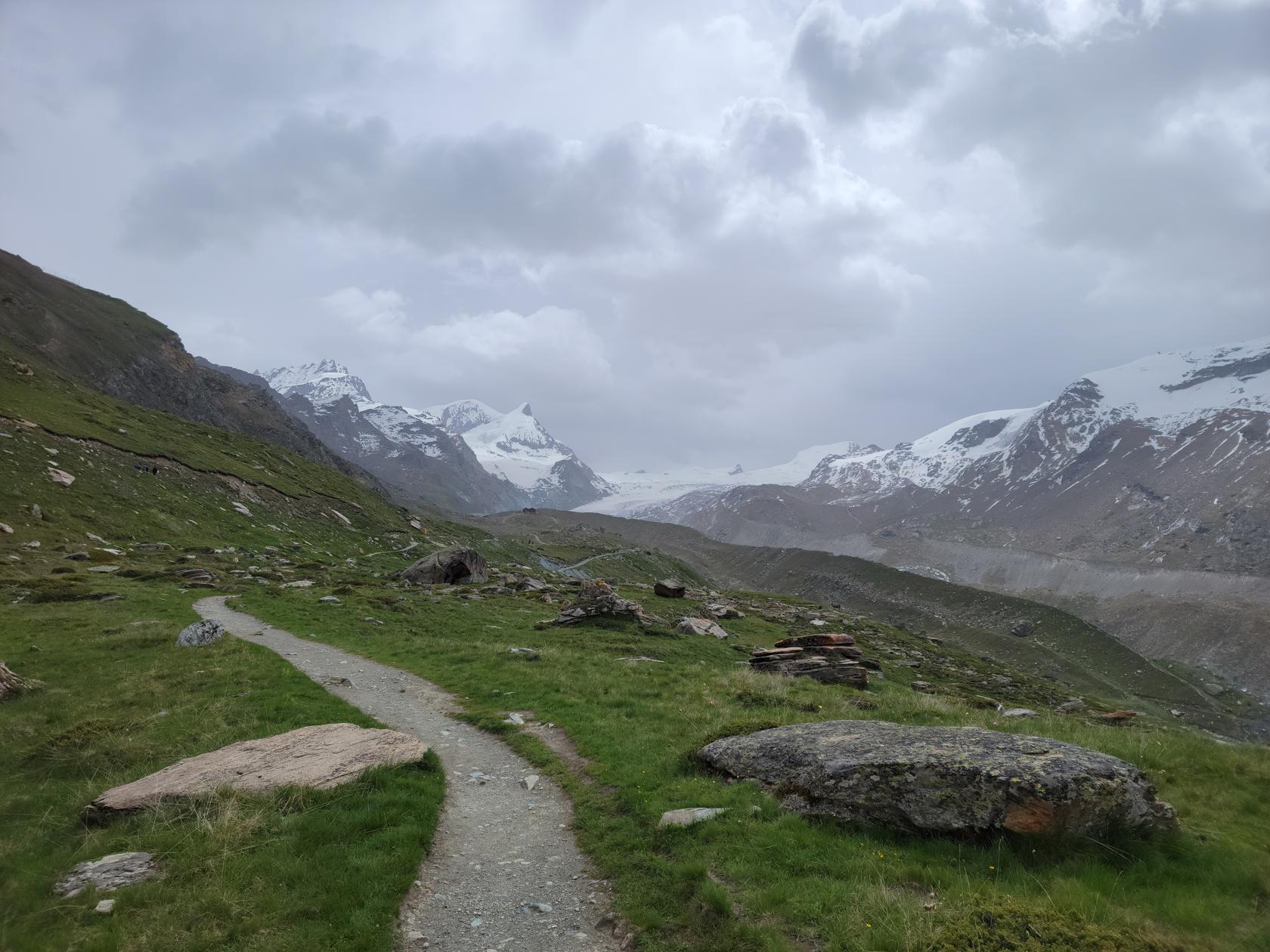
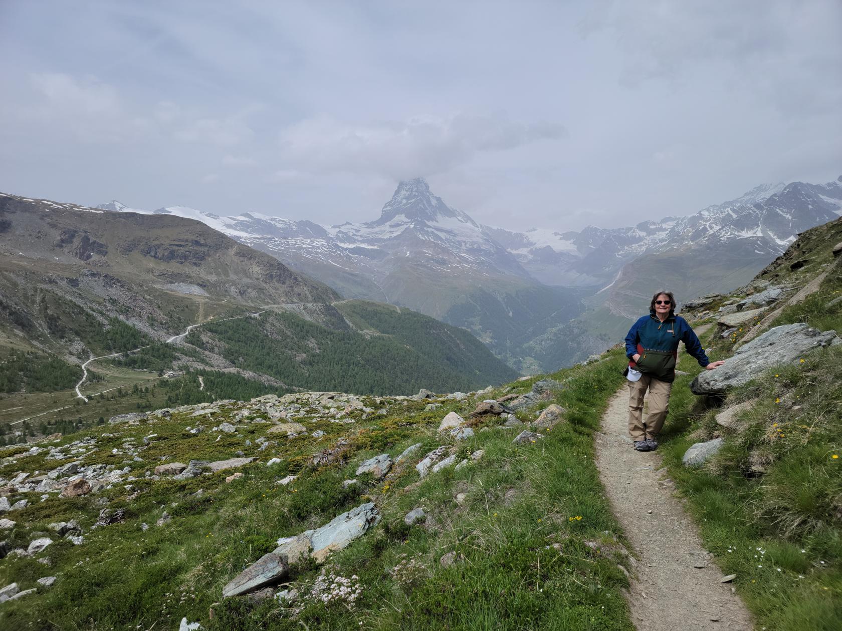
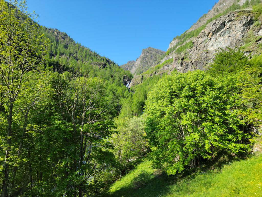
Taking the Murmelweg to Sunnegga – Zermatt, Switzerland
Trail behind looking towards Blauherd – Zermatt, Switzerland
The below video is a fairly good example of what to expect.
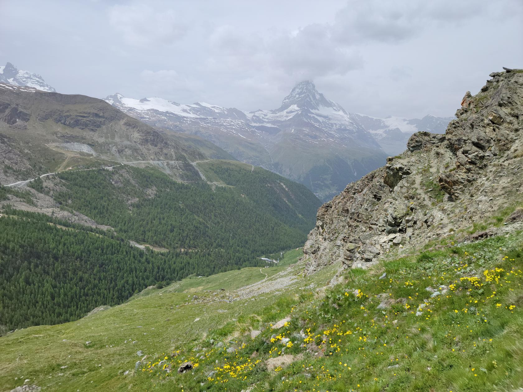
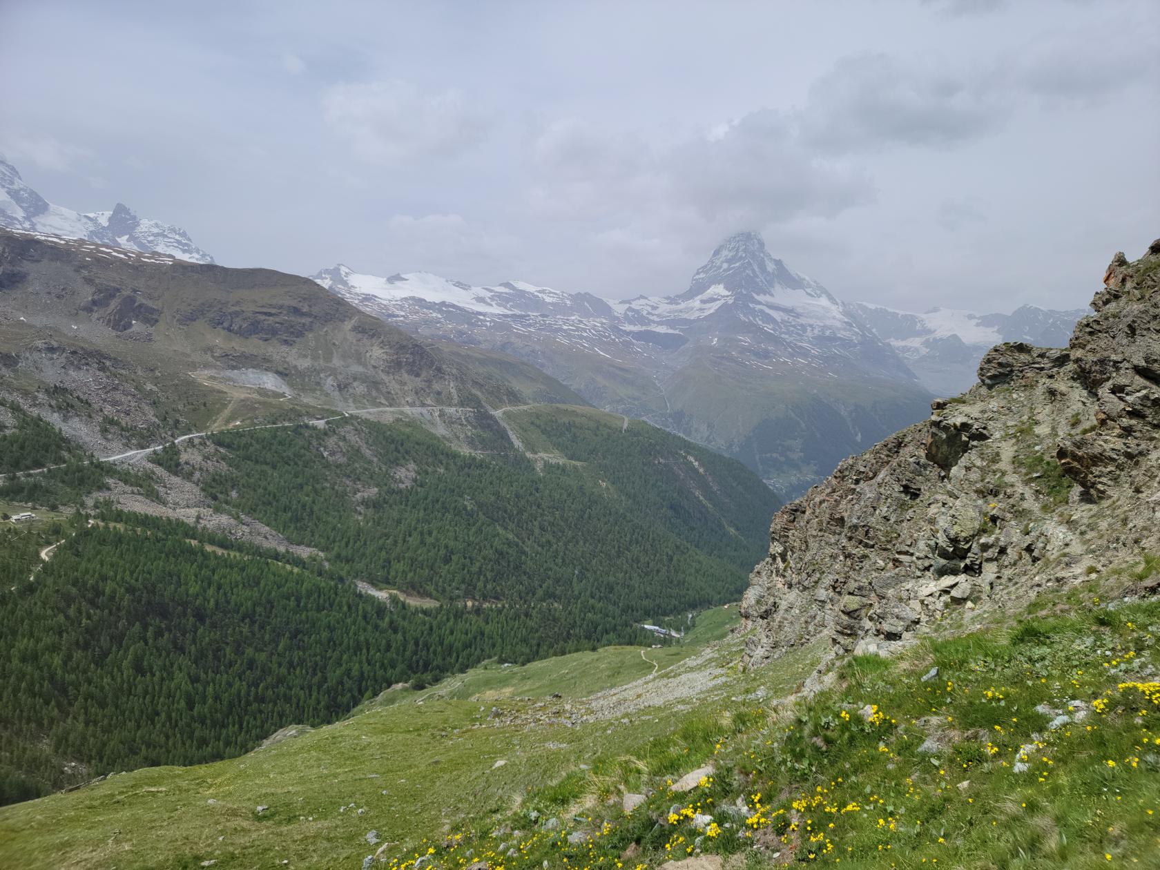
We chose this route over the five lakes trail, which you can actually see as you hike this trail, only because we heard that route was rather boring after about the first two lakes. However, if you have the time and motivation, I would commend it, since it has more elevation changes and a bit more challenging than this trail.
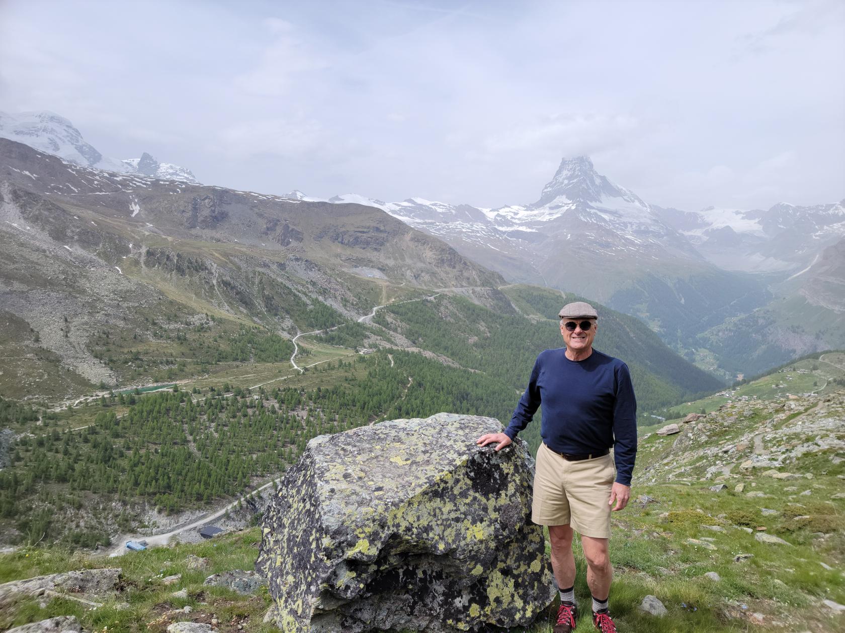
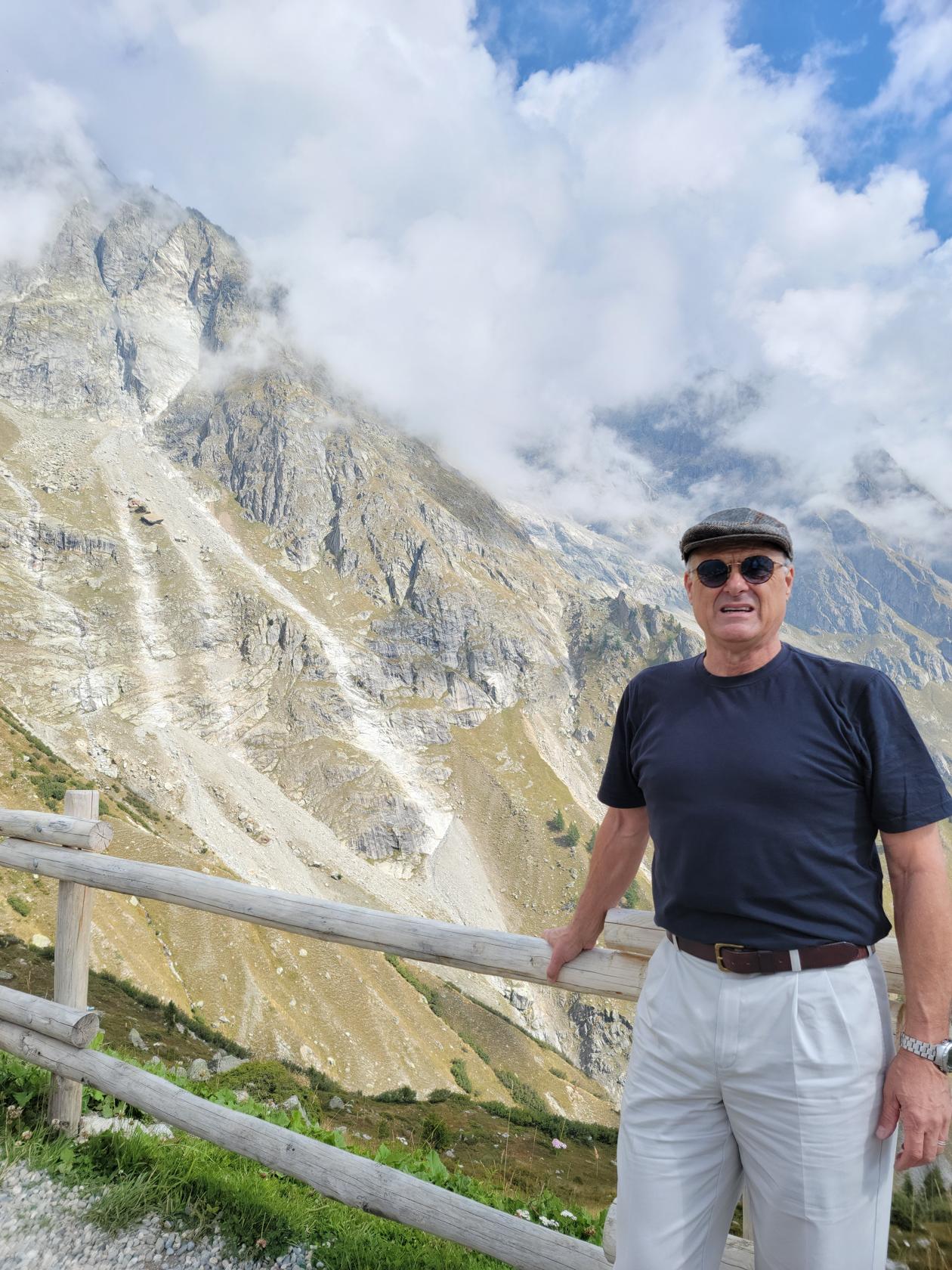
Erick and the Matterhorn – Zermatt, Switzerland
Murmelweg – Zermatt, Switzerland
Trail turns into rocks – Murmelweg – Zermatt, Switzerland
Patti on the Murmelweg – Zermatt, Switzerland
Patti leading the way – Murmelweg – Zermatt, Switzerland
A murmel hole – Murmelweg – Zermatt, Switzerland
Alpine flowers and valley before Matterhorn – Zermatt, Switzerland
Alpine flowers and valley before Matterhorn – Zermatt, Switzerland
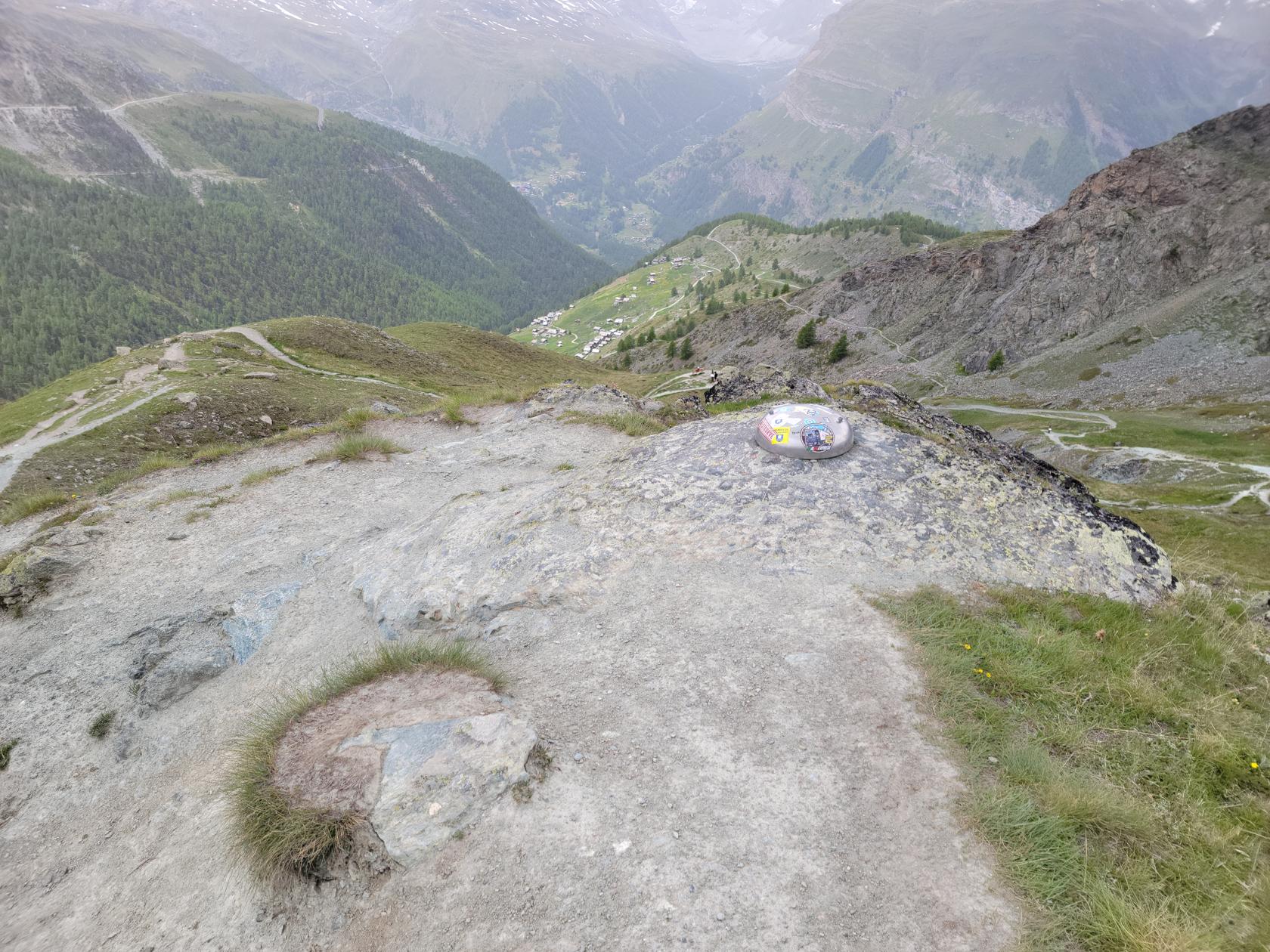
Geodetic marker – Zermatt, Switzerland
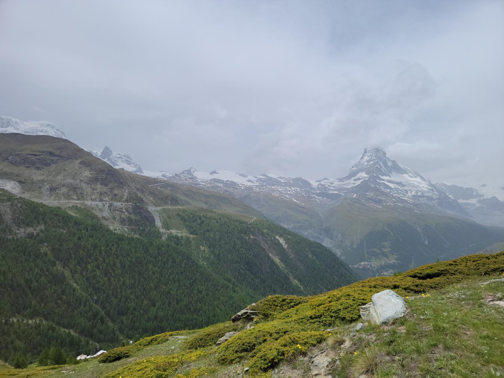
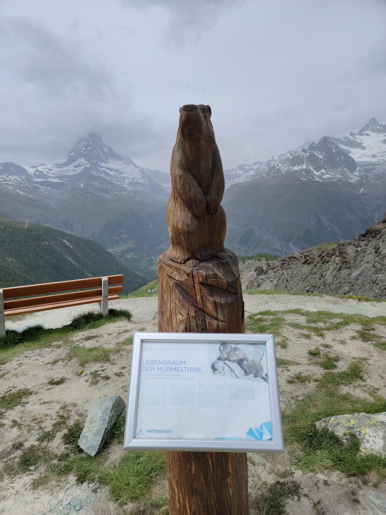
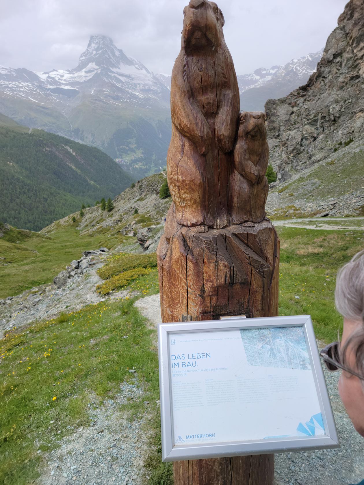
Matterhorn and adjacent peaks – looking towards RiffelalpAnimal carvings with little tails – Murmelweg – Zermatt, Switzerland
Animal carvings with little tails – Murmelweg – Zermatt, Switzerland
Animal carvings with little tails – Murmelweg – Zermatt, Switzerland
Animal carvings with little tails – Murmelweg – Zermatt, Switzerland
Animal carvings with little tails – Murmelweg – Zermatt, Switzerland
The area of Findeln and Gornergrat below – MurmelwegAnimal carvings with little tails – Murmelweg – Zermatt, Switzerland
Getting close to trail end – MurmelwegAnimal carvings with little tails – Murmelweg – Zermatt, Switzerland
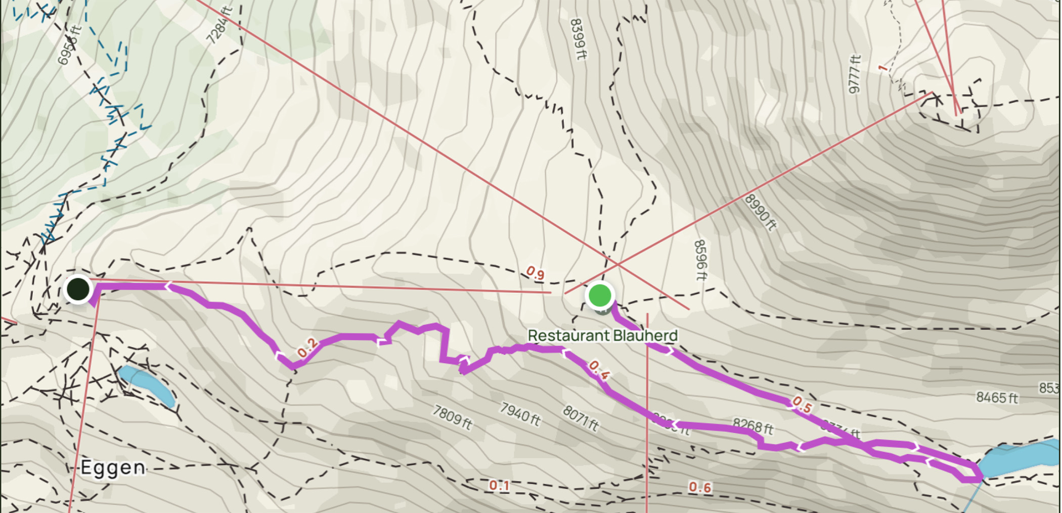
Our Route – Map
The following reference map details our trail route. The route was a bit over two miles with only a few hundred feet elevation decline and took us about an hour and a half to complete, stopping frequently for photographs.
Blauherd-Stellisee-Murmelweg-Sunnegga Trail – All Trails – Zermatt, Switzerland
Restaurants
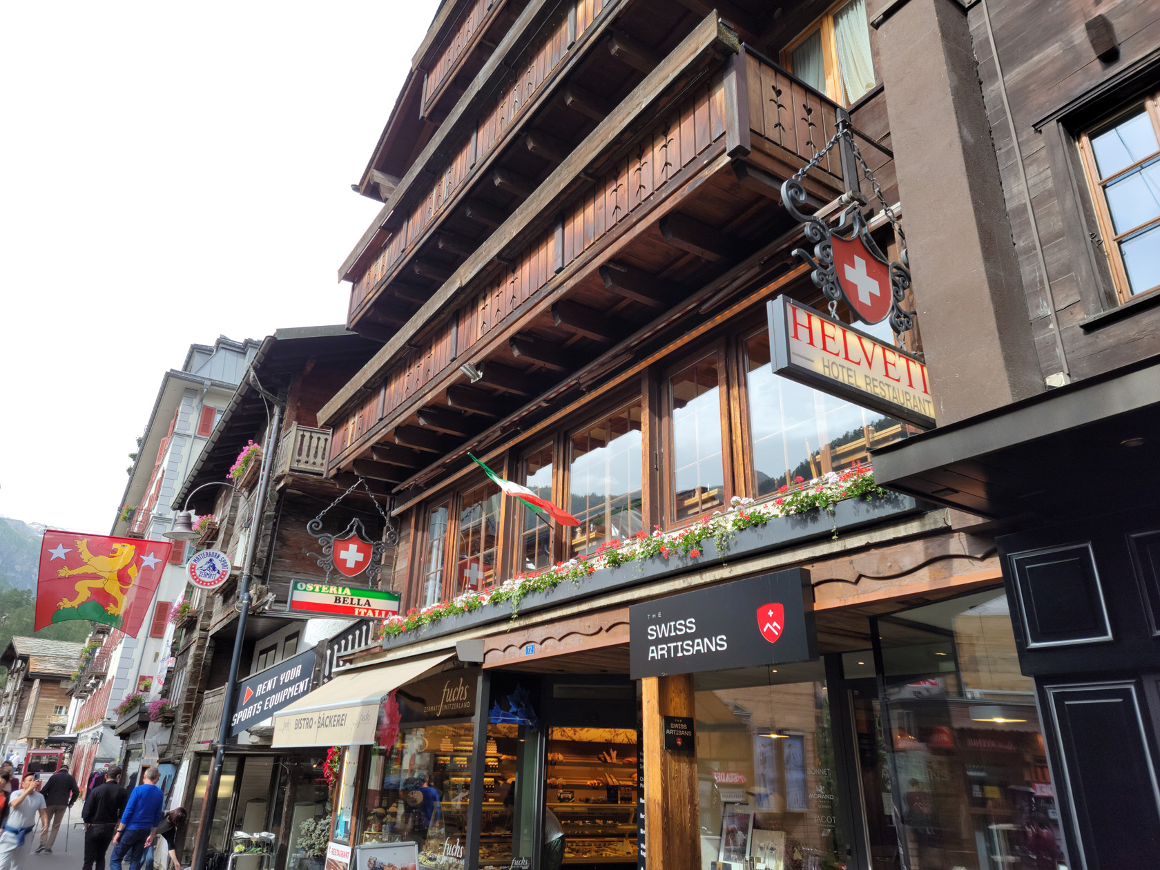
Osteria Bella Italia
Osteria Bella Italia – Zermatt, Switzerland
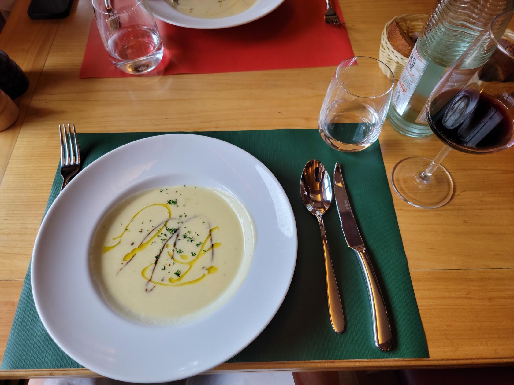
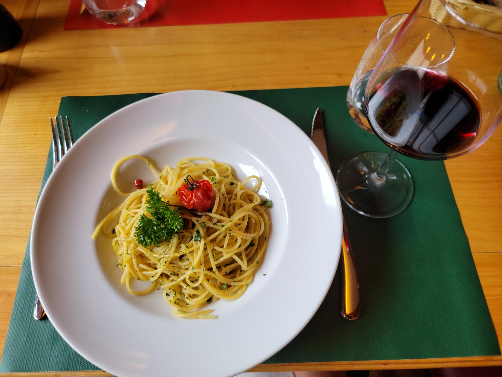
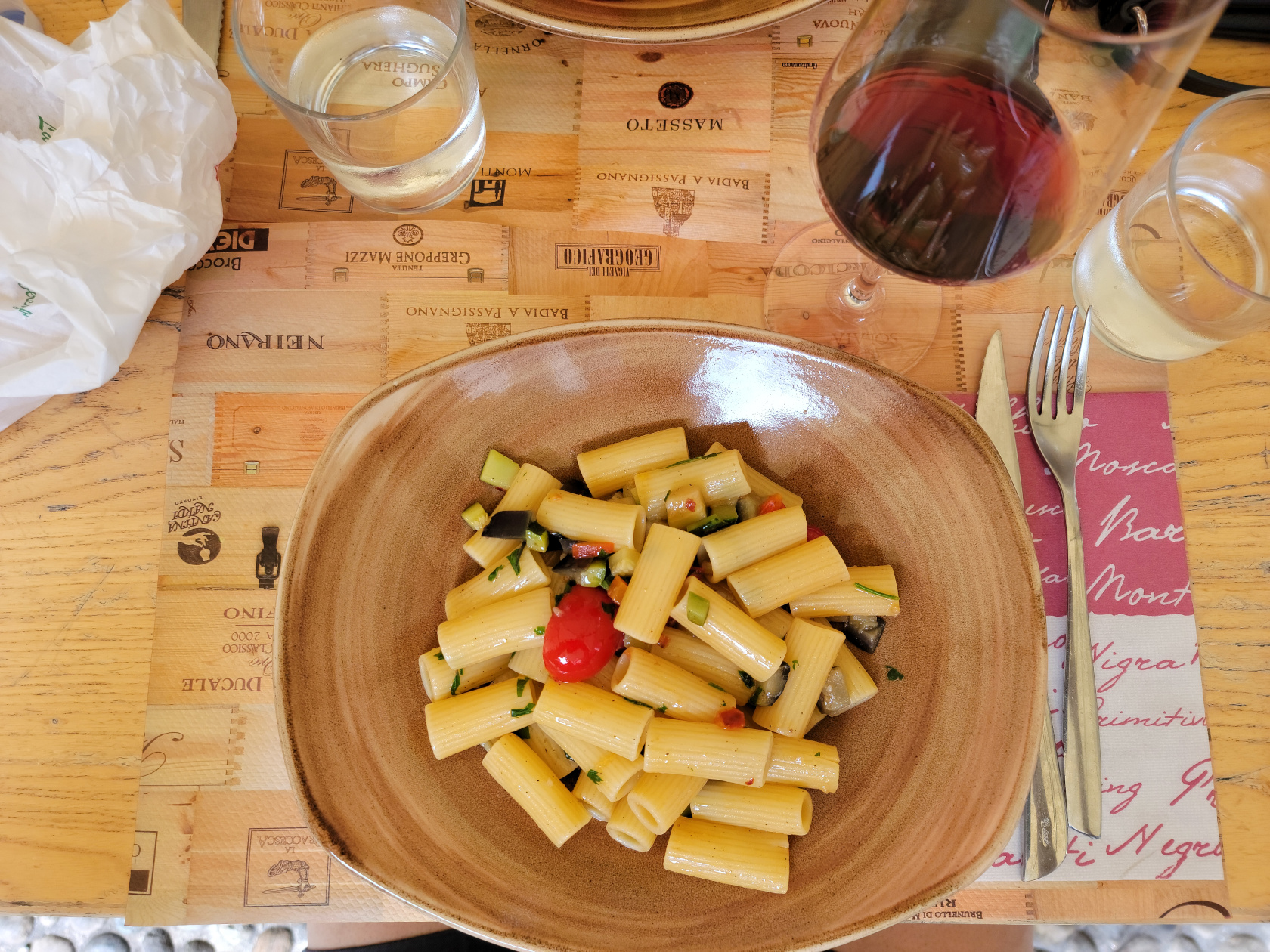
An Italian restaurant that is part of hotel on the Bahnhofstrasse, the Osteria Bella Italia is what my wife and I call and overpriced, corporate dining establishment serving food they want to be Italian. It’s not bad, but the preparation is what I would say a bit sub-optimal. Then there are the prices. I paid 22CHF for a small bowl of pasta with garlic and oil, totally unheard of in Italy.
Cauliflower soup – Osteria Bella Italia – Zermatt, Switzerland
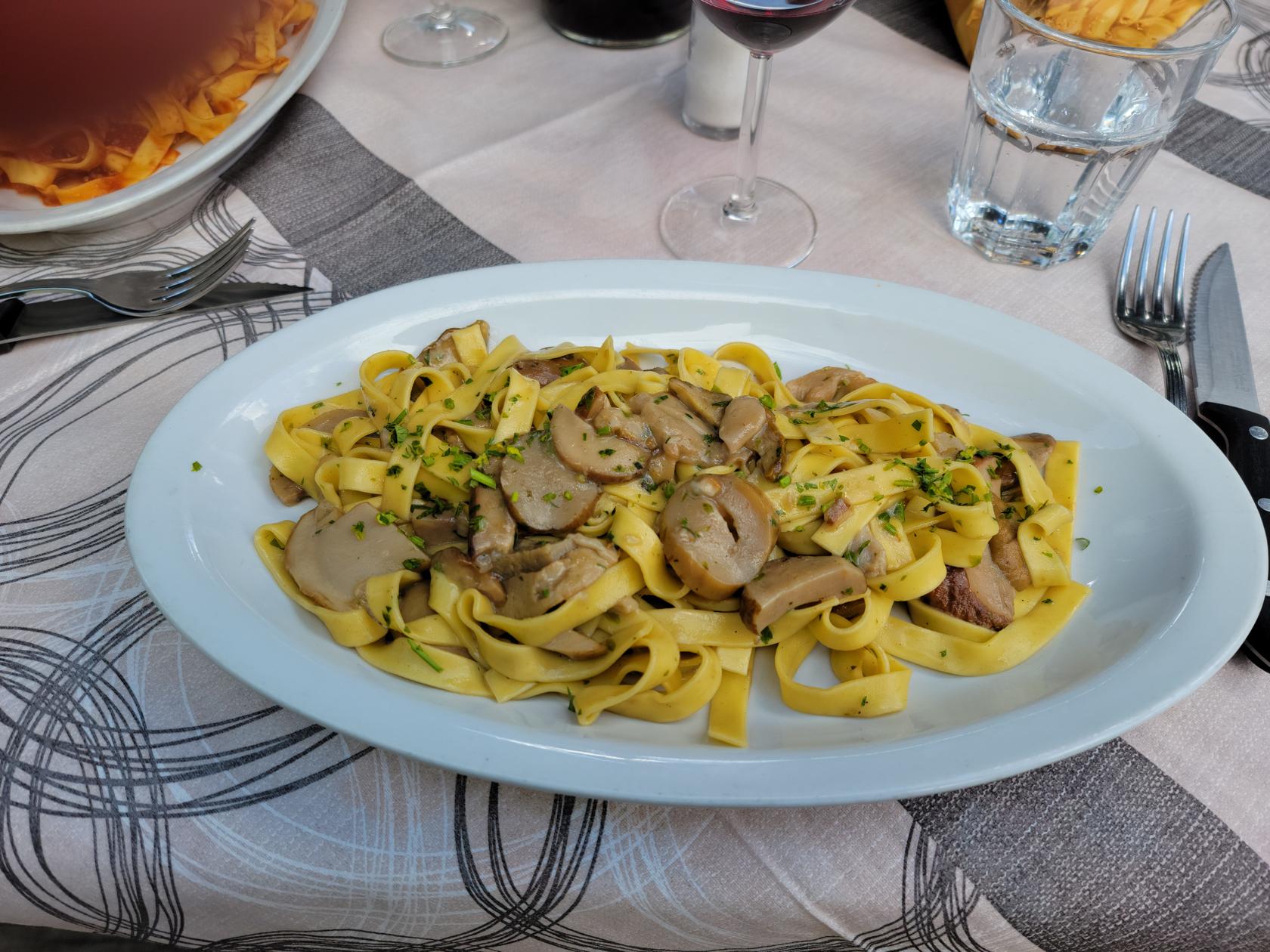
spaghetti aglio olio e peperoncino – Osteria Bella Italia – Zermatt, Switzerland
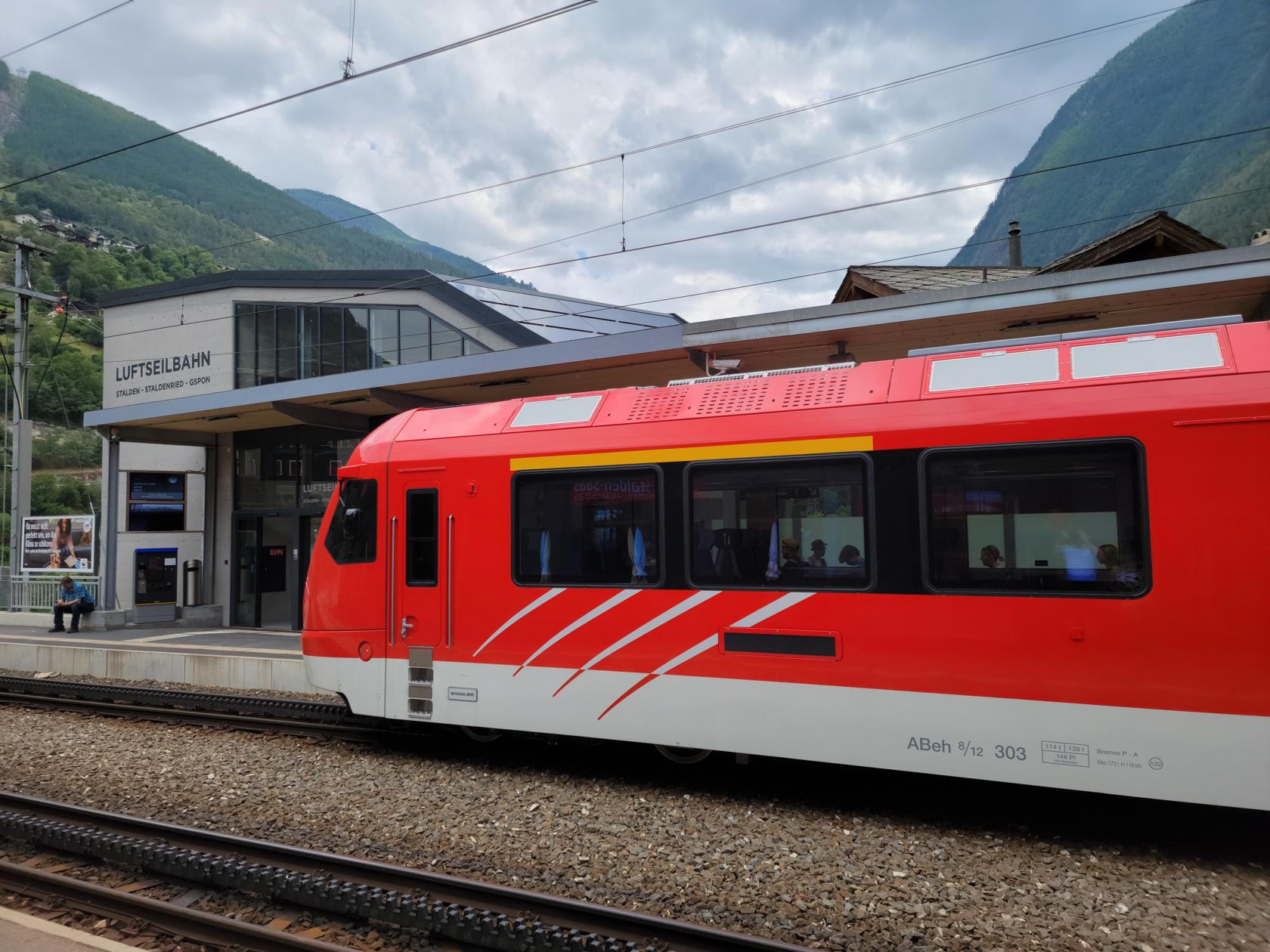
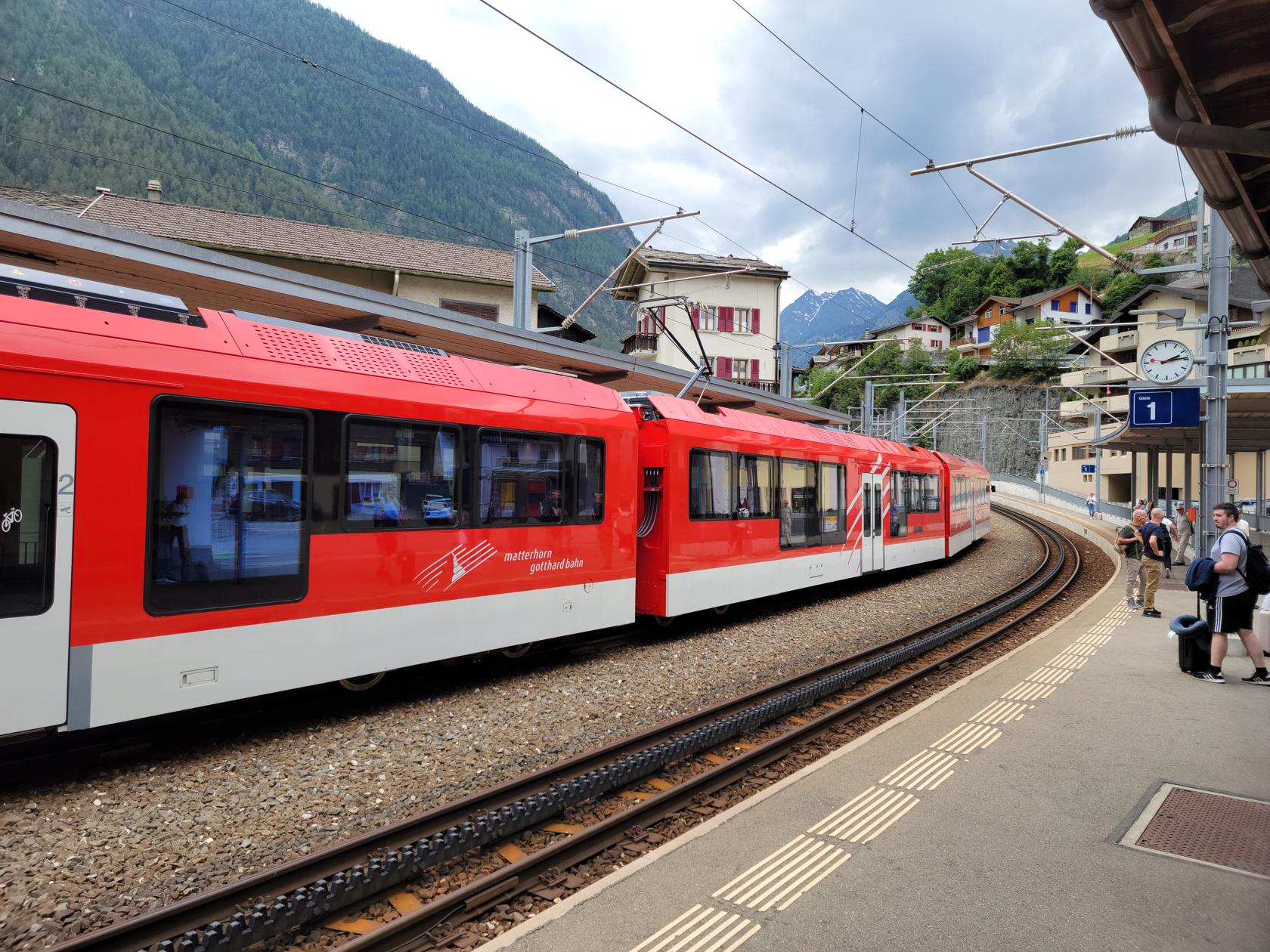
This week we traveled by train from Turin to Zermatt, Switzerland in the hopes of enjoying the weather and the clean air. There is plenty of clean air, but the weather has remained extremely variable, with it almost always raining in the afternoons.
Zermatt train station – Zermatt, Switzerland
After we got off the EuroCity train in Visp we had to take the local train from there to Zermatt. These trains are run by the canton and are especially equipped to ascend to the 5200ft elevation we needed to ascend in order to get to our destination.
Unfortunately, our first attempt failed and the train that we were on broke down at its first stop. We had to wait approximately a half an hour before another arrived to complete our journey.
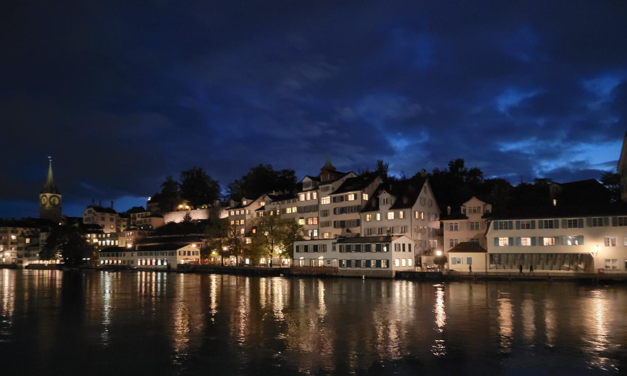
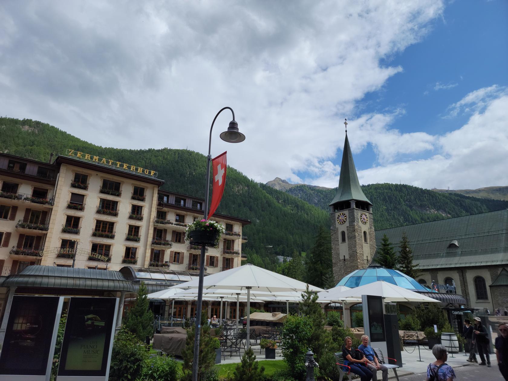
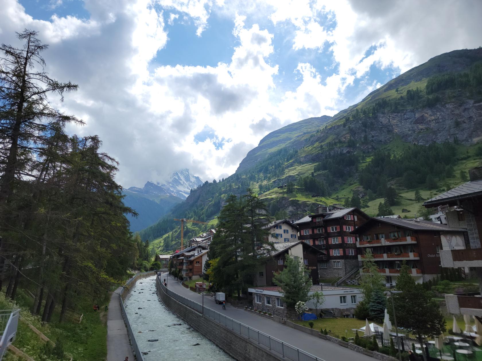
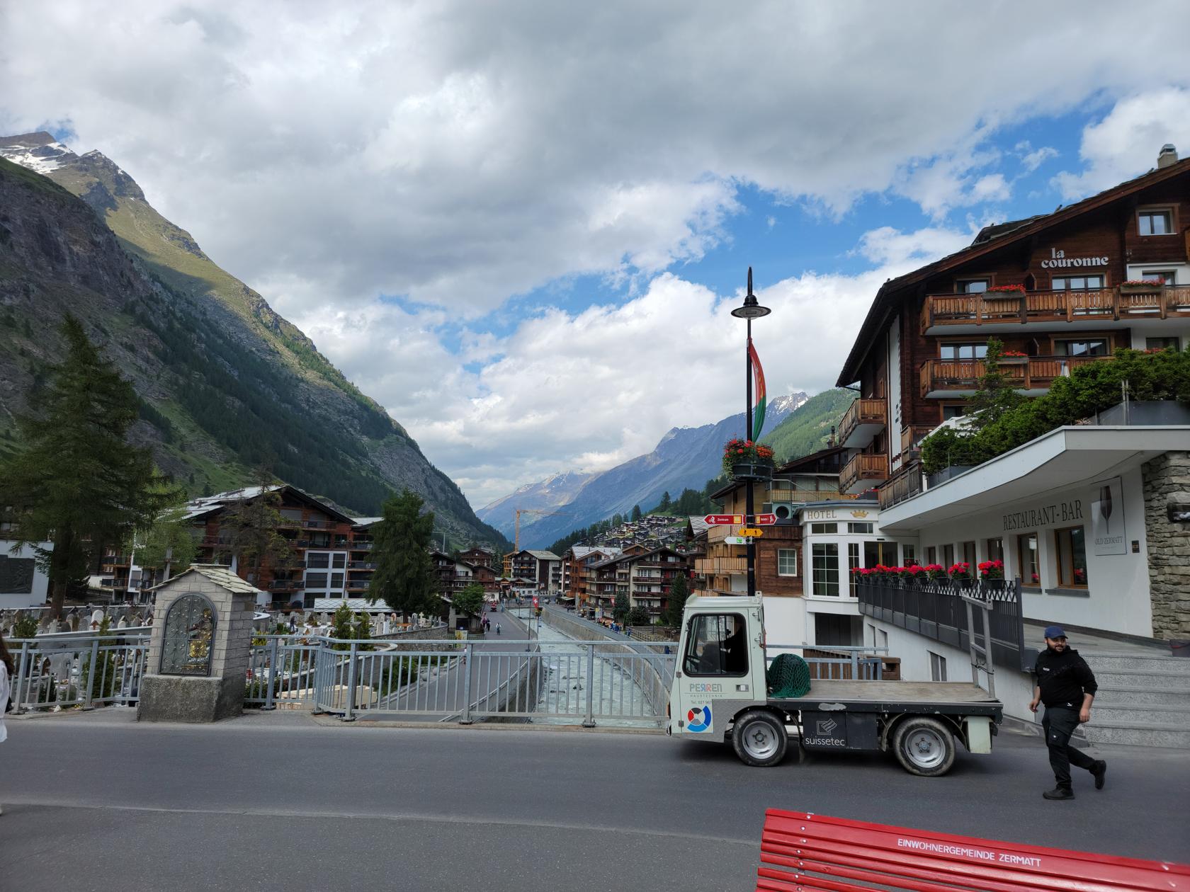
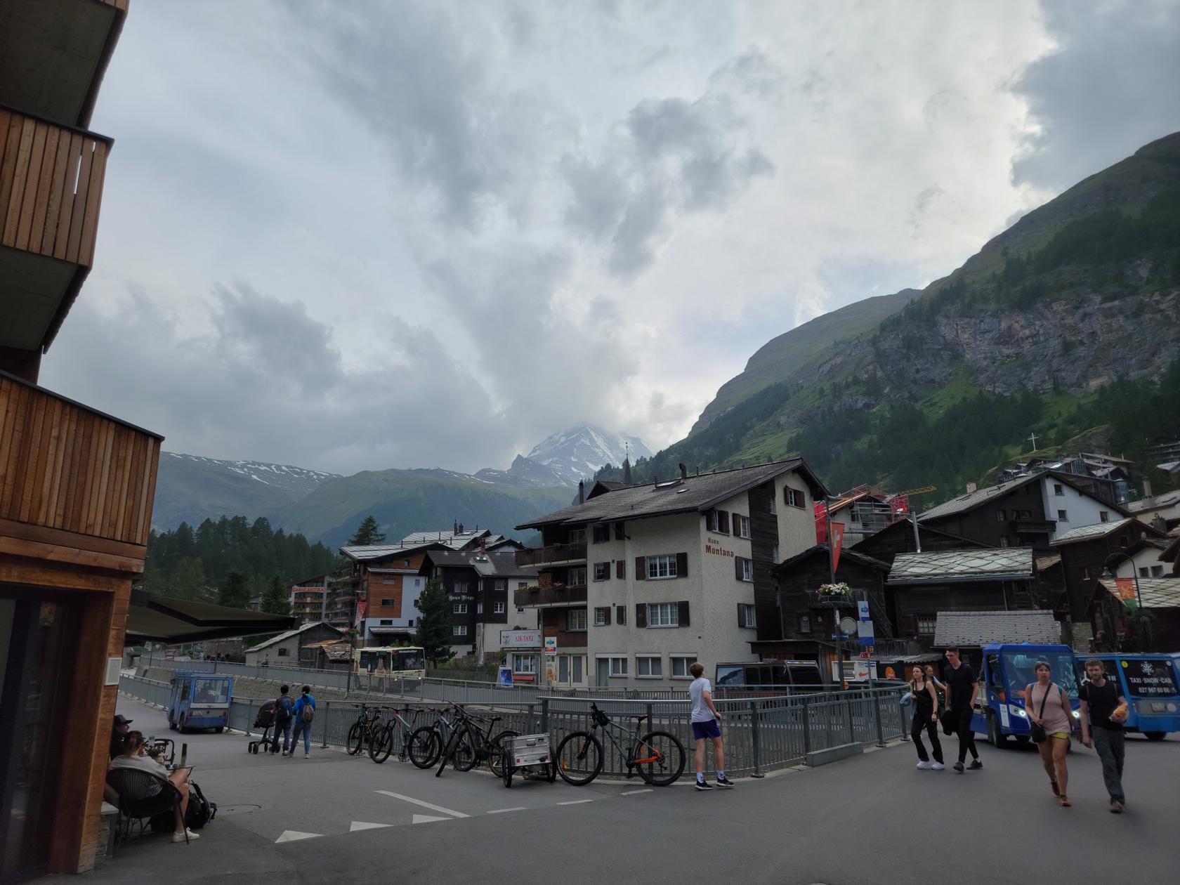
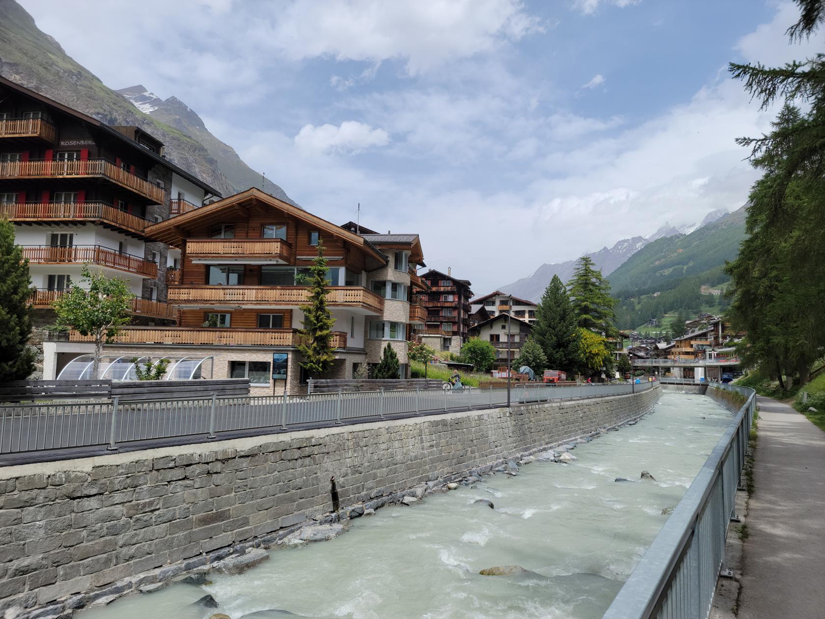
Zermatt
Zermatt is considered a town by the local government and with a constant population of around five thousands, that would seem to be about correct. However, the bulk of the people that you find here are tourists. And as one would expect, the tourist population swells during the weekends as local Swiss and others from neighboring regions come to enjoy the alpine air.
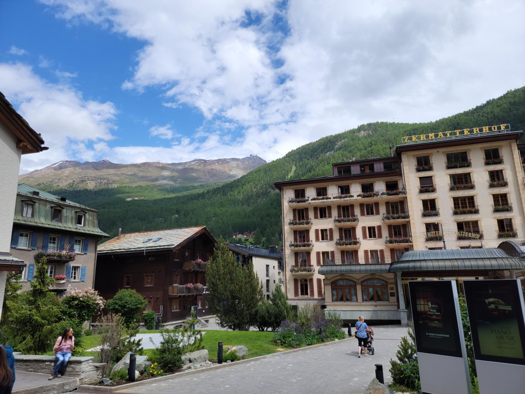
Pfarrerkirche and Zermatterhof – Zermatt, Switzerland
Zermatterhof – Zermatt, Switzerland
Looking toward the Matterhorn – Zermatt, Switzerland
Looking down the Mattertal – Zermatt, Switzerland
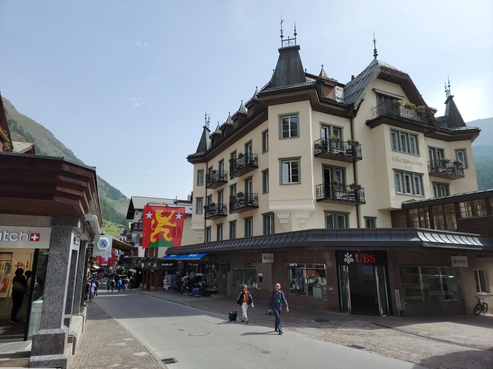
Bahnhofstrasse, the main street – Zermatt, Switzerland
Matterhorn shrouded in clouds – Zermatt, Switzerland
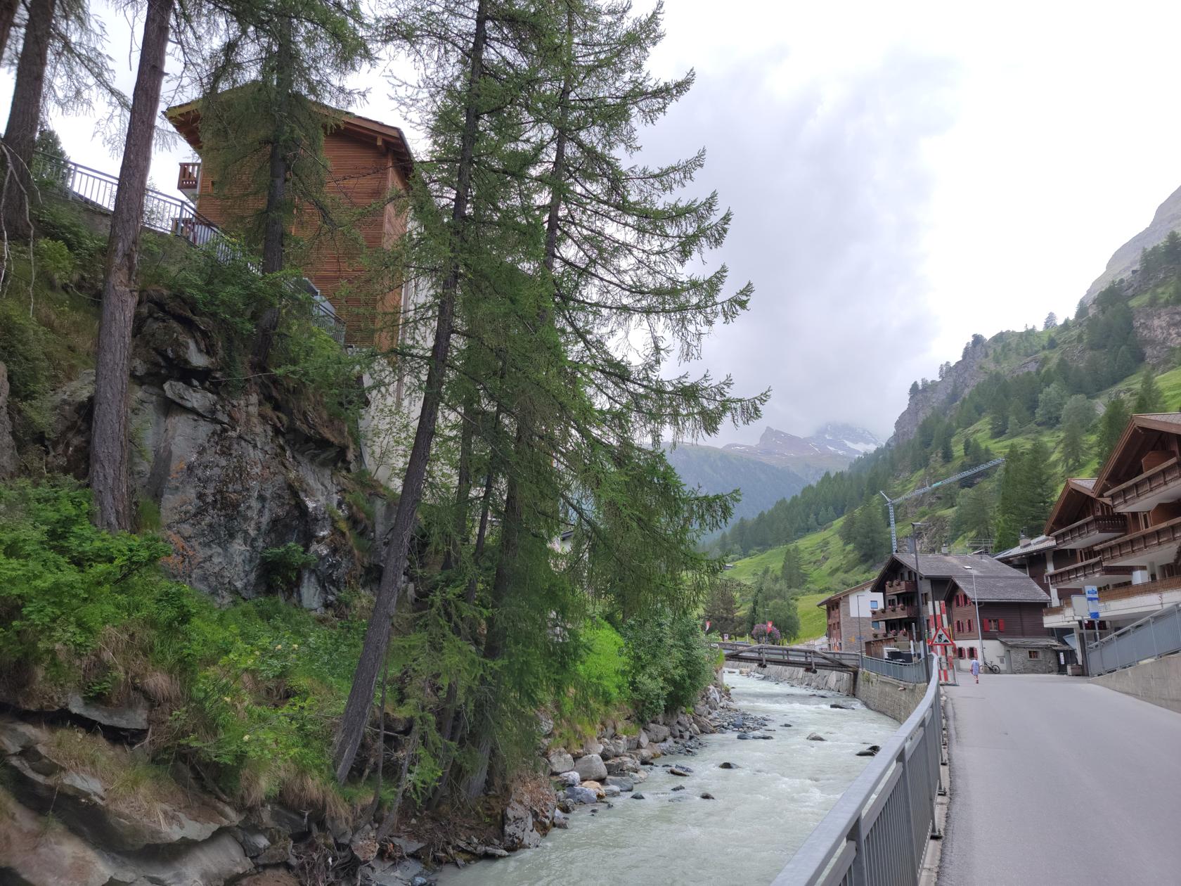
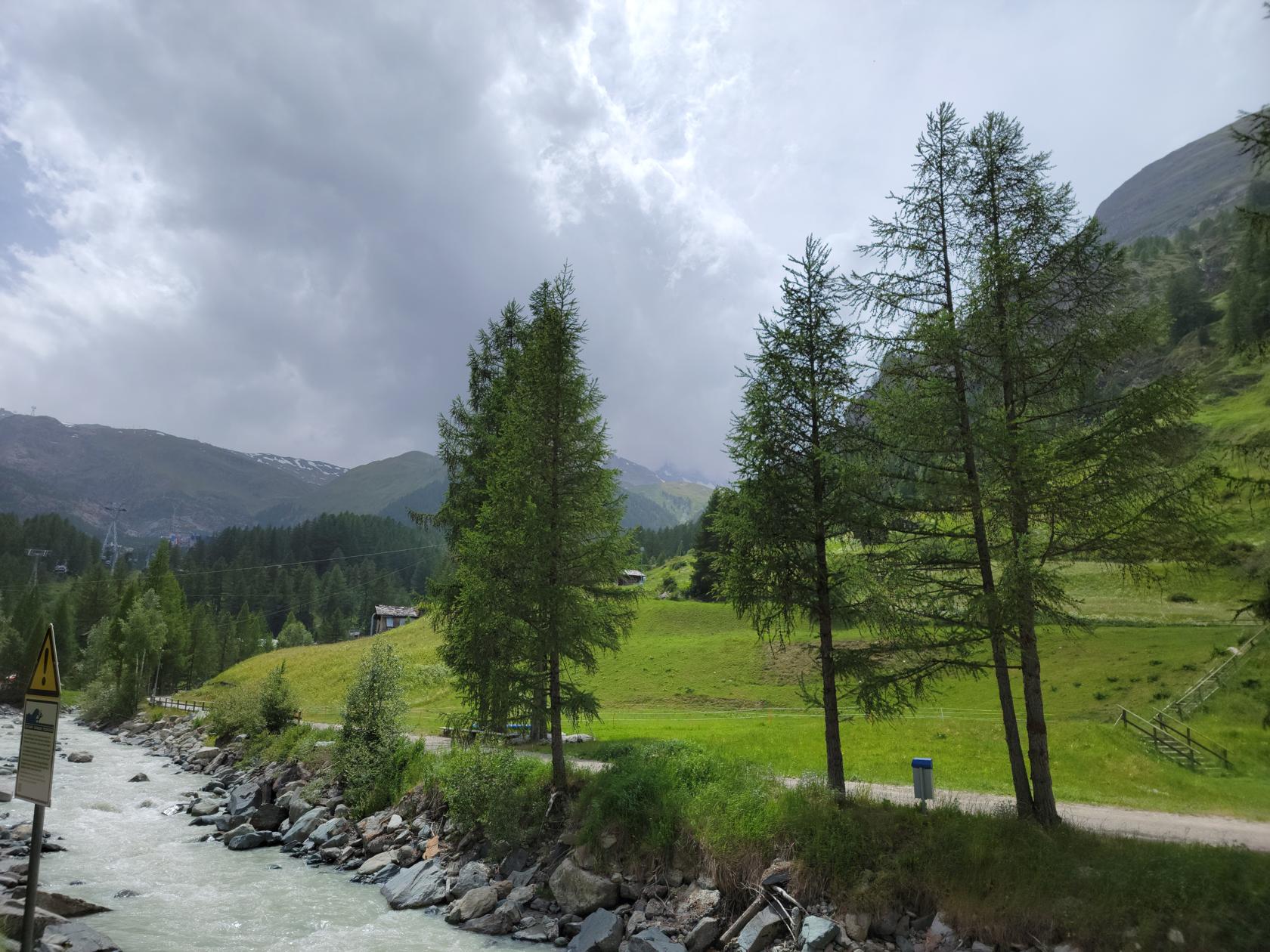
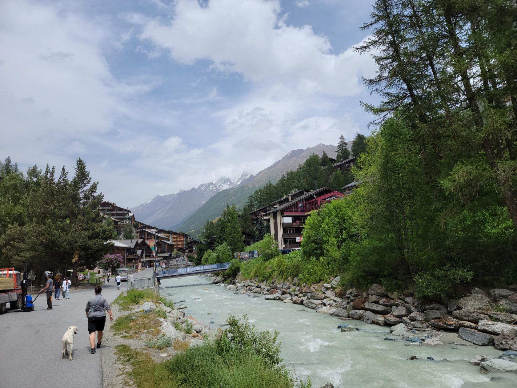
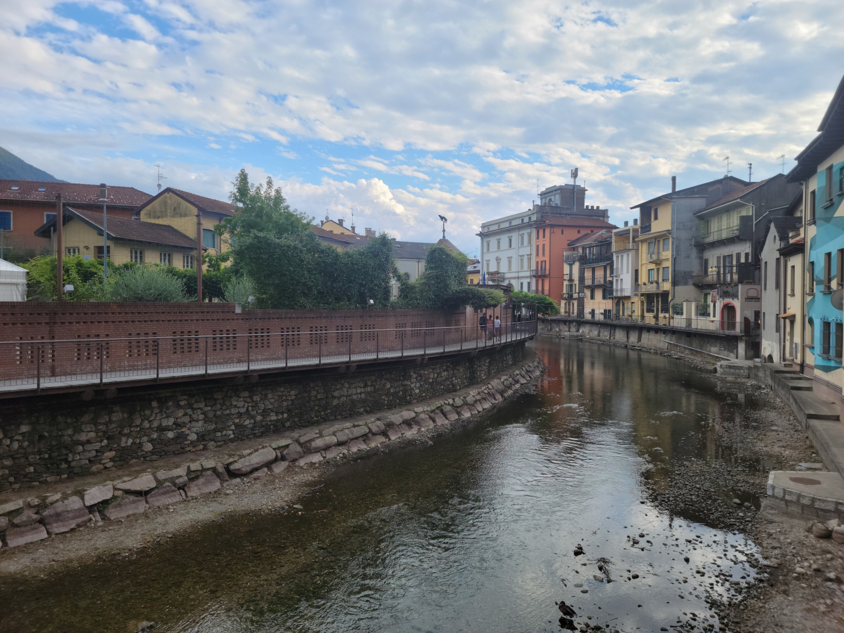
The town is divided by a river with is fed by the many glaciers that surround the town. However, the flow of this river is controlled by a dam and there are signs that warn those who want to sun themselves on the rocks along its banks, that water can be unexpectedly released and you can be swept down river. We actually witnessed the water level rise once due to the rain we had been receiving.
Gomerabach – Zermatt, Switzerland
Uferweg – Zermatt, Switzerland
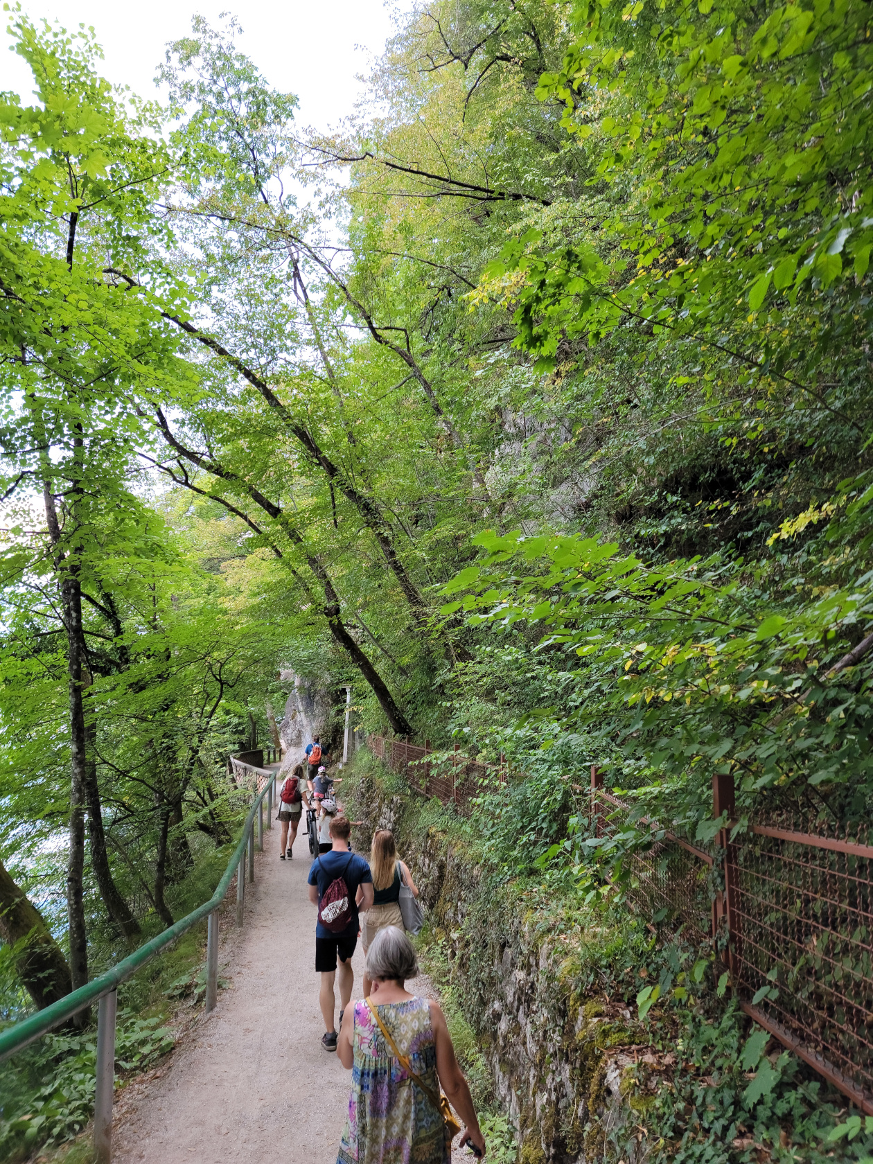
Uferweg – Zermatt, Switzerland
Area above Zermatt along the river – Zermatt, Switzerland
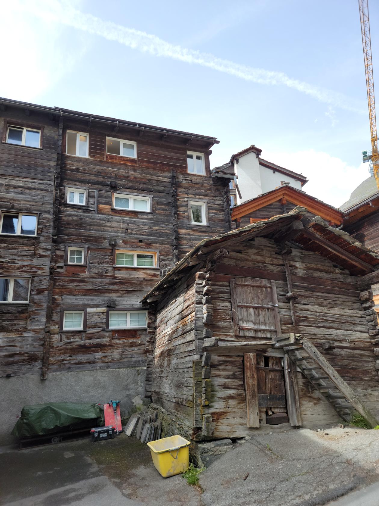
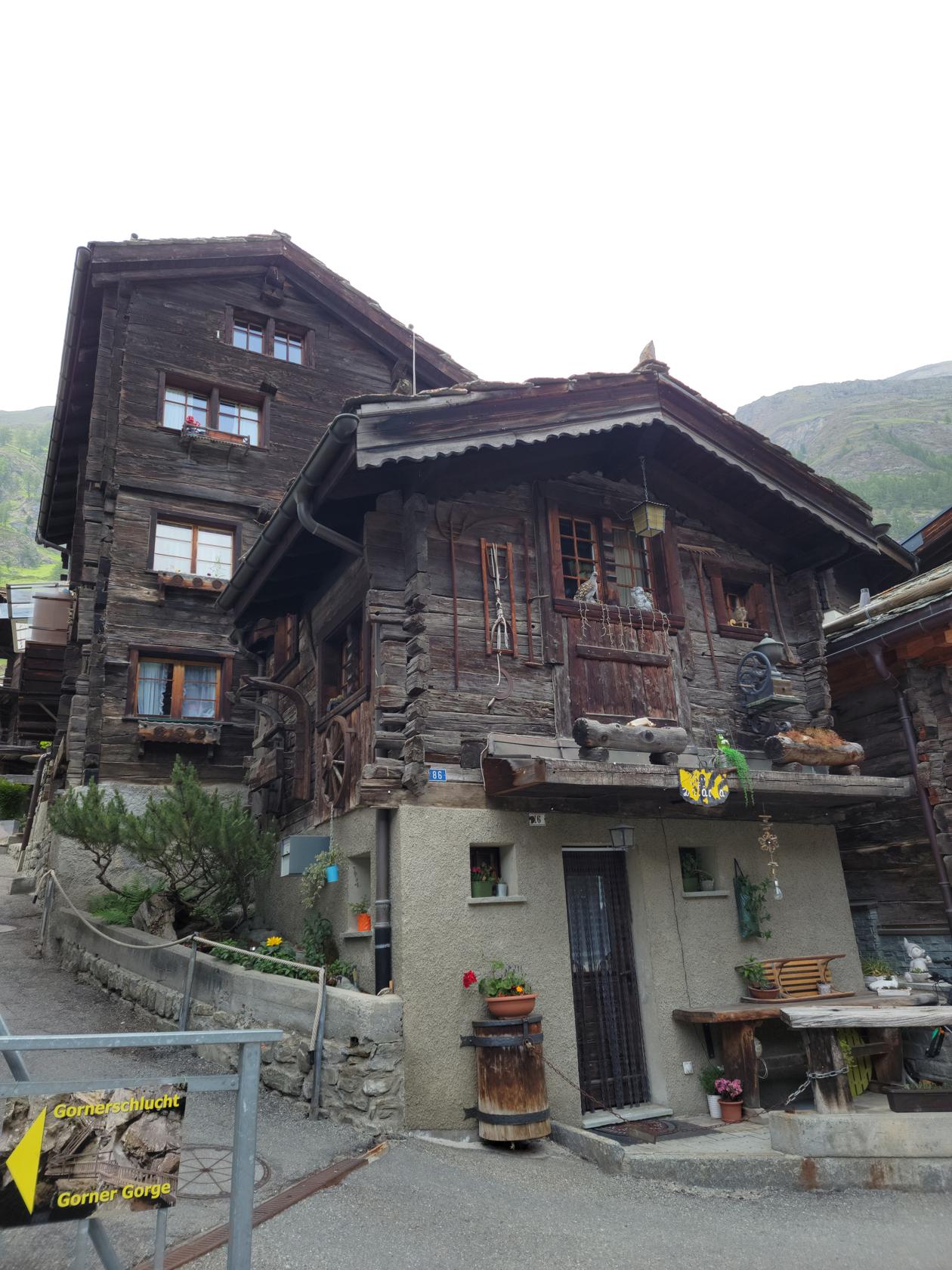
Old Zermatt
There are examples in the upper parts of Zermatt, of the original buildings that were used by the early residents. Some are still in use today. However, with the increased land prices, most have sold out and moved up valley to get away from the tourism gentrification.
Triftbachtal – Zermatt, Switzerland
Triftbachtal – Zermatt, Switzerland
Scenery on one of our walks – Zermatt, Switzerland
Scenery on one of our walks – Zermatt, Switzerland
Original buildings of Zermatt – Zermatt, Switzerland
Older original buildings of Zermatt – Zermatt, Switzerland
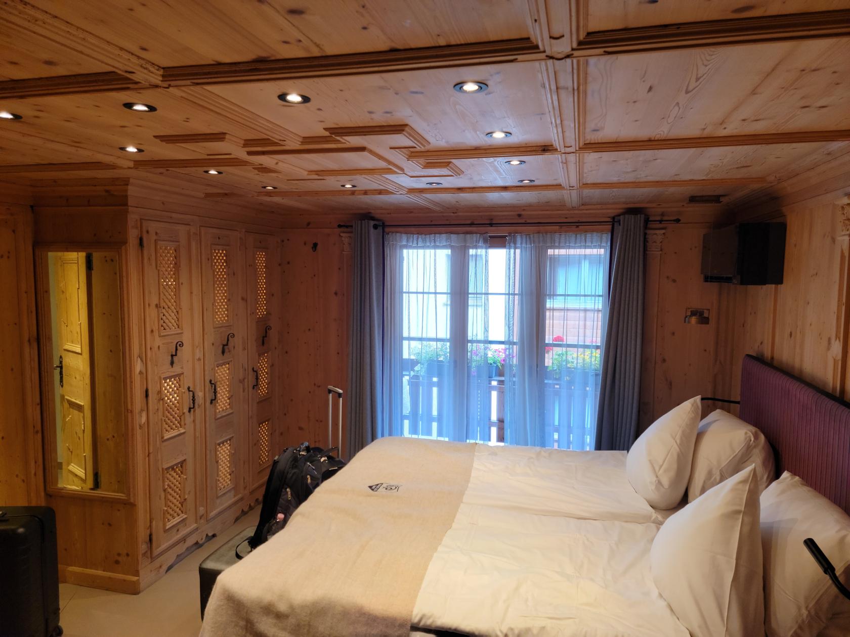
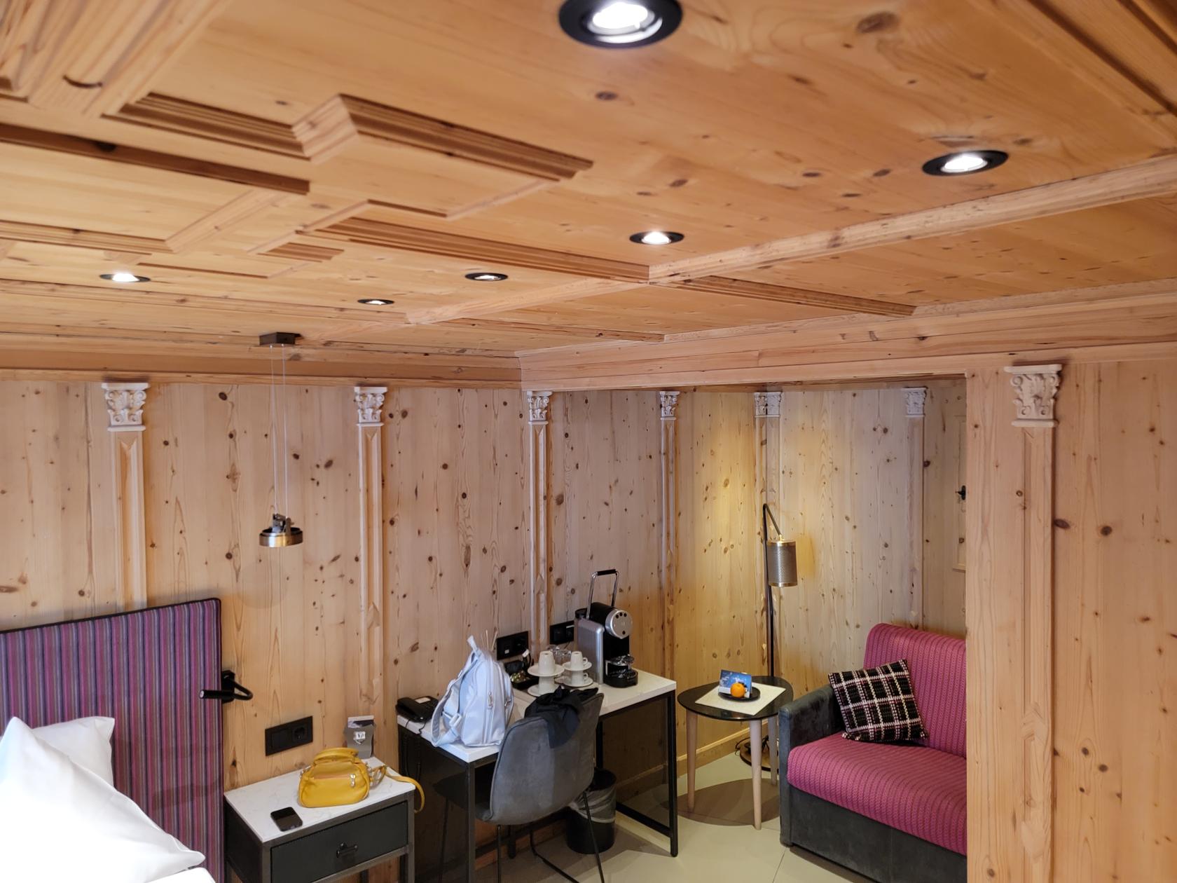
The Tradition Julen
Our hotel is the four star The Tradition Julen hotel. It is one of the more pricier hotels in the area but the rooms are very cozy and comfortable. In fact, it is one of the few four star hotels that I have not had the displeasure of asking for something that should be already included in the room! The service is first rate and so far we are having a great stay. It is also close to the center of town, but kind of out of the way too, so you won’t get a lot of tourist walking by the hotel, which makes for a quieter stay.
Our room – Hotel Tradition Julen – Zermatt, Switzerland
Our room – Hotel Tradition Julen – Zermatt, Switzerland
Restaurants
During our week long stay here, we ate at an assortment of restaurants. The area does have its traditional food and our hotel actually houses a traditional Valais Stube which serves food like this, mainly raclette, beef fondues and other curiosities.
Stadel Restaurant
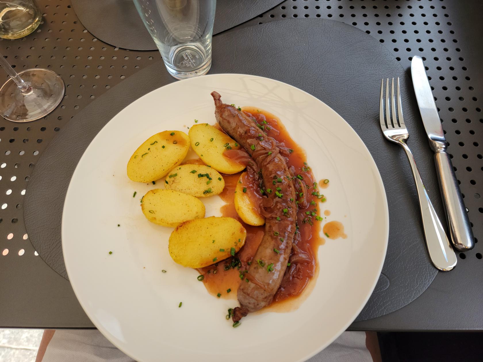
The first restaurant we stopped at that had just opened for the summer months. The service and food were good, but I have to knock them a bit for not having any sauerkraut – it is on the menu. It would have paired well with the Water Buffalo Bratwurst I had ordered and enjoyed.
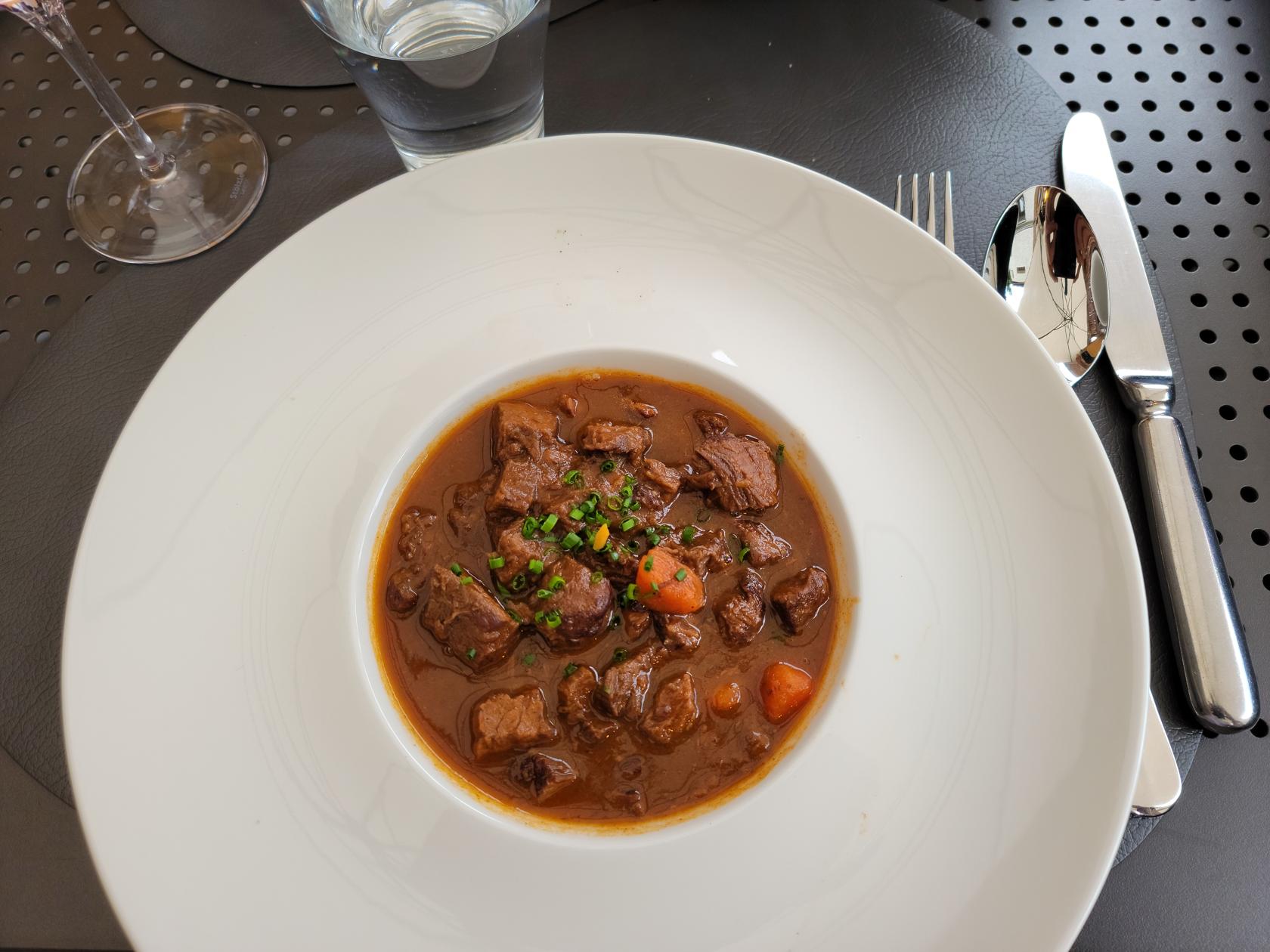
Water Buffalo Gulash – Stadel Restaurant – Zermatt, Switzerland
Water Buffalo Bratwurst with potatoes – Stadel Restaurant – Zermatt, Switzerland
Hotel Julen Restaurant
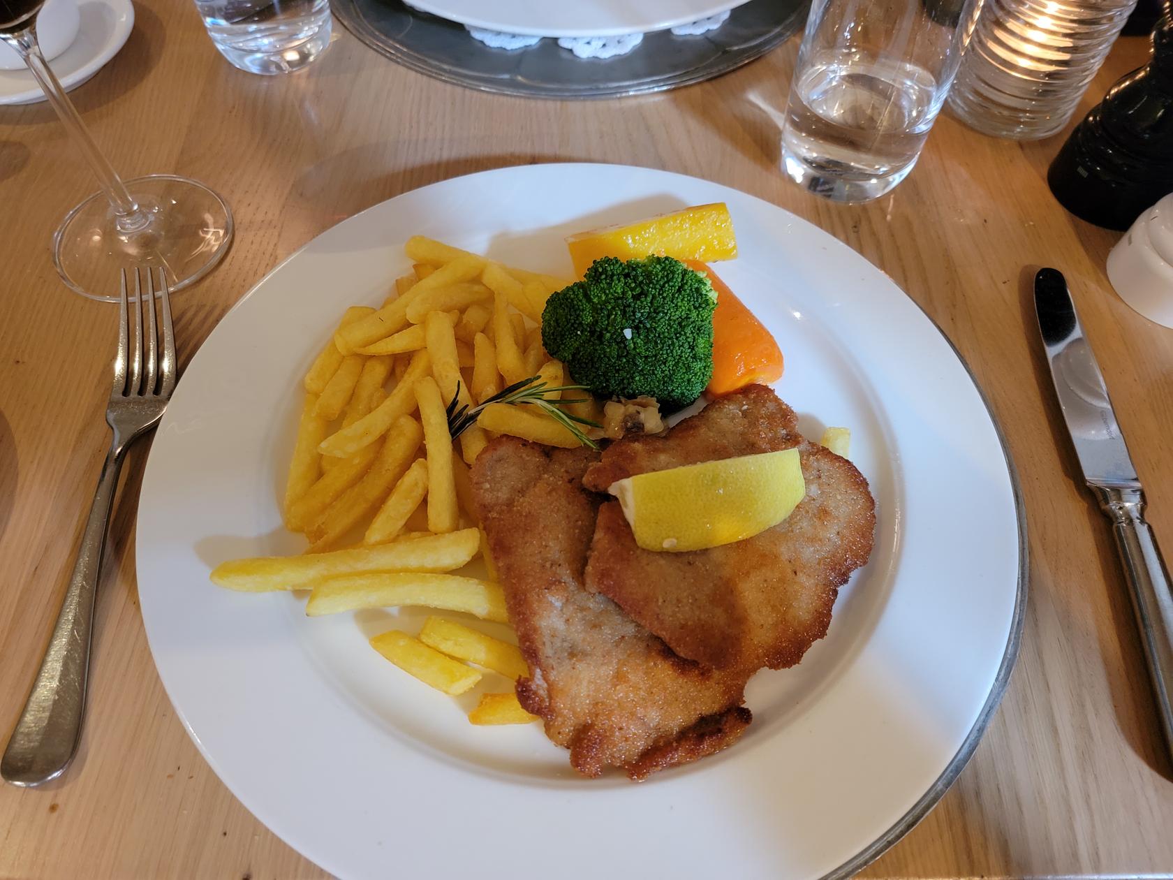
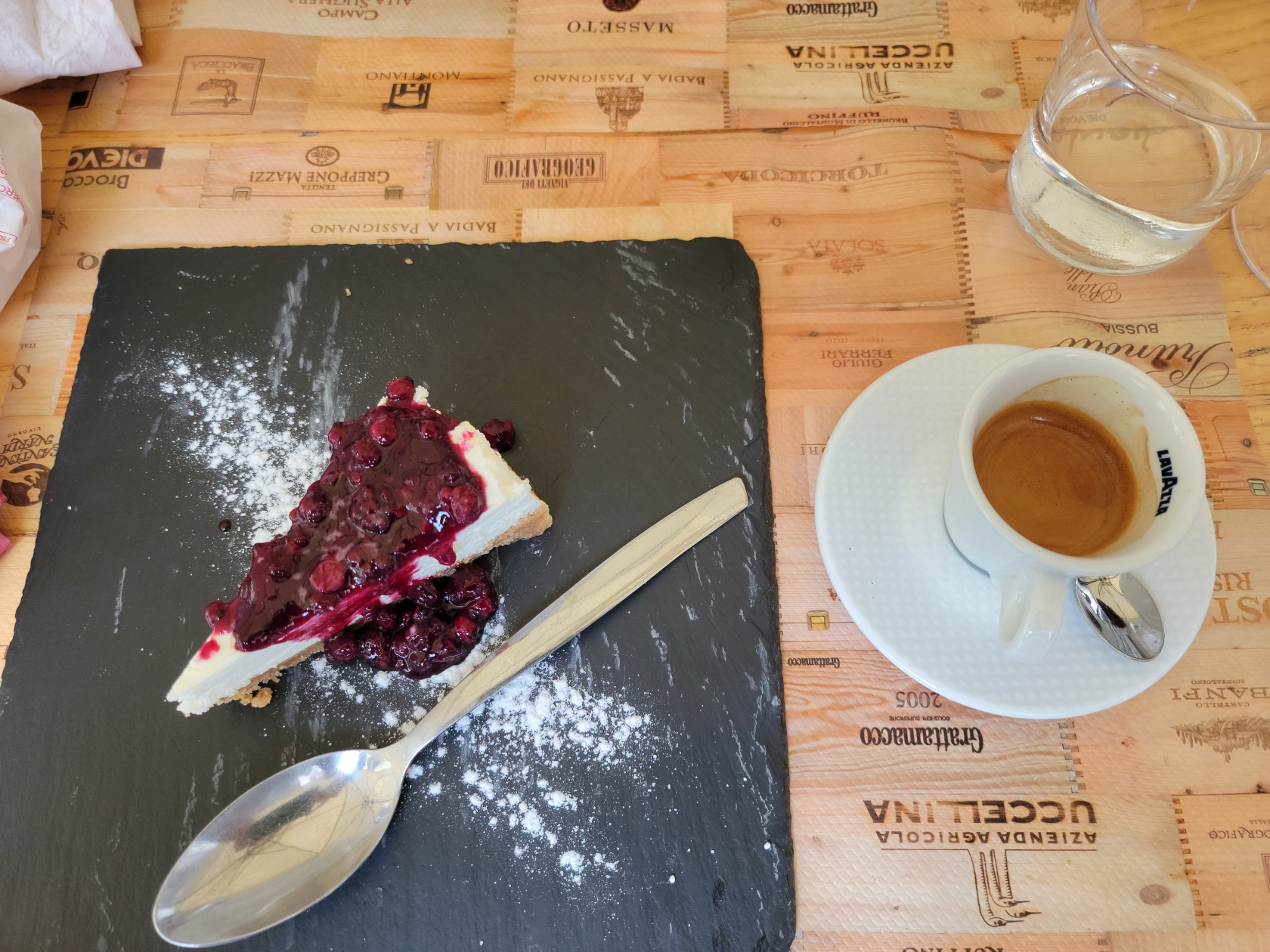
Our hotel has its own restaurant that serves cosmopolitan cuisine. Due to weather complications, we were forced to stay in and enjoy what it had to offer one evening and were not disappointed. We thought the food was very good and the prices fair.
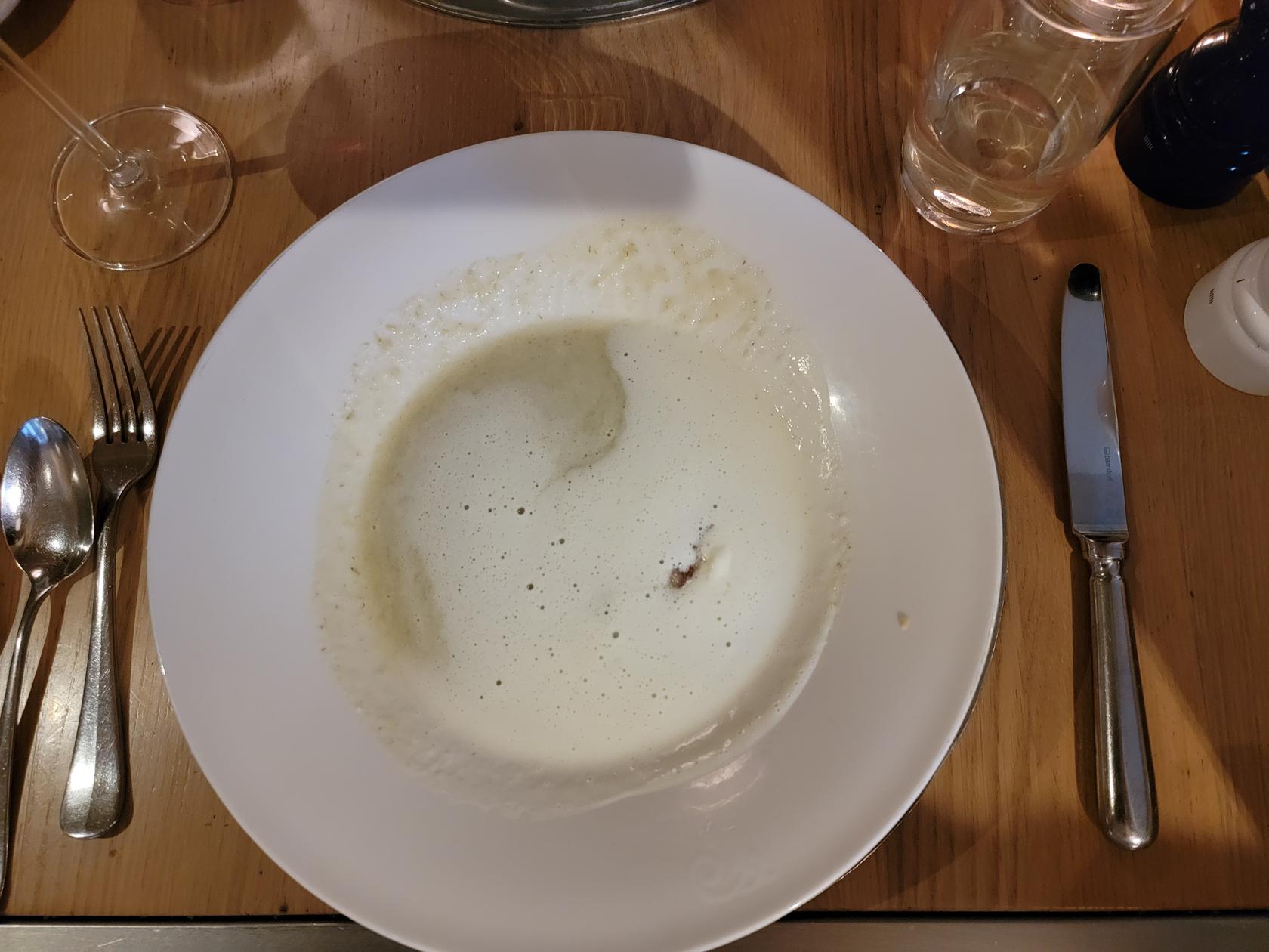
Cauliflower soup – Hotel Julen Restaurant – Zermatt, Switzerland
Traditional Wiener Schnitzel with french fried – Hotel Julen Restaurant – Zermatt, Switzerland
Our initial feel for the town is good, it has excellent services and plenty of restaurants and bars. Some of the food can be pricey, but if you stick to the traditional German fare, the prices seem more reasonable. The people are very friendly and speak multiple language, especially English, so getting around should not be an issue.
So we are still here and our next plans included hiking and using the amazing funicular, cog railway and gondola system. I will make additional entries for those once we have completed and recuperated from them a bit. Until then, stay tuned.
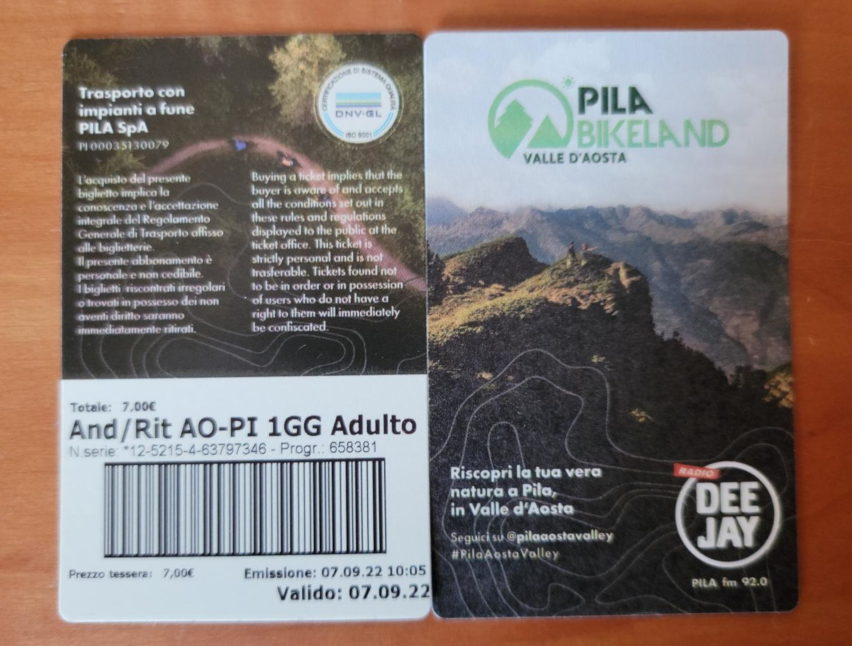
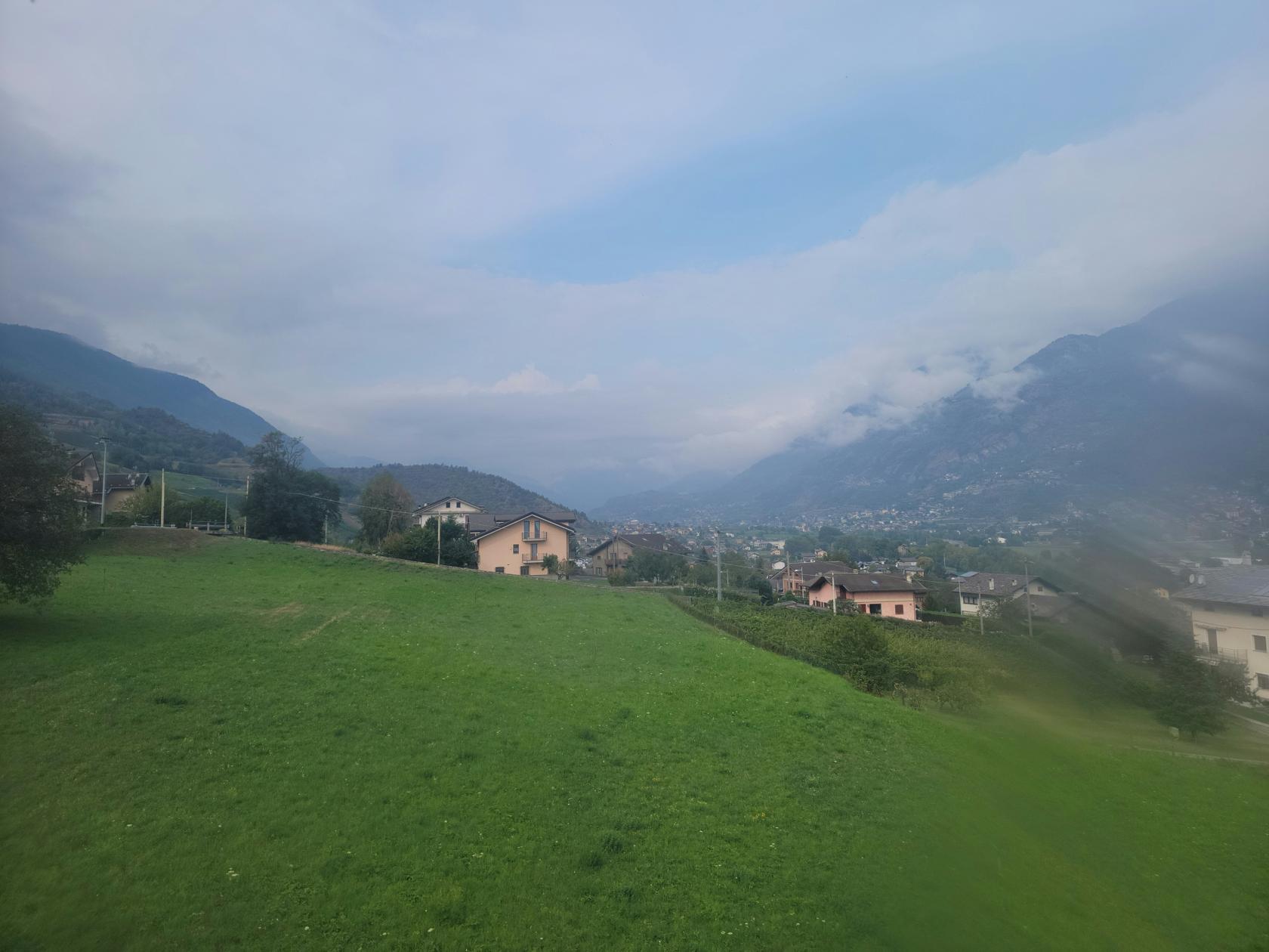
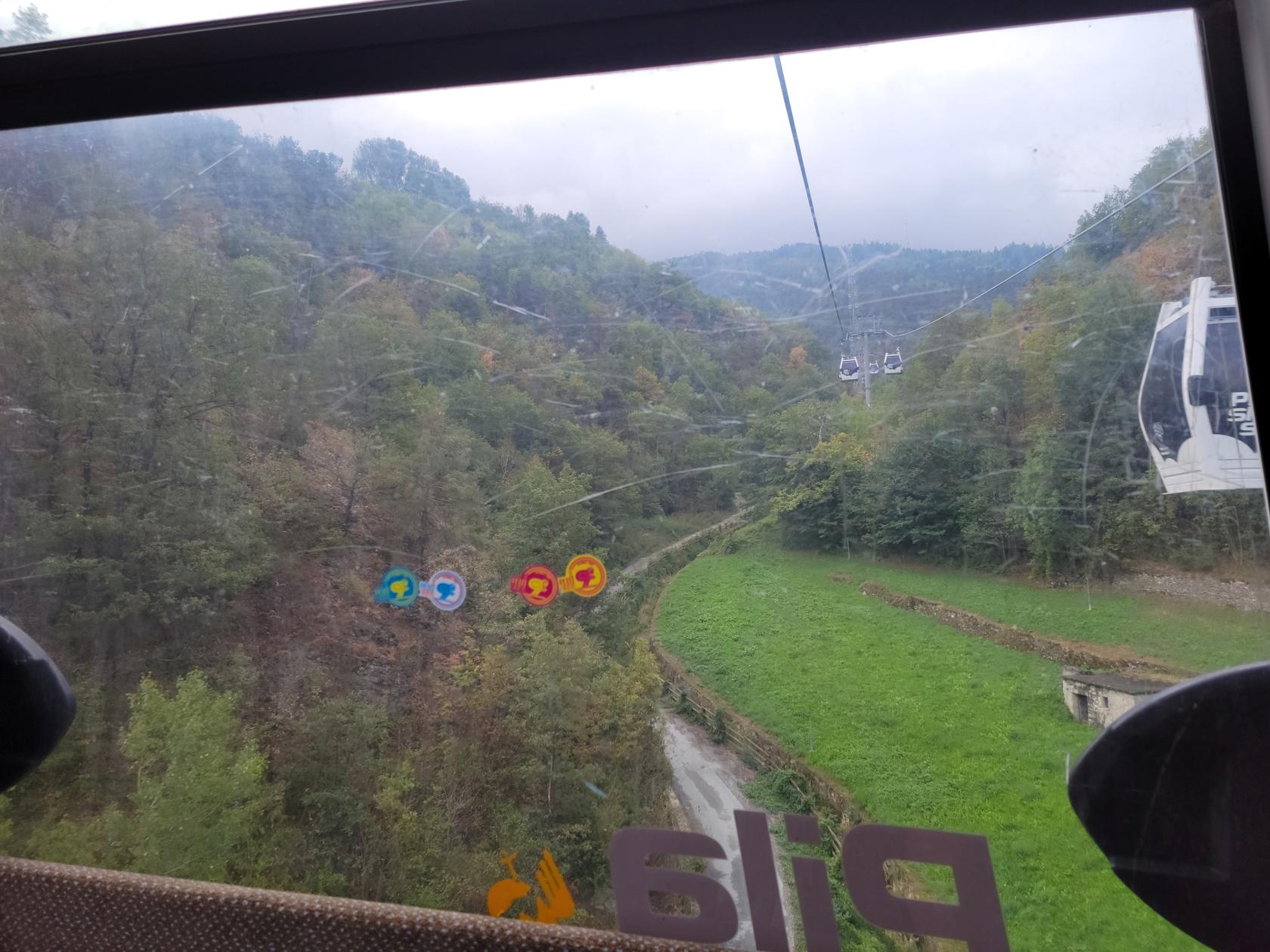
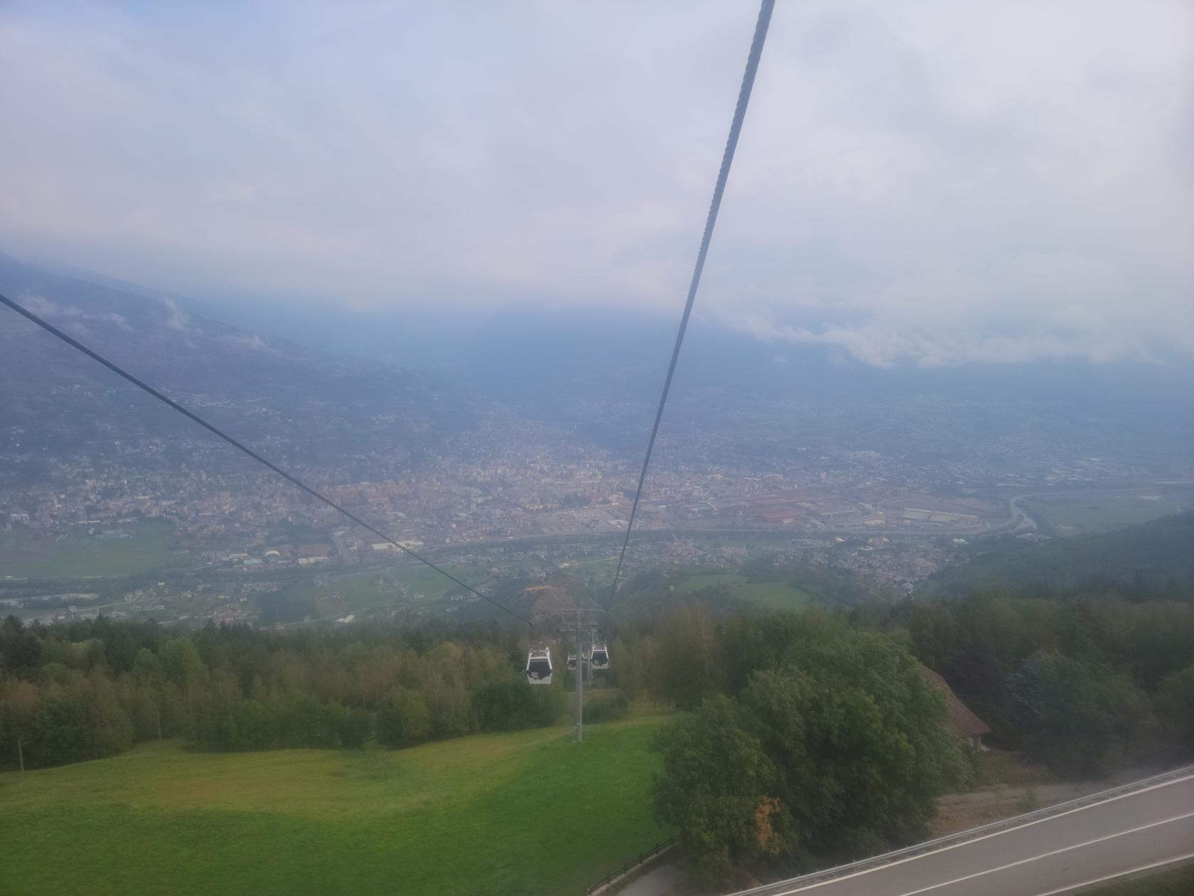
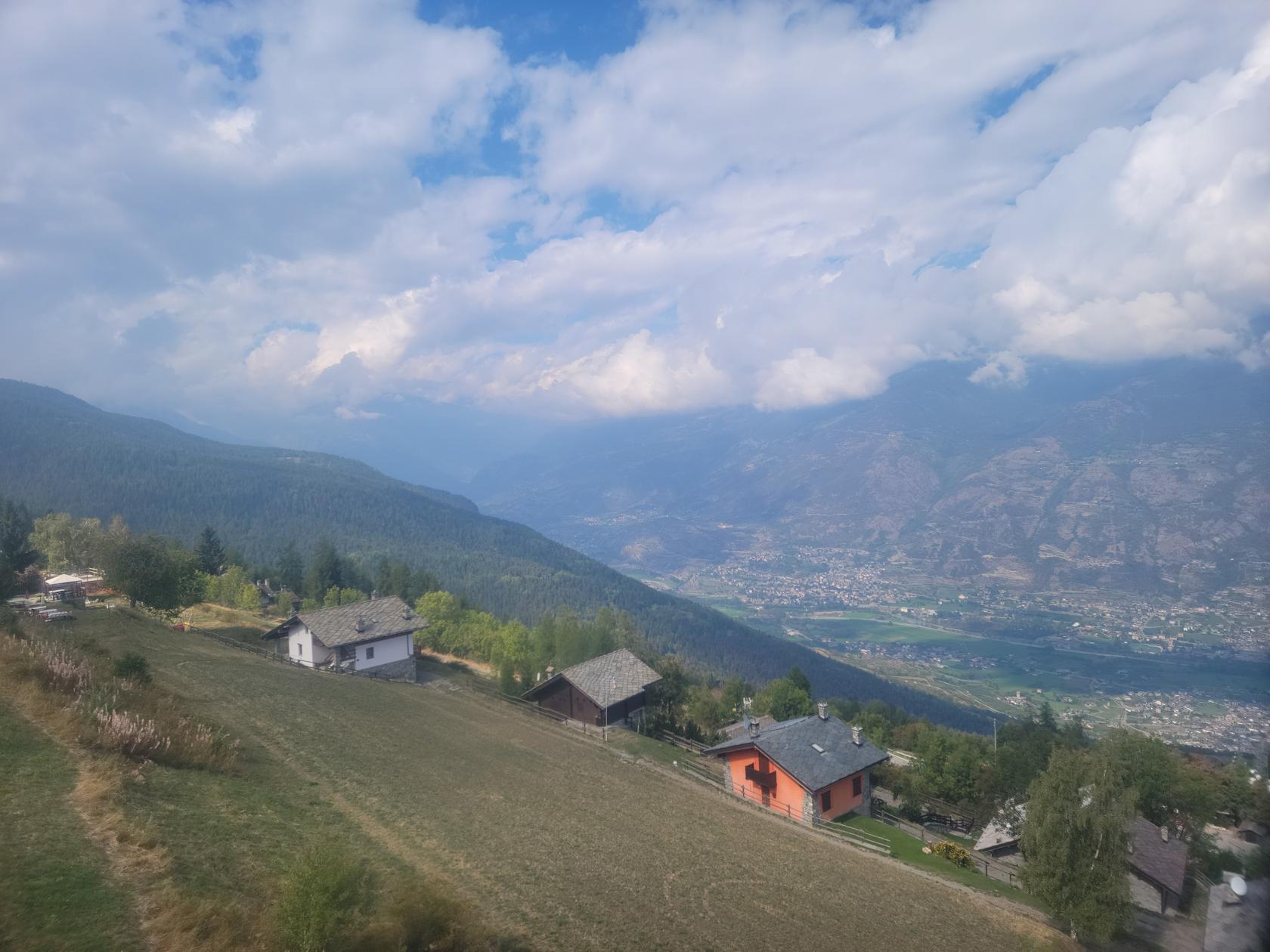
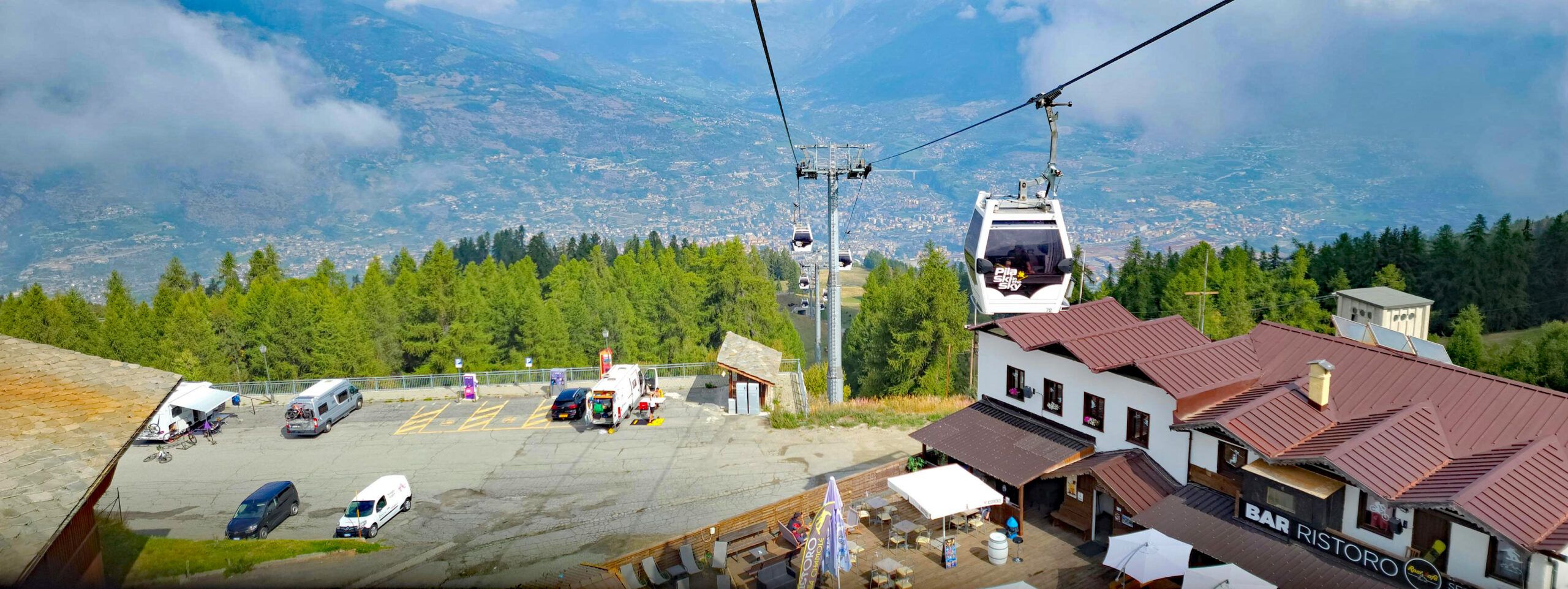
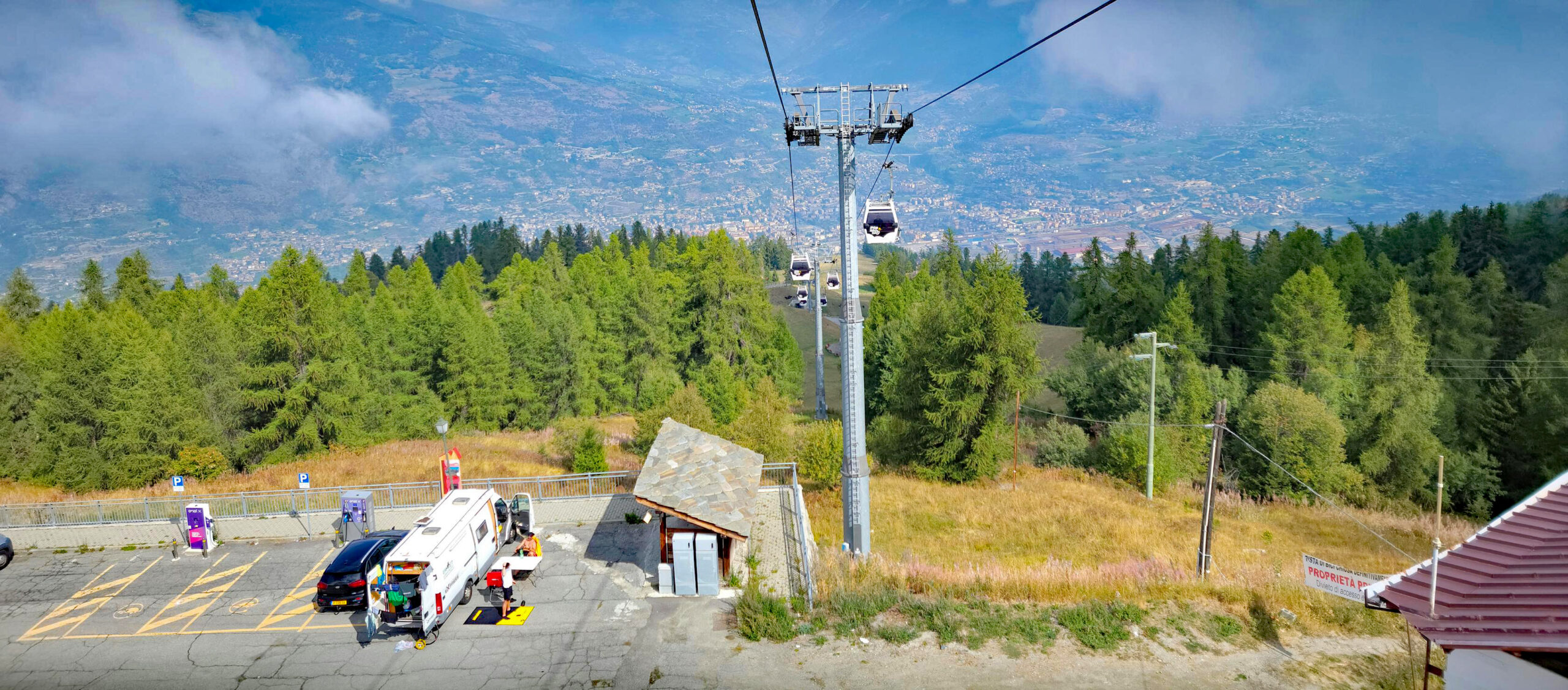
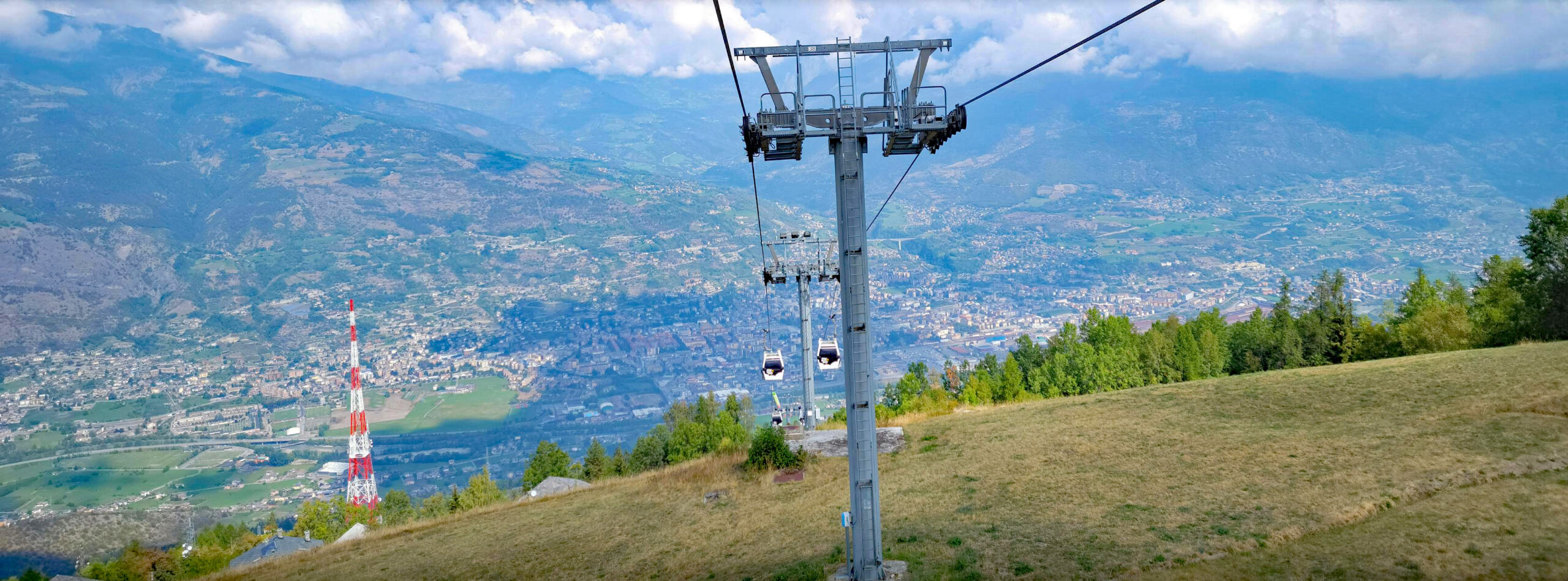
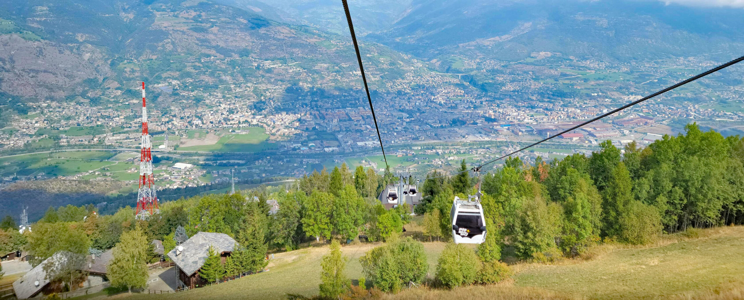
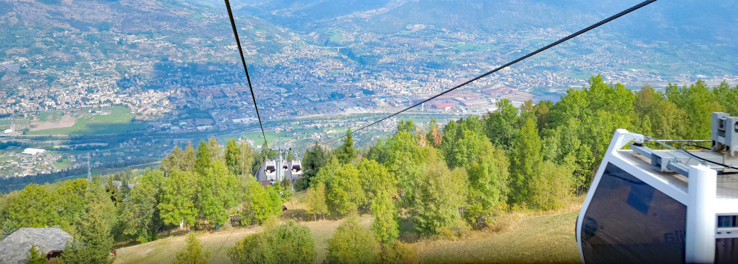
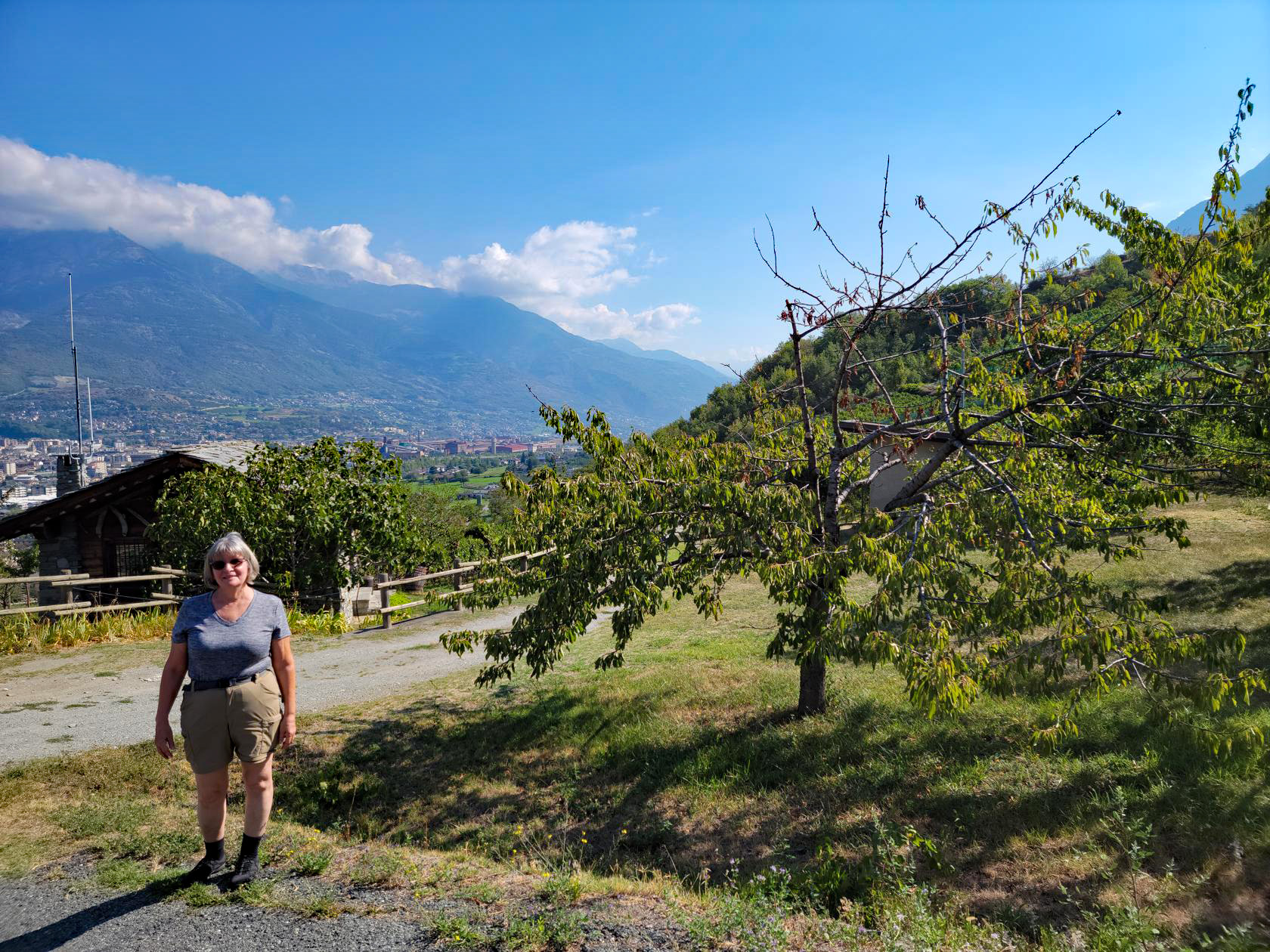
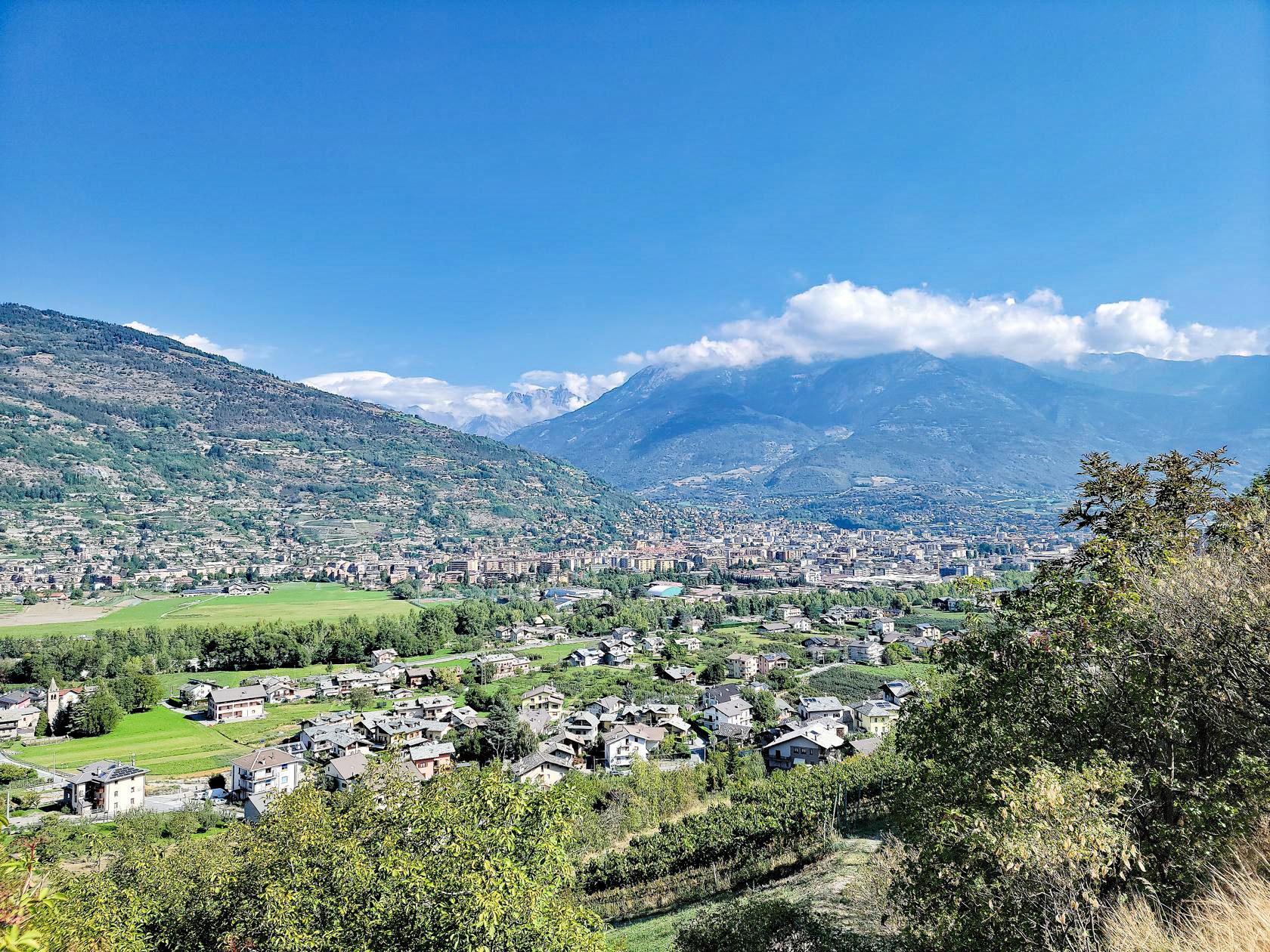
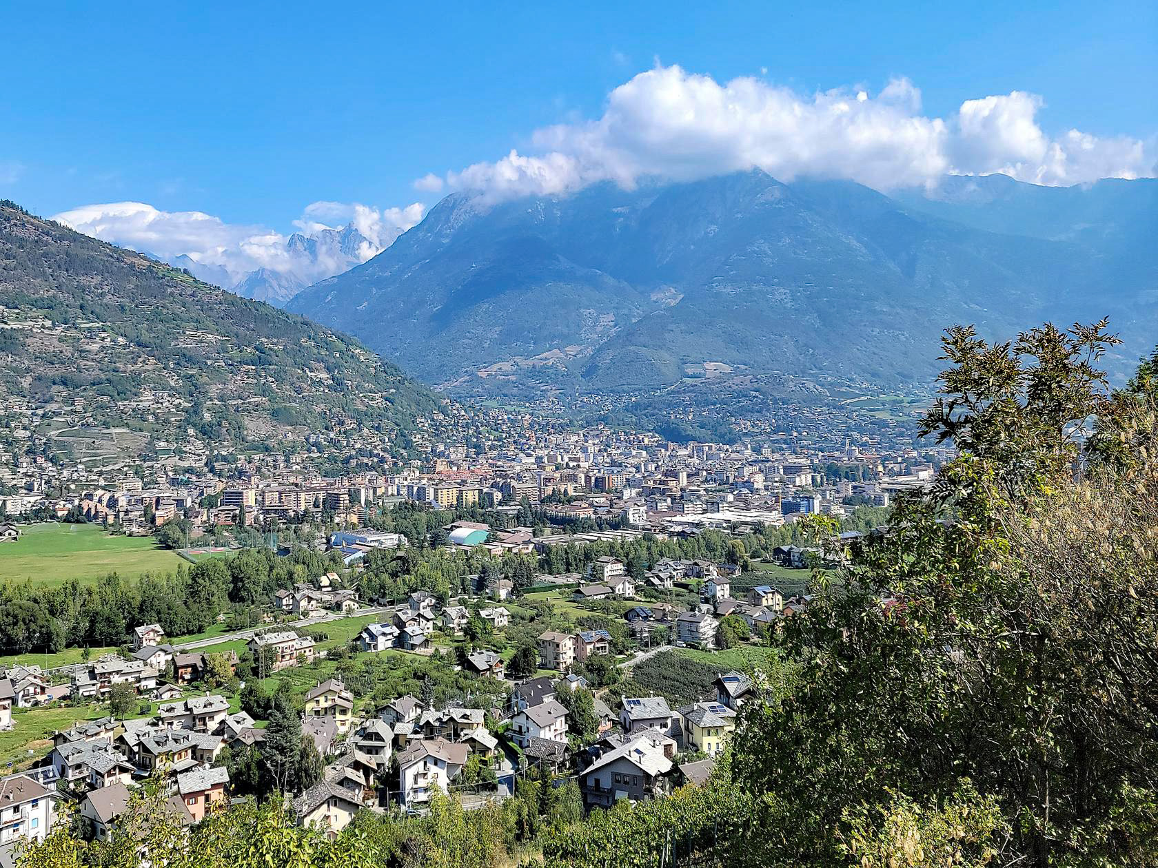
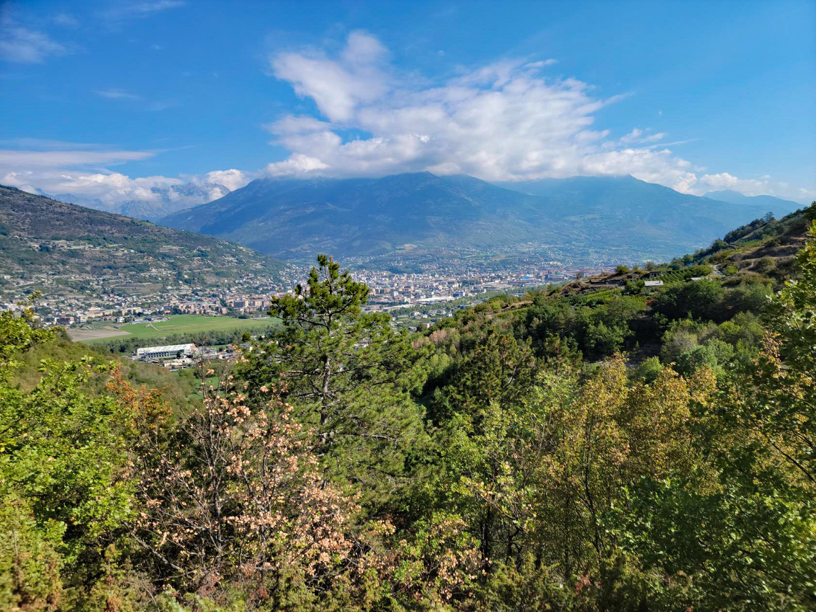
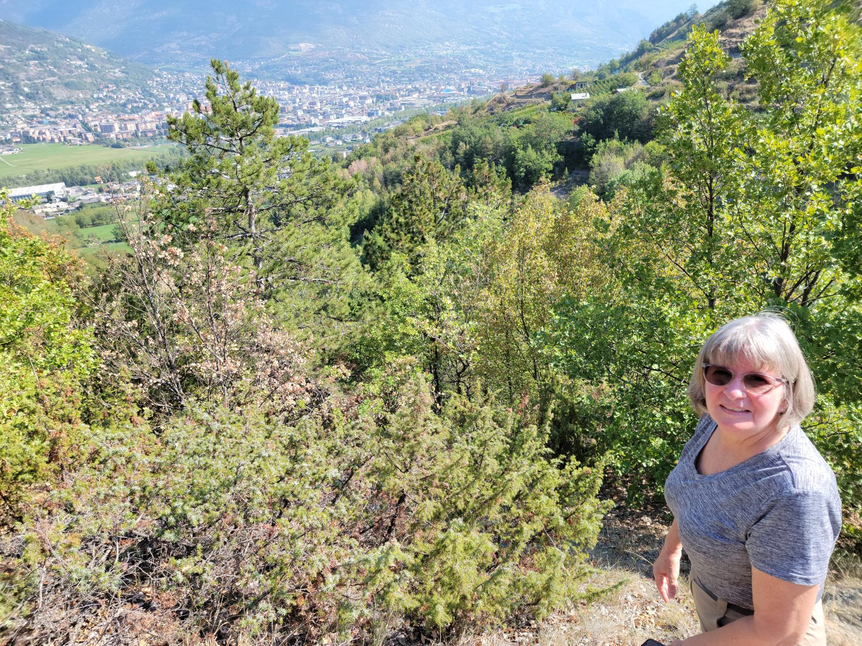
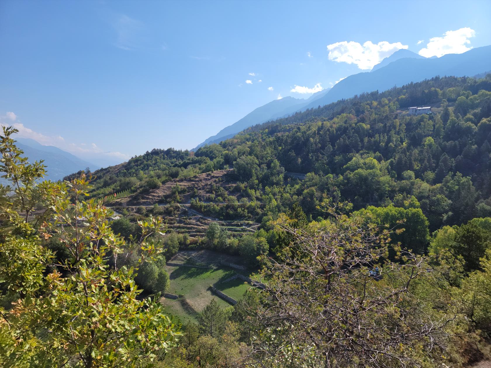
Taking the Pila Cable Car from Aosta one can have a marvelous day trip above the clouds. At over six thousands feet in elevation, Pila sits over Aosta and the valley like an eagle’s nest.
Pila – Pila Cable Car – Tickets For Two
For a modest round trip fee of 7€/person, you can take the 15-20 minute ride on the cable car and enjoy a ride up the mountainside and the Aosta Valley. The cable car takes you over the small towns on the other side of the Dora Bàltea river from Aosta, where you can see the bucolic farms and vineyards from above.
Our Cable Car Ride And Day In Pila
Since there really isn’t much else to tell, a few short series of photographs is all that it takes to enjoy this wonderful day adventure, enjoy!
The Way Up
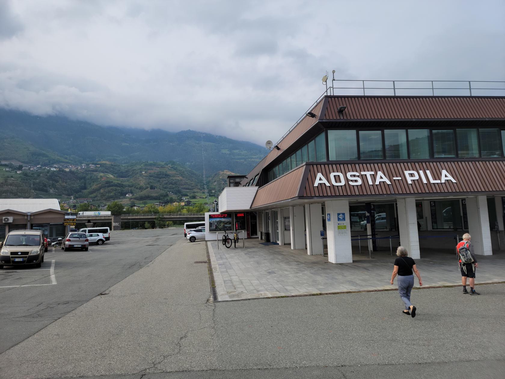
Aosta – Pila Cable Car Station
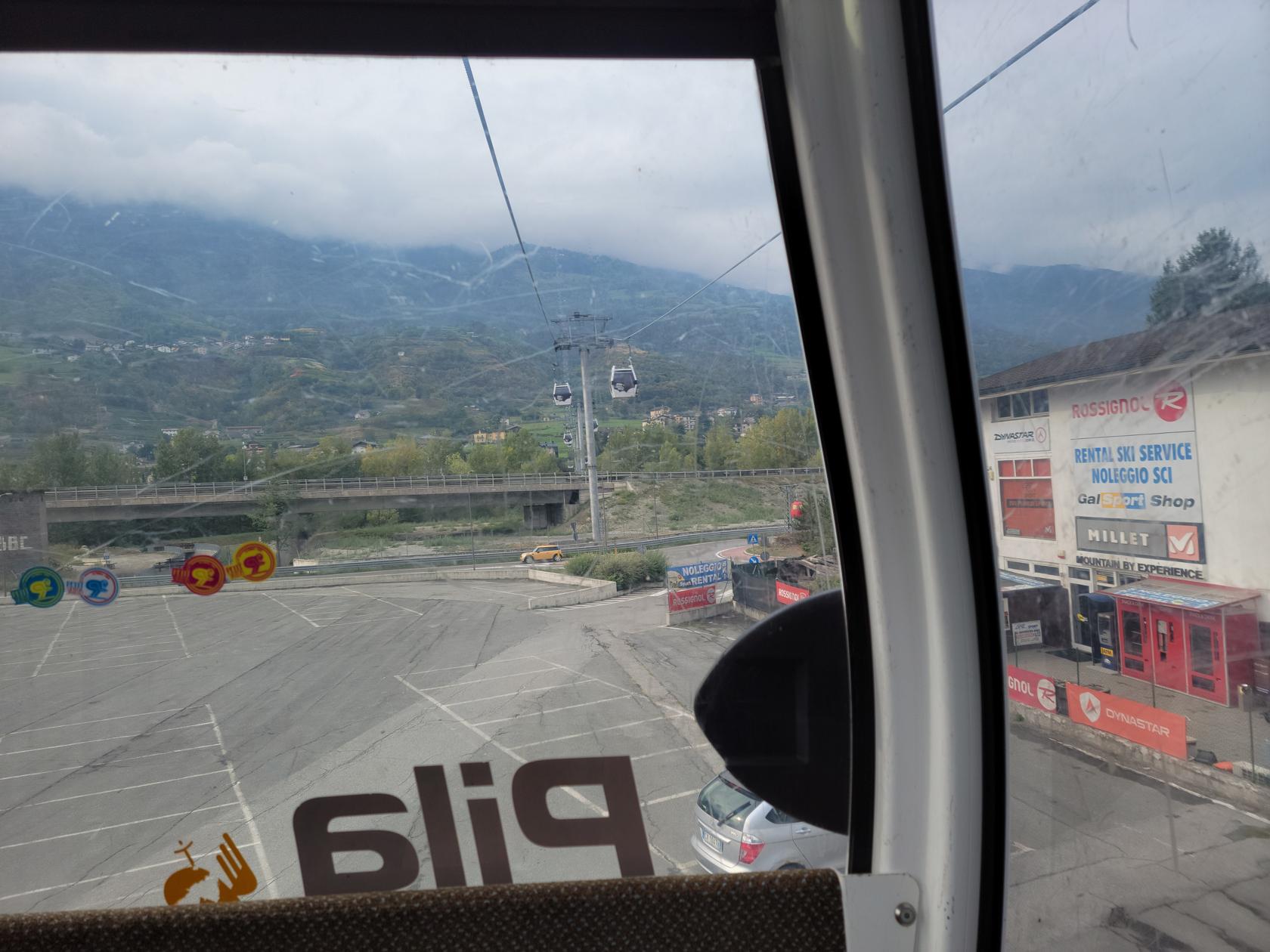
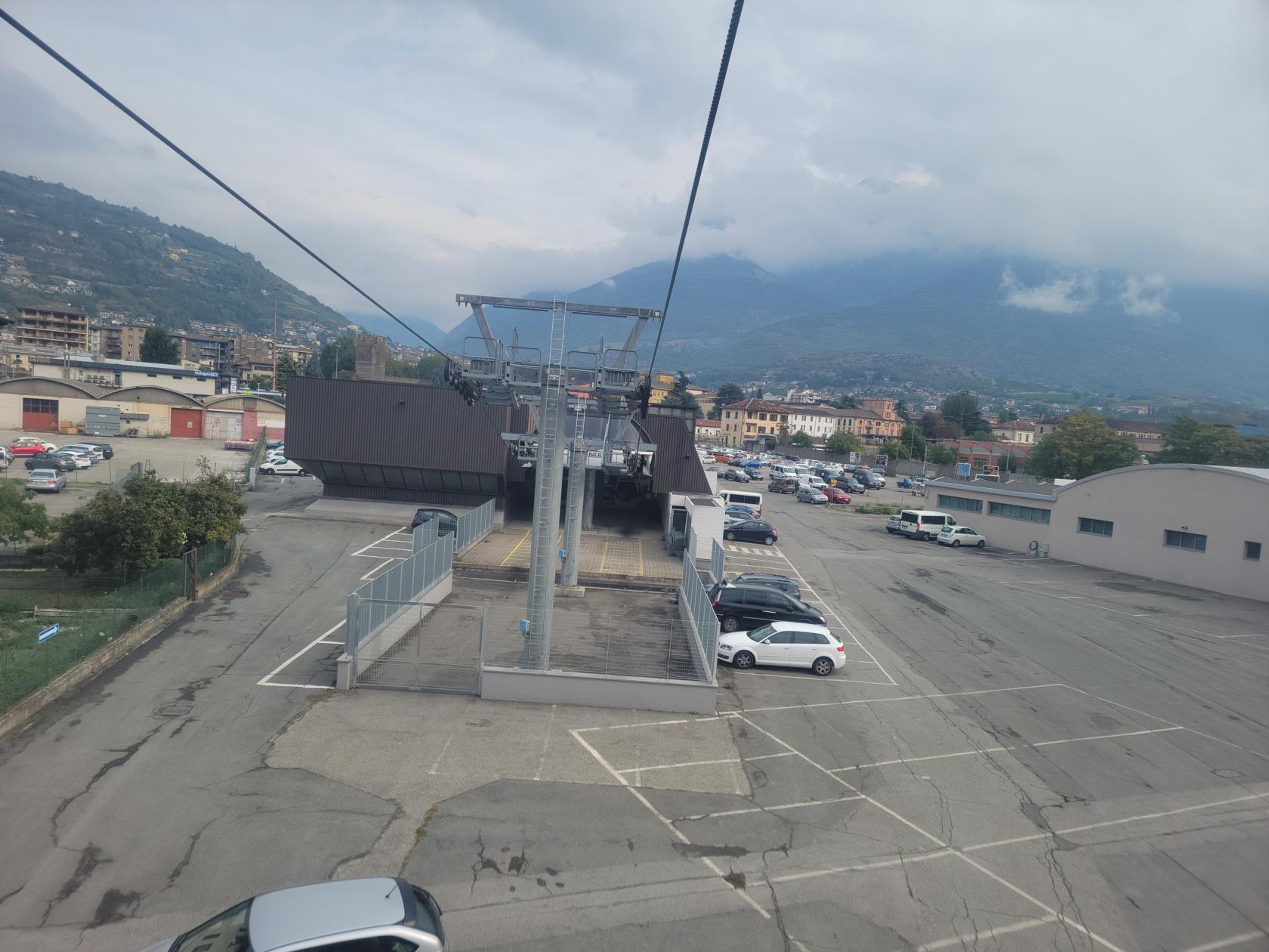
Aosta – Pila Cable Car Ride Up
Aosta – Pila Cable Car Ride Up
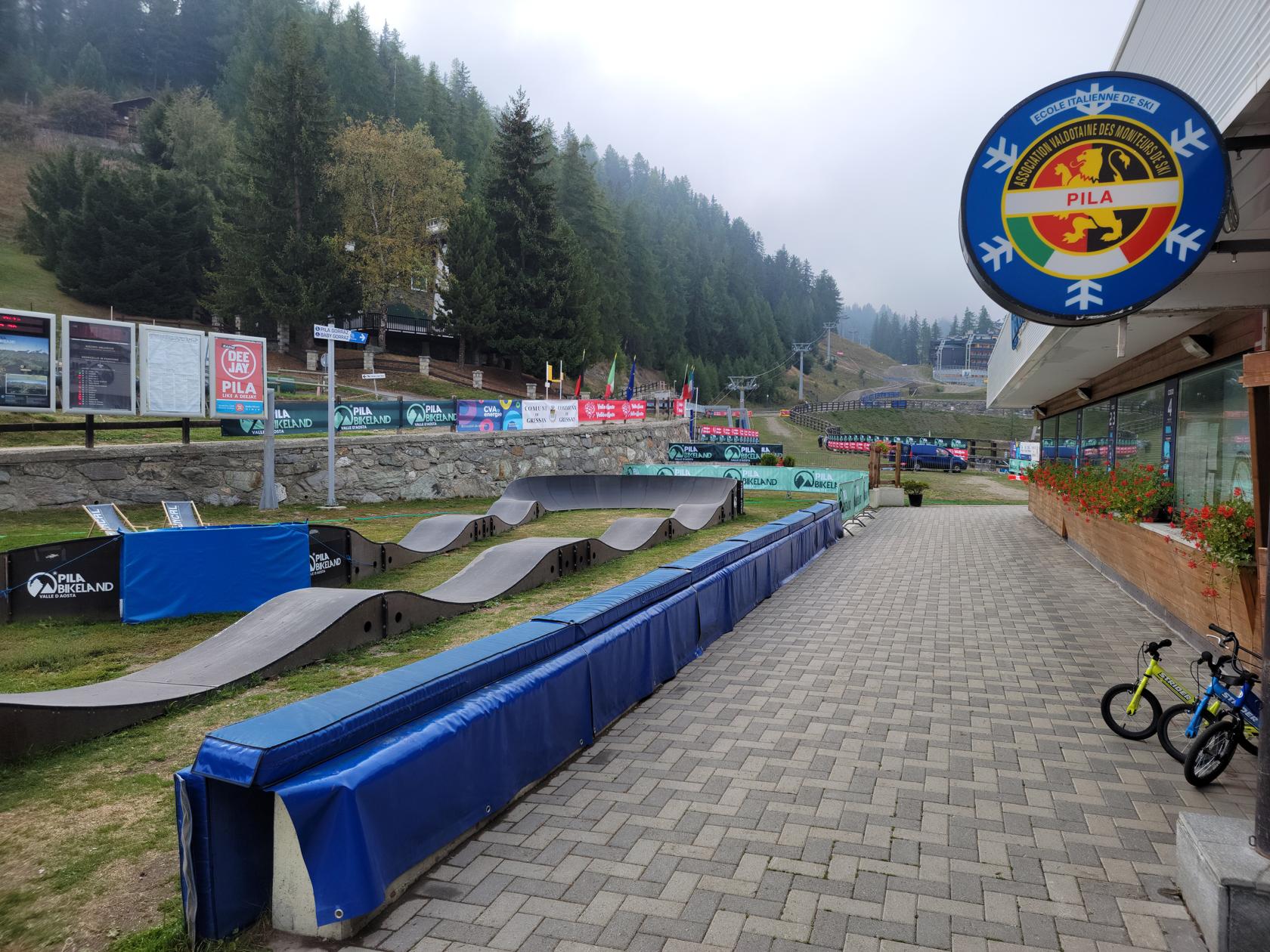
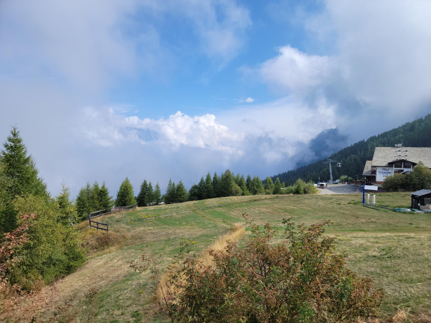
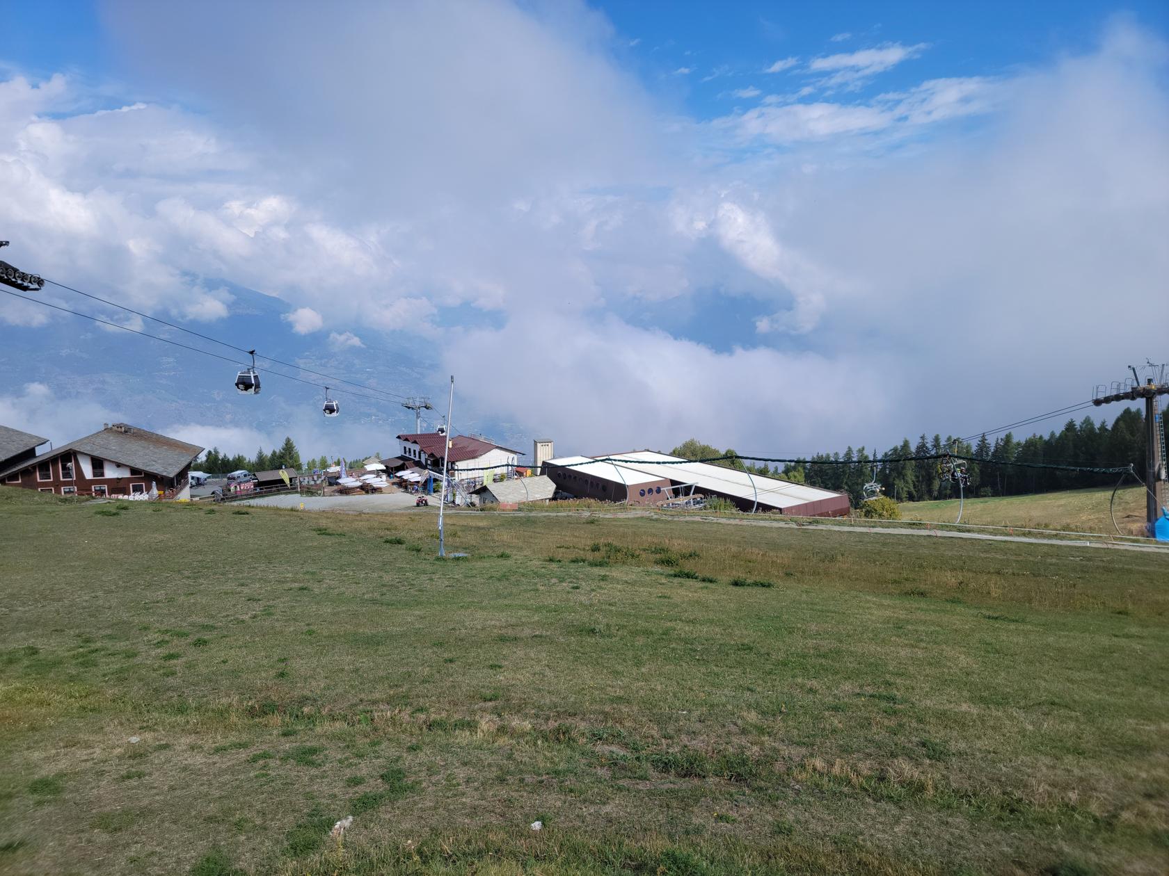
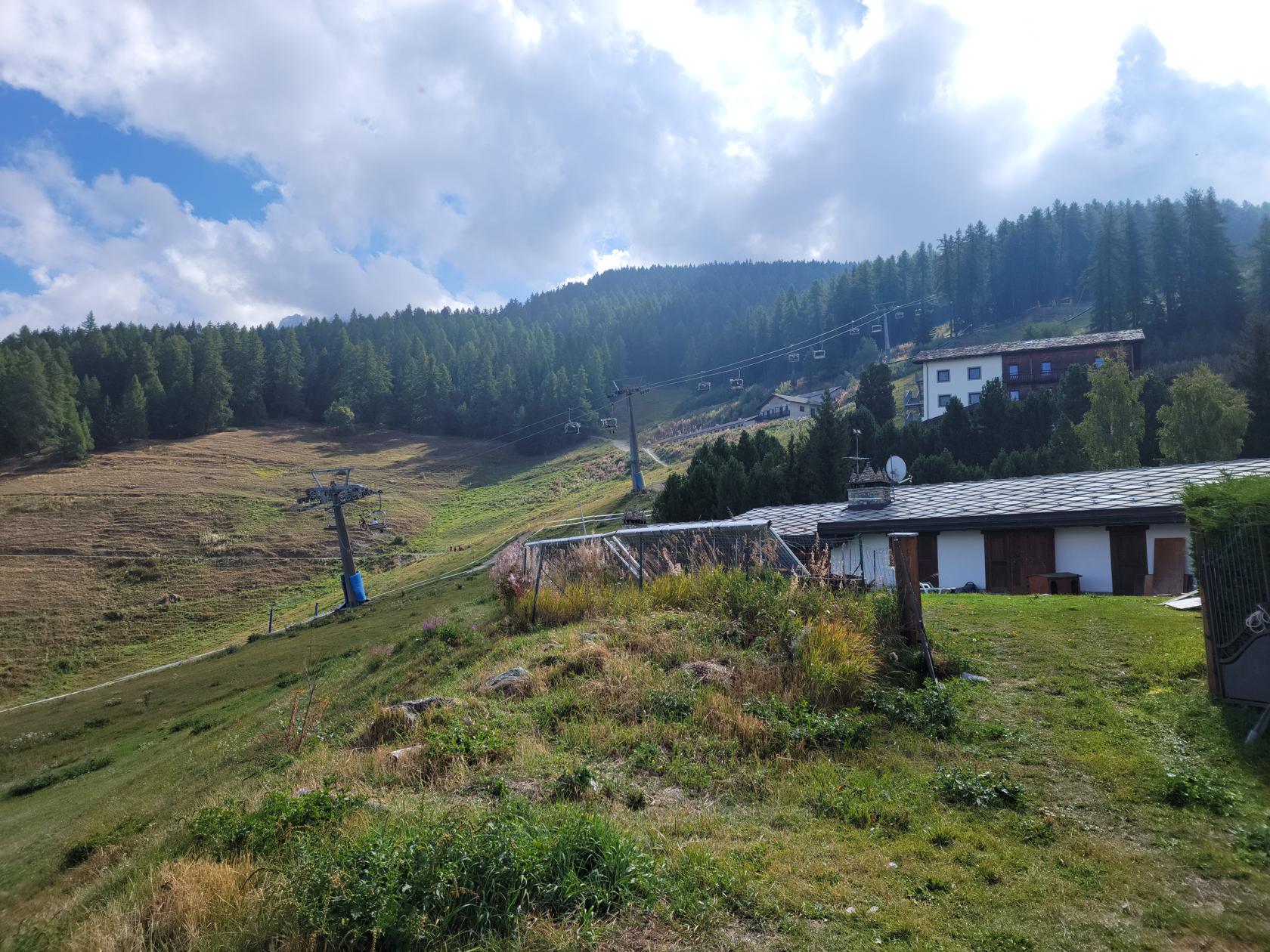
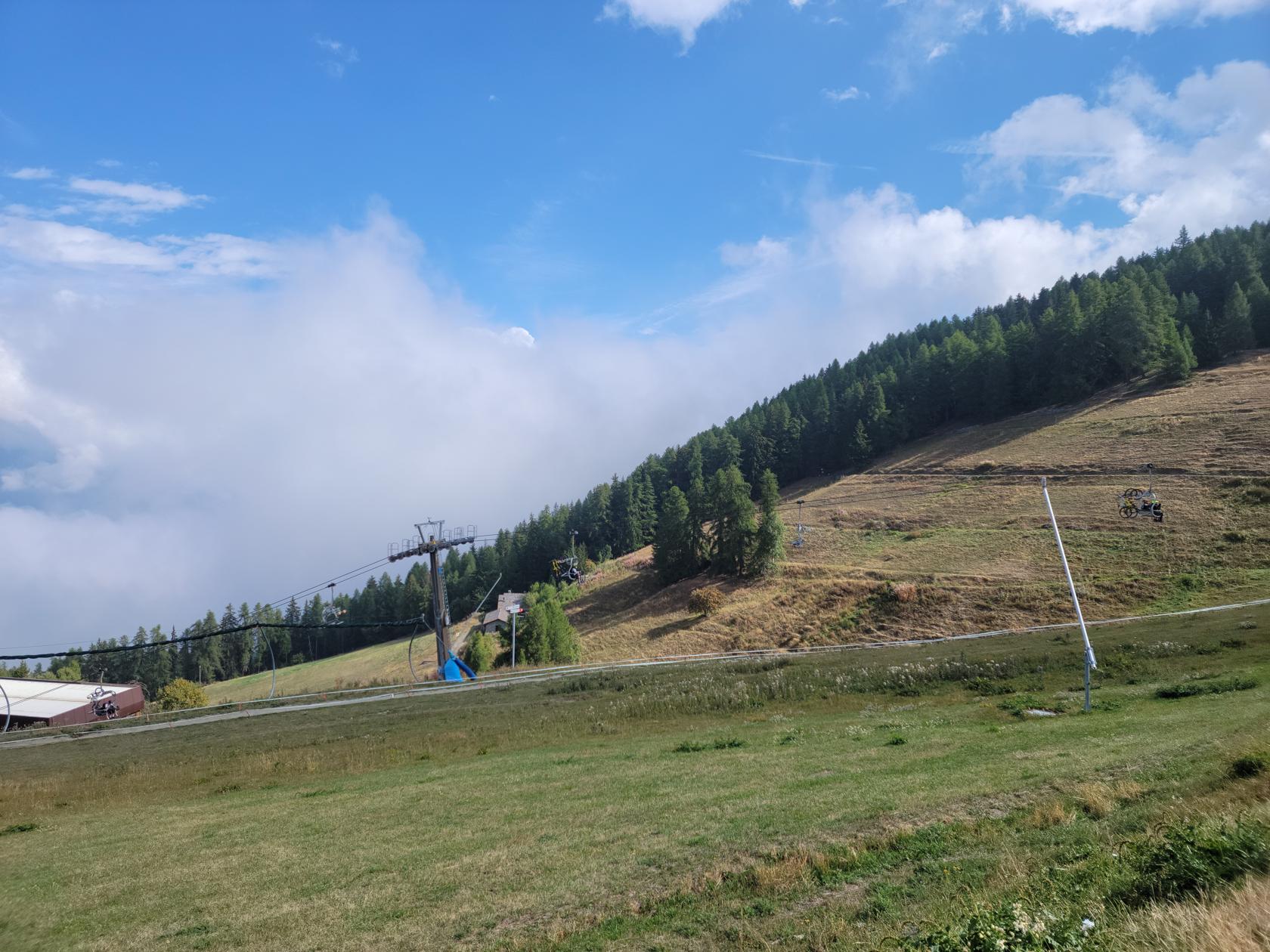
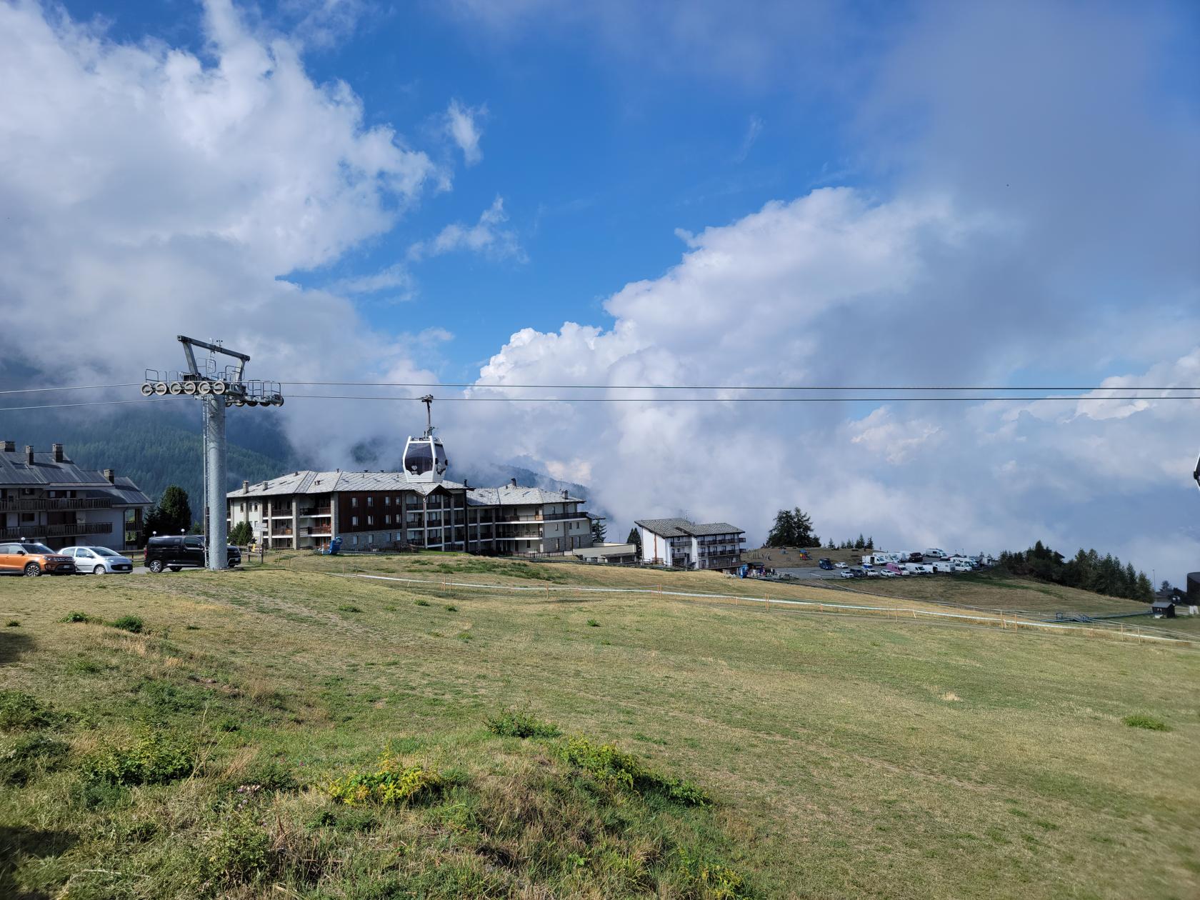
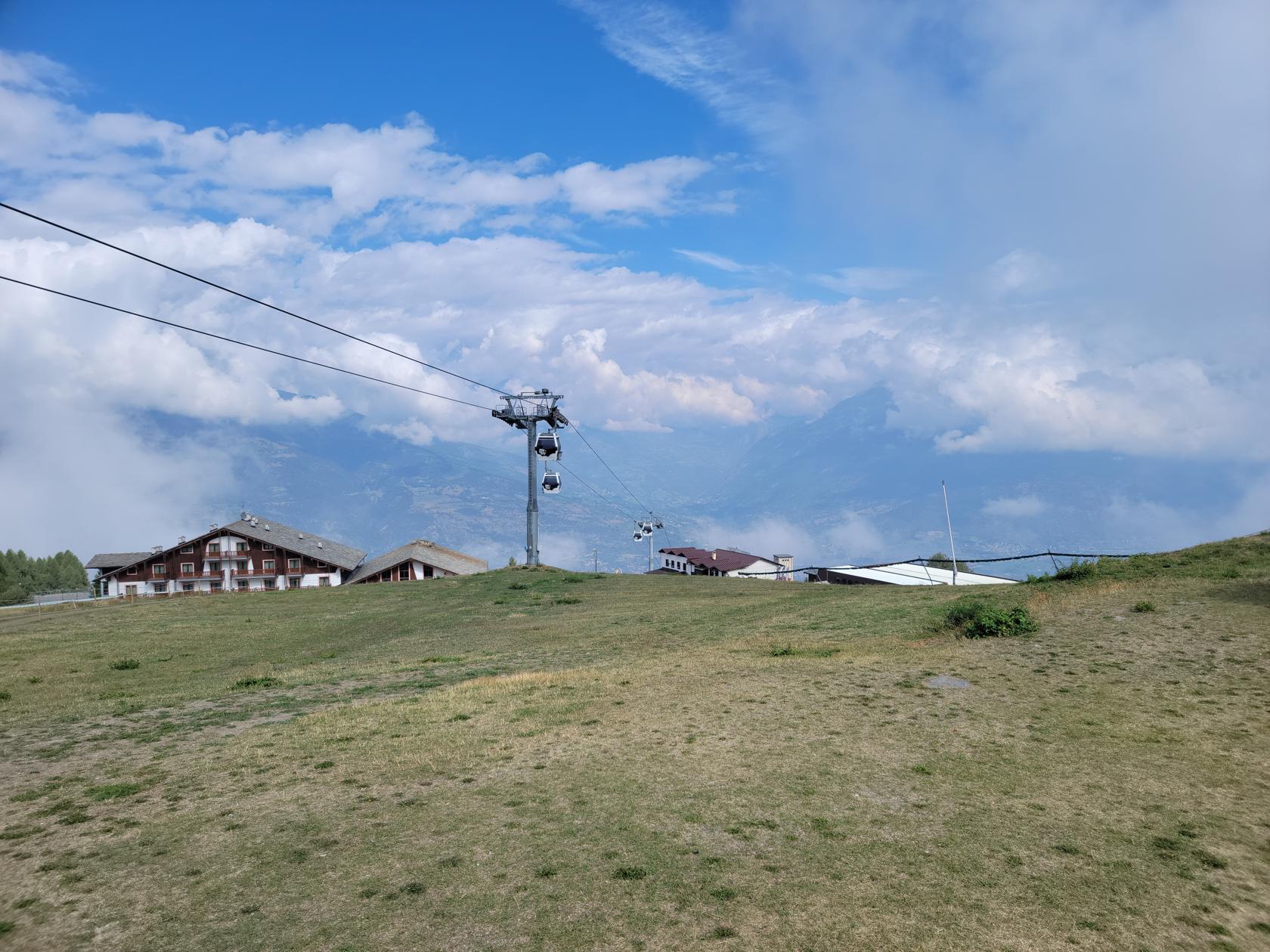
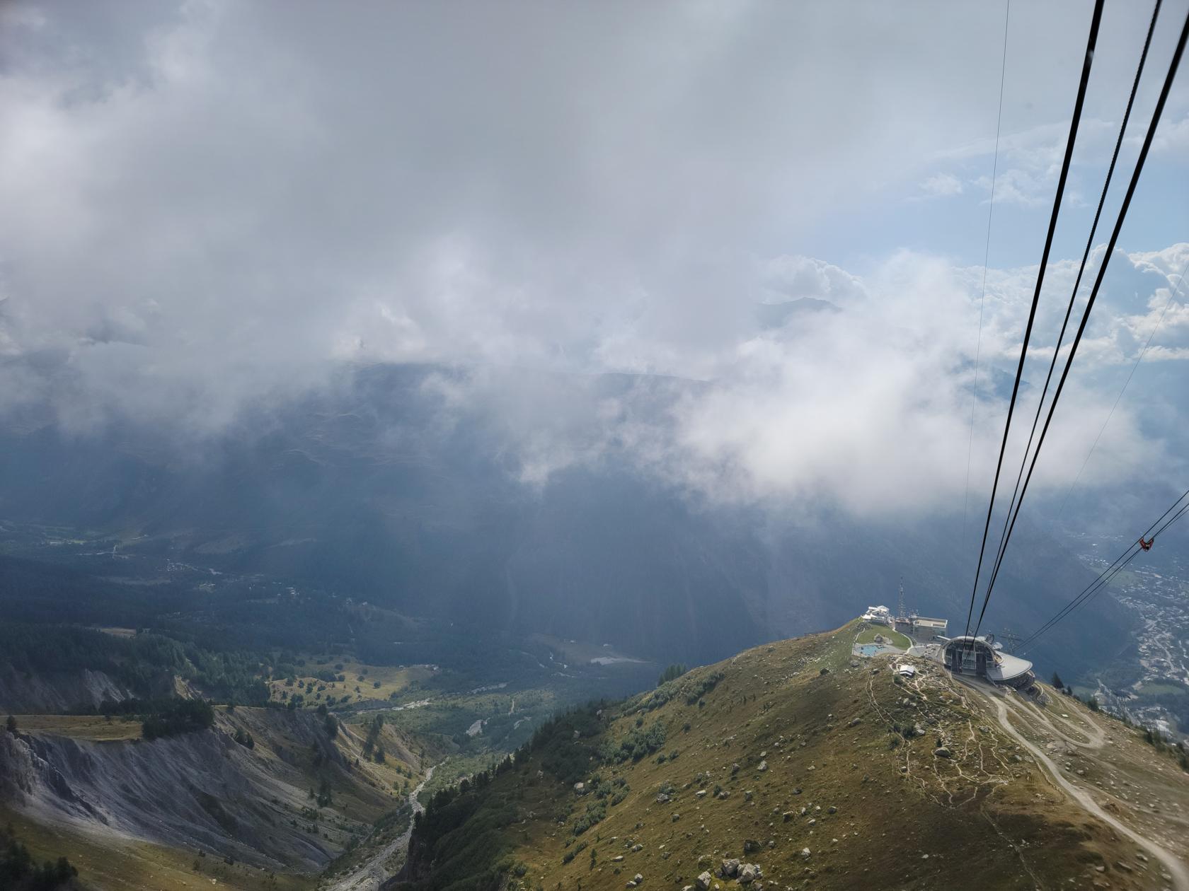
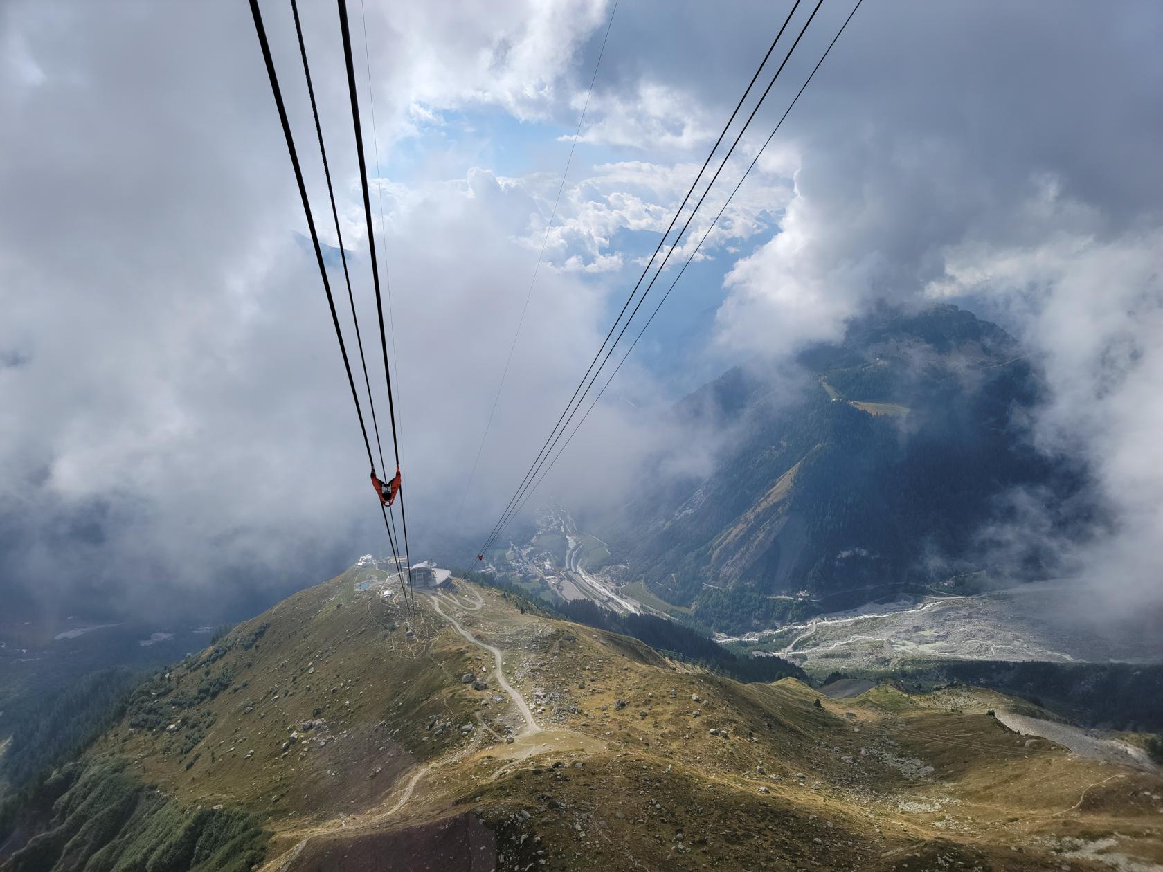
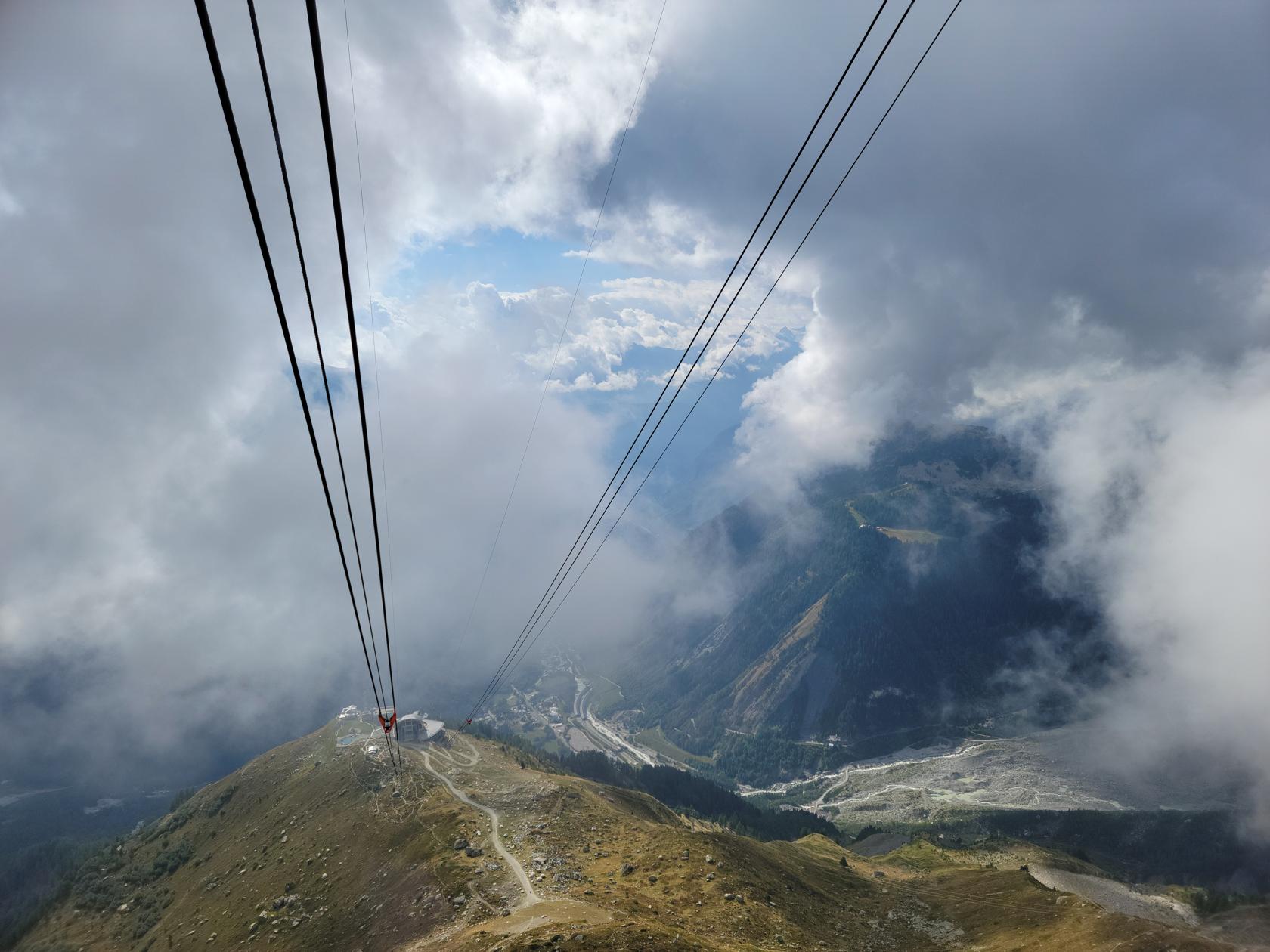
Pila – Pila Ski Resort and Views
Pila Ski Resort – Cable Car Going Up
Pila Ski Resort – Cable Car Going Up
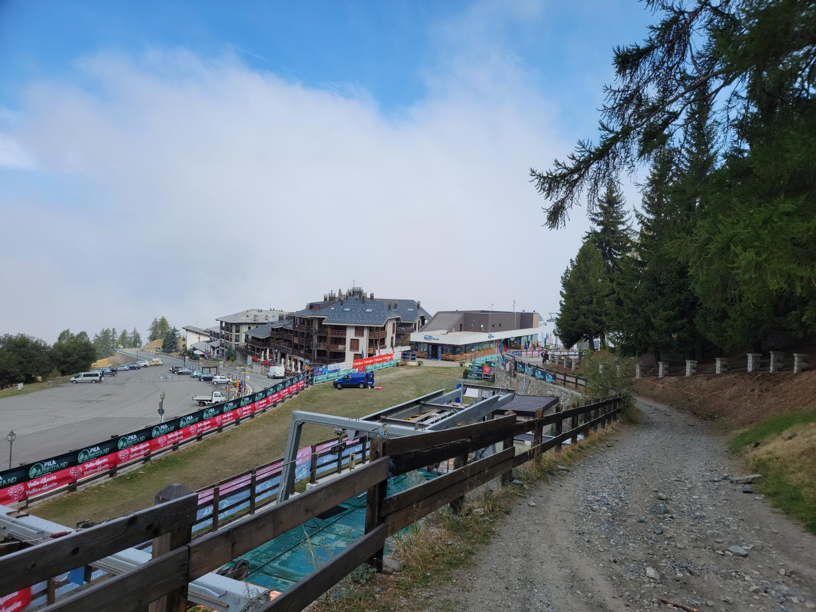
The Ski Resort
Pila Ski Resort – Bike Center
Pila Ski Resort – Dirt Trail
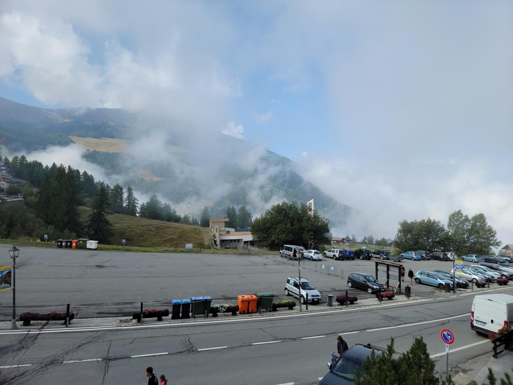
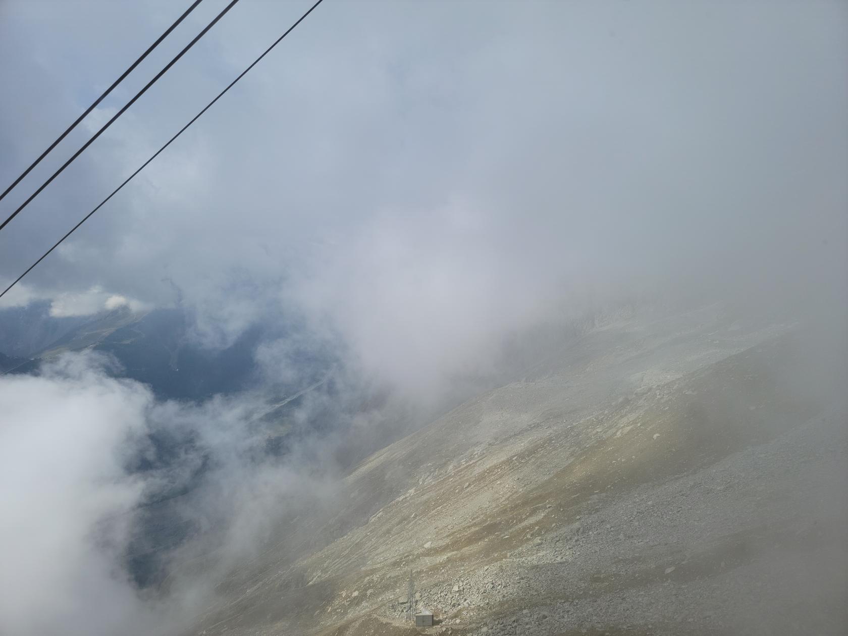
Pila Ski Resort – Fog Clouds rolling in
Pila Ski Resort – Resort and Clouds
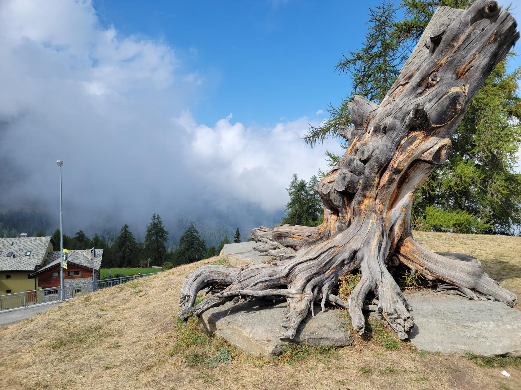
Pila Ski Resort – An Old Stump
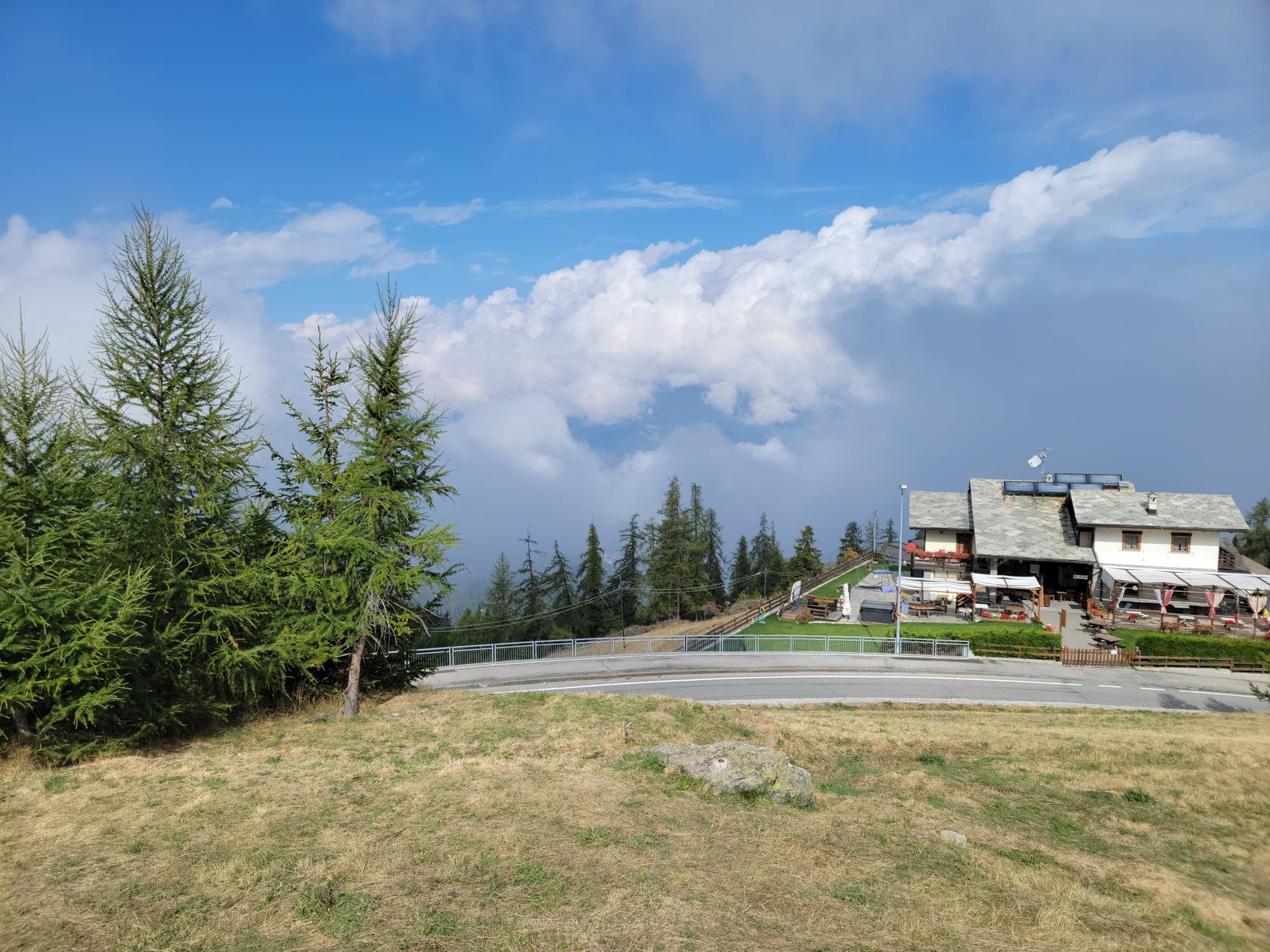
Pila Ski Resort – Clouds
Pila Ski Resort – Cable Car and Aosta Valley below
After a long day of bus rides and cable cars, it was time for some hiking. Nothing hard for our age, but moderate enough, just to get the legs to ache and the bones to complain a little.
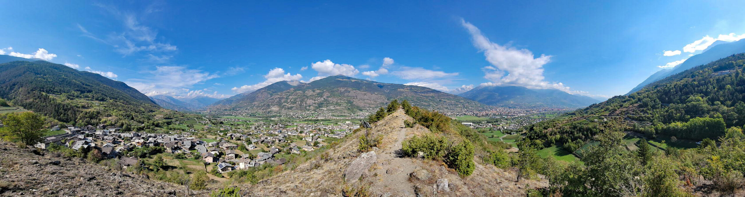
Aosta – Gargantua Nature Reserve Hike – Panorama from other end
Having purchased a subscription to AllTrails, we had time before we left Turin to plan several hikes, of varying difficulty. Since the weather was so nice, we went for a scenic hike and chose Gargantua Hill.[1]Though technically any heap of rock and dirt may be called a hill, this is actually a glacial moraine, deposited thousands of years ago when the glaciers from the last Ice Age left this valley.
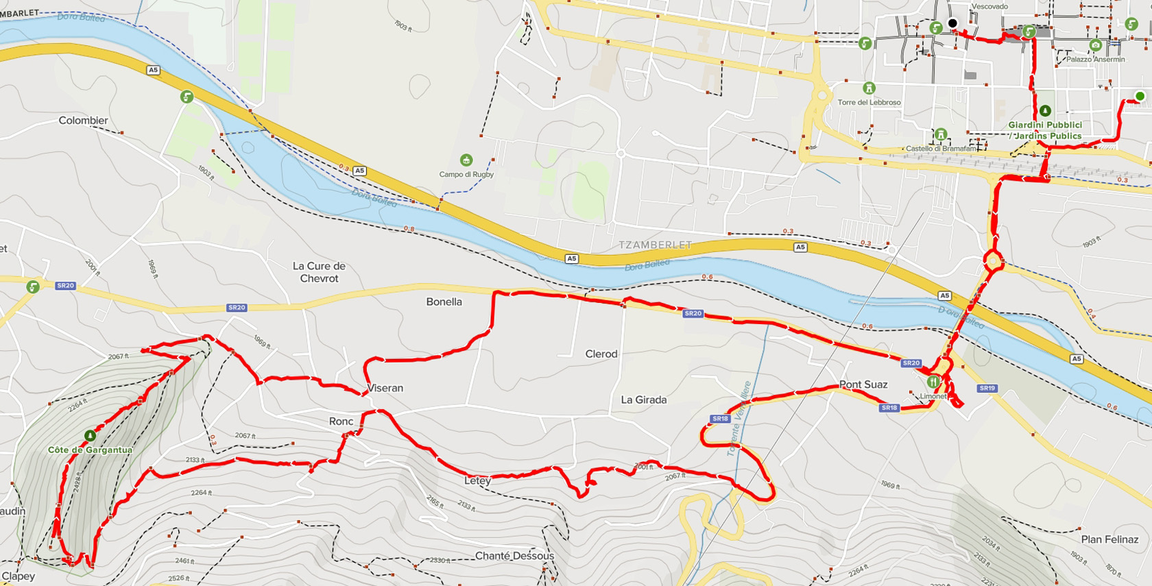
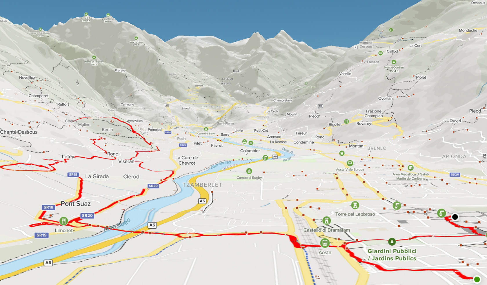
Map – Our Route
Aosta – Gargantua Nature Reserve – Hike Map 2D
Aosta – Gargantua Nature Reserve – Hike Map 3D
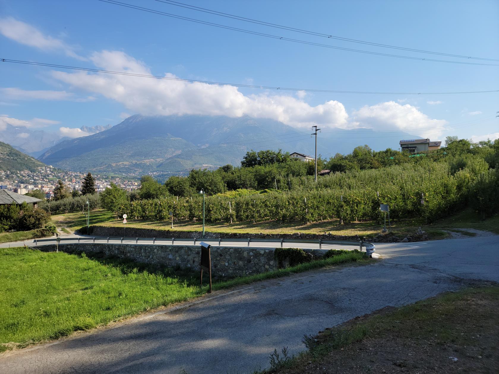
The hike was rather simple, leave our hotel, use the tunnel to go under the rail station, walk across the Pont Suaz bridge and walk the neighborhoods until we reached the hill, then ascend it.
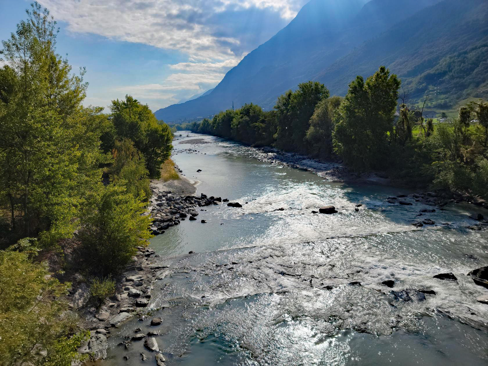
Aosta – Gargantua Nature Reserve Hike – Dora Bàltea river
Aosta – Gargantua Nature Reserve Hike – Dora Bàltea river
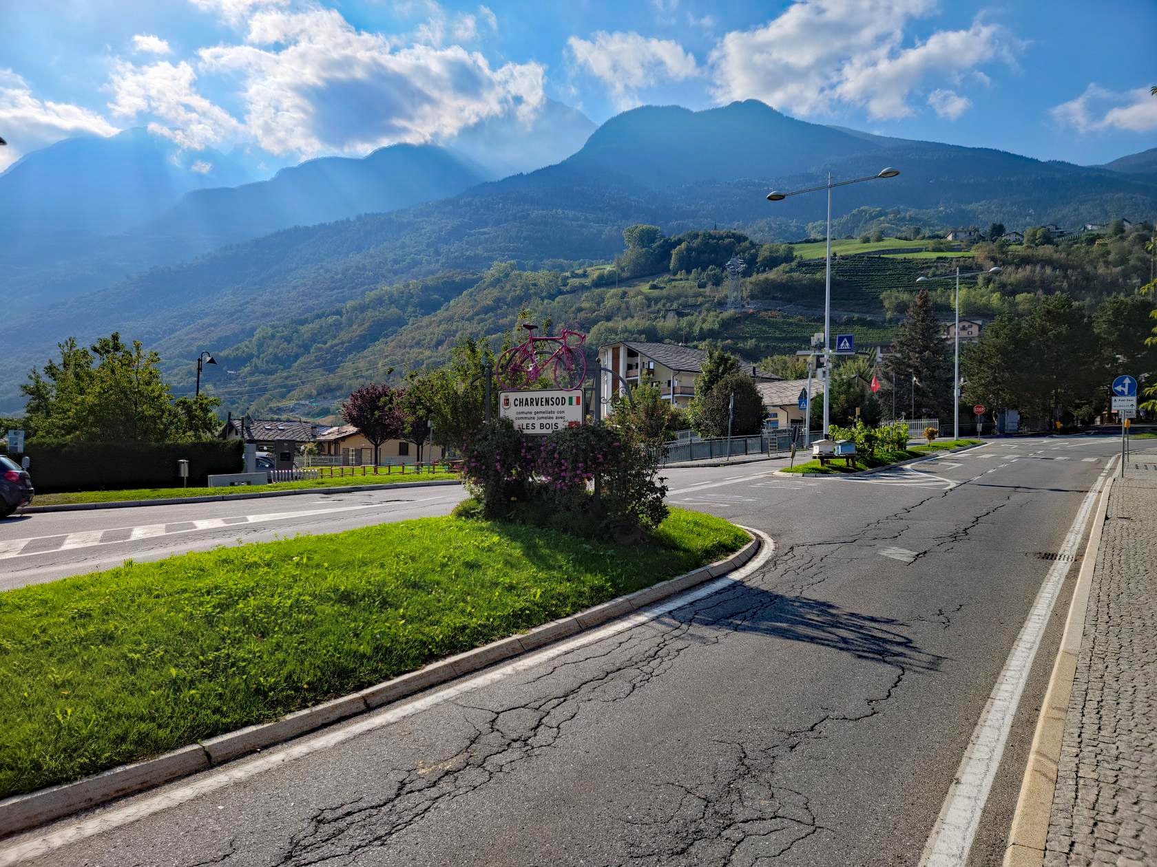
Aosta – Gargantua Nature Reserve Hike – Town of Charvensod
Aosta – Gargantua Nature Reserve Hike – Crossing the Pila Cable Car
We brought plenty of water, and were happy that we did, because it was pretty warm, perhaps in the middle 80s (about 28/29C). I also wore a hat part of the way, which helped to shade the sun beating down on me, so one can say – wearing a hat is good advise.
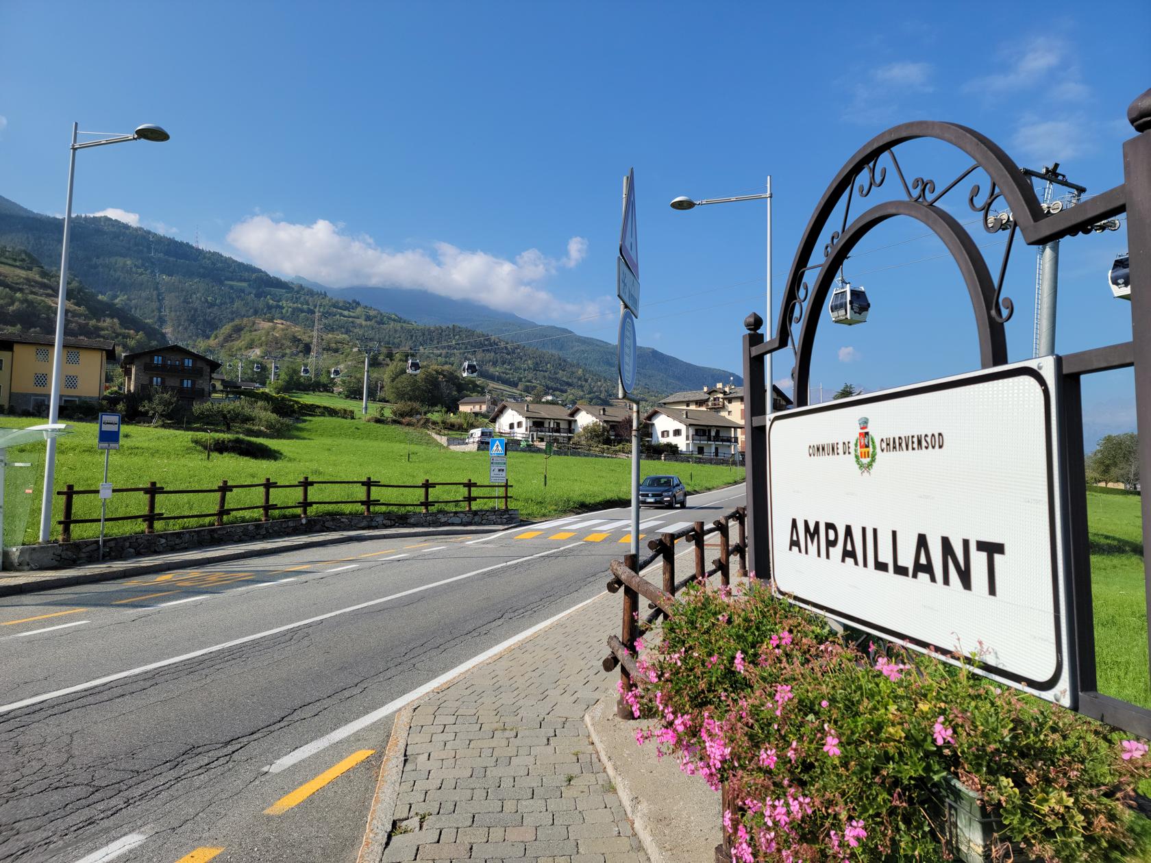
Aosta – Gargantua Nature Reserve Hike – Town or Ampaillant
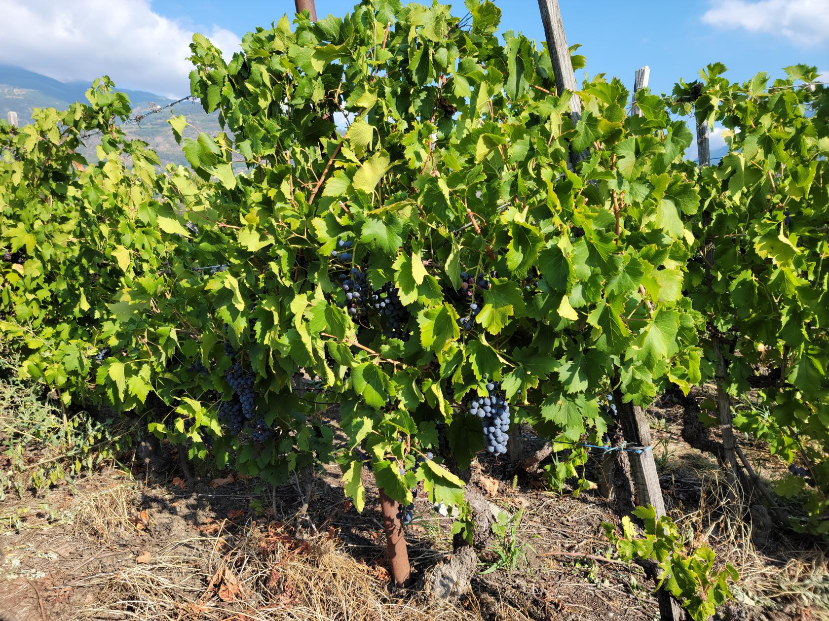
Aosta – Gargantua Nature Reserve Hike – Local Vineyard
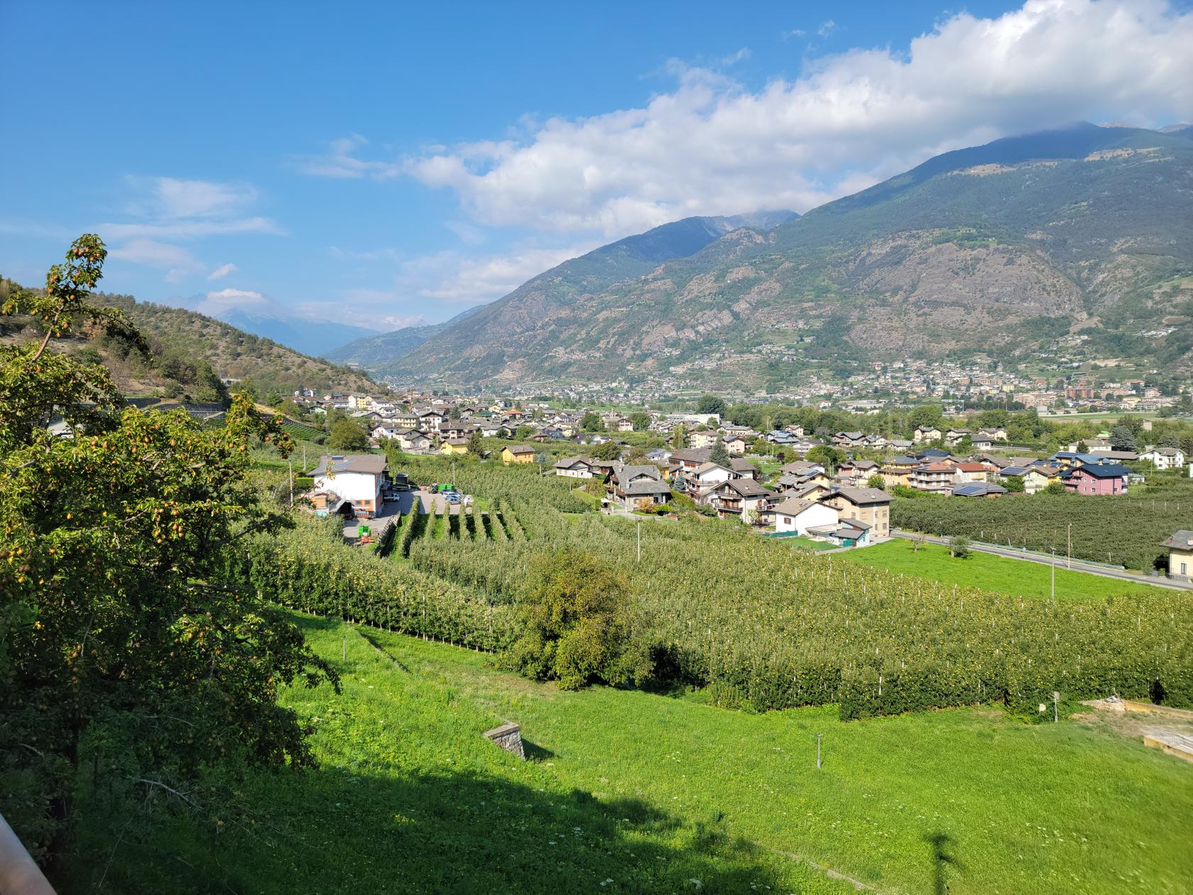
Aosta – Gargantua Nature Reserve Hike – Apple Orchards in Ampaillant
Aosta – Gargantua Nature Reserve Hike – Apple Orchards in Ampaillant
Aosta – Gargantua Nature Reserve Hike – Aosta in the distance
Aosta – Gargantua Nature Reserve Hike – Aosta in the distance – Closeup
Gargantua Nature Preserve
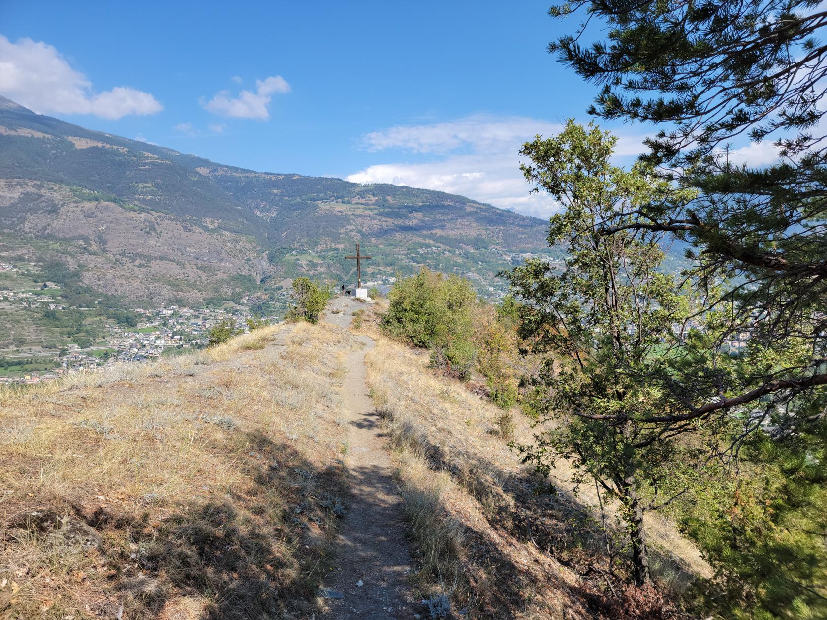
The hill is part of the Riserva Naturale de Gargantua, or Gargantua Nature Preserver, and is some 150m, or 450 feet, in elevation. It has several trails on either side, most of which can be used to ascend and descend it. The one we chose was from the vineyard side to the east, with an approach from where it joins with the mountain. This was slightly easier than a direct approach, since it afforded us the use of the farming roads a third of the way up.
Aosta – Gargantua Nature Reserve Hike – Trail on Gargantua
Aosta – Gargantua Nature Reserve Hike – Aosta
Aosta – Gargantua Nature Reserve Hike – Patti on the Gargantua Trail
Aosta – Gargantua Nature Reserve Hike – Tall Peaks
The hill is mostly porous dirt, rocks and stones, therefore it does not hold water very well and was severely dry due to this year’s climatic conditions in Italy. The dirt was very loose and without proper foot gear, one could easily slip in it.
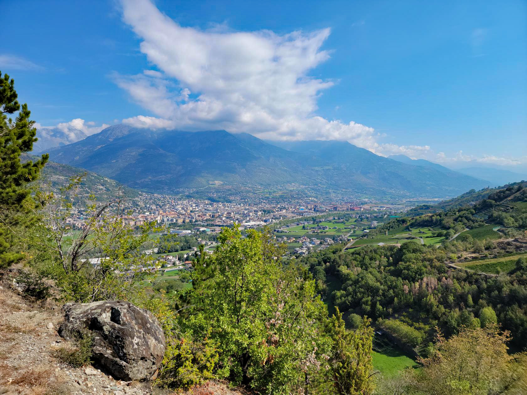
Aosta – Gargantua Nature Reserve Hike – Panorama on top of hill – 150m (450ft) above valley
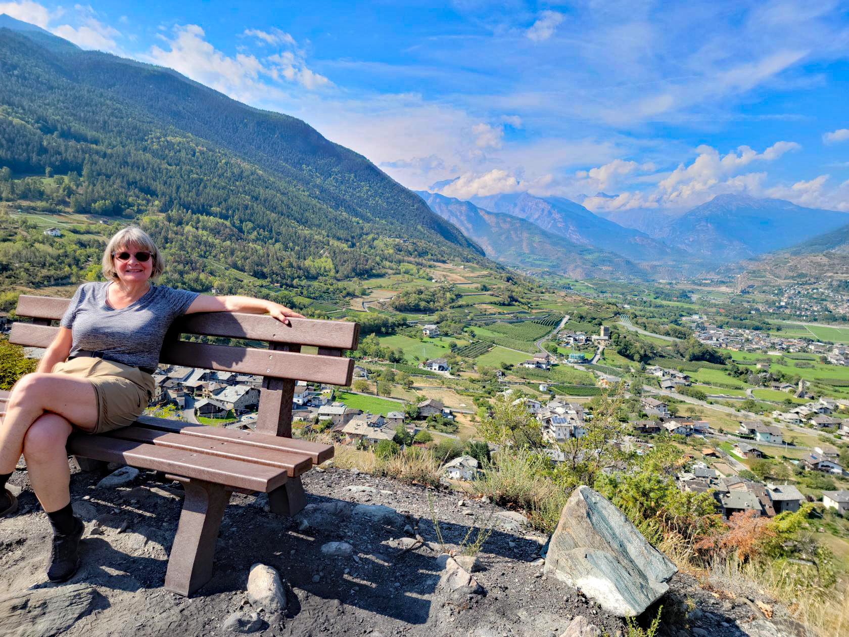
The summit provides impressive views of the entire Aosta Valley, with an excellent view of Aosta to the east.
Aosta – Gargantua Nature Reserve Hike – Valle d’Aosta to the east
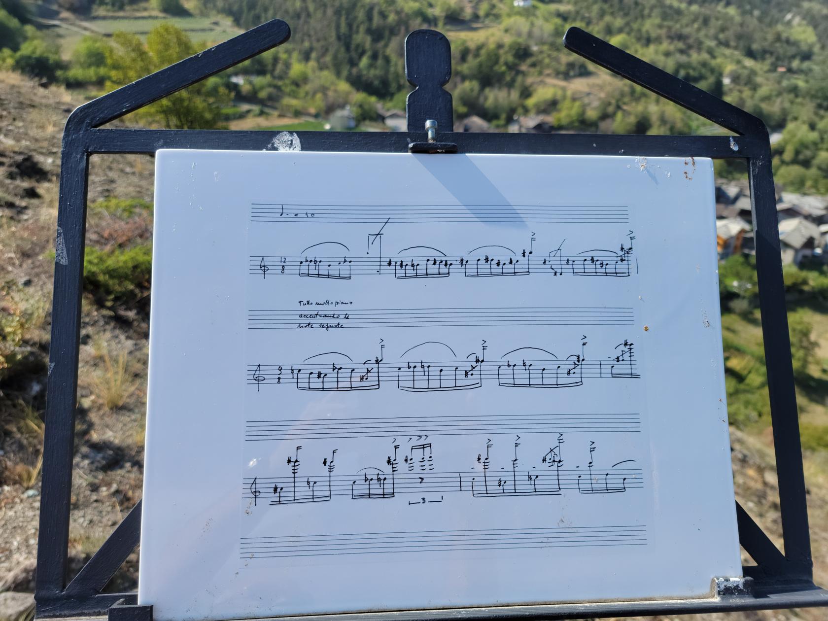
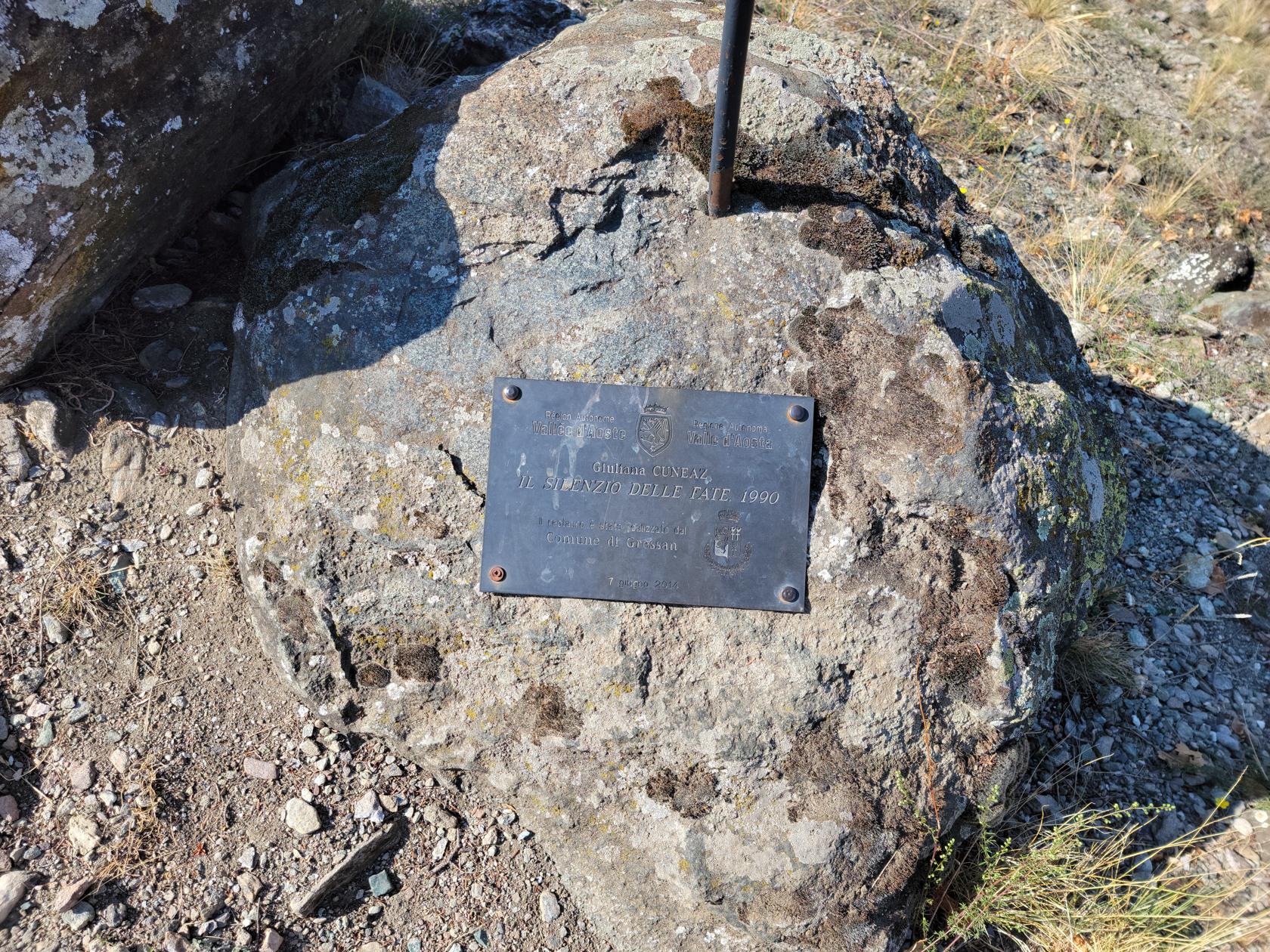
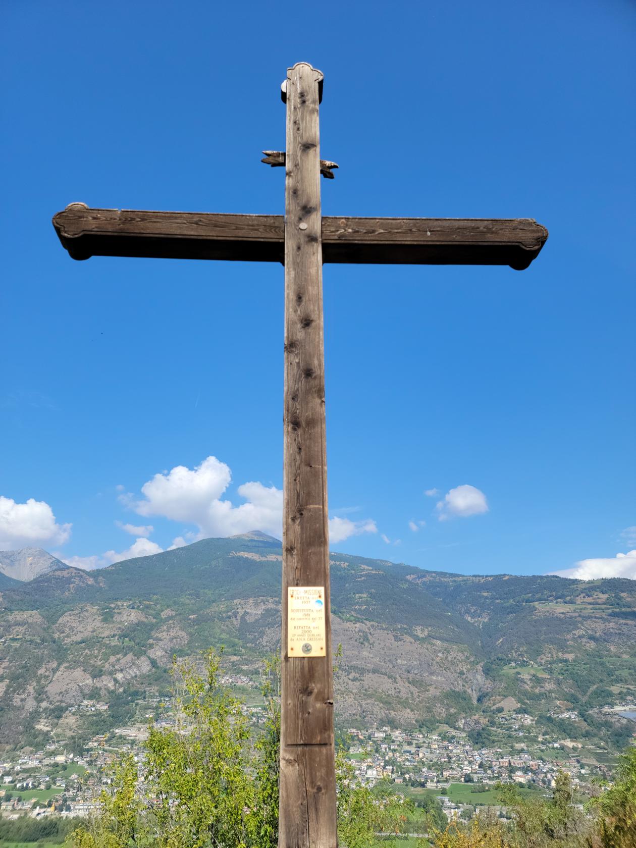
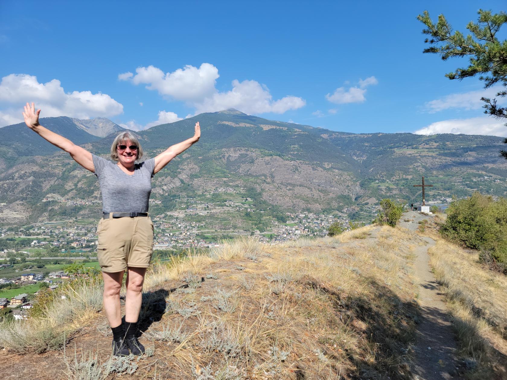
There are also several monuments and other artifacts on the top, including a score of music, a cross and some signs (which I did not translate).
Aosta – Gargantua Nature Reserve Hike – Il Silenzio della Fate – Score Sheet
Aosta – Gargantua Nature Reserve Hike – Il Silenzio della Fate – Marker
Aosta – Gargantua Nature Reserve Hike – The Cross
Aosta – Gargantua Nature Reserve Hike – Valle d’Aosta to the east
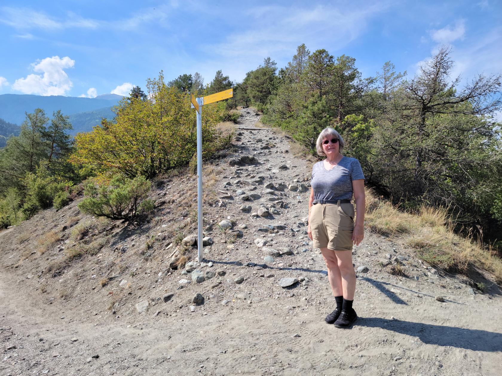
The hike down was a bit more interesting than the ascent, since it was from the end of the hill that sticks out into the valley. Therefore, it was a bit steeper and more treacherous. There were several places that we had to be careful, but luckily there were always enough rocks on which we could purchase a grip.
Aosta – Gargantua Nature Reserve Hike – The Cross
Aosta – Gargantua Nature Reserve Hike – Patti made it!
Aosta – Gargantua Nature Reserve Hike – Patti on the way down
Aosta – Gargantua Nature Reserve Hike – Gardens
Aosta – Gargantua Nature Reserve Hike – Gardens
That does it for our day hike in Aosta. In all, it totaled about 7.5 miles and some 450ft in ascent and descent, and about three and a half hours to hike. We went straight to a restaurant, since we had been out since 9:30AM and did not want the restaurants closing while we were dropping our things off at the hotel. All in all, a very gratifying September day of hiking in Aosta. Go Hike!
Aosta – Gargantua Nature Reserve Hike – Panorama with mountains
Though technically any heap of rock and dirt may be called a hill, this is actually a glacial moraine, deposited thousands of years ago when the glaciers from the last Ice Age left this valley.
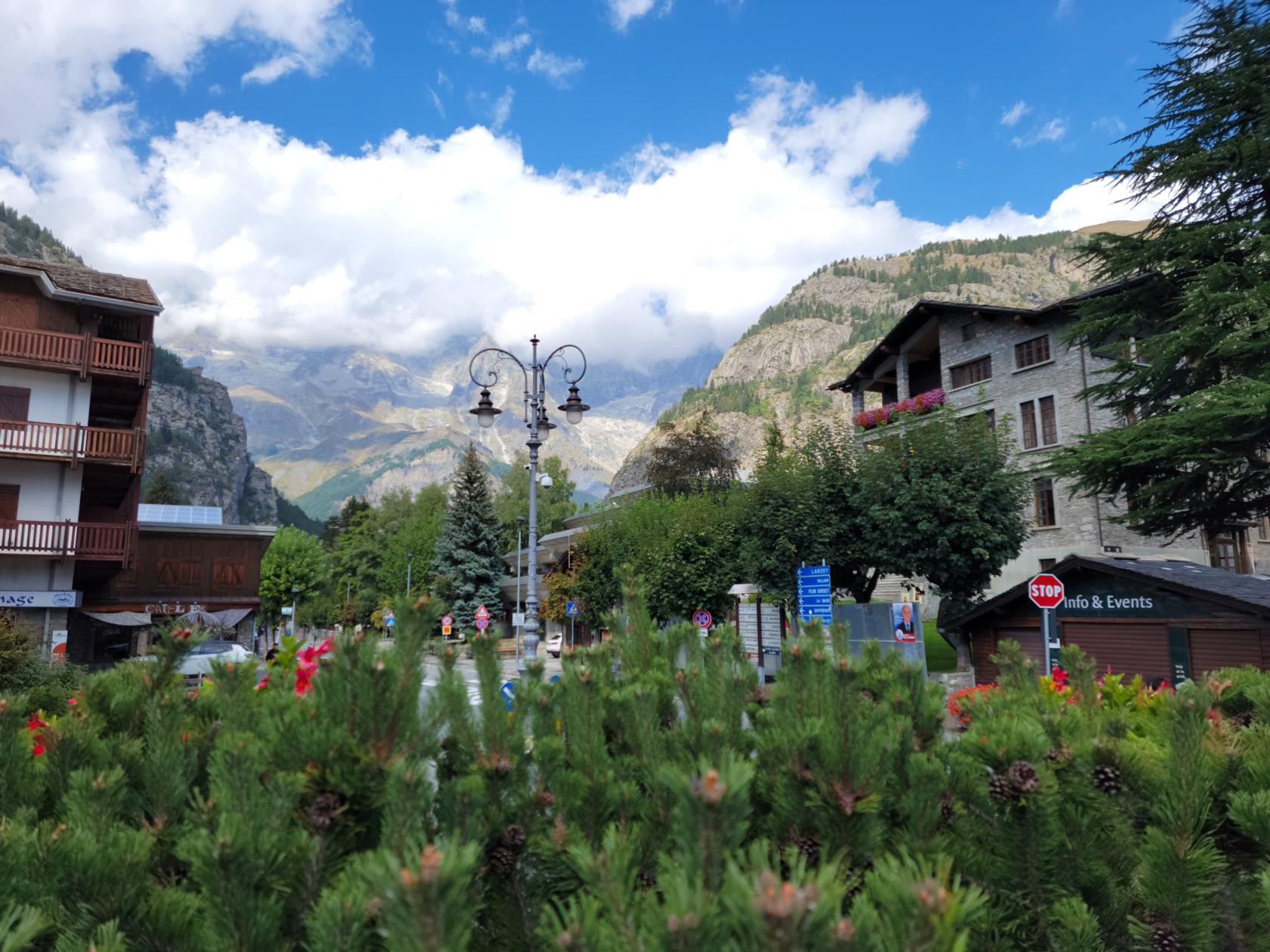
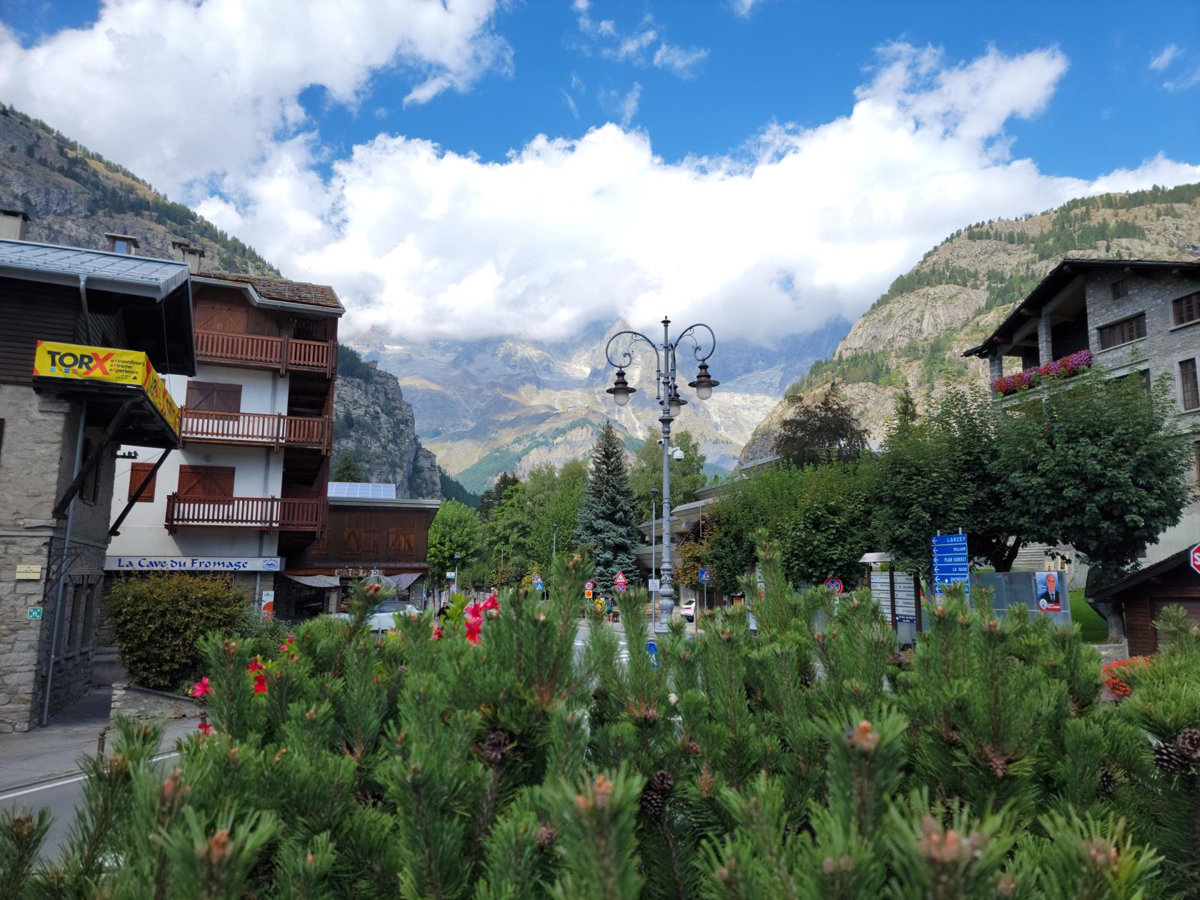
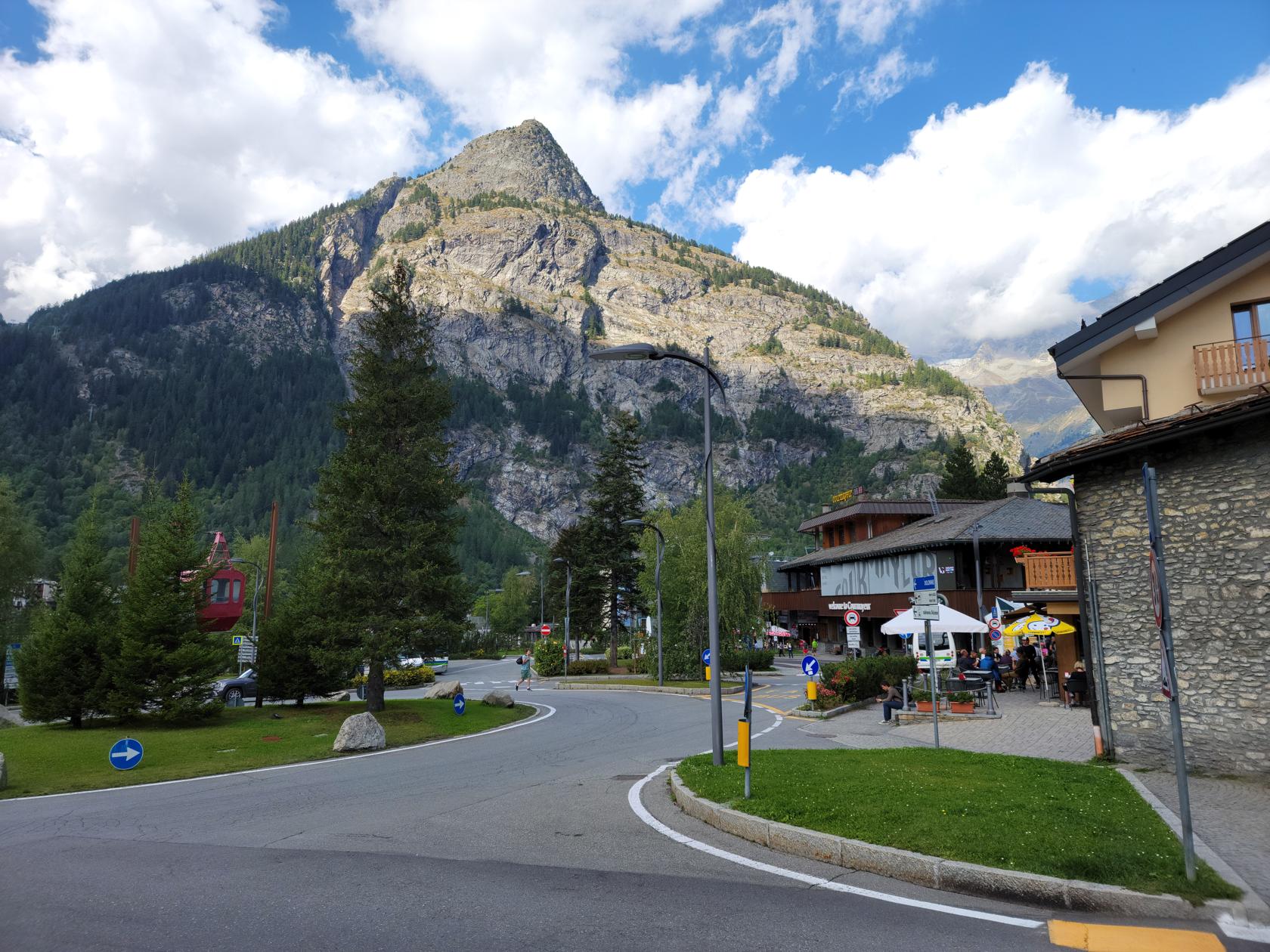
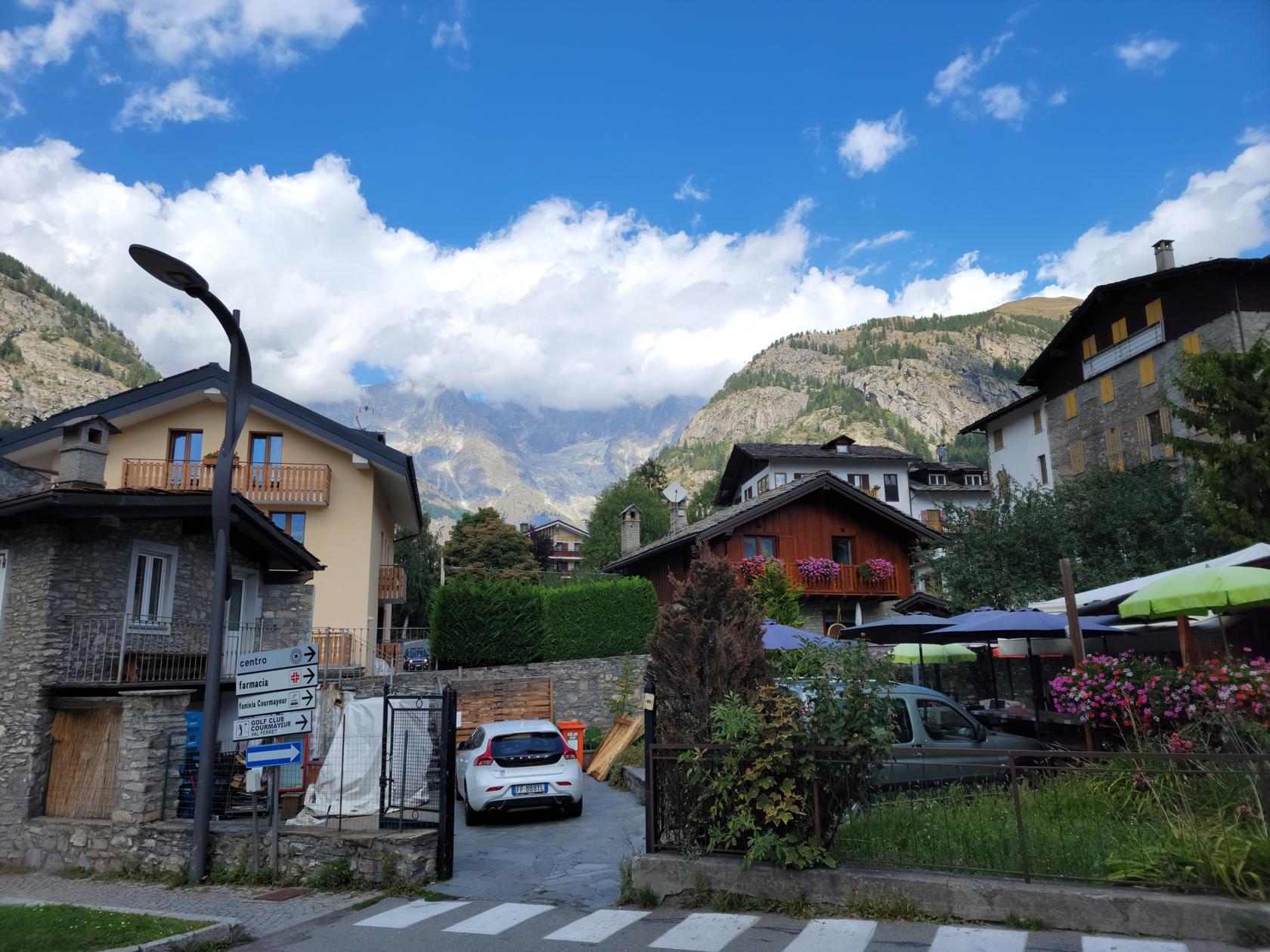
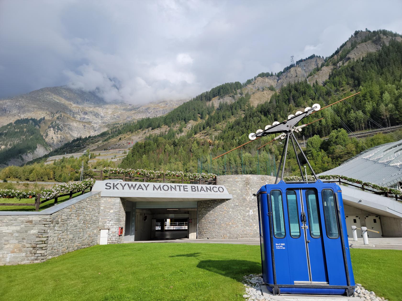
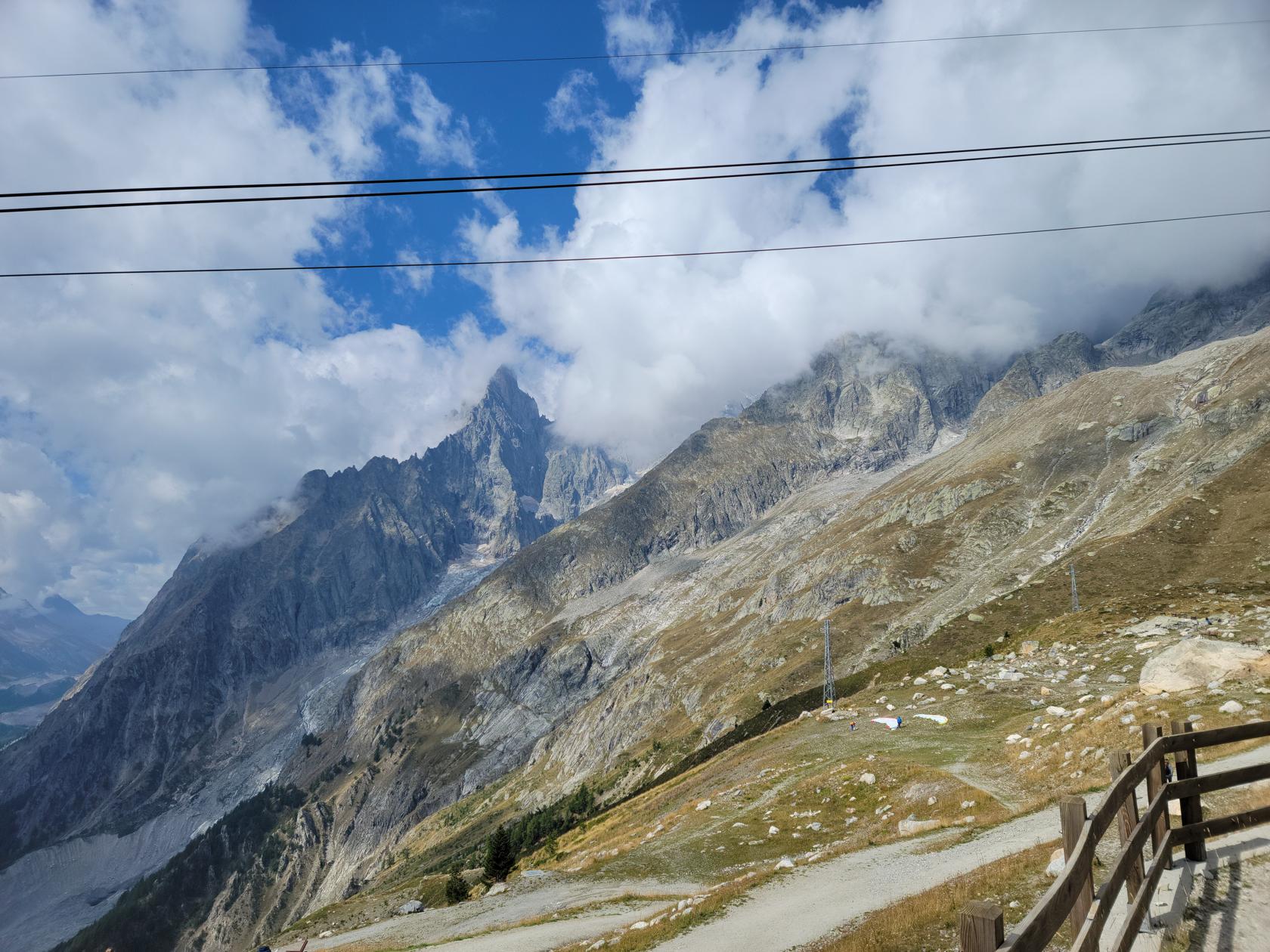
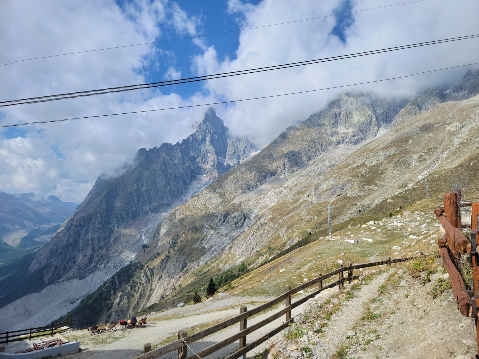
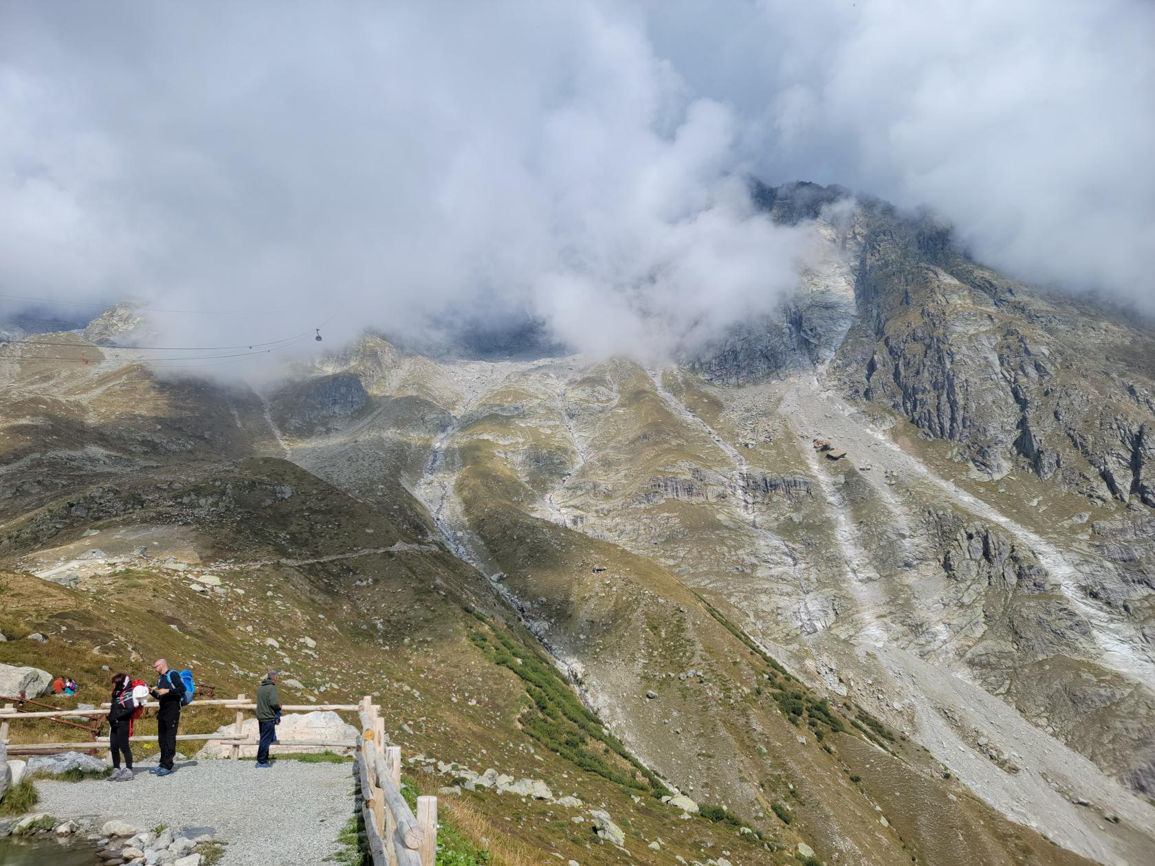
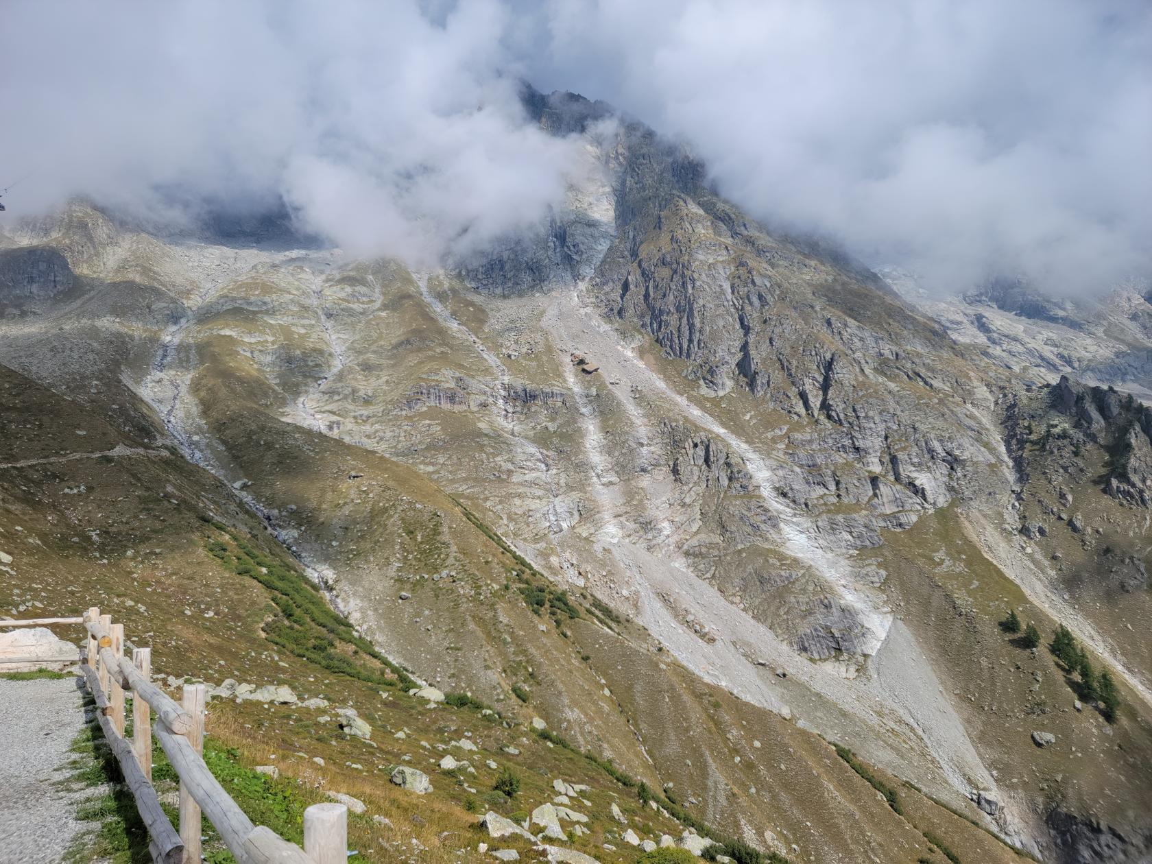
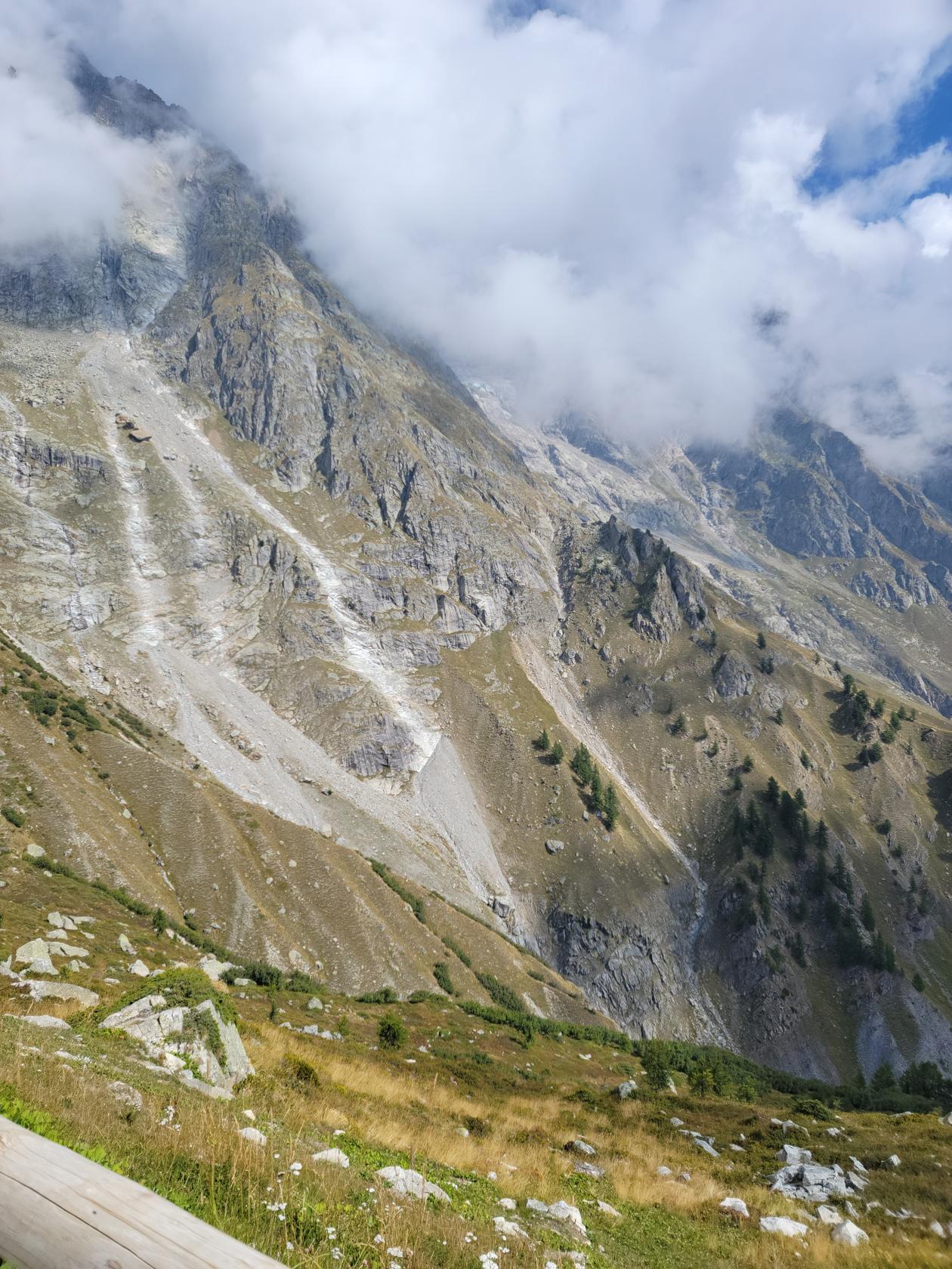
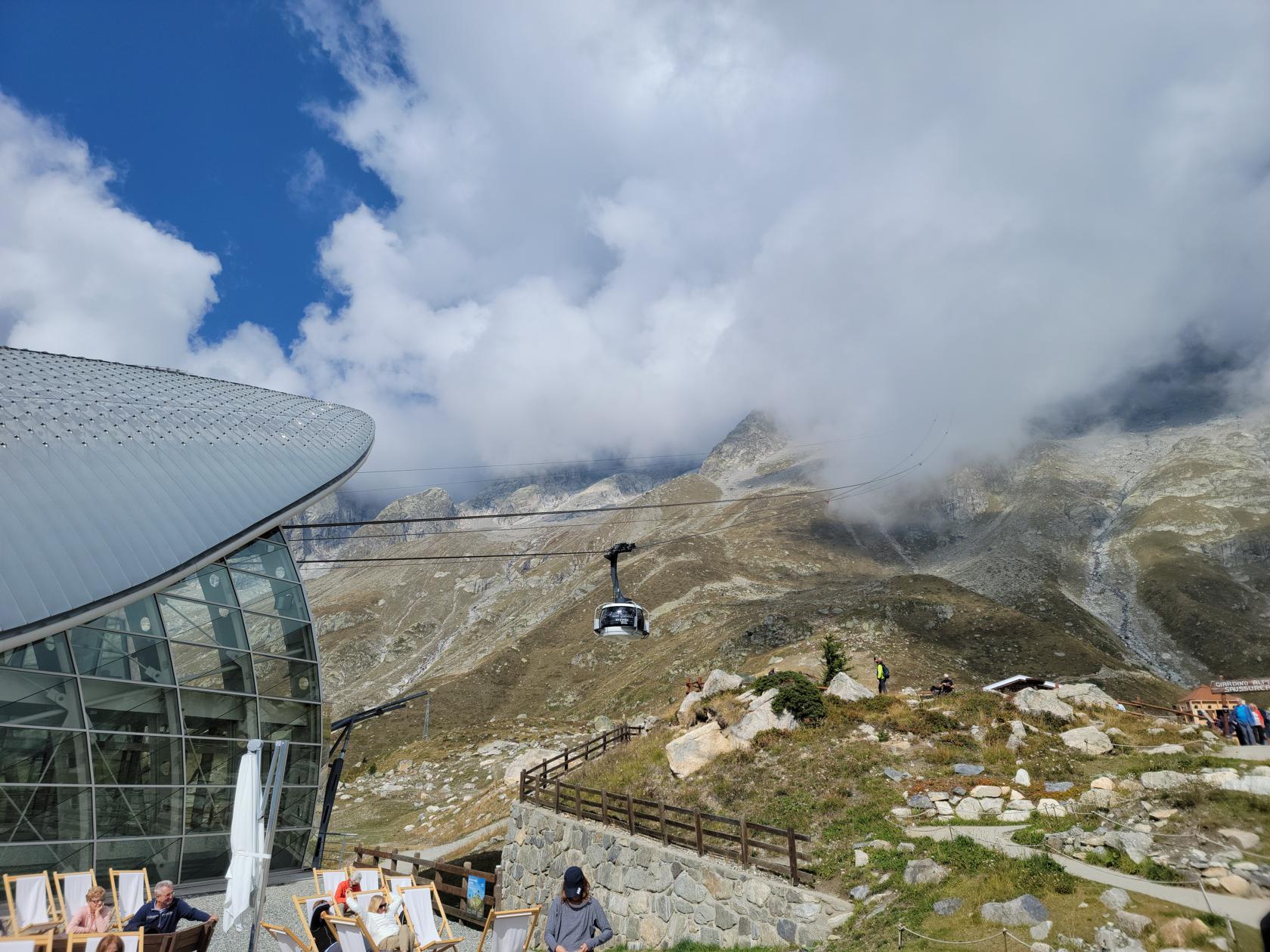
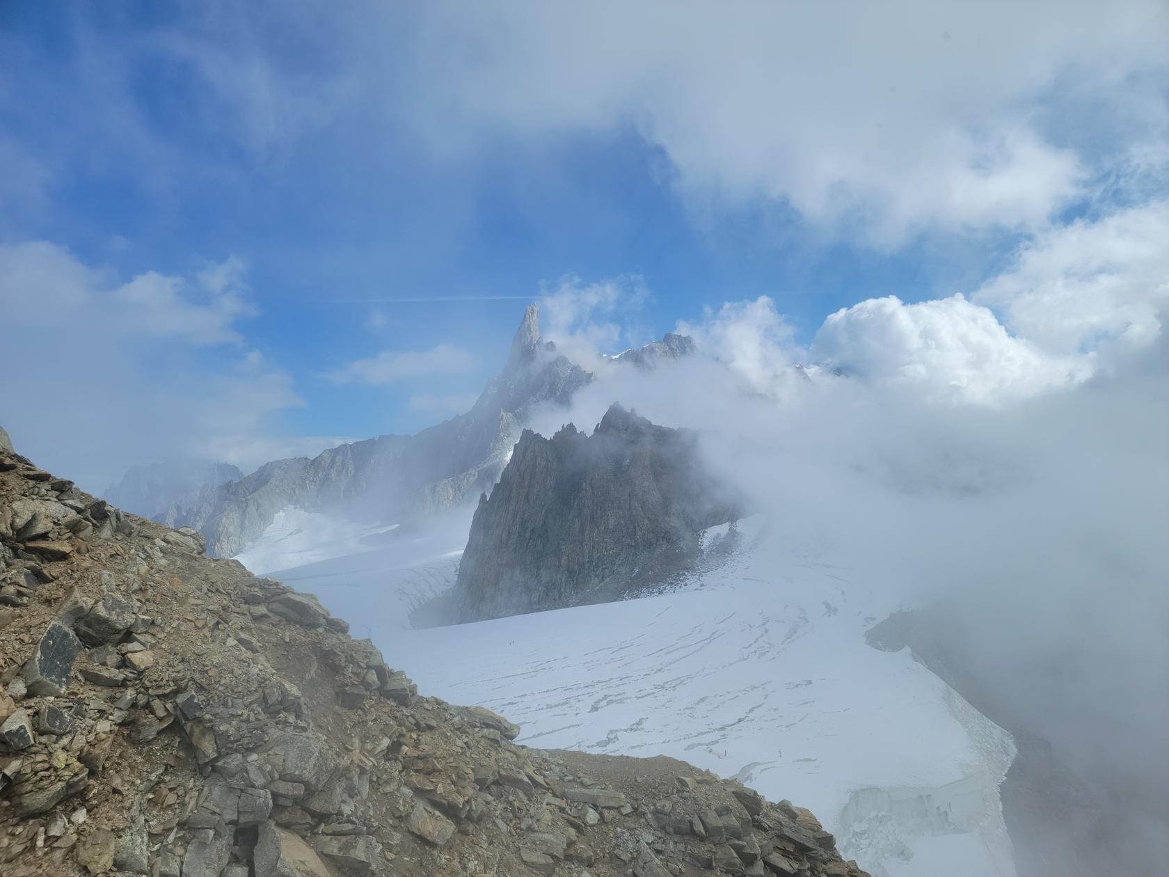
Courmayeur – The Skyway Monte Bianco – Erick at the Saussurea Alpine Botanical Garden
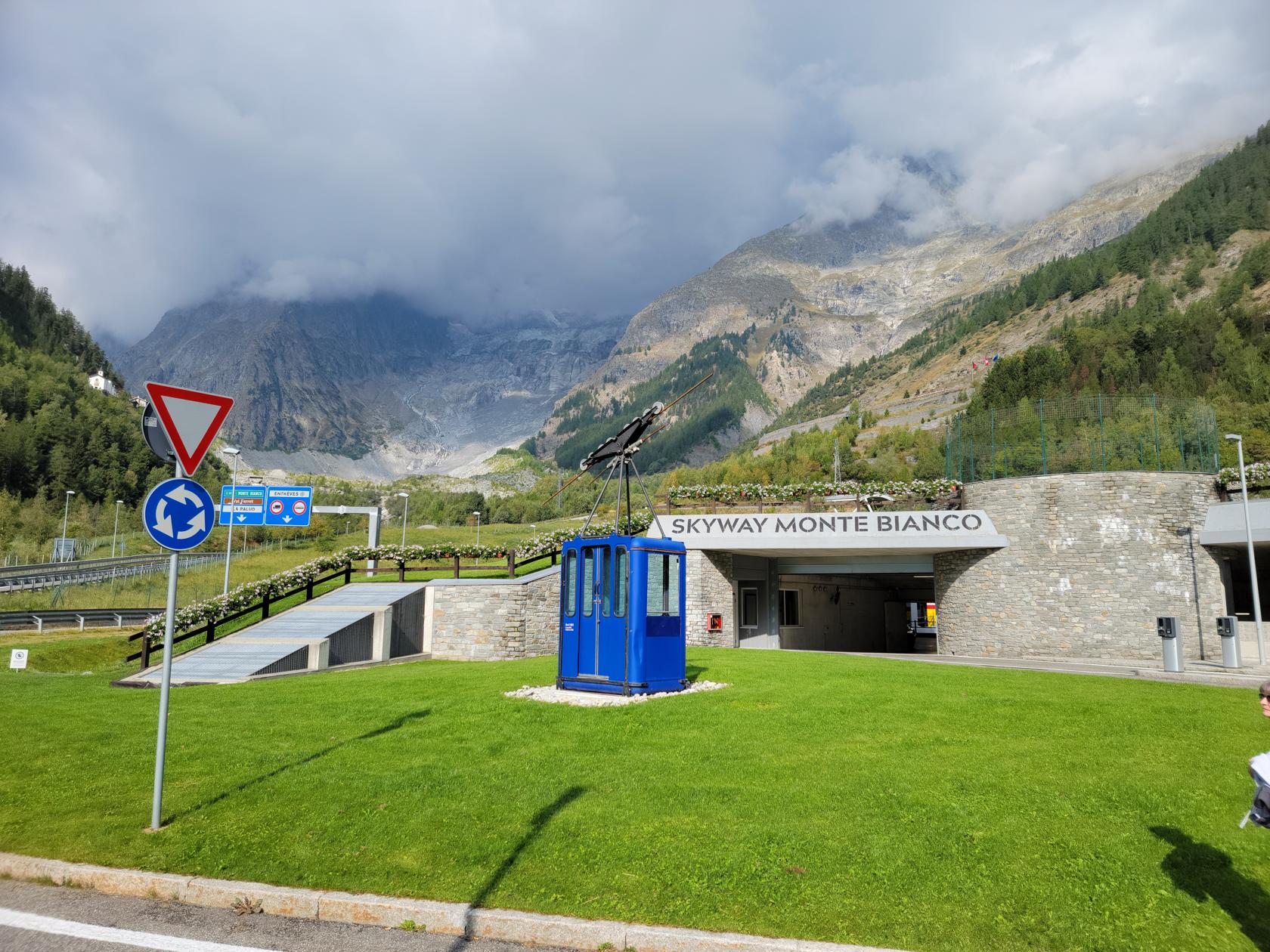
Some 33km from Aosta, or about one hour by bus, is the small ski hamlet of Courmayeur and the starting point of our day journey to Pont Helbronner (Helbronner Point) and Monte Bianco, or Mont Blanc.
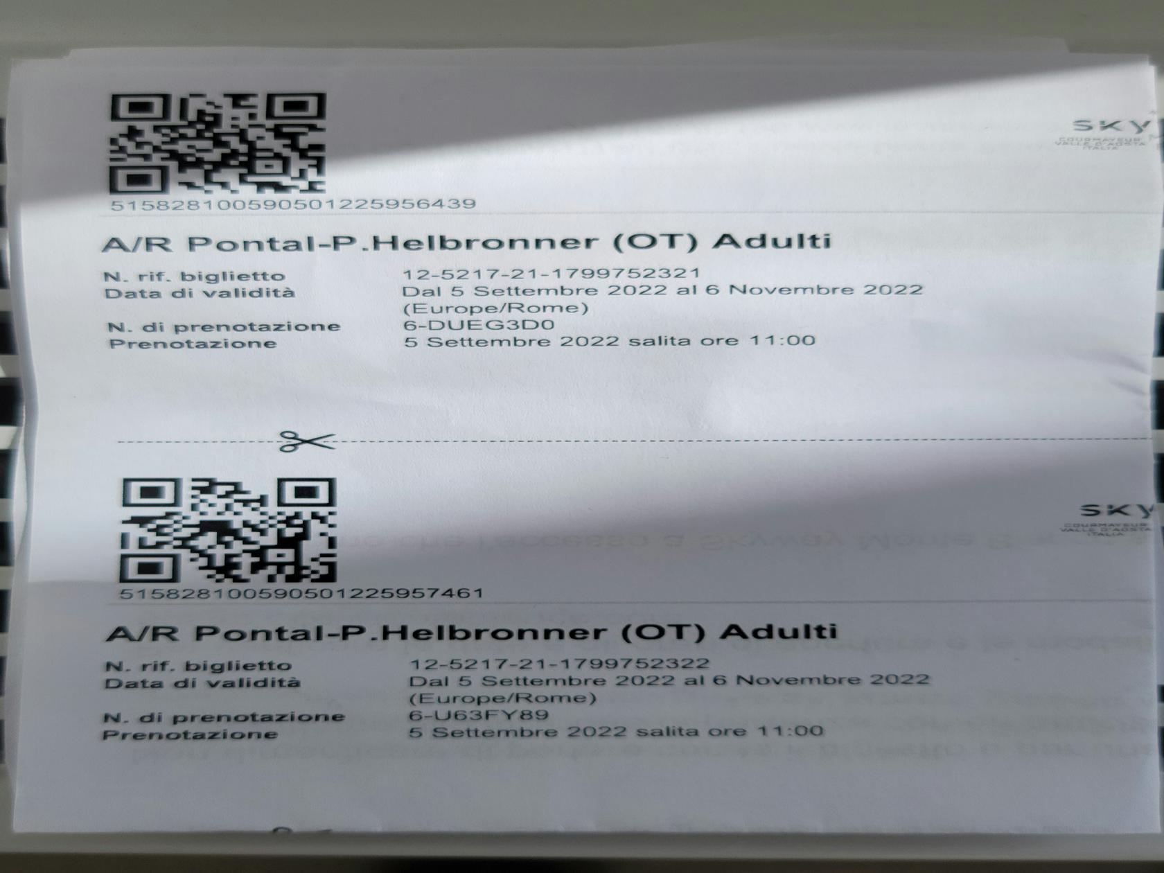
Courmayeur – The Skyway Monte Bianco – Tickets For Two
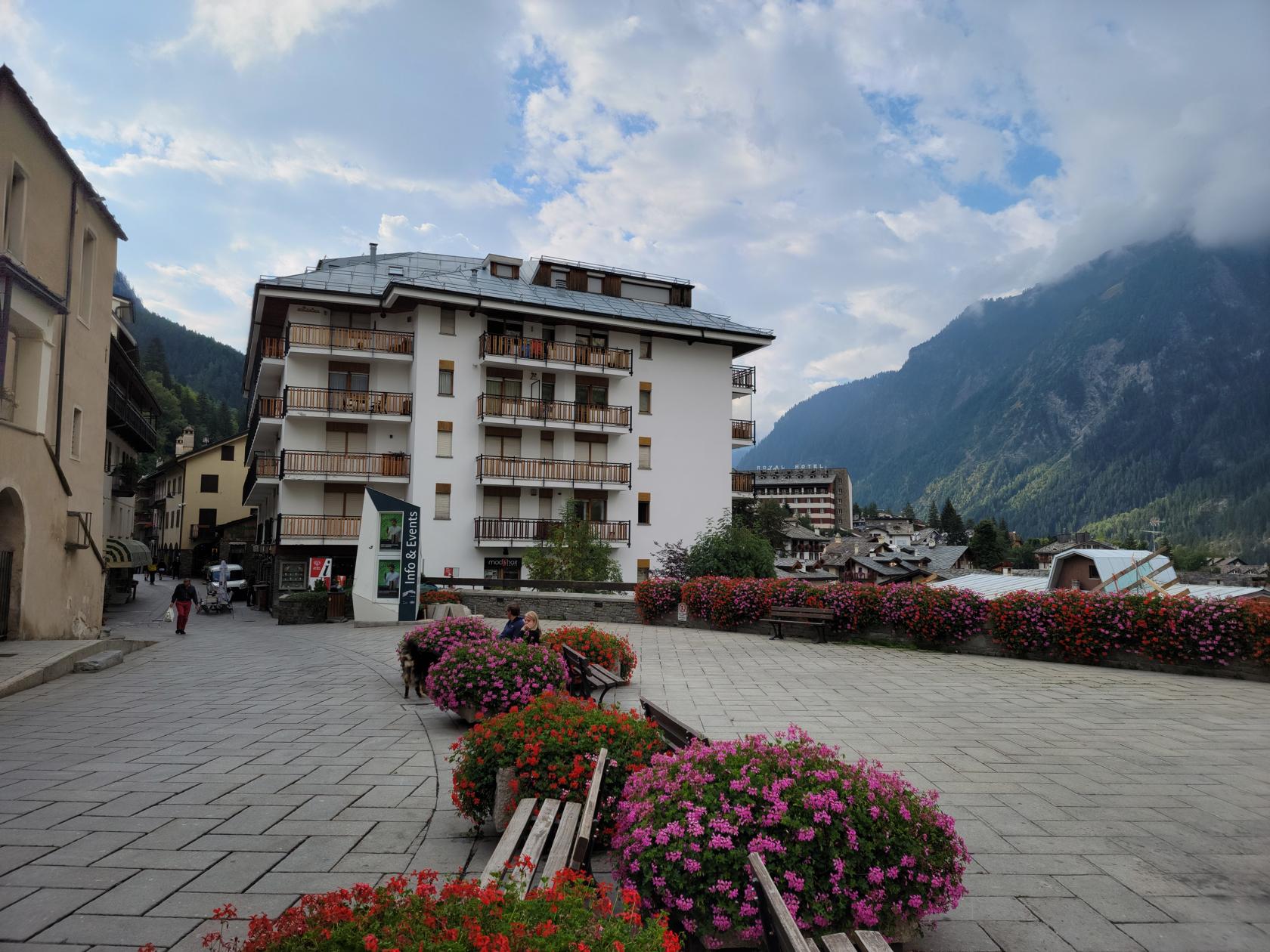
Courmayeur
A quaint little ski hamlet that offers a traditional Italian, Swiss and French Alpine feel. The town is built to withstand the snows that most likely visit this region every winter season. Luckily, we visited when the weather was a bit more mild and pleasant.
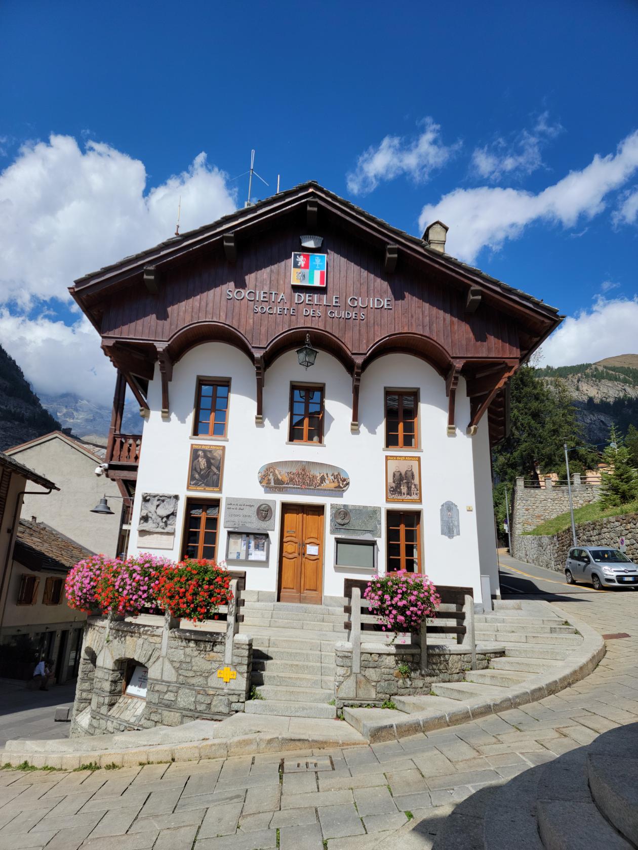
Courmayeur – The Town’s Climbing Society
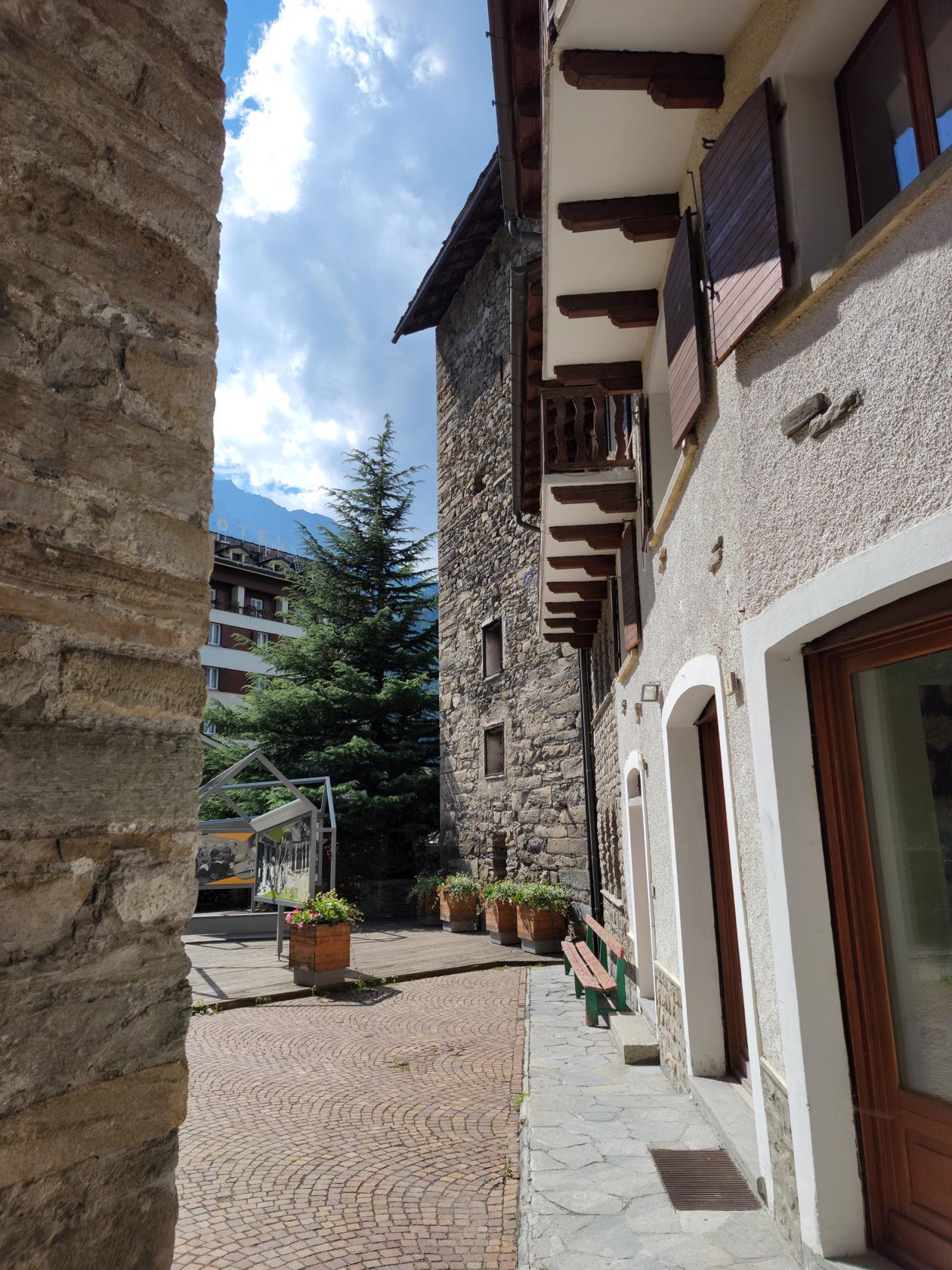
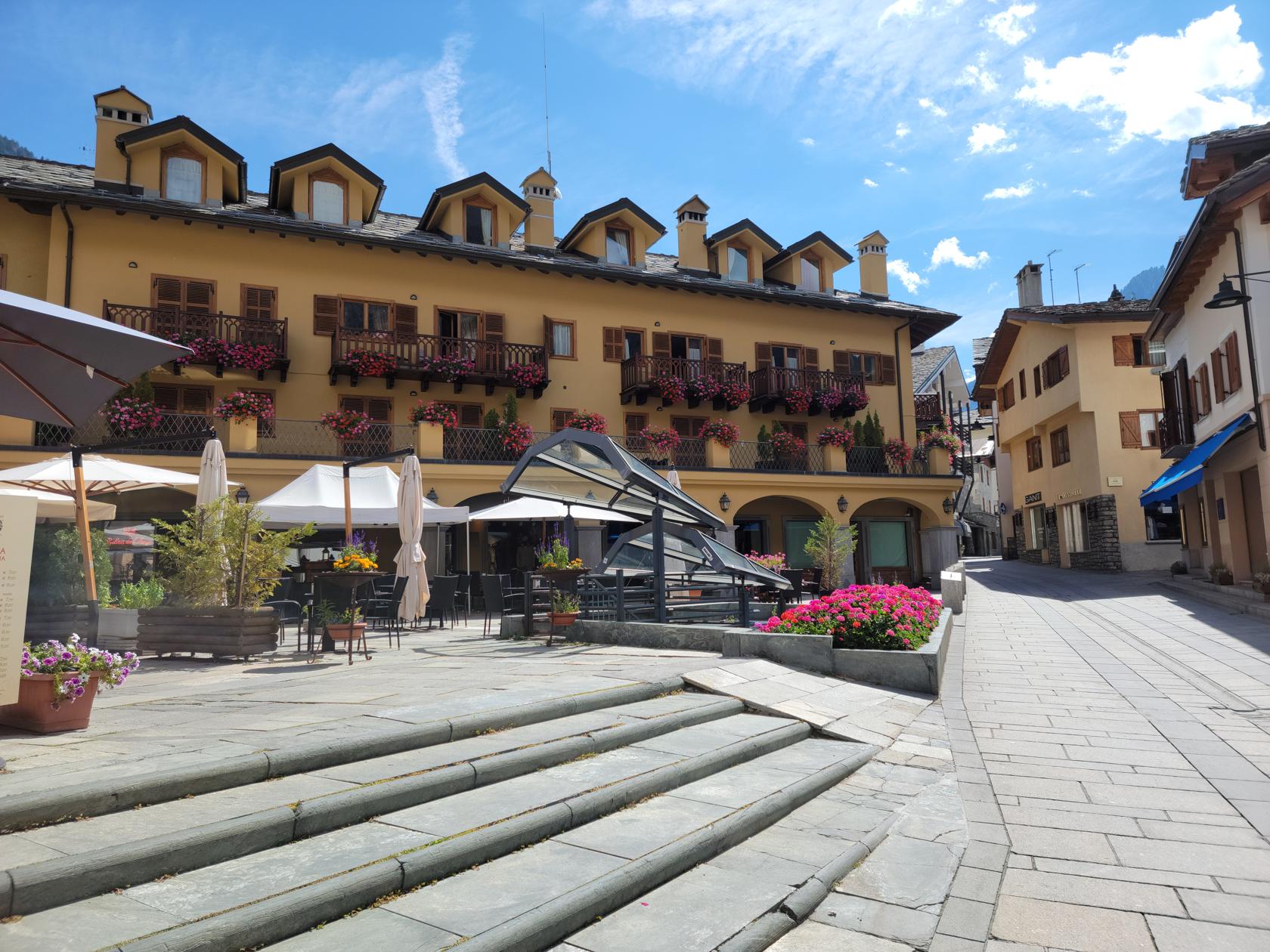
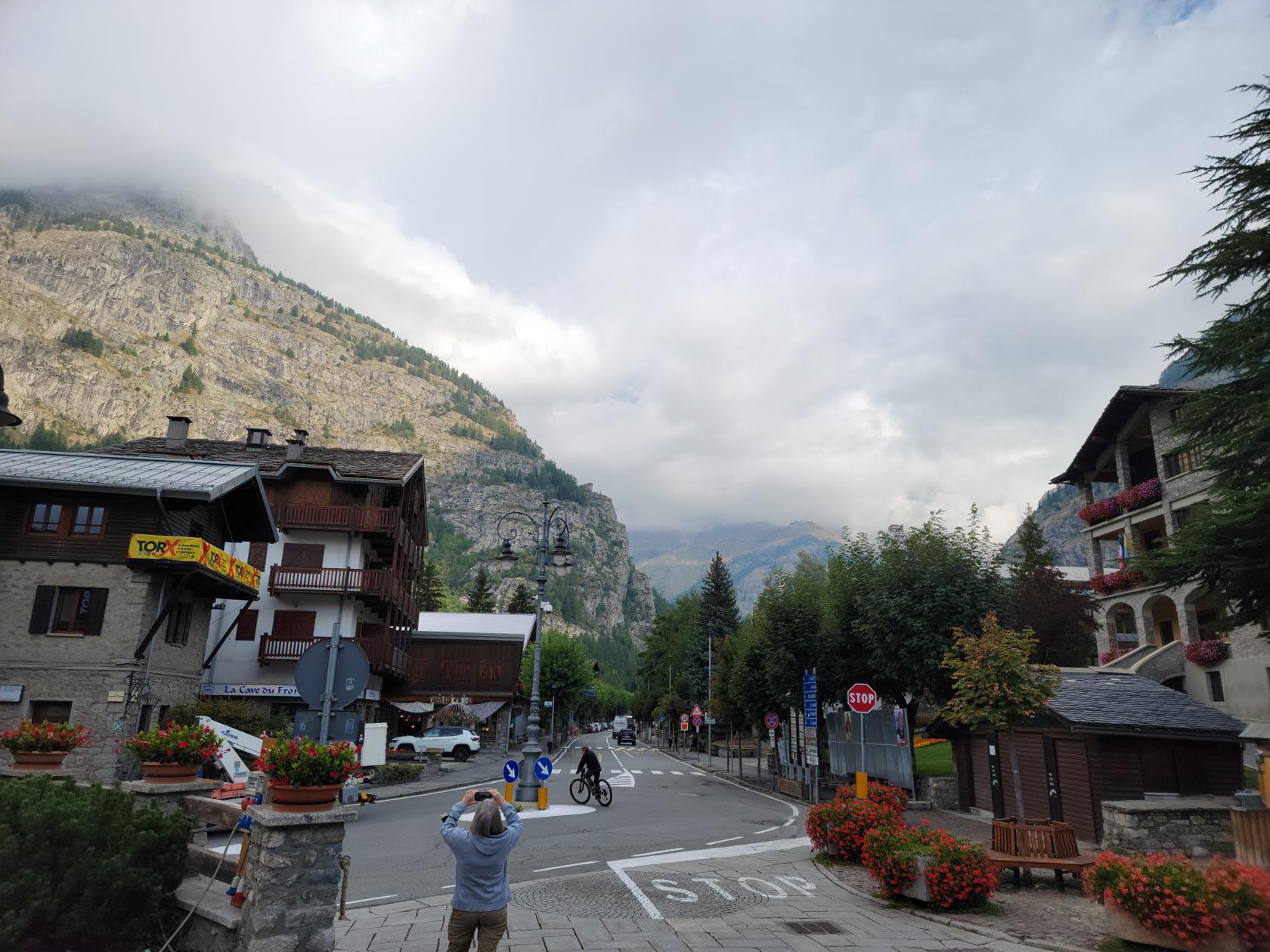
Courmayeur – The Town Main Street
Courmayeur – The Town Main Street
Courmayeur – The Town Main Street
Courmayeur – The Town Main Street
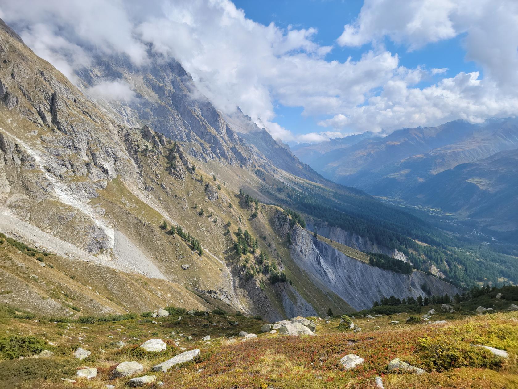
Courmayeur – The Mountains
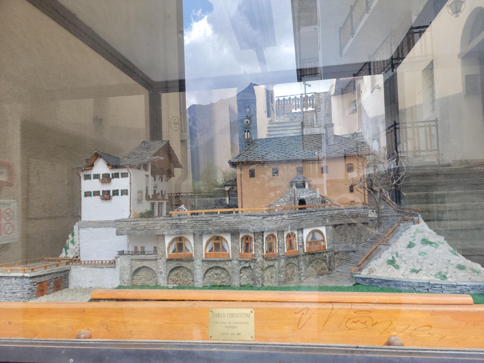
Courmayeur – Diorama of an old structure in town
Courmayeur – The Mountains and Moghu Pines
Courmayeur – The Mountains and Moghu Pines
Courmayeur – The Mountains
Courmayeur – The Mountains
Courmayeur – A Town in the High Alps
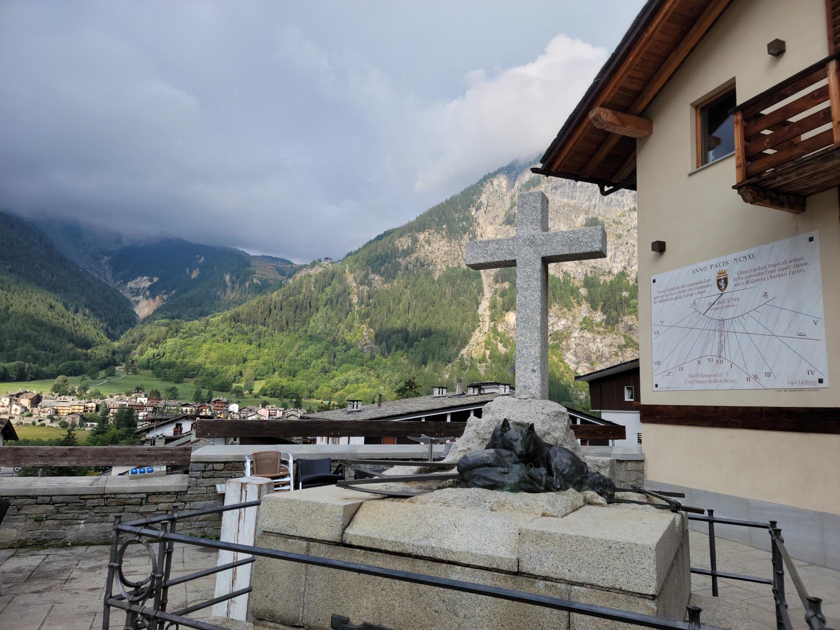
Courmayeur – A Sundial in Town
Courmayeur – The Town and Mountains
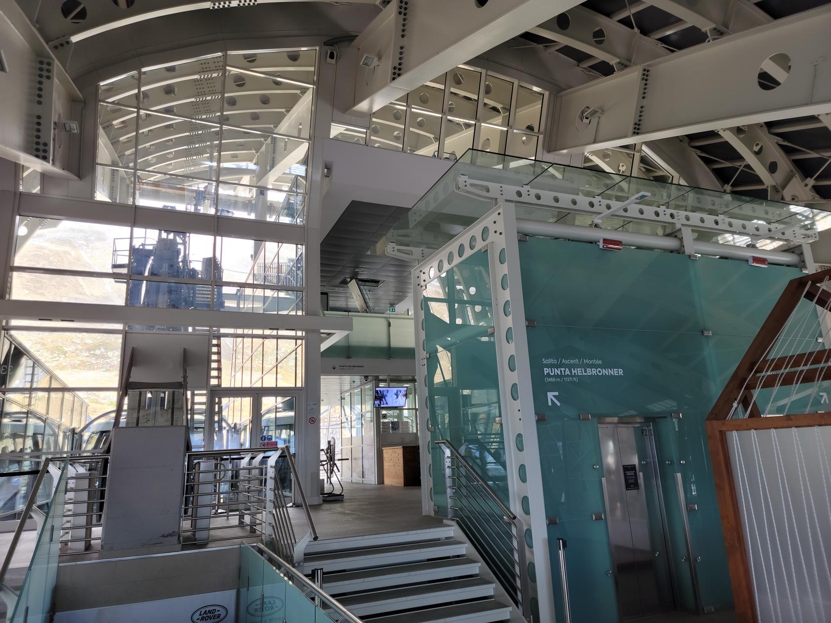
Or primary reason for being here was taking the Skyway Monte Bianco and visiting the mountain across from Mont Blanc, in order to get some good photographs of it and the valley of glaciers that it creates.
Helbronner and Mont Blanc
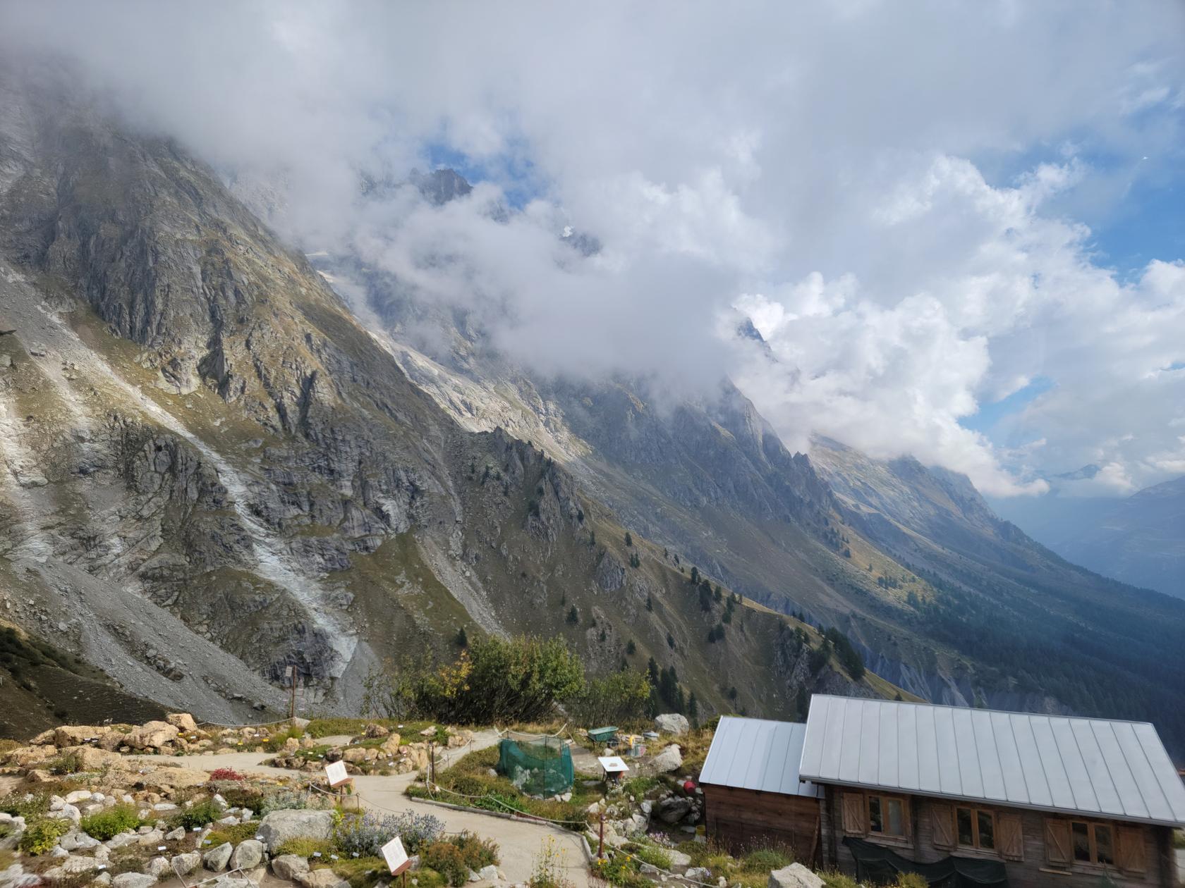
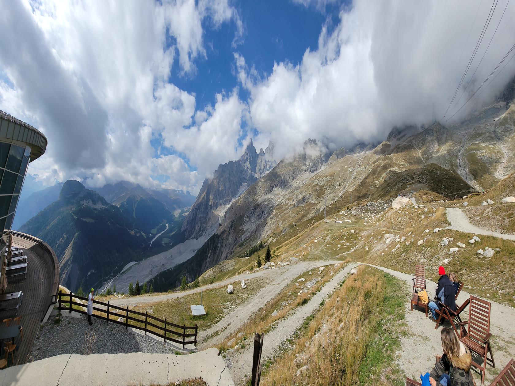
Once you board the cable car you ascend rapidly to the intermediate stop of where the Saussurea Alpine Botanical Gardens are, where you can stretch you legs and your soul.
Courmayeur – The Skyway Monte Bianco – Cable Car Entrance
Courmayeur – The Skyway Monte Bianco – Cable Car Entrance
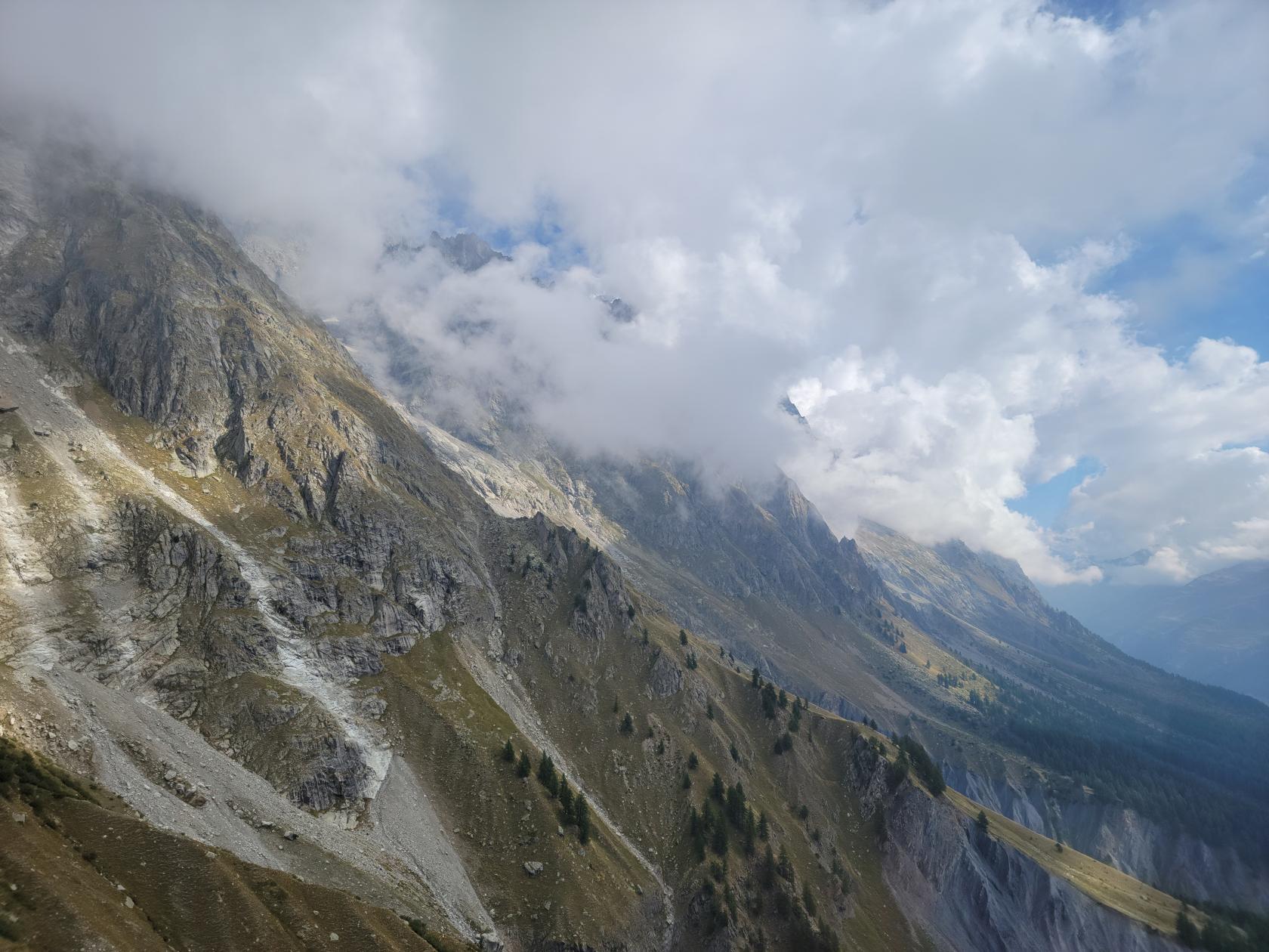
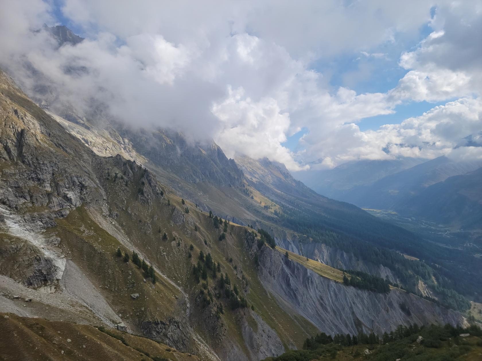
Courmayeur – The Skyway Monte Bianco – View From Cable Car
Courmayeur – The Skyway Monte Bianco – View From Cable Car – Mountain Face of Aiguilles Marbrées
Courmayeur – The Skyway Monte Bianco – View From Cable Car – Mountain Face of Aiguilles Marbrées
Courmayeur – The Skyway Monte Bianco – View From Cable Car – Second Cable Car at Saussurea Alpine Botanical Garden
Courmayeur – The Skyway Monte Bianco – View From Cable Car – Second Cable Car at Saussurea Alpine Botanical Garden
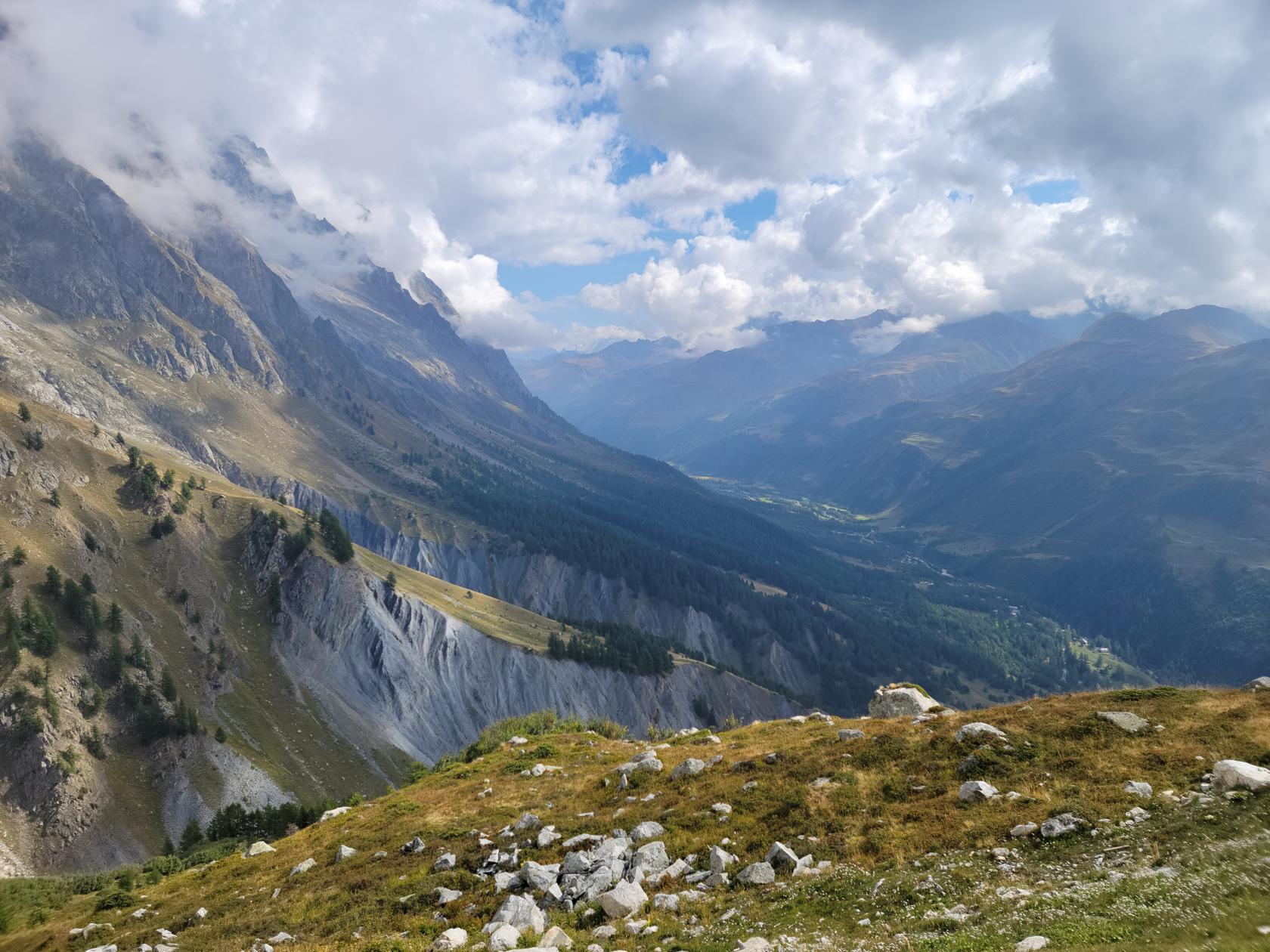
Courmayeur – The Skyway Monte Bianco – View From Cable Car – The Aosta Valley Floor
Courmayeur – The Skyway Monte Bianco – View From Cable Car – Cloud Shrowded Mont Blanc
Courmayeur – The Skyway Monte Bianco – The Way Down – Aosta Valley
Courmayeur – The Skyway Monte Bianco – The Way Down – Aosta Valley
Courmayeur – The Skyway Monte Bianco – The Way Down – Aosta Valley
There are many things you can do here besides enjoy the cafe or bar. There are hiking trails all over the mountain, and within a few minutes you can be totally alone, hiking a few minutes up any of the trails. If not to discover, perchance to enjoy a different view of the mountain side, which in these parts, is steep enough to tax anyone’s endurance.
Courmayeur – The Skyway Monte Bianco – Veni Valley from the Saussurea Alpine Botanical Garden
Courmayeur – The Skyway Monte Bianco – Aosta Valley the Saussurea Alpine Botanical Garden
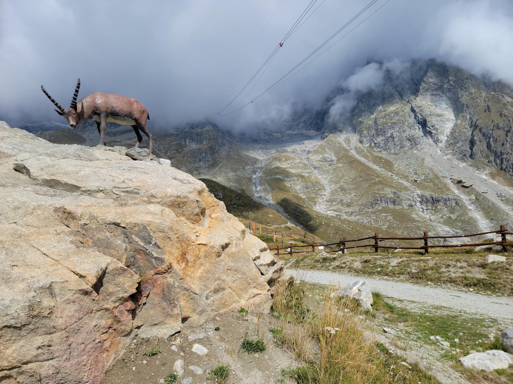
Courmayeur – The Skyway Monte Bianco – Mountain Goat at the Saussurea Alpine Botanical Garden
Courmayeur – The Skyway Monte Bianco – Aosta from the Saussurea Alpine Botanical Garden
Courmayeur – The Skyway Monte Bianco – Stella at the Saussurea Alpine Botanical Garden
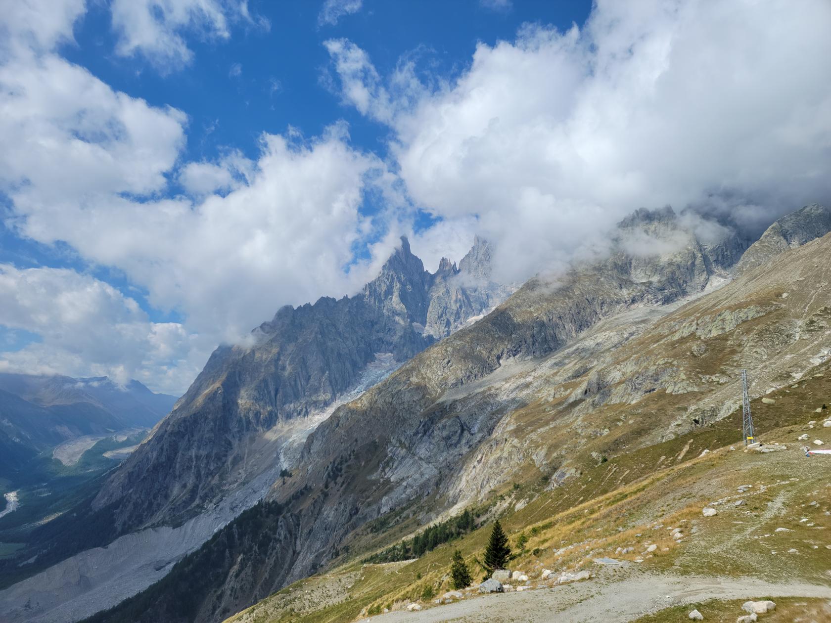
Courmayeur – The Skyway Monte Bianco – Brenva Glacier and Punta Baretti
Courmayeur – The Skyway Monte Bianco – Saussurea Alpine Botanical Garden
Courmayeur – The Skyway Monte Bianco – Fake Ibex at the Saussurea Alpine Botanical Garden
Courmayeur – The Skyway Monte Bianco – Brenva Glacier and Punta Baretti
Courmayeur – The Skyway Monte Bianco – Brenva Glacier and Punta Baretti
Courmayeur – The Skyway Monte Bianco – Brenva Glacier and Punta Baretti
Courmayeur – The Skyway Monte Bianco – Brenva Glacier and Punta Baretti
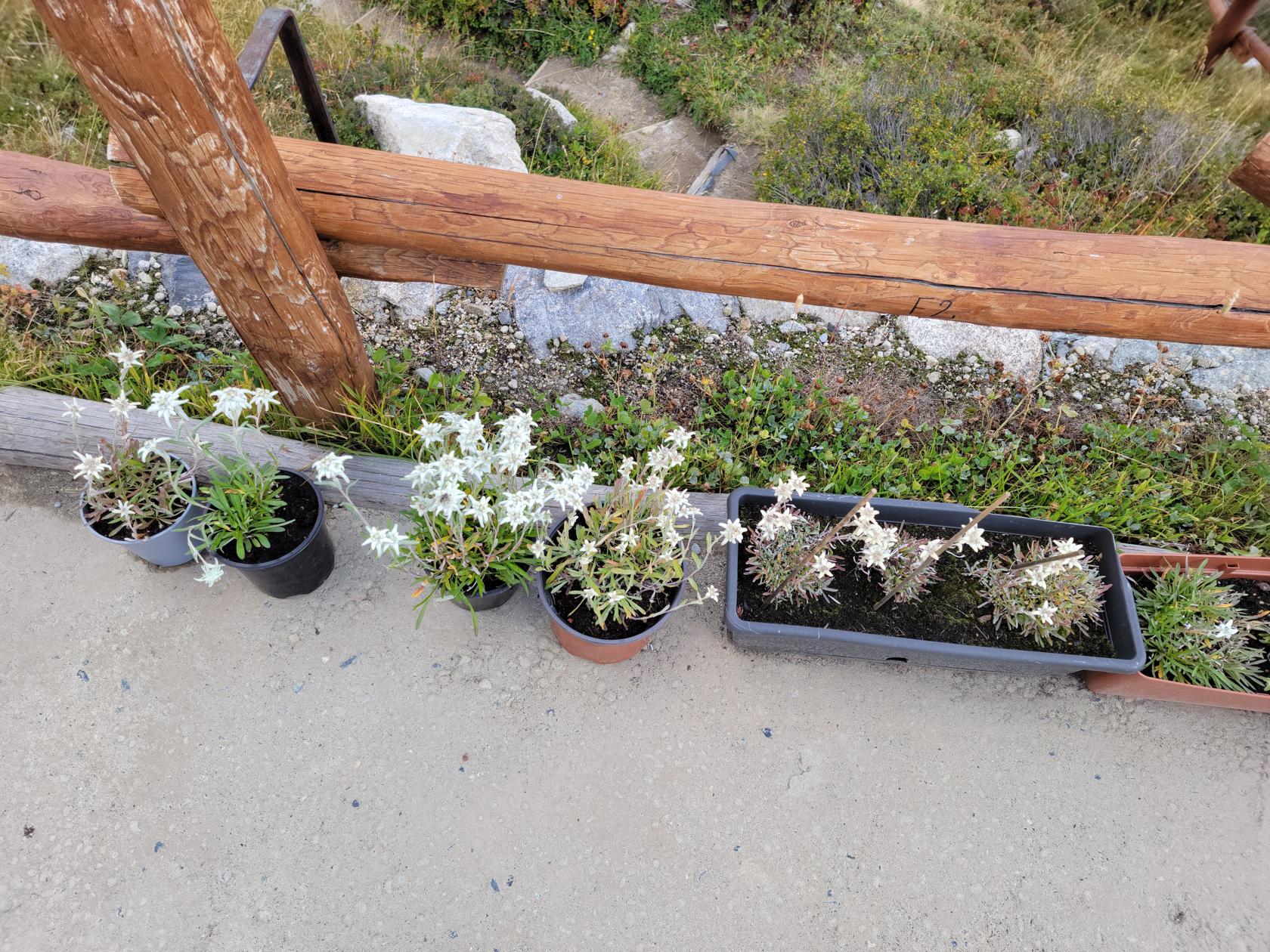
Courmayeur – The Skyway Monte Bianco – Edelweiß at the Saussurea Alpine Botanical Garden
Courmayeur – The Skyway Monte Bianco – Stop at Saussurea Alpine Botanical Garden
Courmayeur – The Skyway Monte Bianco – Stop at Saussurea Alpine Botanical Garden
Courmayeur – The Skyway Monte Bianco – Stop at Saussurea Alpine Botanical Garden
Courmayeur – The Skyway Monte Bianco – Stop at Saussurea Alpine Botanical Garden
Courmayeur – The Skyway Monte Bianco – Stop at Saussurea Alpine Botanical Garden
Courmayeur – The Skyway Monte Bianco – Stop at Saussurea Alpine Botanical Garden
Courmayeur – The Skyway Monte Bianco – Halfway Point
Courmayeur – The Skyway Monte Bianco – Stop at Saussurea Alpine Botanical Garden
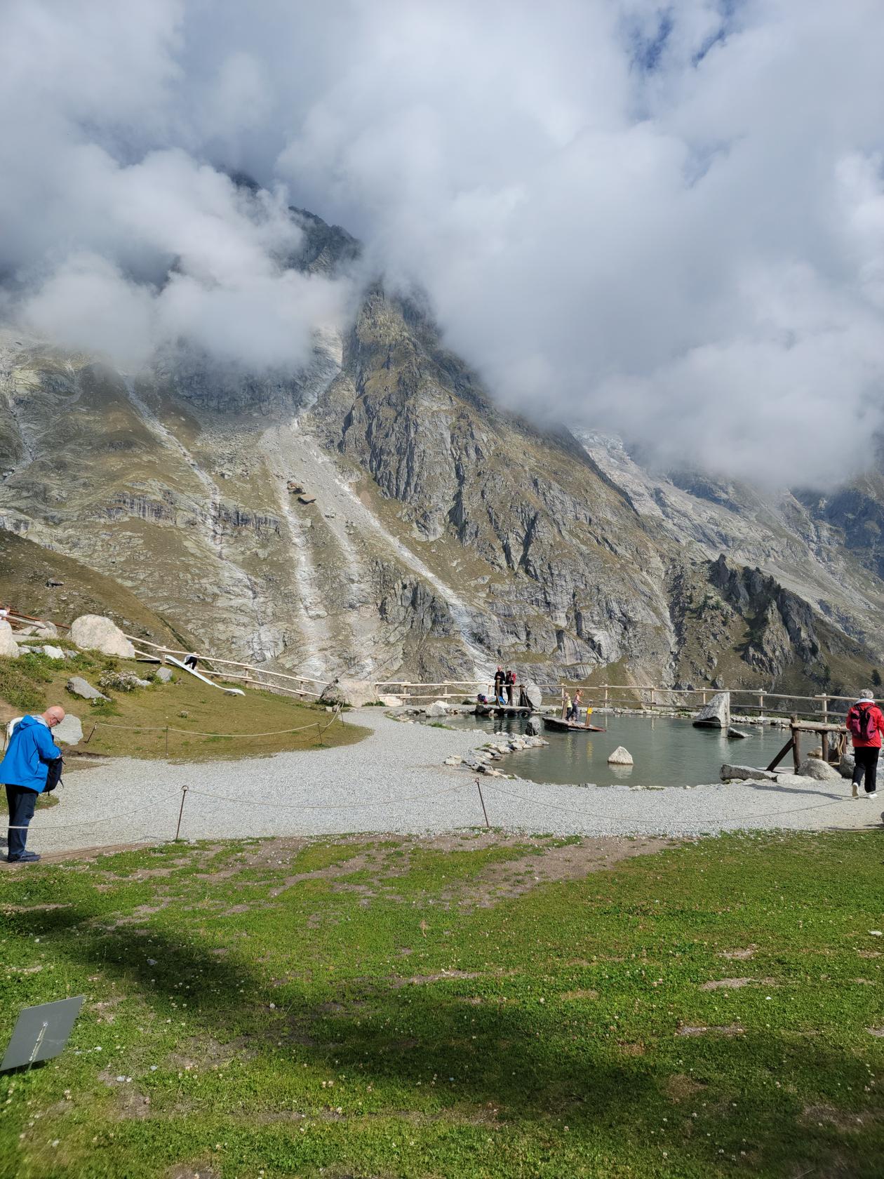
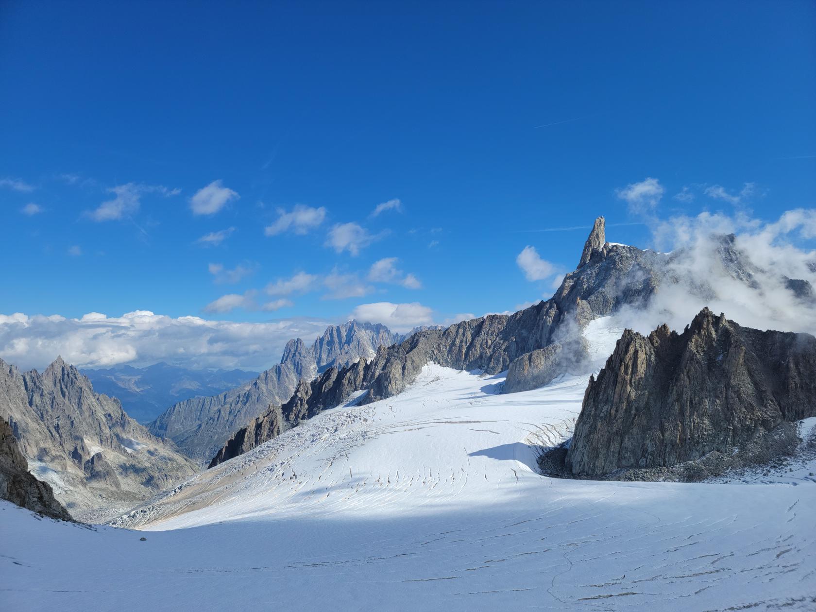
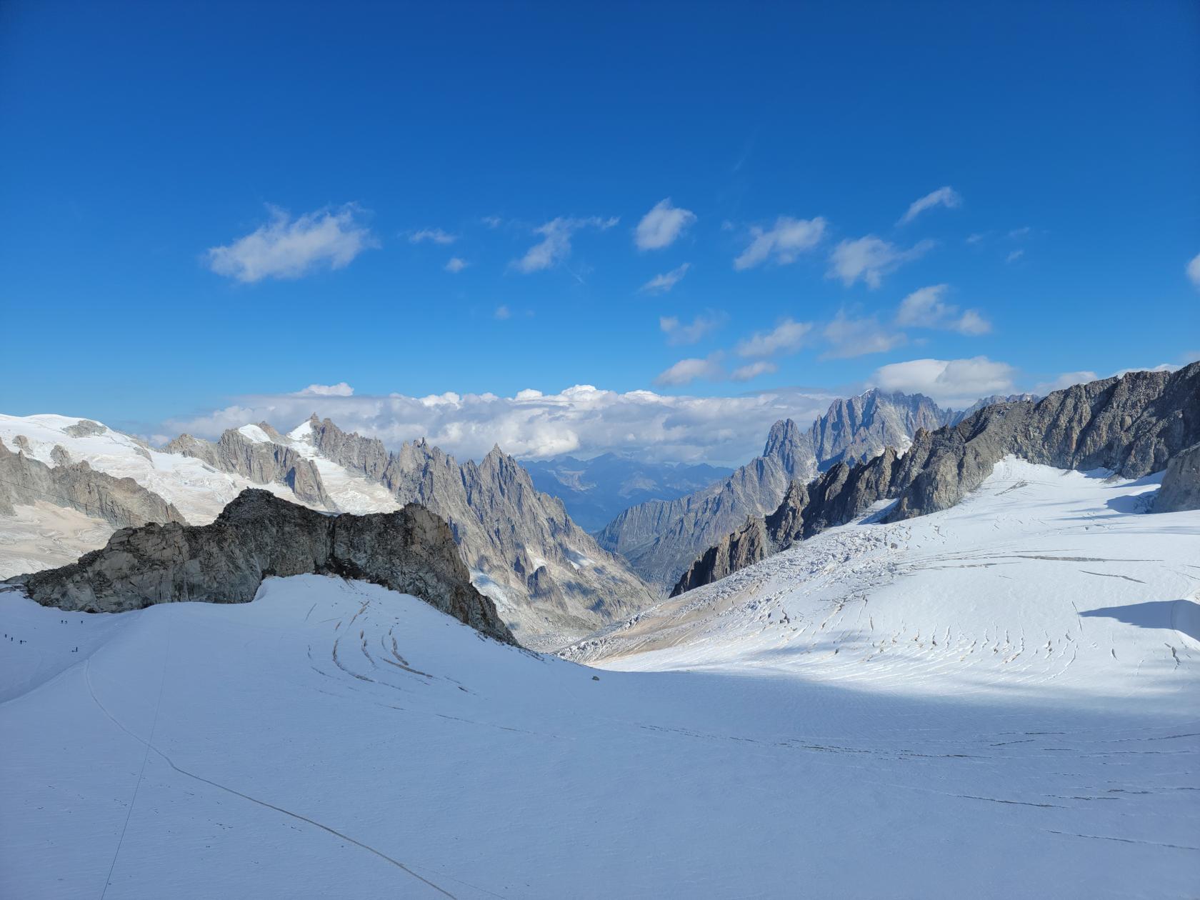
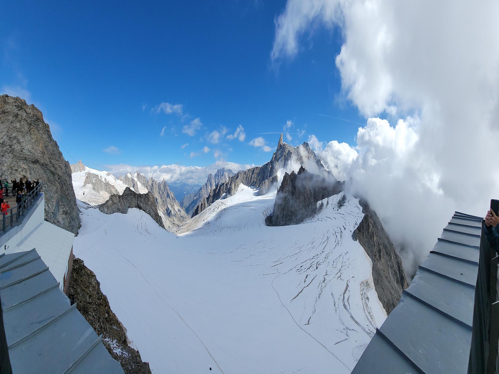
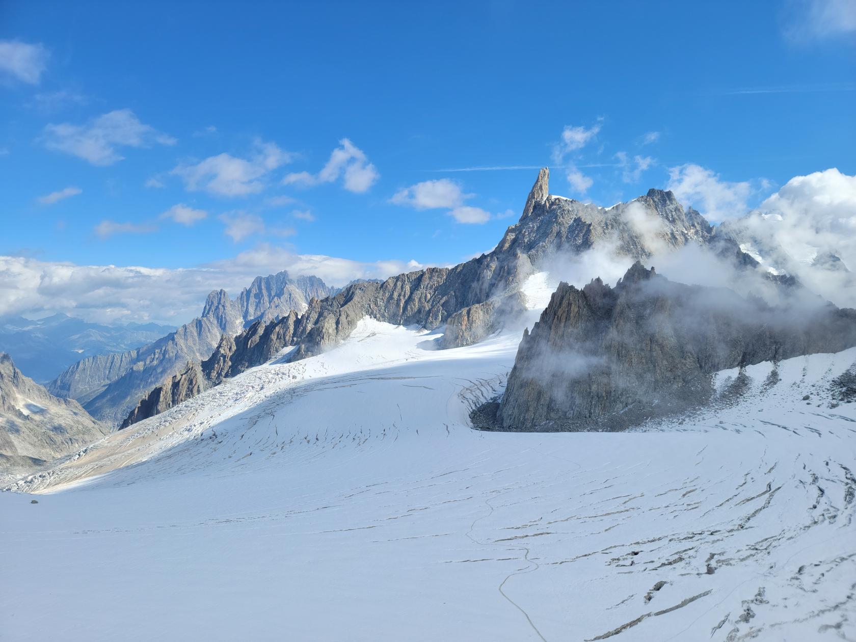
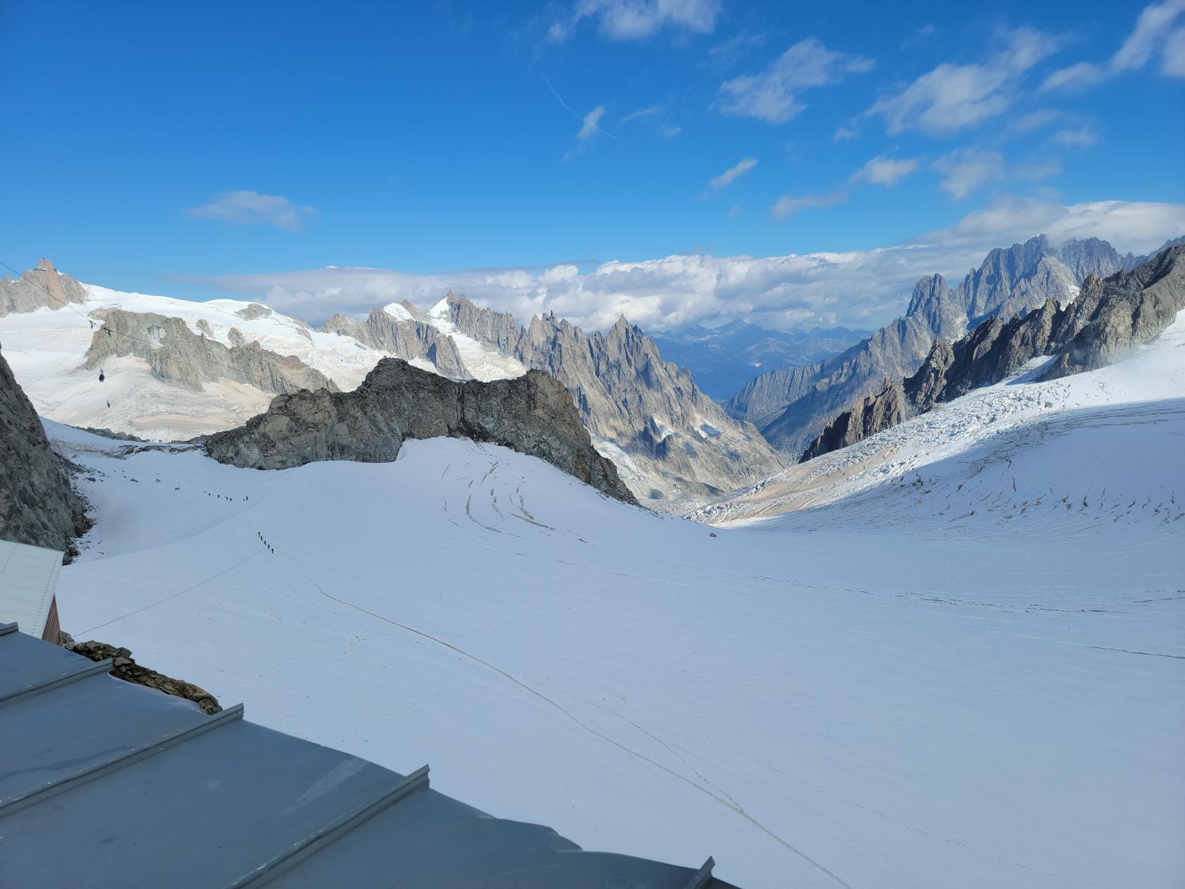
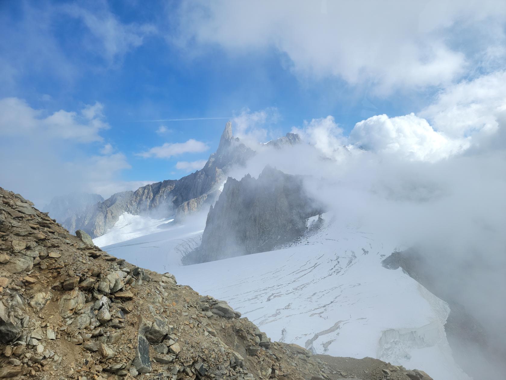
Pont Helbronner
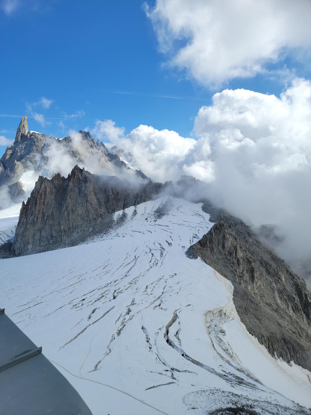
Courmayeur – The Skyway Monte Bianco – View From Cable Car – Mont and Glacier du Géant
A singular place to visit to enjoy the almost lunar landscape of this Alpine geography. Aside from occasional dyspepsia and dizziness that this altitude might cause, the visitor is welcomed to an almost surreal landscape once exiting the cable car and ascending the stairs to the observation deck.
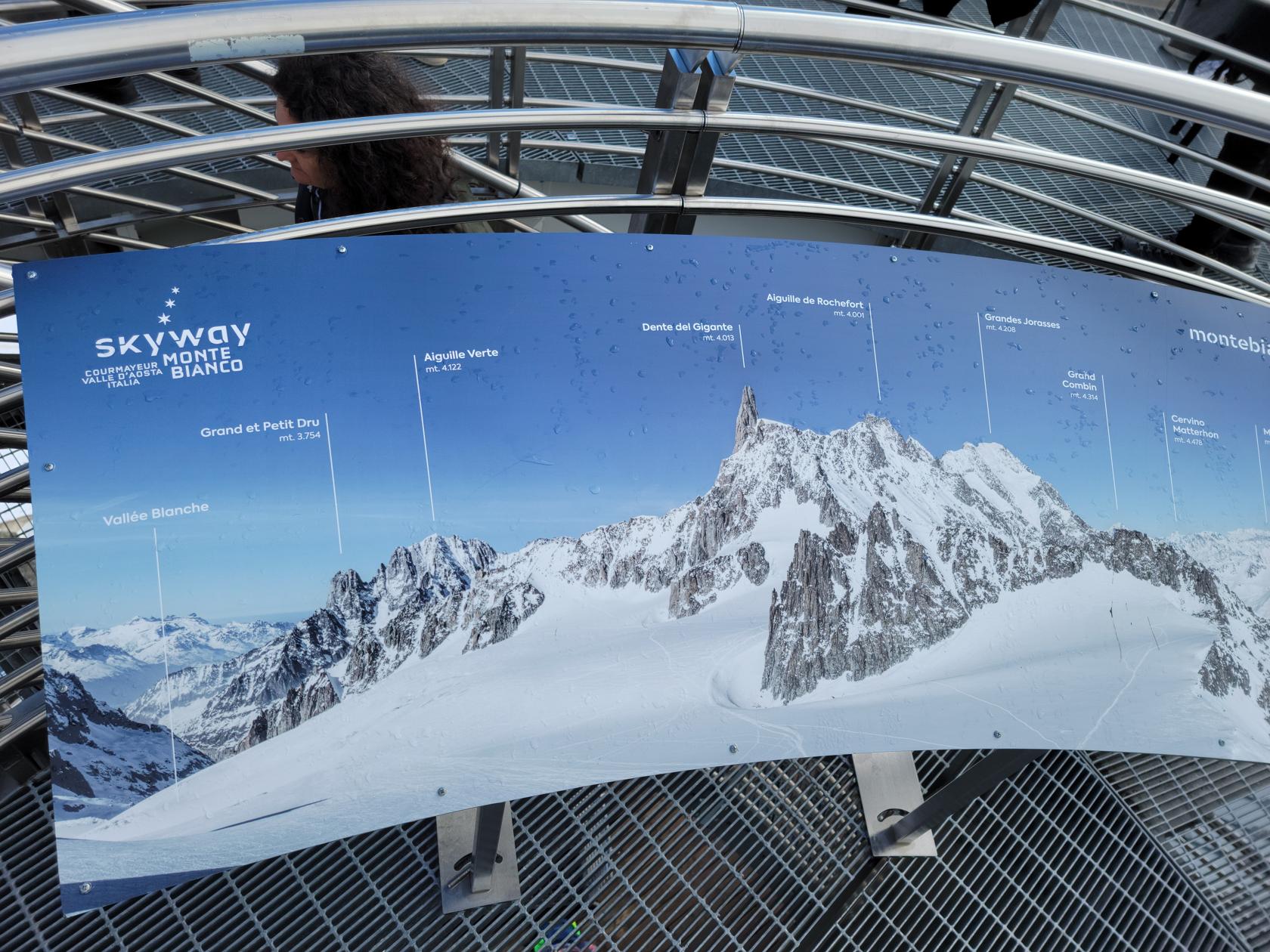
Courmayeur – The Skyway Monte Bianco – Legend
Courmayeur – The Skyway Monte Bianco – Glacier du Géant and Dente del Gigante
Courmayeur – The Skyway Monte Bianco – Glacier du Géant
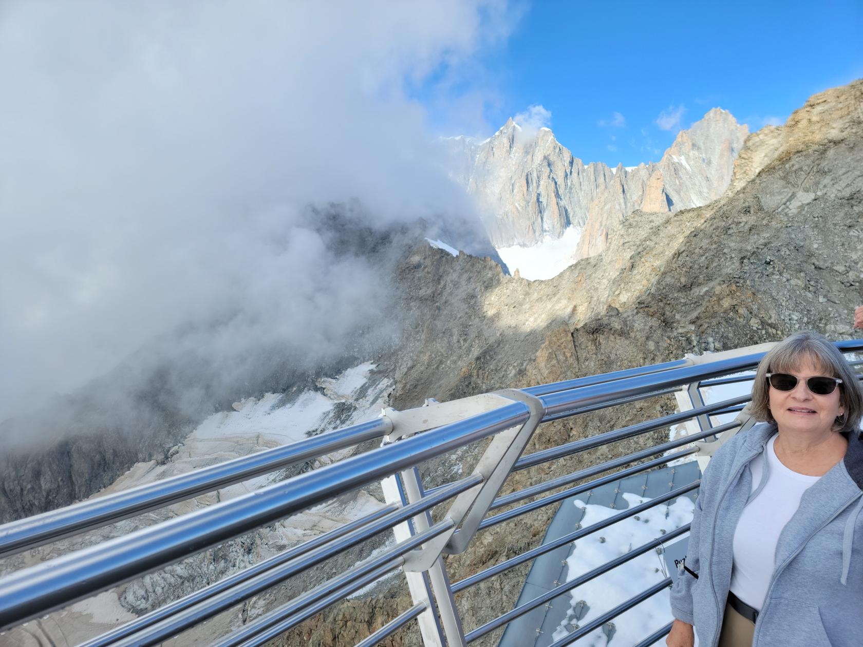
Courmayeur – The Skyway Monte Bianco – Patti and view of Mont Blanc in clouds and Mont Maudit
Courmayeur – The Skyway Monte Bianco – View From Cable Car – Mont Blanc in Clouds and
Courmayeur – The Skyway Monte Bianco – View From Cable Car – Mont and Glacier du Géant
Courmayeur – The Skyway Monte Bianco – View From Cable Car – Dente del Gigante
Courmayeur – The Skyway Monte Bianco – View From Cable Car – Glacier du Géant
Courmayeur – The Skyway Monte Bianco – View From Cable Car – First View du Géant
Courmayeur – The Skyway Monte Bianco – View From Cable Car – Second Cable Car at Saussurea Alpine Botanical Garden
Restaurants
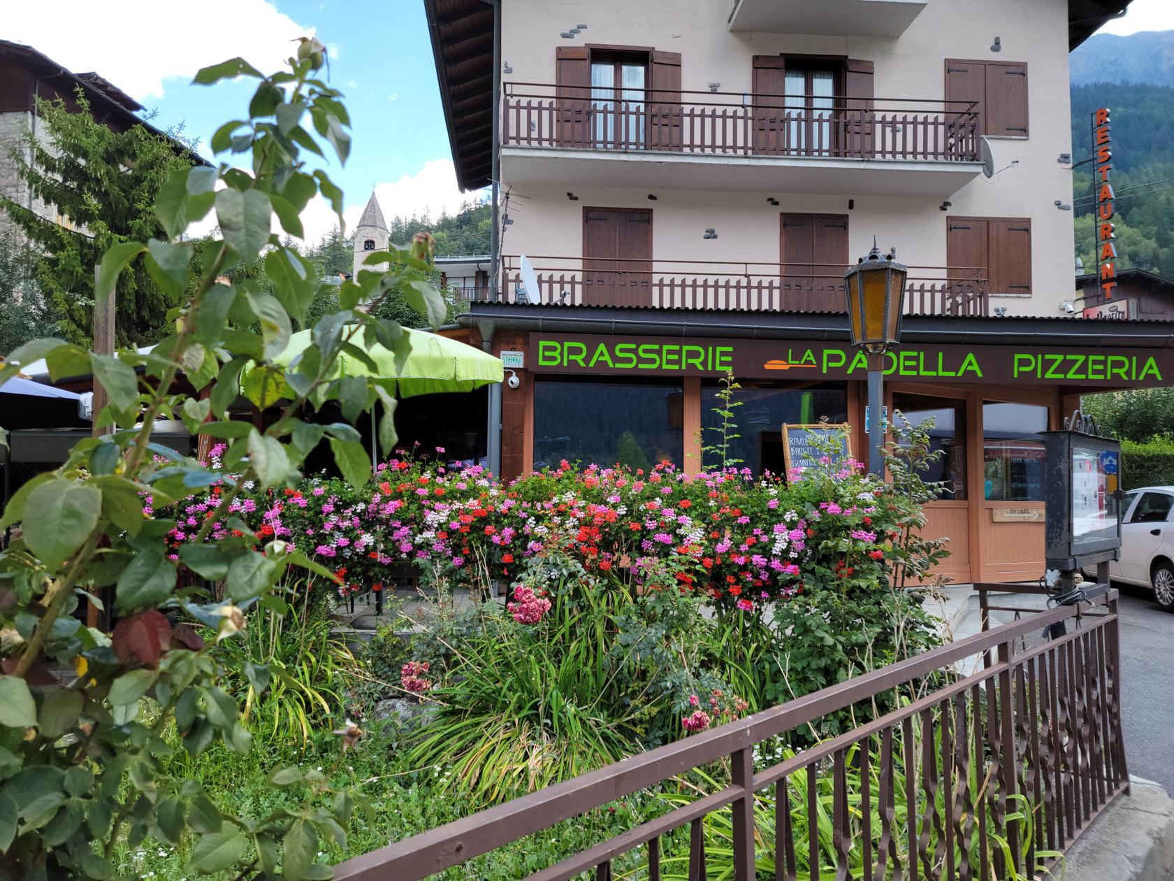
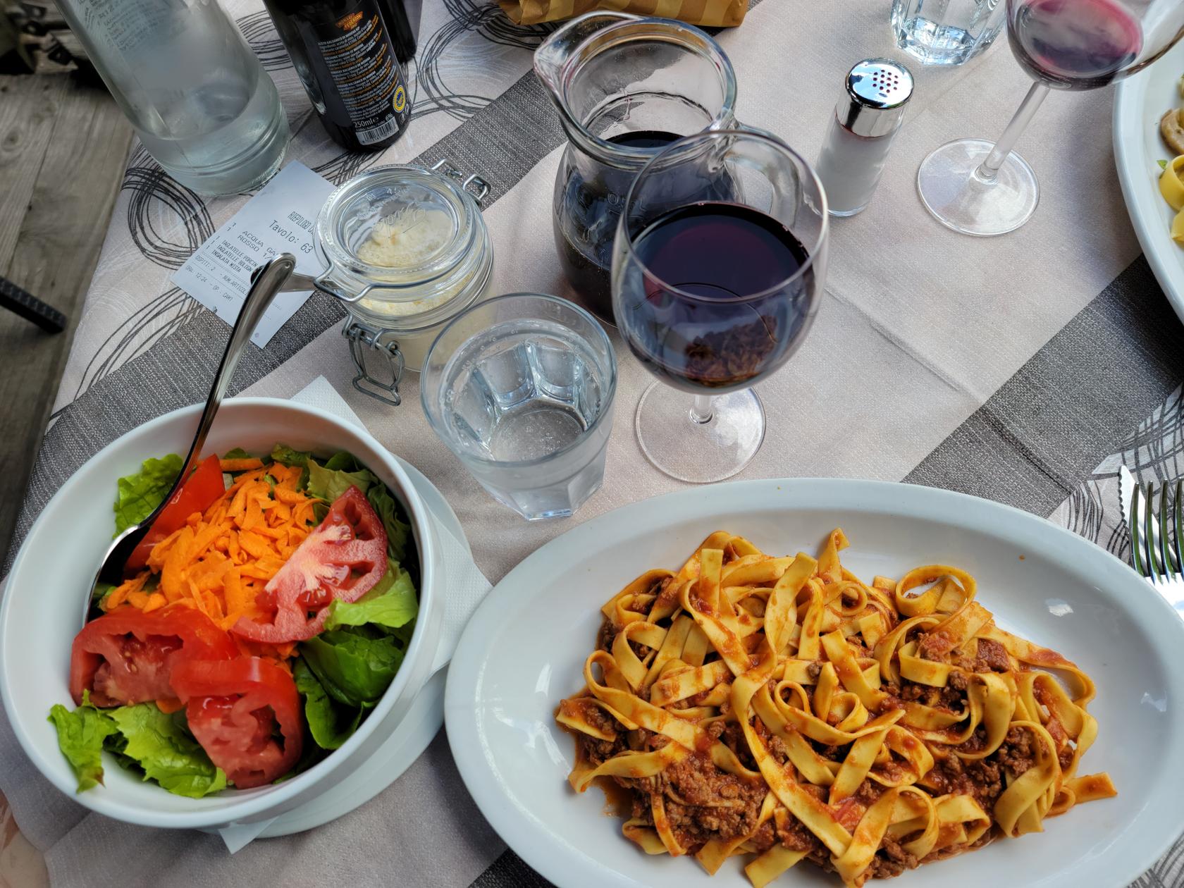
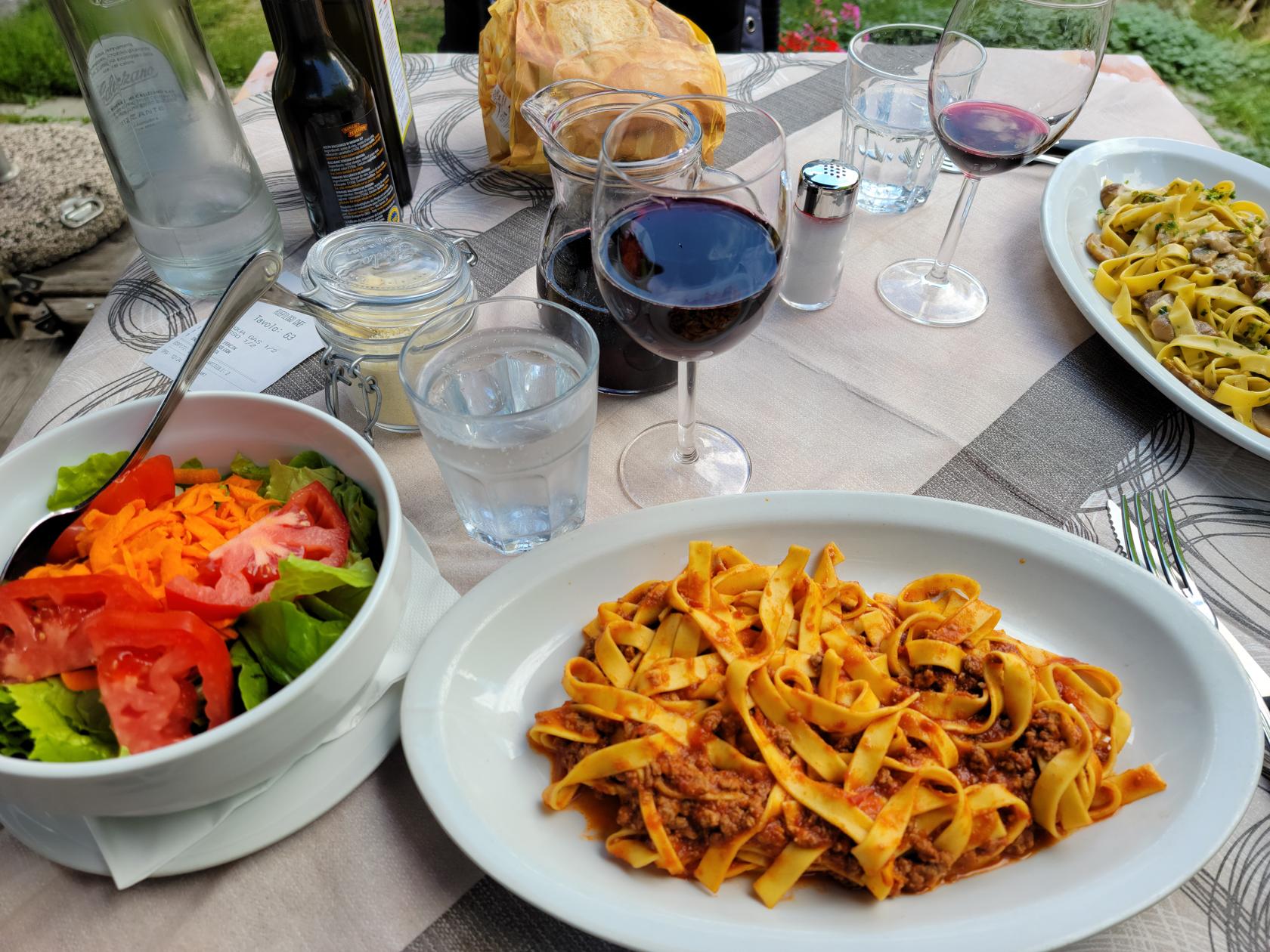
Brasserie la Padella Pizzeria
A normal pizzeria and brasserie by any Italian standards, as a stop for lunch it fit the bill nicely. We enjoyed a quick lunch of pasta, salad, water, wine and coffee with very pleasant service as an added bonus. There is nothing to complain about here, the staff is well versed in taking orders and serving food quite promptly.
Courmayeur – Brasserie la Padella Pizzeria
Courmayeur – Brasserie la Padella Pizzeria – Erick’s Tagliatelle in Ragu and Insalate Mista
Courmayeur – Brasserie la Padella Pizzeria –
Courmayeur – Brasserie la Padella Pizzeria – Patti’s Tagliatelle with Porchini mushrooms
Like many other people who have lived an appreciable time, there are things in my life that are not easily dispensed of nor discarded. For some, it might be an old car which holds special memories of past trips, vacations or the odd sojourn to another country. Similar items, to many other people, might hold very fond memories, where, when it comes to that point in time when the item is worn out or past its usefulness, it is time to think of discarding it. However, when and if such a personal item still appears to be in good shape, it is very difficult to make that decision. So it is for me and especially things I wear. For example, my hiking boots, they are – shall we say – my friends when I am hiking.
Cottian Alps
My Old Sole
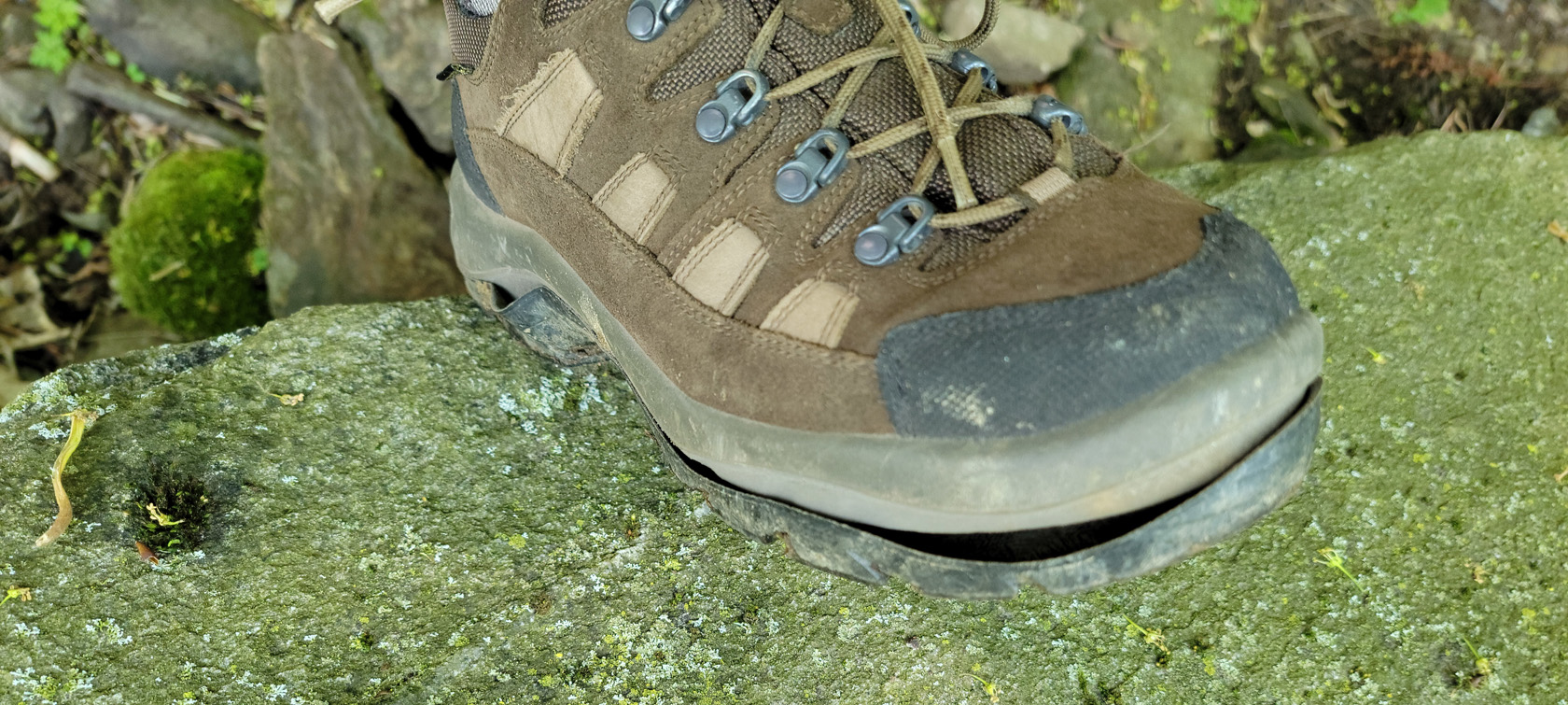
As I related in one of my past articles this year, Villanova, Italy – Hiking to Rifugio Jervis – Up, Up, Up!, I ran into difficulty during our hike with my hiking boots, when the soles of both boots decided to start falling off. I don’t recall what made me notice it, but somewhere at the top of the climb, I saw the issue when I stopped and placed my foot on a rock.
I purchased my hiking boots back in 2012 when LL Bean, the famous clothing retailer and manufacturer was having a sale. I purchased them for $125 at the time, which I think was 50% reduction from the normal price. The model was going out of style and they were probably liquidating their inventory of the item.
Guarantees In Life
As most of us know, nothing is guaranteed in life except death and taxes, is an old saying. For a very long time, LL Bean had a lifetime guarantee on most, if not all, of the products it sold. When they changed their policy, it was not doubt to staunch the amount of fraud that was occurring with its products on the second hand market and for other reasons, which was never the intention of its guarantee.
It was not my intention when I contacted LL Bean to invoke an old guarantee policy, that was in force when I purchased my boots. I acted in good faith to determine if they could repair my boots, and inquired about the process. What I got in return from their support group, left me somewhat dismayed and nonplussed.
I am so sorry you have experienced this issue. If you’re not satisfied, you can return or exchange an item within 1 year with proof of purchase. After a year we will accept returns of defective items on a case by case basis.
If after viewing the special conditions and if you feel they do not apply, you are welcome to send this item to our returns department for their evaluation with the original order number. Our returns department or retail representatives will determine if the return is accepted once they have the item in hand.
So after reading the above, I still thought that the glue that was used to weld the sole onto the boots was defective and inquired on whether or not they could repair it. The reply I received was to the affect that I would have to send the boots in to determine if this could be done. If they decided the glue was defective, they would not repair the boots, but rather send me an equivalent pair of boots of their choosing.
Anyone who has hiked enough in very comfortable boots will tell you, it’s not easy to find a good comfortable pair. Some even have to be broken in and at my age that might take too long.
I tried to reason with them via email and explained to them I did not want a new pair of boots. All I wanted was for their repair department to glue the soles back onto the boots and send them back and inquired about the cost. They replied that they probably could not repair the boots since they were so old and sending a new pair was the only option.
Therefore, I choose to keep my boots and decided to find some time in between our travels to research any local options we might have in Turin and Piedmont.
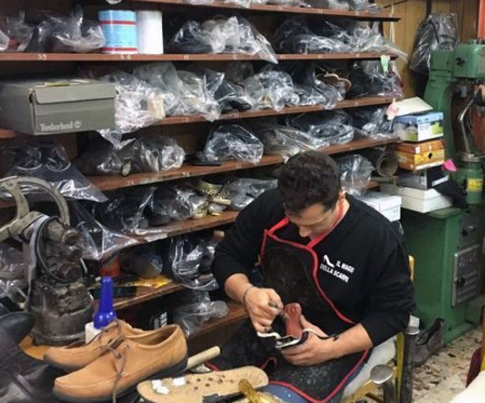
Il Mago Della Scarpi
Calzolaio Il Mago delle Scarpe Alex Store – Turin
Our local shoemaker in Turin is named Alex. He has a nice little shop on via Eusebio Bava, across the Piazza Vittorio Veneto from us. I initially tried to contact him in early August, but his shop was closed due to Ferragosto. This is when most Italians head for the hills for the beach in commemoration of the fifteenth of August, and normally last about two weeks, or until the first Monday in September. However, I was in luck, Alex came back early and I was able to get in to see him this week.
Alex – Il Mago della scarpi – Turin
I brought my cache of boots in a plastic sack and quietly entered the store. His daughter was playing by the cash register, while Alex was off to the left, doing what shoemakers do, repairing shoes. I introduced myself and showed him my boots. He took one, bent the sole down and scratched the inner sole adhesive and said they could be fixed in Italian. He handed me a ticket, #97 and said to return in four days. I replied thank you very much and have a very good day, departed the store and went home.
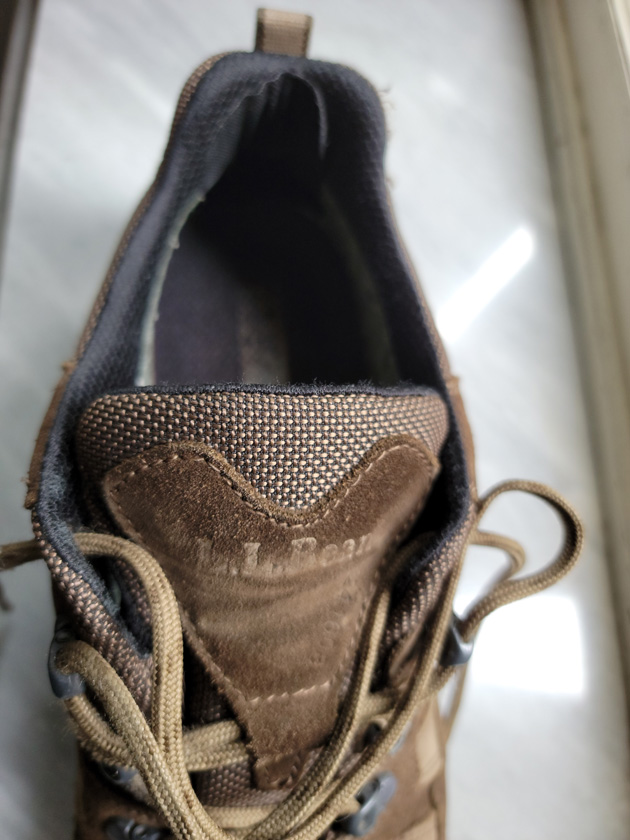
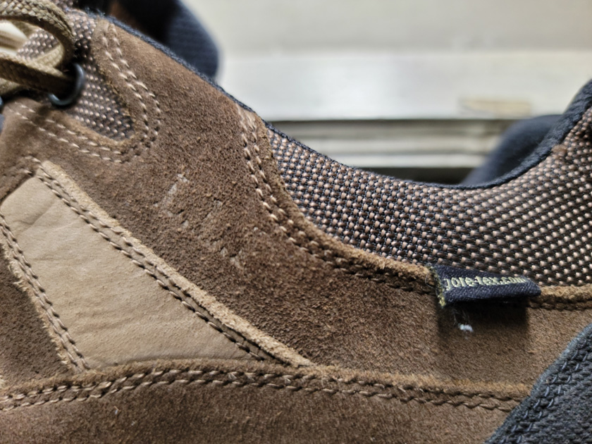
I returned after my four day hiatus to see what Alex had done to my hiking friends. He related to me it was no problem to fix them and one of his helpers handed me two separate clear plastic bags from off the high shelves behind him with my boots in them. I took them out to get a very good look at them, before finishing the transaction. All I saw was an excellent job.
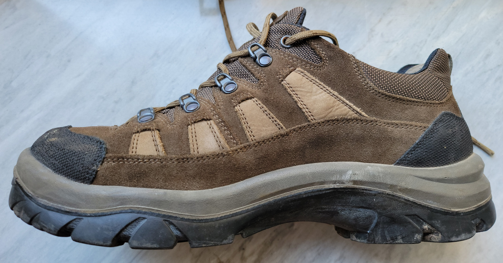
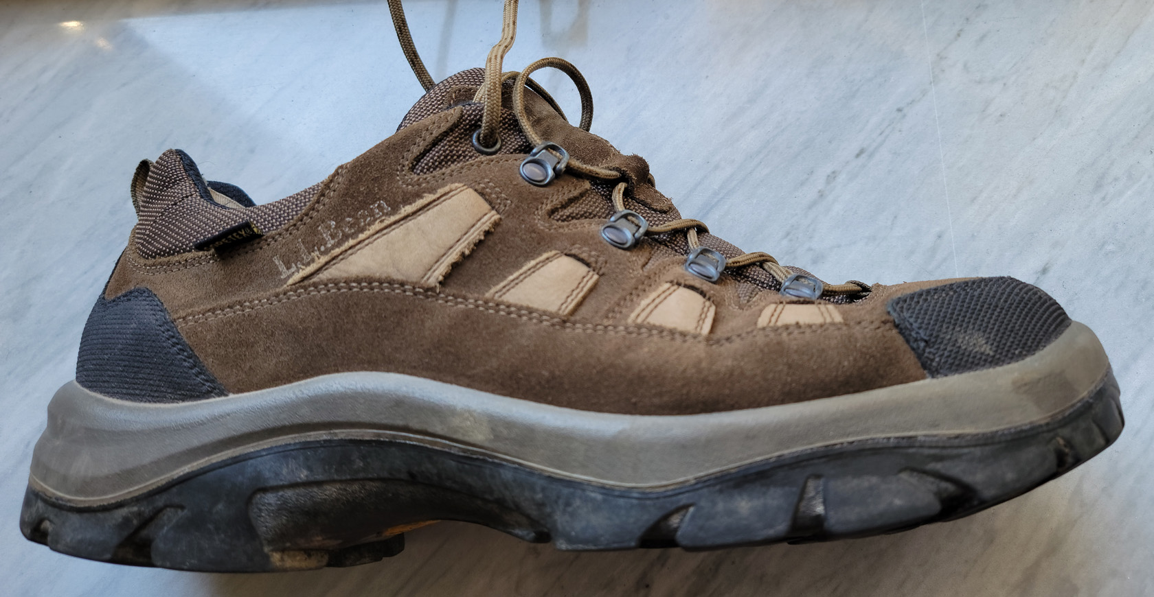
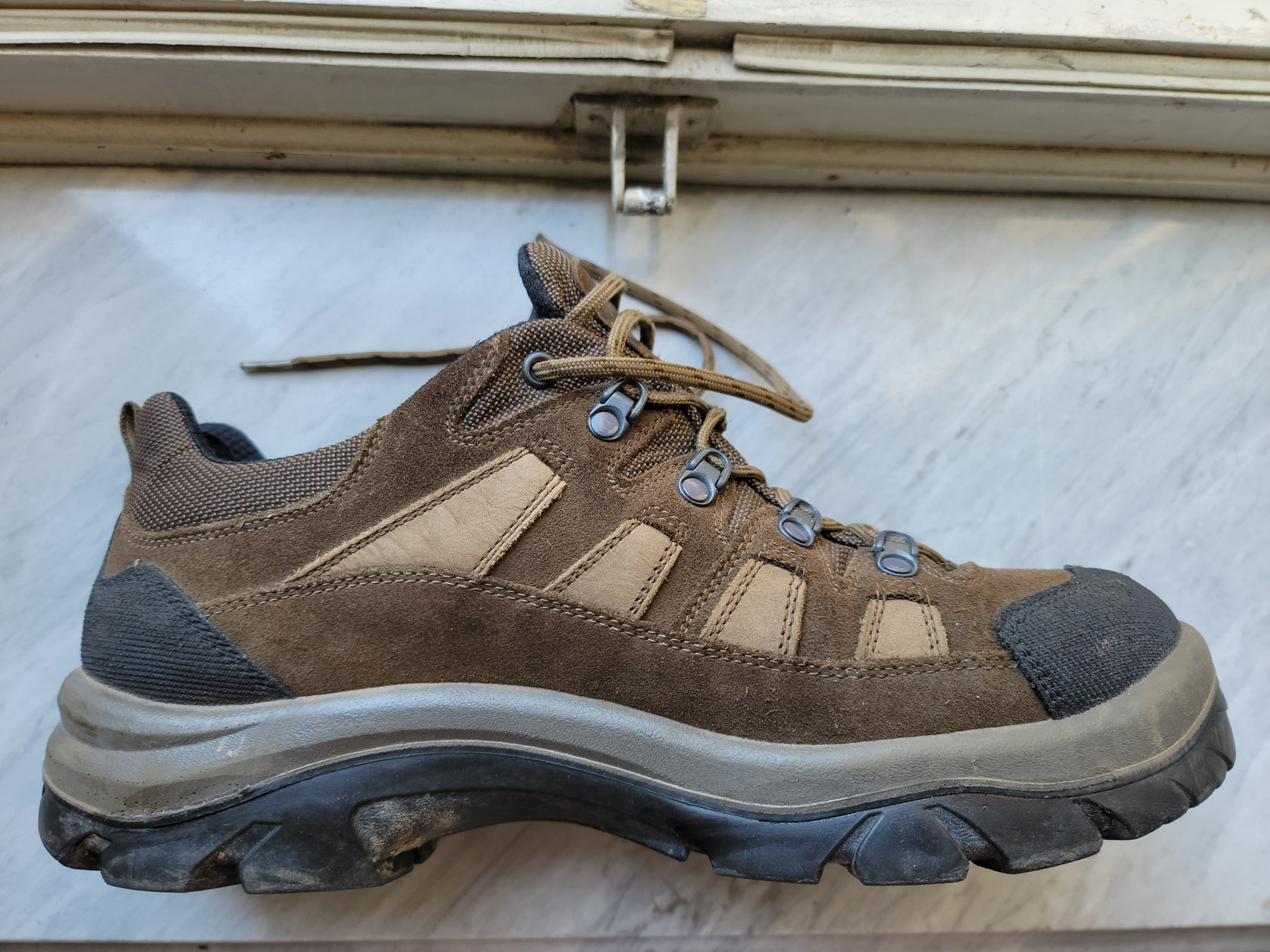
My LLBean Goretex Hiking Boots – Tongue
My LLBean Goretex Hiking Boots
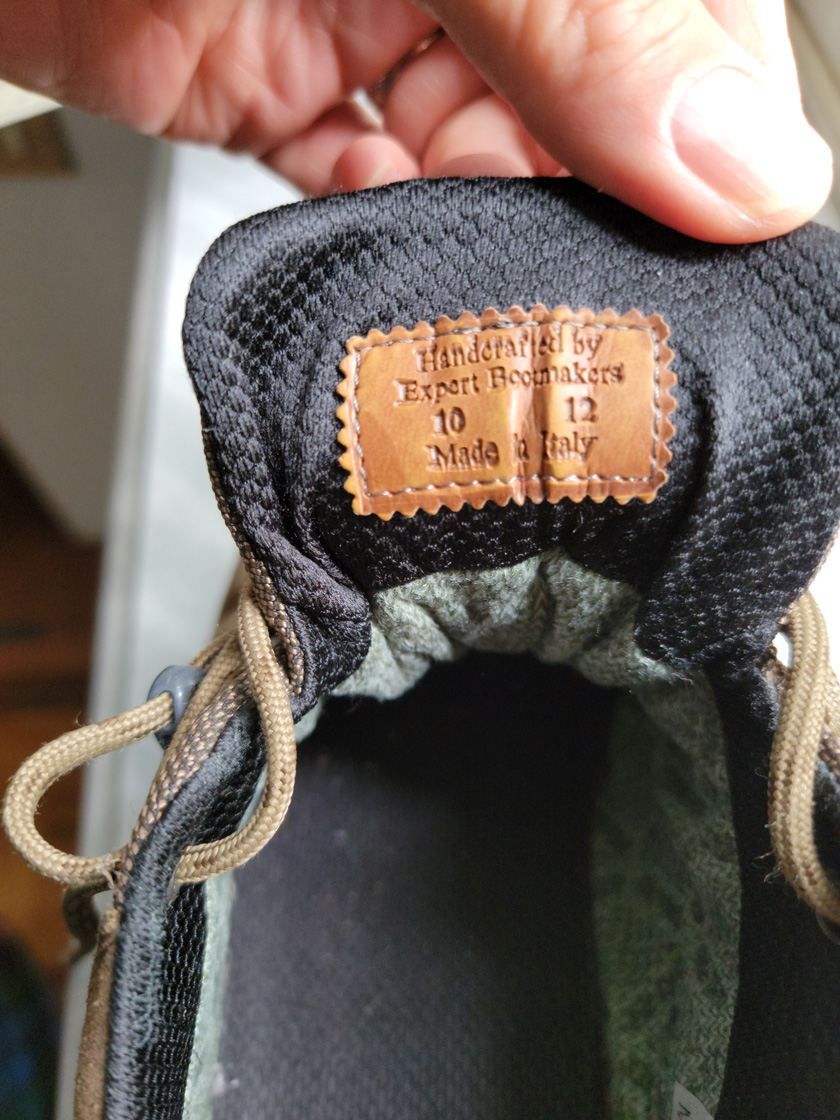
My LLBean Goretex Hiking Boots – Tongue Label – Made in Italy – How Ironic!
My LLBean Goretex Hiking Boots – Right Boot – Thank you Alex!
My LLBean Goretex Hiking Boots – Right Boot – Thank you Alex!
My LLBean Goretex Hiking Boots – Left Boot – Thank you Alex!
My LLBean Goretex Hiking Boots – Left Boot – Thank you Alex!
I was very happy, they look for all intents and purposes, brand new! Elated, I asked him how much did I owe him in Italian and his reply amazed me even more – 4€. I asked him, each? He said, No, total. I didn’t know what to say. I gave the man 6€, a 50% tip! He was very happy, I was happy and I am pretty sure my boots were happy too. As you can see by the photographs above, they are like me, old soles, but not yet ready for the dumpster. To add to the irony, they were originally made in Italy. So, I guess, they had to come back home in order to get properly fixed anyway. The way things just work out, lends some credence to Karma, for better or worse.
My last thought on the matter: I am guessing if LLBean were to repair them, it would probably have cost me anywhere in the neighborhood of $50, upto the original cost of the boots themselves and perhaps even more. That is just a guess, but probably pretty accurate for America’s throw-away society.
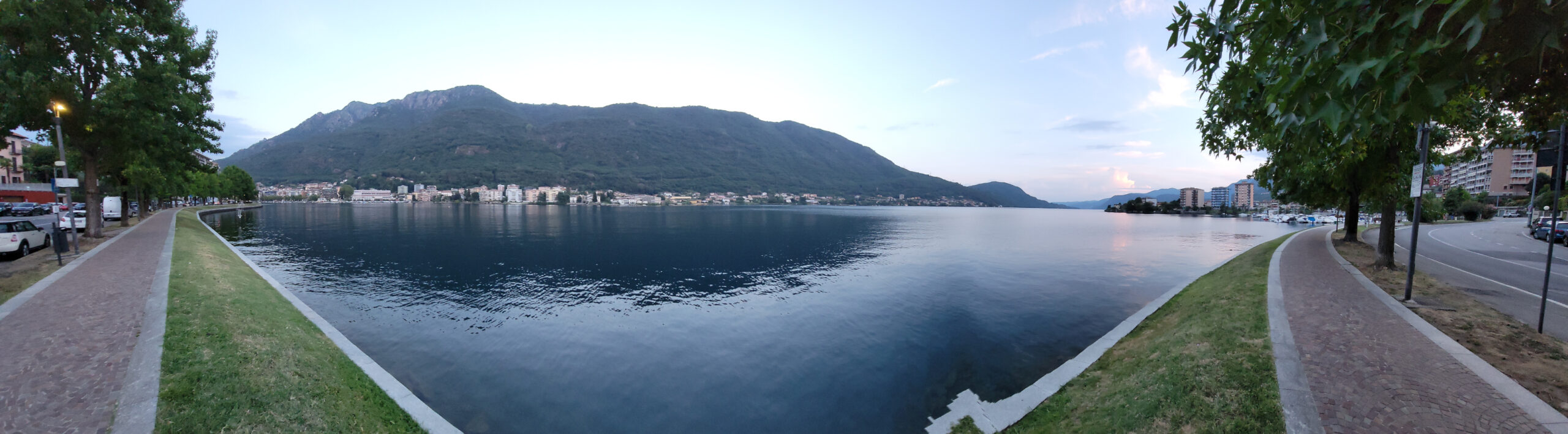
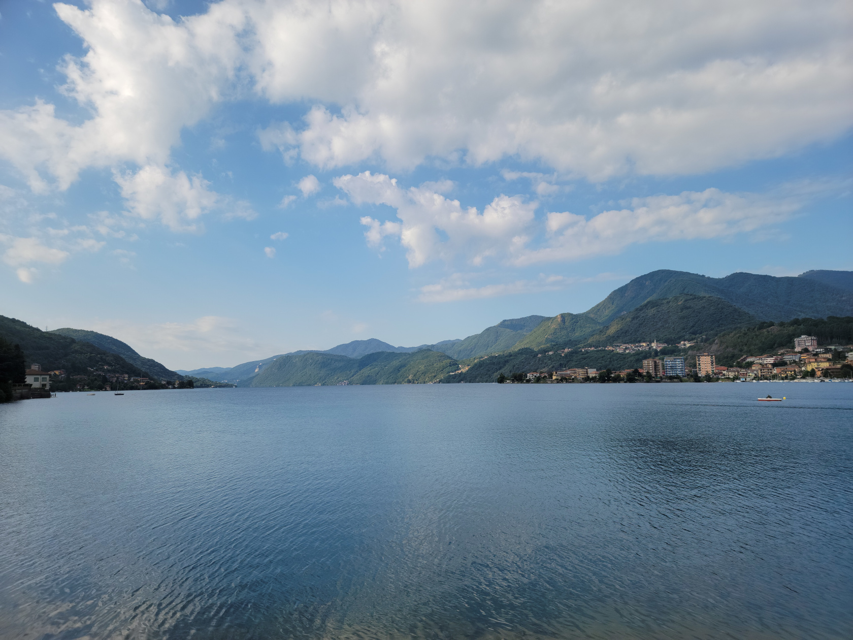
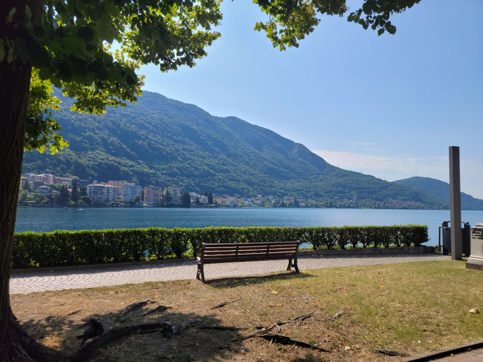
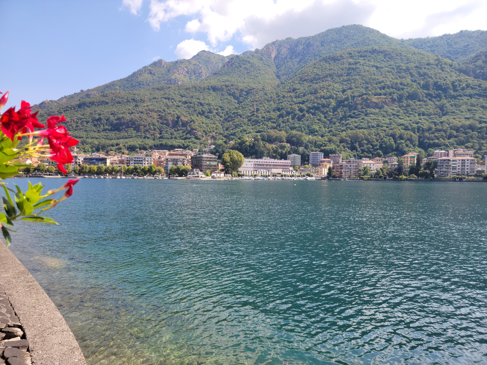
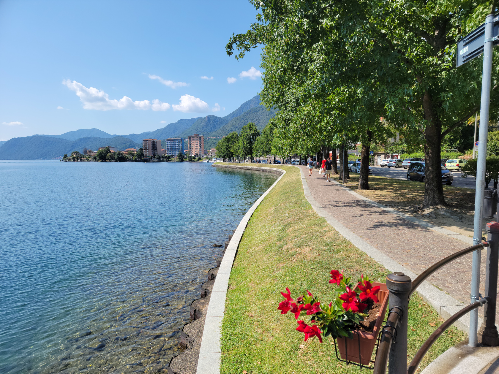
Hidden quietly in the north of Italy is the small lake of Orta and the lazy town of Omegna. After two trains and a bus ride, we finally arrived at our new short trip destination. We checked into our three star hotel, the Croce Bianci, perhaps the best centrally located one in the town.
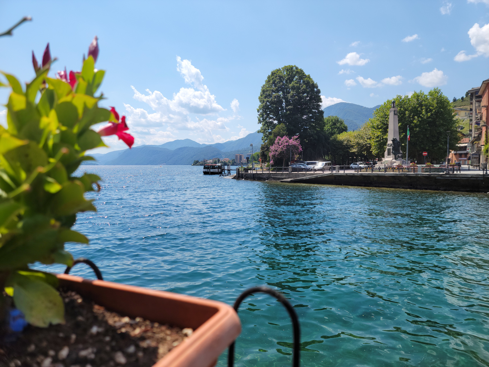
Orta Lake – Panorama from Omegna Shoreline
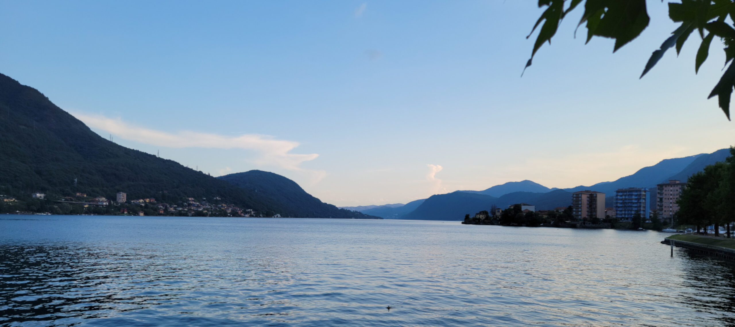
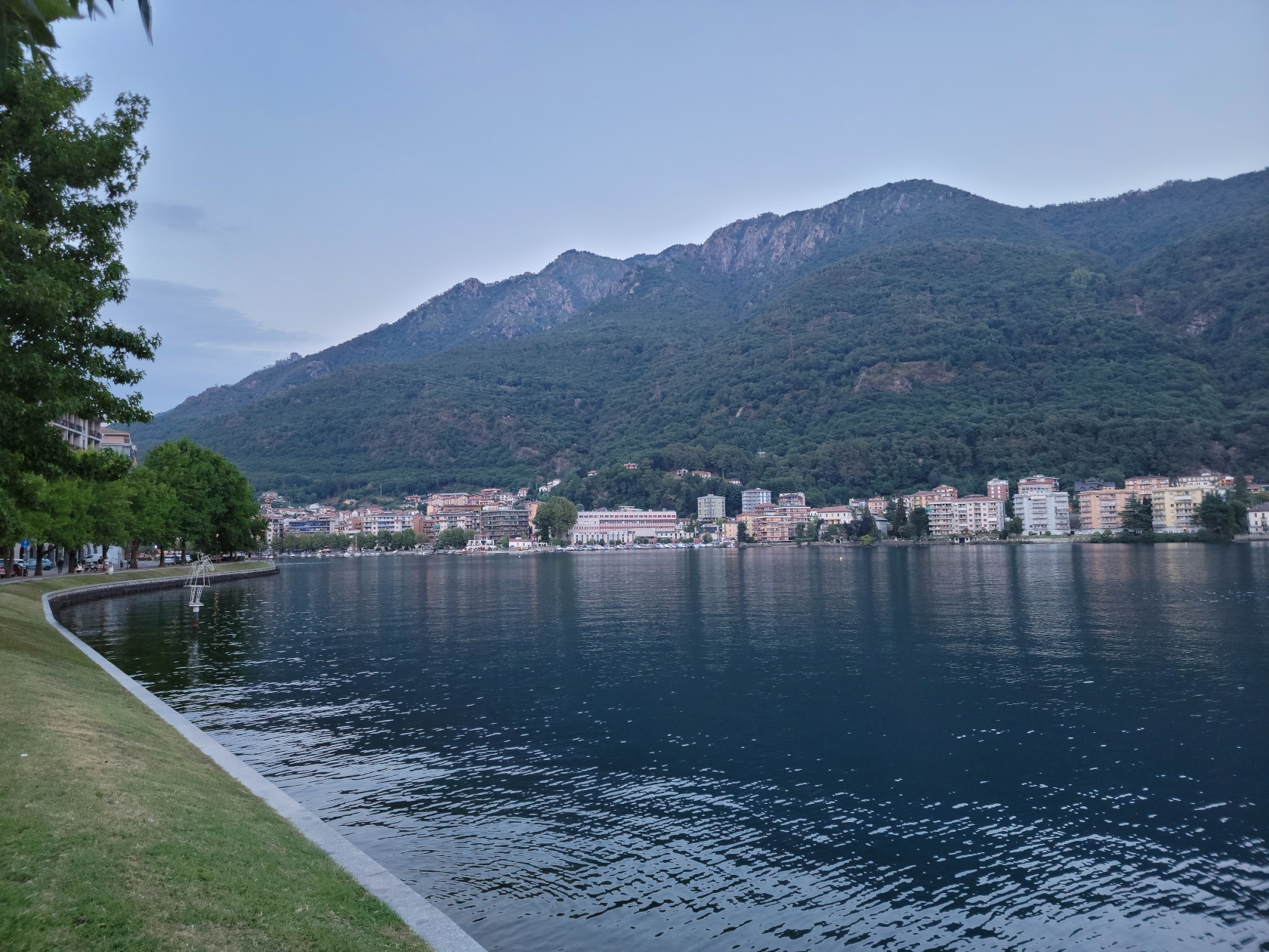
Because of its small size and lack of glamour, Lake Orta is often overlooked by most overseas travelers, who are more interested in the high impact tourist destinations to check off their bucket lists. It is visited mostly by Italians from Milan, some of whom own weekend homes here, the French, Germans and the occasional Brit. Since there is really not much to see and do on this side of the lake, a short slideshow is perhaps more in order.
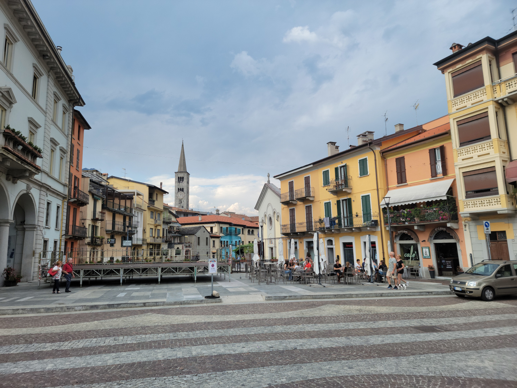
Omegna – Nigoglia Square
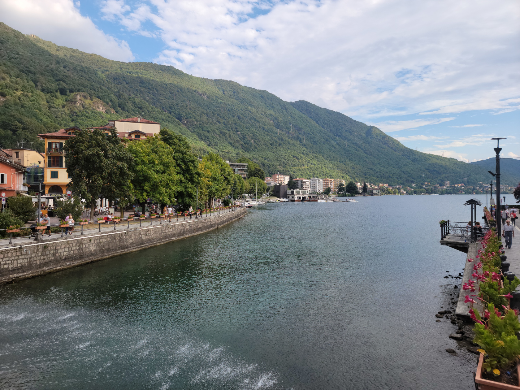
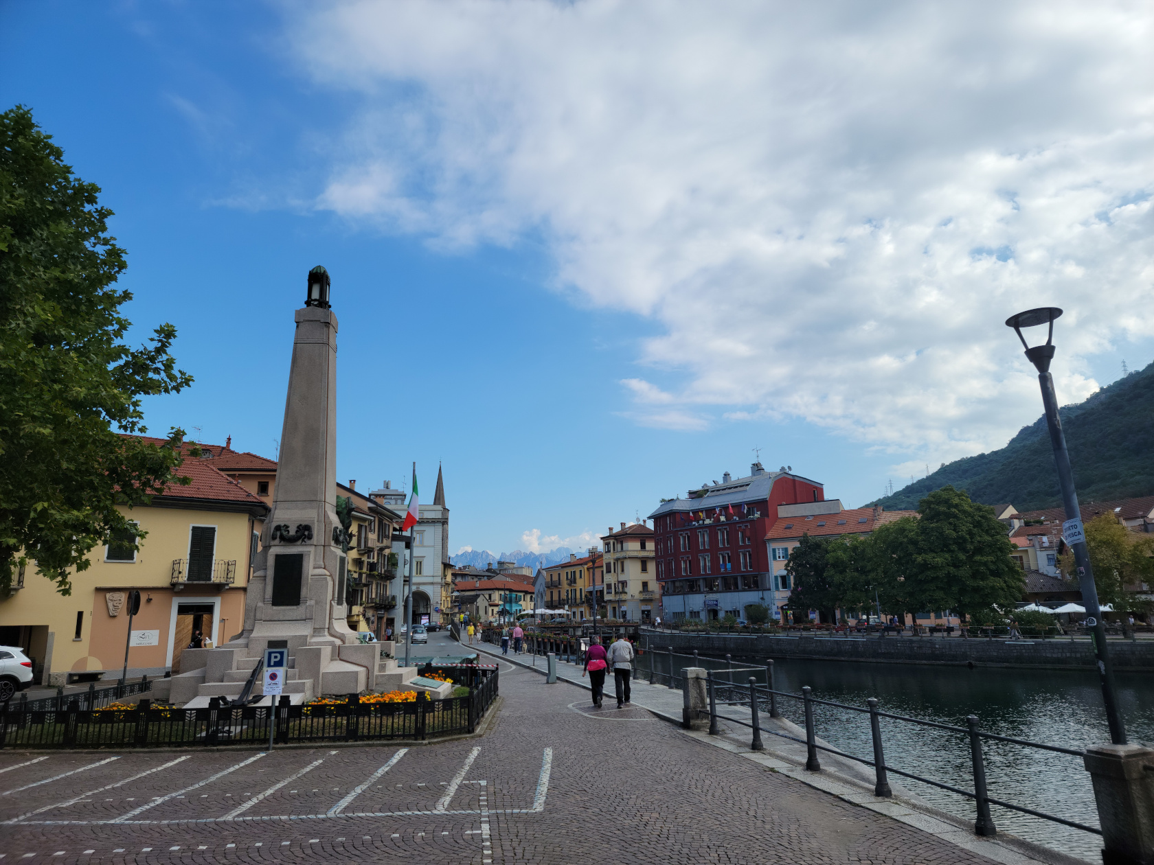
Omegna – Lake Orta by the bridge
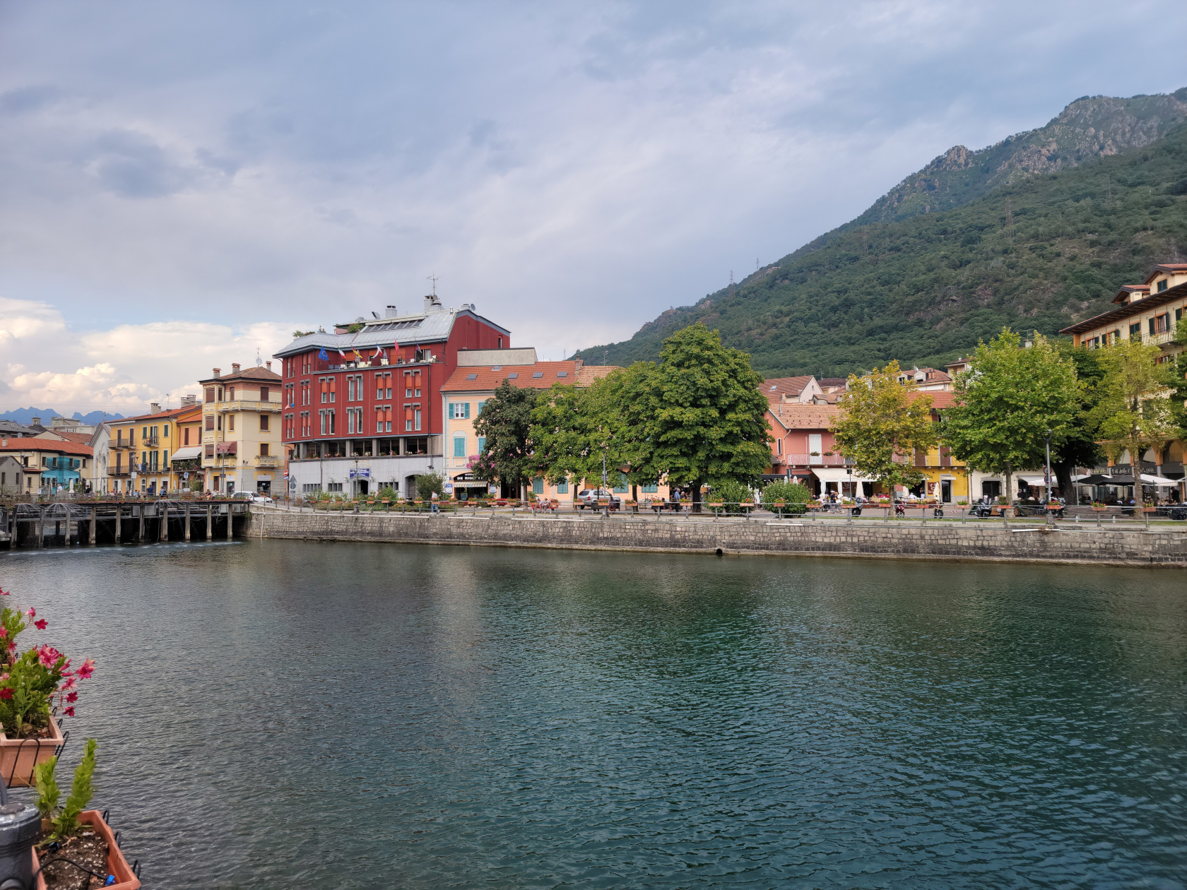
Omegna – The Hotel Croce Bianca (red building)
Omegna – The Strona
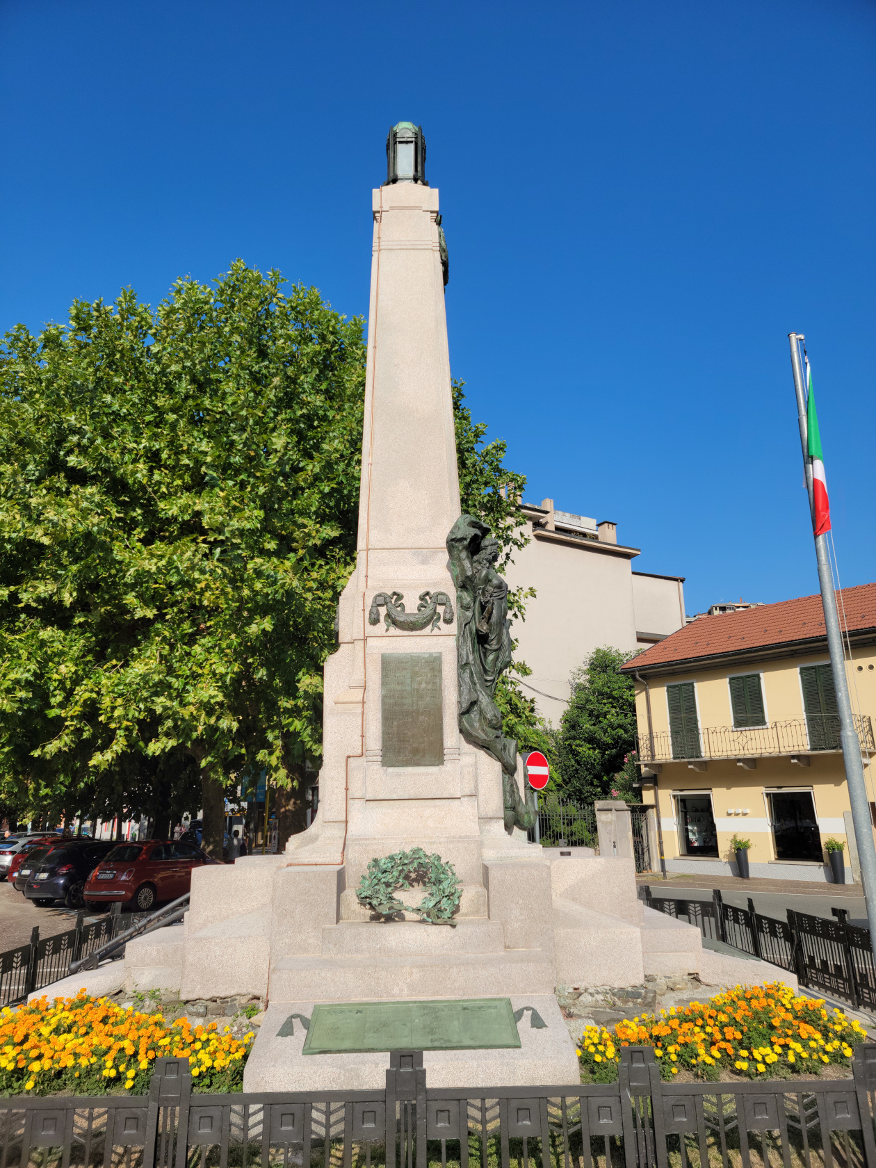
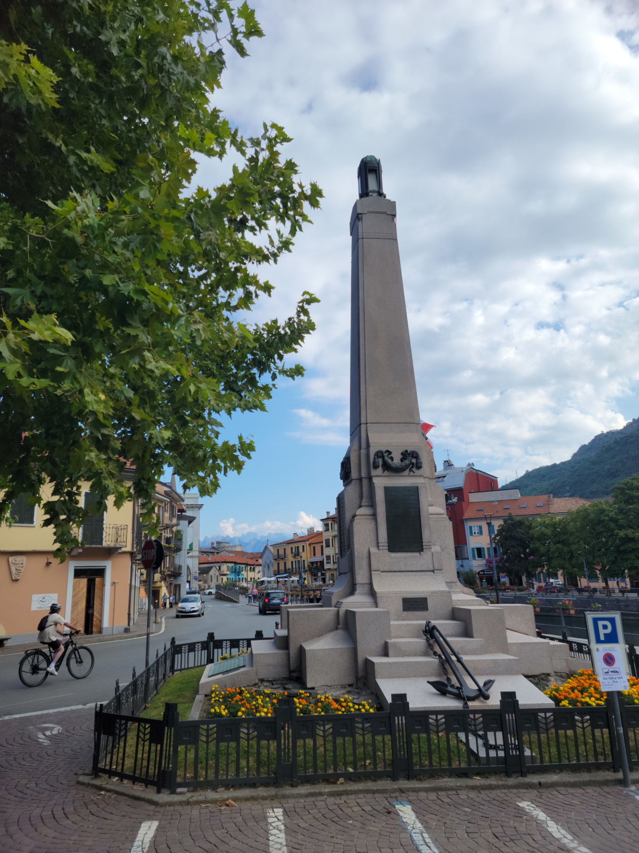
Omegna – Caduti Monument
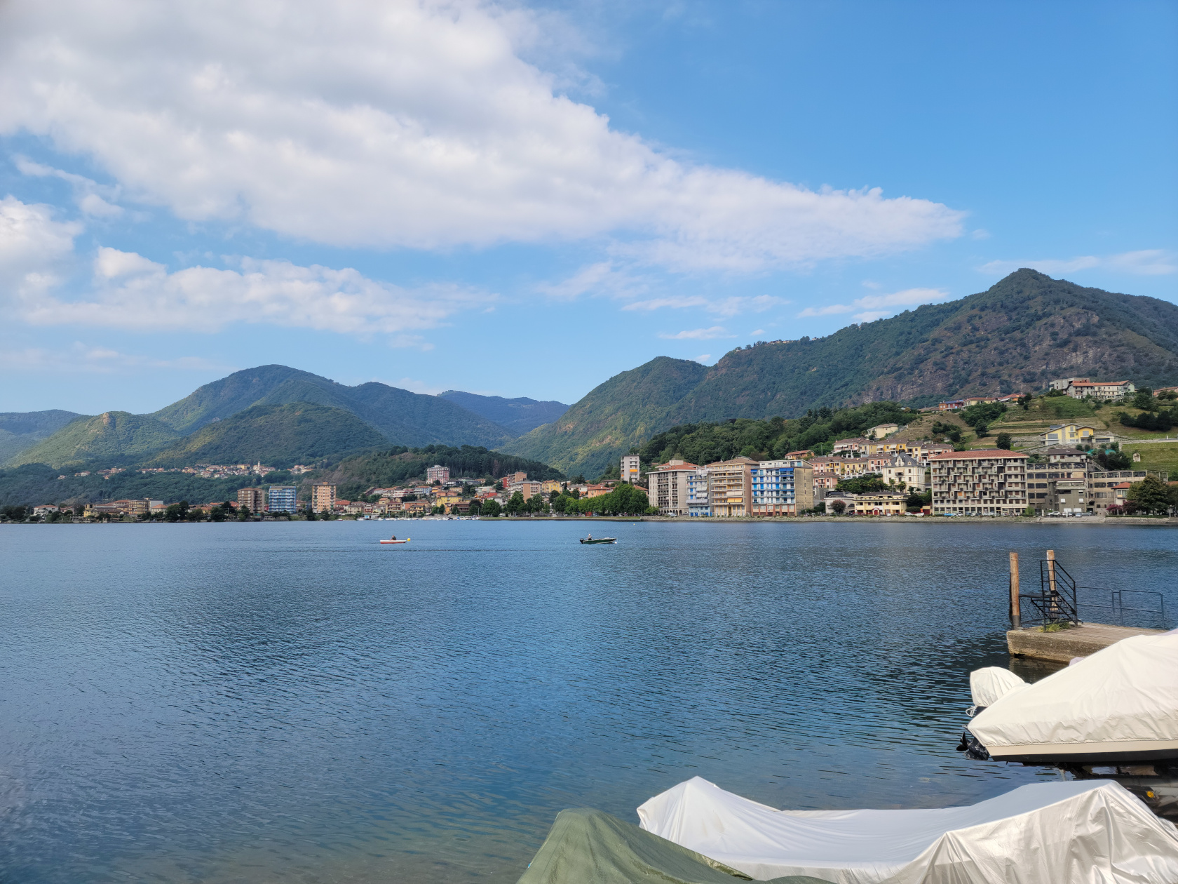
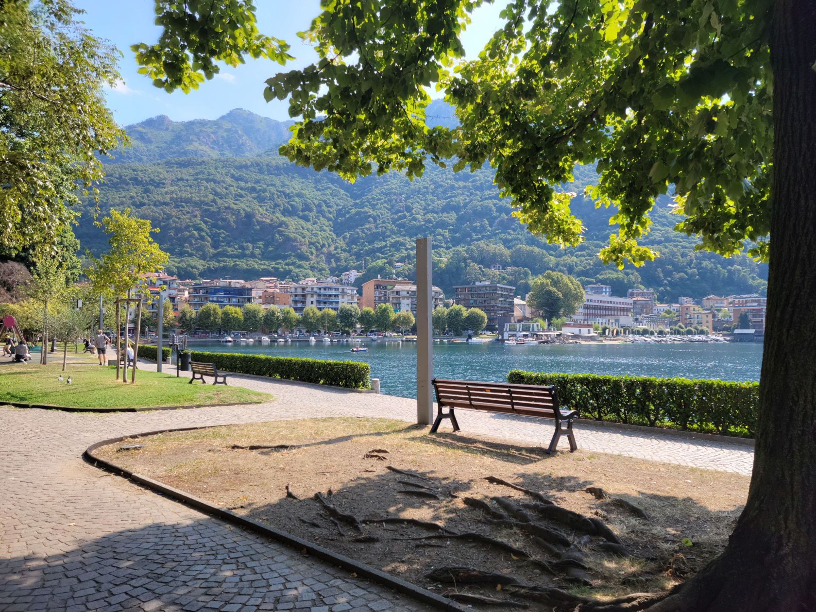
Omegna – Lungolago Gramsci
Omegna – Caduti Monument and Hotel Croce Bianci – Lungolago Gramsci
Omegna – Caduti Monument
Omegna – Lake Orta
Omegna – Lake Orta
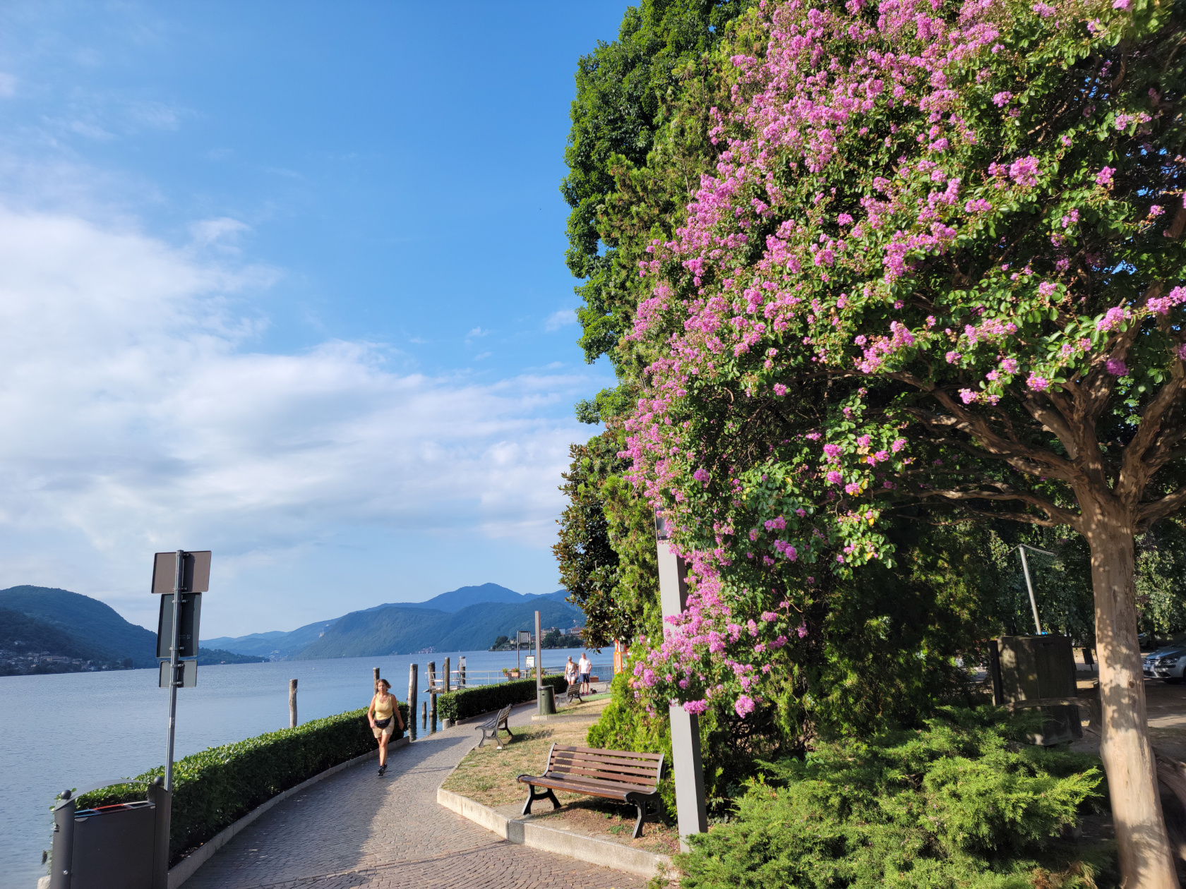
Omegna – Lungolago Gramsci
Omegna – Lungolago Gramsci
Omegna – Lungolago Gramsci – Lake Orta
Omegna – Lungolago Gramsci – Lake Orta
Omegna – Lungolago Gramsci
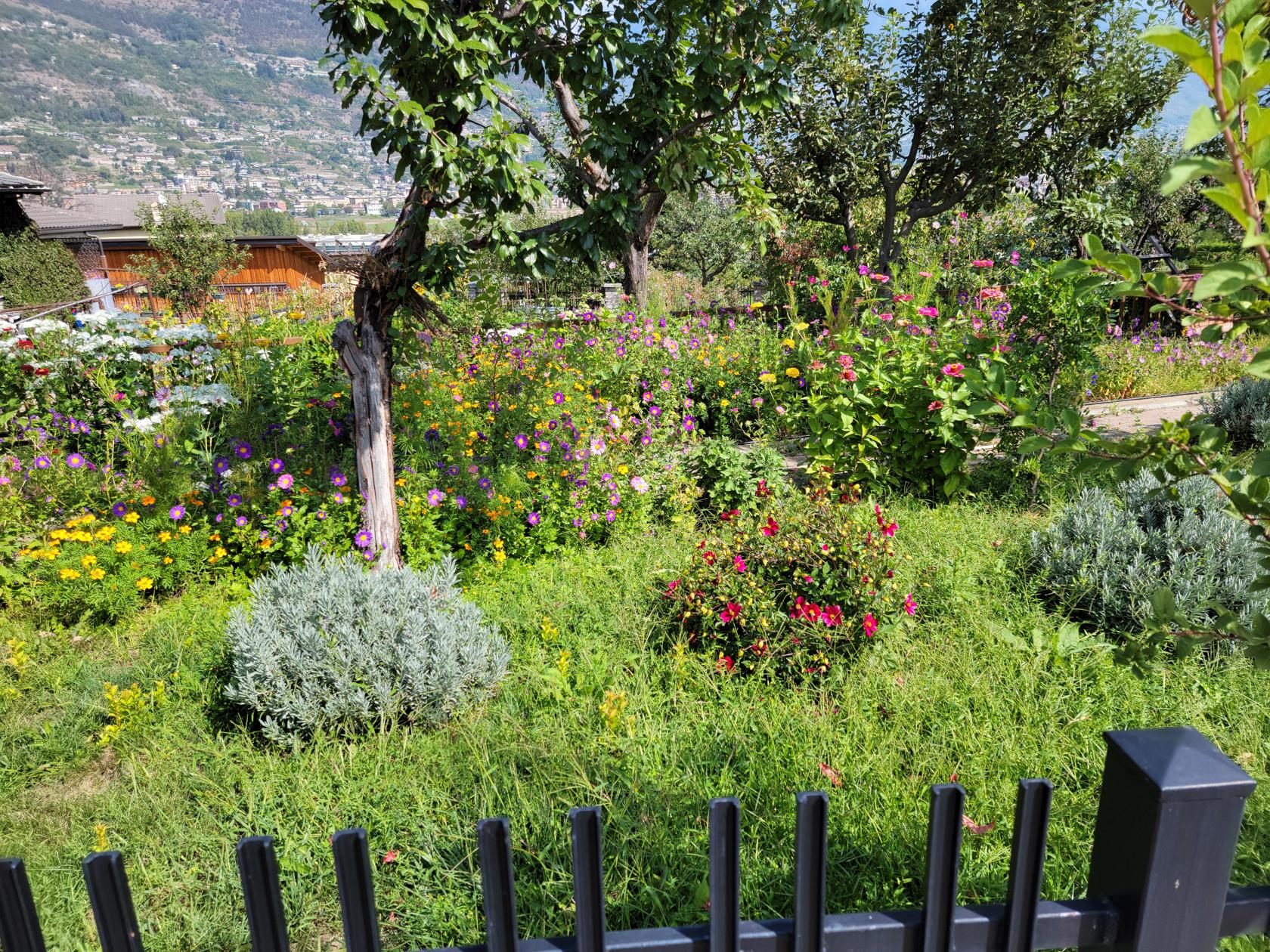
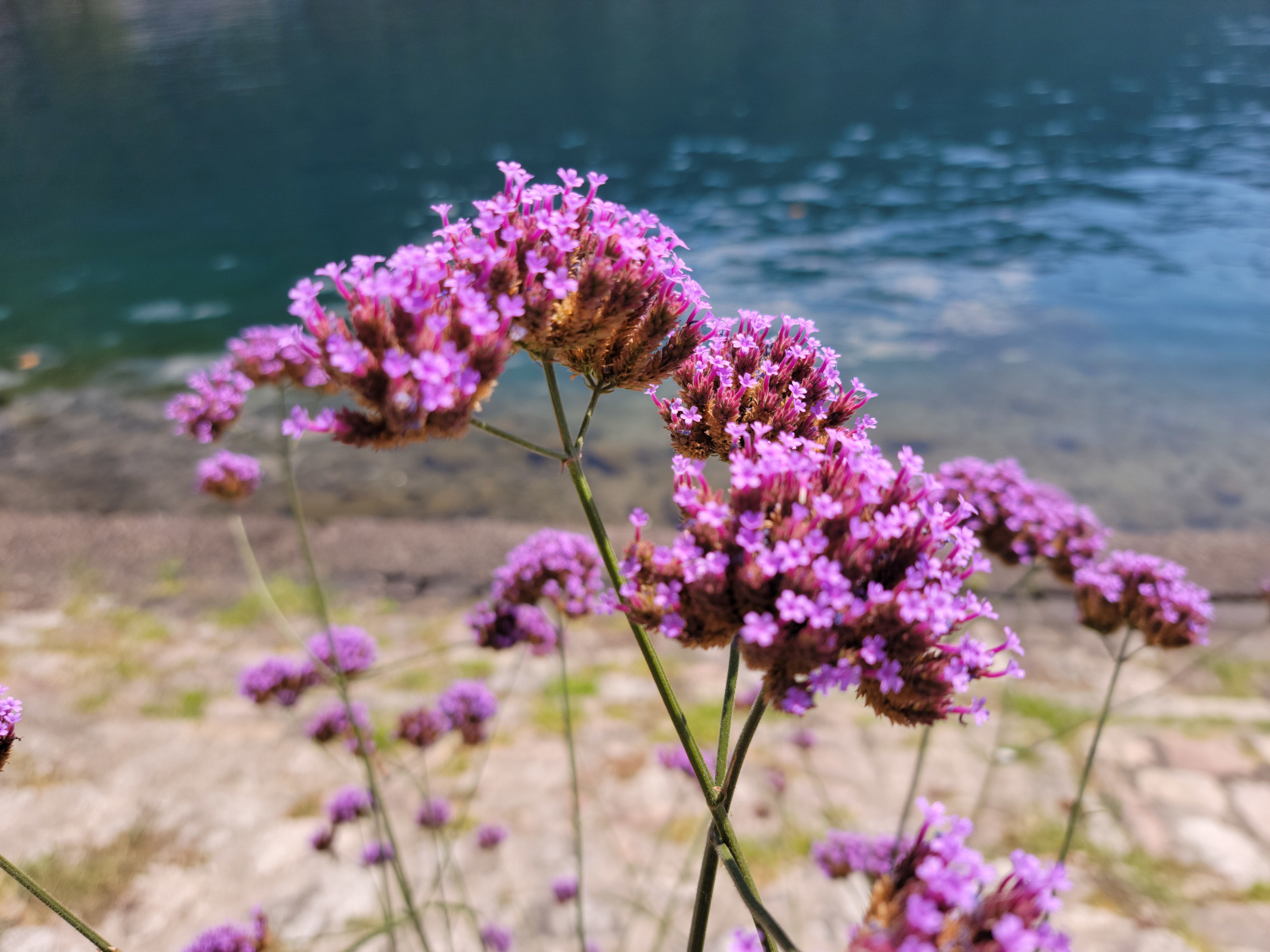
Omegna – Lungolago Gramsci – Flowers
Omegna – Lungolago Gramsci
Omegna – Lake Orta at night
Omegna – Lake Orta
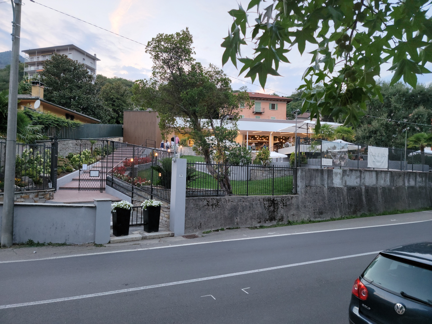
Omegna – Ristorante Punti Di Vista
We made plans to visit Omegna just to relax and actually do nothing more than just check the lake out. This is definitely a good place to accomplish nothing. However, there are plenty of activities available, from camping, boating, cycling, swimming, hiking and the odd trek to a neighboring town, if one is so inclined. The area is definitely family friendly, even the town has a large and very well equipped playground for them.
The remainder of our trip will visit other parts of the lake and be continued in another entry, so stay tuned. Ciao for now…
Restaurants
Salera 16
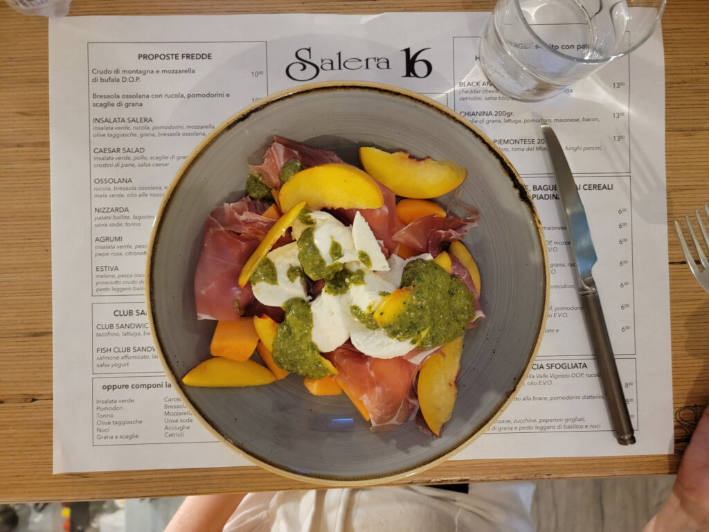
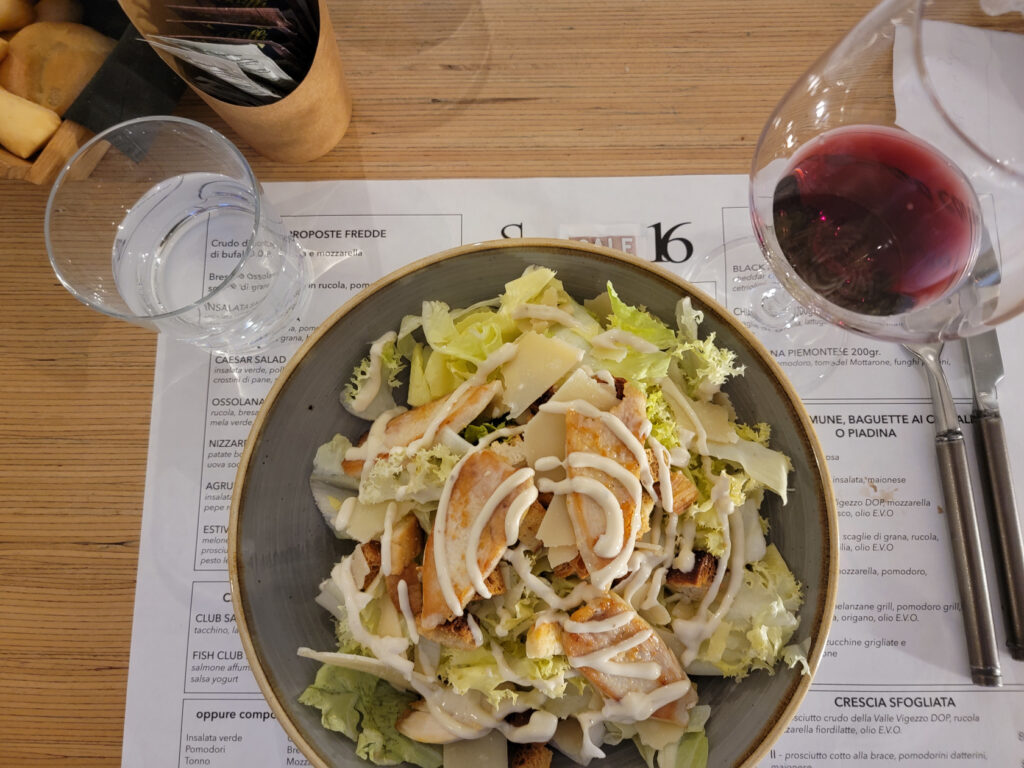
A more hip and trendy place is the Salera 16, which caters to the younger crowd with burgers, fries and other handheld items. A good place to stop for something quick.
Omegna – Estiva: Fruit Salad with Prosciutto, Mozarella and Pesto – Salera 16
Omegna – Caesar Salad with Chicken and shaved Parmesan – Salera 16
Al Centrale Bistrot
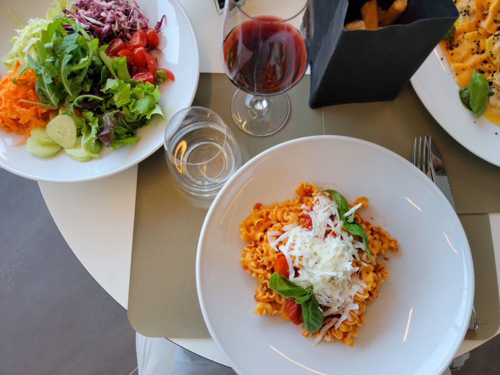
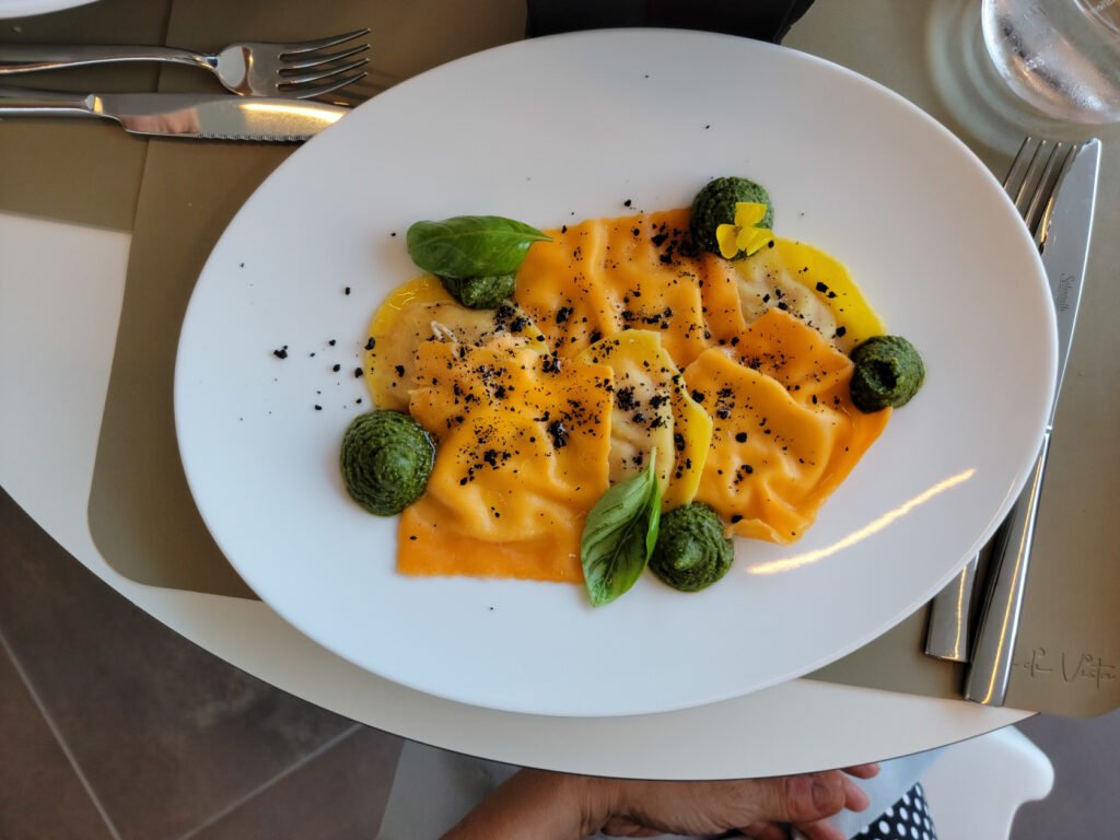
This little bistrot has excellent food at great prices, though the menu is limited and changes daily. If you are not fussy and adaptable you definitely find a tasty treat here. Their wines by the glass are very good.
Omegna – Pasta Bolognese and Insalata Mista – Al Centrale Bistrot
Omegna – Ravioli with Pesto – Al Centrale Bistrot
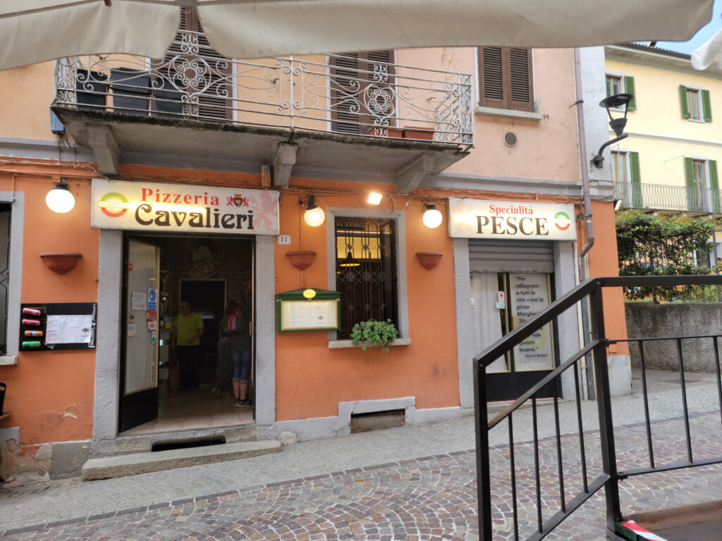
Ristorante Il Cavalieri
The first restaurant we visited when we arrived, it offers traditional Italian fare and pizza. It behaves more like a trattoria and gets a lot of local traffic. So an excellent place for reasonably priced authentic Italian food. I found the Vino Sfuso, or bulk house wine, a bit of a disappointment, but it is still drinkable and reasonably priced.
Omegna – Il Cavalieri Pizzeria
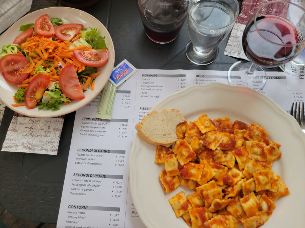
Omegna – Ravioli and side salad – Il Cavalieri Pizzeria
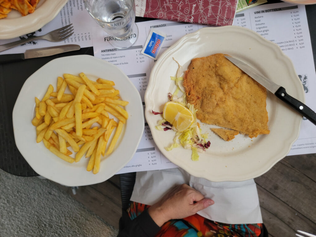
Omegna – Chicken Cutlet Milano Style with Fries – Il Cavalieri Pizzeria
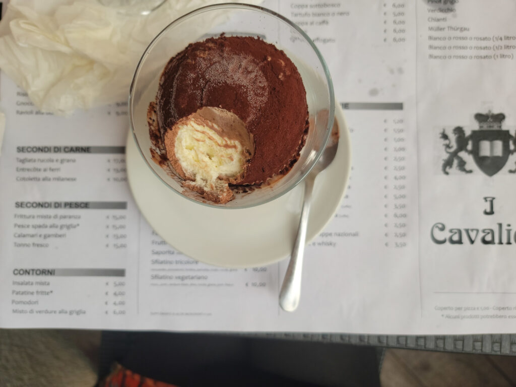
Omegna – Tartufo – Il Cavalieri Pizzeria
Ristorante Punti D’Vista
A ten minute walk along the Lungolago Gramsci of Omegna on the west bank will bring you to this hotel and restaurant. Set slightly uphill from the road it has a commanding view of the lake and plenty of outside seating. Reservations are recommended though, as the patio seating fills up quite fast.
Omegna – Ristorante Punti Di Vista
Omegna – Rigatoni with olive oil, tomatoes and fried vegetables – Ristorante Punti Di Vista
Omegna – Cheese Cake with currants, Coffee and Sambuca – Ristorante Punti Di Vista
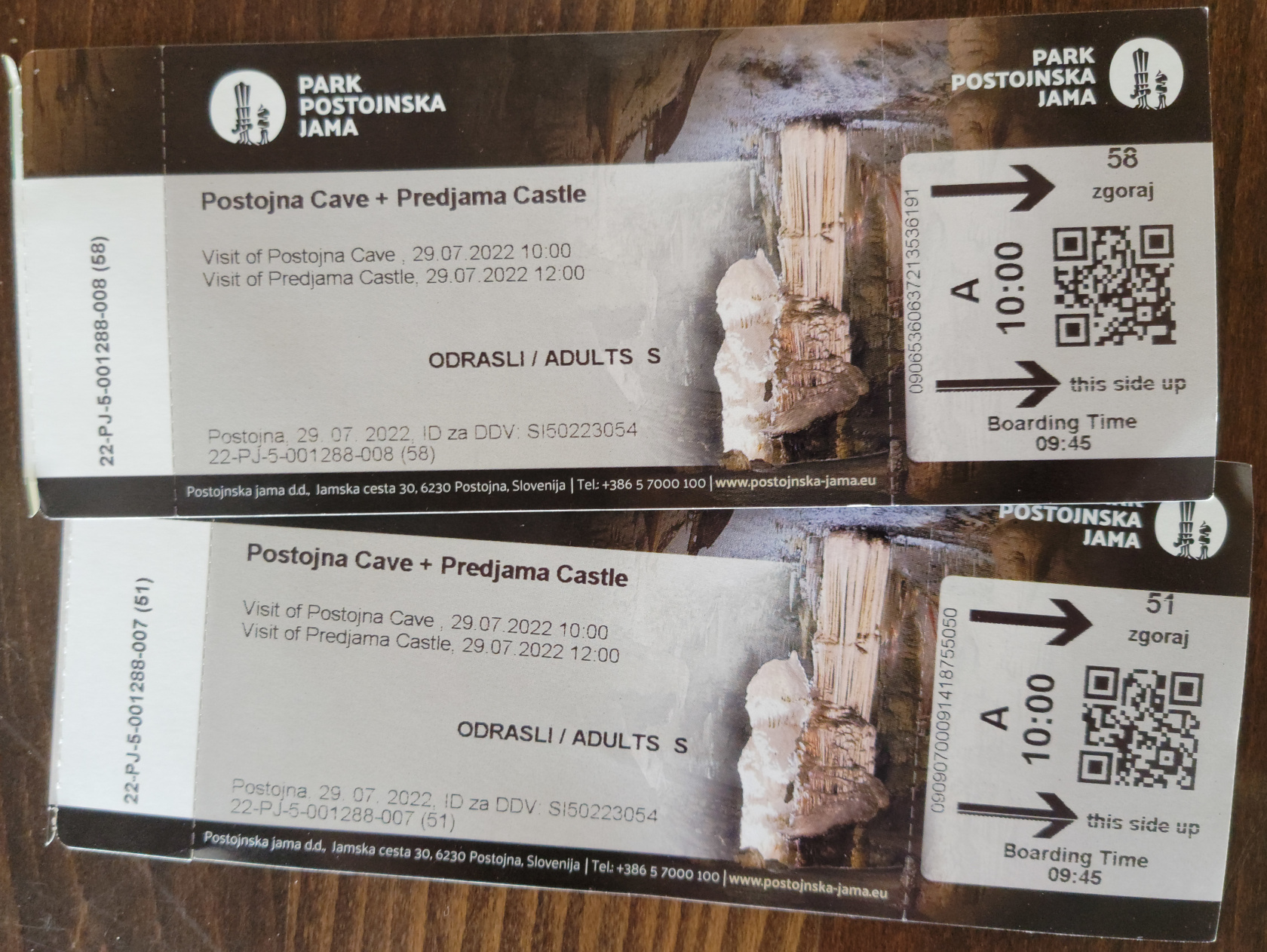
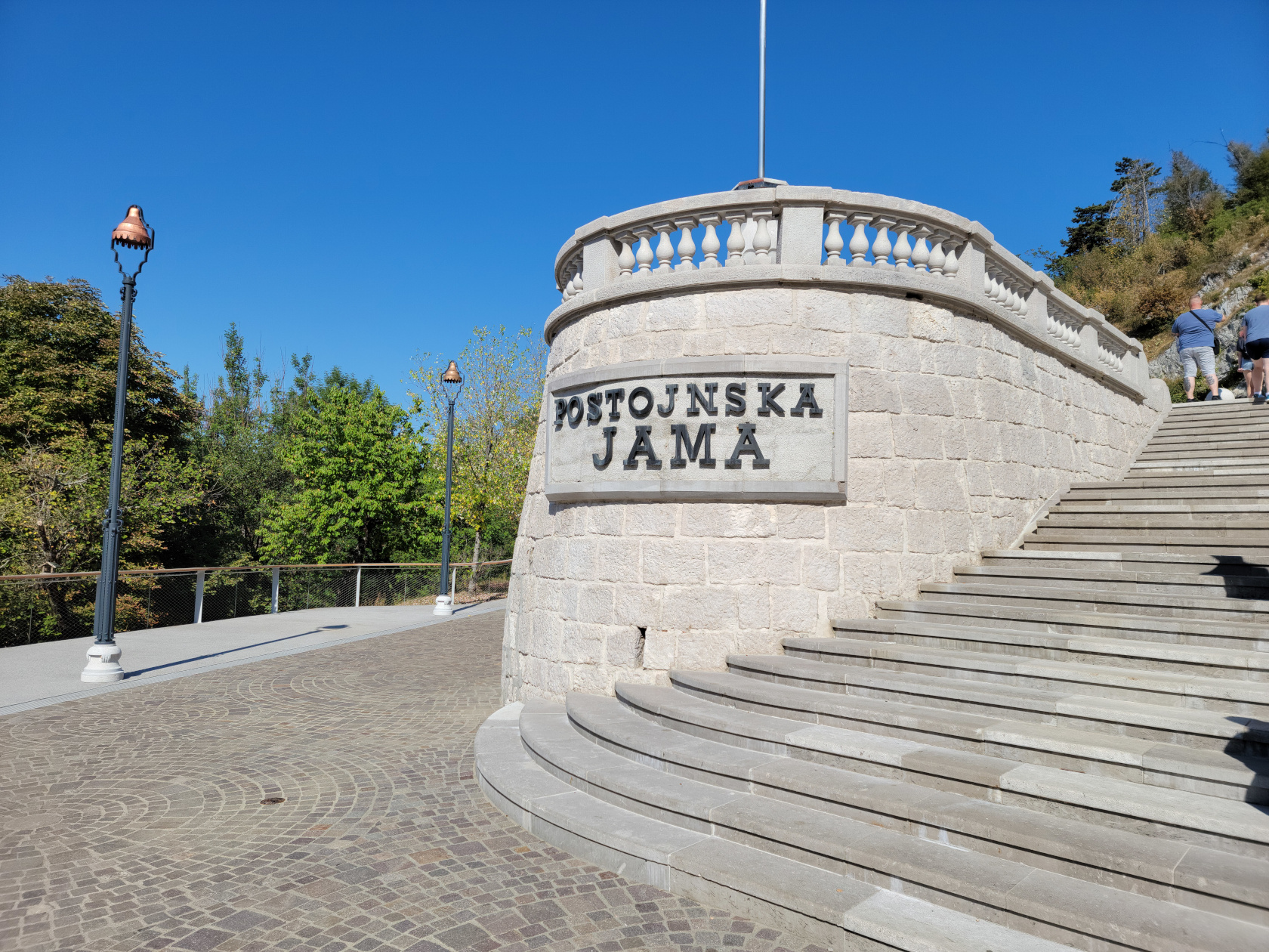
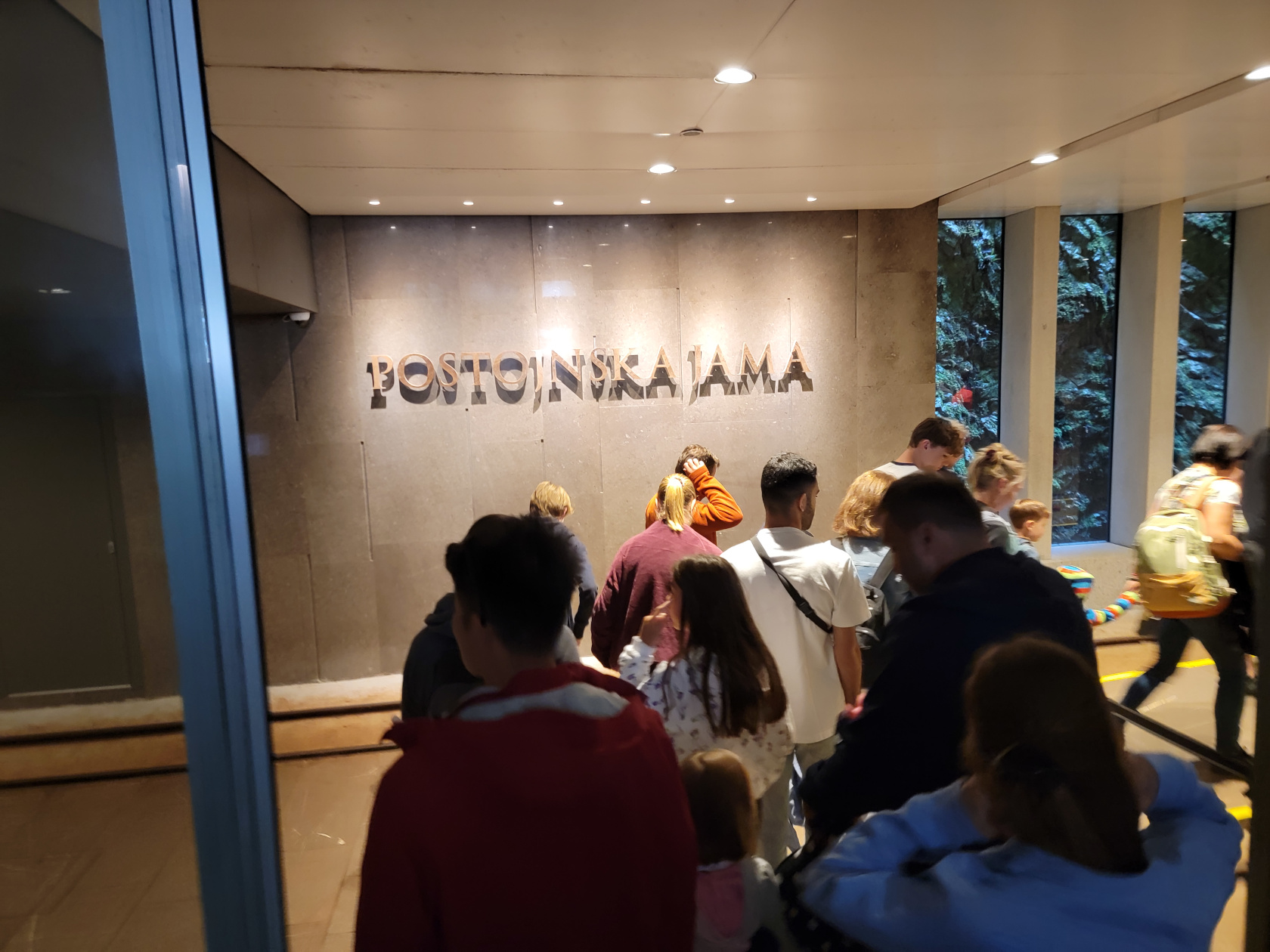
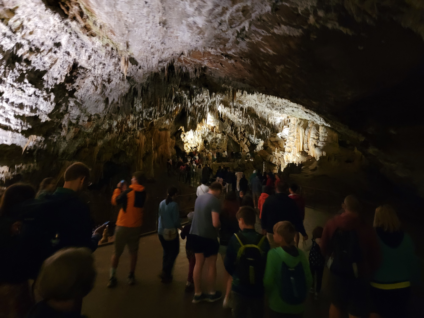
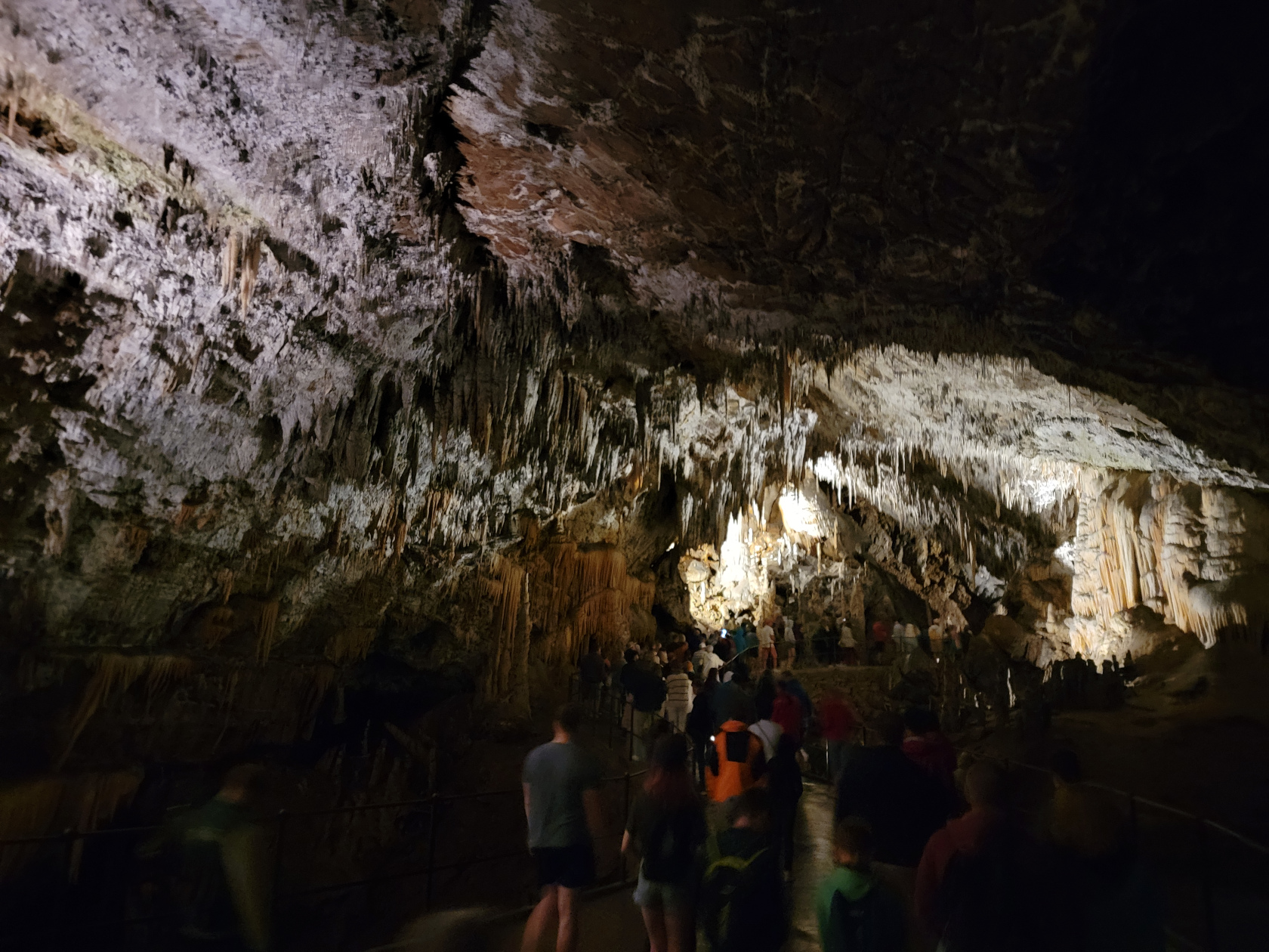
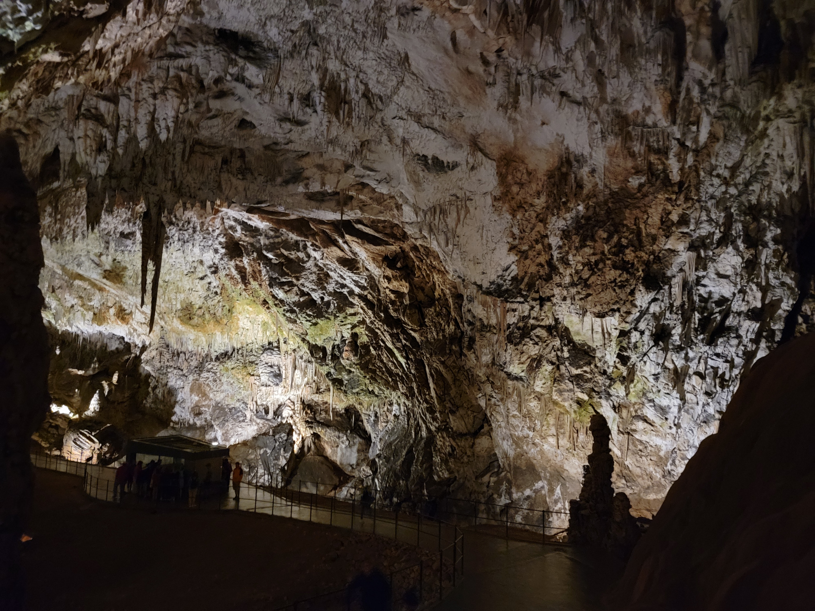
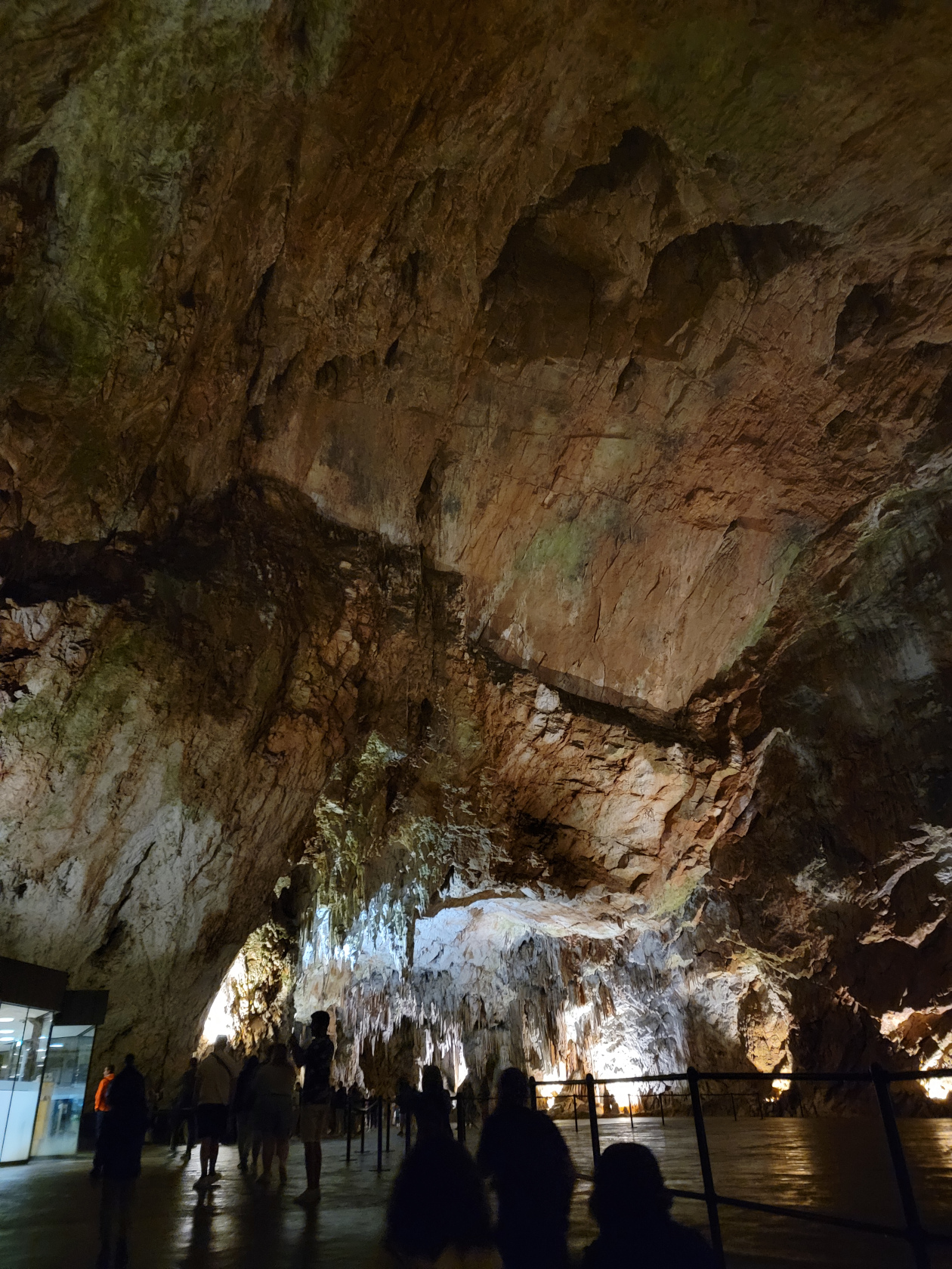
The Postonja Cave, an enormous network karst cave and cavern system, is located forty-five minutes to an hour from Ljubljana driving south on E61 towards Trieste, Italy. The best way to get there is driving, but you can take a bus or hire a tour (which is what we did). Our coach tour cost us 93€ each and we were eight people total, a very manageable group size.
The Cave Tour
The tour is fairly well managed and is split into a train ride tour, which brings you deep into the mountain; and, a walking tour inside the cave system, which explains the geology and processes going on in the cave itself. They also explain some of the fauna that lives in the cave, as well as the ecology. The entire tour from entrance to exit is about one and a half hours. The temperature in the cave system is around 50°F, so bring a jacket or sweater, if you are inclined to get cold. I wore a short-sleeved shirt and was fine, though the train ride was a bit chilly due to the breeze.
Postonja Caves – Tickets For Two
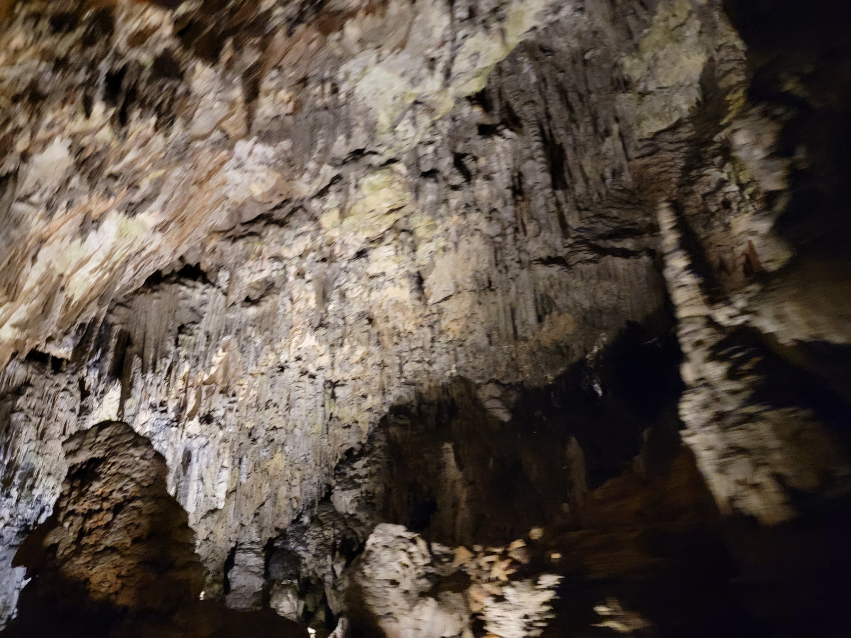
Below is a set of short video clips recording the train tour, and a slideshow of the walking tour. Both are in order of when they were taken. I took more than enough photographs because it is such an amazing thing to see and how often does anyone actually go underground for anything?
If you ever get a chance to go, it is well worth the trip. It is one of the largest cave networks in the world, and the second longest in the country of Slovenia.
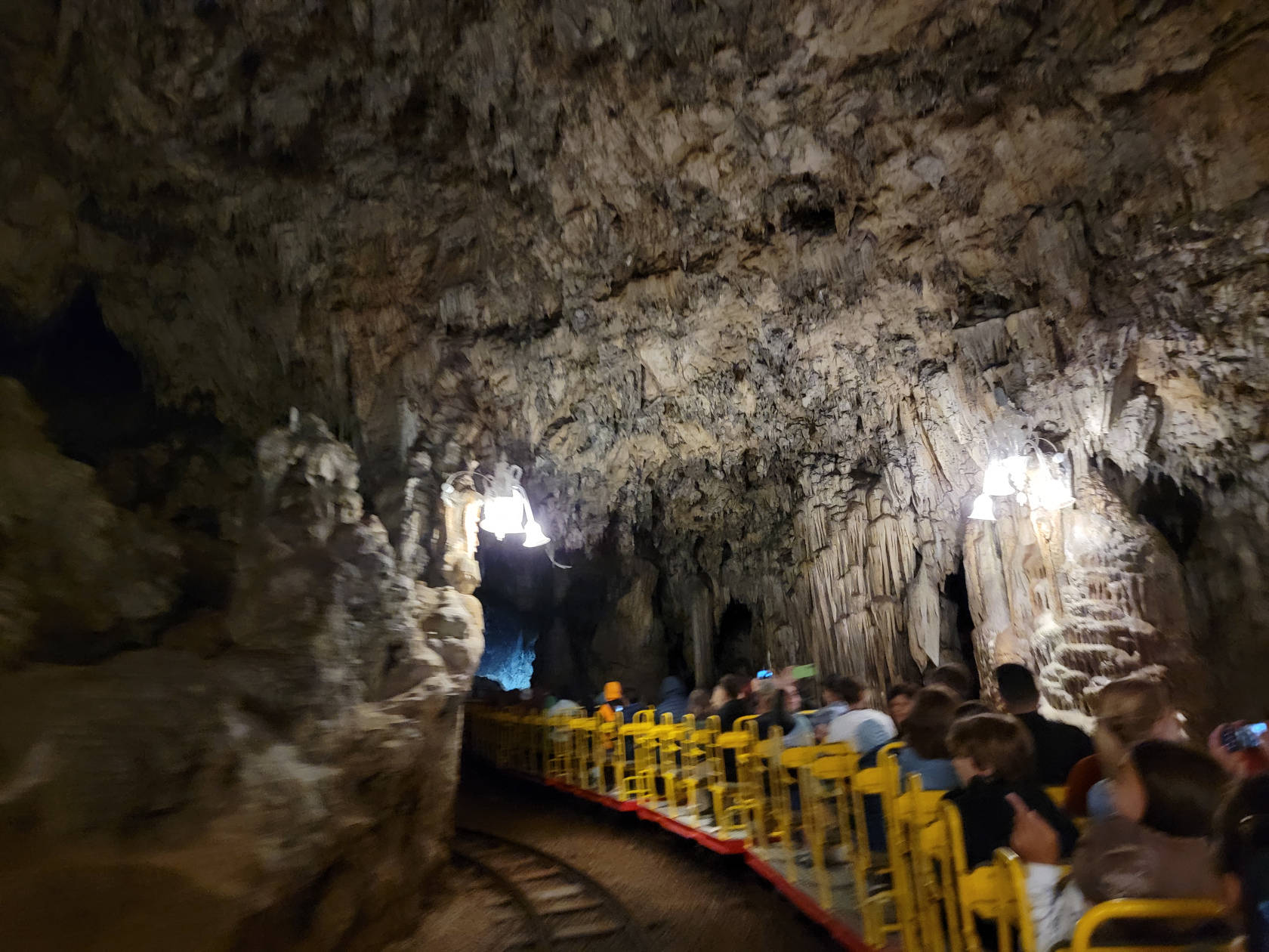
The Train Ride Tour
The Walking Tour
Postonja Caves – walking to the caves
Postonja Caves – Entrance
Postonja Caves – Inside boarding trains
Postonja Caves – The Ride into the Caves
Postonja Caves – The Ride into the Caves
Postonja Caves – The Ride into the Caves
Postonja Caves – The Ride into the Caves
Postonja Caves – The Ride into the Caves
Postonja Caves – The Ride into the Caves
Postonja Caves – The Ride into the Caves
Postonja Caves – The Ride into the Caves
Postonja Caves – The Ride into the Caves
Postonja Caves – The Ride into the Caves
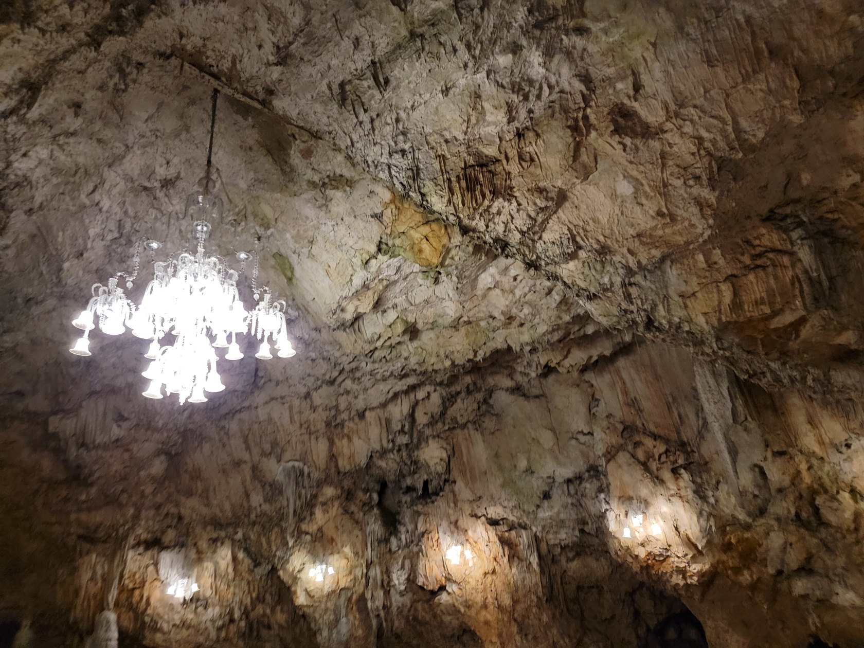
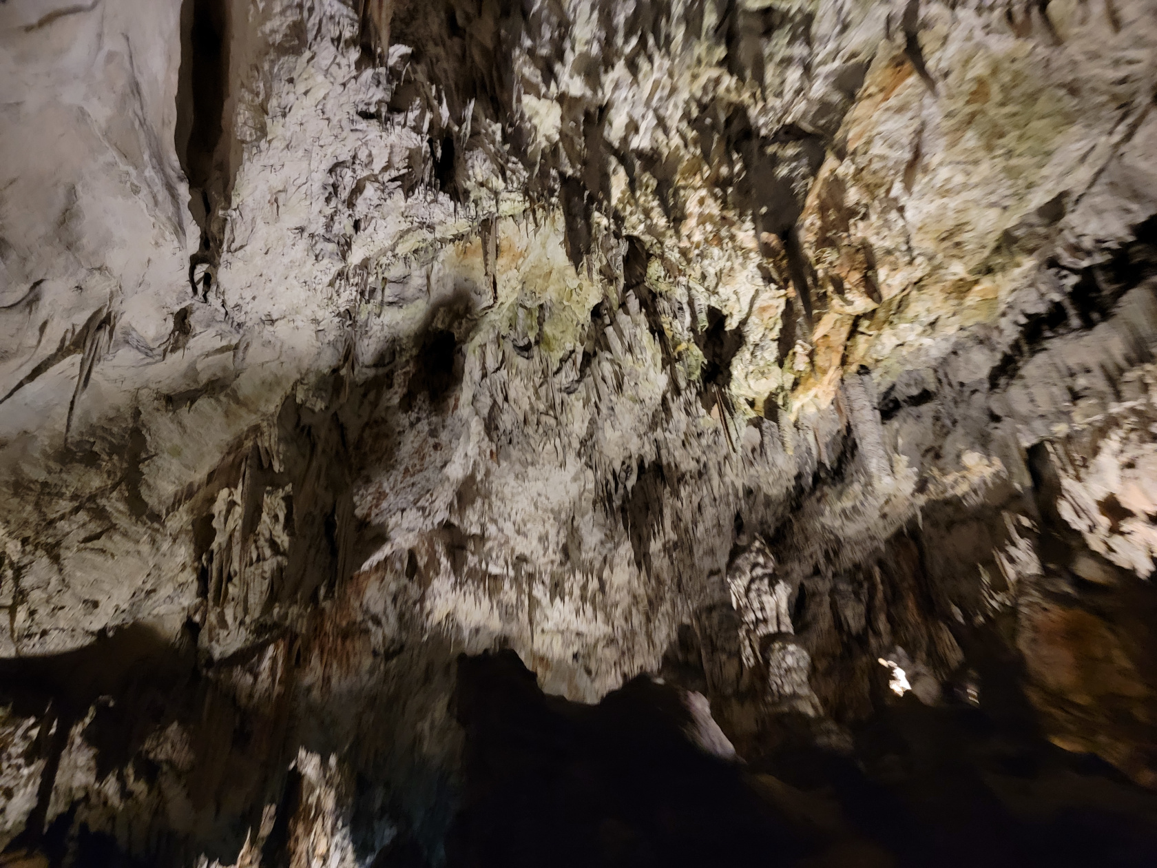
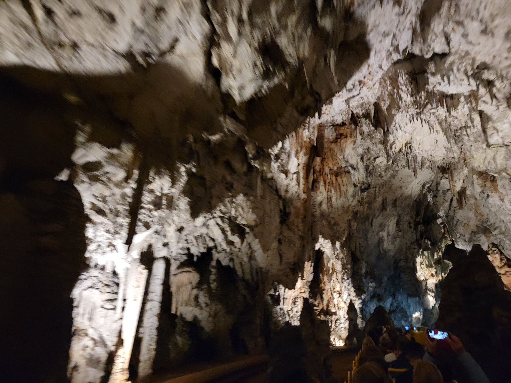
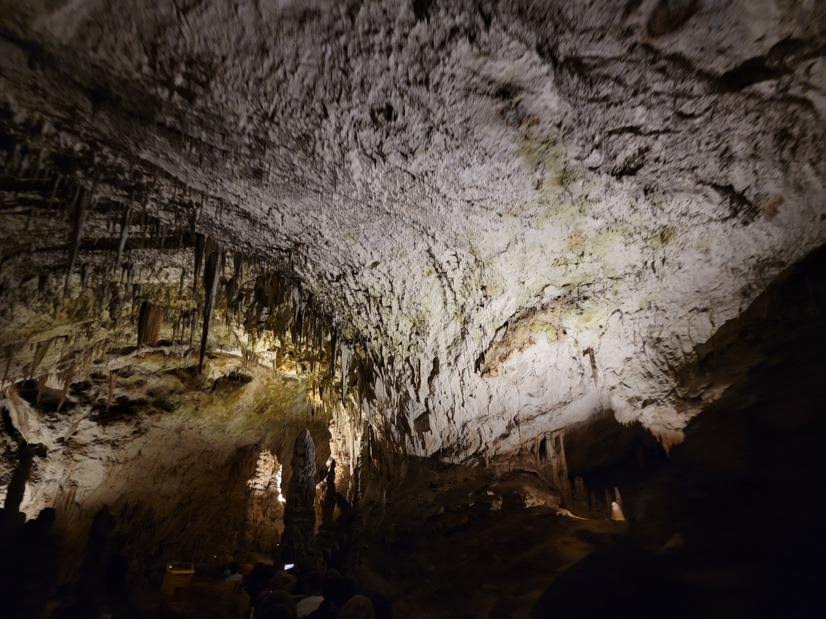
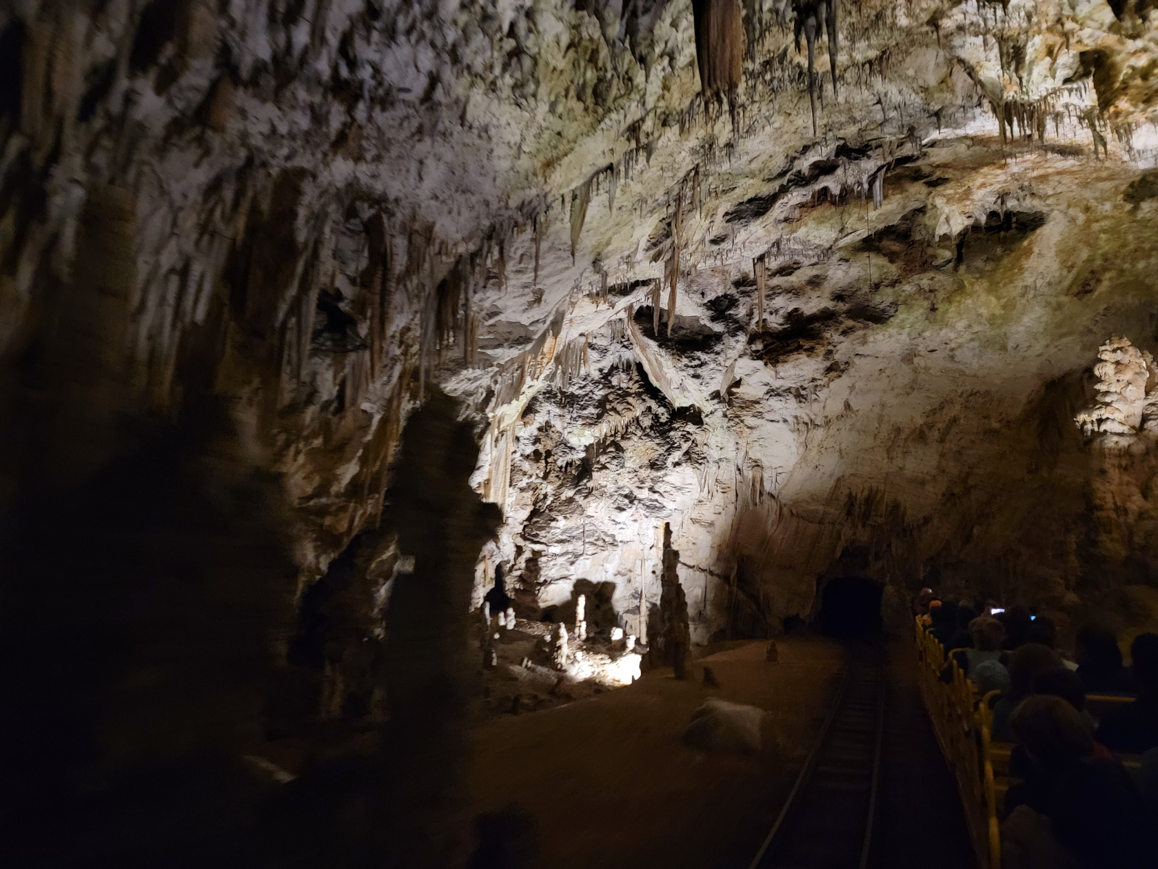
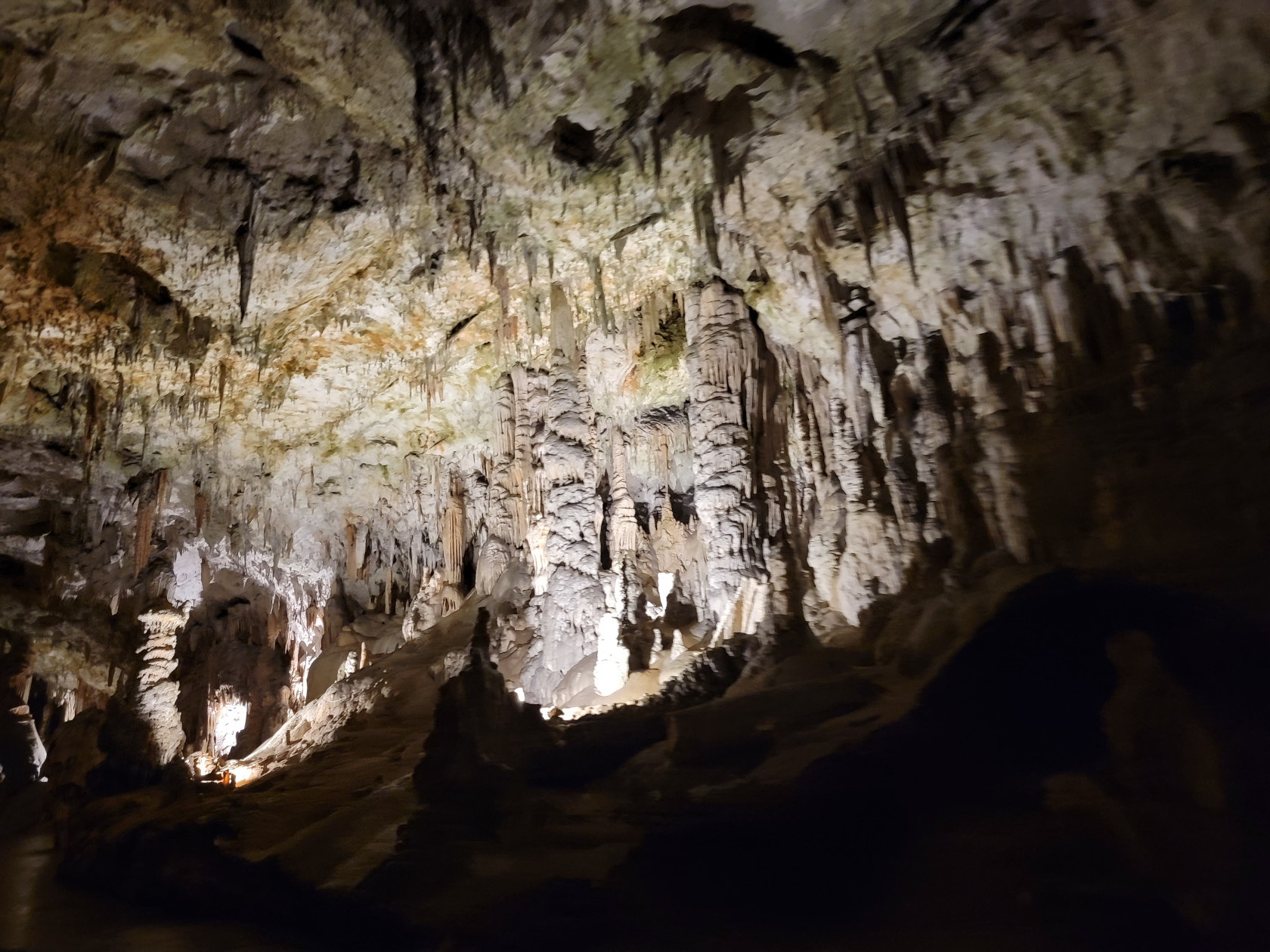
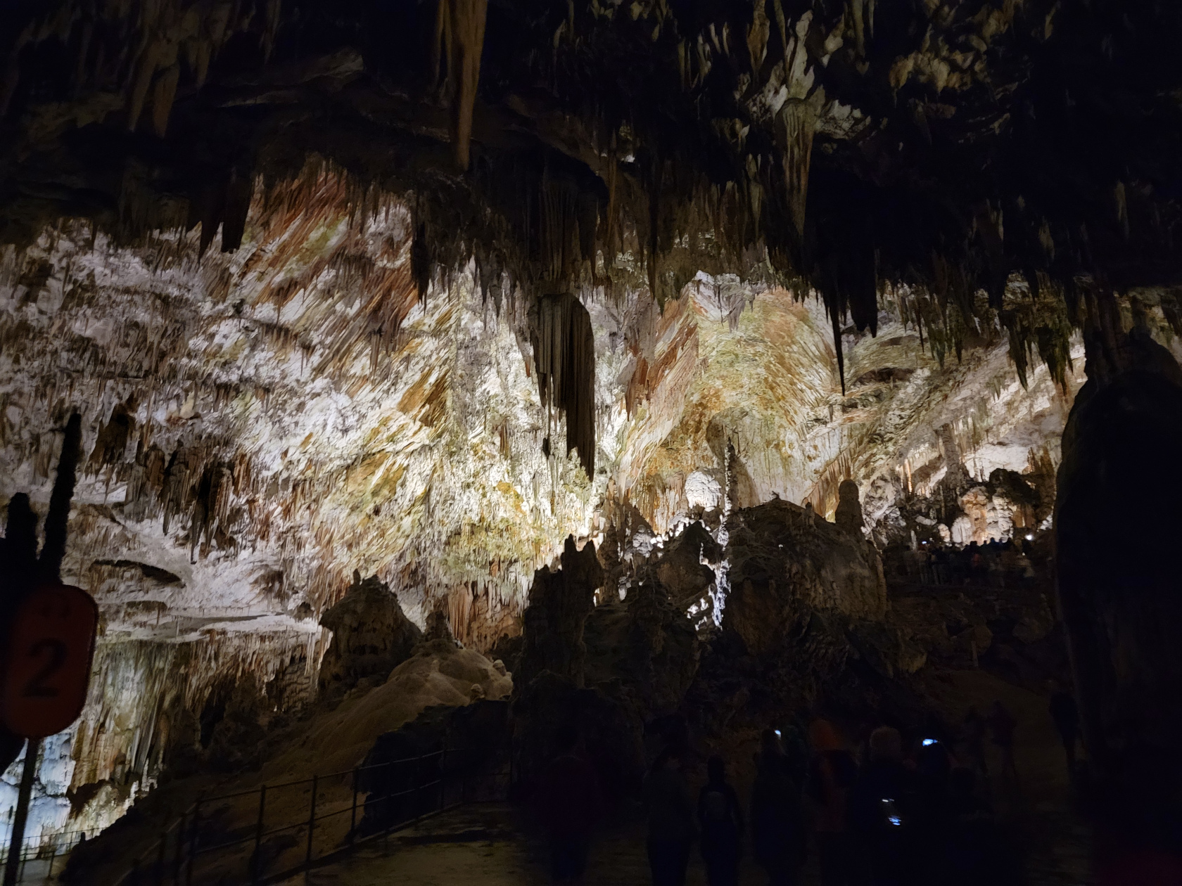
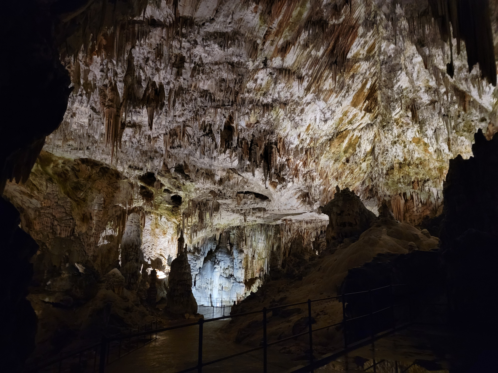
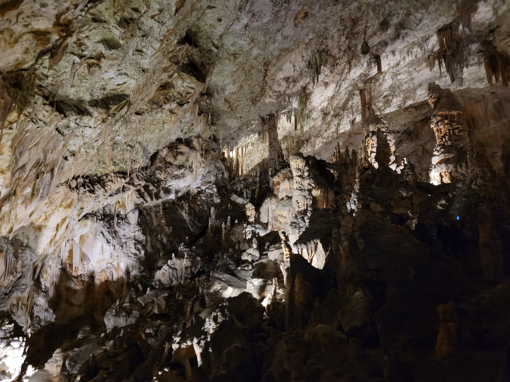
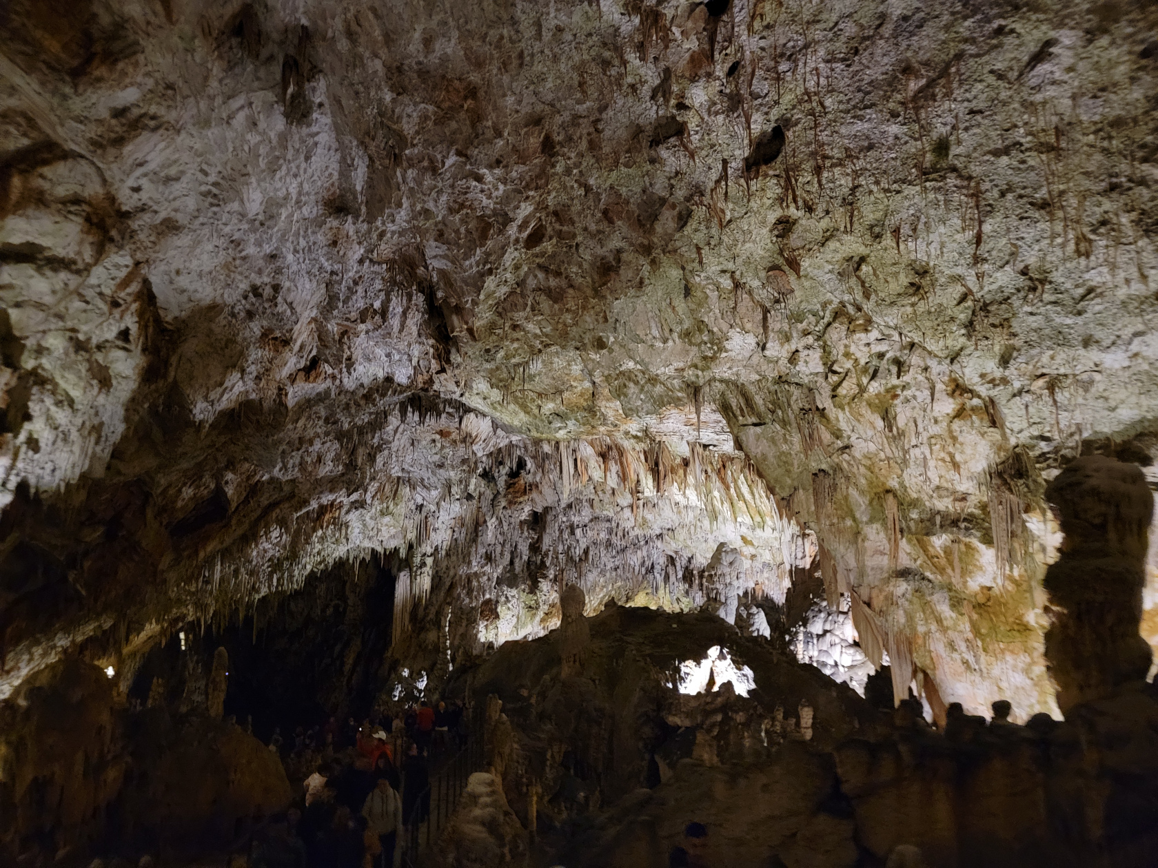
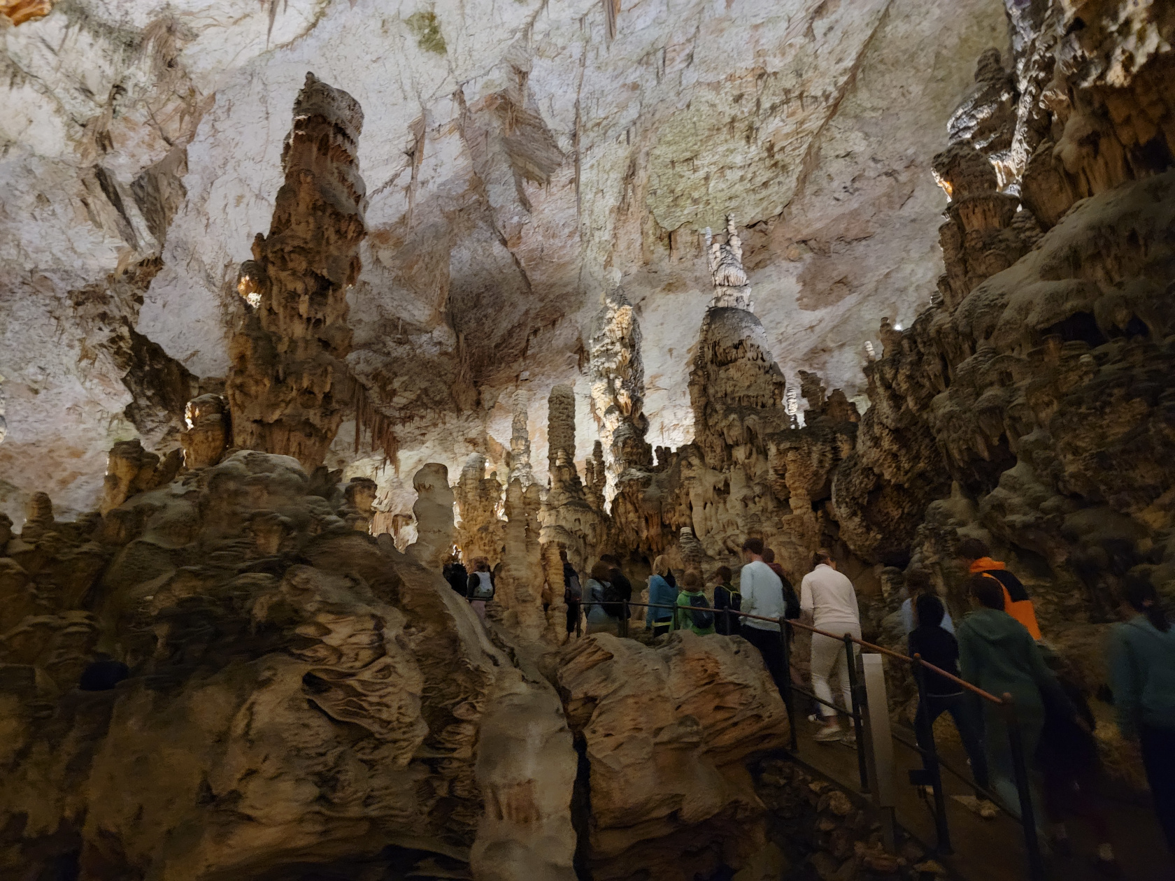
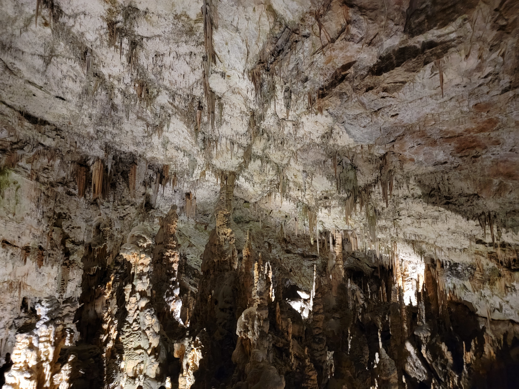
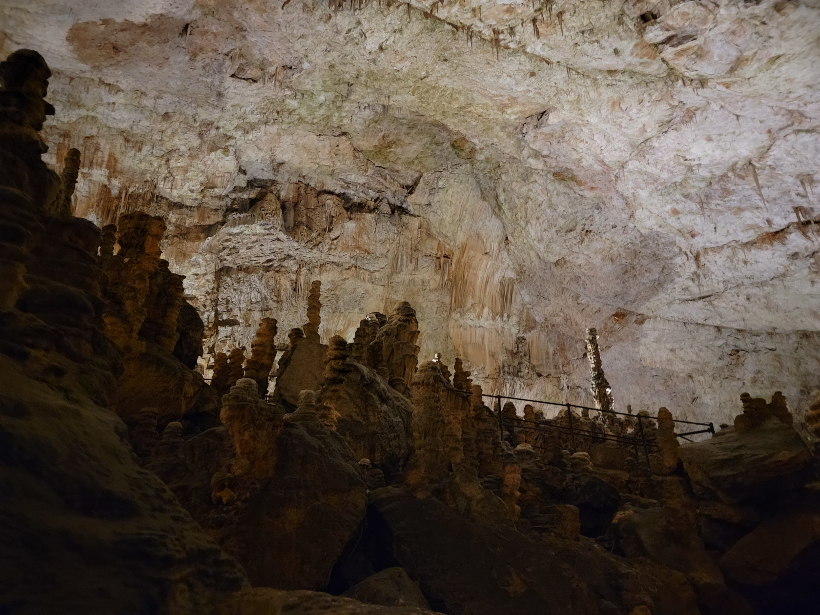
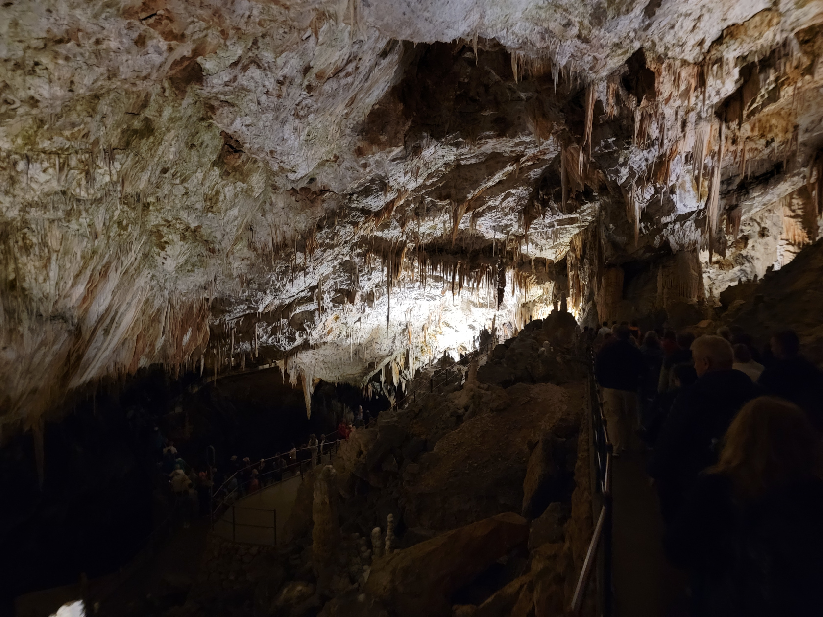
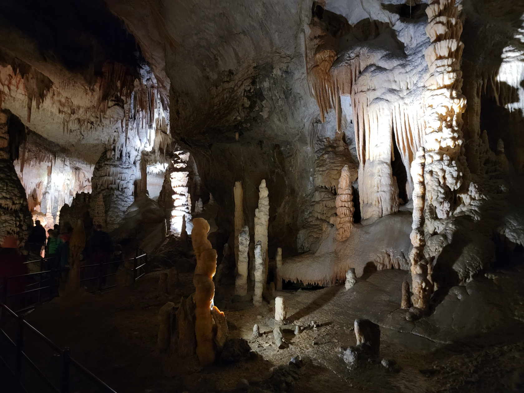
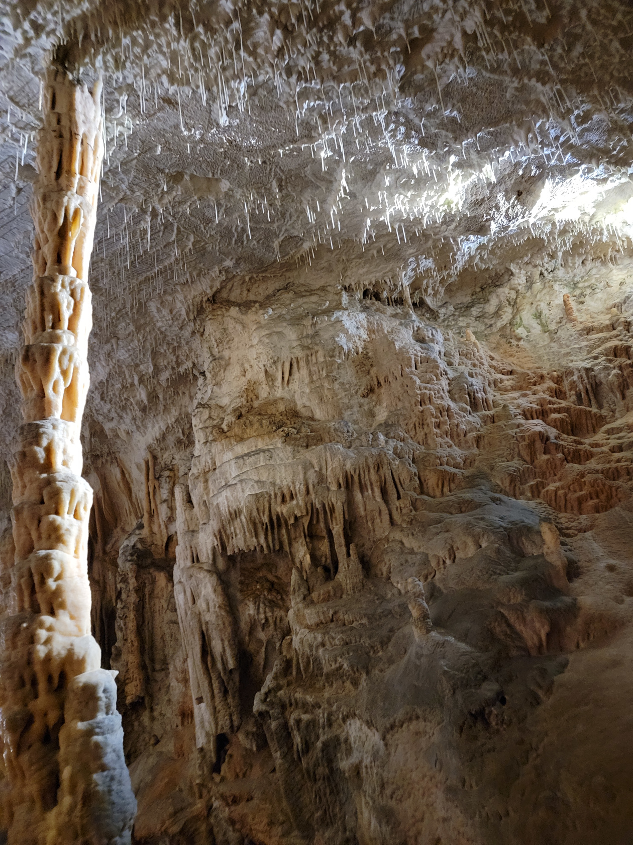
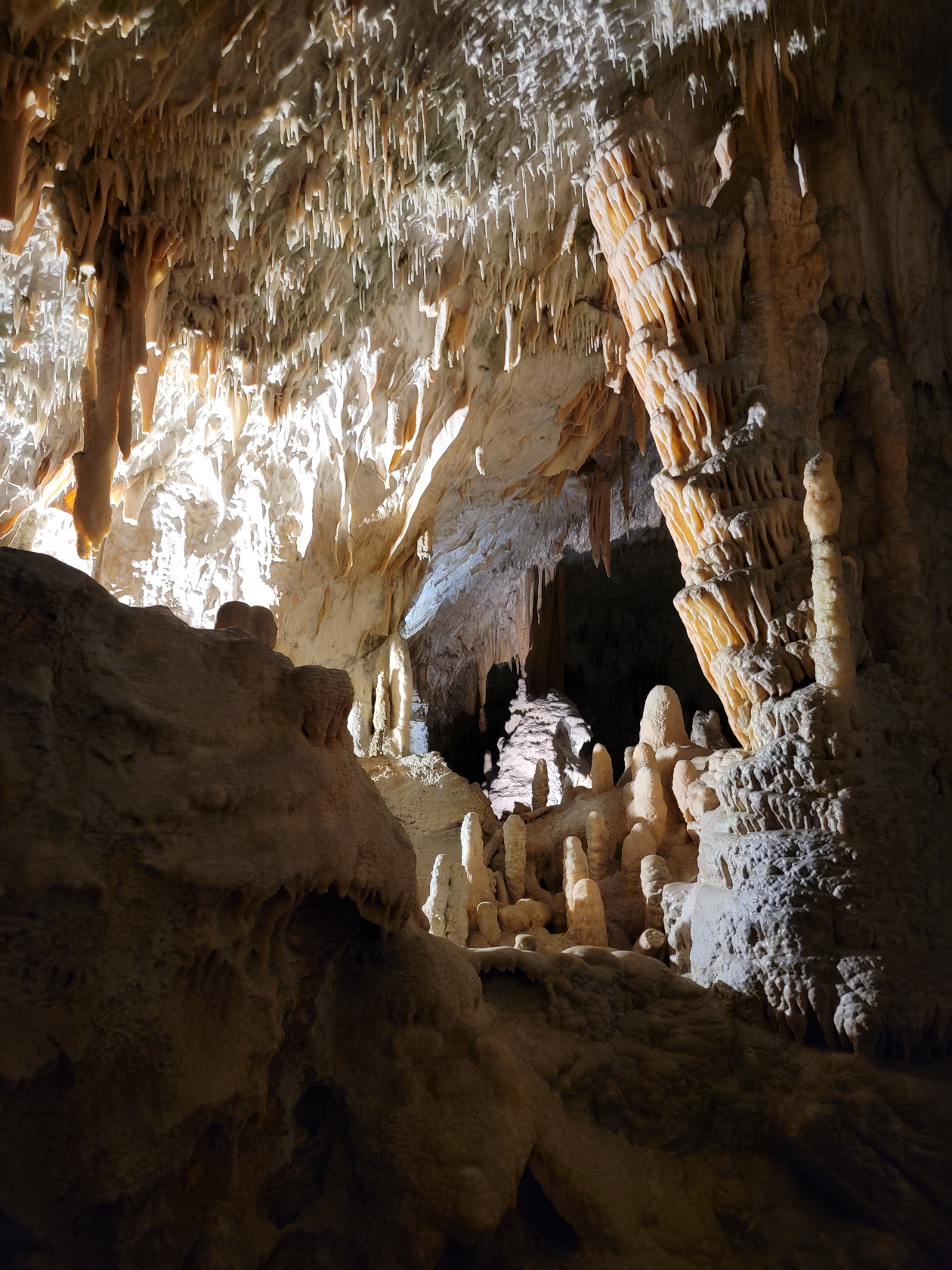
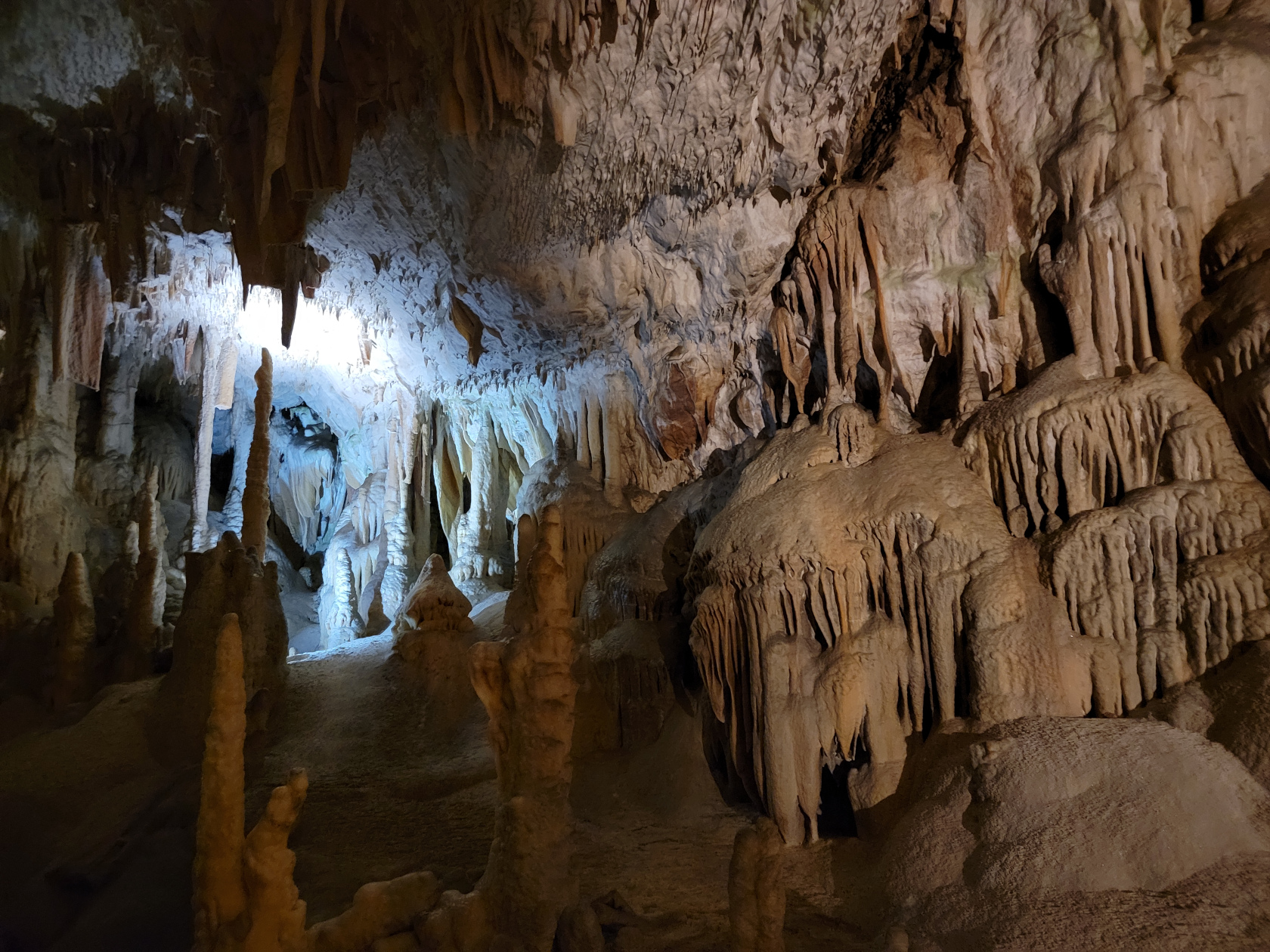
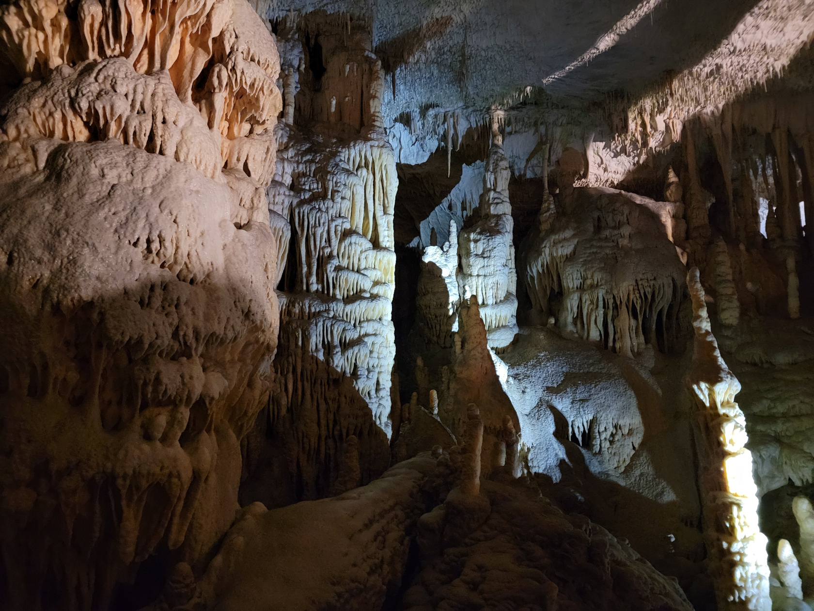
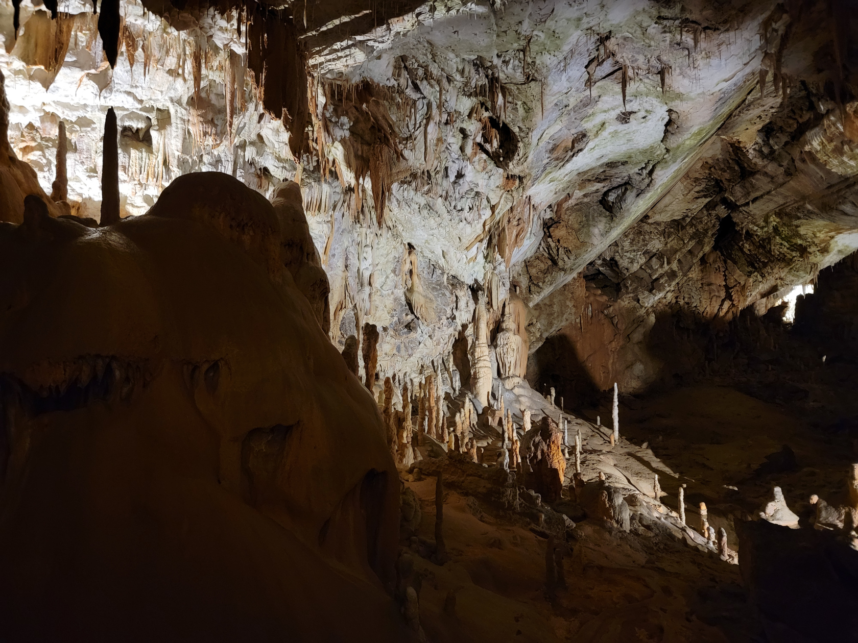
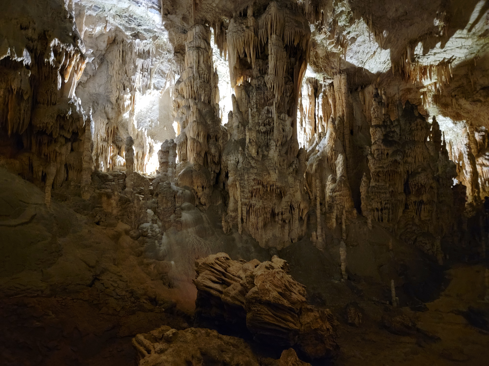
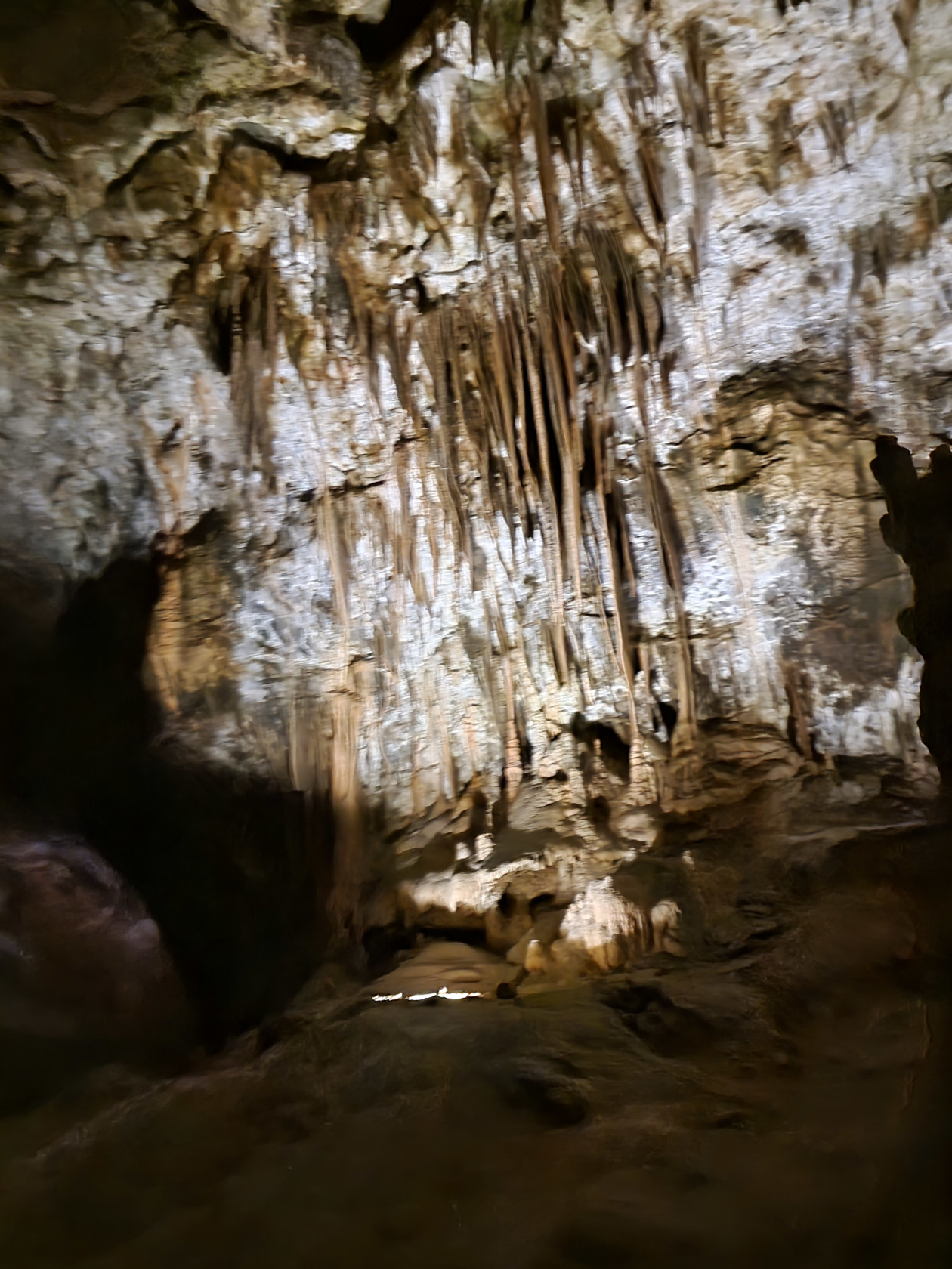
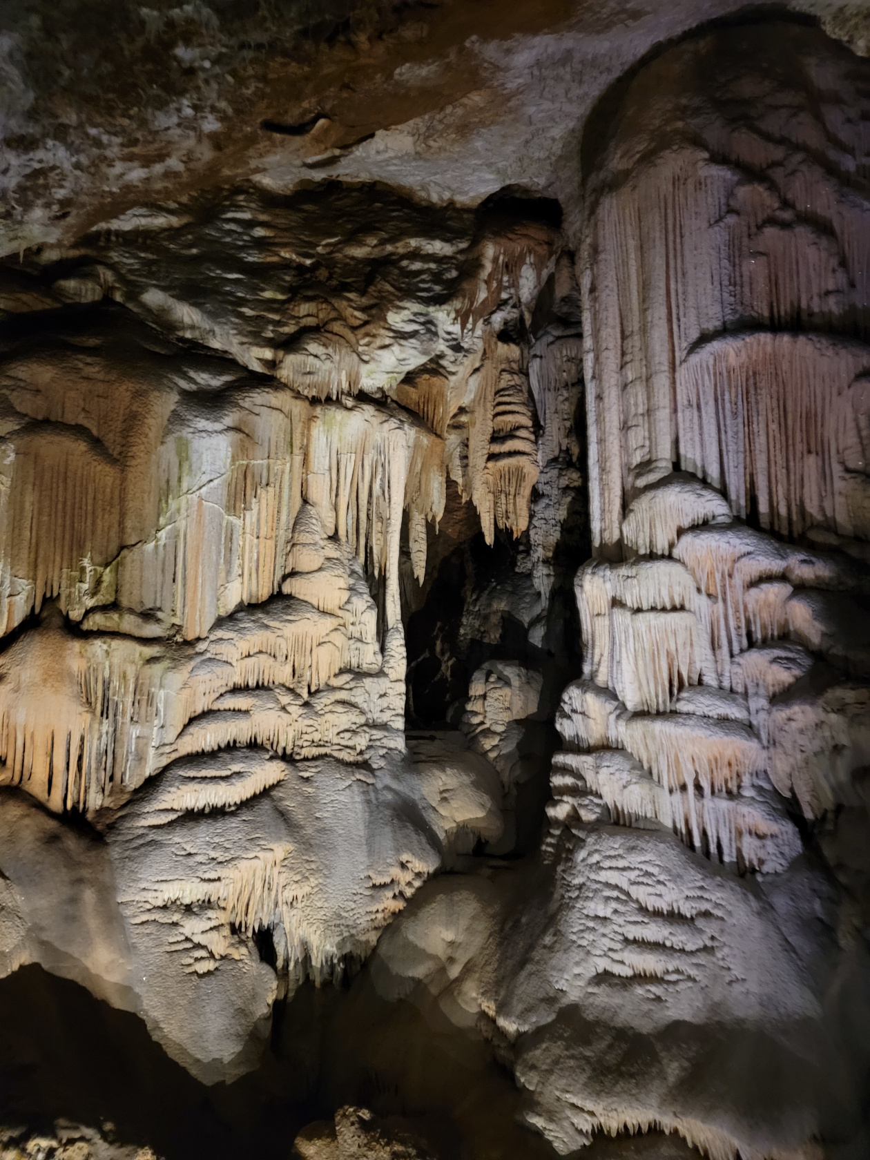
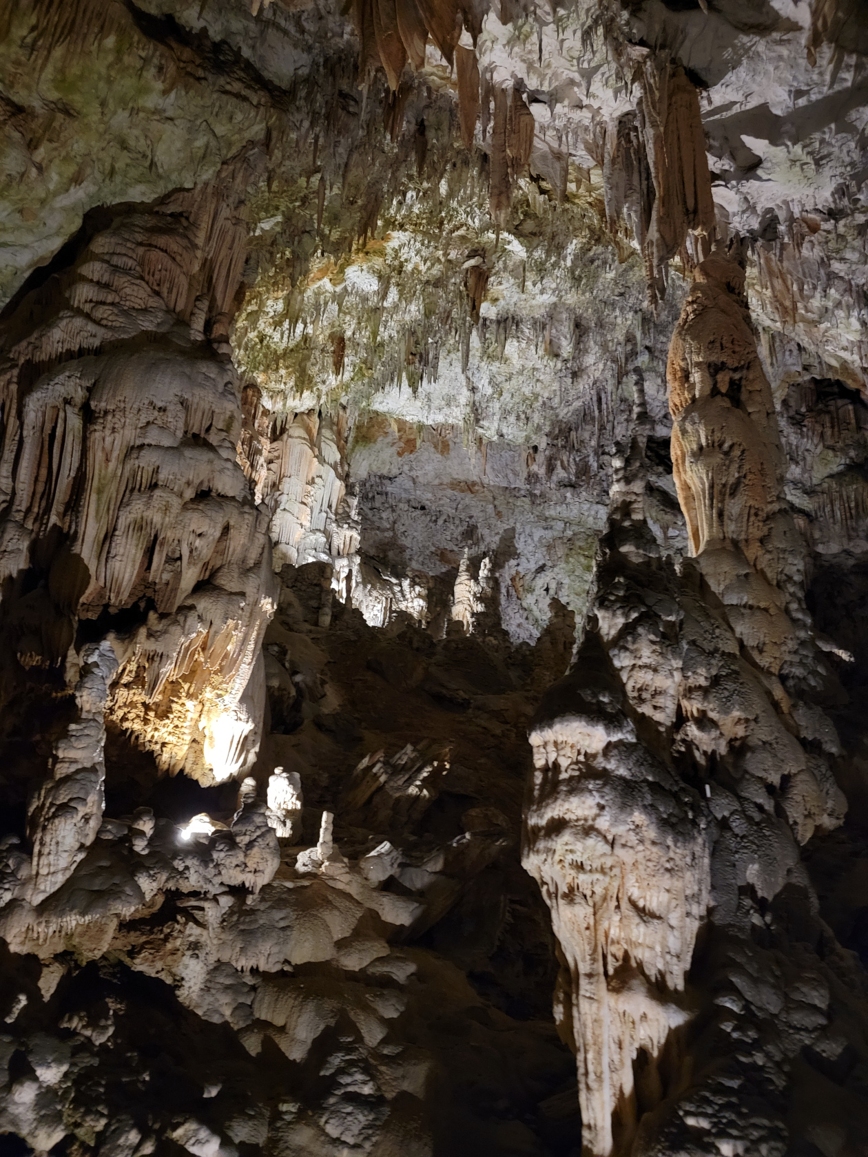
Postonja Caves – The Caves
Postonja Caves – The Caves
Postonja Caves – The Caves
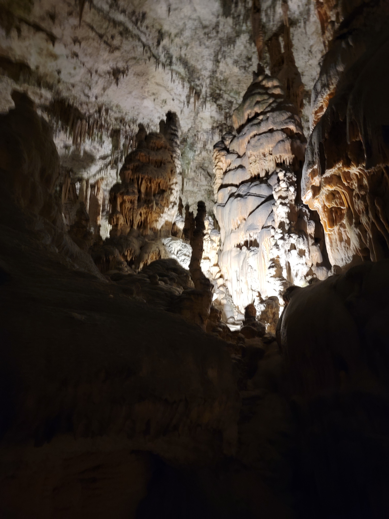
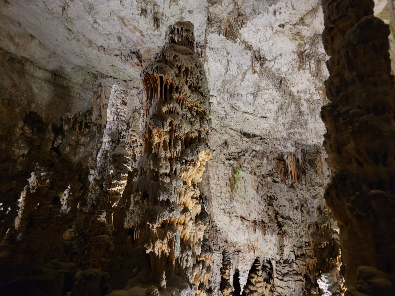
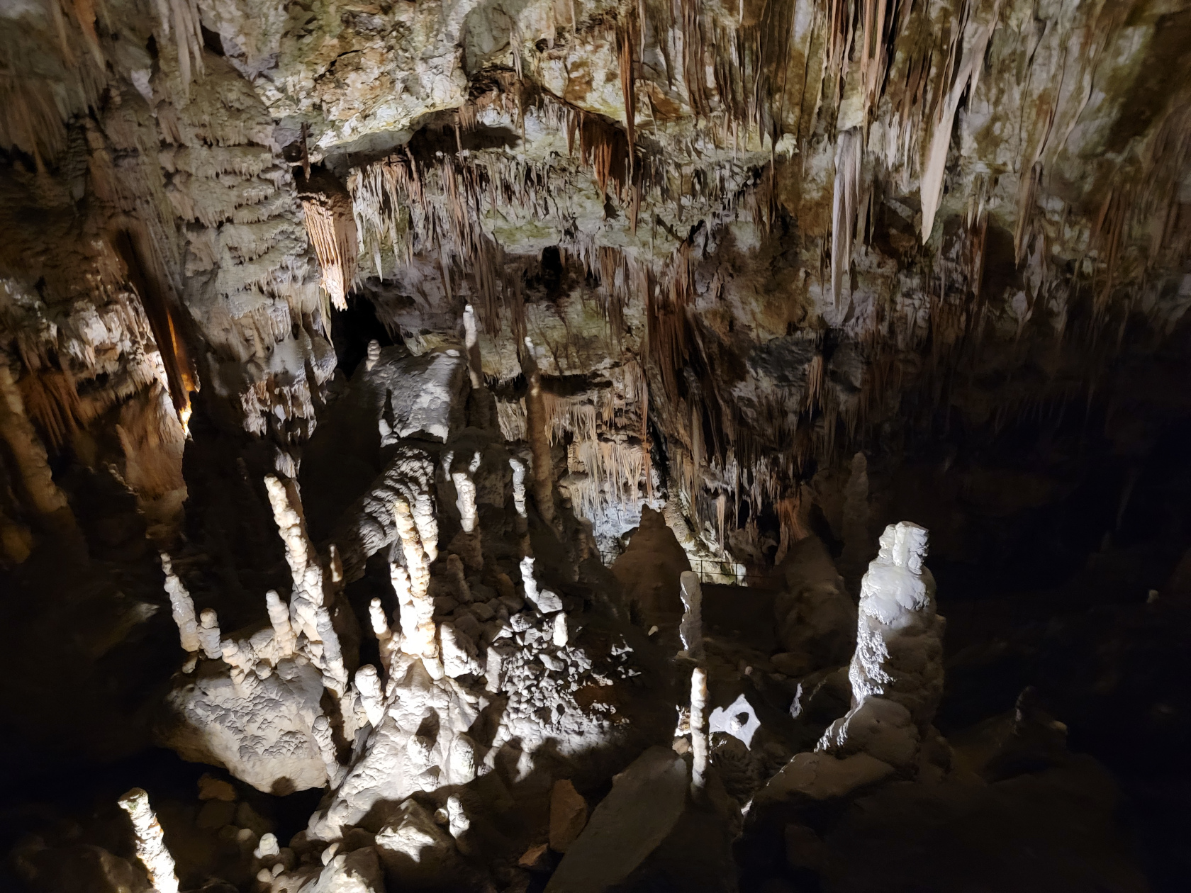
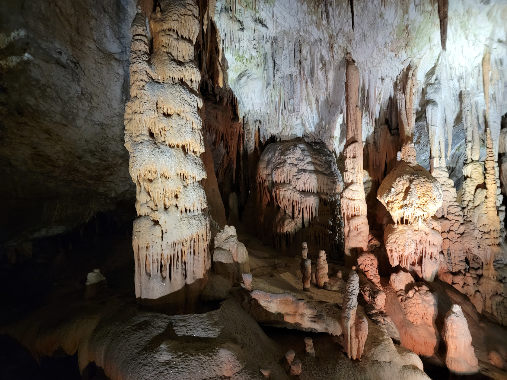
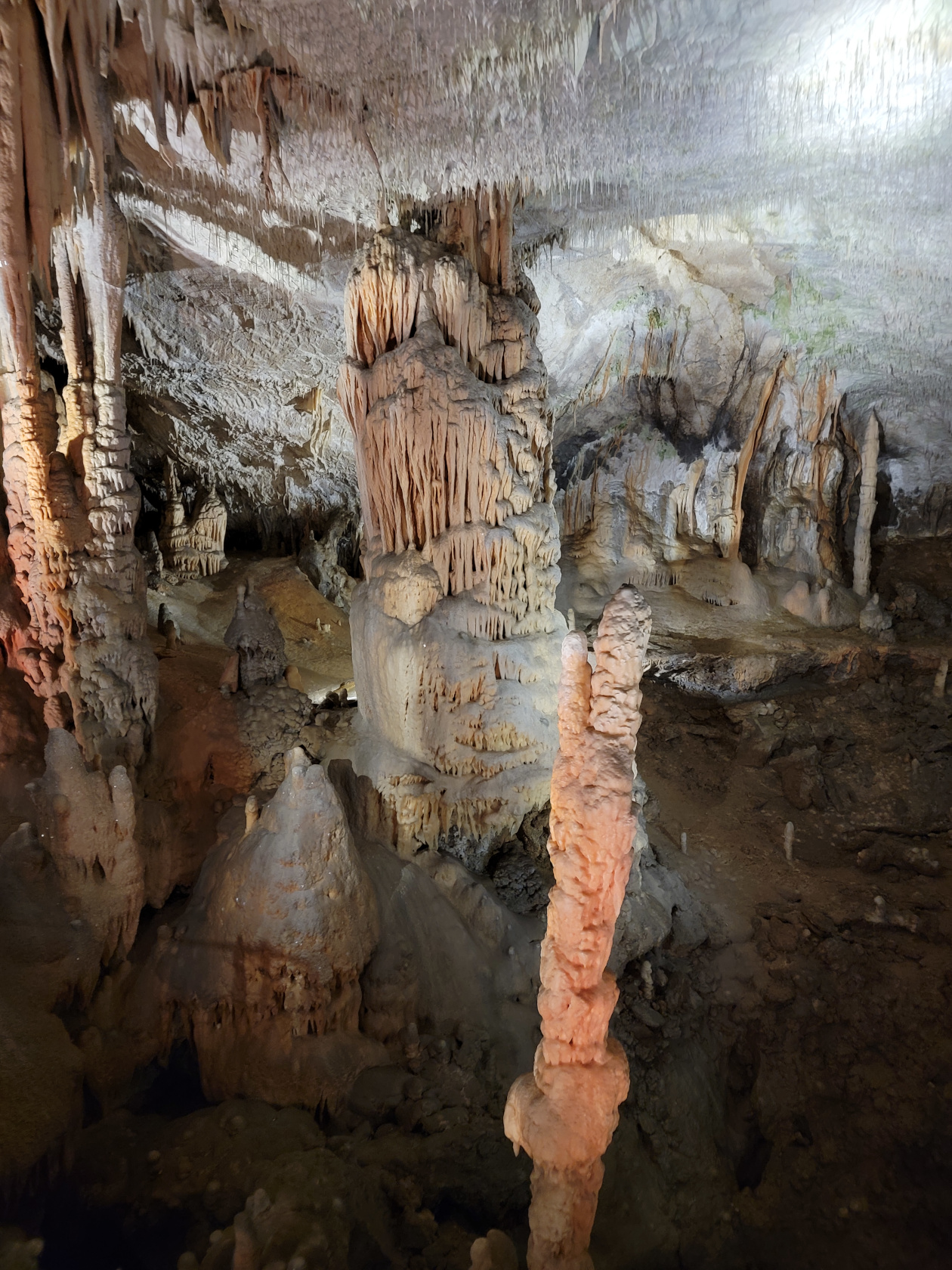
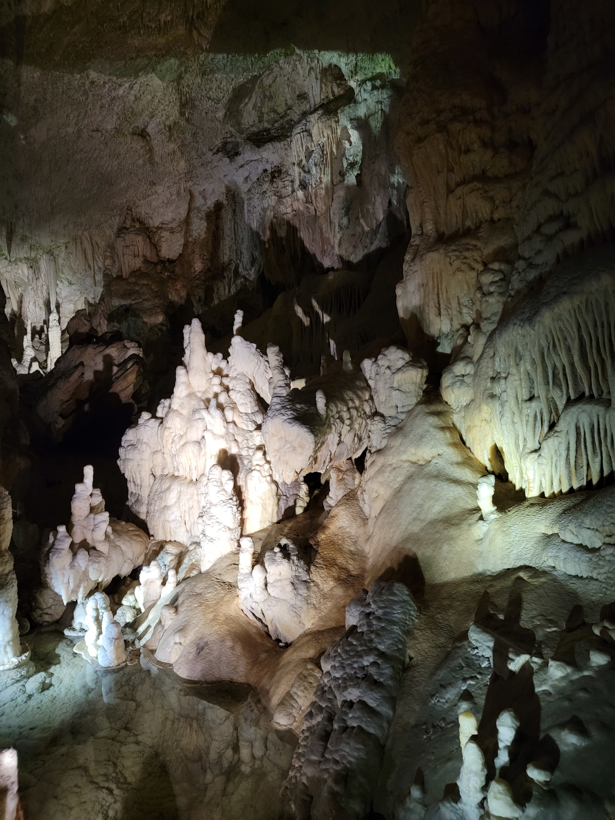
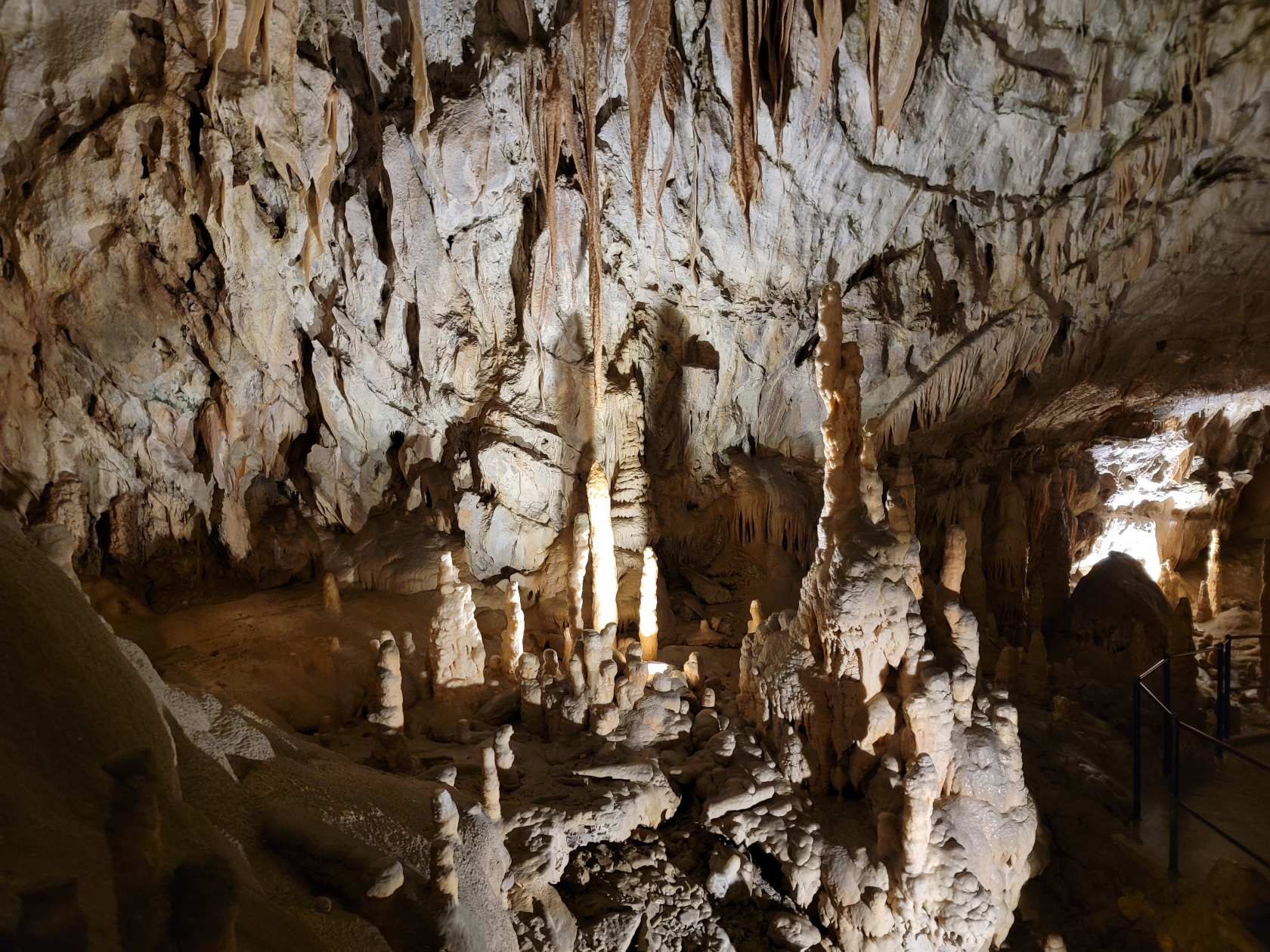
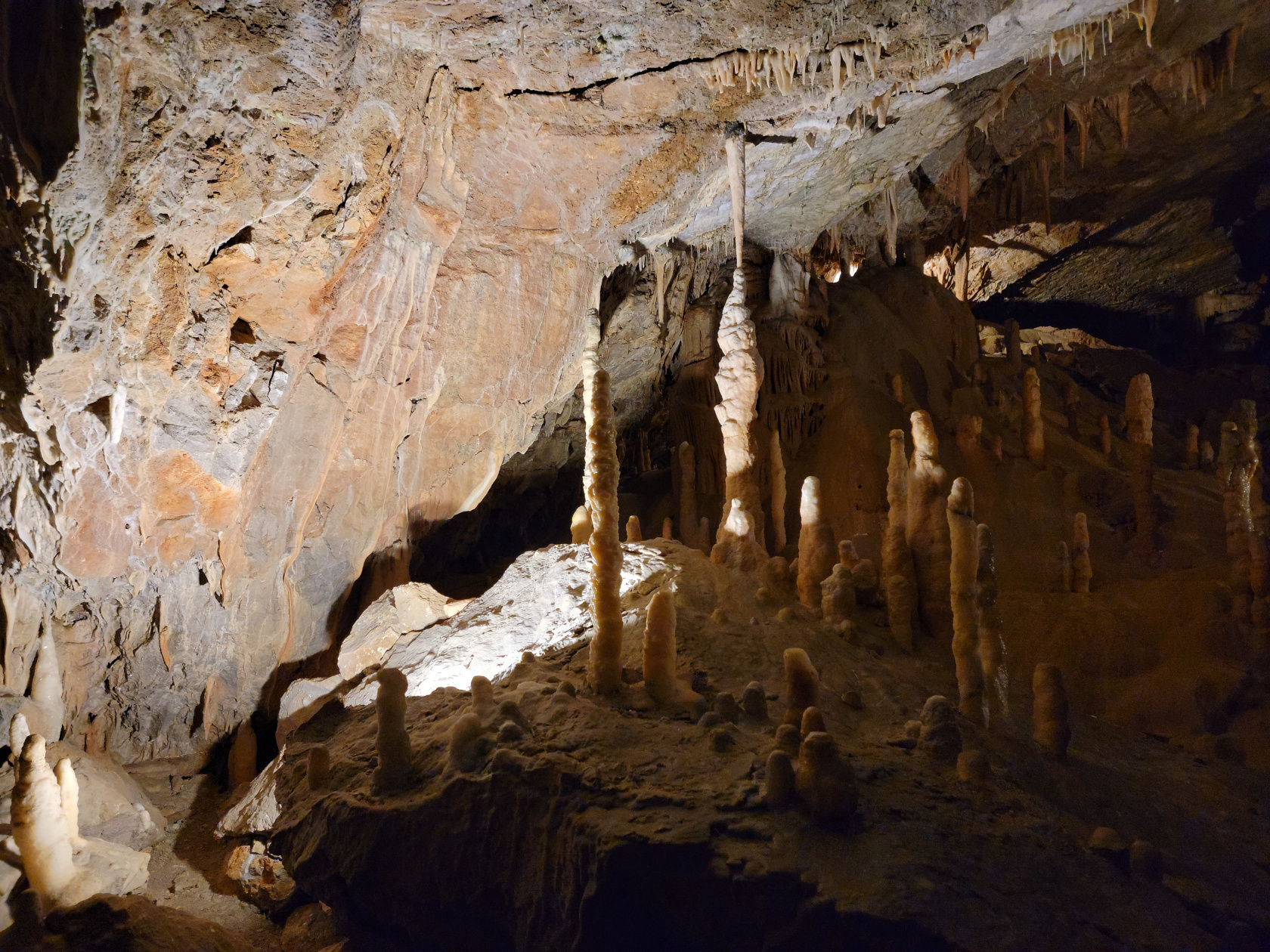
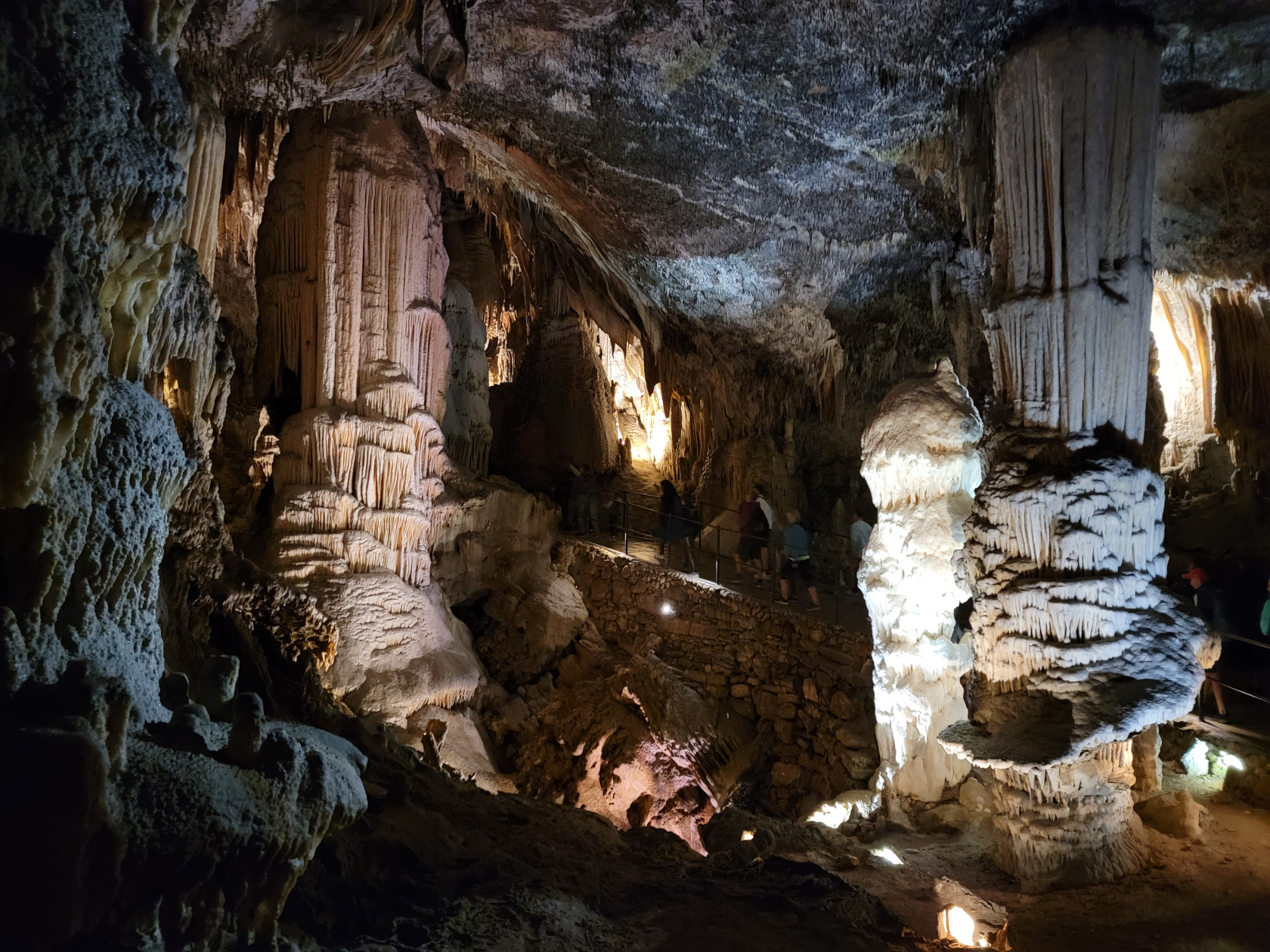
Postonja Caves – The Caves – Large Stalagmites
Postonja Caves – The Caves – Large Stalagmites
Postonja Caves – The Caves – Large Stalagmites
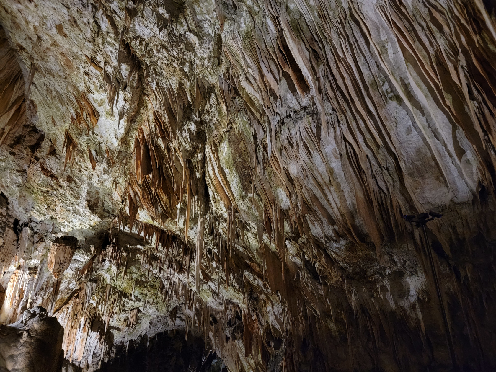
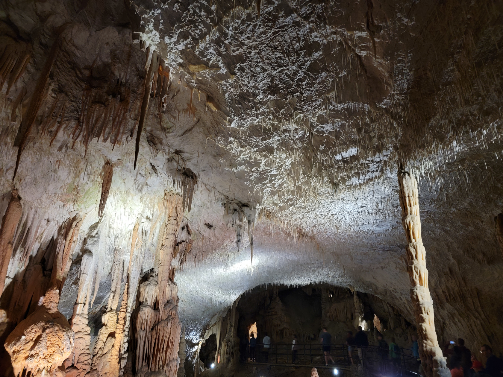
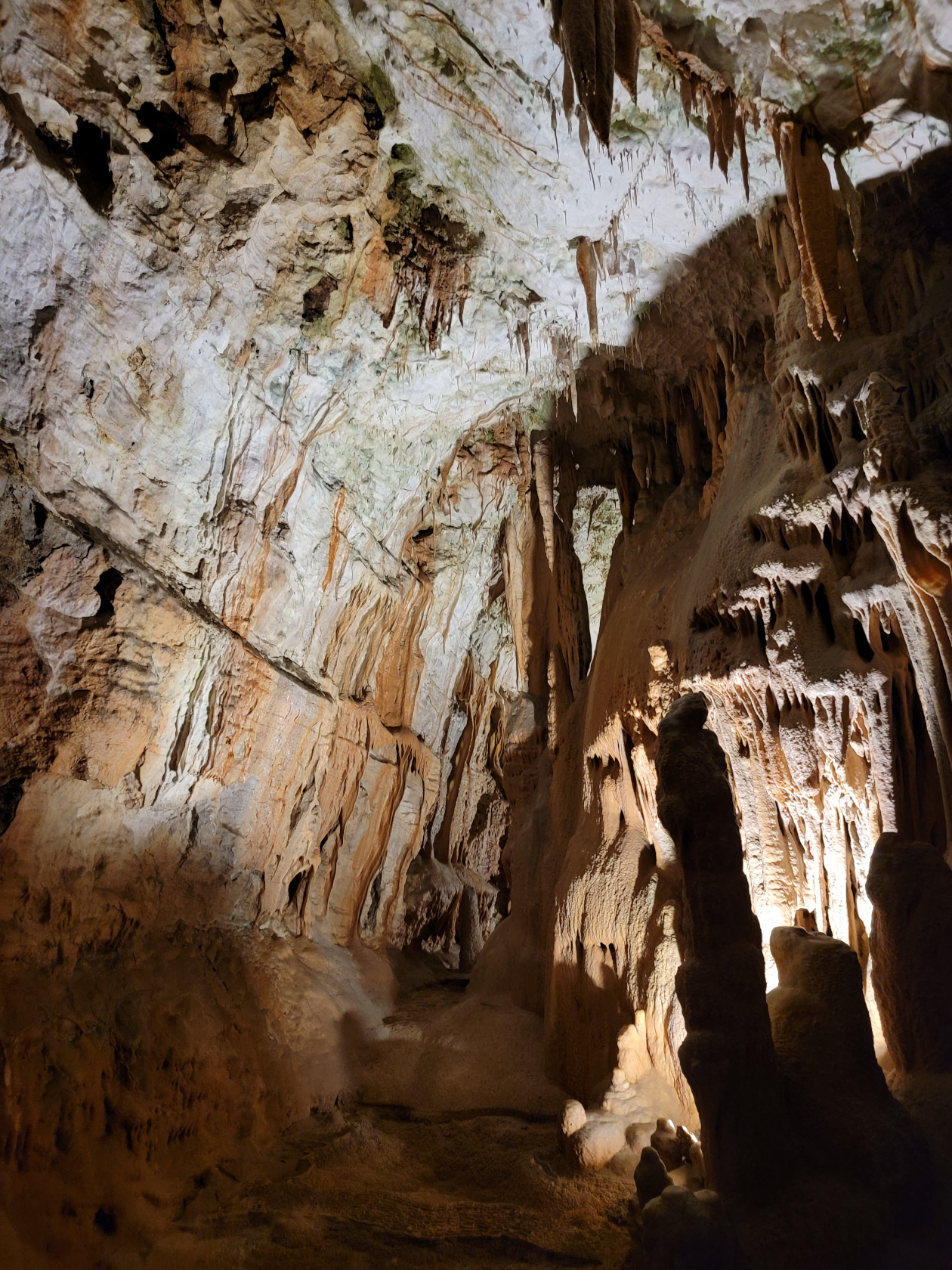
Postonja Caves – The Caves – Spaghetti Stalagtites
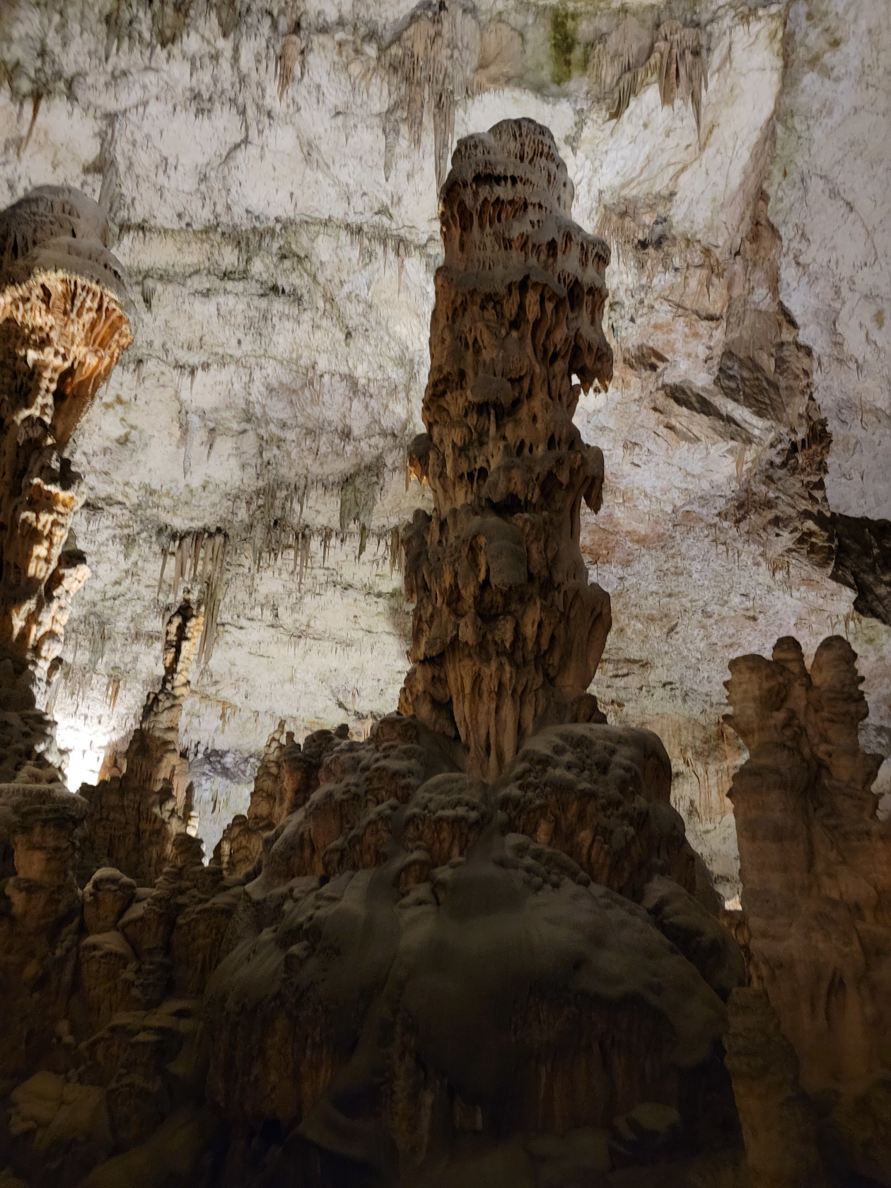
Postonja Caves – The Caves – Large Stalagmite
Postonja Caves – The Caves – Large Stalagmites and Spaghetti Stalagtites
Postonja Caves – The Caves – Large Stalagmites and Spaghetti Stalagtites
Postonja Caves – The Caves – Stalagmites and Spaghetti Stalagtites
Postonja Caves – The Caves – Spaghetti Stalagtites
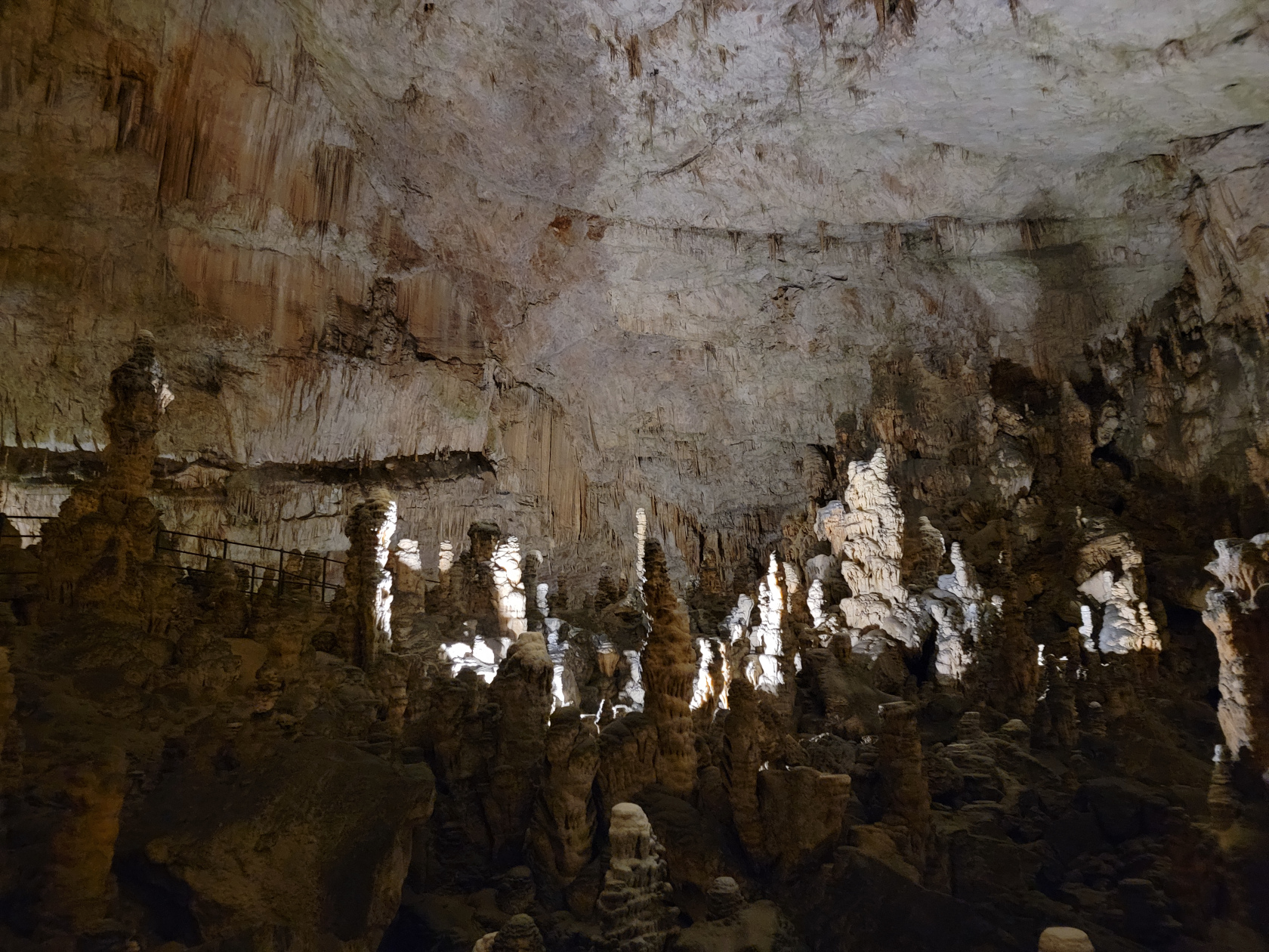
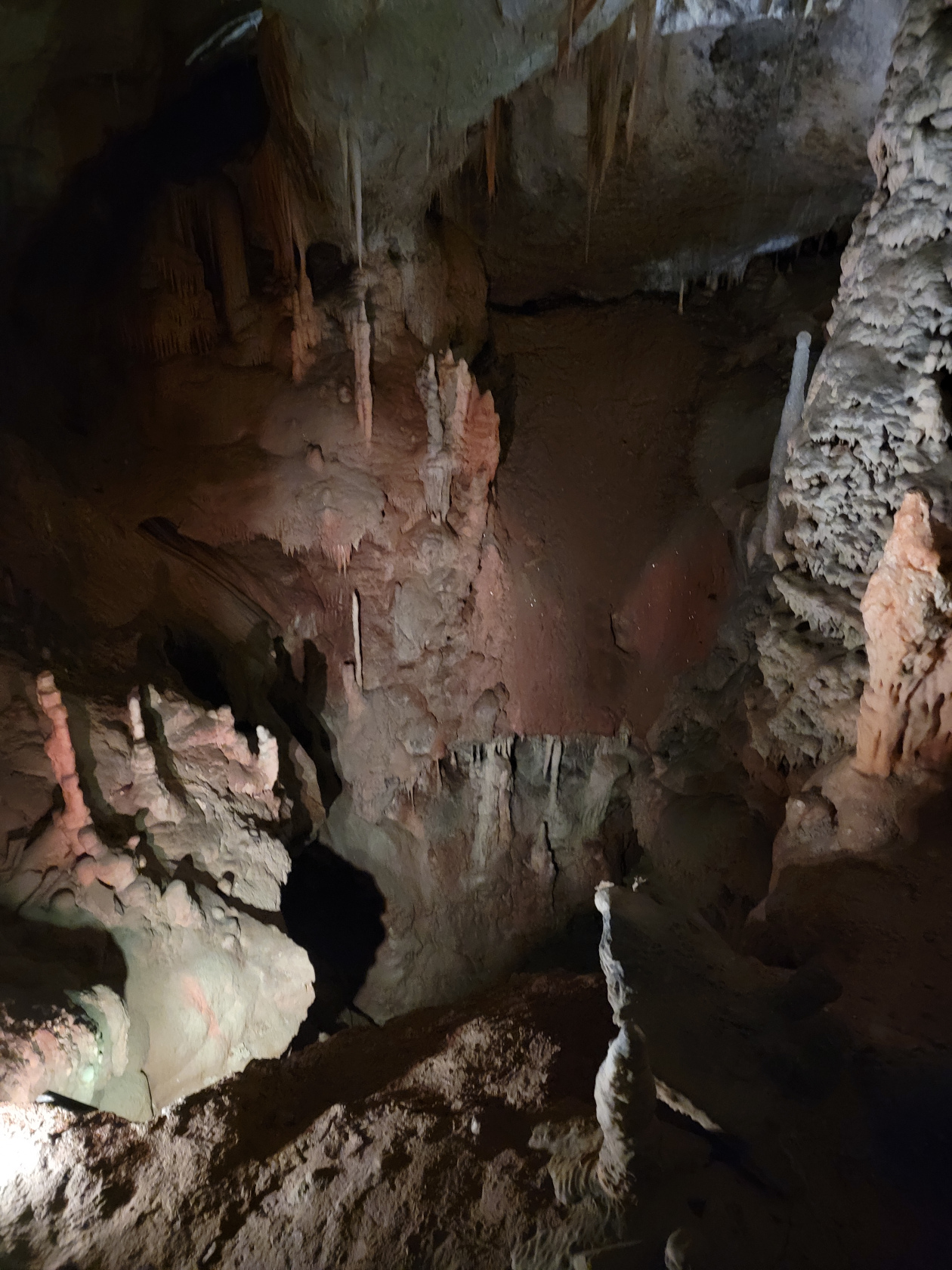
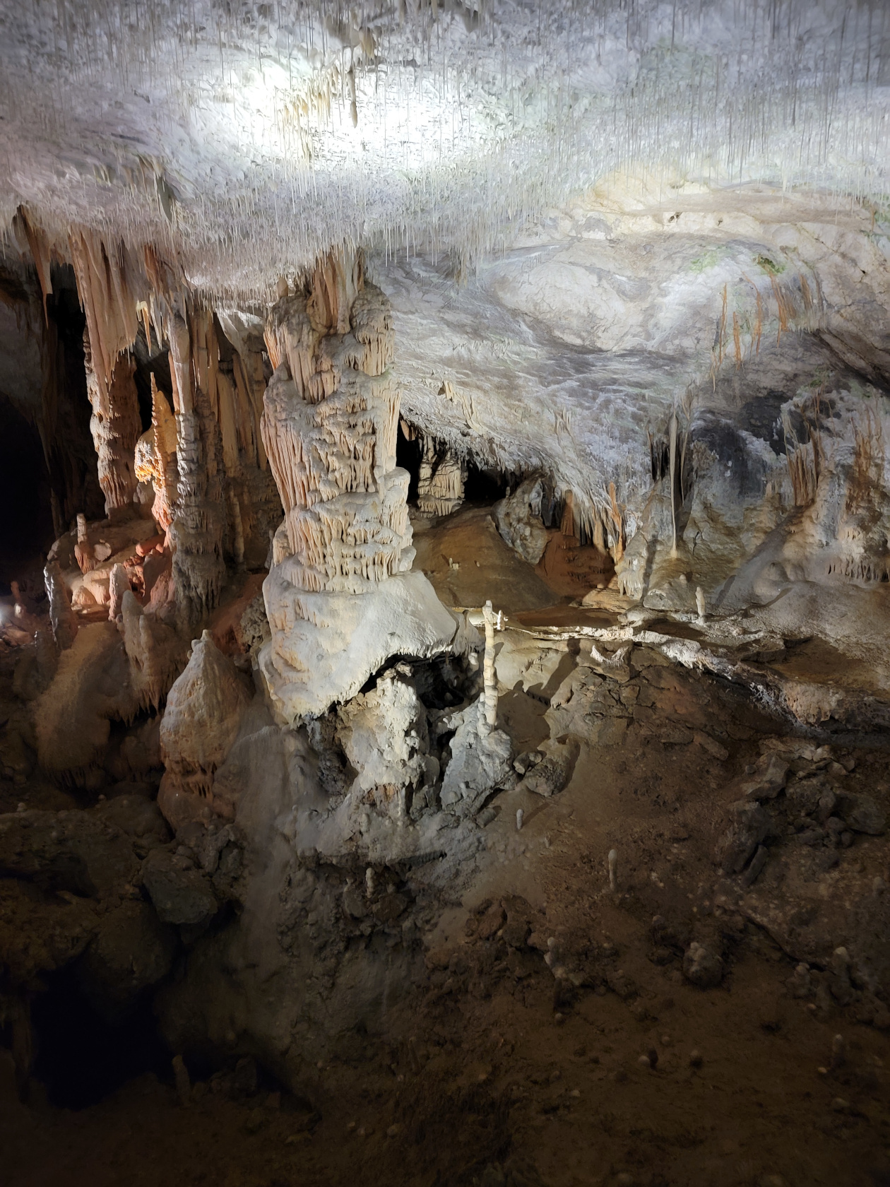
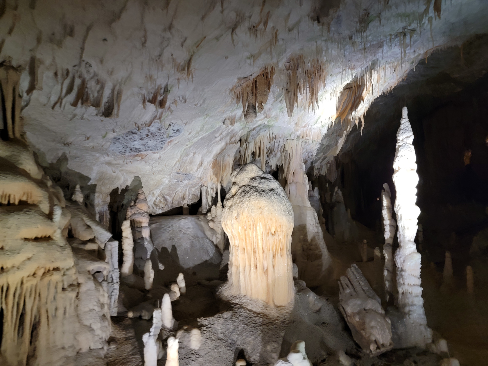
Postonja Caves – The Caves – Large Cavern
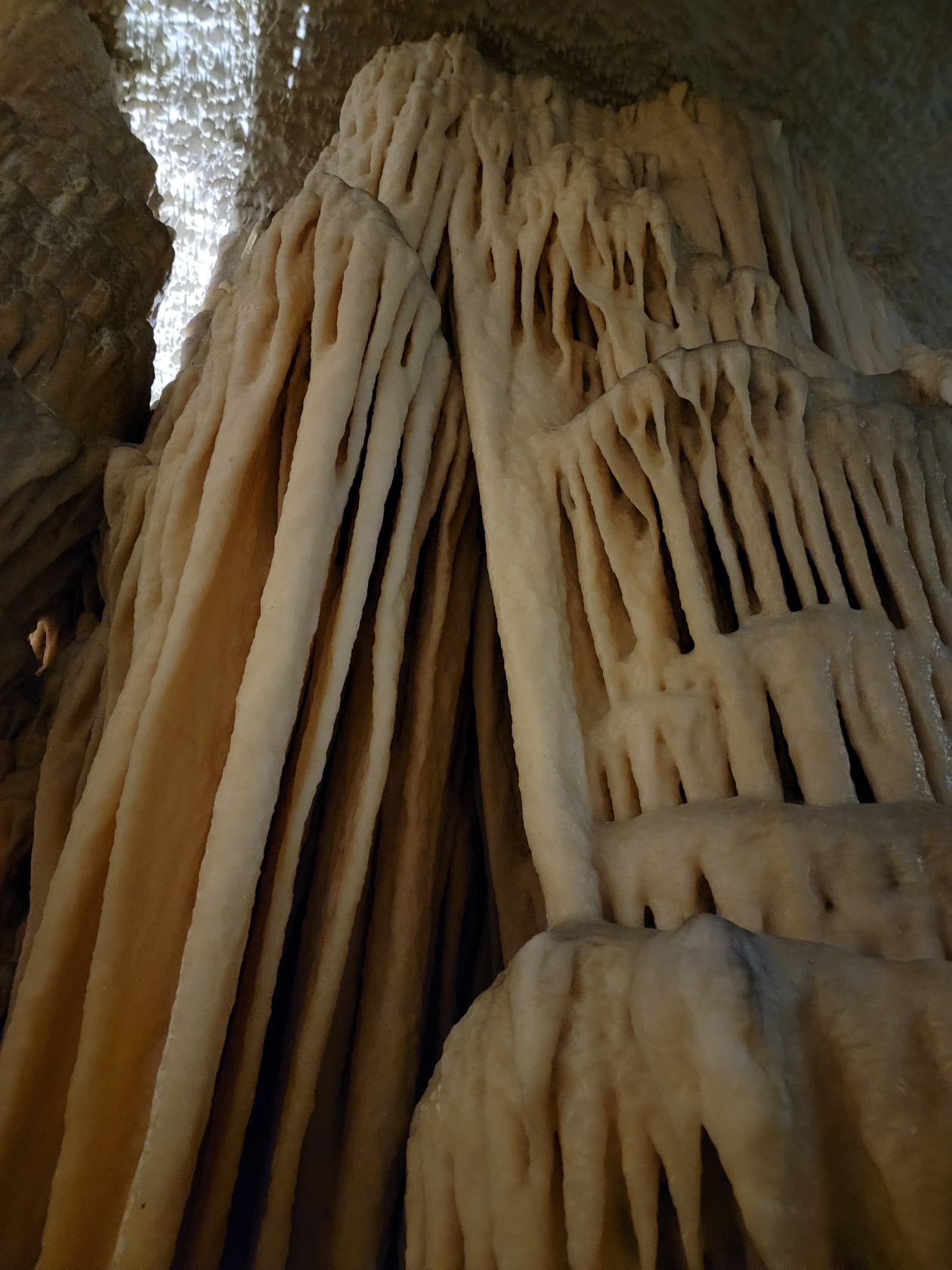
Postonja Caves – The Caves – Large Stalagcurtains
Postonja Caves – The Caves – Large Stalagmites
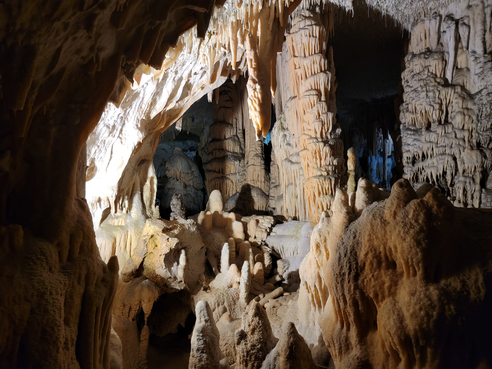
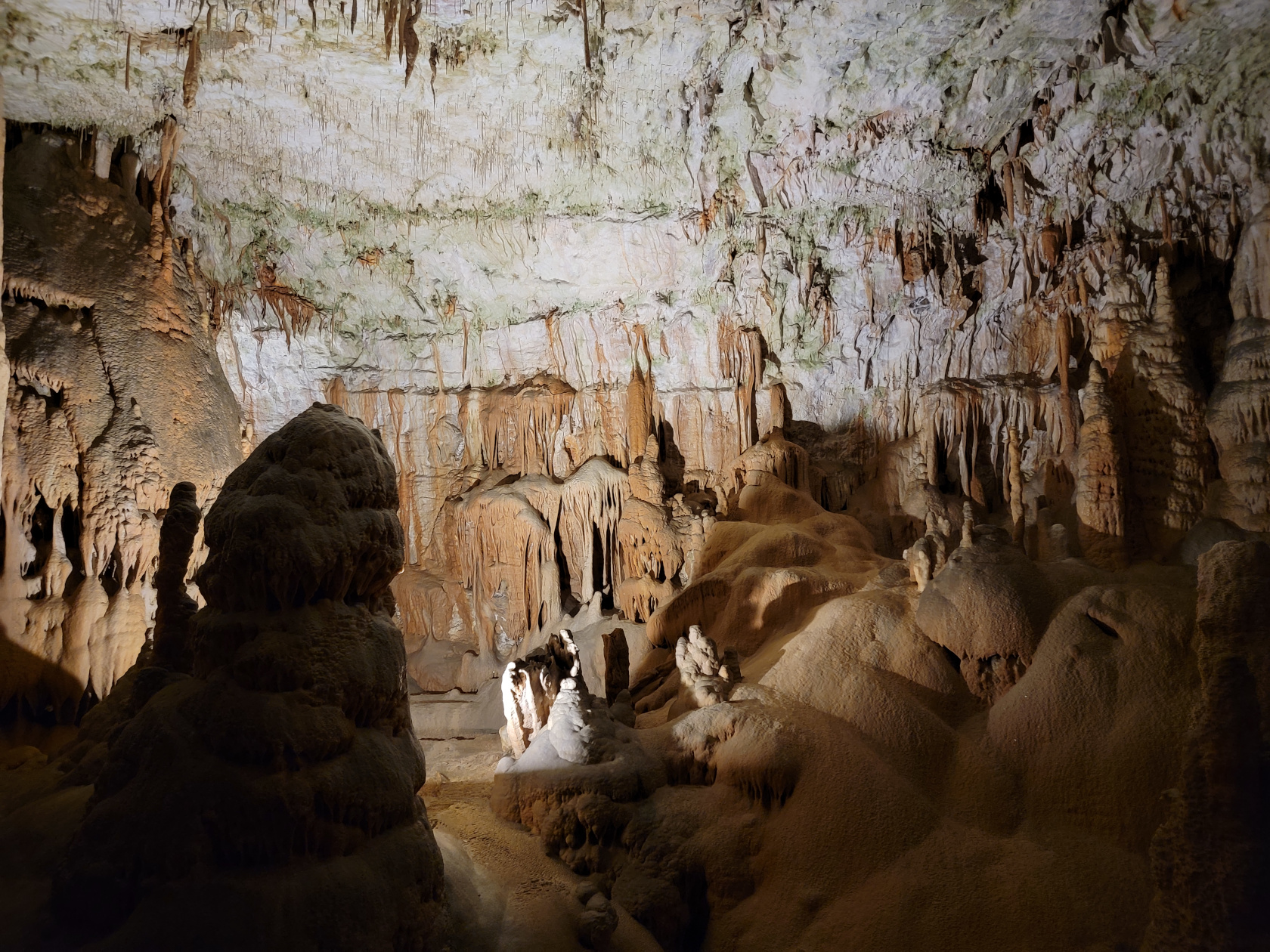
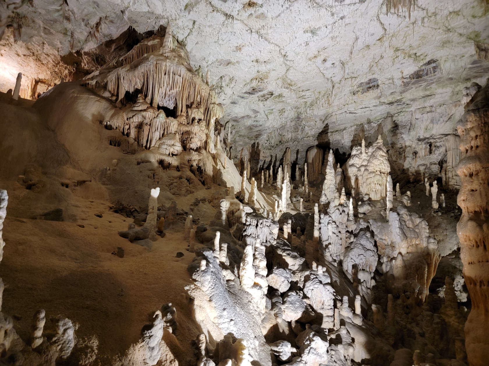
Postonja Caves – The Caves
Postonja Caves – The Caves – Spaghetti Stalagtite Cavern
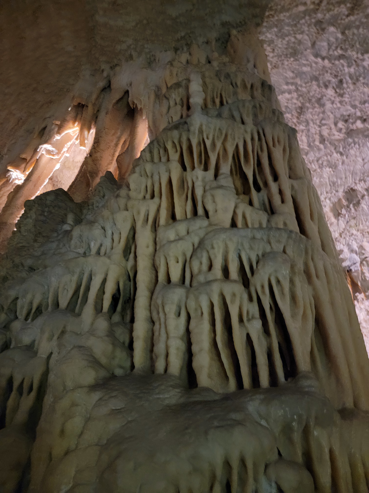
Postonja Caves – The Caves – Large Column
Postonja Caves – The Caves – Column and Spaghetti Stalagtites
Postonja Caves – The Caves – Large Stalagmites, Column and Spaghetti Stalagtites
Postonja Caves – The Caves
Postonja Caves – The Caves
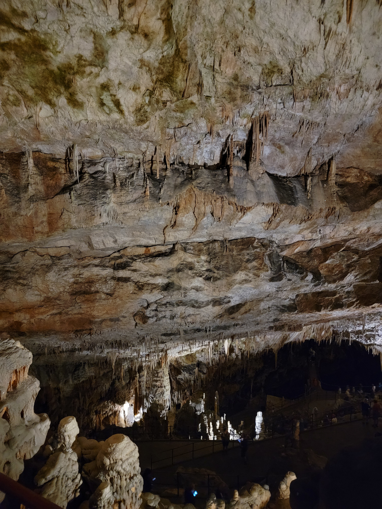
Postonja Caves – The Caves – Large Stalagmites – Leaning Tower
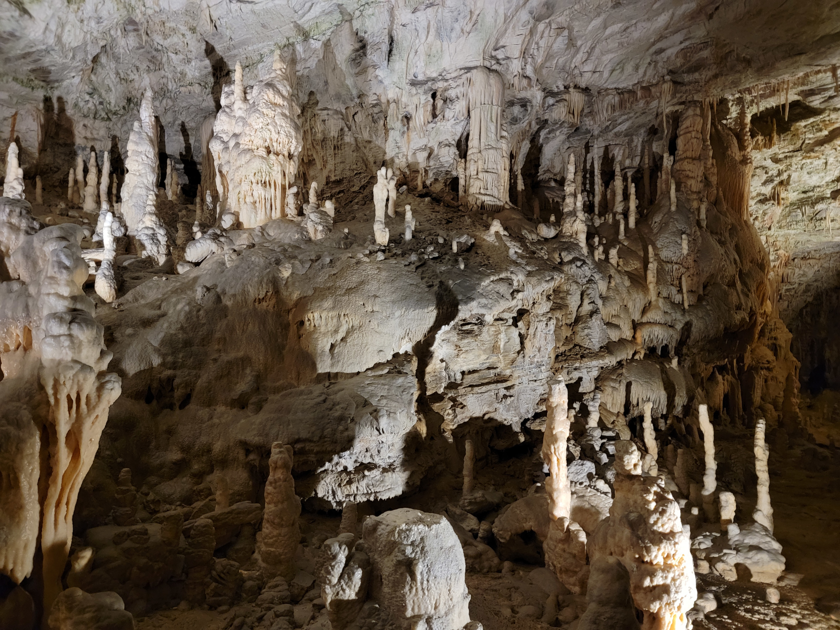
Postonja Caves – The Caves
Postonja Caves – The Caves – Calcification
Postonja Caves – The Caves – Calcification
Postonja Caves – The Caves – Column Calcification
Postonja Caves – The Caves
Postonja Caves – The Caves
Postonja Caves – The Caves
Postonja Caves – The Caves
Postonja Caves – The Caves
Postonja Caves – The Caves
Postonja Caves – The Caves
Postonja Caves – The Caves
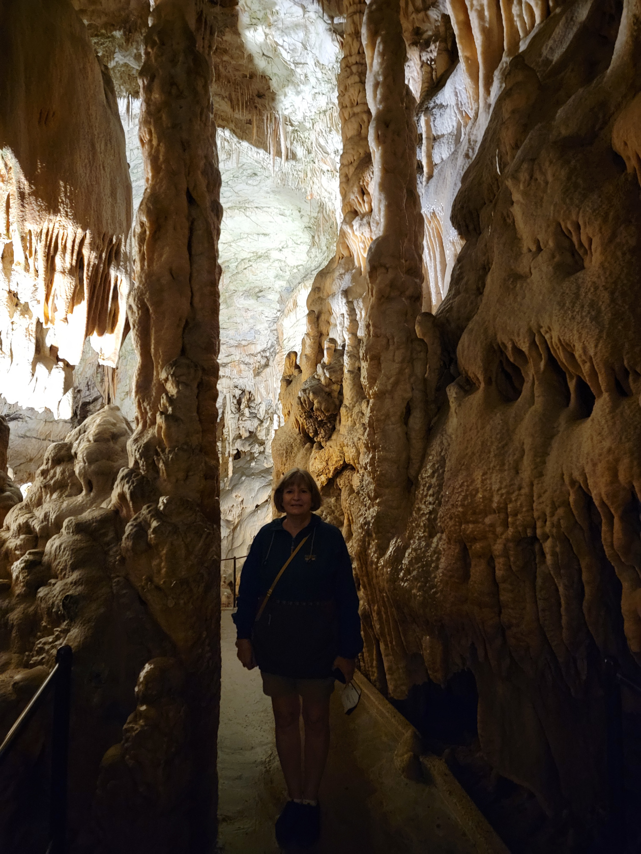
Postonja Caves – The Caves – Patti
Postonja Caves – The Caves
Postonja Caves – The Caves – Mini Columns
Postonja Caves – The Caves – Meeting Cavern
Postonja Caves – The Caves – Meeting Cavern
Postonja Caves – The Caves
Postonja Caves – The Caves – Bridge and Groom Stalagmites
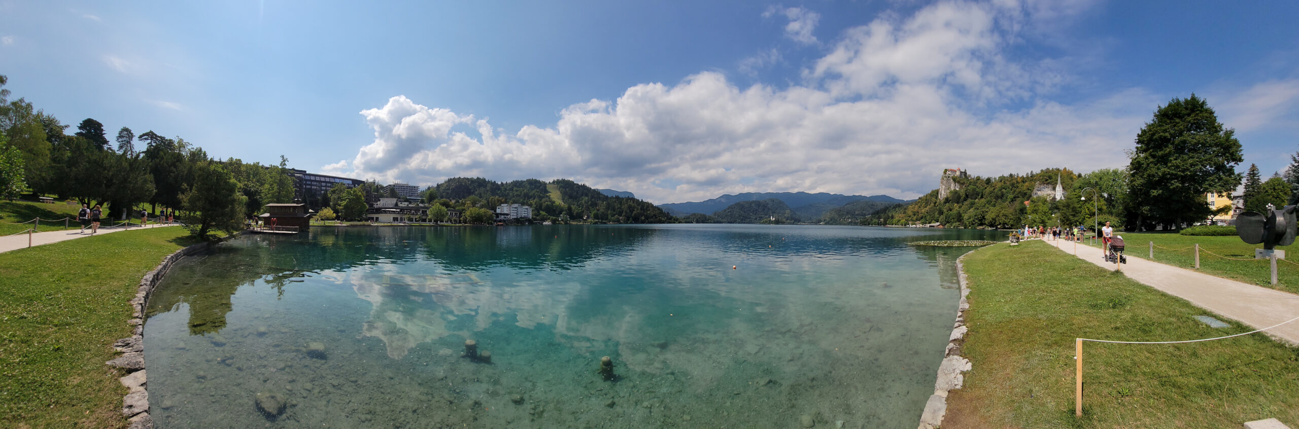
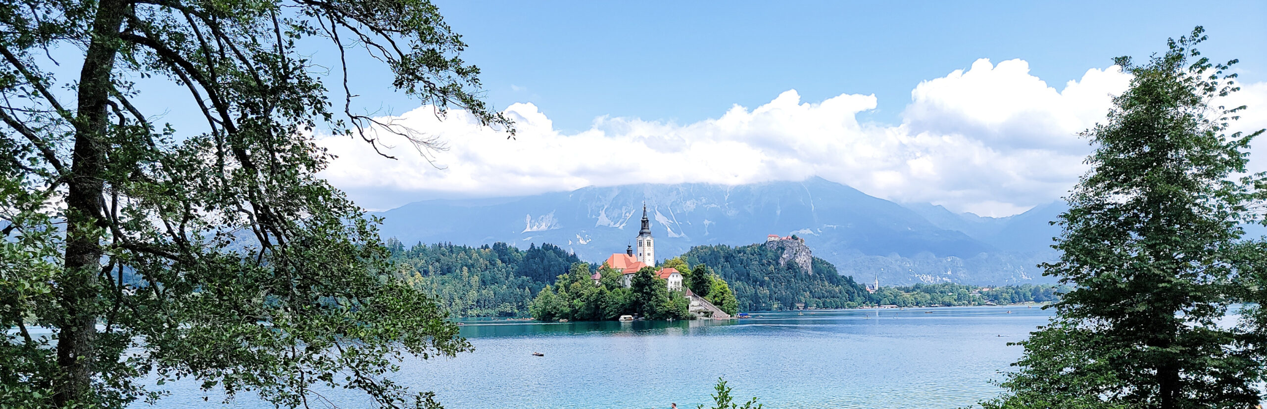
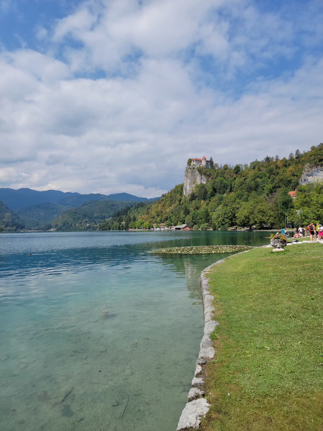
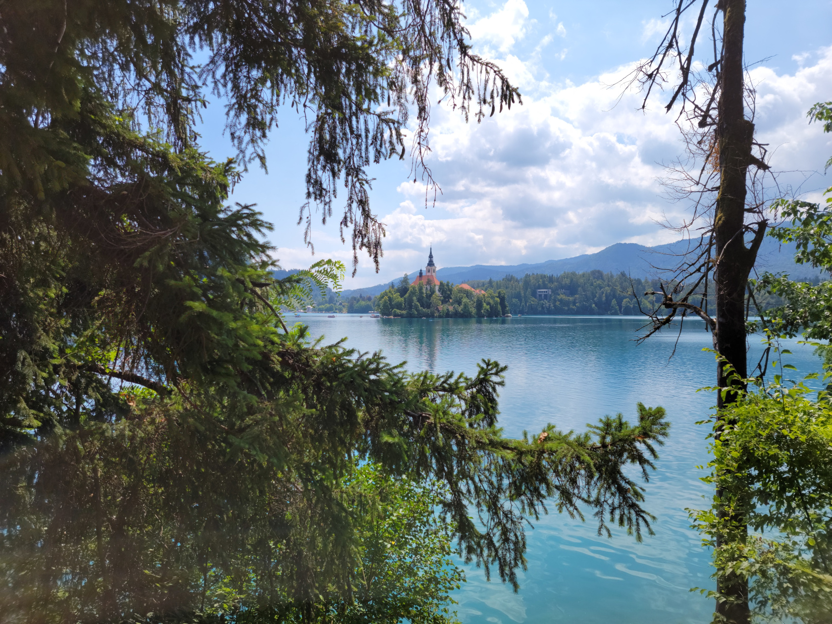
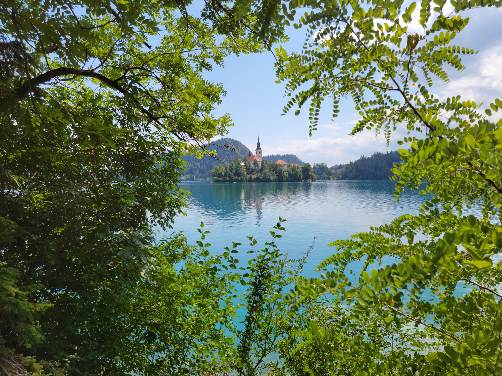
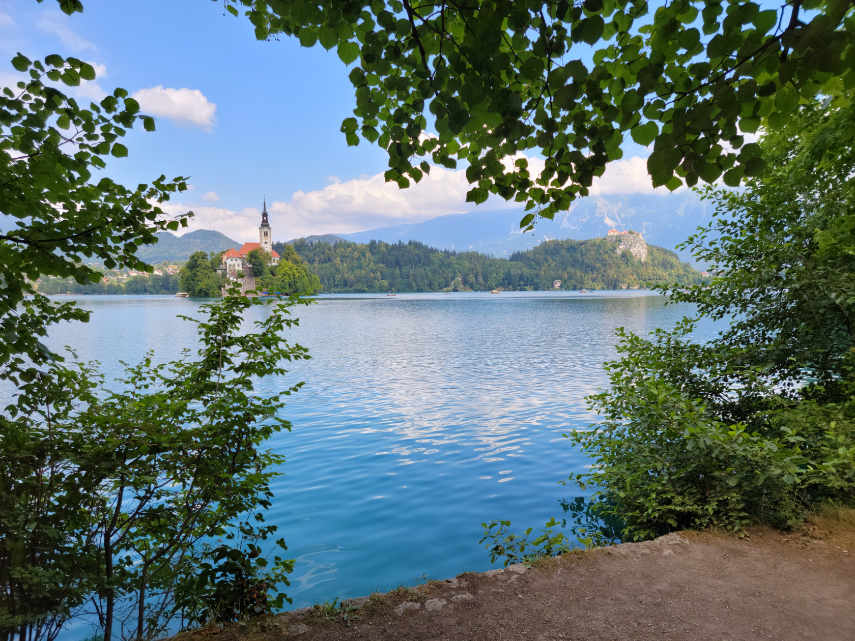
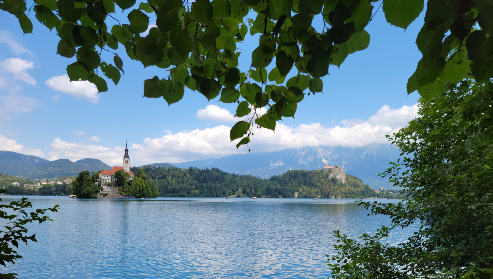
At the base of the Southern Limestone Alps[1]They are additionally known as the Julian Alps., or Karawanken Mountains, sits the small town and lake of Bled . It is almost a must see place to go on a day trip from Ljubljana, especially if you have enough time. Since we have the time, we usually overbook our stays at places that are totally unknown to us. For Ljubljana specifically, and Slovenia in general, we were happy that we did, since it afforded us a day trip such as the one to Bled. Slovenia really is a great place to visit!
Bled – entrance from parking lot – panorama
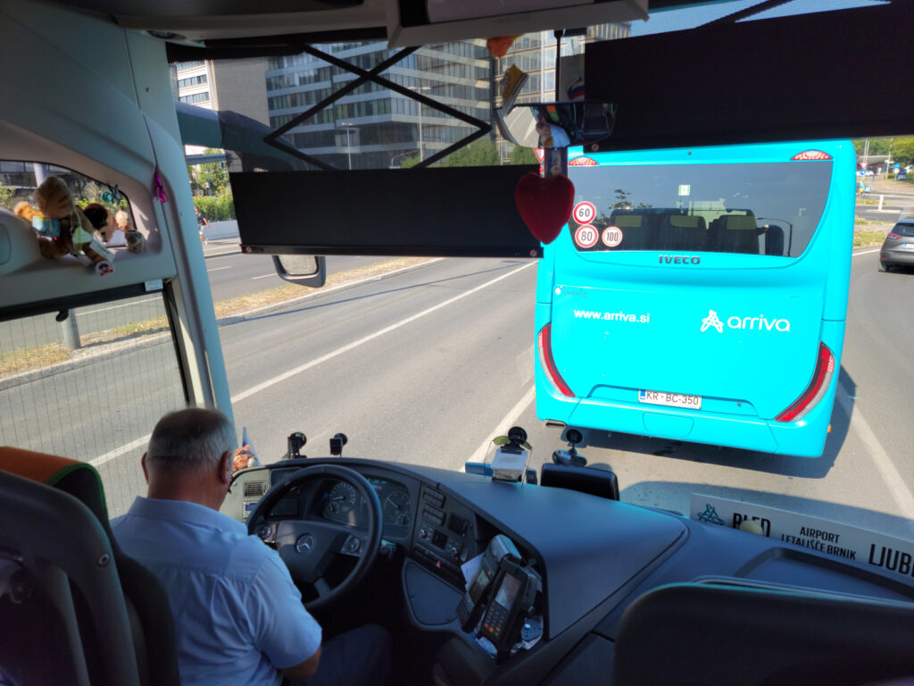
Lake Bled – Getting There
To get to the lake you must travel northwest from Ljubljana, there is the E61 that can be taken by car or bus. The trip normally takes forty-five minutes by car, and up to an hour and a quarter by bus, but can take longer if there is an accident or construction on the highway. Upon the suggestion of the information booth by the Triple Bridge we took the bus, even though we now think the train may be faster. The bus is packed, so if you are worried about Covid-19, and you should, you should be prepared to wear you FFp2 mask.
It should be noted, the bus takes two different routes going to and coming from the lake, each taking about the same time. There is of course the train, which may actually take less time gong to and fromm Bled, but then you have about a twenty or so minute walk from the town of Bled Train Station to the lake. The bus on the other hand goes all the way to the lake, even though we chose to get off at the Blen Union station.
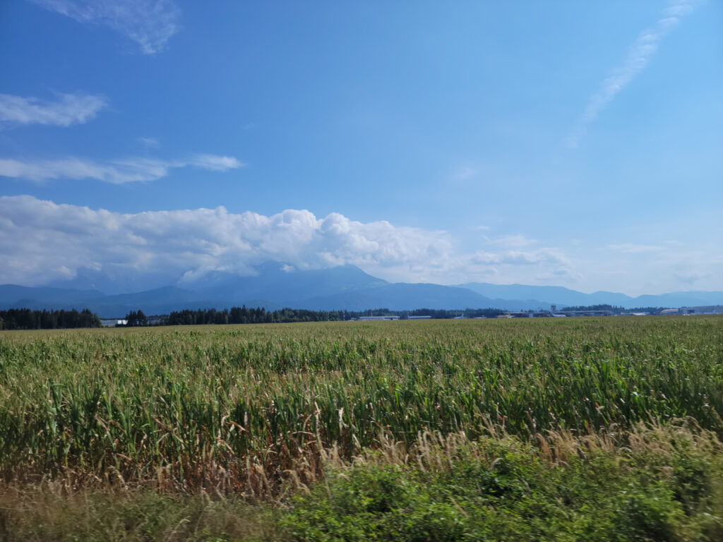
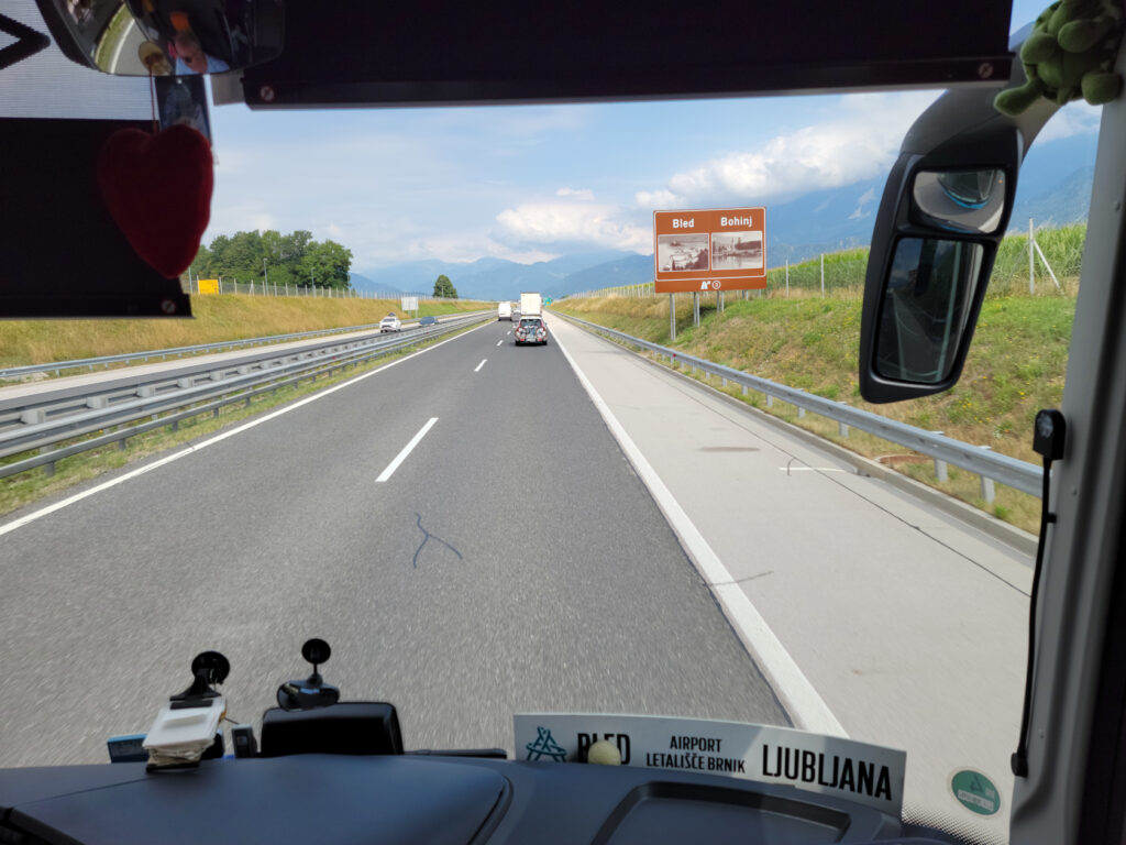
Bus Ride to Bled – Starting out
Bus Ride to Bled – Mountains along the way
Bus Ride to Bled – Sign for Bled
Bled – Upravna enota Radovljica
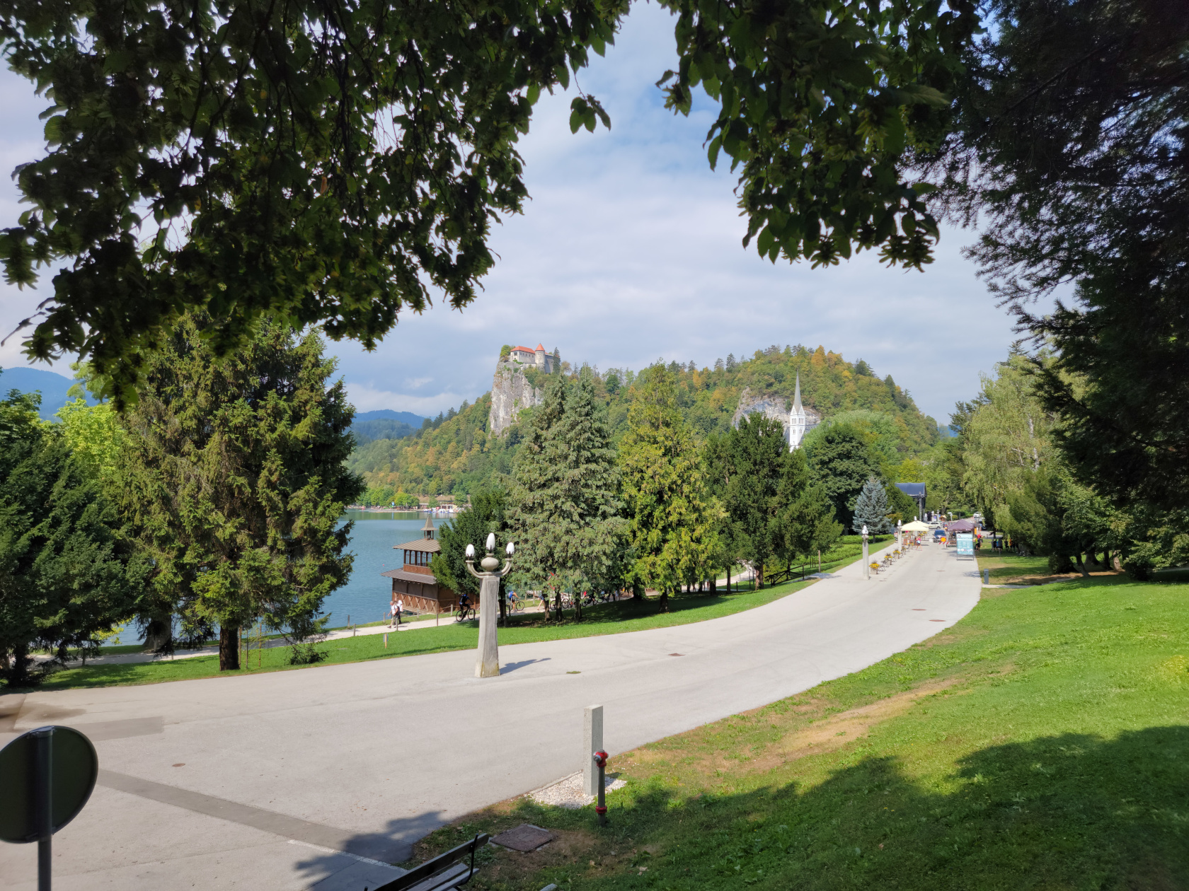
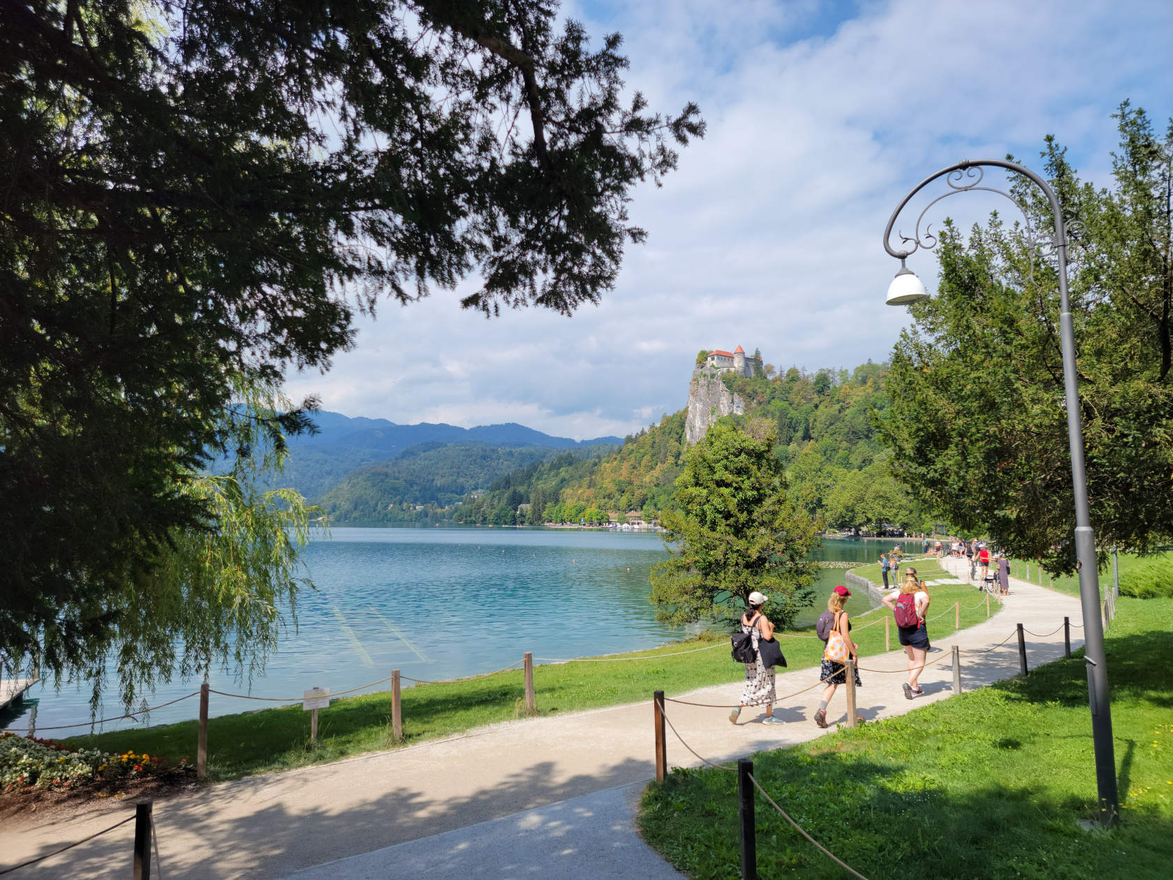
Lake Bled – The Trail
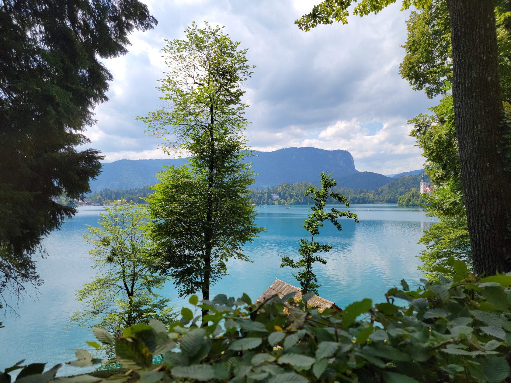
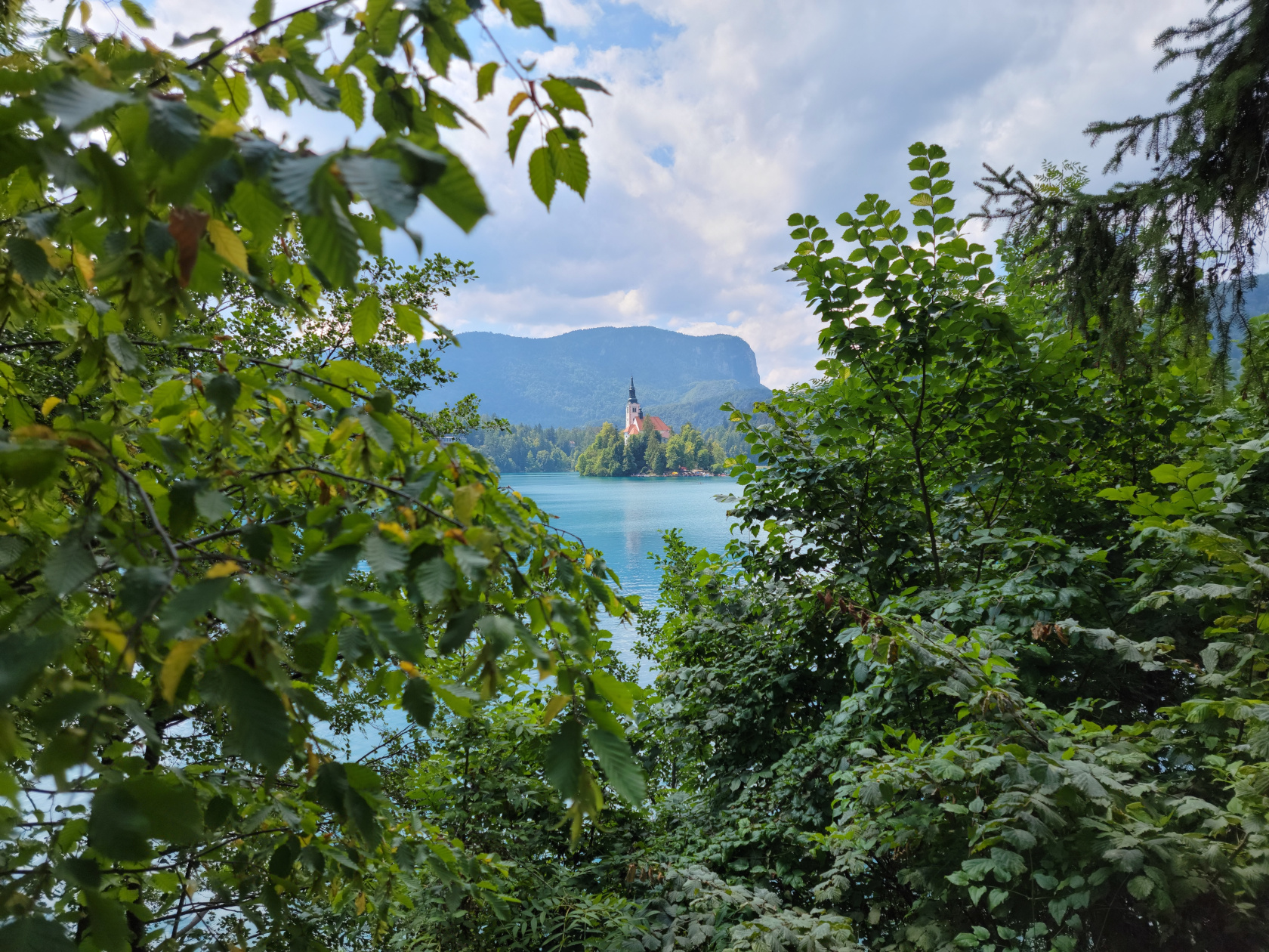
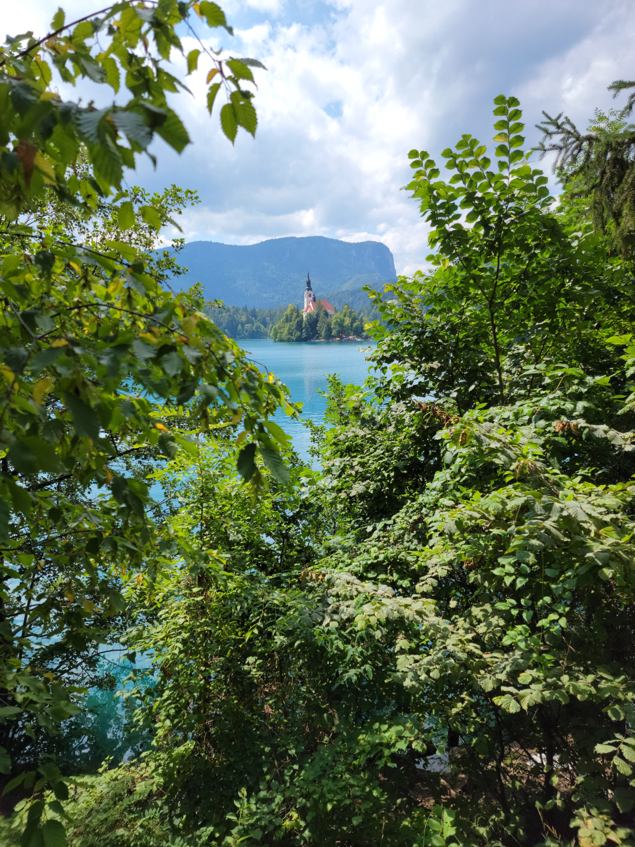
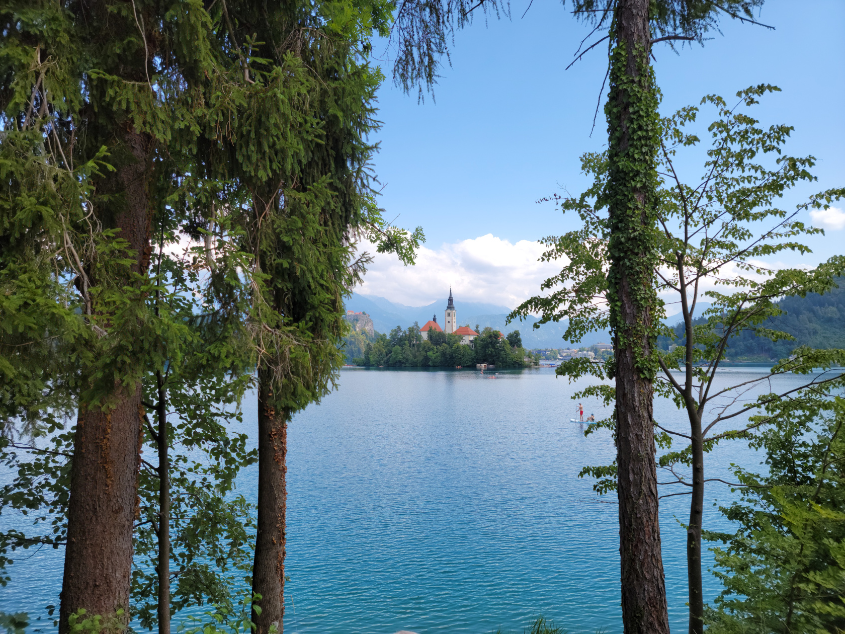
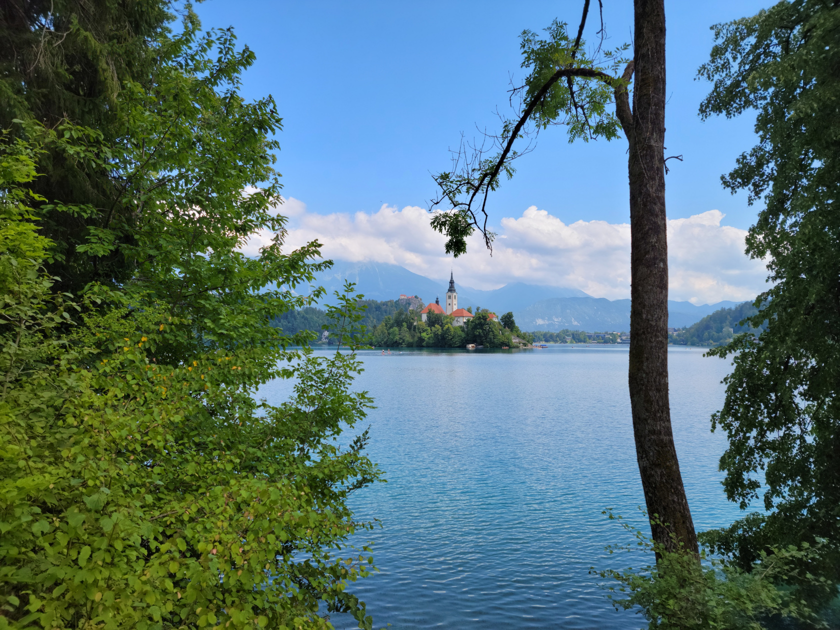
Bled – Assumption of Mary Church on Slovenia’s only island
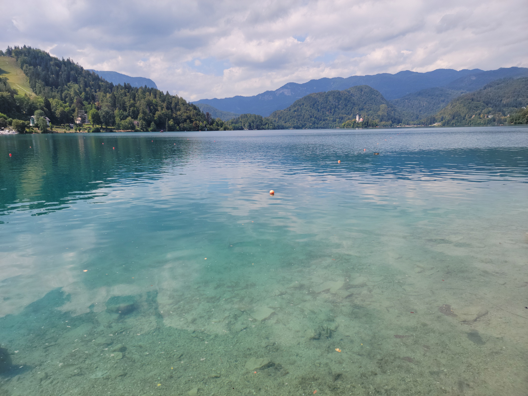
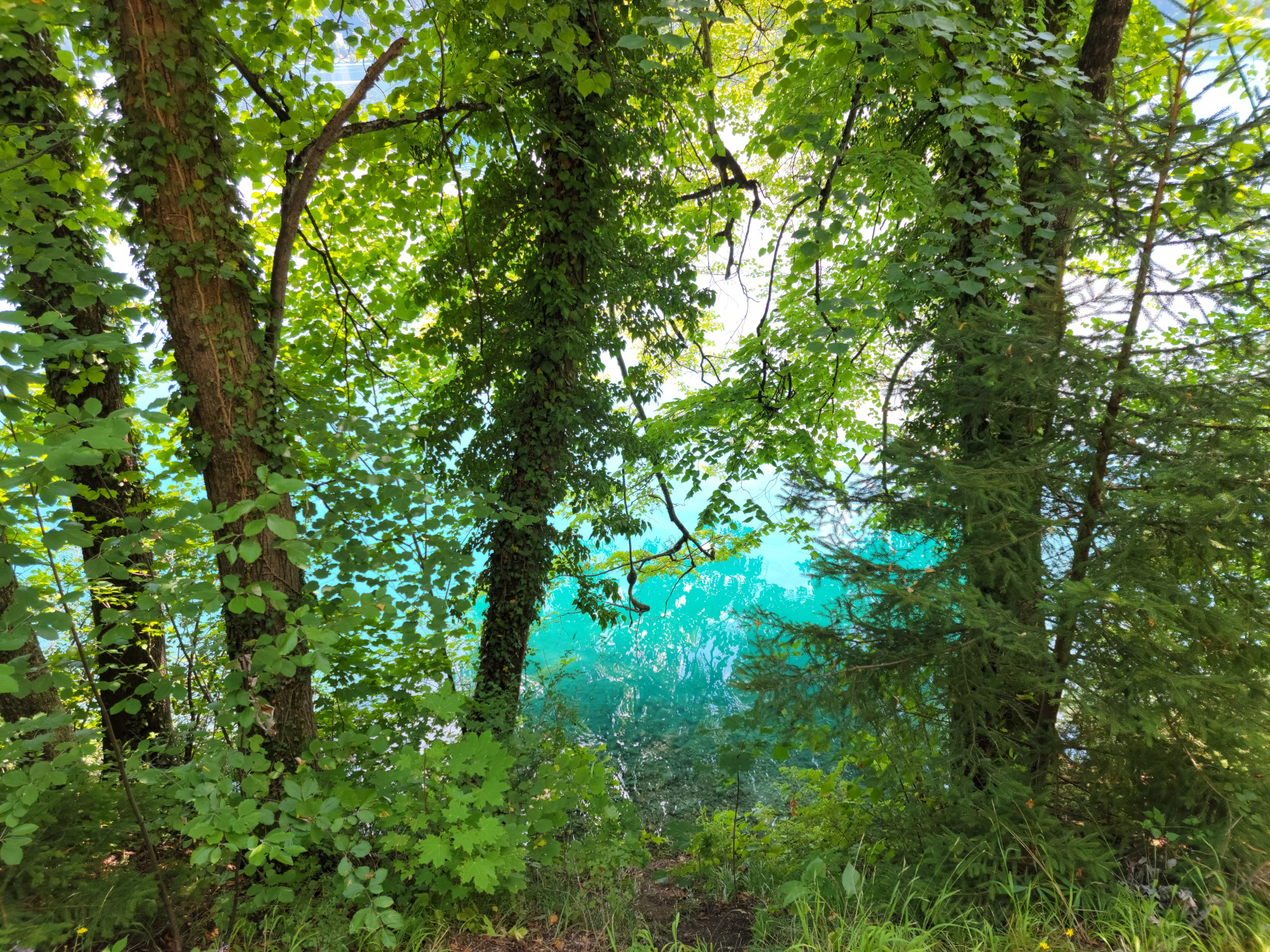
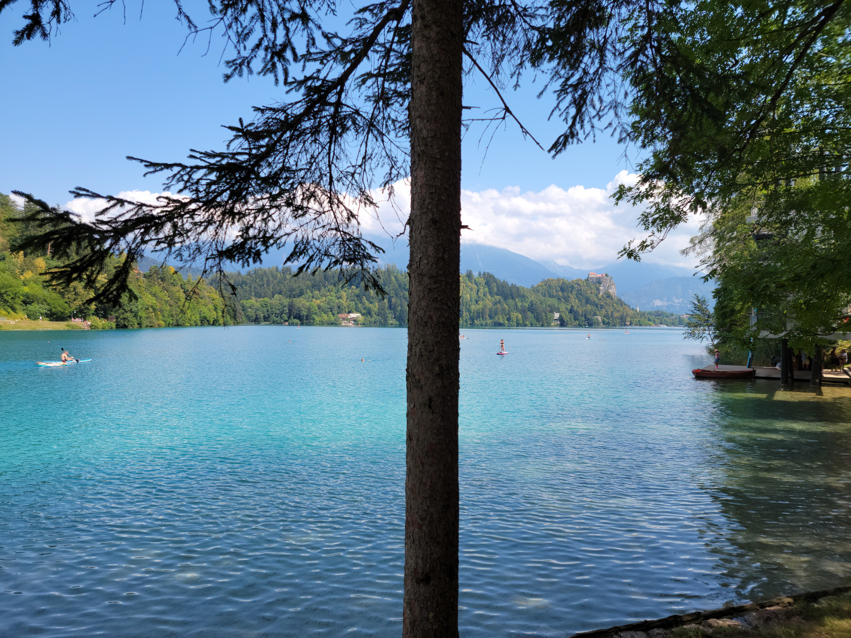
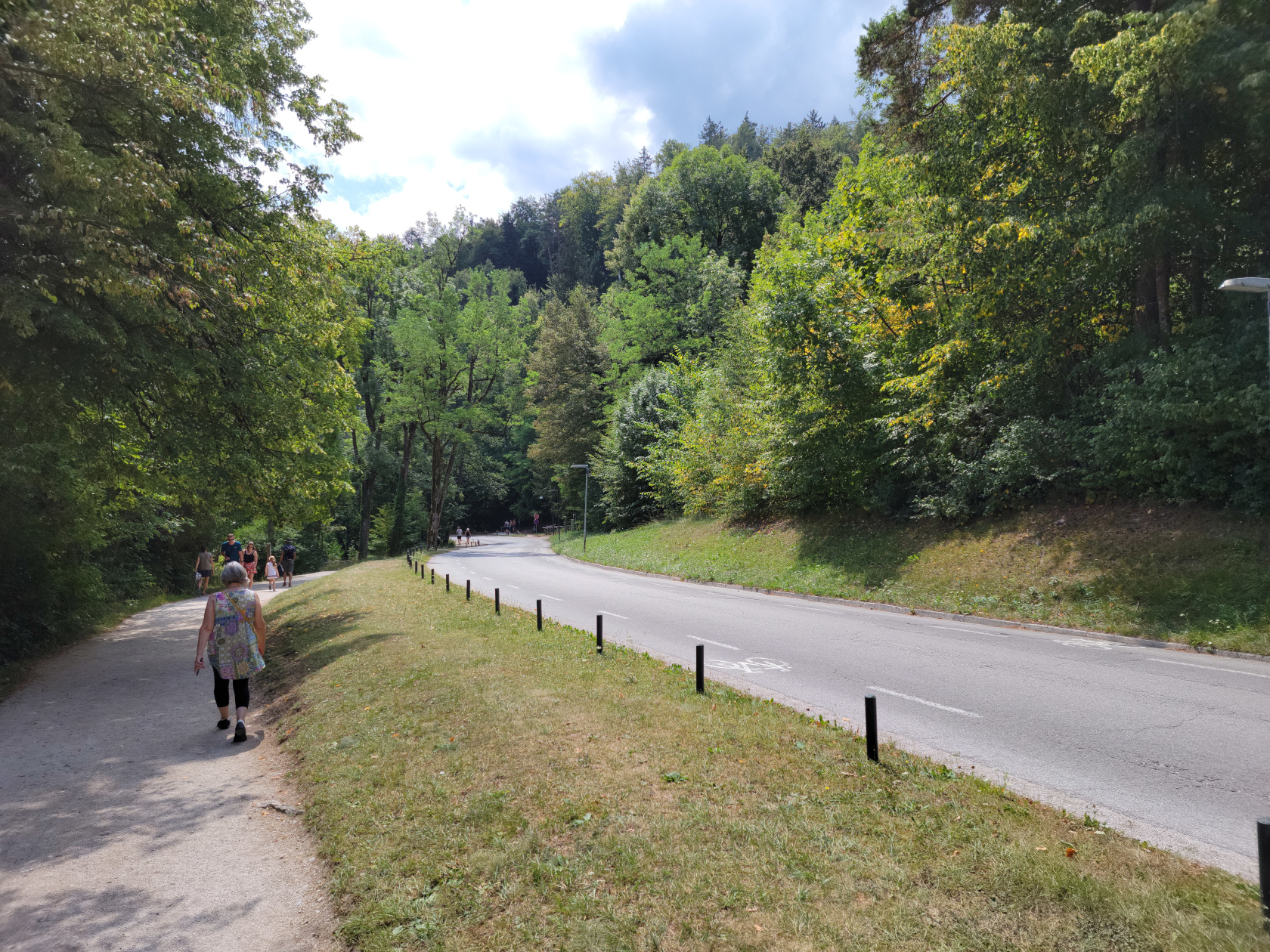
There is an excellent trail that totally circumnavigates the lake, going through several tourist beach and cafe points, any one of which you can take a pause in your walk to get refreshed.
Here is a slideshow of our great afternoon walking the lake shore trail, enjoying the beautiful weather and scenery.
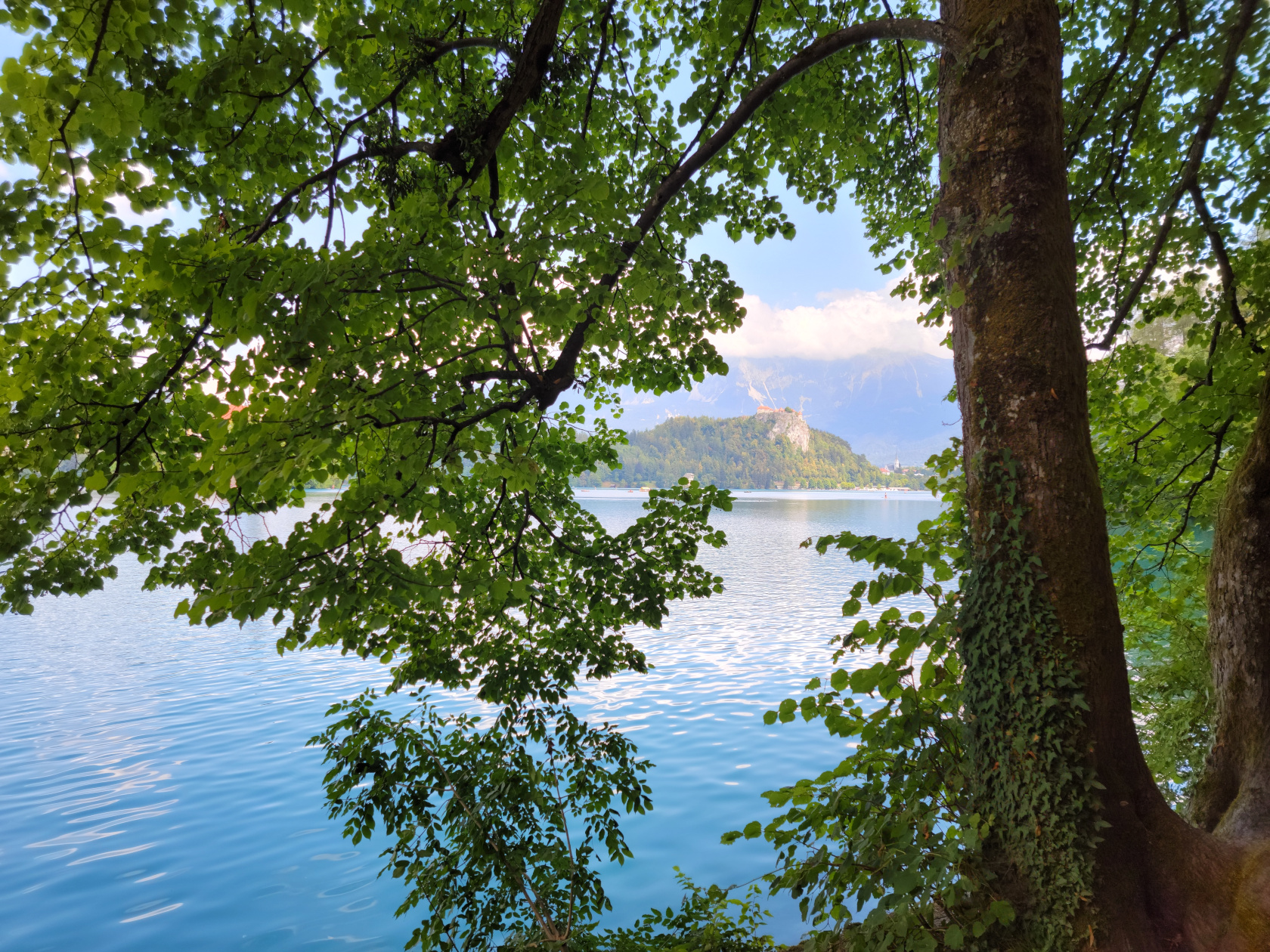
Bled – Bled Castle
Bled – entrance walkway
Bled – Bled Castle
Bled – the Julian Alps in the distance
Bled – Lake Bled is surrounded by the Julian Alps
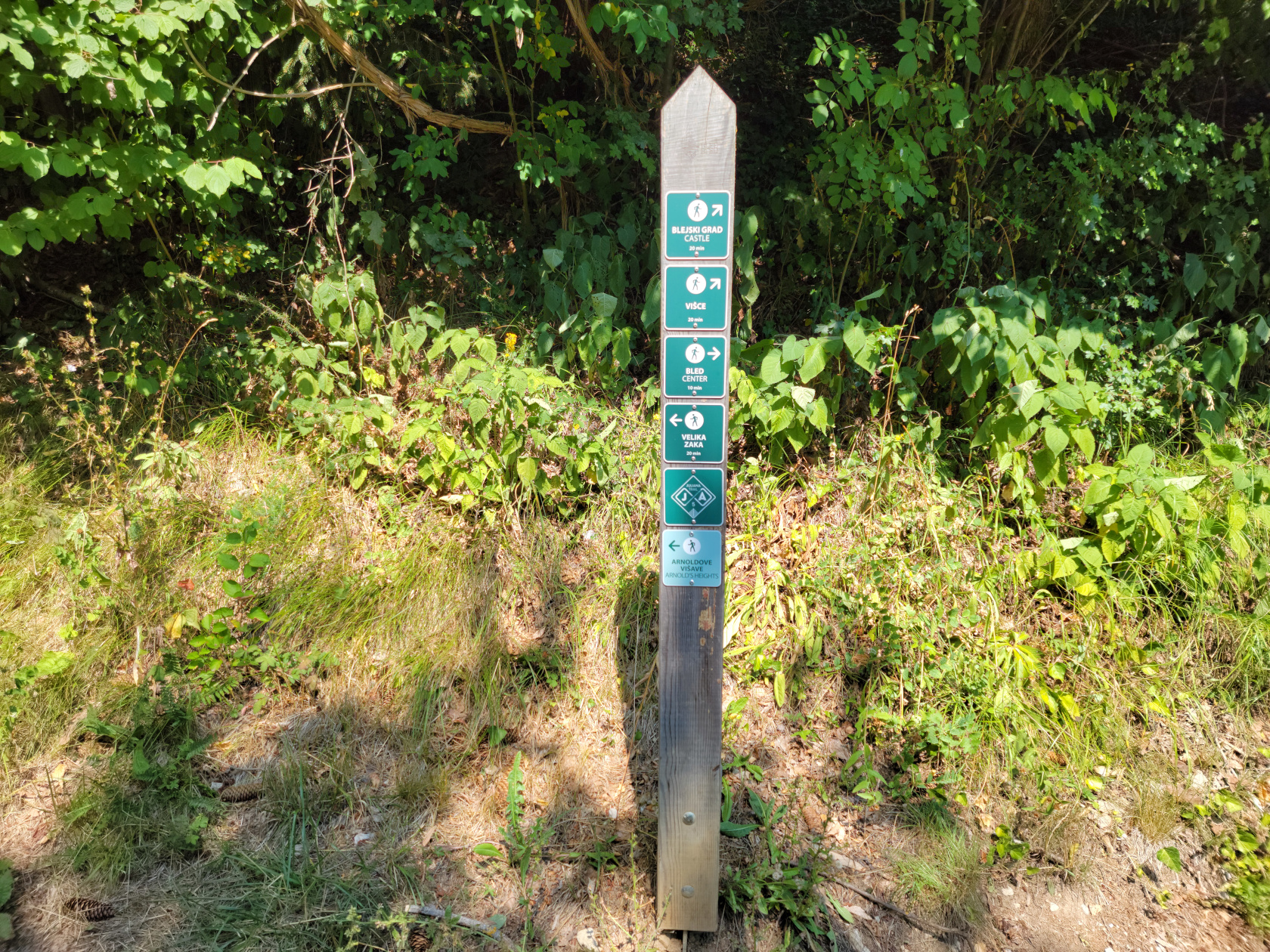
Bled – trail post
Bled – Assumption of Mary Church on Slovenia’s only island
Bled – Assumption of Mary Church on Slovenia’s only island
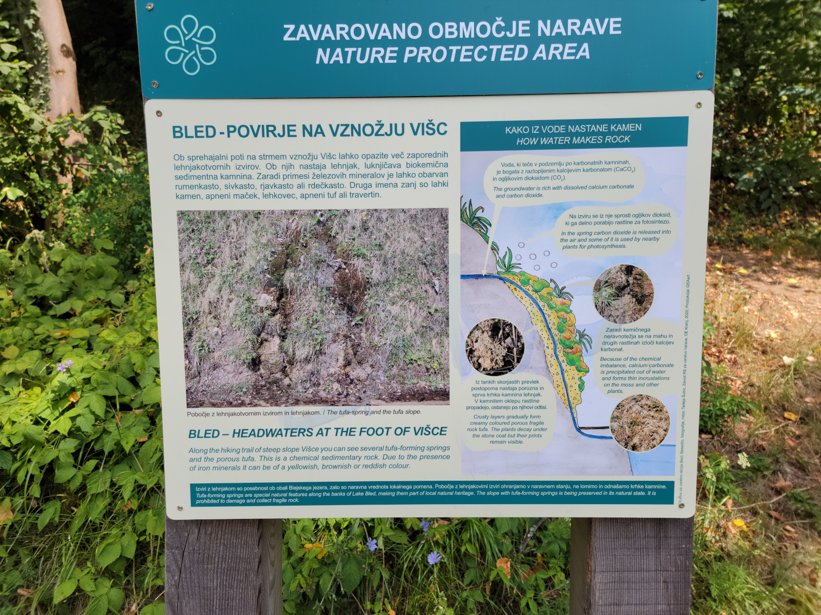
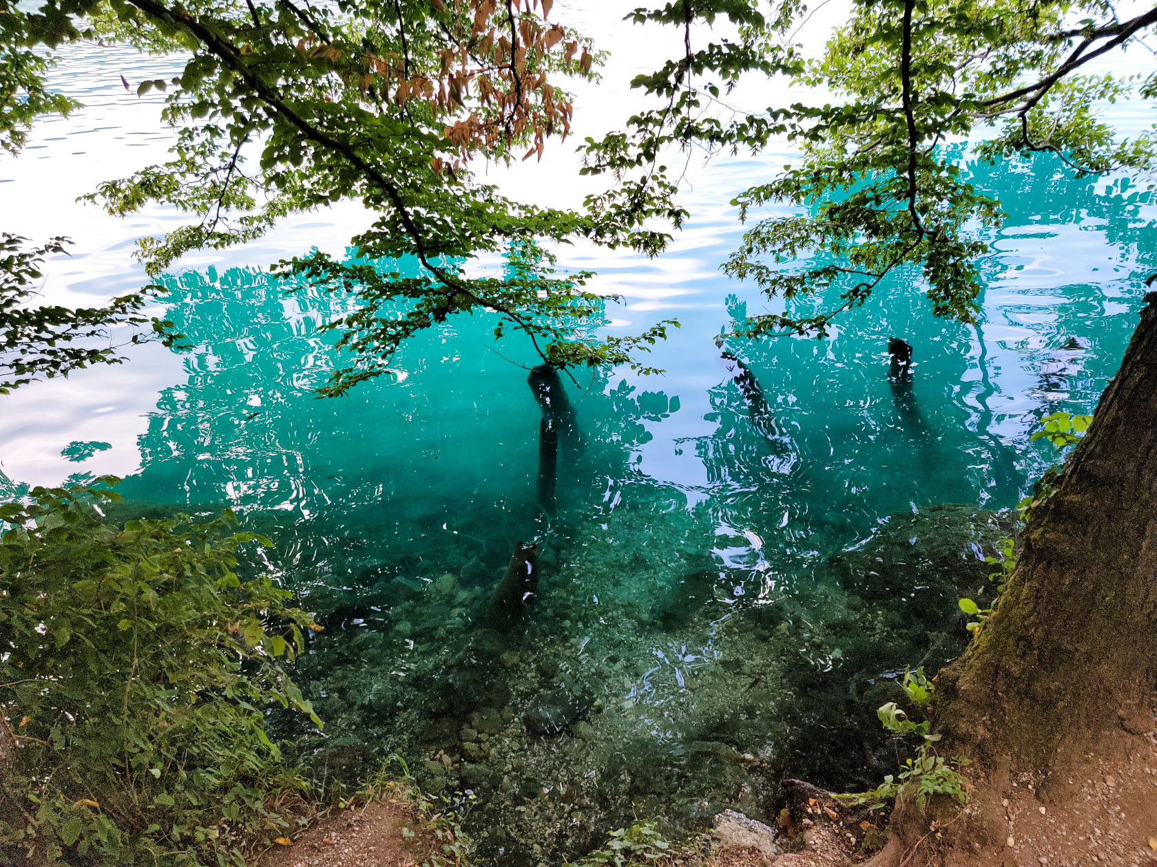
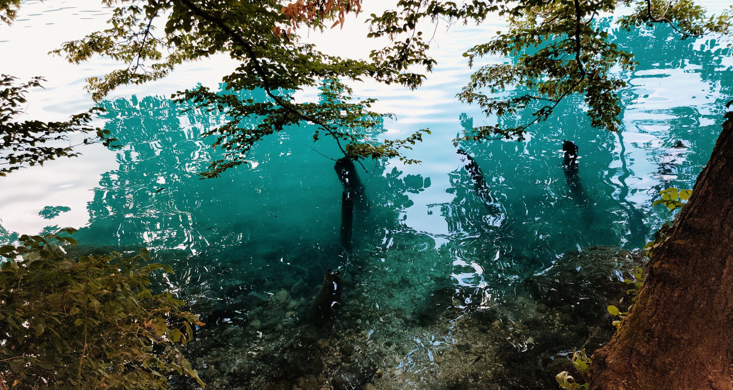
Bled – how the water runs through the rocks
Bled – Assumption of Mary Church on Slovenia’s only island
Bled – Assumption of Mary Church on Slovenia’s only island
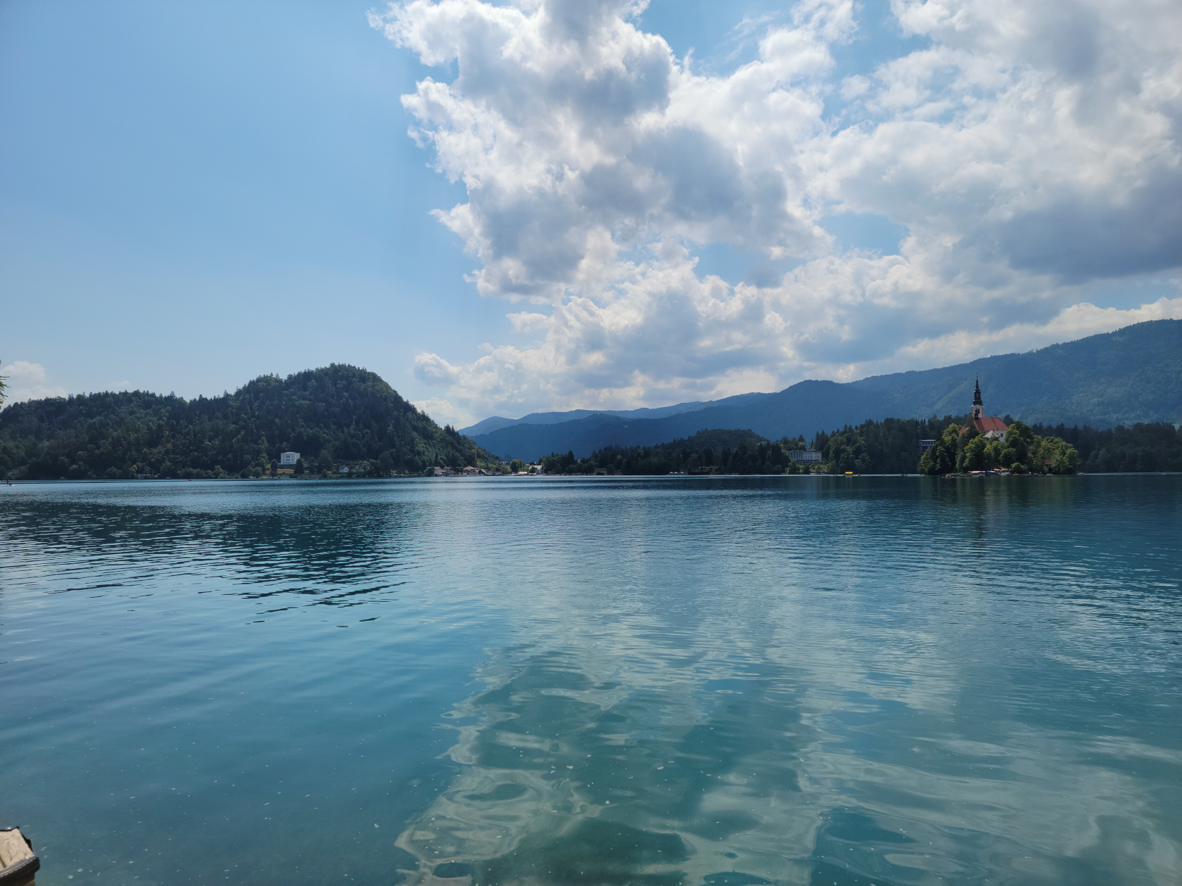
Bled – the lake water is bluish green
Bled – Assumption of Mary Church on Slovenia’s only island
Bled – Assumption of Mary Church on Slovenia’s only island
Bled – the beautiful lake Bled
Bled – Assumption of Mary Church on Slovenia’s only island
Bled – walking the trail
Bled – Assumption of Mary Church on Slovenia’s only island
Bled – Blad Castle
Bled – Assumption of Mary Church on Slovenia’s only island
Bled – Slovenia’s only island
Bled – cyan colored water
Bled – cyan colored water
Bled – walking the trail
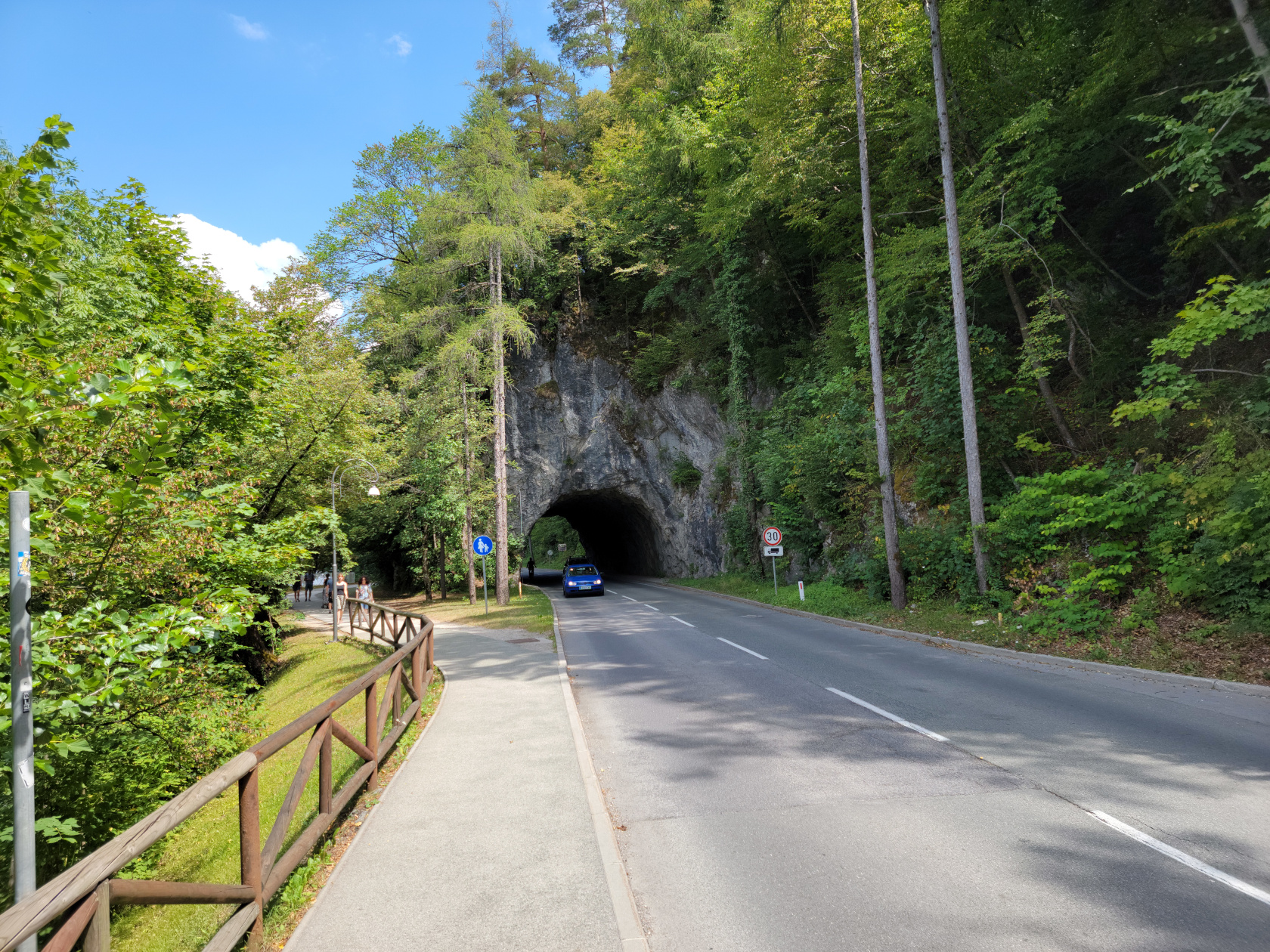
Bled – road tunnel
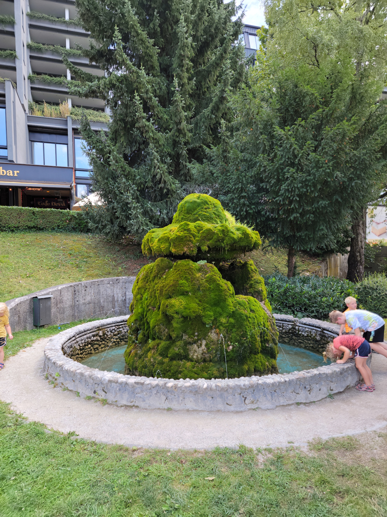
Bled – the moss fountain
Restaurants
Hotel Starkl Restaurant
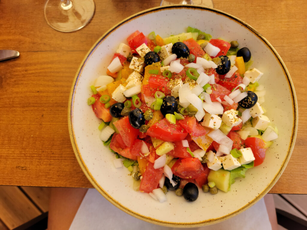
Around 12:30 or so we stopped about three quarters of the way, going anti-clockwise around the lake, at the restaurant Hotel Starkl. It is best to get to any European tourist restaurant thirty to forty-five minutes in advance, because at one o’clock they fill up quickly. Here we purchased simple salads and enough wine and water to enjoy the fabulous weather.
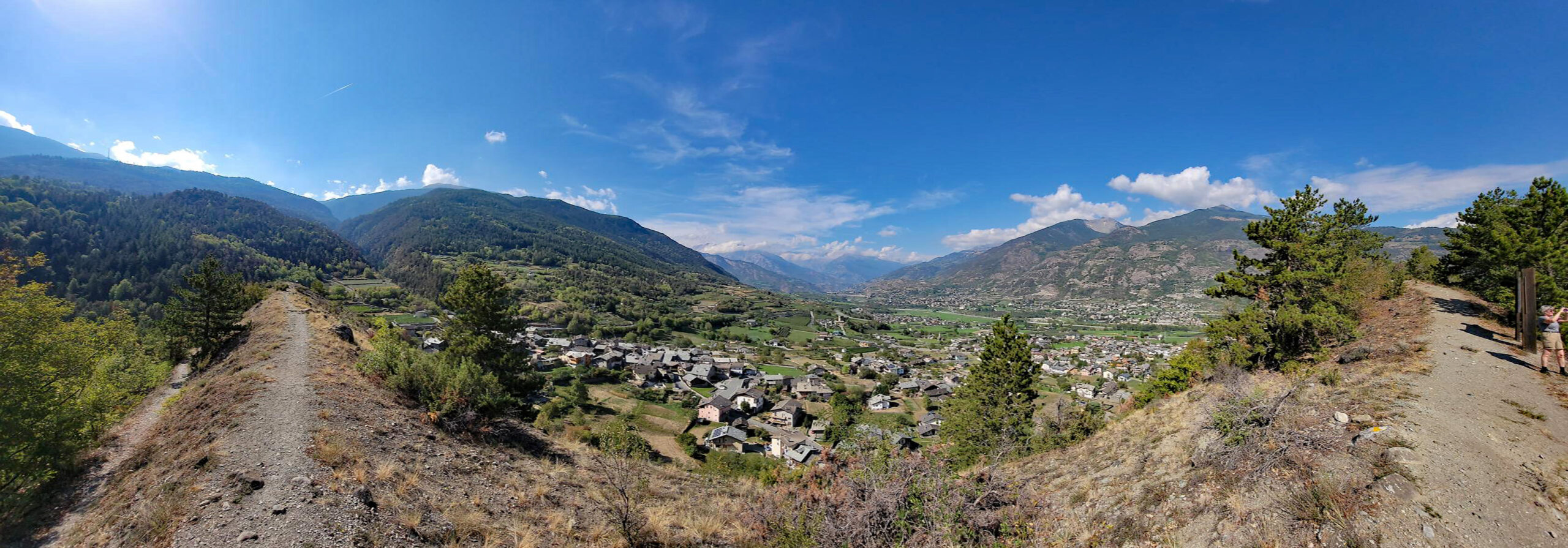
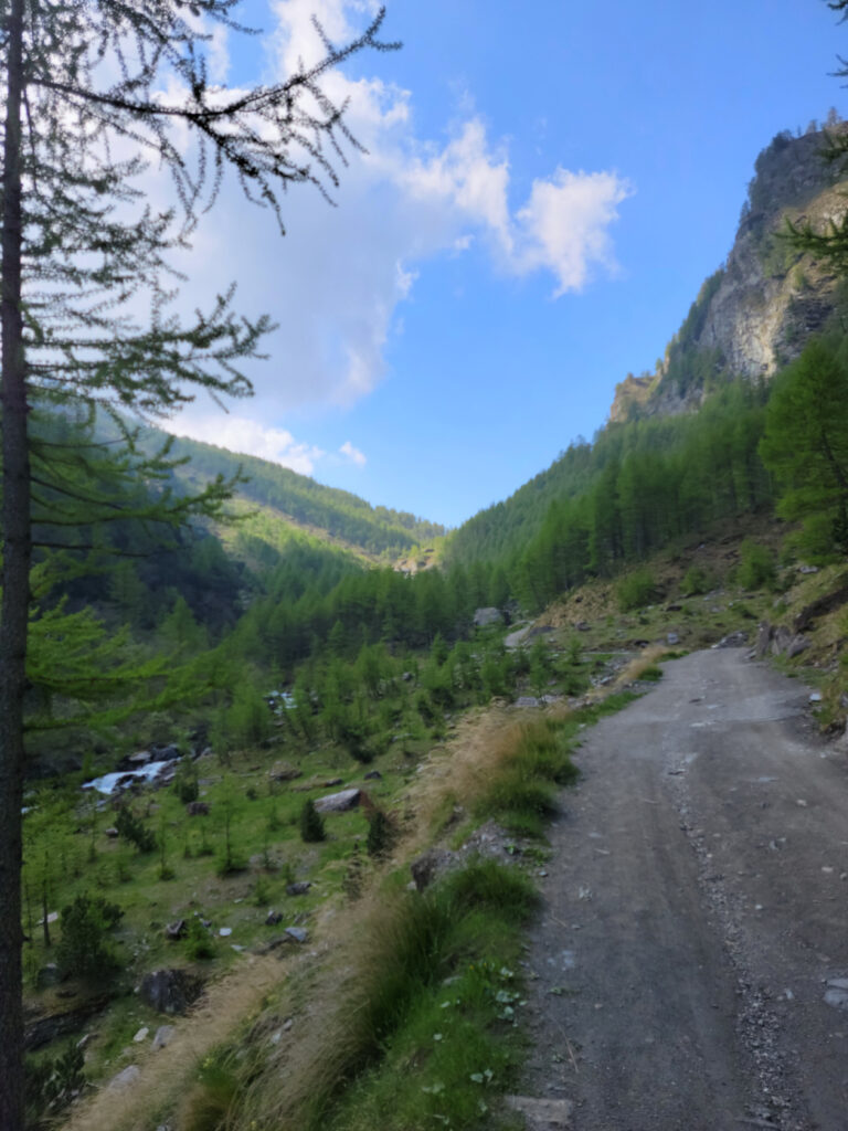
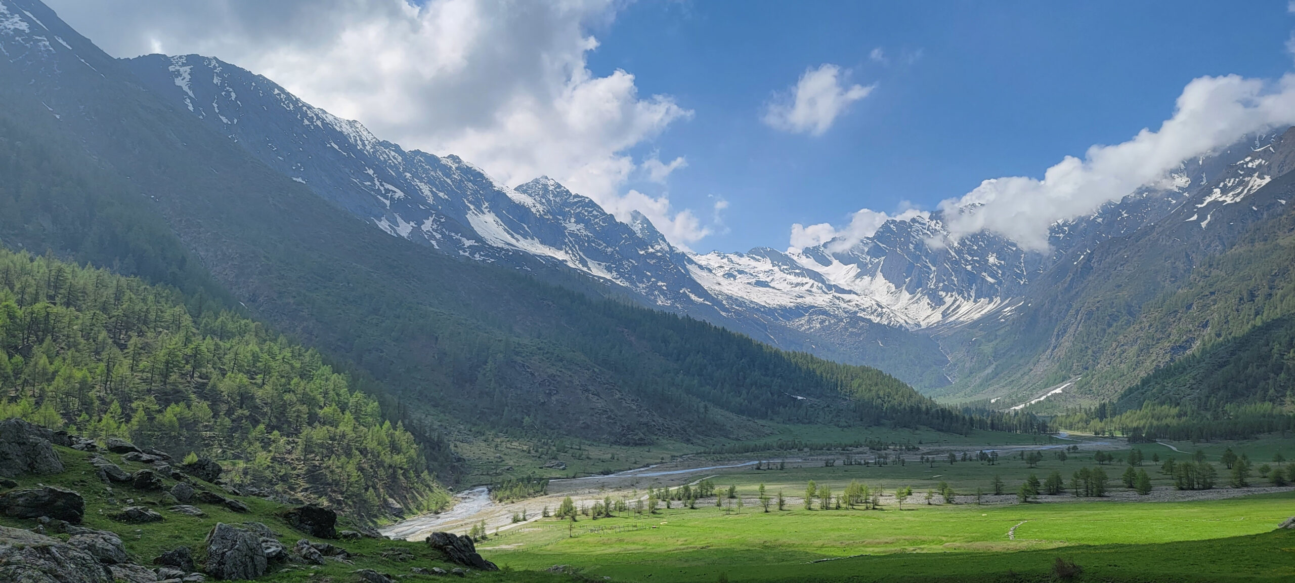
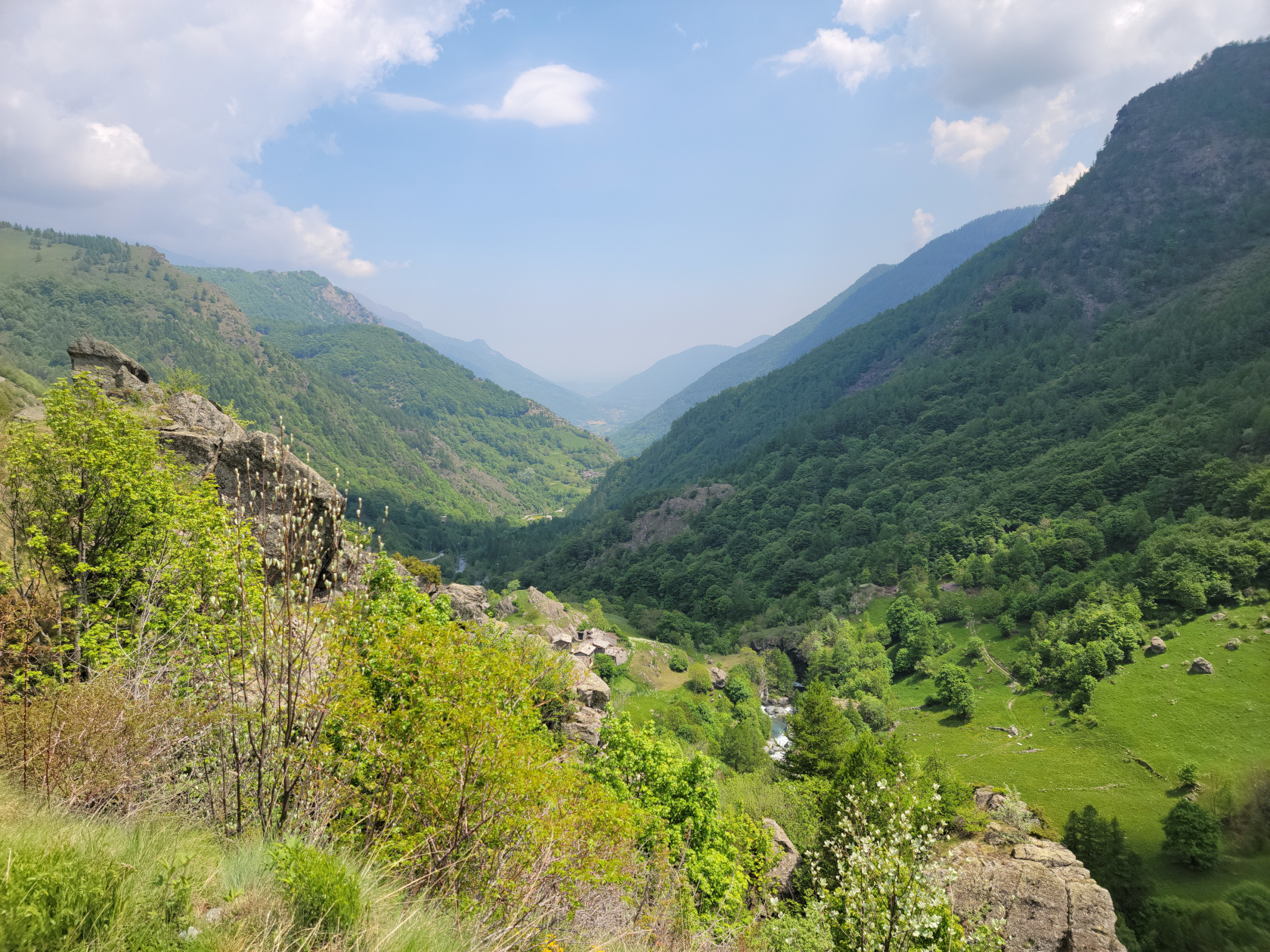
An easy day hike from Villanova in Val Pellice, or the Pellice River Valley, later to become the Torrente Pellice, is the destination of the Refuge of Willi Jervis, known locally as Rifugio Jervis. The Pellice is actually formed on the western flank of Mount Grenaro, which would be down the valley pictured below and to the left.
View near the Rifugio Jervia at 1740 meters (about 5710 feet) by the Torrente Pellice
The Hike
Though the hike should have only taken us a hour and fifteen minutes up and the same back, it took us approximately three and a half hours. Some of this was taken up by stopping for photographs and the occasional drink (it is important to stay hydrated, especially when it gets warm, plus at altitude the body loses more moisture, so be careful). This of course cannot be helped when faced with a new experience and such beauty.
Starting Point Villanova
The drive from Malpertus to Villanova took all of ten minutes on the windy roads of the Conca Cialancia Natural Park , which includes the Val Pellice and the surrounding mountains. Our hosts, Sam and Lisa Chiodo at Renovating Italy at Borgata Malpertus, are amazing and were kind enough to give us a ride and later pick us up at the start of the trail in Villanova. If you are looking for a home base in the area, look them up, they are both great.
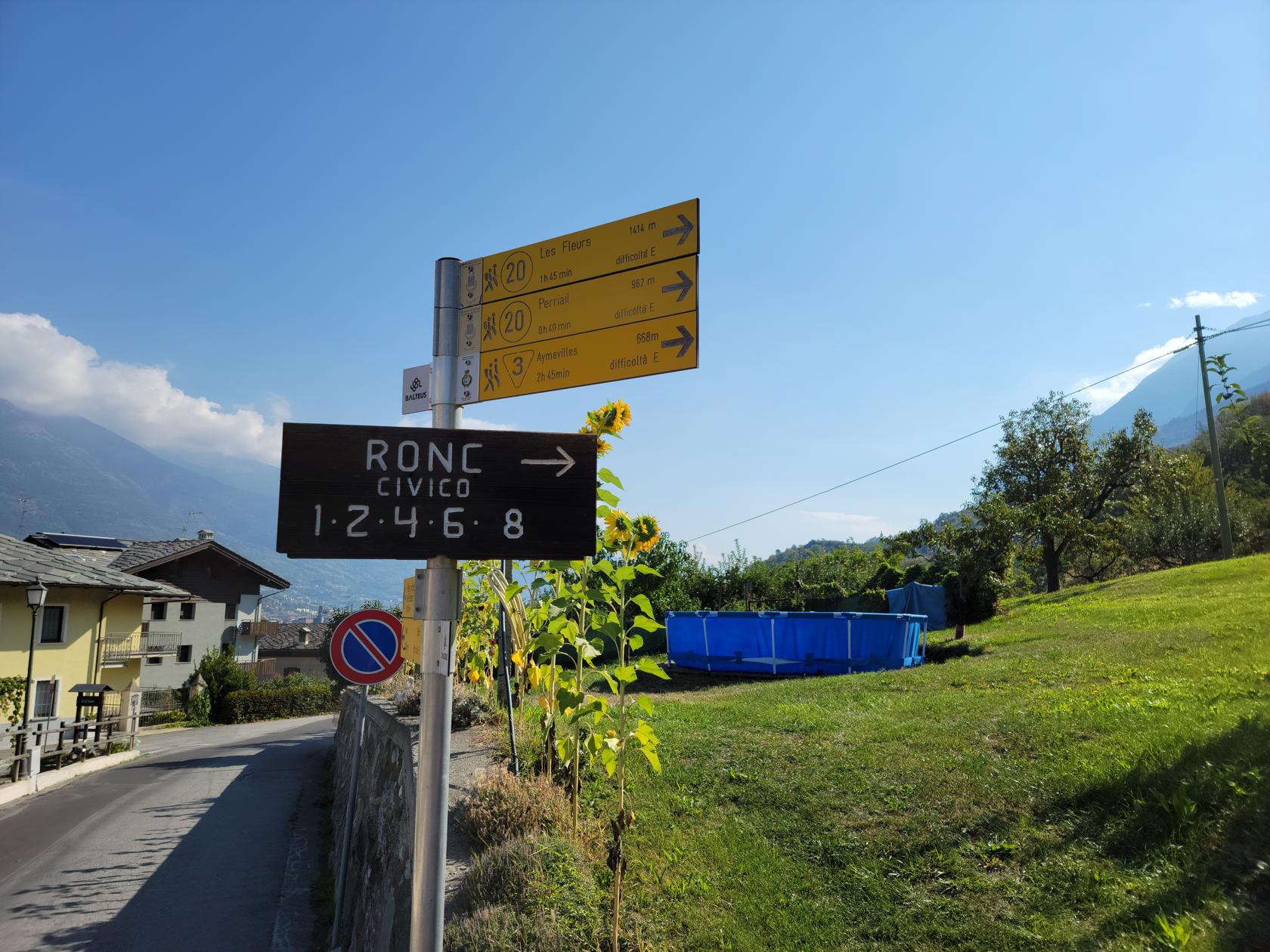
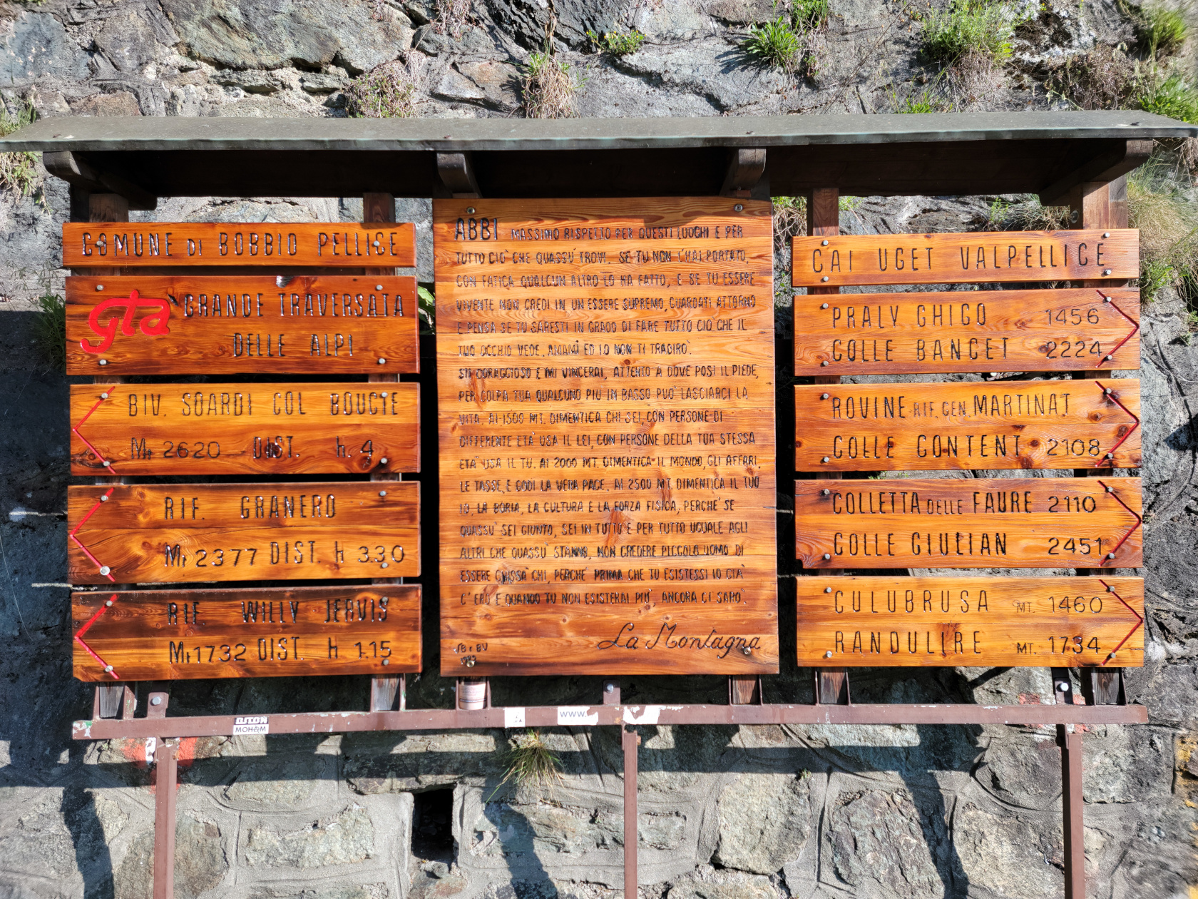
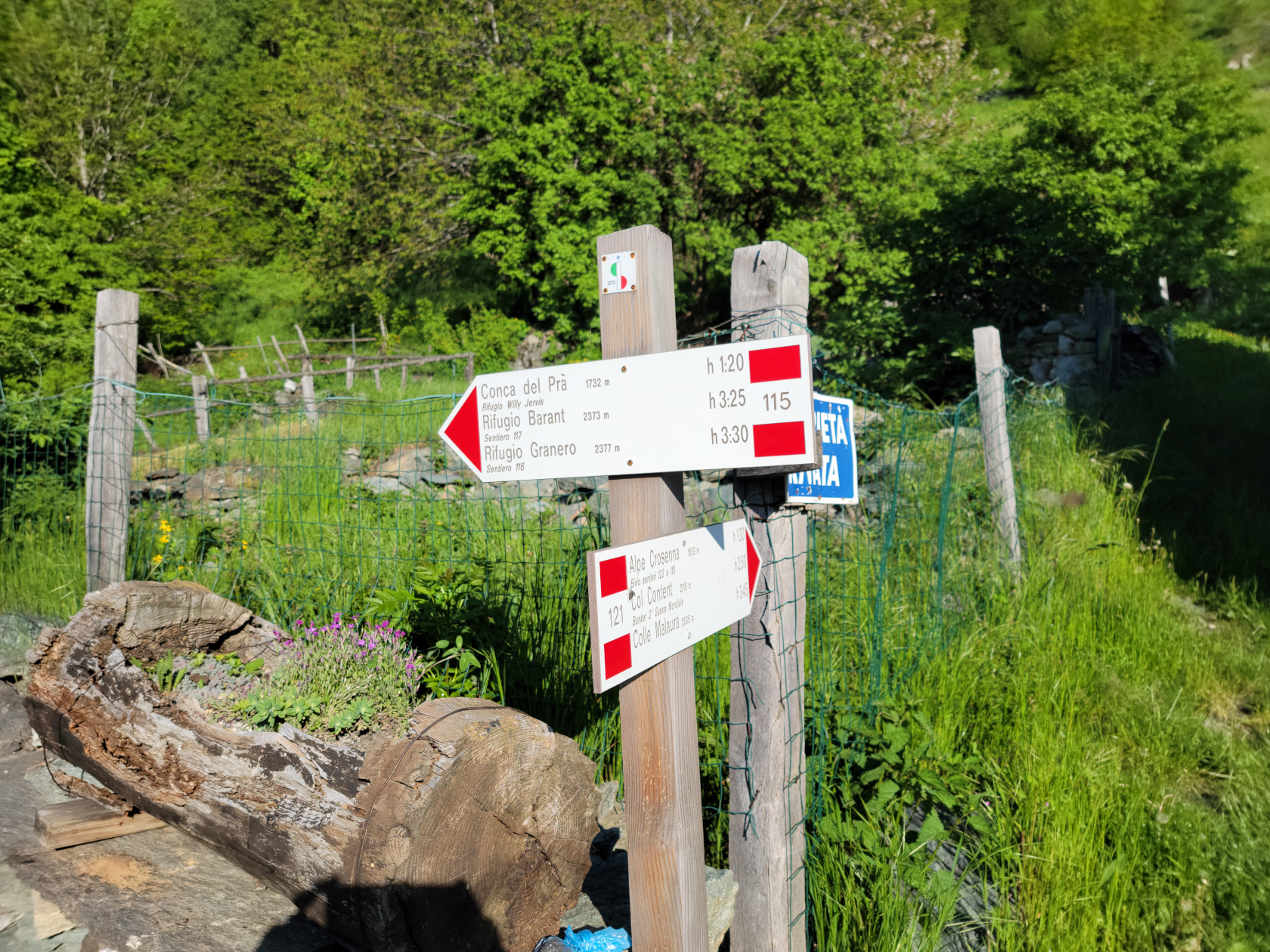
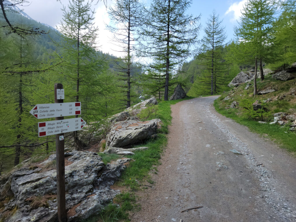
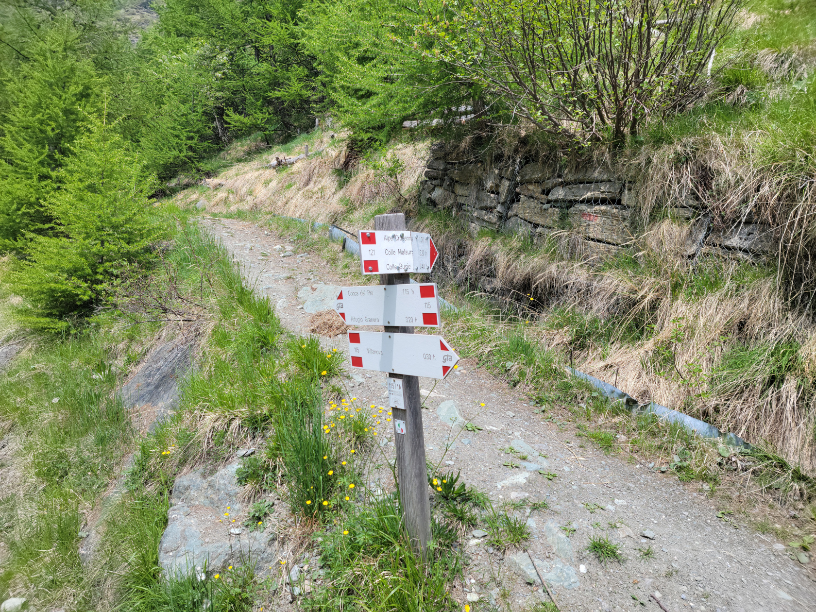
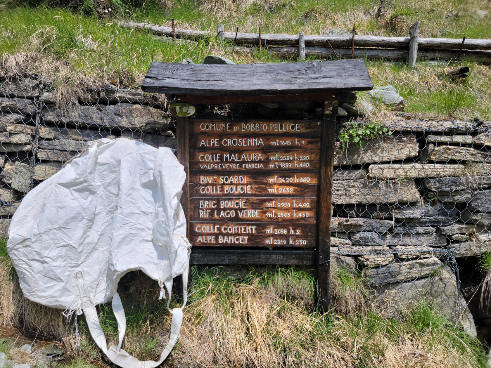
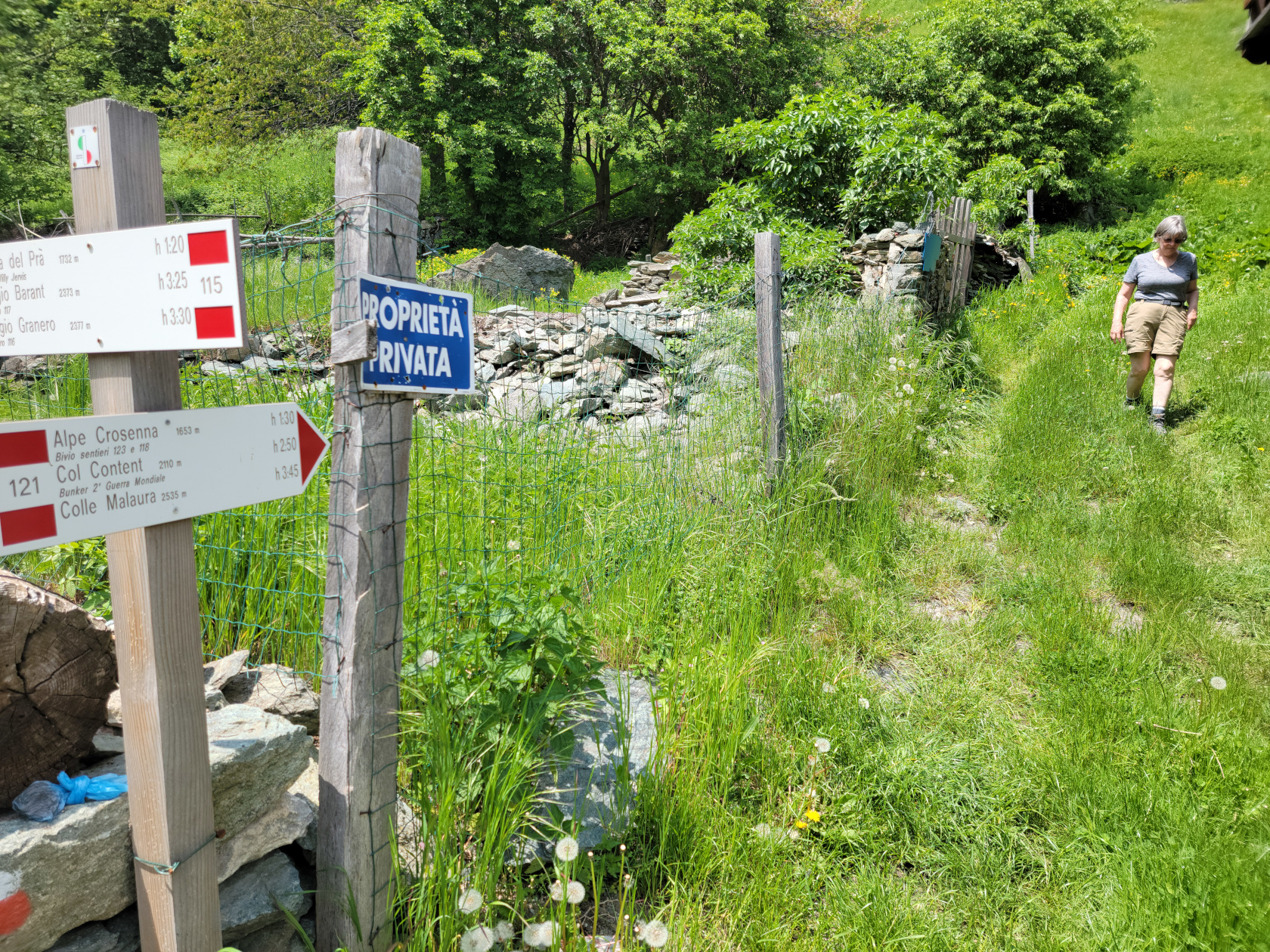
Commune hiking signs in Villanova, at the start of your trek
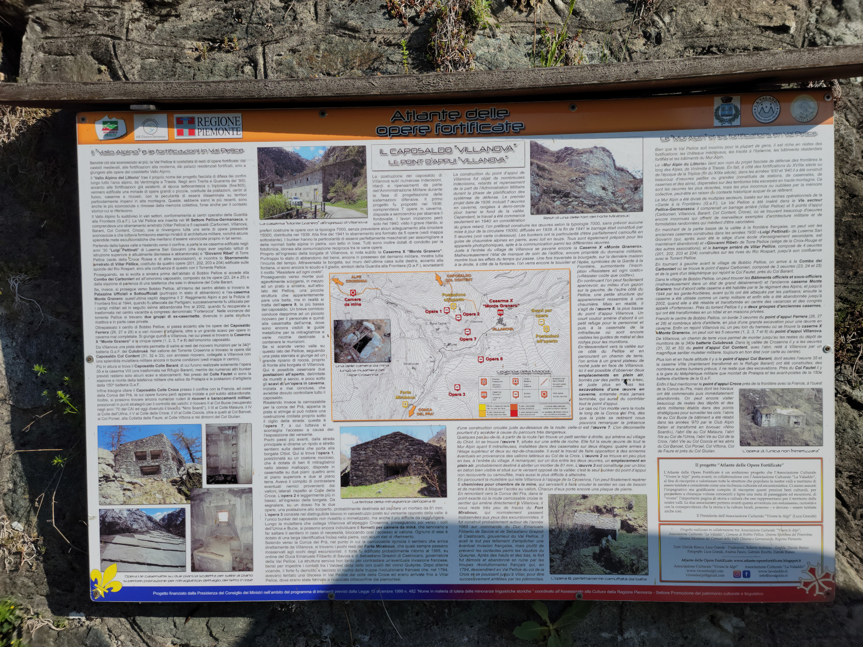
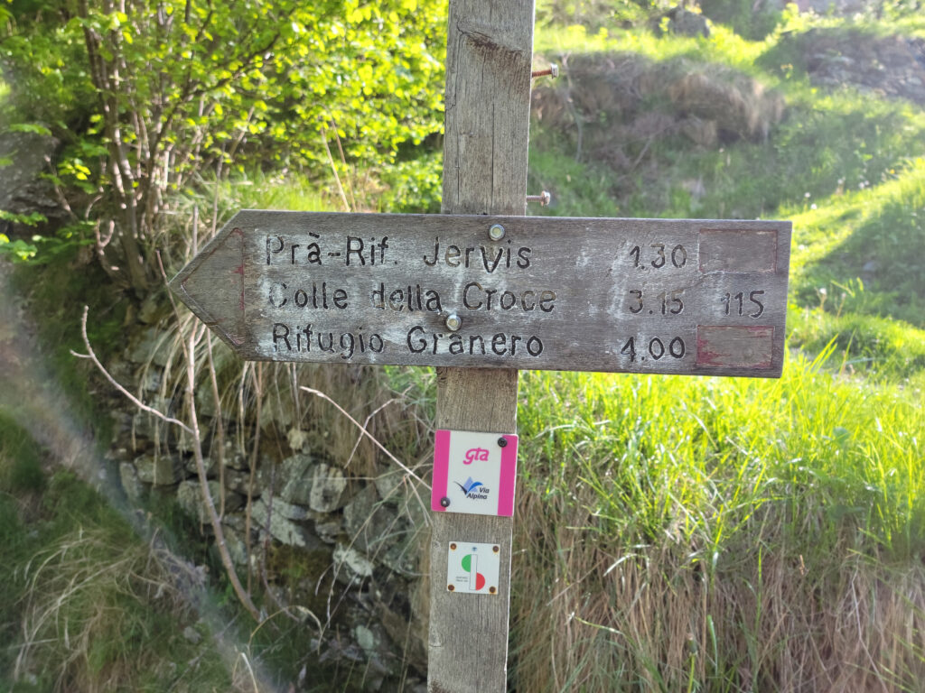
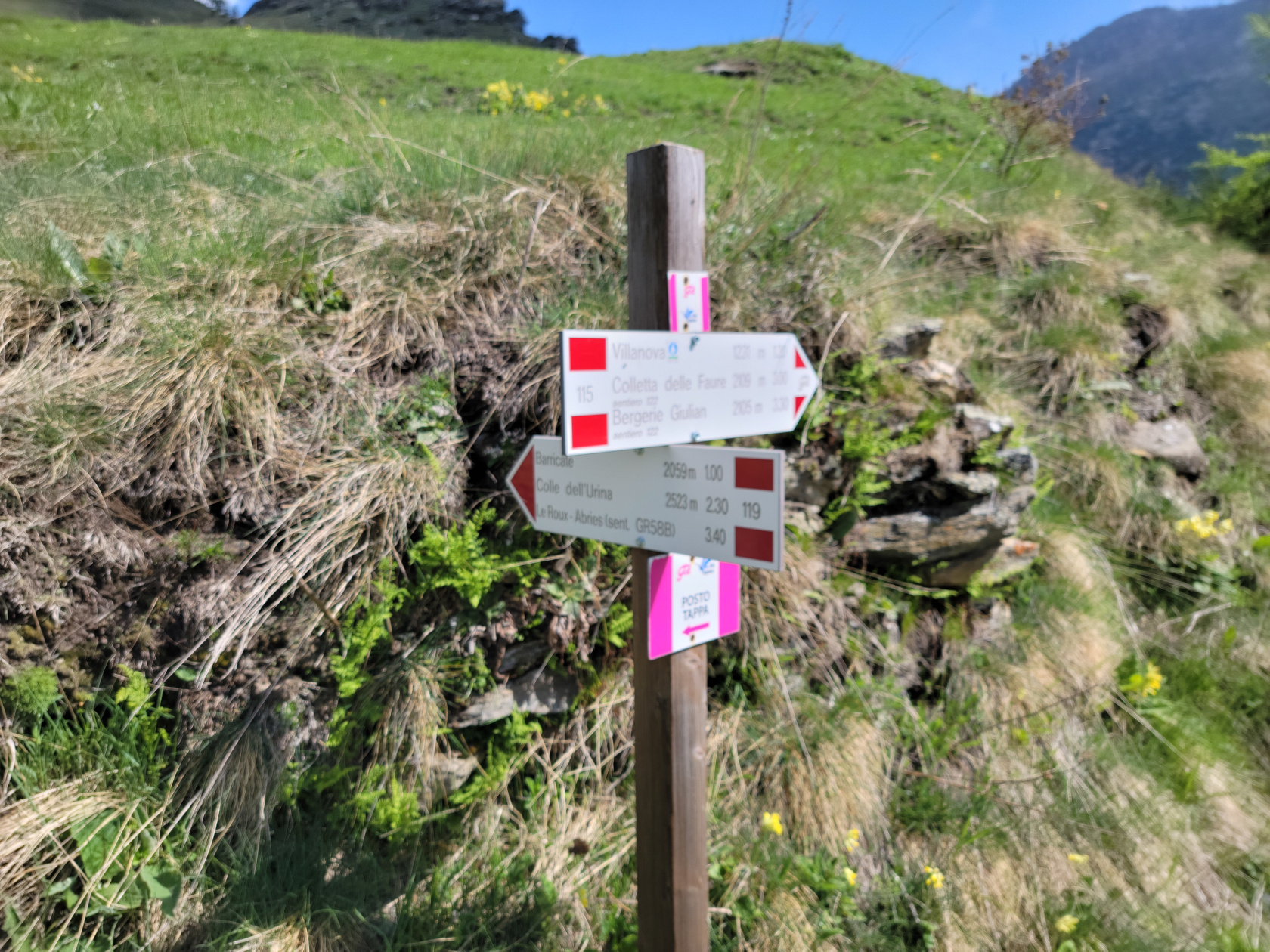
Sign at Villanova, showing routes and some history
Trail signs showing other trails and directions in Villanova
Looking closely at the wooden signs above, our destination is the last item on the left hand side, Rif. Willi Jervis. It estimates the average hike time as one hour and fifteen minutes, but it took us considerably more, since we were always stopping to take photographs, or just to admire the views.
We took the Mulattiera which is difficult enough
Though we actually took the Mulattiera, or mule path, we went down the Sentiero to see the waterfall. The more difficult Sentiero, or pathway, which goes over boulders can be taken, but we thought the mule trail would be difficult enough and our host Sam agreed. So we walked down to the Cascata di Villanova, a waterfall not far from our starting point, to get a short video and walked back up to start our hike.
The Hike Started Smooth Enough
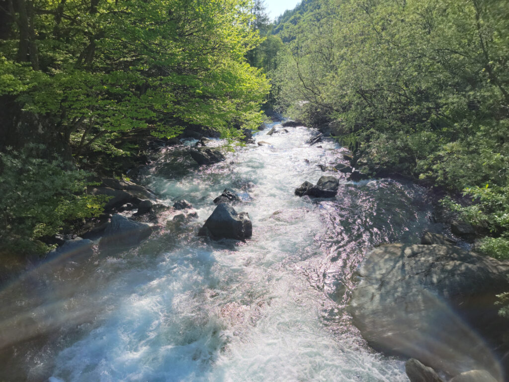
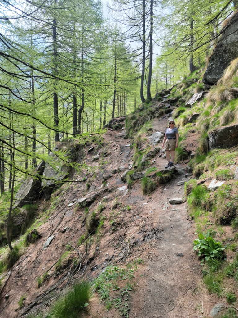
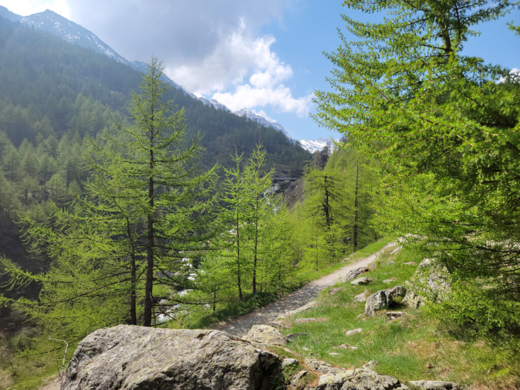
Once you start the climb, it goes up and down for quite a bit until it’s all uphill. There are several places where you have to take care and be very attentive, especially in the beginning and end, but the views and experience are well worth the effort. Unlike other climbs above the timber-line or through a forest, the Torrente Pellice provides both the white-noise to block every crazy little thought you might be having, as well as the solitude that anyone can use to reach a true calm in one’s life. But I imagine there are still those that walk as fast as they can just to get from point to point, and we actually saw a few.
The trail at this point is rather quiet and not very torrential, but further up its character changes drastically. So we started, following a small road until we hit the actually trailhead.
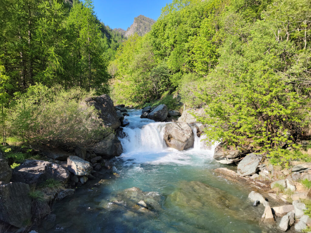
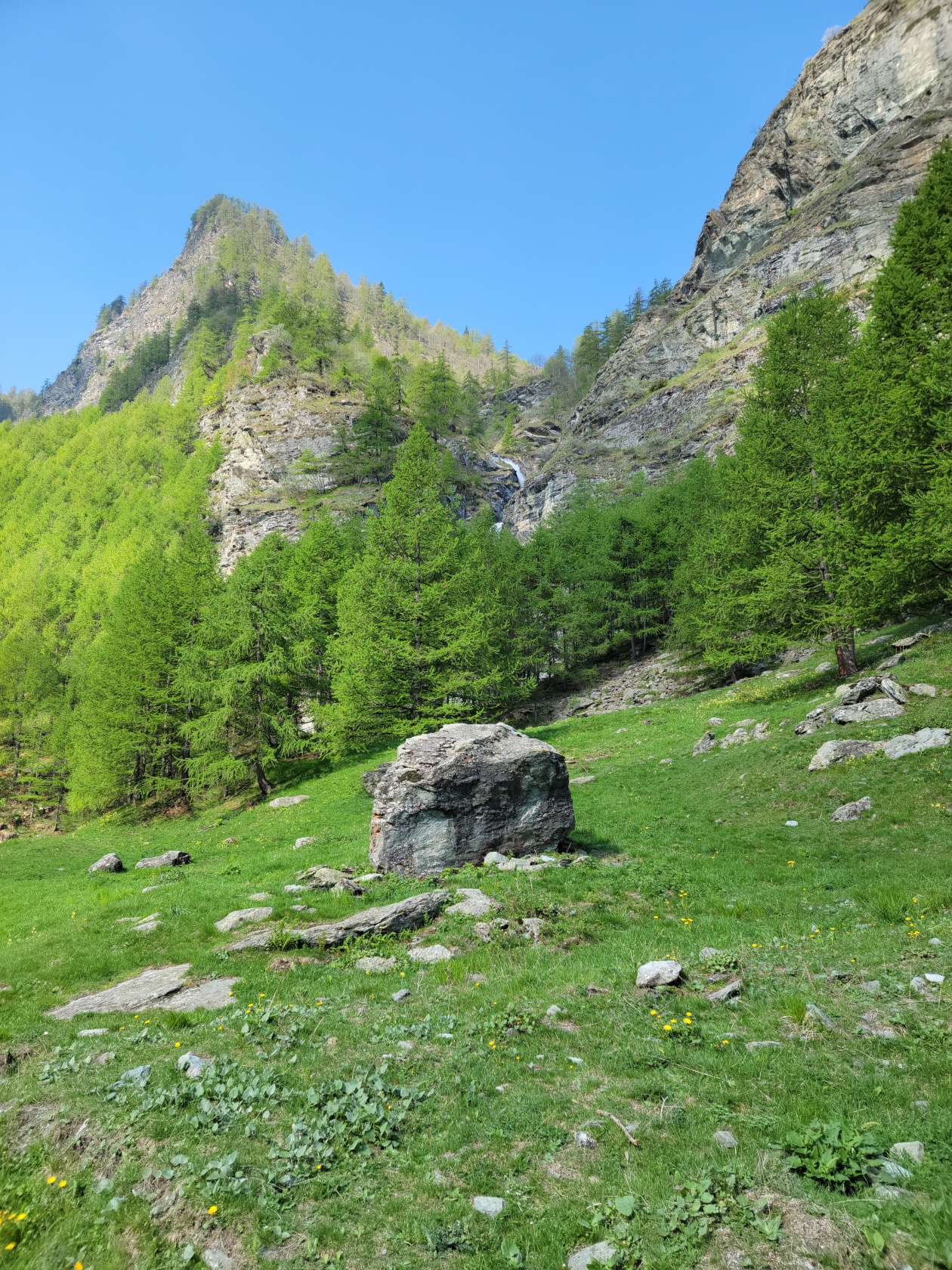
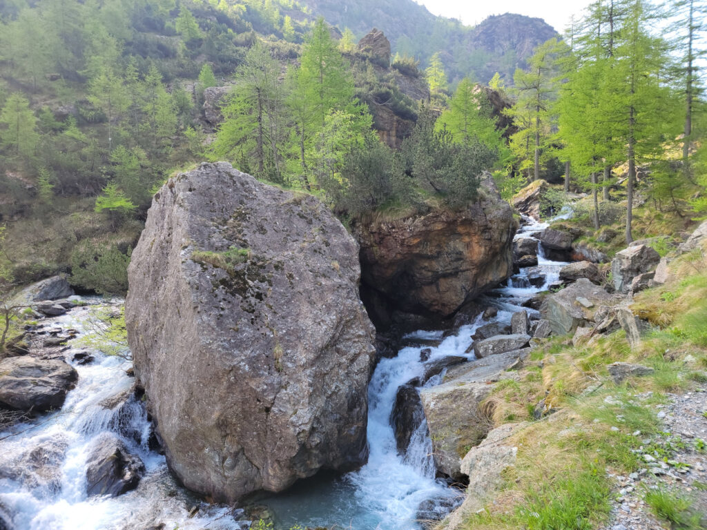
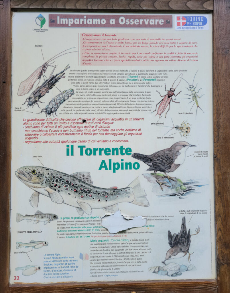
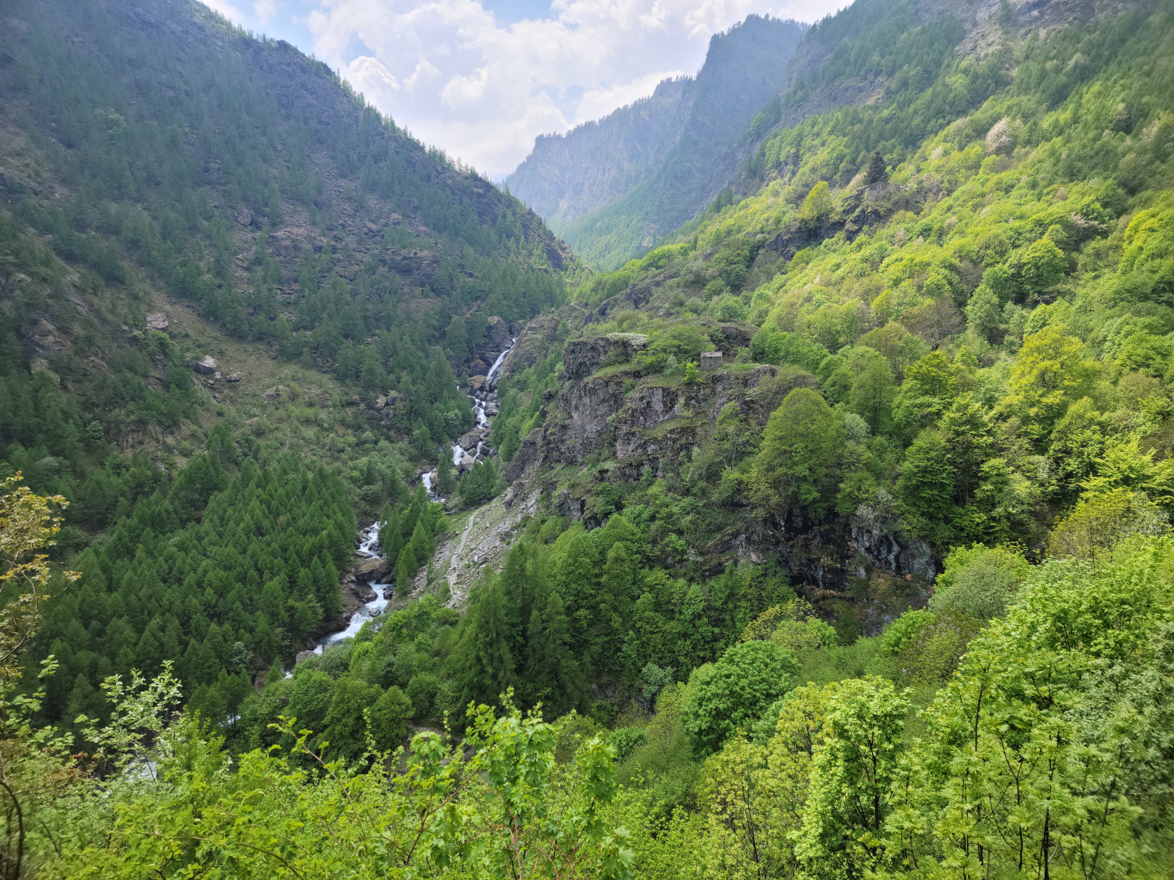
Waterfall, you will see more of these, that’s why they call it Torrente and not Val anymore
The water is clear blue, pristine and full of trout
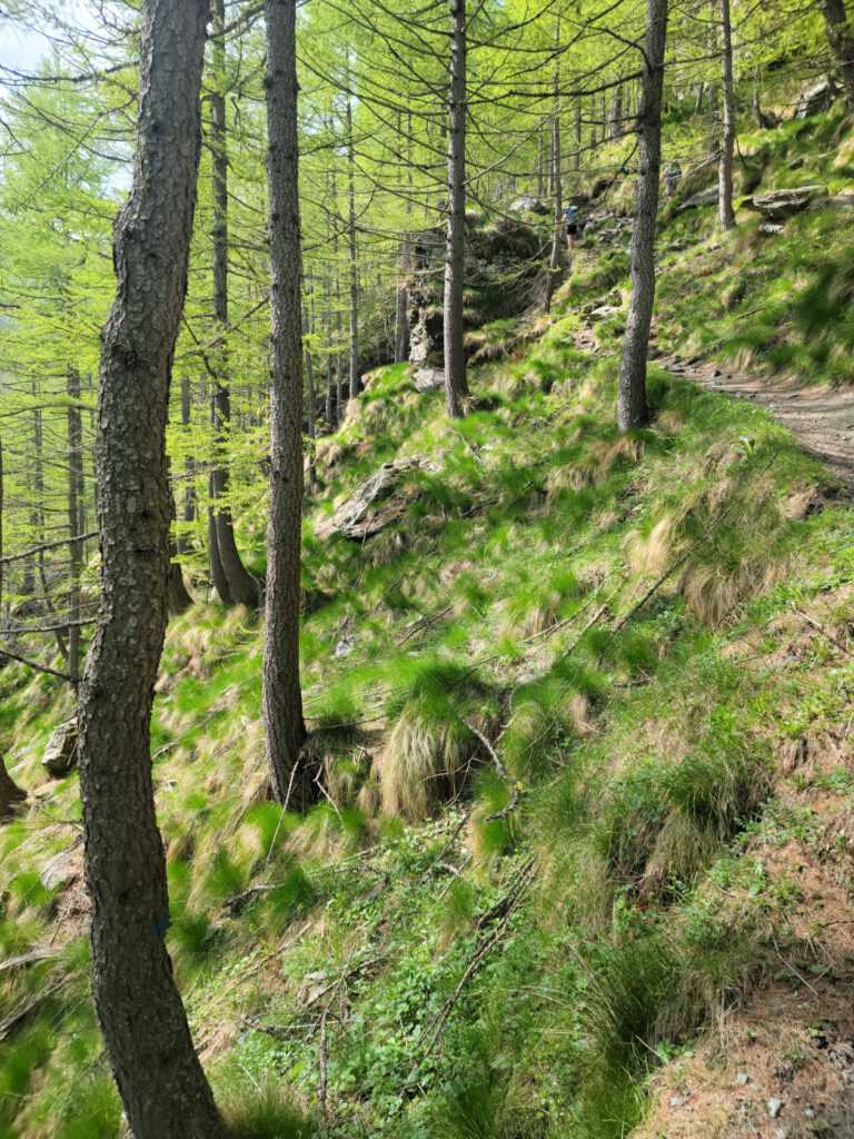
The hiking starts out smooth on a rather level roadway
What started out as one hour fifteen minutes, is now one hour thirty, huh?
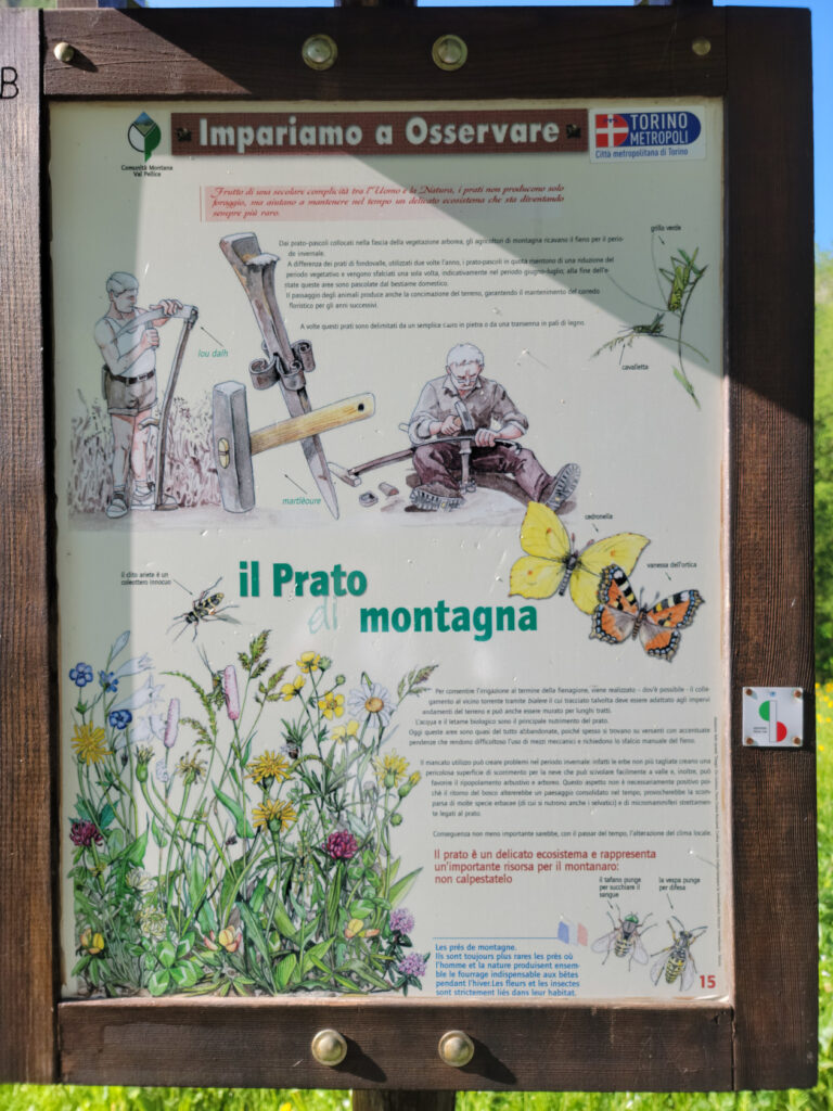
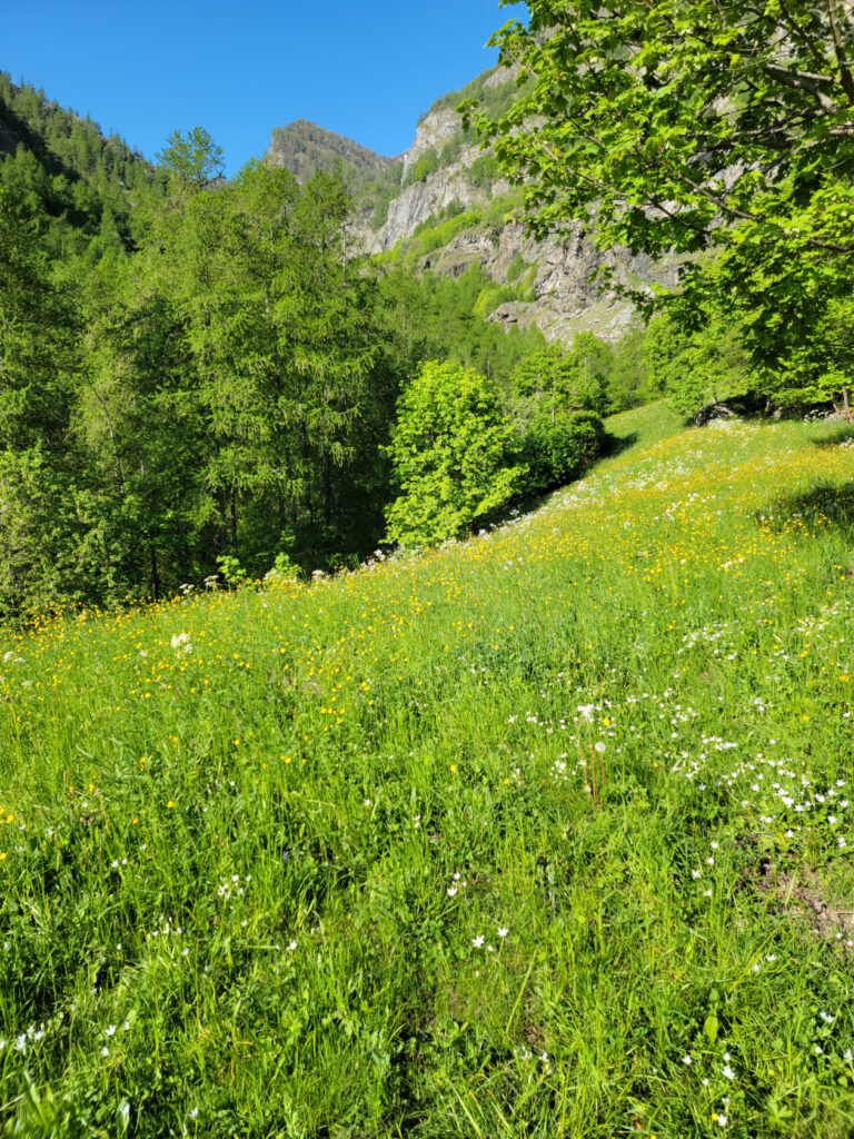
Il prato montagna, or the mountain meadow
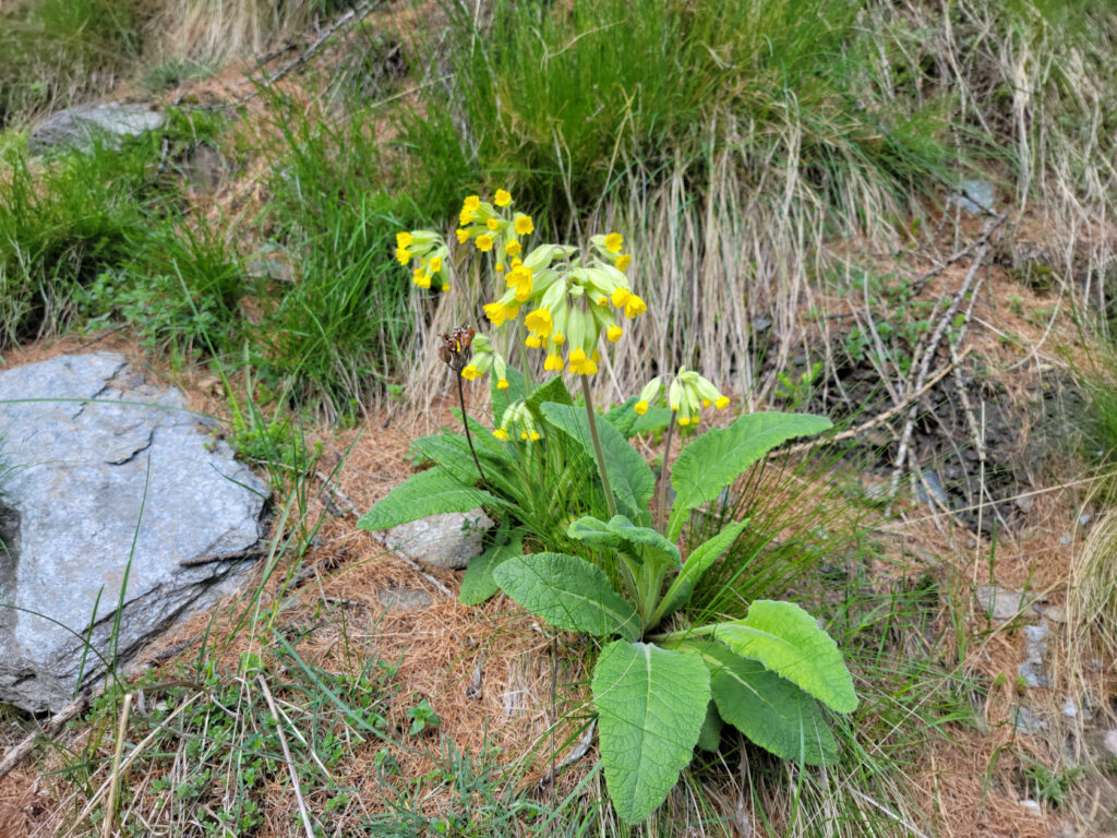
The beautiful flowers of the mountain meadows
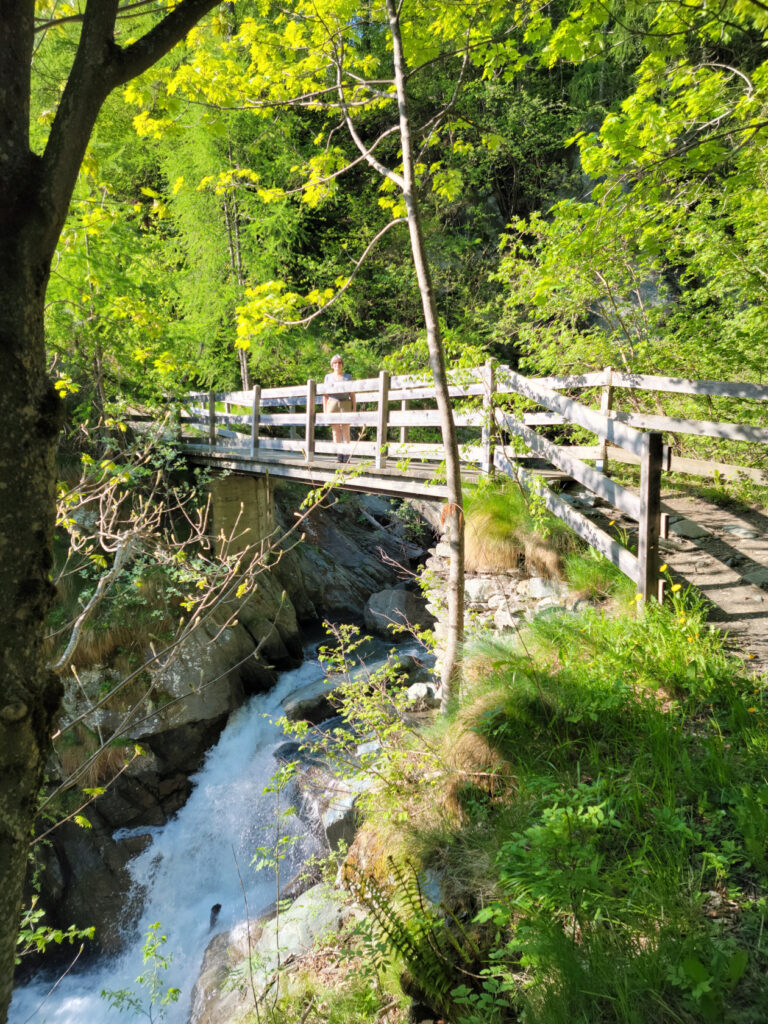
Patti on the bridge
More beautiful flowers of the mountain meadows
We are headed up there, see that other waterfall?
The trail narrows and more flowers of the mountain meadows
And that waterfall we saw from can be heard from where we were standing.
The Start Of The Actual Hiking Trail
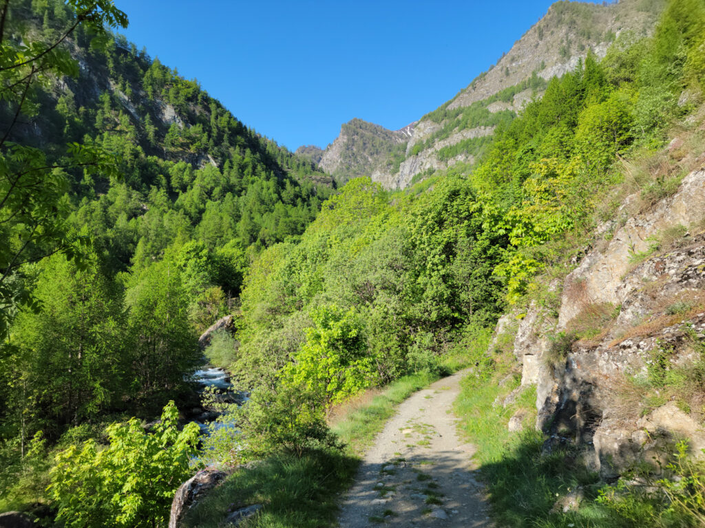
The trail is actually paved with heavy stones most of the way and starts down, instead of up. However, that does not last long.
No more roadway, onto the trail
Patti sitting in front of our first of many cliffs on the stone covered hiking trail
If it weren’t for the absolutely gorgeous weather, we might have reconsidered our decision. The rocks that pave this trail are very slippery and well worn and are most likely very hazardous when wet. However, we remained steadfast and undeterred and pushed on, even with the frequent stops for photographs.
A look down the Torrente Pellice
That waterfall is getting closer
Wide angle view of the trail and the valley below
Looking towards Villanova, which is getting smaller
Patti on our boulder trail and the beautiful Italian Cottian Alps
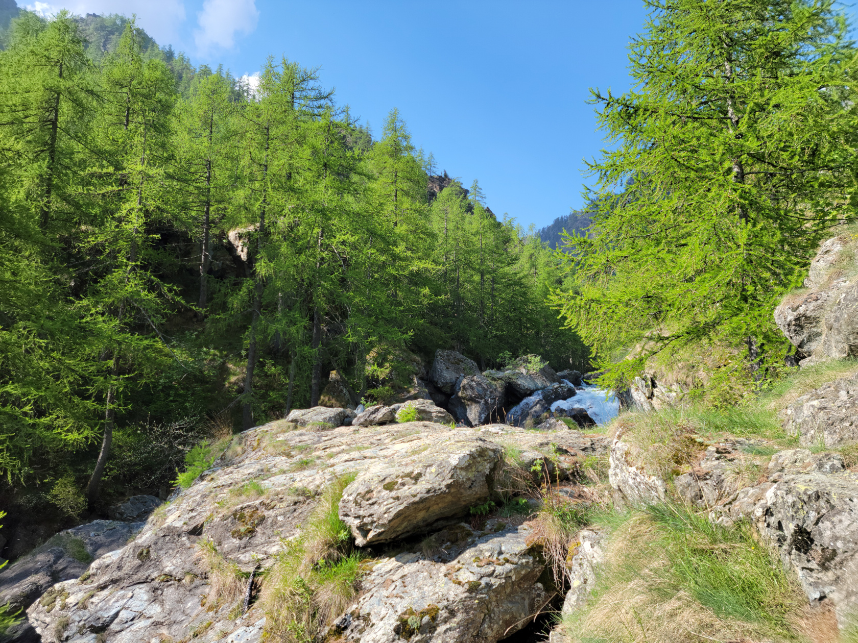
The Torrente Pellice
The higher Cottian Alps in the distance
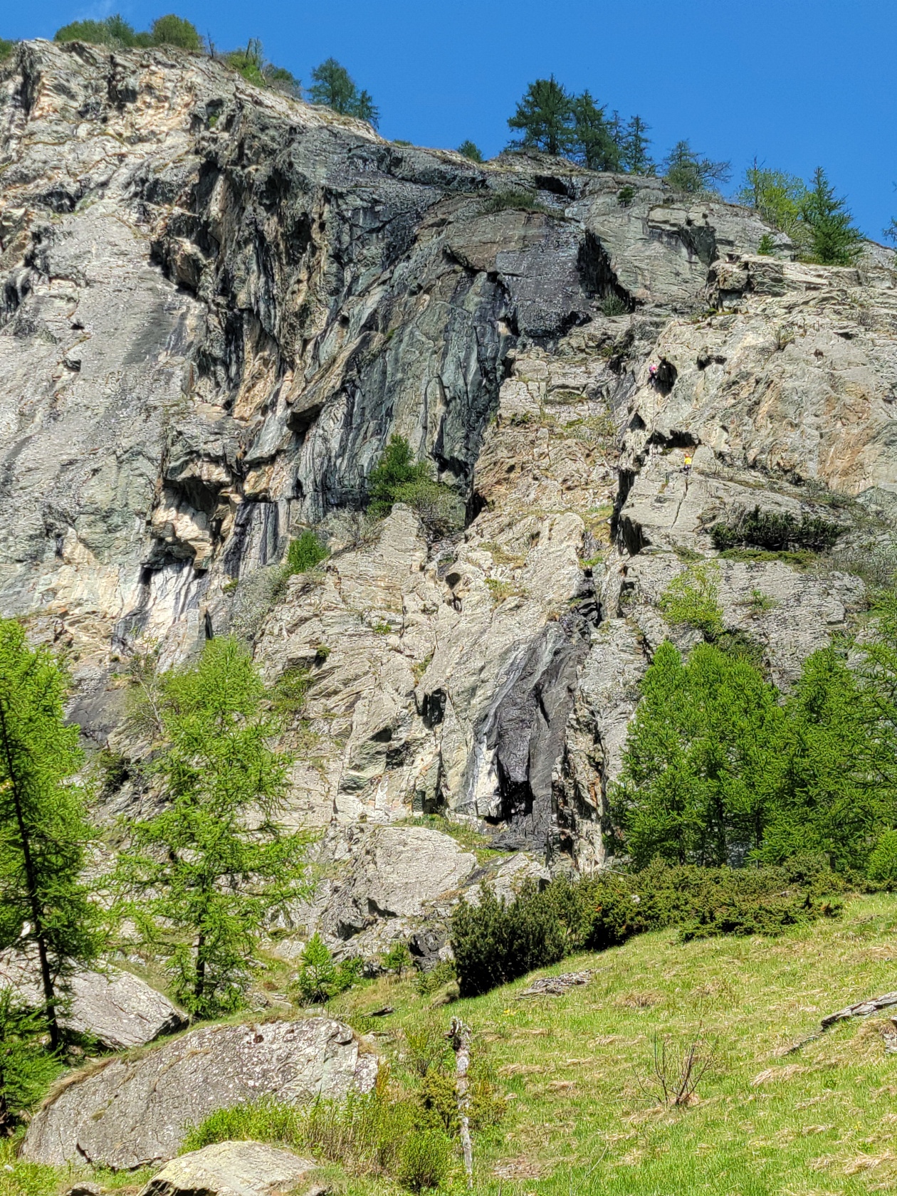
Rock climbers on rock face, notice yellow dot just above the green to the right
Another spectacular waterfall
Boulders, boulders everywhere!
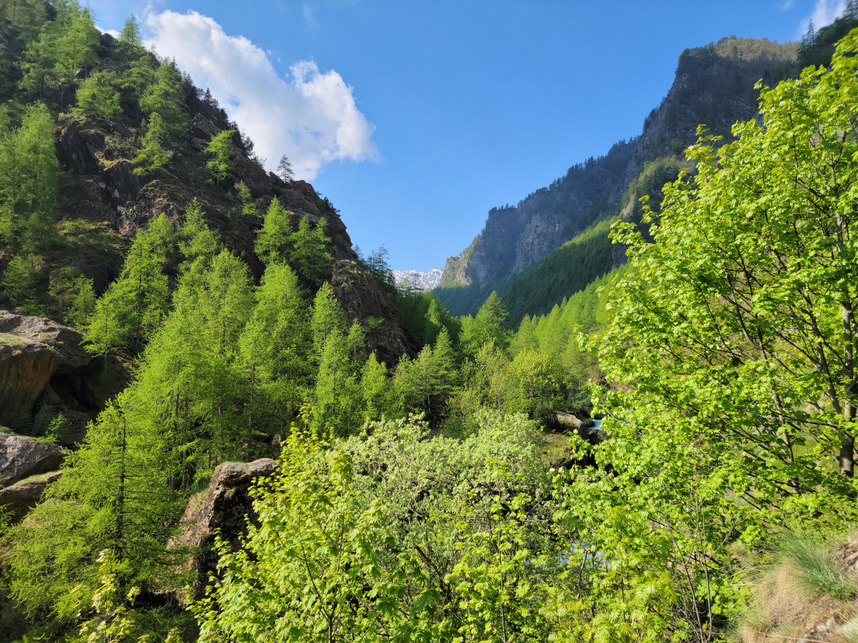
Val Pellice
Val Pellice and the High Cottian Alps in the distance
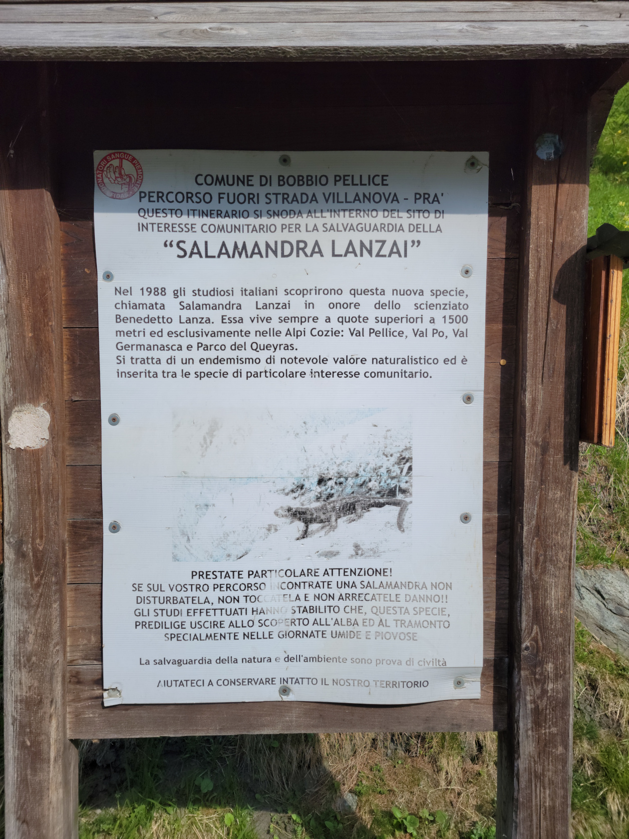
The black salamander is protected here, be careful
We also frequently stopped for a few videos too, just to record the noise of the water moving, which at times was thunderous.
Amazing Waterfalls
We passed several places where water was coming in from other tributaries, mostly in the form of these beautiful waterfalls.
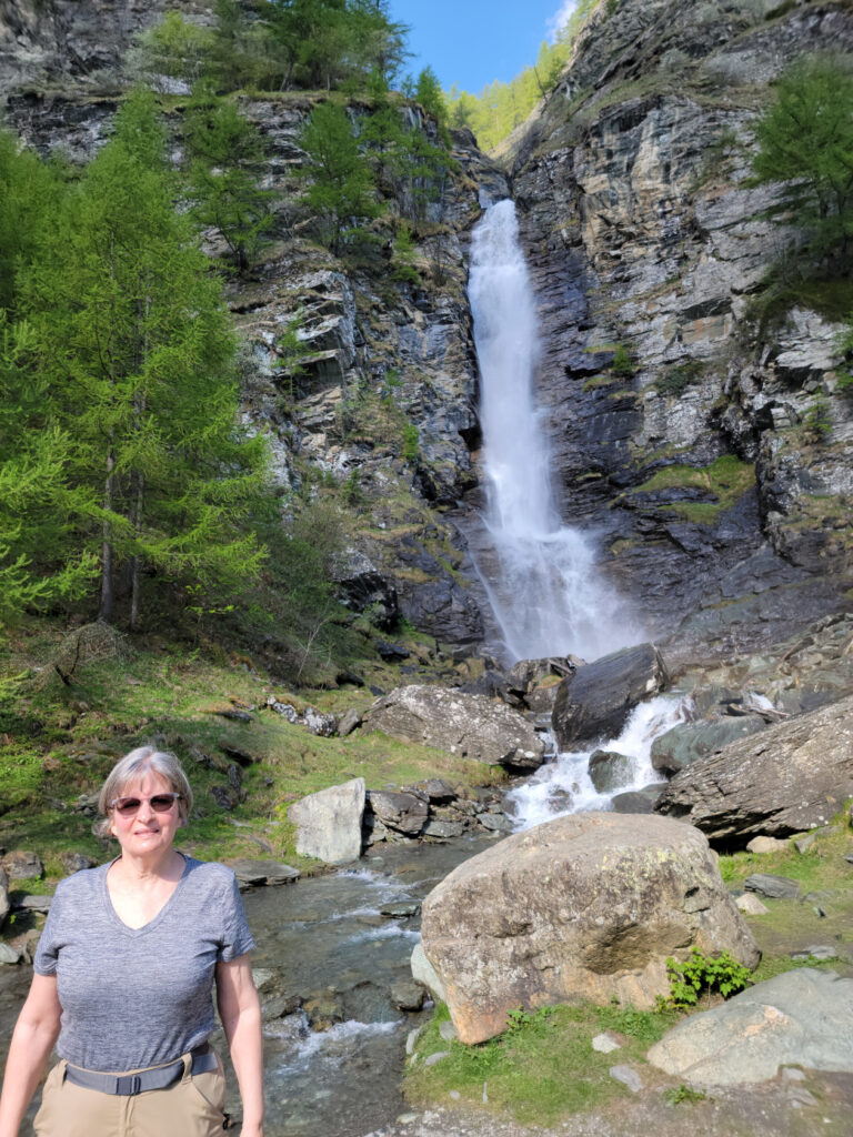
Patti at the Cascata del Pis
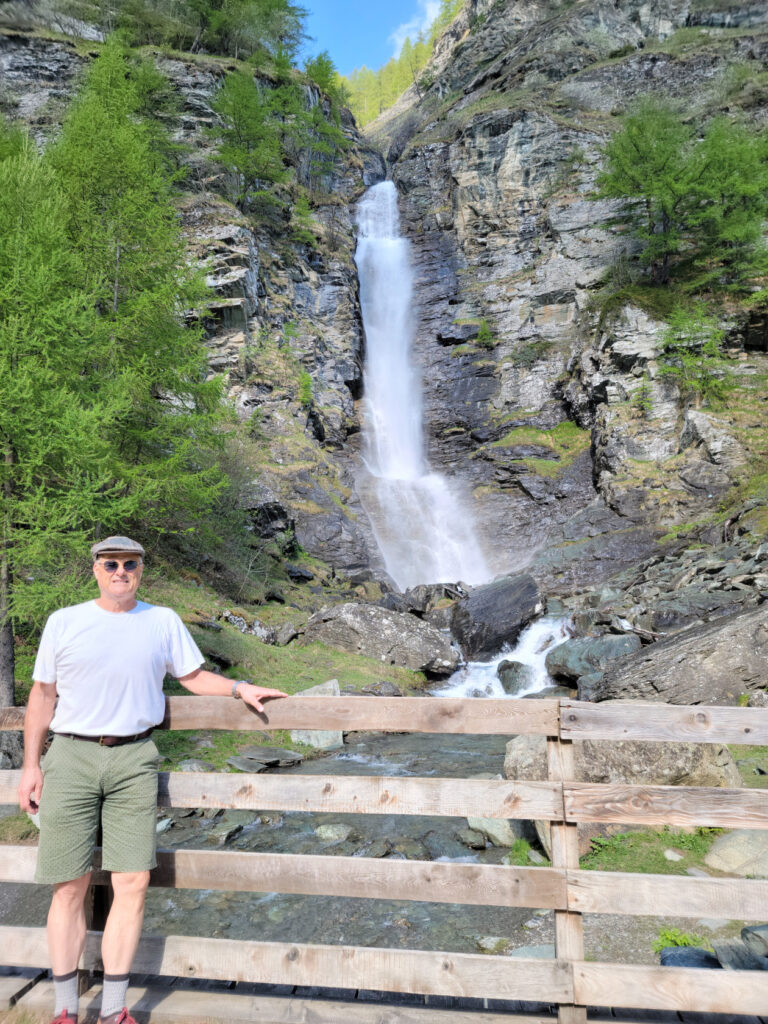
Erick at Cascata del Pis
And the actually hear the real thing, a short video.
From Here – UP, UP, UP
After all that water, the trail kicked up rather steeply. Not that it was a problem, but you did have to watch your footing. Some people hiked with poles, which is definitely a good option, but I find them noisy and annoying and prefer listening to the wind, water and any birds I can hear.
Hiking got a bit technical at times
The access road trail again and easier hiking for a time
Trail comes out occasionally on an access road
Only to be back on the trail soon enough
This boulder is larger than many houses
A bell shaped flower of the high alps
The trail became more challenging the closer we got the to the top
Trout, birds and the insects they eat
Cresting The Trail
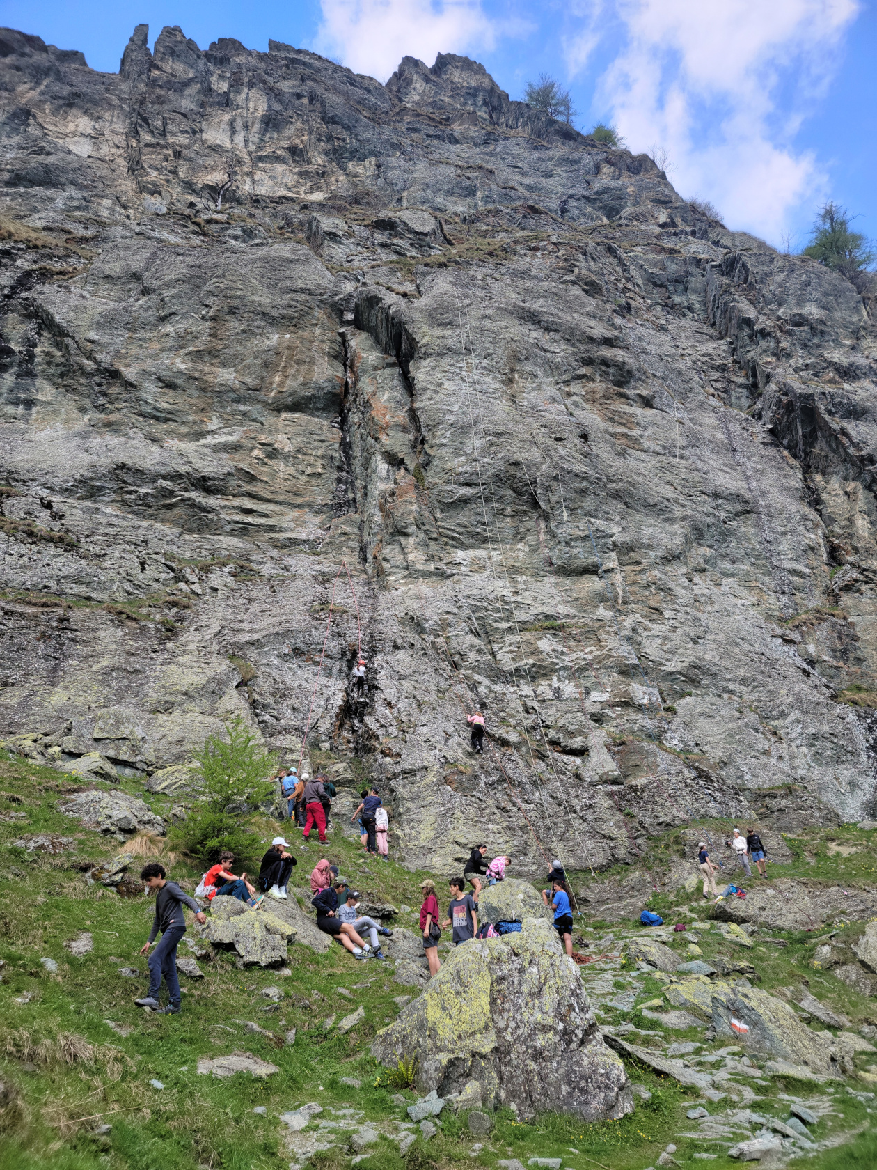
Just as we were about to finish our climb, we ran into a class of young rock climbers and their teachers. Speaking several languages and very close to the Italian-France border, they were obviously making a day of it. They all had brought a backpack with them and those who were not climbing were running around like mountain goats.
A class of rock climbers, speaking French, Italian, Spanish and some German
The trail was actually pretty steep right were all the climbers were, so we had to take our time to move through them as they were belaying.
The steepness of the trail demanded a lot of switchbacks
It got pretty cool up there, some clouds started to roll in
Patti on the same rock with the Val Pellice behind her
Erick on the trail with the Val Pellice behind him
After a few photographs, I actually turned around to take a short video of the climbers, since some of them seemed quite adventurous and adept at the skill.
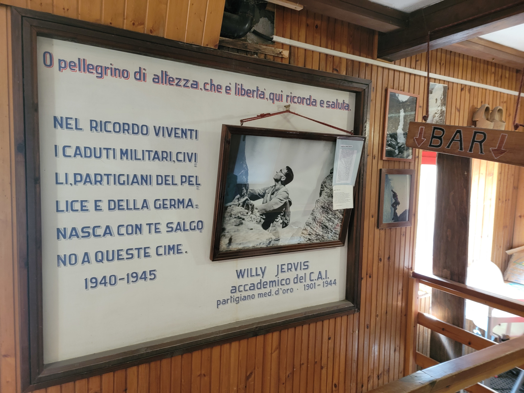
Rifugio Willi Jervis
The upper alpine valley where the refuge is, was a big change from following the river all day. There are marmots, birds and the sound of insects everywhere, but then again, it was a beautiful spring morning.
Finally reached the upper valley floor by the Refuge, trail signs
More trail signs
The upper Val Pellice, looking toward Lago Lungo and the cloud shrouded Pic Traverse
Mont Manzol to the left with Mount Granero peeking out from behind it
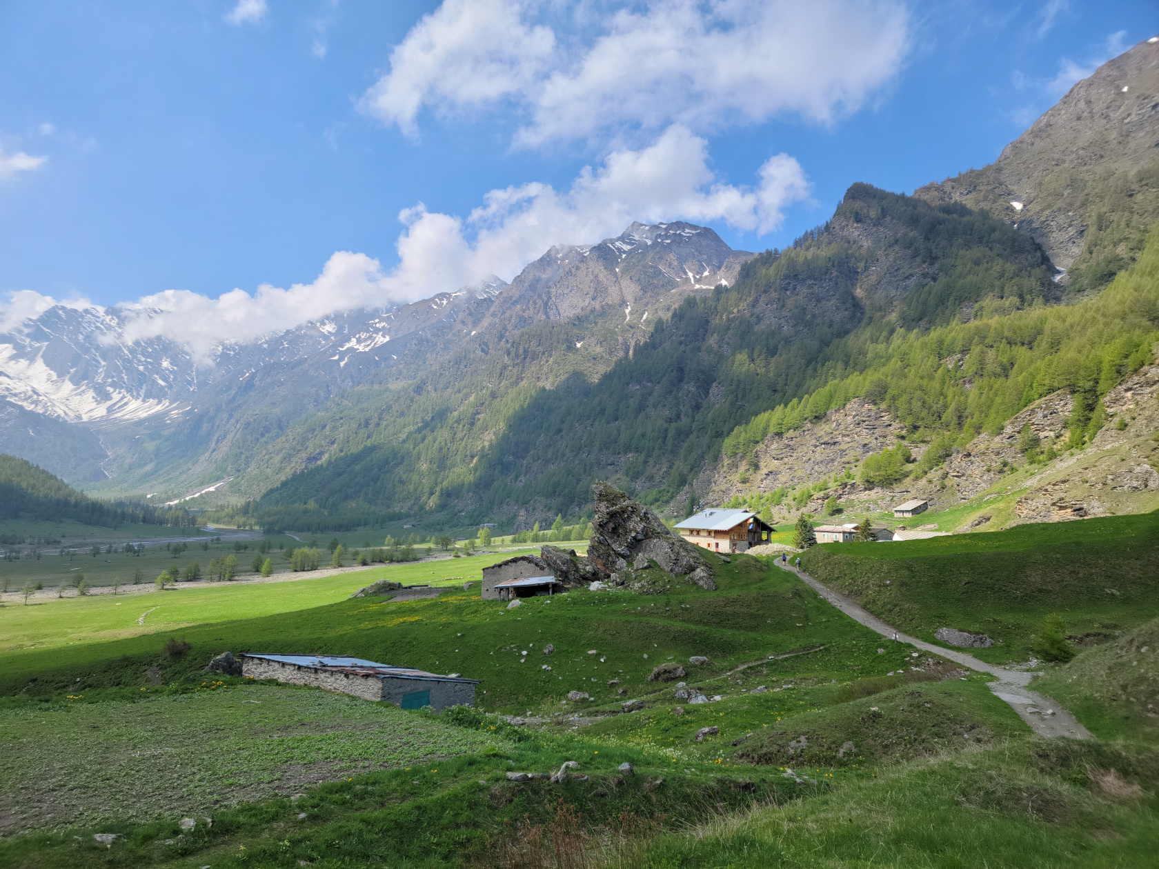
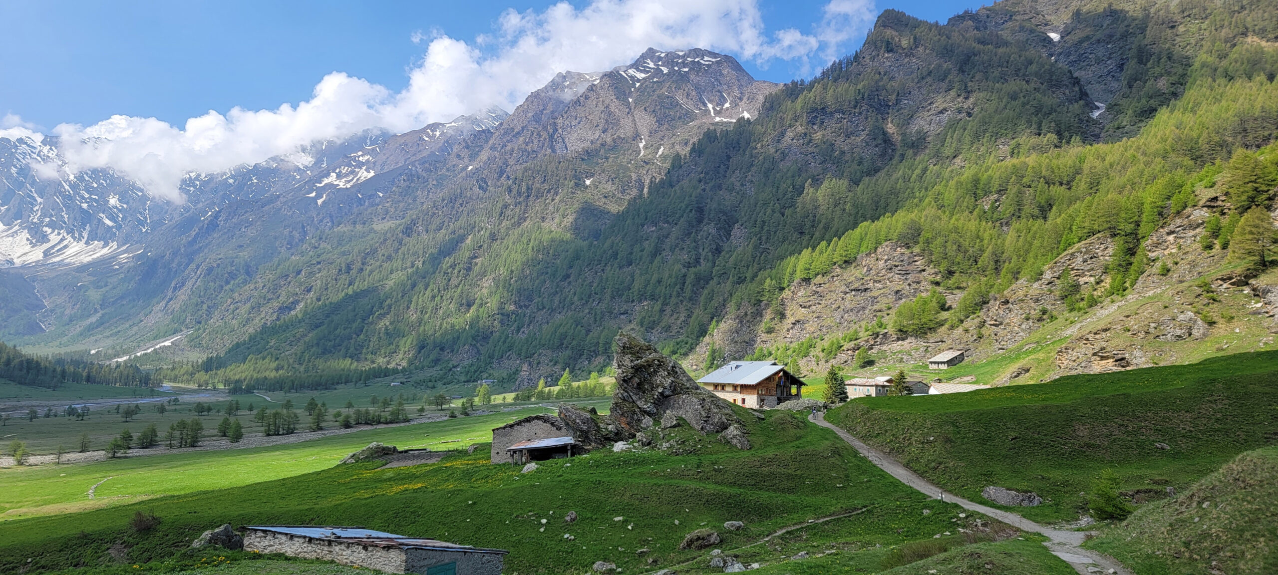
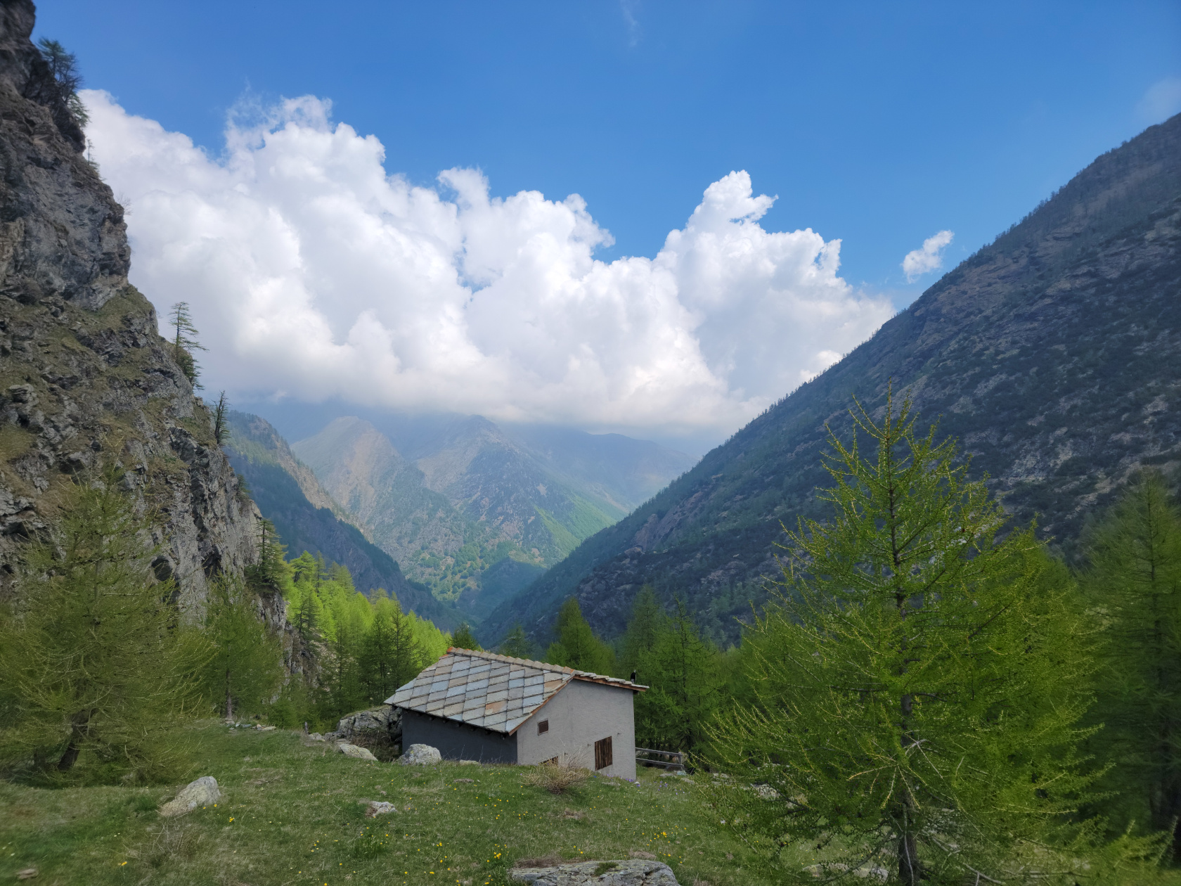
Rifugio Willi Jervis from a distance
Nice panorama of the valley floor and mountains
Rifugio Willi Jervis from a distance
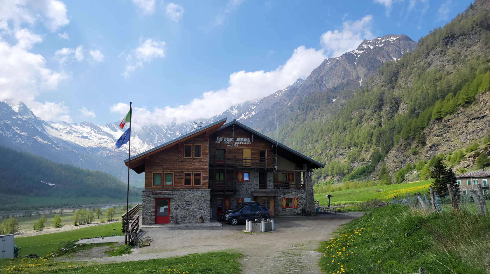
Rifugio Willi Jervis up close
Inside Rifugio Willi Jervis, the bar is downstairs, but it was closed, no caffe for us
Descending
On the way down we took a slightly different route, keeping to the access road more, mostly due to the threat of bad weather. It appeared there were several thunderstorms possibly brewing. So, not wanting to be cold and wet on a trail in the high alps, we decided to descend early and quickly, instead of waiting for pranzo at the refuge, which probably started at twelve noon sharp.
Starting our way down
Taking a slightly different route, you can see the hiking trail we were on down below (next to the river)
From here several additional Cols or peaks can be reached, Villanova ostensibly only thirty minutes away, yeah if you take a short cut
Coming down a different perspective
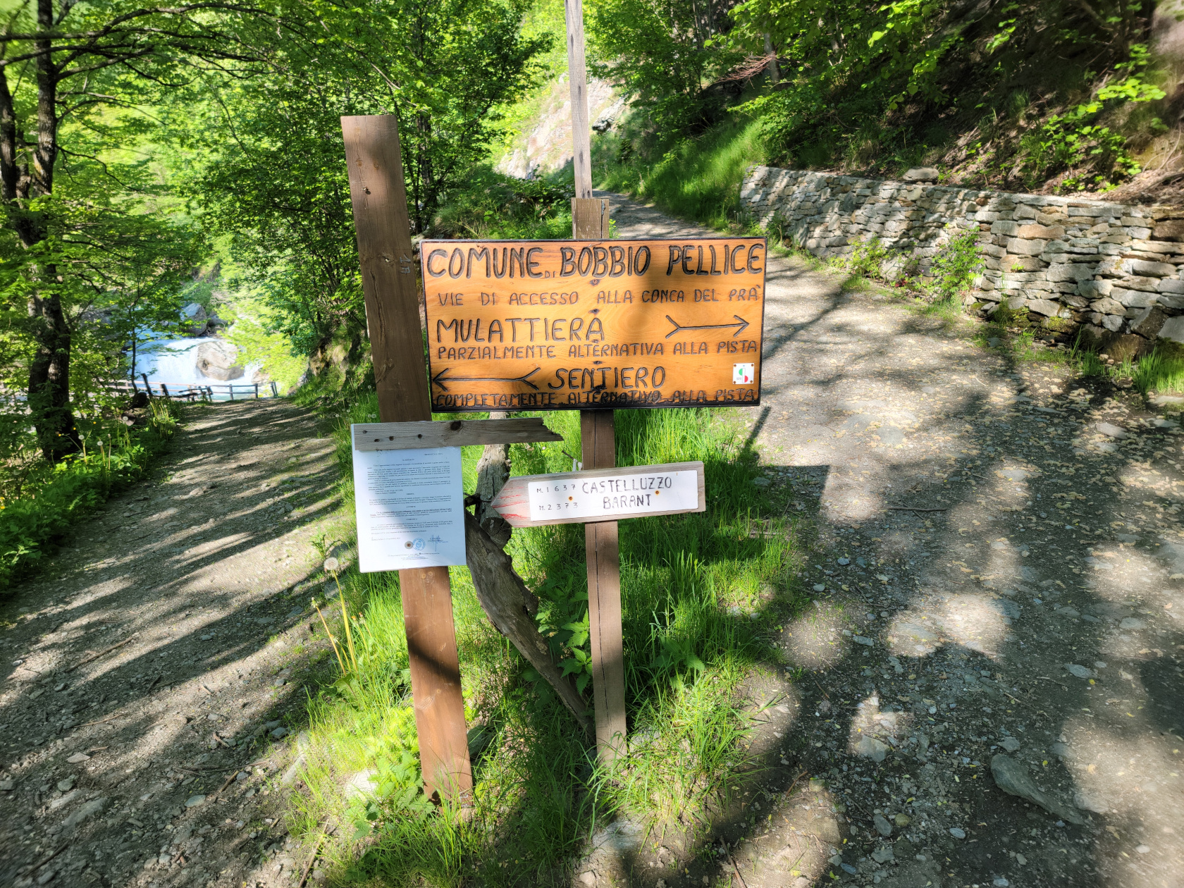
More information from the Comune of Bobbio Pellice, next time we should do Bric Boucie at close to three thousand meters
Patti finishing up her hike in VIllanova
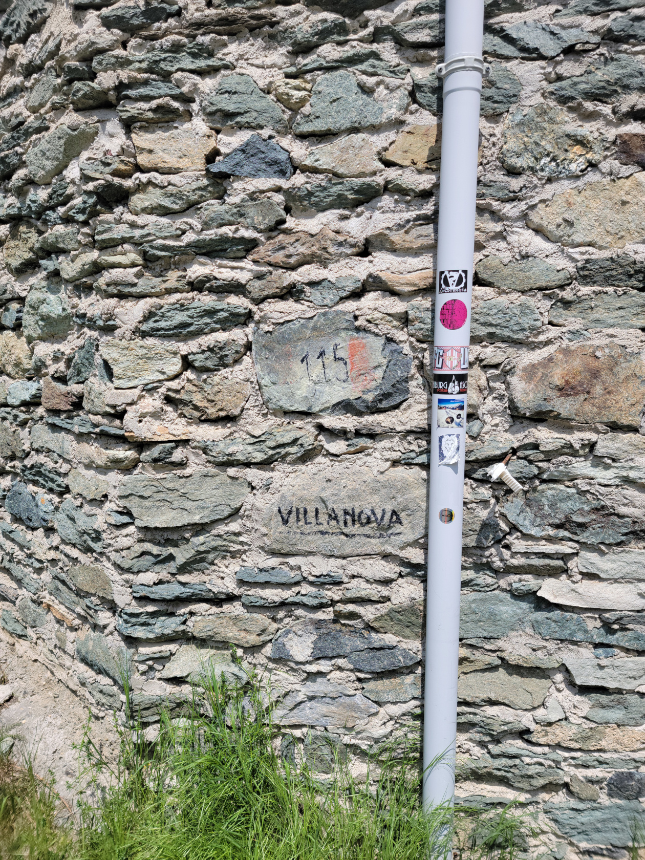
Villanova, we made it
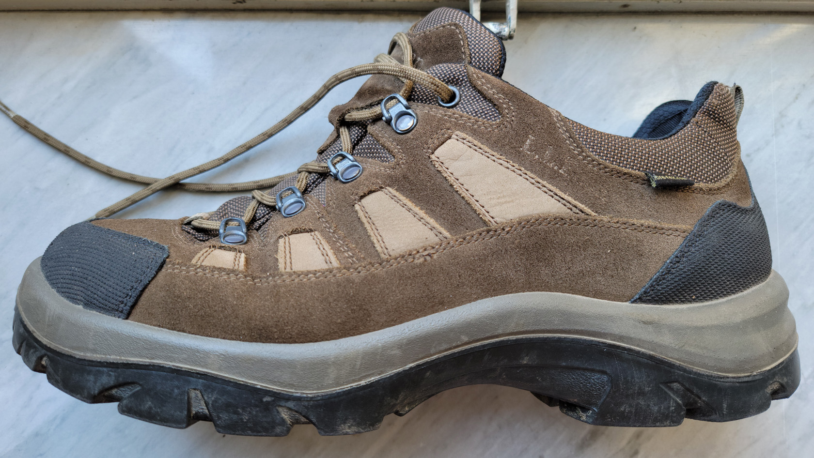
At the end, we both thought it was an amazing climb by all accounts. If you ever have the occasion to make the climb to the Rifugio Willi Jervis, I would suggest starting in the morning, especially if you are taking photographs, the morning sun is just perfect for such an undertaking. Oh, and buy a good pair of boots! I had purchased an ostensibly good pair of hiking boots from L.L. Bean in the States, only to have this happen the day before this hike on the Pista Bassa.
LL Bean Hiking Boot Failure
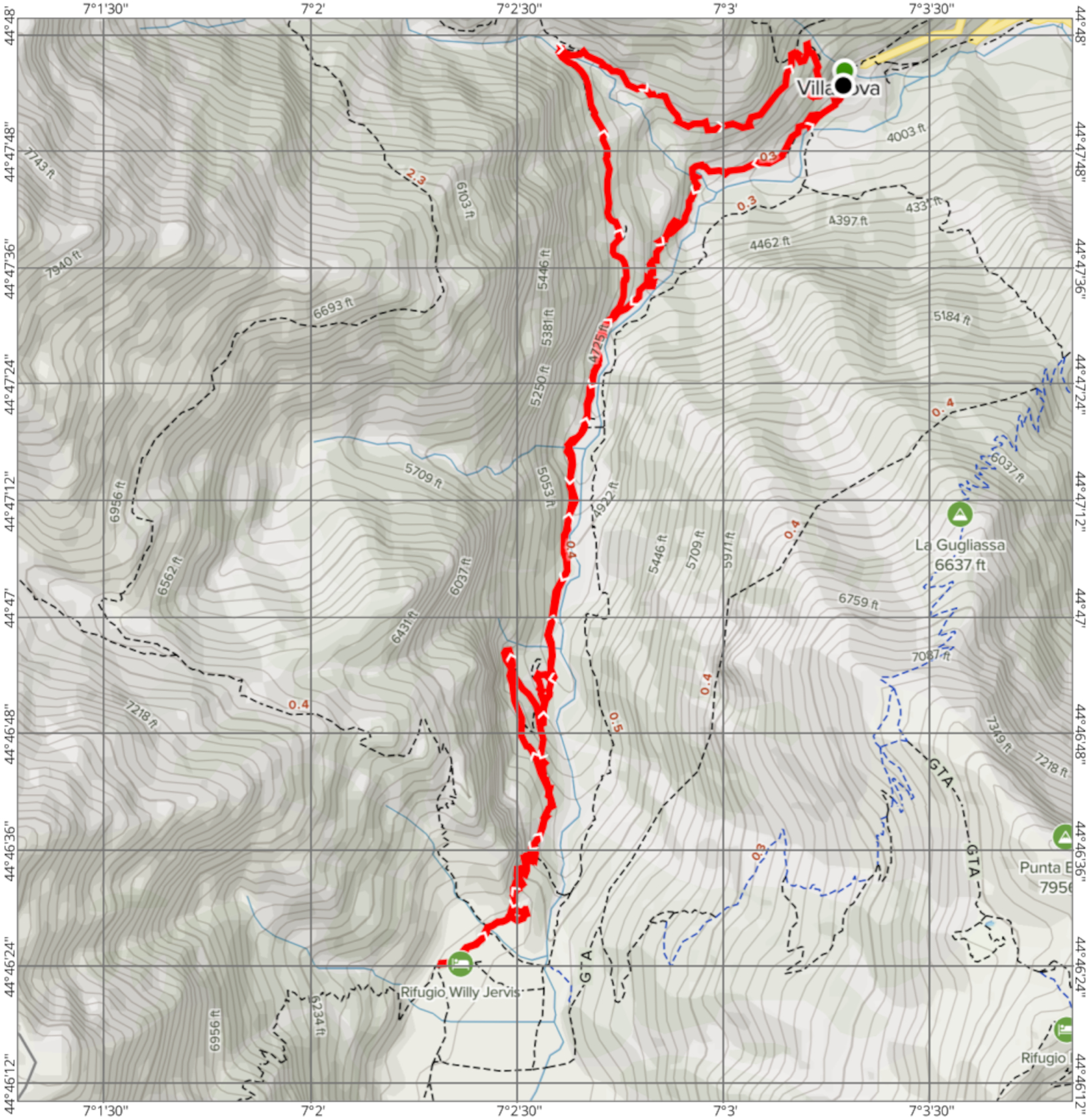
Trail Map
If you are interested in our trail map, see the image below. Or, while using standard and accepted security practices, feel free to download the PDF here.